June 22, 2025 Tornado
Gryglia, Minnesota
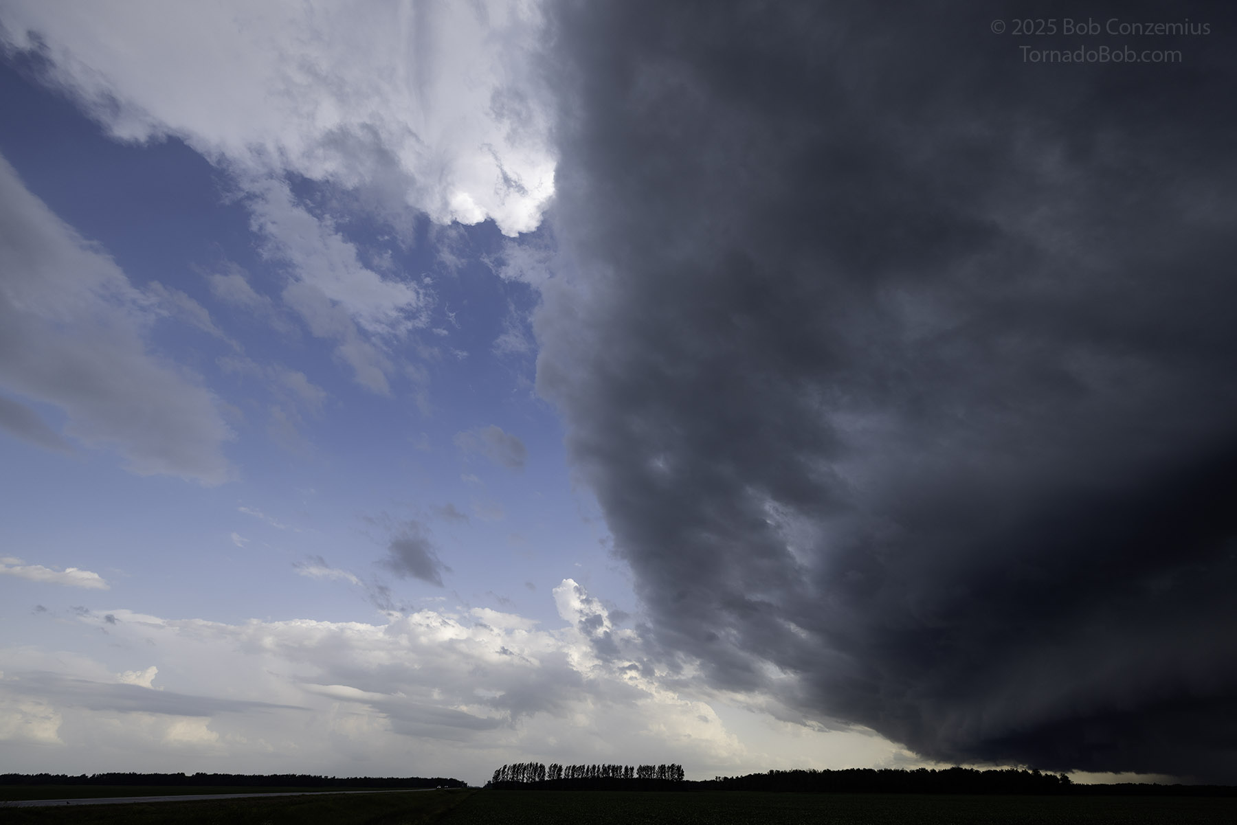
After a day of rest, it was time to chase again. The same 500 mb longwave trough that had produced the North Dakota tornado outbreak two days ago was moving eastward and lifting out. At the surface, a cold front was forecast to move southweastward into Minnesota. Ahead of the front, there was still a lot of very humid air and moderate instability. An outflow boundary was positioned west-to-east across northern Minnesota, generally south of U.S. Highway 2. This outflow boundary was beginning to lift north and wash out a bit. To its south, temperatures were in the 80s, and dewpoints were in the 70s. To its north, temperatures and dewpoints were about ten degrees cooler. HRRR showed thunderstorms developing north of Highway 2 in the far northwestern corner of Minnesota around Thief River Falls and northward, moving across the Big Bog area (very few roads) while NAM nest showed storms also forming quite a bit farther south into west-central Minnesota. My goal was to get to Fosston or, perhaps, Thief River Falls and then position somewhere northward or southward along the cold front, depending on how far southward storms developed along it. My thinking is that I would more likely have to go north.
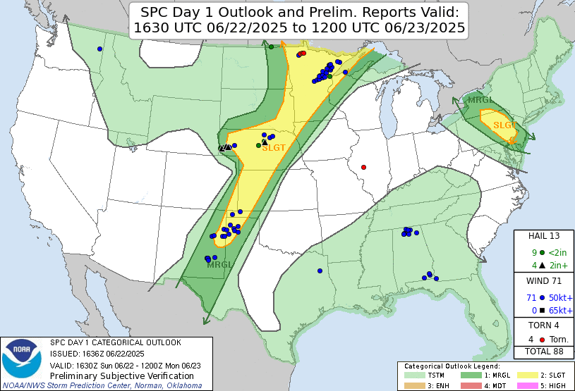 |
| The SPC Day 1 1630 UTC Outlook with severe weather reports. |
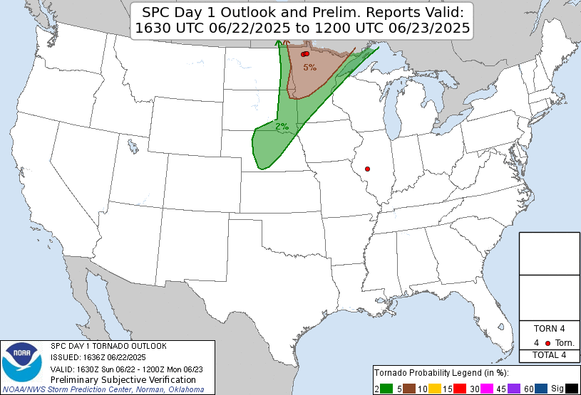 |
| The SPC Day 1 1630 UTC tornado probability graphic with tornado reports. |
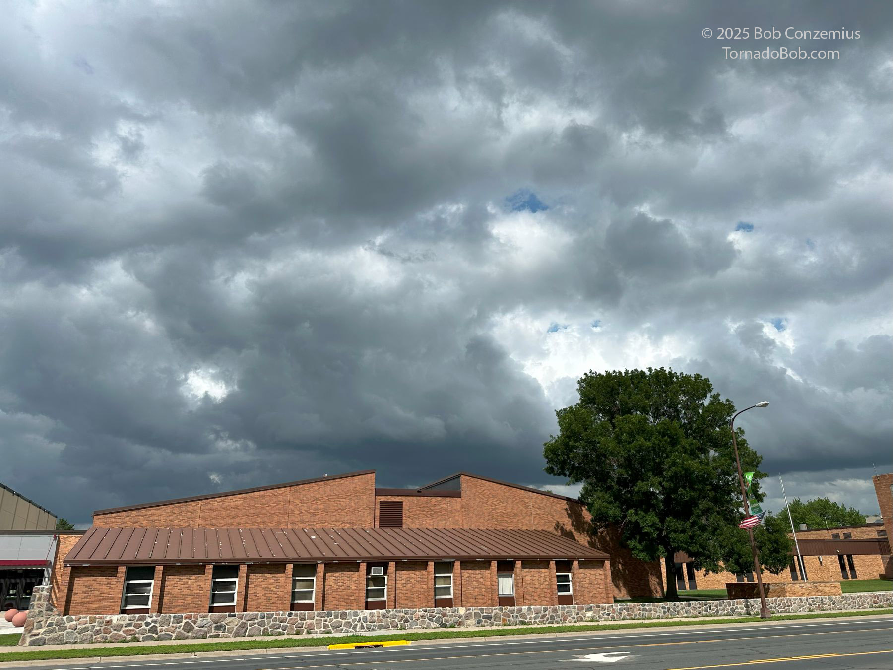
I hoped to stop in Bemidji and top off the charge there so I would have plenty of range for the chase, especially if I would have to drive around the north side of the bog. However, the entire town was without power, including the Superchargers. There was extensive tree damage everywhere, and there was also some structural damage, particularly to pole barns and other fabricated metal buildings. A few of their roofs were torn off. It definitely looked like winds locally exceeded 100 mph.
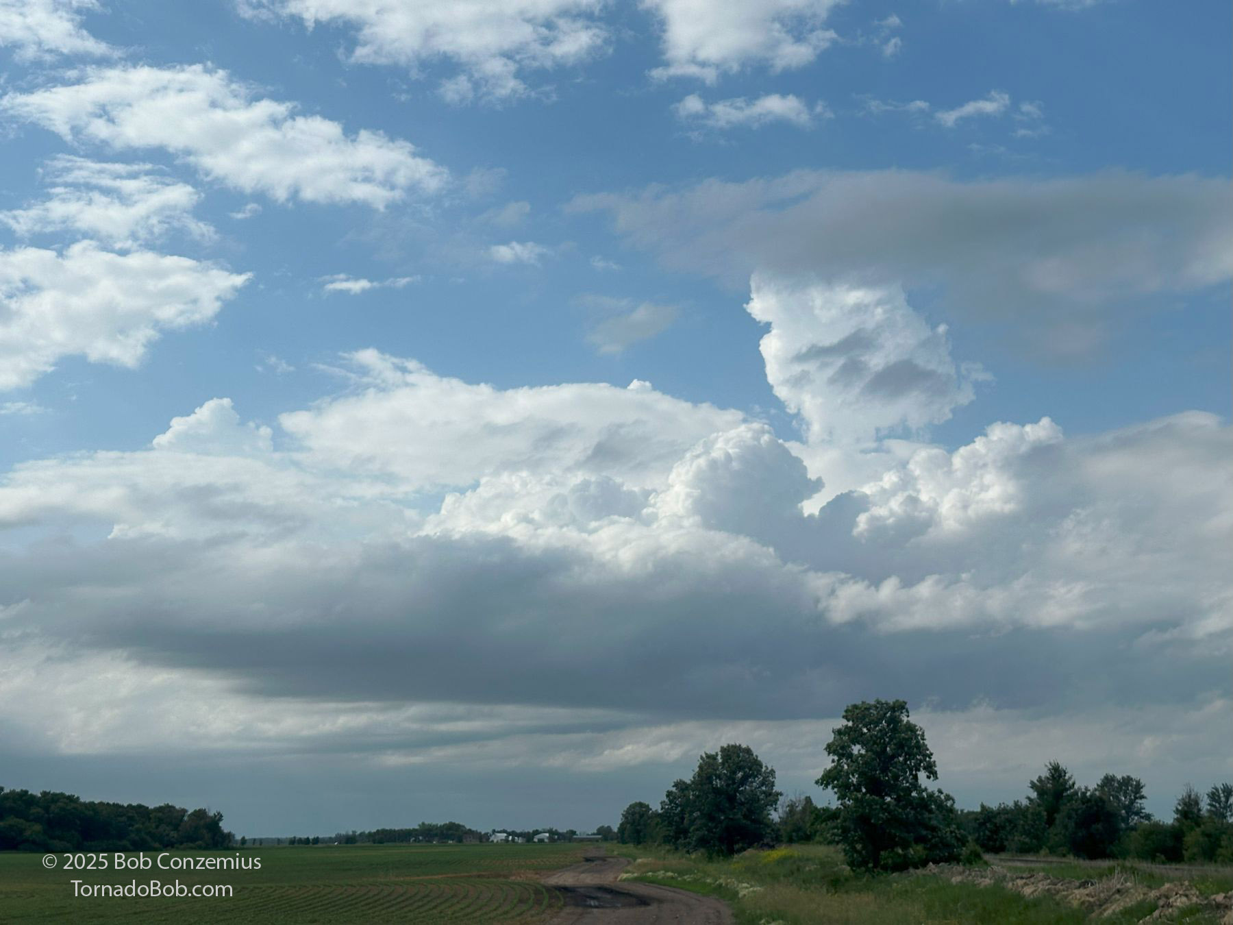
My next charging option was a bit farther west in Fosston. The city hall had a 50 kW charger, which worked just fine once I figured out how to turn it on (these third party chargers are noteworthy for being difficult to figure out, plus they can be unreliable). I plugged in, walked over to a nearby Dairy Queen restaurant, and grabbed some lunch and an ice cream cone. While I was in Fosston, congestus clouds were growing all around, and I watched radar as a couple very small cells developed to my west along a northwest-southeast boundary. These cells had a nice shape right away, but I really needed to finish charging, so I decided to be patient.
 |
| Extensive areas of cumulus congestus around me in Fosston at 4:06 PM. |
 |
| A couple small cells develop, and they have a nice shape. |
Well, those cells died, so I didn't really need to hurry anyway. I decided to wander northward on U.S. 59 from Erskine toward Thief River Falls. The anvils of the original cells were gone, but their updraft bases were still present. It turned out that the initiation process was simply taking a long time.
 |
| 5:09 PM. These first storms did not survive. |
I kept on driving northward as the clouds gradually grew, and shallow echos (tops to, at most, 30,000 feet) were forming on radar. When I arrived at Thief River Falls, the observation showed a temperature of 83 and a dewpoint of 76. Nice temperature-dewpoint spread! The winds were from the southeast. To my north, winds were more easterly, and the temperature and dewpoint were both at least five degrees cooler. I was, therefore, reluctant to drive farther north into lower CAPE air and hoped the storms would become strong where I was. I looked to the south hoping something bigger might come up from that direction, but the clouds were smaller the farther south I looked, and near the southern horizon, the skies were almost completely clear.
 |
| 5:42 PM. Convection initiation was a slow process. |
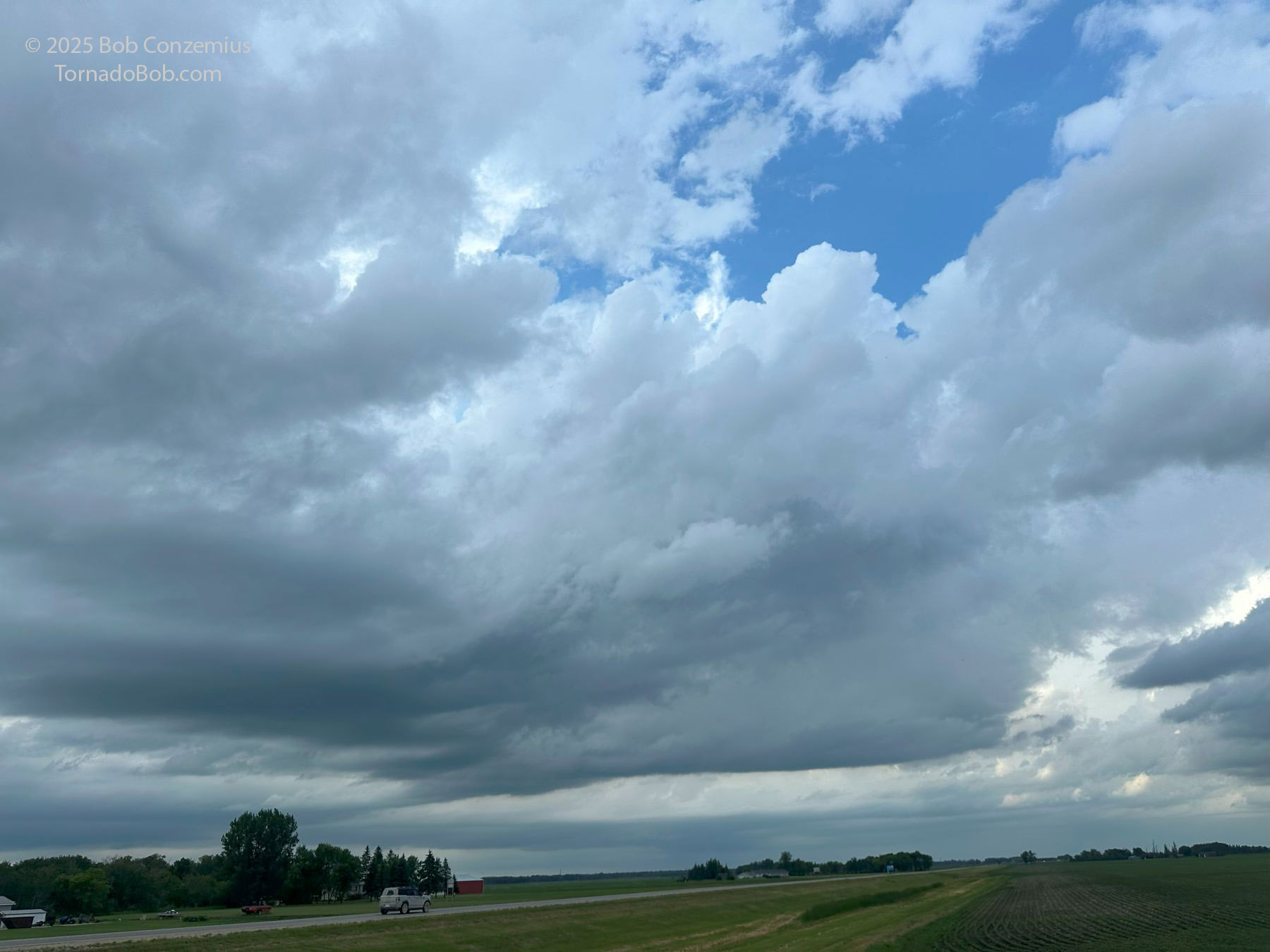
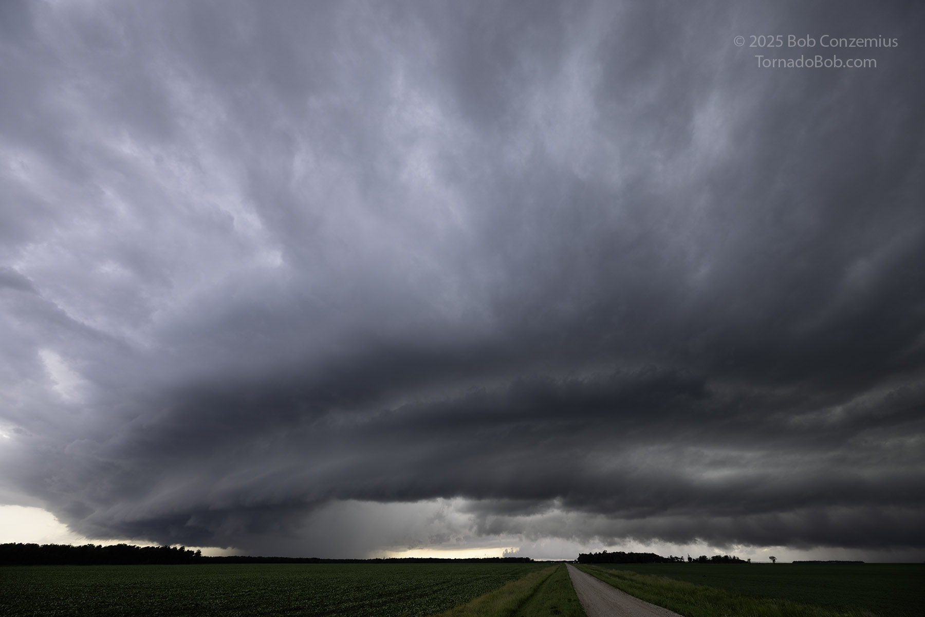
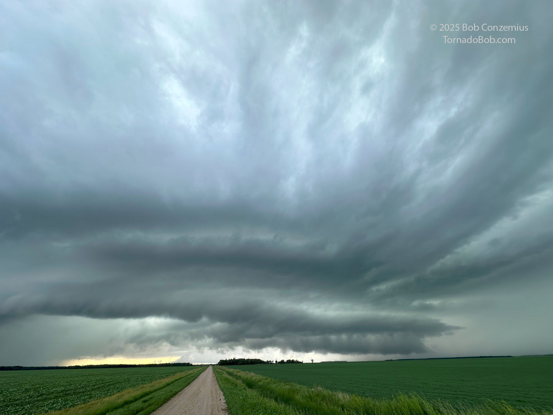
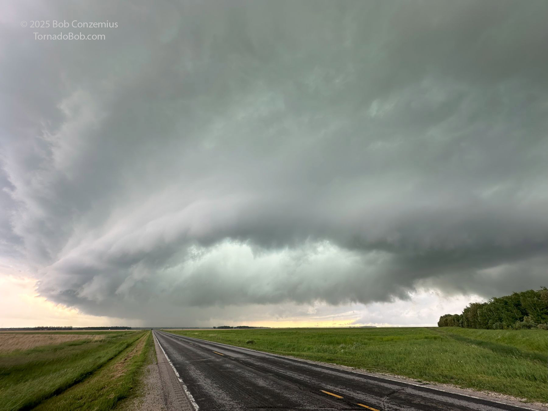
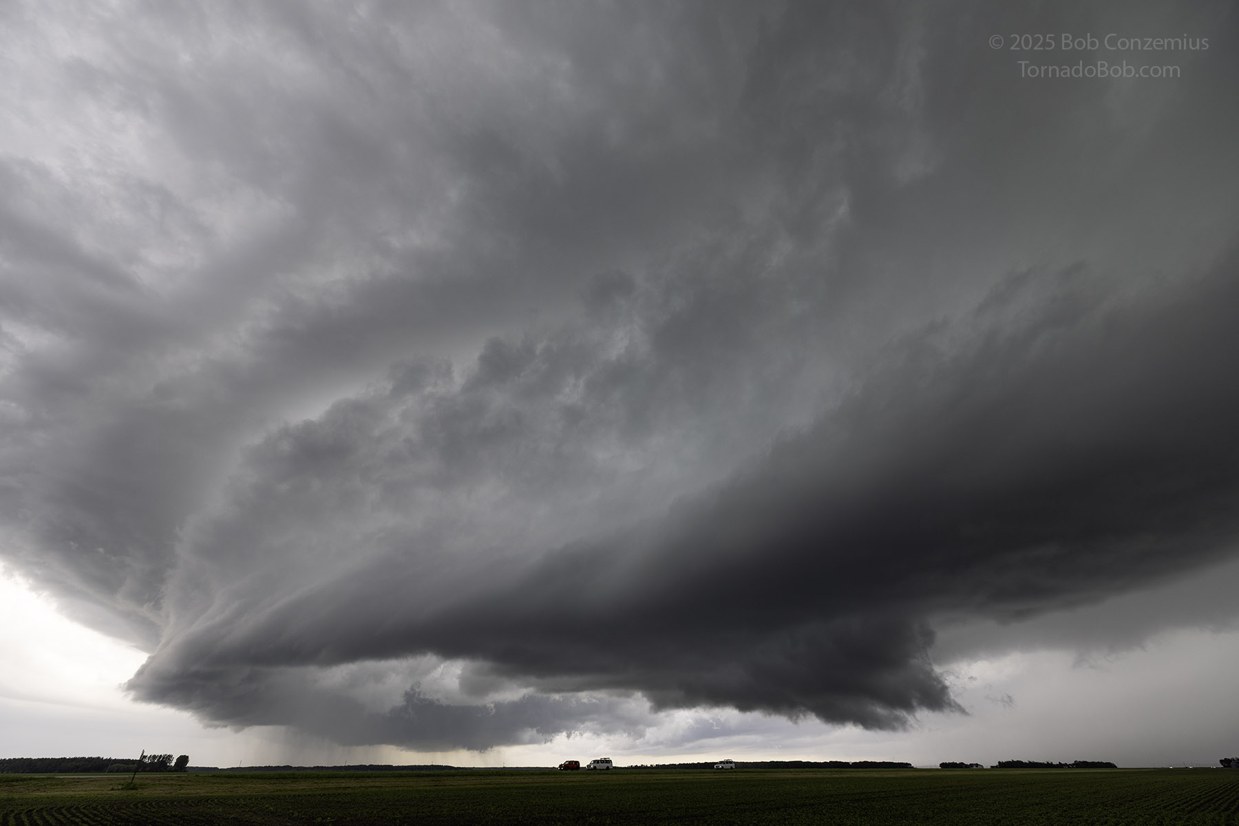
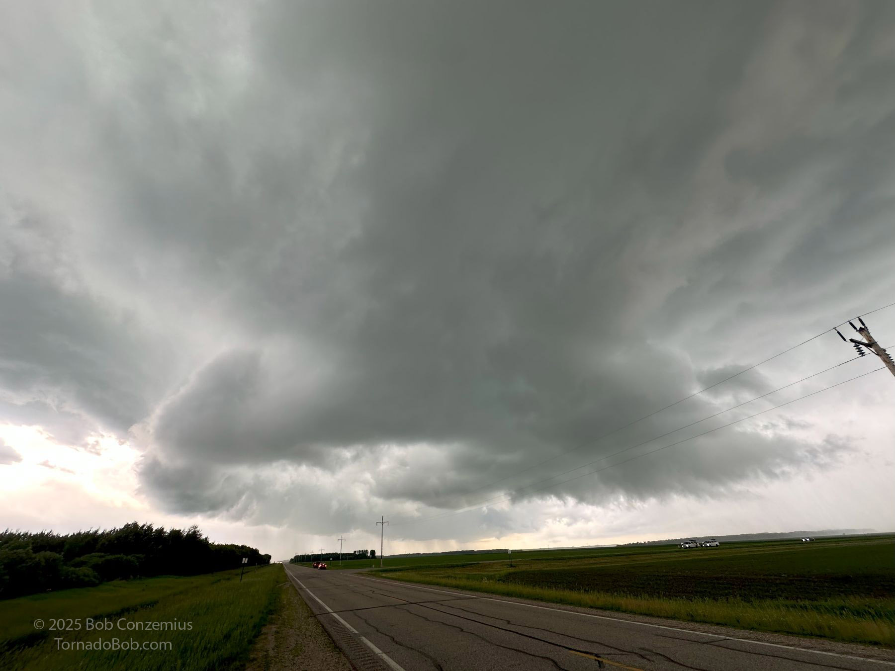
Thus, I had to wait where I was or maybe chase a slightly more elevated storm closer to the Canadian border. The thunderstorm development ended up taking nearly two hours. Just before 6:00 PM (congestus had begun forming by 4:00 PM), I finally had a thunderstorm to my west. This storm, or cluster of storms, gradually grew in size and developed more interesting features at cloud base. On radar, they did not look particularly intense, but the appearance from ground level became increasingly supercellular. At first, the bases were rather flat and multicellular, but over the next hour, a healthy mesocyclone developed, and all the typical supercellular features were present: wall cloud, reaf-flank downdraft, tilted updraft, vaulted appearance, and an arcing shelf cloud on the south side of the RFD.
 |
| 5:51 PM. The first thunderstorm finally develops. |
 |
| Radar now shows a few storms growing in size. |
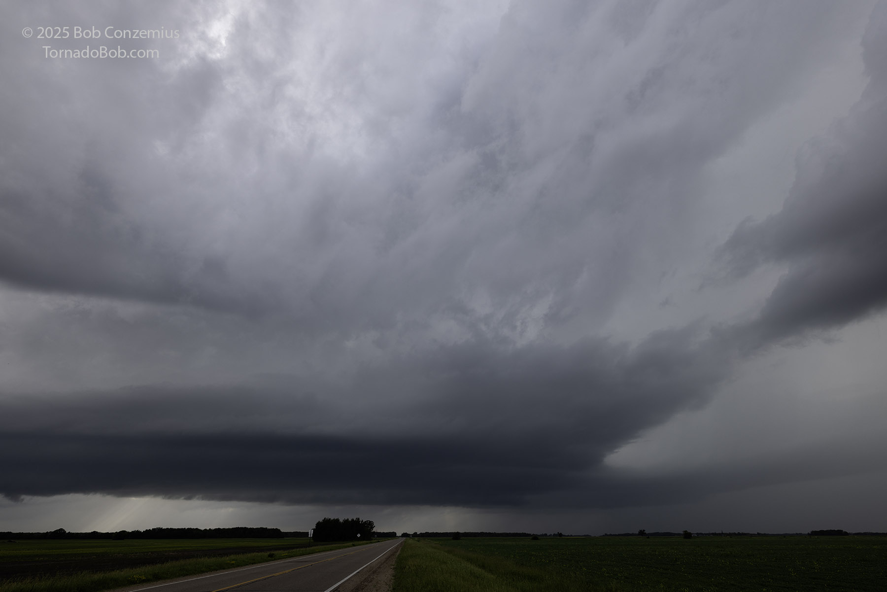 |
| 6:03 PM. The storm looks to be intensifying. Bases are lower but still flat. |
 |
| 6:20 PM. Is this an inflow tail or a developing shelf cloud? Whatever the case, things are getting more interesting . |
I preceeded the storm east through some of Minnesota's best chase terrain, but the open fields don't go on for very long when you're chasing in northwestern Minnesota. Soon, you get into trees. This time it wasn't too bad. The storm took us (I met Seth Trobec, another Grand Rapids area chaser) into the Agassiz National Wildlife Refuge, where the road turned to gravel and wound around a couple shallow lakes. This area used to have a decent population of moose, but the population crashed about 20-30 years ago. The trees aren't that tall, and soon, the road pops out on the east side into more open fields. We stopped again on the east side and looked back west. The storm now had a much lower wall cloud and had some areas of rotation along its leading flank. The base of the wall cloud was probably down to a couple hundred feet above ground level. Reed Timmer drove by, and we waved and said hello to each other.
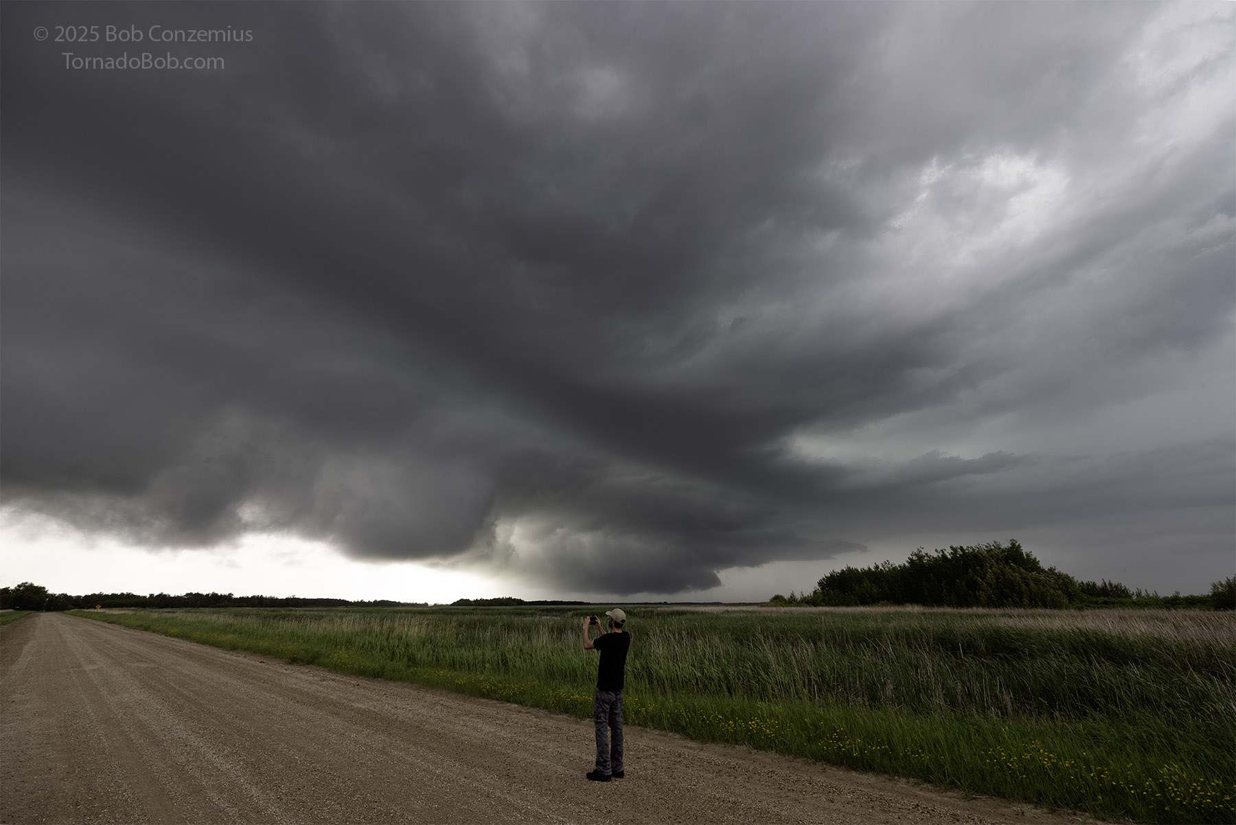 |
| 6:28 PM. Seth Trobec watches the storm in the Agassiz National Wildlife Refuge. Bases are lowering, and the item above his head looks like a genuine wall cloud. |
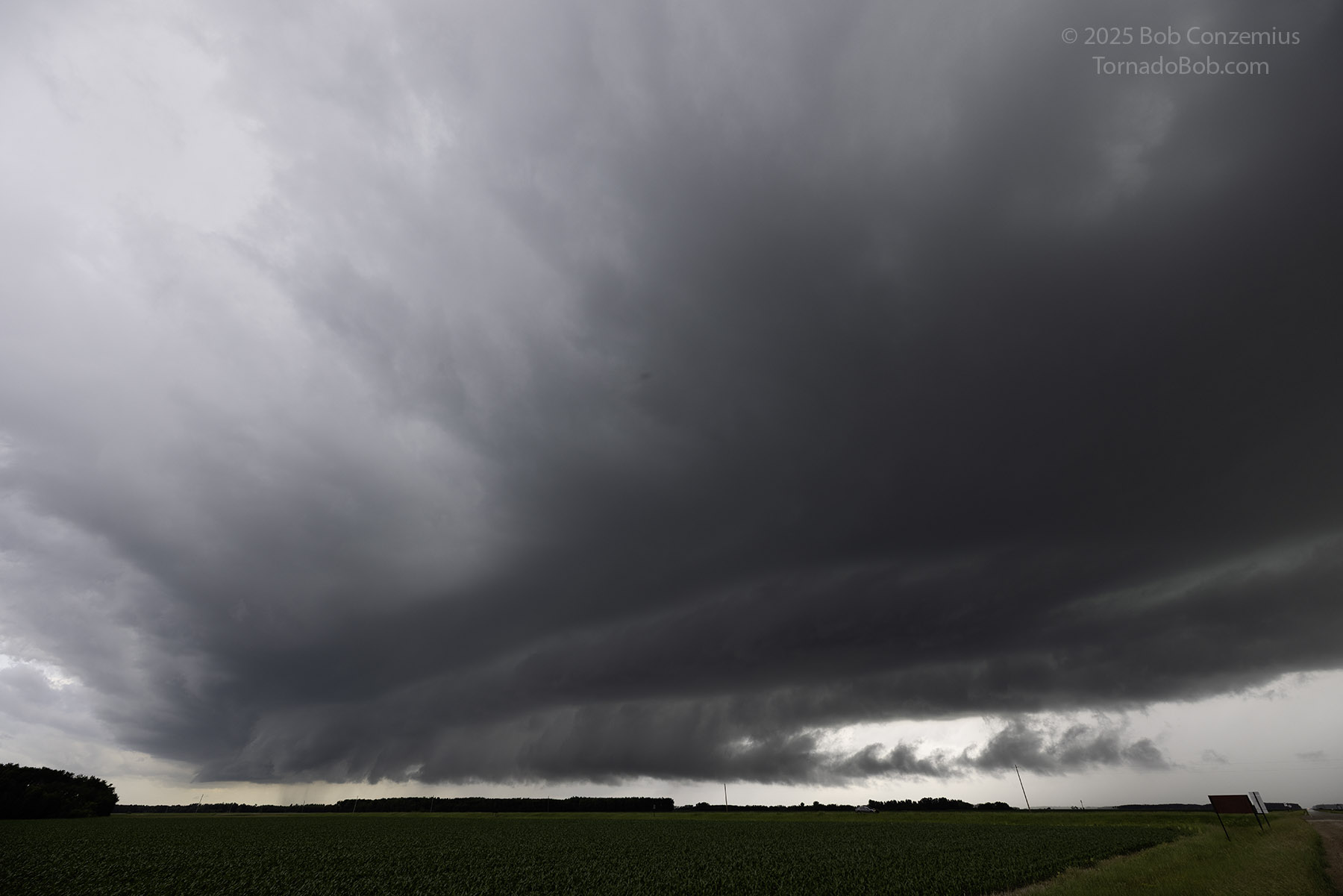
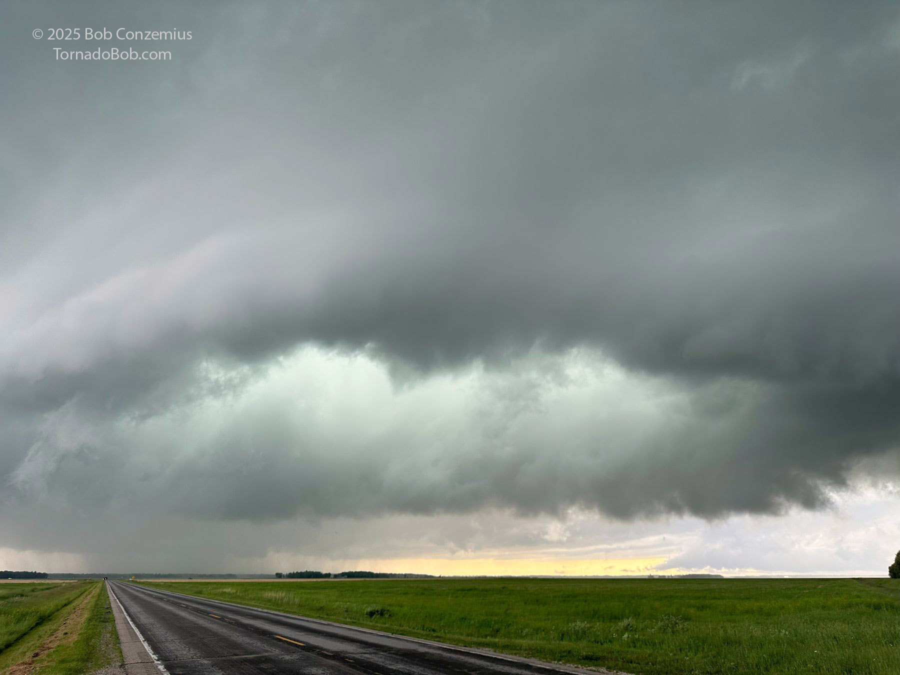
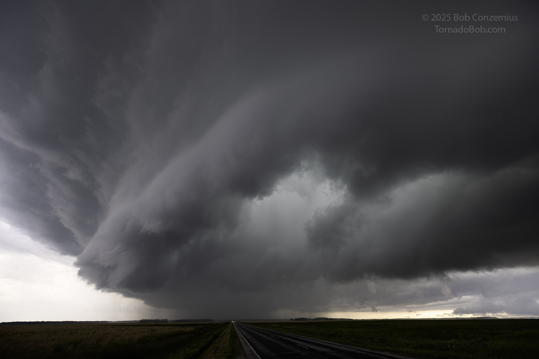
I backed off to a spot a bit farther east. The storm wasn't moving super quickly, so we were able to get ahead of it and see the entire structure. The low-level structure was nice, yet the updraft at mid levels looked a little ragged. The storm was beginning to develop a wet RFD into its base. The storm looked better in person than it did on radar. The interesting low-level features were below the height of the radar beam, and the mid-levels didn't look that interesting, so it wasn't a surprise that the radar presentation wasn't great.
 |
| 6:43 PM. Although the radar presentation isn't particularly strong, the storm really looks like a supercell now. |
 |
| 6:55 PM. Temperature-dewpoint spreads were small, and dewpoints were in the mid-70s, so bases looked ominously low. |
 |
| A broad RFD was hollowing out the center of the storm base, and the motion was becoming more interesting. |
 |
| Looking more directly west at the mesocyclone, showing the wall cloud, at 6:55 PM. |
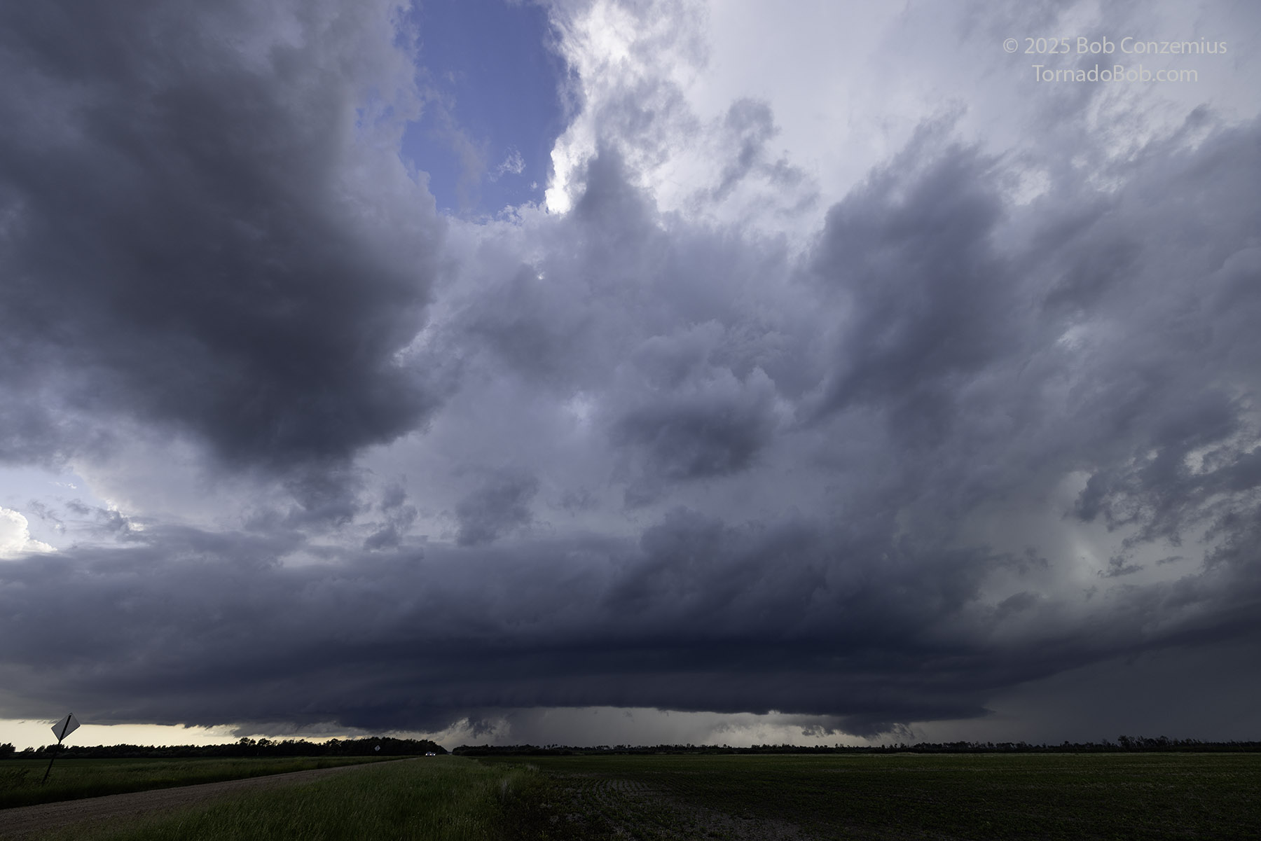
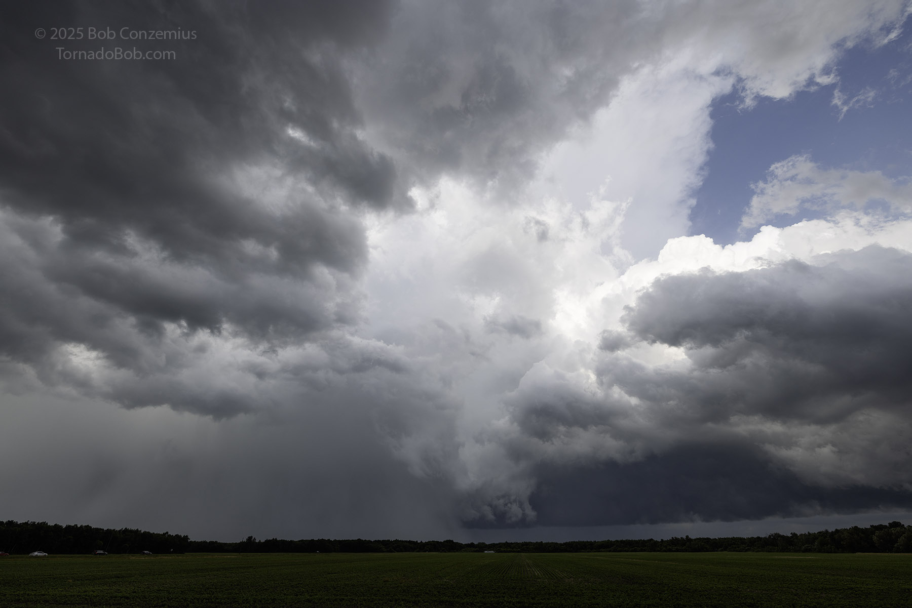
From this point, things got a lot more interesting. Areas of more intense low-level rotation began to develop. These areas had a somewhat occluded look to them with not a lot of dark base around them. They were centered in the middle of the mesocyclone with the darkest cloud bases on the outer periphery of the mesocyclone. At one point, my video shows some pretty fast rotation, and I didn't appear to act very excited because I left rather than continuing to film it, but maybe I was just trying to get out of the way. It was getting pretty close.
 |
| An interesting, elongated RFD type swirl here at 6:58 PM. |
 |
| A wider look at the same swirl. |
 |
| An occlusion occurs, and the item in the center is rotating at 7:01 PM. |
It was shortly after this that the storm took us to the end of the paved road options. I thought the chase could be over at this point. Farther east, there are only narrow, gravel forest roads at best, and I had never crossed the area between Red Lake and Baudette/Warroad. I considered it undriveable. This didn't stop Reed or many of the other chasers.
I was clearly aware of the tornado potential at this point, but it still didn't seem particularly likely. The areas of rotation looked a little misplaced or atypical to me. The core of the storm was overtaking me. I decided to take one last stand on the paved roads and then maybe begin the trek around the north side of the bog through Warroad and Baudette.
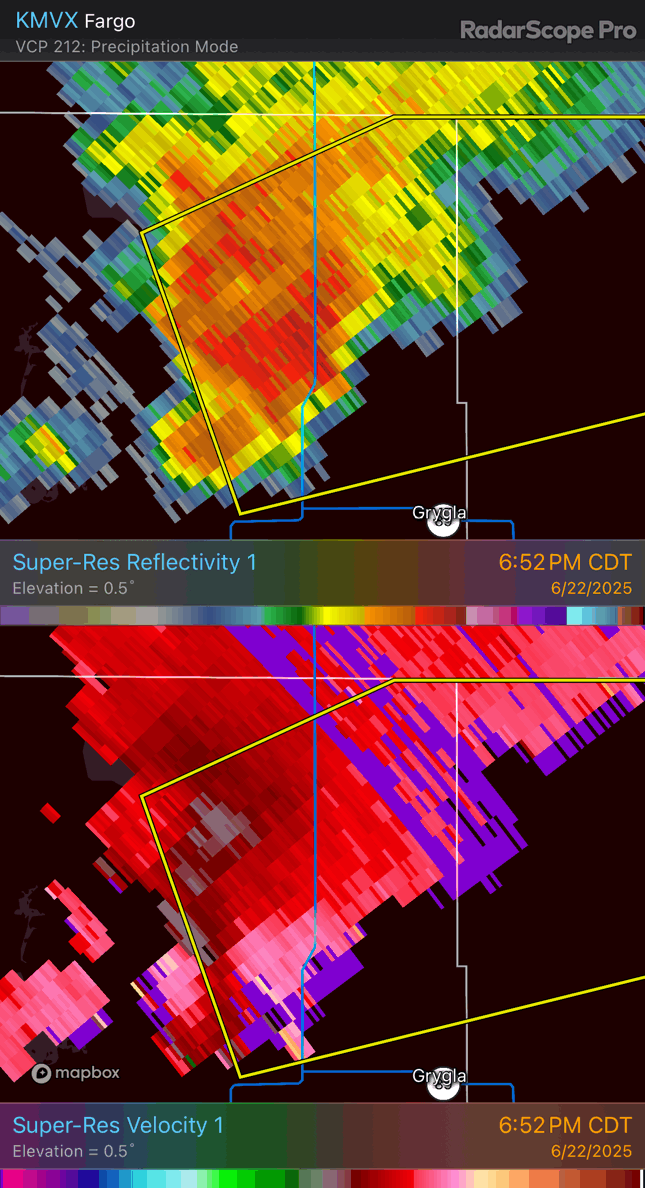 |
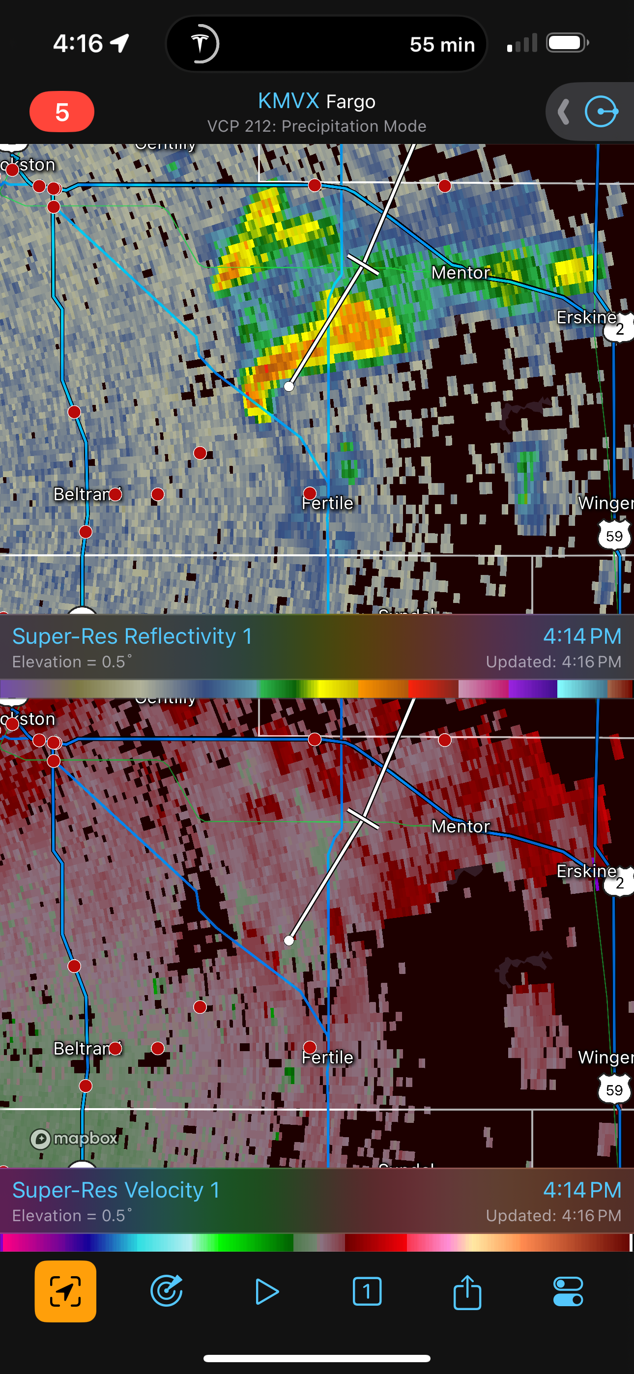
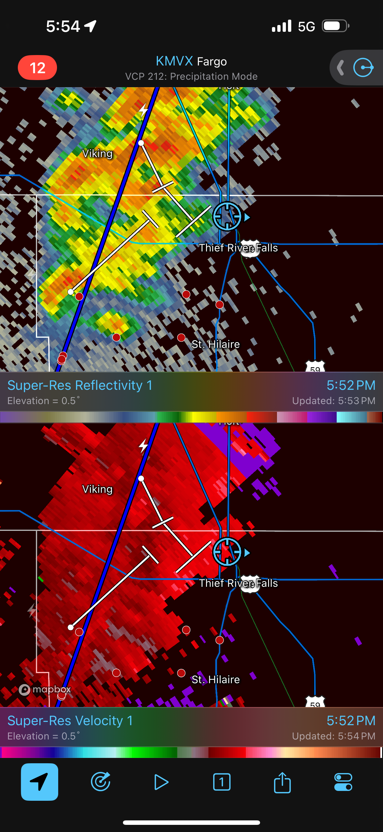
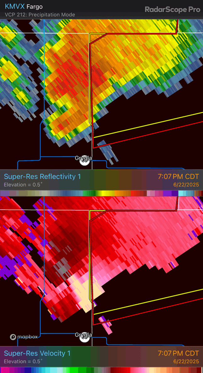
| Radar loop of the storm immediately prior to the tornado. |
 |
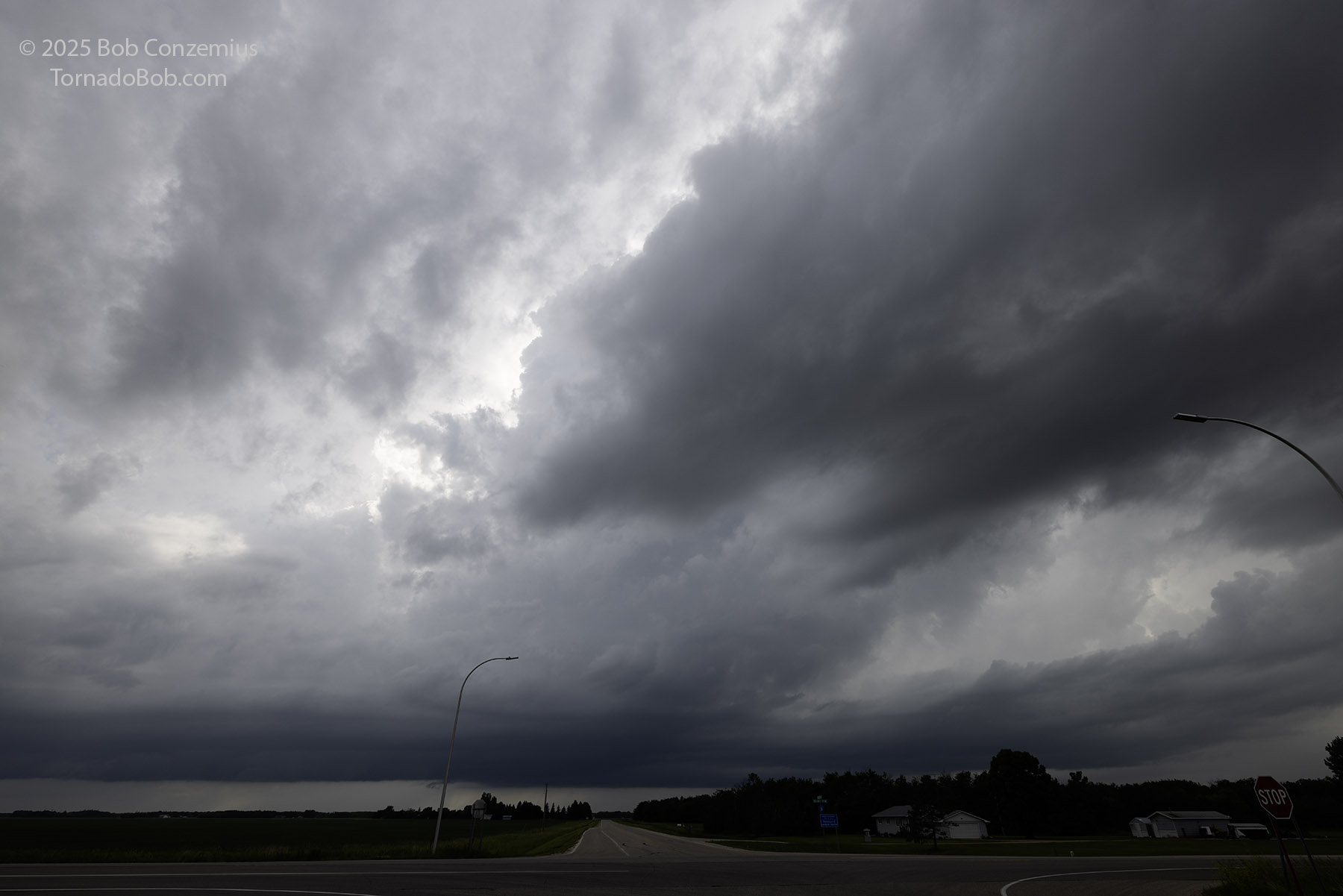
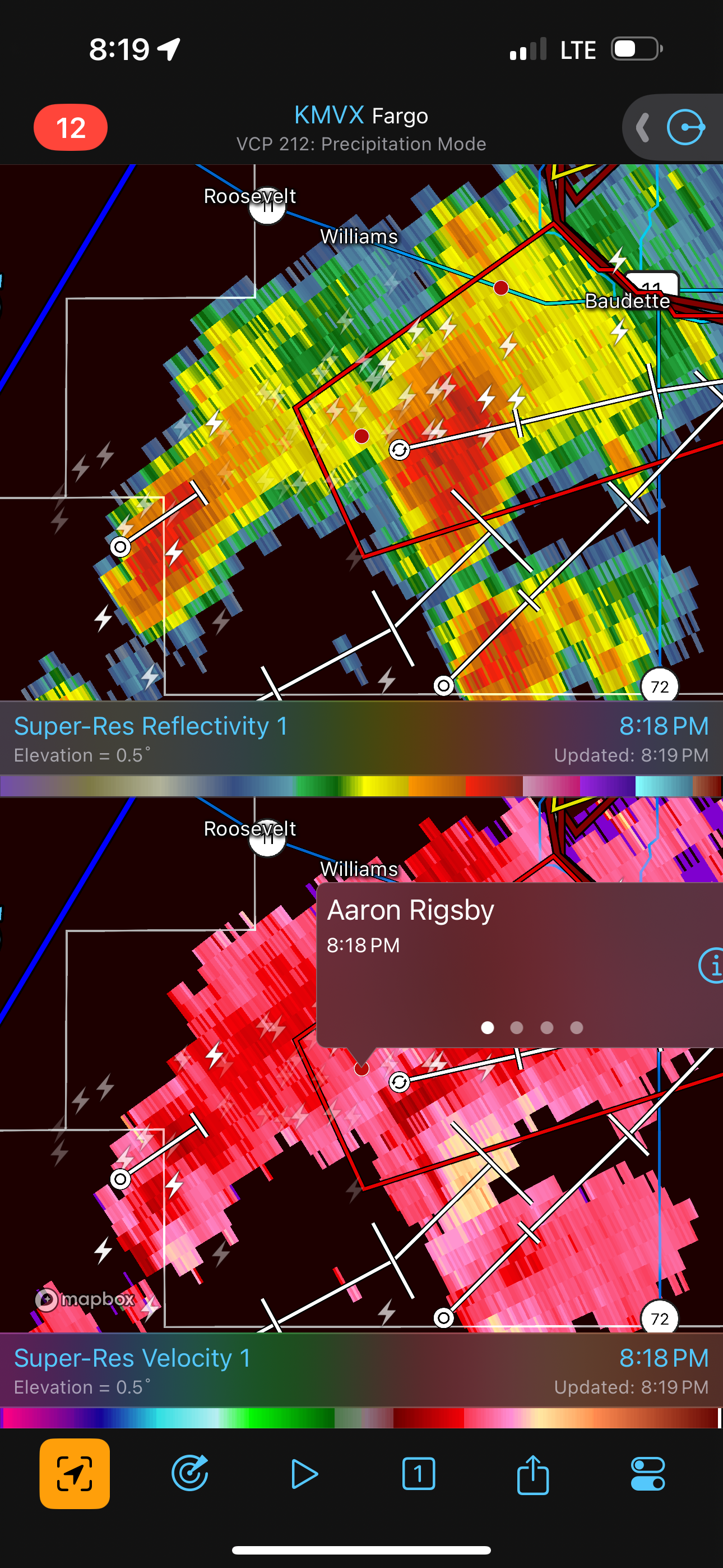
| 7:13 PM. I thought this would be the last picture I would take. The inflow tail was ingesting cloud tags, and rotation was increasing. A tornado warning was issued shortly after this. |
Right as the core overtook me, the National Weather Service Fargo-Grand Forks office issued a tornado warning. Within a minute after that, a tornado icon appeared on my RadarScope app. What? I was not seeing a tornado. Apparently, it had developed as soon as my visibility became obstructed by the heavy rain. I had no hail, so I really needed to try to see what the report was all about. I saw a few chasers turn east on a gravel road, so I decided to follow as long as I could. As soon as I turned east on this road, the rain let up a bit, and I could once again see the important storm structures.
 |
| 7:13 PM. I snapped this picture just before the tornado warning was issued. The still image doesn't look threatening, but the item in the center was rotating. |
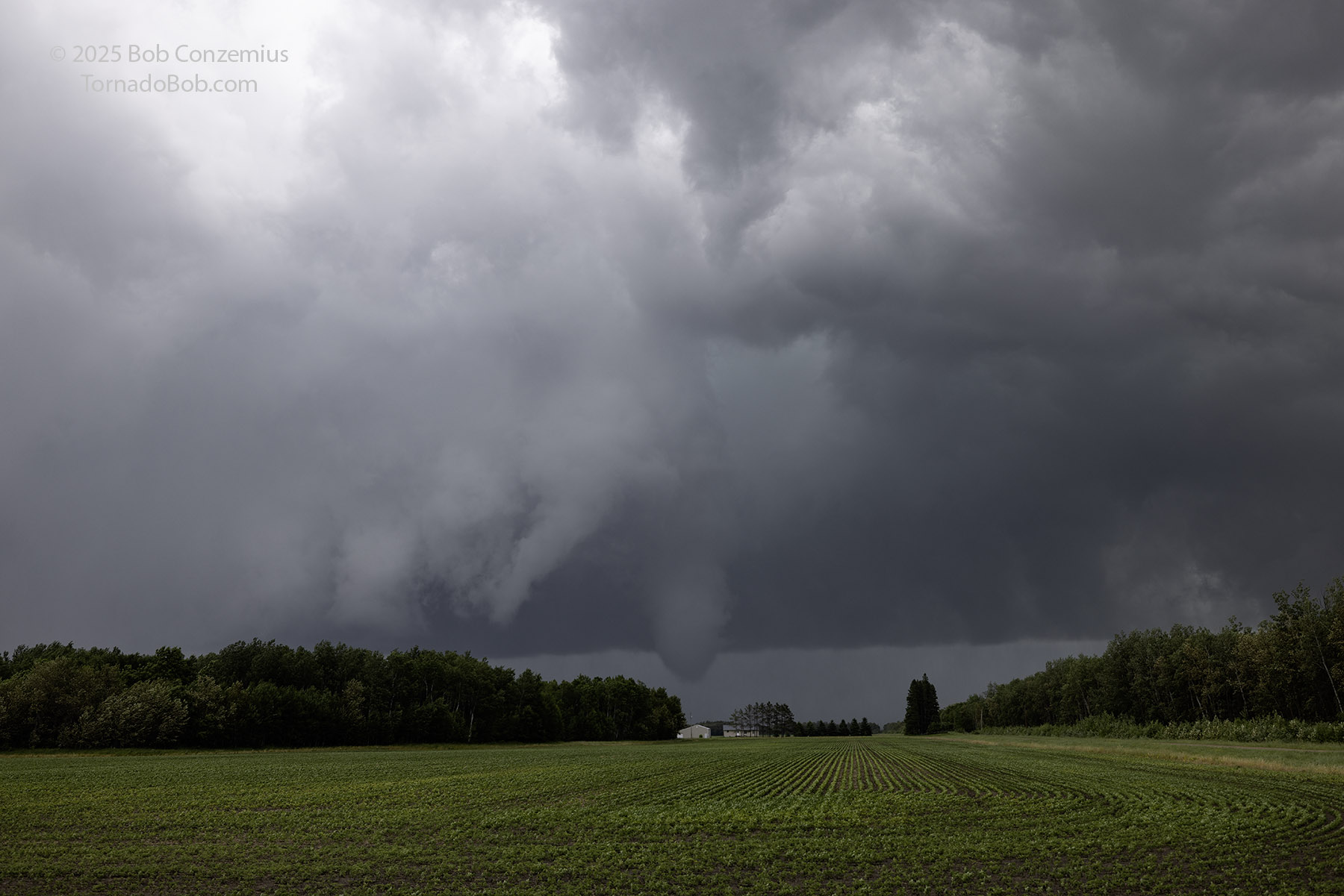
It took about 15 seconds for me to spot the funnel ahead, over an area of trees, just to the south of the road. Cloud motion was pretty rapid from left to right along the back side of the somewhat linear base to my east, and there was right to left motion ahead of that. The condensation funnel reached ground a couple times as I drove east through what I thought was the last open field, and a diffuse debris cloud also developed around the tornado. Most of the chasers I saw were already ahead of me on the dirt road. They did not hesitate to drive on it. I stopped at an intersection and found another field with a view. I took a little video and a couple stills.
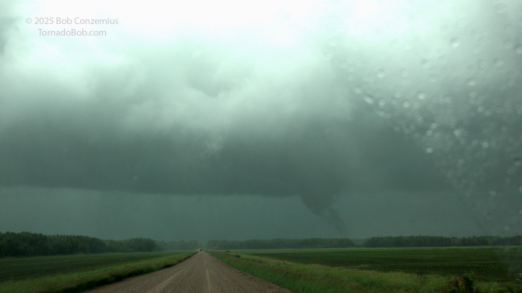 |
| 7:18 PM. Tornado to my east! |
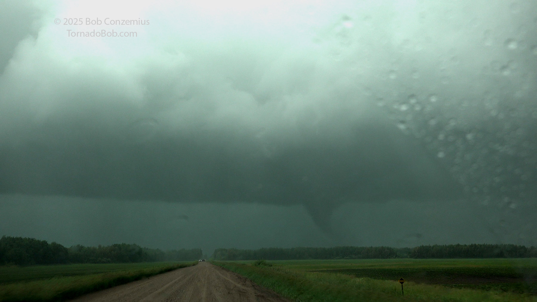 |
| A diffuse debris cloud is visible around the tornado. |
 |
| Condensation was somewhat intermittent. |
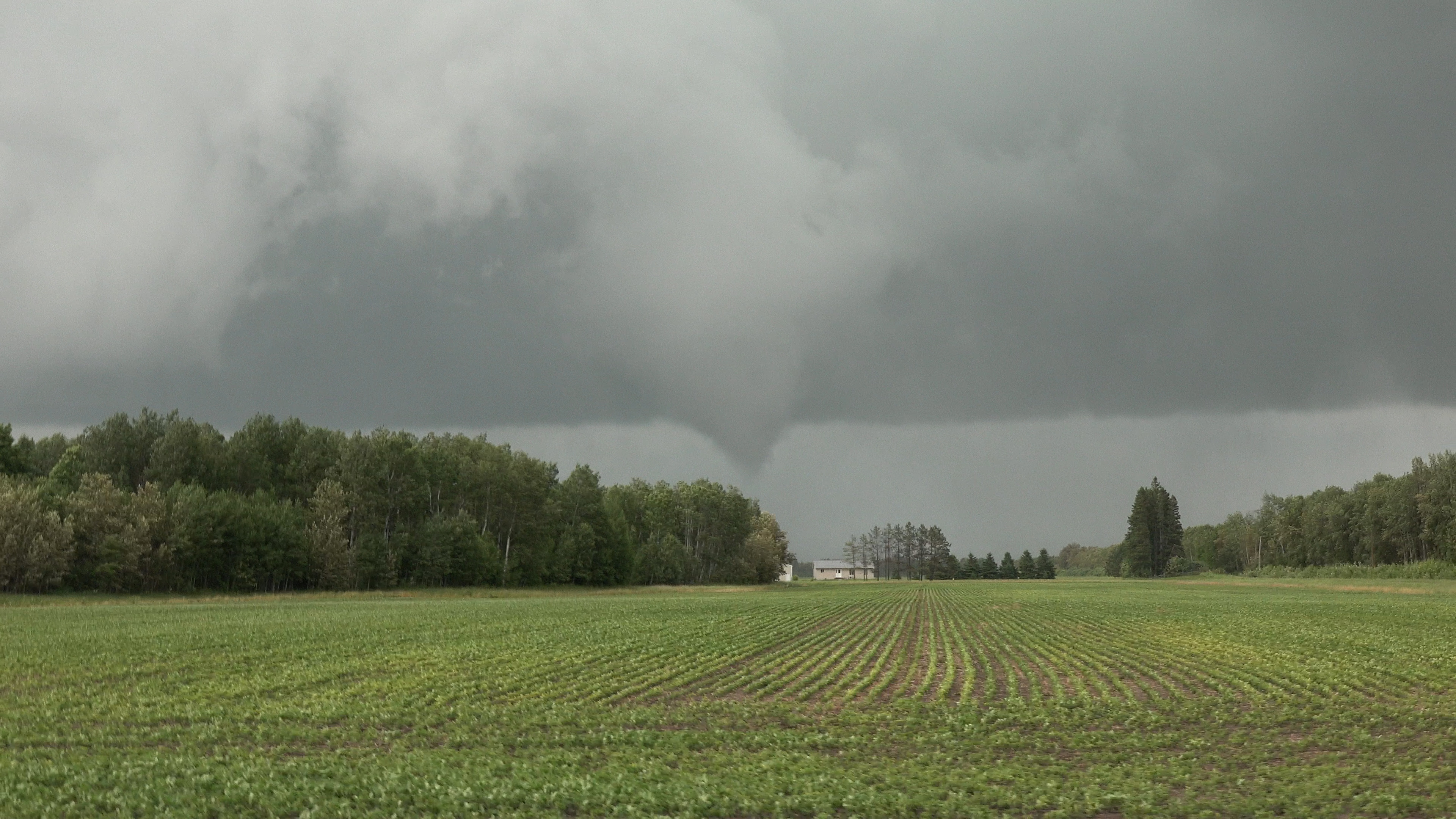 |
| 7:22 PM. The tornado is ongoing. |
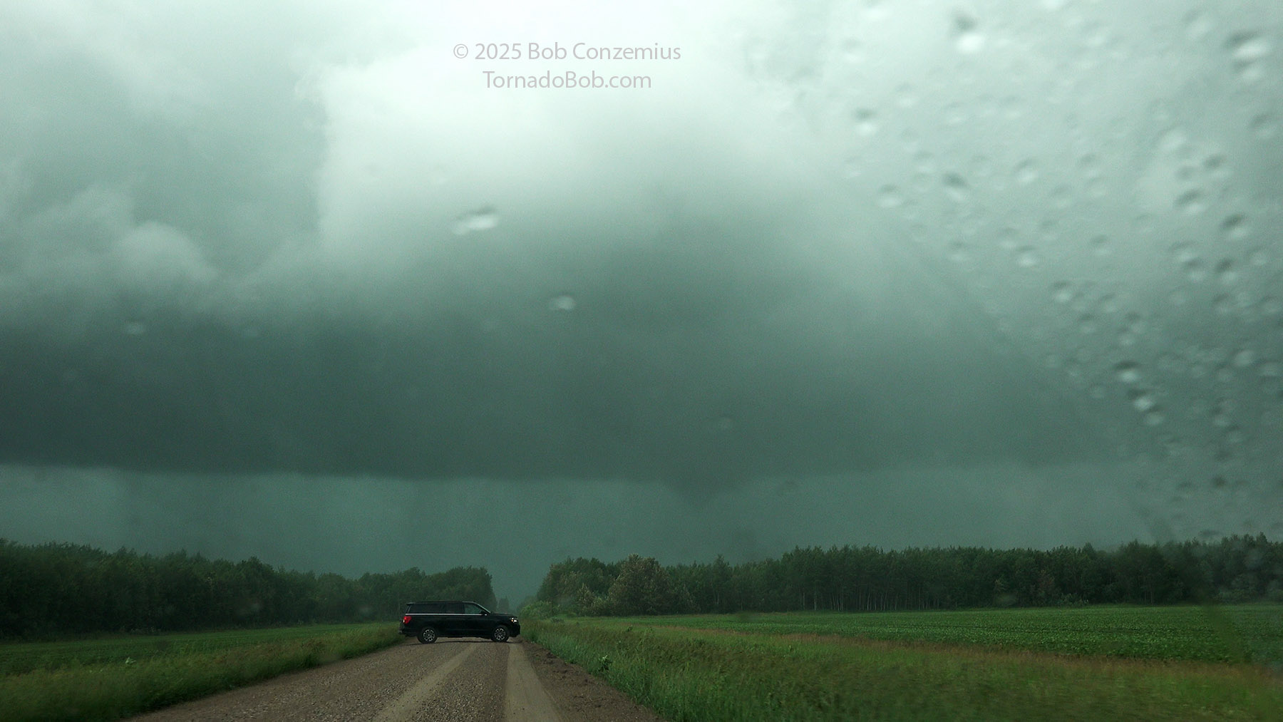
I kept following the gravel roads for a bit, but then I came across an intersection where the roads to the east looked much narrower, so I decided I better go back west and get to pavement. My car's navigation app did not show the route through the bog very prominently, and I was solo, so I didn't have much time to study the road options ahead of me. It was therefore a little difficult to know how trustworthy the roads would be. It turns out that the route through the bog was passable. Quite a few chasers made it through and had more viewing time with the tornado than I did. The tornado wasn't particularly strong or long-lasting, but I do think it went on at least five more minutes after I lost sight of it.
 |
| 7:25 PM. The tornado to my east, going into the Big Bog. This is the last I saw it. |
 |
| Radar loop of the storm during the tornado. |
 |
| 7:28 PM. I gave up on the narrowing roads, so the storm got east of me, but it was still producing a tornado here. |
 |
| Radar image of the storm. |
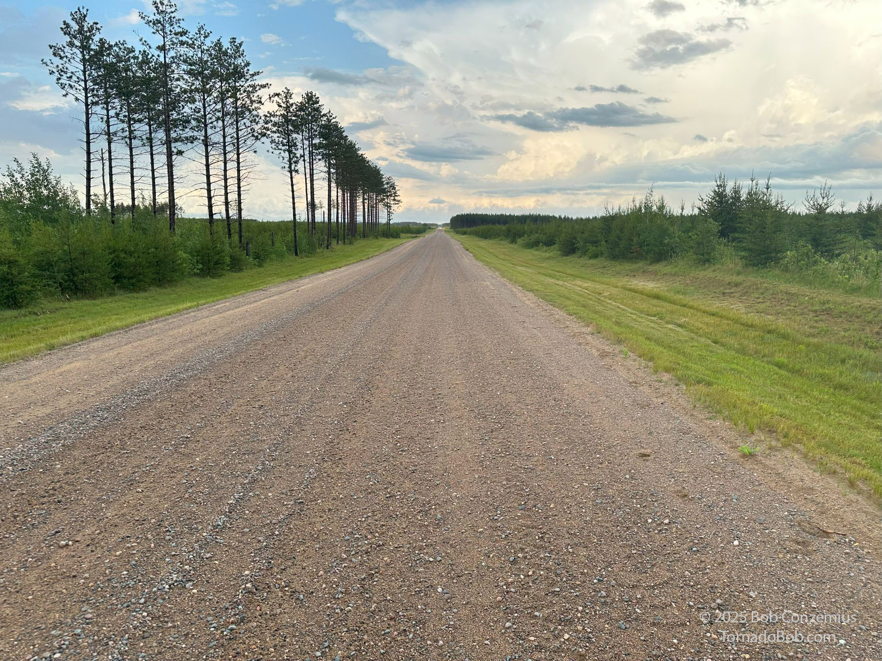
I got back on County Road 54 and headed due north, but then I thought the Thompson Forest Road would be a nice diagonal shortcut to the northeast. It was nice and wide, but it was gravel, and it took a long time to drive that way. I had no chance to get back on the storm. I decided to simply get to Warroad and charge up again at a DC fast charger before heading home. A Level 2 charger that I had used several years before, at Waskish, appeared to no longer be operational according to my Plugshare app, so driving east through the bog really wasn't a good option. The drive through the forest was actually quite enjoyable. I got some views of the back side of the storms.
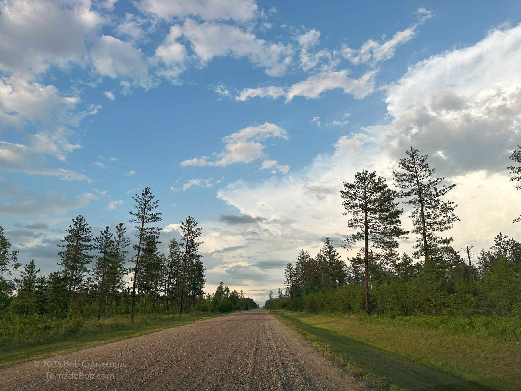 |
| 8:21 PM. Taking the "shortcut" to Warroad on the forest road. |
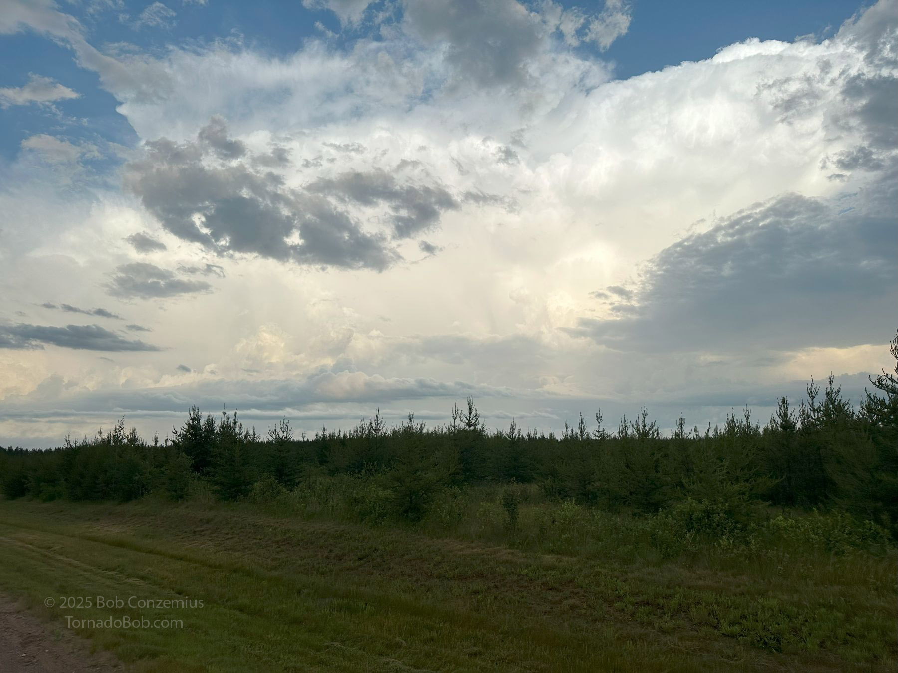 |
| 8:23 PM. The storms were way ahead of me to the east. This was not a shortcut. |
 |
| Looking northeast, ahead of me, on the forest road. |
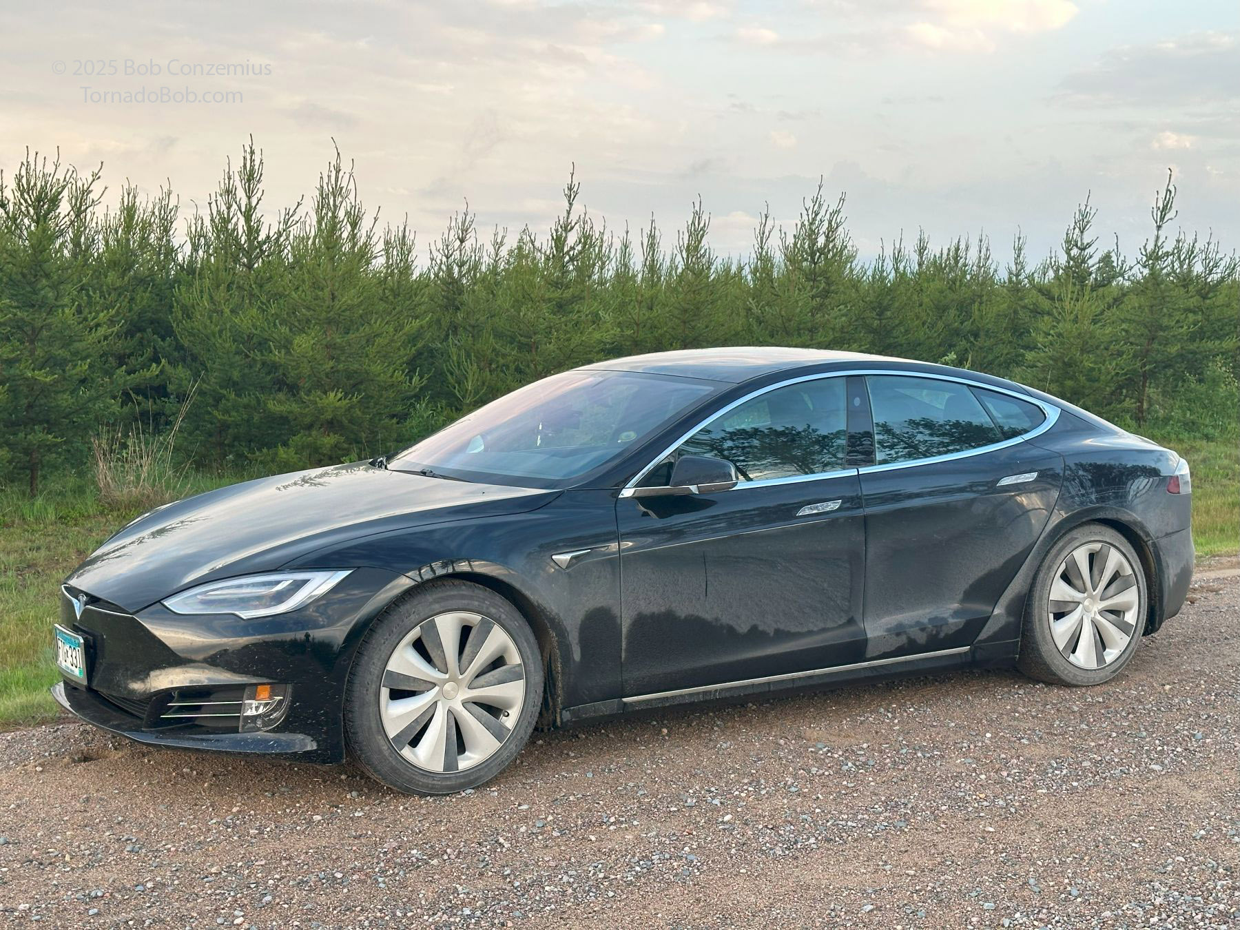 |
| My somewhat dirty car. Probably not that bad given the mileage on gravel today. |
I charged in Warroad and avoided walking into the nearest business, which was a bar. It was a Sunday evening, so it wasn't very busy there, but patrons who were there on this particular Sunday evenings appeared to be a bit tipsy, and I didn't want to deal with that. I found a wonderful ice cream shop around the block, and I decided to hang out there for a while. It was open until at least 10:00, which surprised me a bit. This was a small town, and most small towns close early, particularly on a Sunday evening, but it was also somewhat of a resort town on Lake of the Woods, and it was still pretty light outside at 9:45. The ice cream was great! Afterwards, I drove over to a city park for a look at the lake. Lake of the Woods is too big to see across because of its size but also because the terrain is pretty flat. The sky was now solid gray with a stratus overcast. After taking a couple cell phone pictures, I began the trip home.
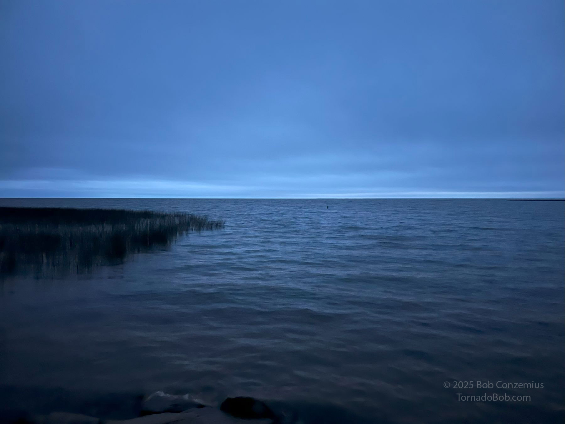 |
| Looking over Lake of the Woods in Warroad at 10:05 PM. |
As I drove southeast, I got a little closer to the storms again, but there was also some partial clearing with stars coming out. As I drove southward on Minnesota Highway 72, I stopped several times and snapped a few pictures in the bog. The traffic through this area is exceptionally light, so I had considerable time to set up a tripod in the middle of the road and take long exposures. The fireflies were out, too. They added some interesting patterns to my pictures.
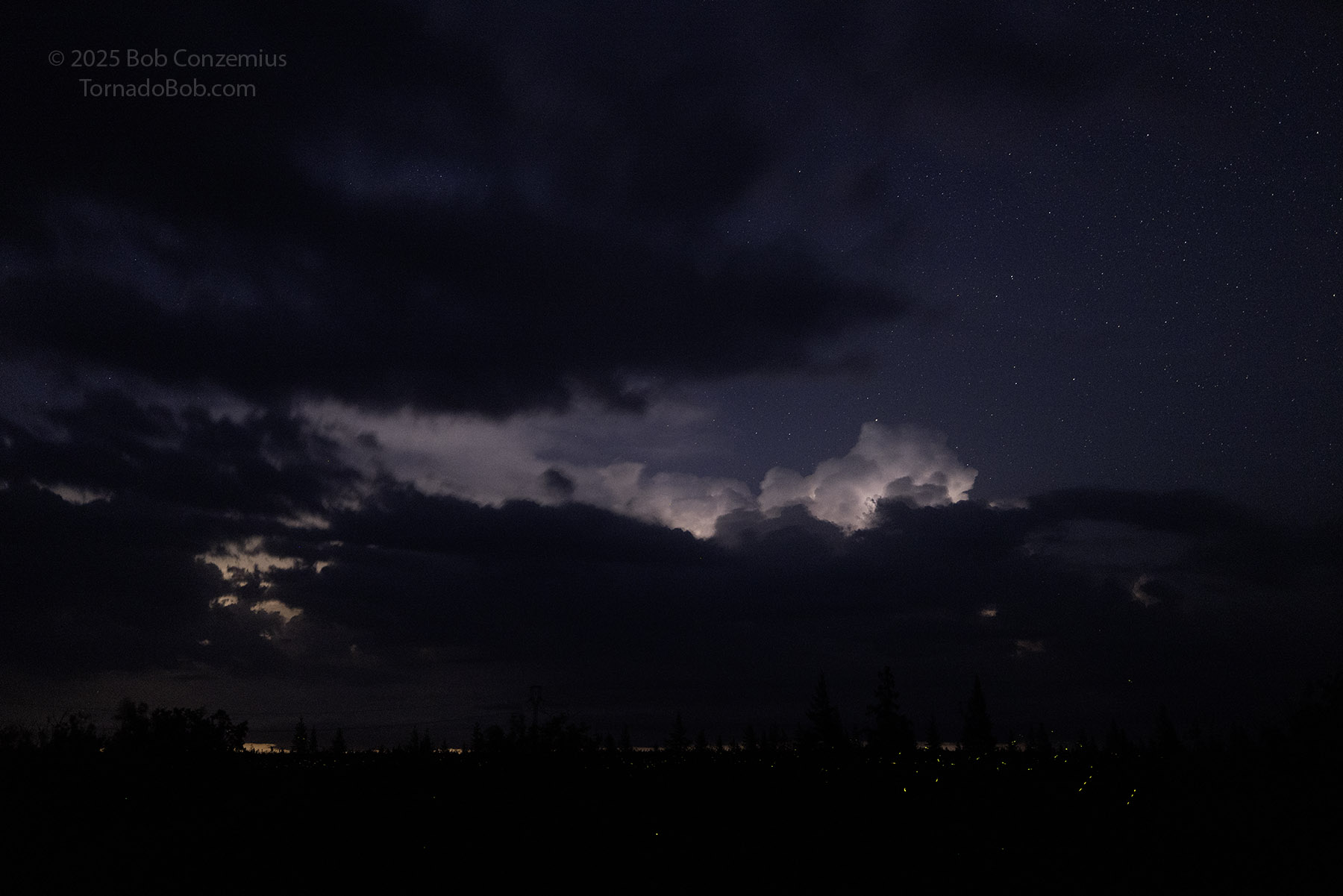 |
| 11:40 PM. Coming home on Highway 72, lightning was illuminating clouds to my east, and fireflies were illuminating the bog. |
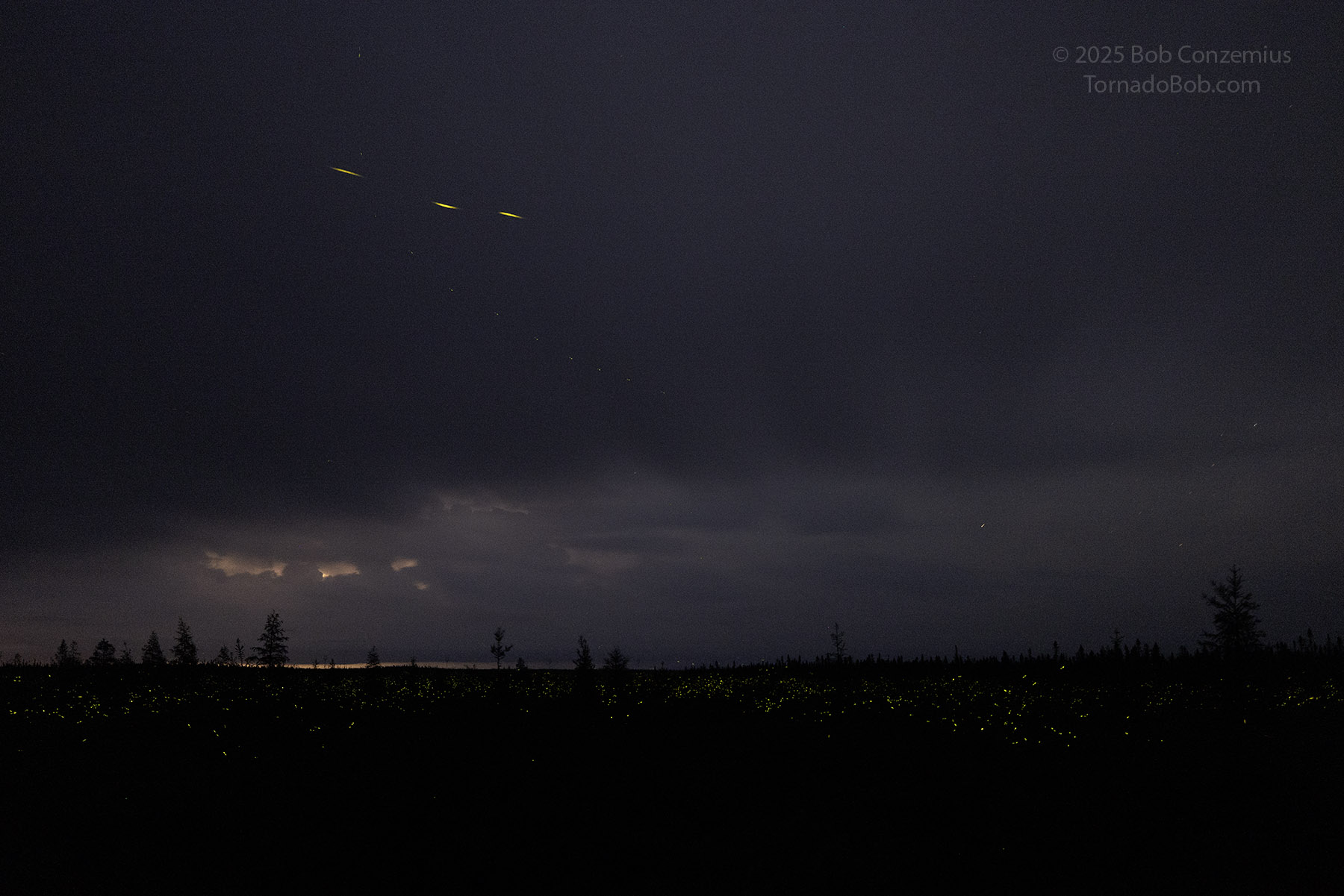 |
| 11:48 PM. A sea of fireflies. |
My arrival home was three hours earlier than it was two nights ago-- around 1:30 AM.
Back to Storm Chases | Home