June 17, 2012 Summit, SD Supercells
I wasn't too sure how I'd do today, given that I was up until 3:30 AM shooting beautiful blue auroras. However, there was a risk for severe thunderstorms (can't remember now because I waited a full year before writing this summary, but I think it was a moderate risk), and it was a Sunday, so off to the southwest I went. Models and data pointed to the extreme northeastern corner of South Dakota. Shear was sufficient for supercells, and low-level shear and low cloud bases made things at least marginally favorable for tornadoes.
Showy Lady Slippers
As I was driving west out of Park Rapids, MN on Highway 34, I saw something I had never positively seen before-- the official Minnesota state flower-- the showy lady slipper. There was a whole ditch full of them. I parked the car and walked back to that ditch to take as many pictures as I could in five minutes. Unknowingly, someone had driven through there with an ATV. Too bad people on and in machines are usually going too fast to notice stuff like this. I'm not sure how I noticed them myself, especially since I had never seen them before.
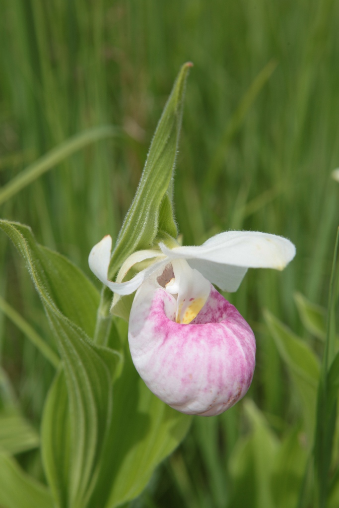 |
| Showy lady slipper, Minnesota state flower, west of Park Rapids. |
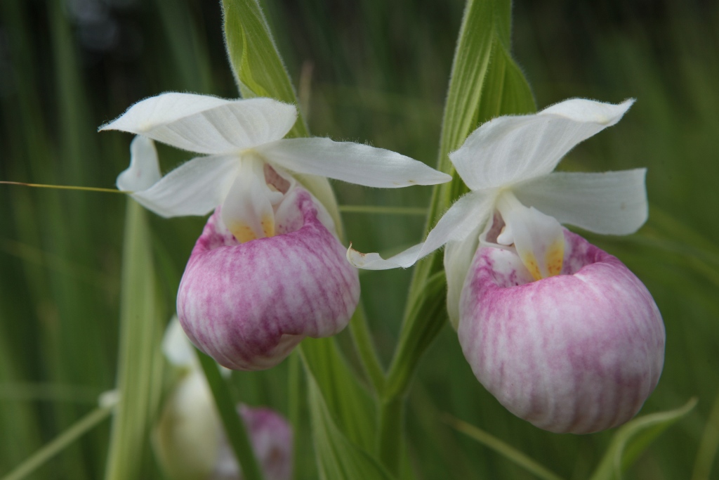 |
| A pair of showy lady slippers. |
Greeting the Supercells
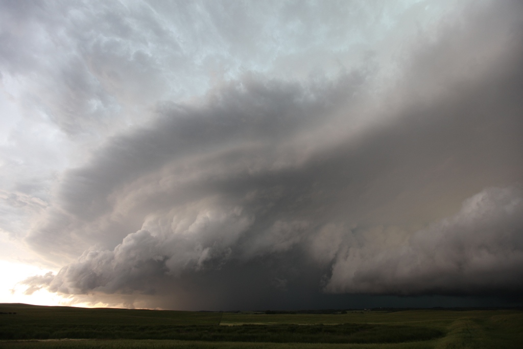
I tried to make the photo shoot as fast as possible, and I was soon back on the road. I drove through Wahpeton and soon had a storm developing right in my target area. By the time I raced to the South Dakota border on I-29, I had a LOT of storms developing in my target area. There were too many storm interactions occurring, and at this point, I concluded that my tornado chances were pretty minimal. I targeted a dominant storm I could reach near the southern edge of the complex of storms and watched it for a bit, but the contrast was low, and light rain was moving into my location, so I continued south. Soon, a dominant storm appeared from farther west in the cluster, and it gave me a clean base to look at without any intervening rain. By this time, I was between Sisseton and Summit. The approaching shelf cloud looked great coming over the green hills of the Buffalo Ridge, but the look I had in the raw images I took did not satisfy me. Either the clouds were too bright or the landscape was too dark. I adjusted the image so that the clouds still had the eerie, dark appearance and the landscape looked green, but it was tough to achieve without losing contrast on the shelf cloud.
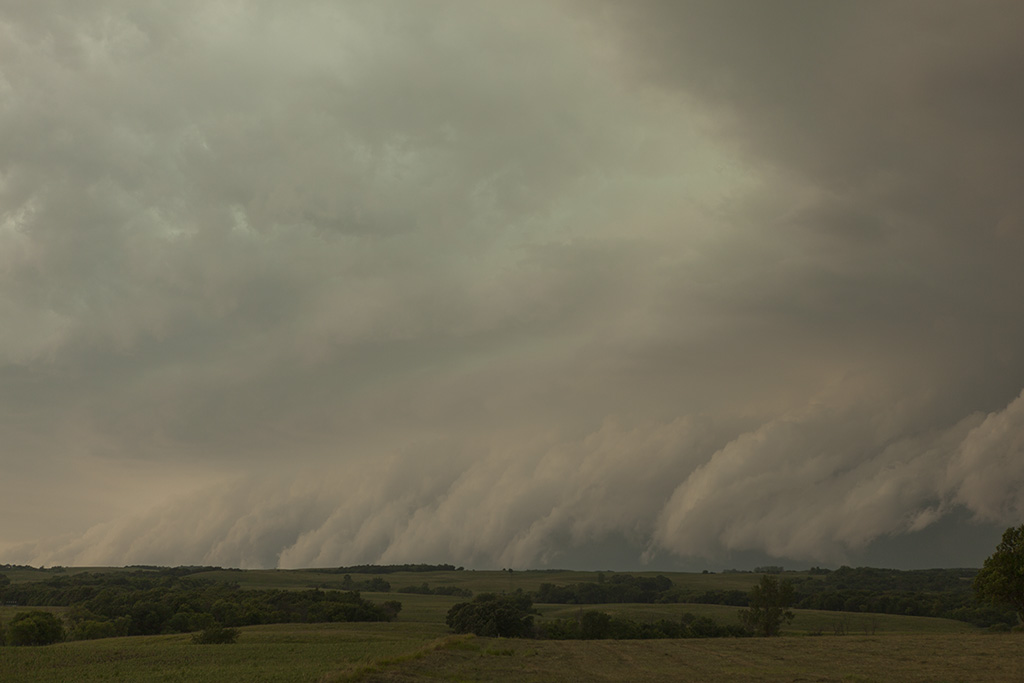 |
| A shelf cloud rolls over the Buffalo Ridge. |
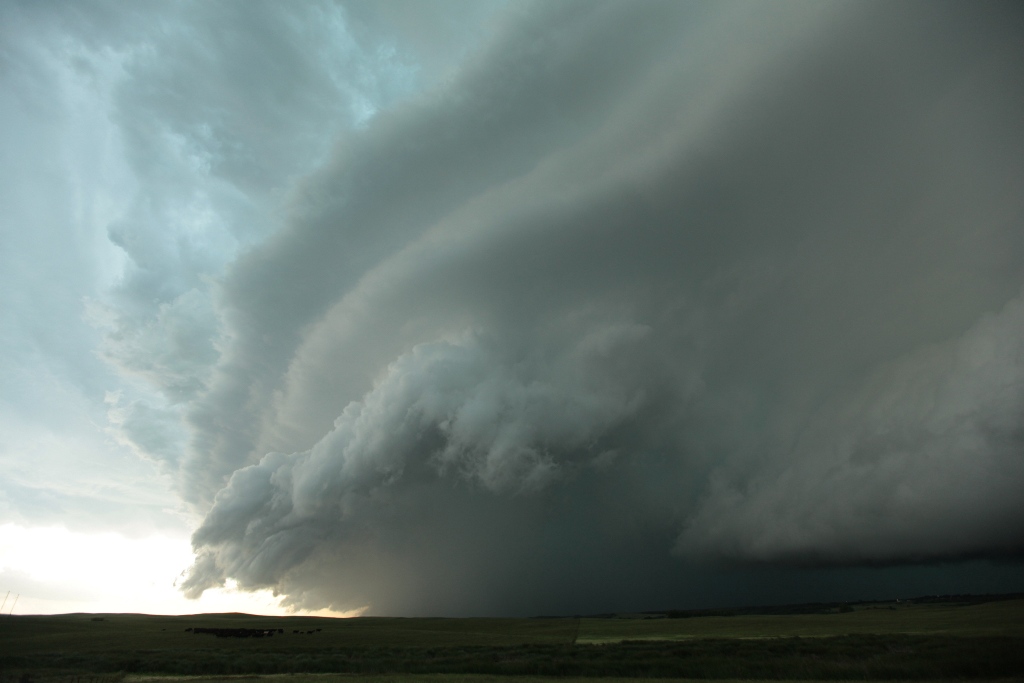
When I came over the top of the Buffalo Ridge, I could see an inflection point in the long shelf cloud and decided to stop and take a look. It started to develop some rotation at this point, so I stopped to shoot stills and take video for time lapse. It was a great vantage point.
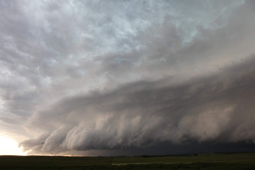 |
| A big, arcing shelf cloud at the front of an expansive wet RFD. |
 |
| Rotation is starting to develop here at the leading edge of the shelf cloud. |
 |
| The storm is almost overhead now-- time to leave. |
The storm was swinging around to my south, so I needed to get back on the road. The RFD swung around me to my south, and I drove back through it to get back on dry roads. I didn't want to be swallowed up by precipitation. and lose the storm, and it was moving pretty fast, so at this point, I had no choice but to continue east-southeast on U.S. 12 from Summit. I got ahead of the storm long enough to snap a couple quick photos and hop back in the car, driving east again.
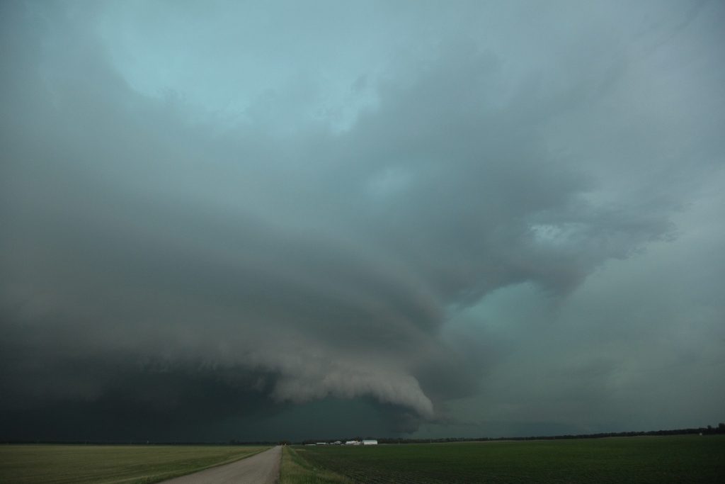 |
| A very low shelf cloud at the leading edge of an HP supercell. An inflow band is present in the lower right. |
That took me to Milbank, and in the meantime, many more storms were quickly filling in behind me. I soon recalled all situations in which I had severe storms congealing to my west, and the result was the same every time. When supercells merge into an MCS, nobody stays in front. The storms overtake you every time. I thought I'd rather drive home on dry roads than in heavy rain, so I decided to slip between storms at this point while it was still possible and take the northwestern route back home instead of the rainy southeastern route.
A Farewell to Storms
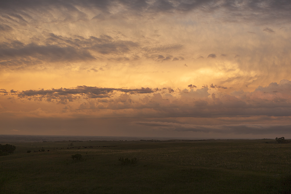
Back west on U.S. 12 I went, returning to Summit, where I stopped to get one last look at the storms now to my east. The sun started to set as I was taking video, so I set up the camera and took a few stills. It was very tough to expose the shot correctly, so I took multiple exposures and found the one I liked best. Some processing of the image to bring out the darker landscape in front of me helped bring out the scene. I often have better luck working with just one image than using multiple images to do HDR. Maybe I'm not good at HDR, but I'm rarely satisfied with it. Anyway, when the color of the sunset faded, I set my sights toward home, starting northward on I-29.
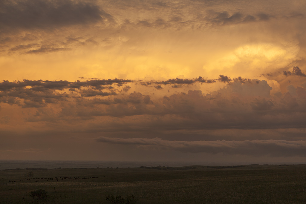 |
| Sunset from the top of the Buffalo Ridge in South Dakota, looking into Minnesota. |
 |
| Another parting sunset shot from the Buffalo Ridge. |
A Smorgasboard of Beauty
As the sky darkened on I-29, I recalled that the earth's magnetosphere might still be a bit unsettled after the geomagnetic storm of the previous night, so I did a quick check of the ACE Spacecraft data, and saw that the interplanetary magnetic field was still tipped far enough south for some auroras. I continued back through Wahpeton and then Barnesville before it got dark enough to see the auroras, and they were pretty low on the horizon, but they were indeed present. I took some photos as the twighlight faded to green light and fireflies swarmed around me. I also noticed that there was a band of cumuloform and cirroform clouds to my northwest. There was another band of thunderstorms about a hundred miles or more in that direction. I had a chance to get an aurora and thunderstorm shot. I popped a few stills, but it was getting late, and I needed to get home. I didn't realize it at the time, but a lighting flash lit up one of the very distant clouds in one of my shots, so I technically had my first thunderstorm-aurora shot, but the more dramatic part of the image was the swarm of fireflies. I continued east back into the clouds, and there ended both my storm chase and aurora chase.
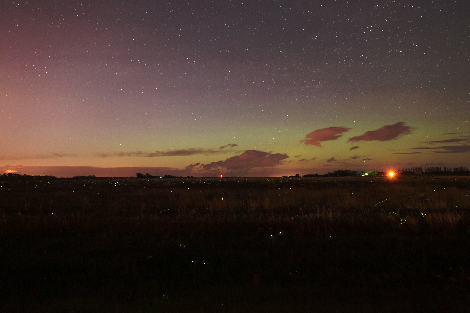 |
| A field full of fireflies, a second band of distant storms on the horizon, and a faint green aurora. |
Back to Storm Chases | Home