Scott Woelm, Meredith Lindrud, Theresa Casper, John Wetter (with girlfriend Jamie), and I departed St. Cloud State shortly after 5pm, thanks in part to Scott kicking me to get out the door from work. We really liked the MN/ND/SD border area as a target, since that area had an extremely convergent signature on our surface analysis. However, I was lamenting over the CINH, thinking this might wait until after dark-- no cumulus-- just stratus everywhere.
When we saw the first cell on radar in western Wilkin County, I couldn't get out of there fast enough, and I repeatedly asked Scott to slap me upside the head for looking at data too long (a problem for me this year).
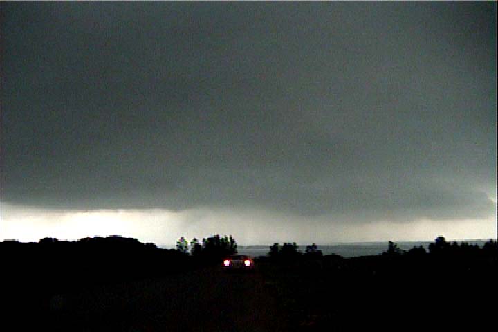
Anyway, we drove west-northwest to Alexandria through a pretty solid stratus overcast, with surface winds at our backs, and clouds moving left to right across the road, so the low level shear was quite incredible. As soon as we got there, a severe warning was issued for our county (Douglas), but we could see nothing through the stratus. A look at TV radar showed this was a supercell. Since the storm was coming right down I-94 at us, we decided to duck south a bit, then west to find the updraft base. The skies cleared briefly to our south to reveal a VERY healthy anvil rapidly overspreading the sky. Seeing clearing to our south, we knew this storm was very close to the warm front and had at least a chance of producing tornadoes.
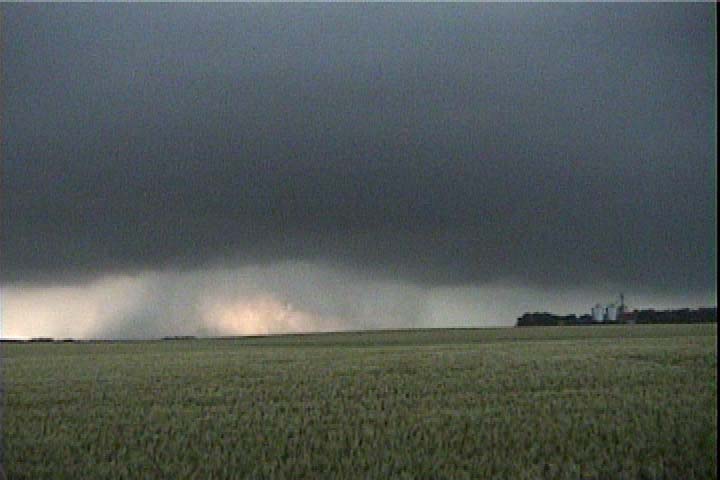
We finally intercepted the storm about 15 miles west of Alexandria. Our only real visual clue we were getting close was the blackening stratus deck to our northwest, punctured by frequent staccato CG bolts. As we drove nearer to the heart of the darkness, we finally saw a broad, circular updraft base reveal itself through the the dark haze to our west. The base looked mean, with some precip curtains in it, yellowish backlighting, and RFD trying to punch through. As we set up on tripod and filmed, the base quickly became filled with rain, and our easterly inflow winds became cooler and more northeasterly from the core. Perhaps it was already time to abandon this one and drop south, hoping for more cells to to come from the west, while still keeping an eye on the notch to our original storm.
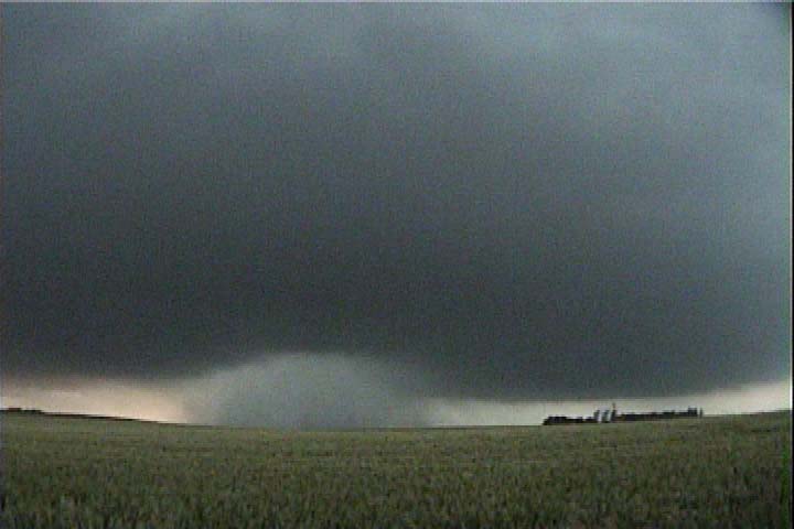
Once we dropped south, it became clear what to do. Another, stronger updraft base was immediately to our west-southwest, the low stratocumulus were screaming right into it. This updraft seemed to be ingesting higher theta-e air, and we could see blue skies to our south (the capped steambath). We dropped a little bit south, then moved east and south with it. The storm was mostly in the HP process with a circular updraft base mostly filled with rain and RFD shelf cloud wrapping around the southern side of the base. A tornado warning was issued for our new cell. We ran ahead of it a bit, stopped to film until the outflow/RFD hit us (not very cold), then blasted east again to get back in inflow.
When we were a few miles southwest of Lowry, a tornado was reported on the ground with our storm. We saw a couple tube-like rain shafts to our north but nothing tornadic. We proceeded east while lamenting these goofy tornado reports but wondering at the same time if we were totally missing something.
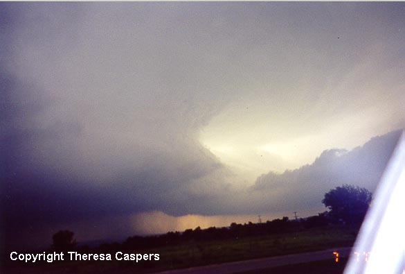
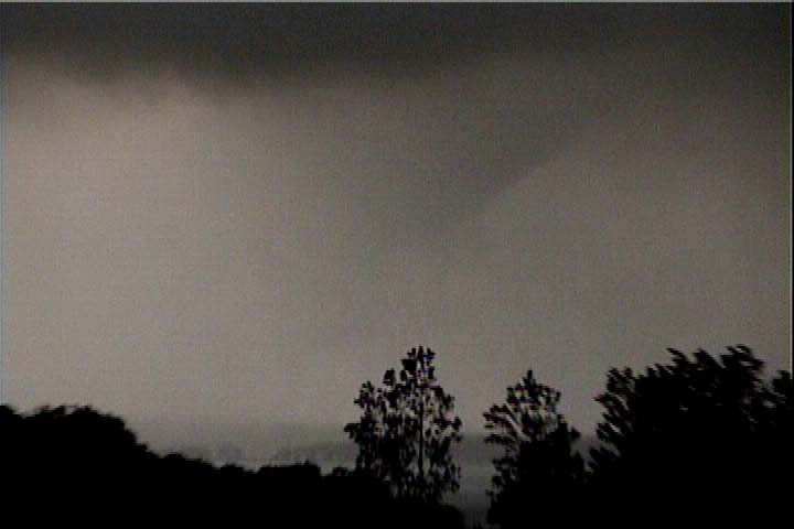
After this, the main core got closer, the storm looked a little more linear, and very strong northerly outflow winds were shaking my car. I thought our supercell show was done. Our road (County 24) took us into a fairly deep lake valley with a few curves, and I realized this might have upset my sense of direction for a bit, for when (in Glenwood) I looked back behind me, the low stratus had disappeared, and the grungy sky had opened up to reveal a wonderfully banded updraft vault (photo courtesy of Theresa Caspers) with a thick inflow tail on its northeast side. Another band of inflow stratus was immediately to my south and screaming straight in to the updraft. We pulled out of the valley and stopped to look westward over Minnewaska. Since frequent (positive?) CGs were popping very near, we had to stay in the our cars.
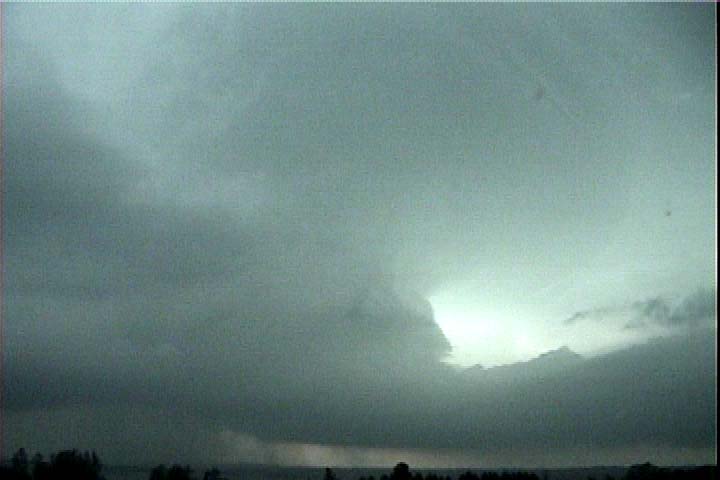
I briefly hopped out to get a couple stills, then an RFD punched into the mostly rain-filled base. A somewhat ragged, cone-like lowering slowly descended just to the north of the RFD, and it grew closer to the ground, while precip was advancing across the lake very slowly toward us. Rain was swirling around the funnel, and very rapid downward cascading motion enveloped it, bringing more rain around and obscuring our view. It dissappeared in the rain for a bit, but things cleared away again to allow us to see an S-shaped rope funnel much like the Gurnsey, WY tornado, but ours had very poor contrast and was embedded in rain. We called the NWS through a ham repeater superlink to report the tornado.
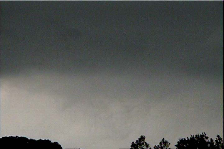
We dropped east and south repeatedly to stay ahead of the updraft base, but we never saw any more tornadoes. There were a few more reports, but I think most of the tornadoes were brief and rain-wrapped. We were occasionally out of position to see right into the notch, but what we saw did not indicate large, well-lit tornadoes.
Scott and I grabbed a bite to eat at the Willmar Subway, then set up east of town to get some video and stills of the lightning after dark. The updraft was pretty well lit by intracloud lightning and zits. It was a beautiful show. Later, after I drove back north through the weakening and shrinking storm, the moon popped out from behind what was left of the updraft base, and zits, anvil-crawlers, and intracloud lightning lit up the downshear side of the updraft. I tried getting out for stills/video, but the storm was drifting north at me.
Overall, the storm was much grungier than what you'd think by looking at radar, but for a few brief minutes, I saw the best structure I've ever seen in Minnesota-- looking like Meade, KS last May 31, but obscured on the southern flank by a band of inflowing stratus.