May 22, 2020 Dusty Tornado
North Texas
This was the departure day for Tour 3, and in most cases, departure days are not chase days. However, there was a risk of supercells and maybe a tornado or two in north Texas, and one of our guests from Tour 3 wanted to take a stab at this event. We needed the day to prepare the van for the next tour (oil change, car wash, etc.), but Kim was bringing up the second van from Arlington, and we had not used that van during the tour, so it was ready to go on a chase. We just needed to bring it back clean for the Tour 4 guests.
After a couple hours drive from Woodward, we arrived at the base hotel in Oklahoma City and dropped off the rest of the Tour 3 guests. As it was already early afternoon, we needed to get south to be there in time for new storms. We departed, heading southwest on I-44 toward Wichita Falls.
When we crossed the Texas line, towering cumulus had me turning west on TX 240 at Burkburnett. We continued to Haynesville then dropped south to Electra for a pit stop and to wait for one of the small cells to become a bit more dominant. The answer regarding which storm to chase came rather quickly as one cell to our northwest strengthened near Oklaunion. As it was threatening to cross the Red River into Oklahoma, I decided to take U.S. 183 northward, but a combination of more difficult road options there, plus the fact that the storm would turn right and stay in Texas if it were to do anything interesting, made me turn around and get back into Texas.
That was a wise choice. We needed to be in Texas to see the action area of the storm. We followed it east on farm-to-market roads east of Oklaunion as it developed a wall cloud. Things were looking interesting, but then we suddenly needed to make a pit stop again at Electra. The storm was not imminently tornadic, and we could still see the action area from the gas station, so it was okay. While we were there, however, my anxiousness increased as a broad funnel appeared to develop from the storm. Radar showed a very strong RFD developing, and there was a pretty substantial area of convergent wind shear. It was a time to get back north!
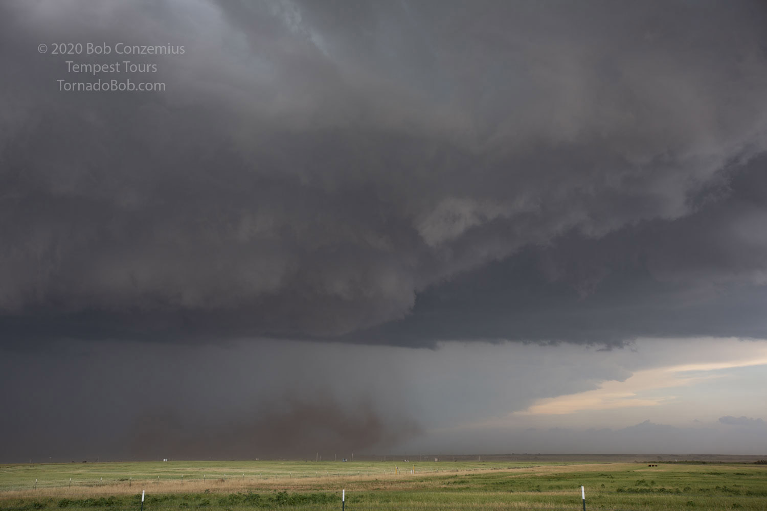
We got a little behind the storm, but due to a lack of rain in the RFD, we could see what was going on. A rather tight mesocyclone developed, but I wasn't sure whether it was tornadic or not. Certainly, the combination of moderate inflow winds to the east and very strong (80 mph) RFD winds indicated a tornado would likely develop. A dust column soon rose to the cloud base. When we could stop, I snapped a quick picture or two and took a little video, but we were racing to get in better position east of the mesocyclone, and there wasn't much time to spend on photography.
 |
|---|
| This rotating dust cloud under the mesocyclone was reported as a tornado. |
The dust column was reported by several chasers as a tornado, so I'll count it, but I would say it was right on the threshold between tornado and not a tornado. By any reasonable assessment, it met the definition of a tornado, but I was looking for more of a condensation funnel, I guess, to remove all doubt. There was a very wide, funnel-like feature at cloud base that did not extend much below the mean base, but I was looking for something more pronounced.
That area of rotation weakened and filled with rain, and by the time that happned, we were even with the action area. We continued east, parallel with it, but it was producing no further tornadoes. Ahead of us was Wichita Falls. We needed to navigate around town and depart the action area of the storm to get back on a road the kept us with the storm. All other road options that could have avoided Wichita Falls led us into the core. We did not want that, so it was time to have some patience in order to have better long-term prospects.
On TX 79 southwest of Petrolia, we got back into position, and it now appeared that most residents of north Texas were also chasing the storm. The shoulders were filled with stopped motorists looking at the new wall cloud. I found the best place I could to view it and pulled over. Soon, another tornado warning was issued on the storm. We stayed and watched the wall cloud for a while and noted some rotation, but we never saw a funnel. Apparently, there was another swirl of dust underneath this wall cloud (below the horizon, out of our view), and that was enough to make for another tornado that occurred while we were watching, but there was nothing clear to us.
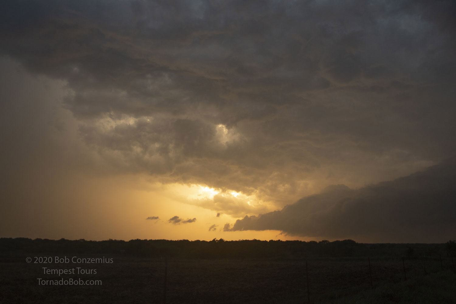
We continued east and watched nearly steady, broad rotation with the action area of the storm as it turned a bit more HP. Meanwhile, another cell had strengthened to our south, and it reportedly produced a tornado, but it was far too late to catch that cell, and I never saw a good picture of the reported tornado it produced. Eventually, this southern cell crept up on our cell, and some additional precipitation developed in-between. As the gap closed, we took a moment to photograph the sun setting between them.
 |
|---|
| Sun manages to sneak through the clouds at the end of the day. |
It was now time to head east to I-35 and get north again. We drove to Gainesville and hopped on the interstate, but new cells awaited us as we crossed into Oklahoma. Fortunately, these were not particularly strong and gave us only a bit of moderate to occasionally heavy rain. We were able to get out of the way and then finish our drive back to Oklahoma City in mostly dry conditions.
 |
|---|
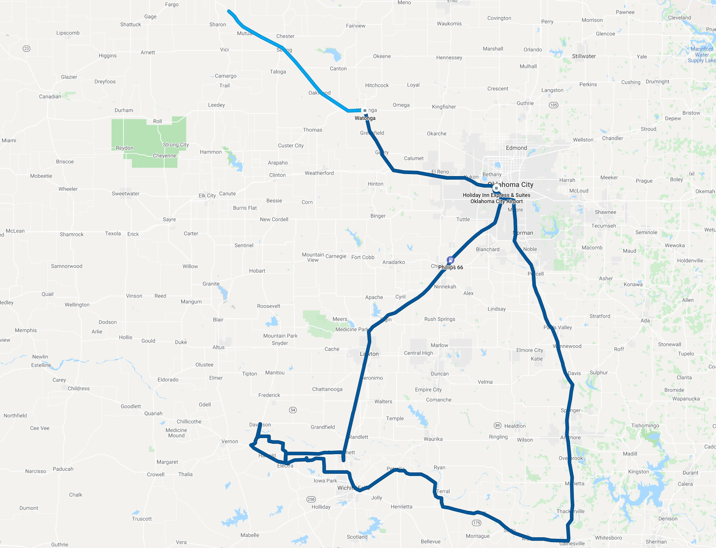
| Our route for the day. |
Back to Storm Chases | Home