May 30, 2022 Tornado-Producing Squall Line
Central Minnesota
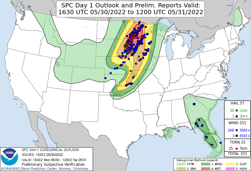
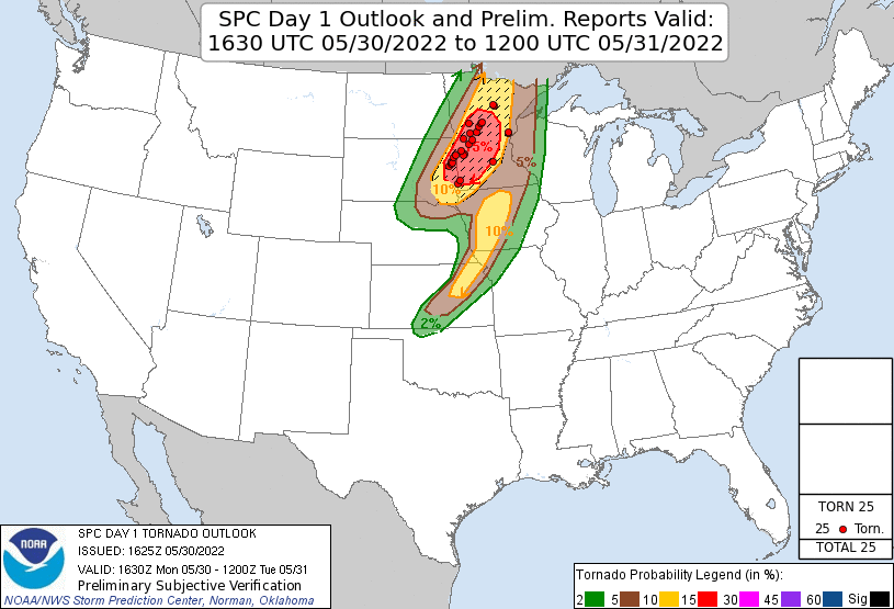
This was the big day. The SPC forecast a moderate risk of severe storms over much of Minnesota, including a 15% risk area for tornadoes (with a 10% or greater chance of strong tornadoes). There was significant instability, wind shear was very strong, and there was strong lift approaching with a shortwave trough predicted to cross Minnesota during the afternoon and evening. It had the potential to be a high end event. The biggest question was regarding the convective mode. The hodographs featured strong low-level (0-1 km) shear, but there was not a huge amount of turning in them. Was the turning sufficient to get discrete storms, or would they all form a line immediately upon development? Some of the convection-allowing model runs showed discrete storms. Others distinctively showed a squall line. We were going to head out and see what the result would be.
 |
|---|
| The 1630 UTC Day 1 Outlook. |
 |
|---|
| The 1630 UTC Day 1 Tornado Outlook with verification. |
We drove south through Park Rapids, Wadena, and to Starbuck, where we had some early storms developing in far western Minnesota. These looked to be a bit too early to be the main show, and I didn't want to get suckered too far west, but I figured we had time, so we drove west to Chokio then north to investigate the first storm. When we first saw the updraft base in the distance, it had some slightly interesting structure, and weather observations just to our south showed some rapid destabilization (temperature and dewpoint were jumping). However, as we got closer, we had a mostly flat, cold-looking base. The low-level wind field was also not very interesting (just very light easterly winds).
We let this first storm go since it didn't appear to be the main show, and other storms were firing farther southwest. These storms were starting to get tornado-warned. Since we were in relatively cold air (temperature in the 60s) and light winds, we decided to drive back east to get on the warmer side of the boundary, and hopefully, we would be back into strong south-southeast winds and warm, humid air.
 |
|---|
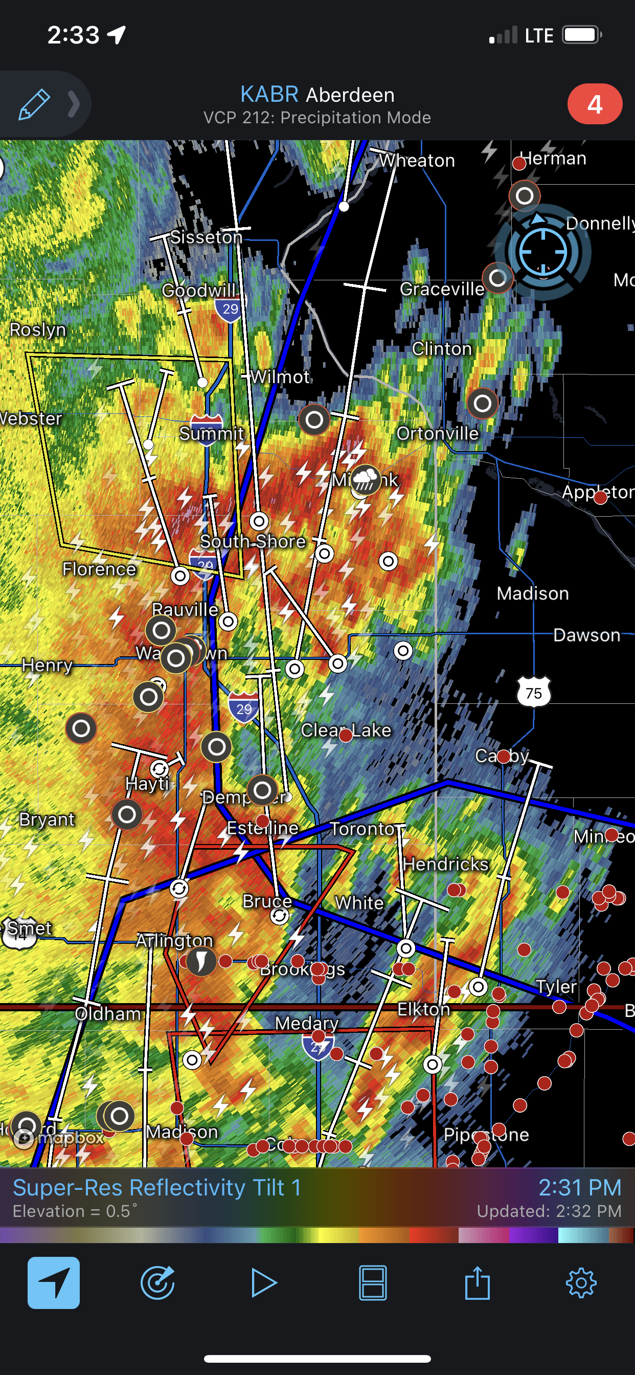
| A radar view of the mess that was approaching from the south-southwest. |
We got to Alexandria and found some stronger surface winds from the south. We had been hoping for some discrete development in our area, but it now appeared the main show was the line of storms strengthening to our southwest. Multiple tornado warnings were now in effect along this line. It looked like this would be the main show. Radar showed some chance to see individual storms as a cluster of newer storms along the northern part of the line had a bit of separation between them. We decided to engage. It would be a bit like threading the needle as there really wasn't much separation at all, but it was at least theoretically possible to get in a rain-free area between them.
As we were approaching, all the gaps essentially closed, and we found ourselves in heavy rain most of the way. I was tracking where the velocity couplets were, and aimed to drive in-between them. This worked reasonably well, but given the wind shear, the circulations at ground level might not be in the same place as the circulations on radar, which was sampling the atmosphere several thousand feet up.
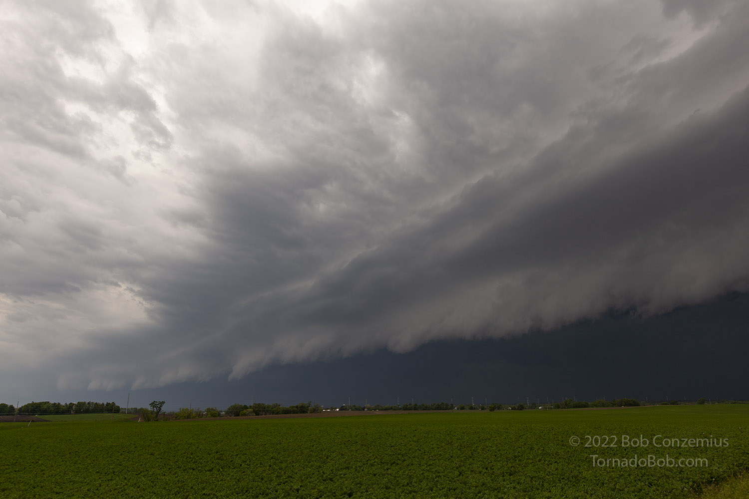
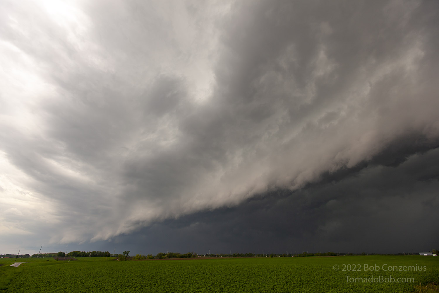
We got into an area of more intense rain and had to stop. Suddenly, the wind, which had been somewhat southerly or southeasterly, shifted to very strong westerly winds, rocking the car somewhat. We waited in place while the wind surge and the rain both subsided. We had enough visibility to drift east again, but with the same rain and wind just in front of us, we could not drive too quickly. We found a bit of a gap in intensity and drove ahead through this area. This brought us to Sauk Centre, where we hopped on I-94 for a bit to get ahead of the shelf cloud. I at least wanted to salvage a good shelf cloud picture or two from this chase. That we did, as we set up a mile or two off I-94 between Melrose and Freeport. I timelapsed with my video camera and took a couple stills, and just before the rain hit, we ducked back in the car and started to drive back west to get on the other side of the line.
 |
|---|
| The squall line southeast of Alexandria. |
 |
|---|
| The line closes in quickly. |
We only had to get back to Sauk Centre. Craig knew a less-traveled route that he used to take to get to Blackduck from his former home in Windom. We took that route north and crossed a tornado damage path north of Clarissa, MN, after hearing about tornado reports or damage near Eagle Bend. As it turned out, only one tornado was photographed in Minnesota during this event, when the squall line was first organizing, in southwestern Minnesota, by a local resident who happened to see it nearby. As far as I am aware, no chasers got any video or stills of the tornadoes, as the remainder were buried in heavy rain with near zero visibility.
 |
|---|
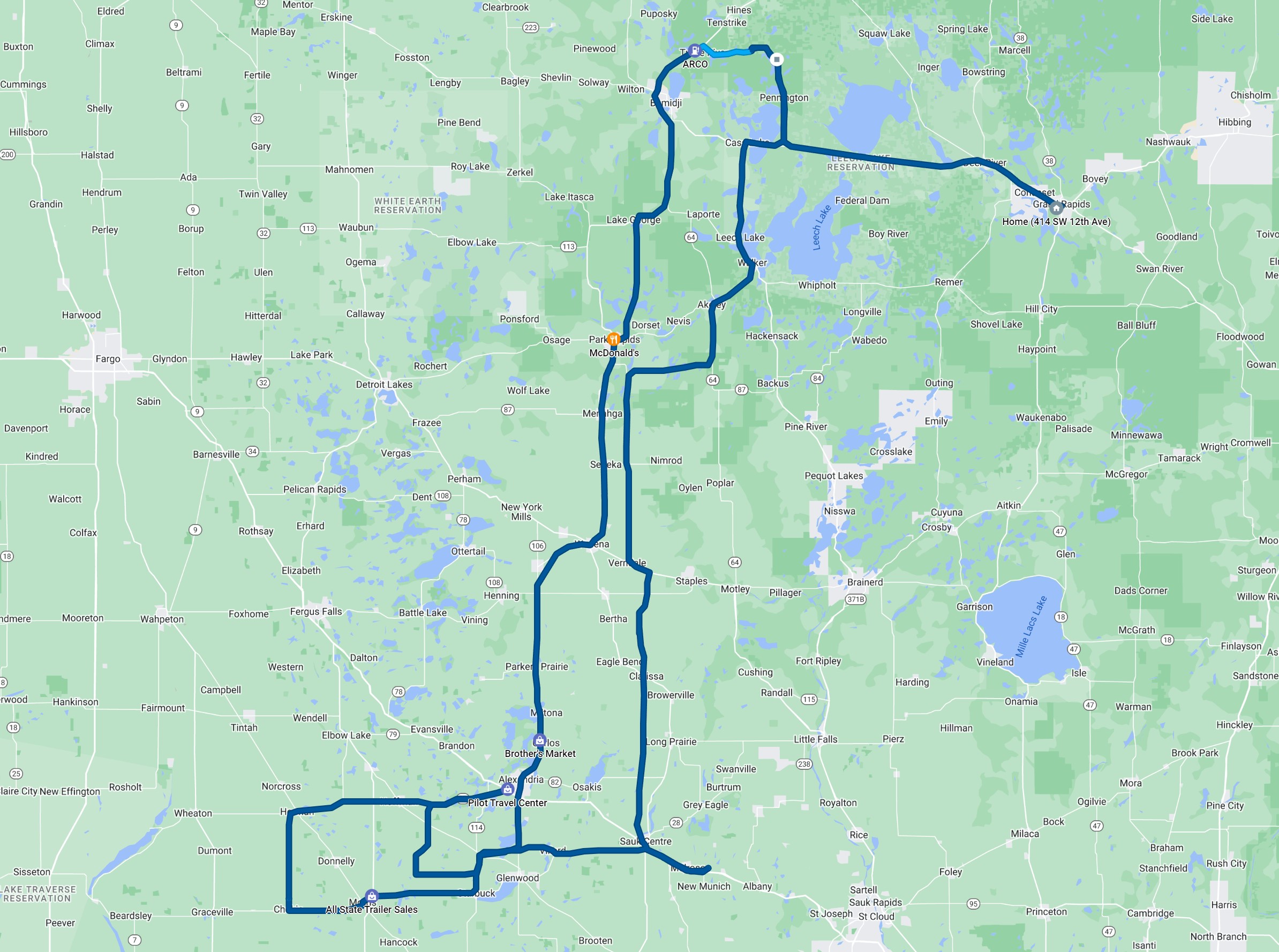
| The roads we travelled to see the storms. |
Back to Storm Chases | Home