April 22, 2022 Supercells
Oklahoma Panhandle
It looked like this could be a day for some high end storms. A trough was digging into the western U.S., and there was an enhanced risk of severe storms from southwestern Nebraska into the Texas panhandle. The convection-allowing models showed storms developing in along parts of the dryling, but the coverage of storms did not look that great. There would probably be large gaps between storms, and if we did not fine tune our target well enough, we might end up in the middle of a gap with more than a hundred miles to drive toward the nearest storm. It was a somewhat tough decision which way to drive. The models had storms in northern Nebraska into South Dakota, but some runs also showed some healthy storms in the Texas panhandle, and that southern target would leave us in better position to chase the following day. For that reason, we wanted to go to the southern target, but the sure bet for storms was in the northern target area. Initiation of storms farther south on the dryline was less certain. Going halfway in-between did not appear to be a good option as the models had fewer storms there than in Texas.
 |
|---|
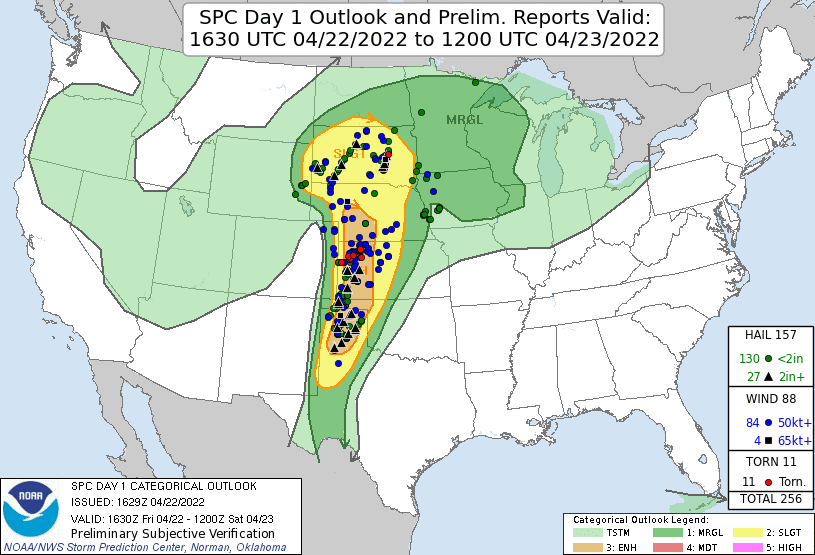
| The SPC 1630 Day 1 Outlook. |
 |
|---|
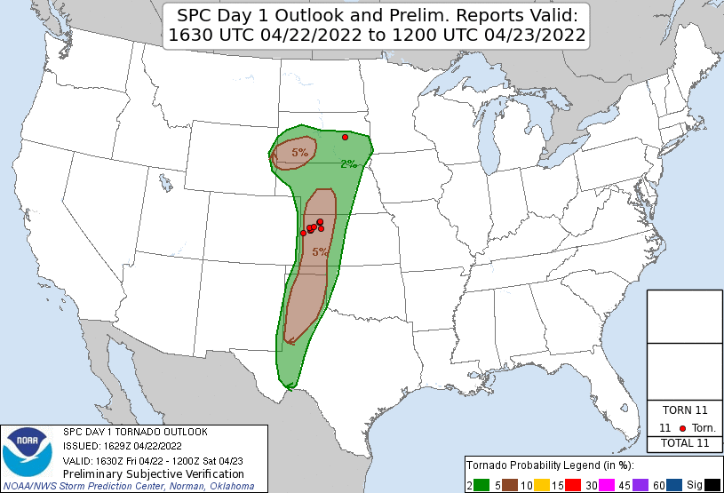
| The SPC 1630 Day 1 Tornado Outlook. |
We started north with our planned route taking us to Grainfield with a jog west on I_70 to Colby then north from there. Along the way, we were watching every hourly run of the HRRR and looking at satellite loops and surface observations. Uncertainty plagued us. Beyond Colby, we would be at a point of no return. I would be the northern target or nothing. The northern target was plagued by some cold air to the north of the warm front, and if the storms got north of the front, they would likely become elevated and less interesting from a chase perspective.
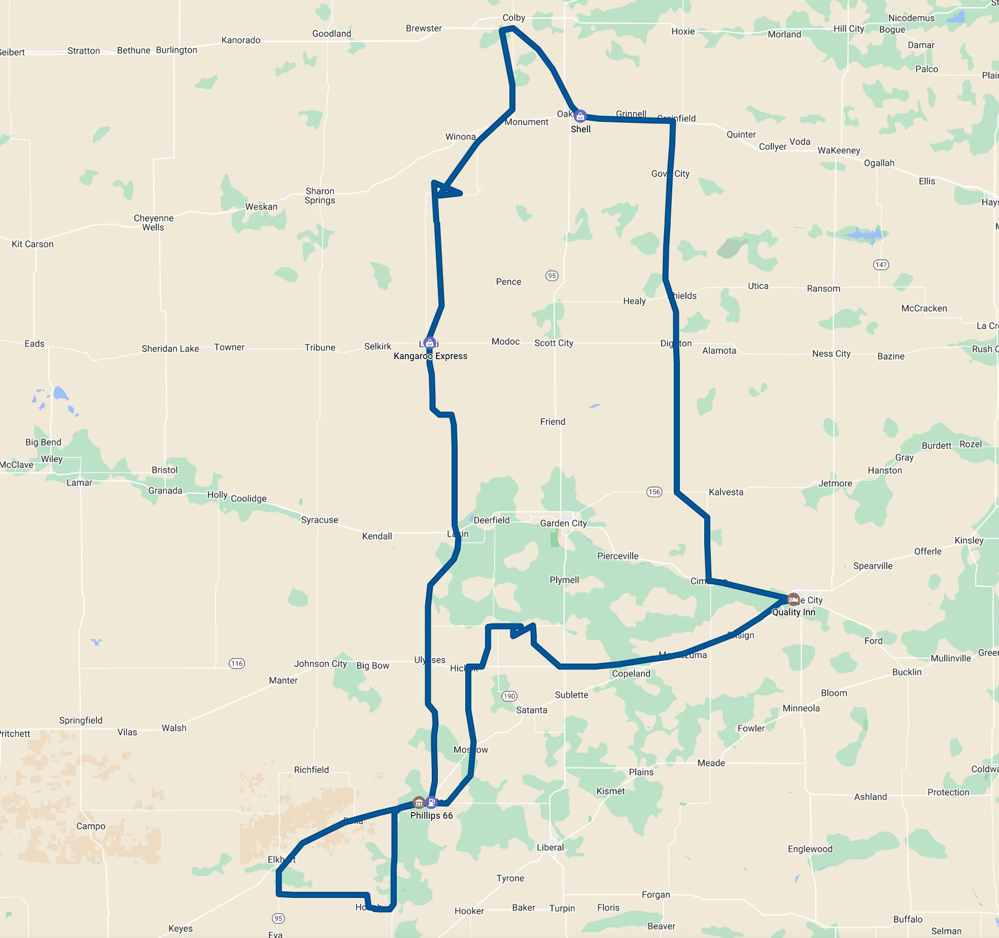
We turned back south. and took the most direct route toward the northern Texas Panhandle. That's where storms would likely develop. Low-level shear looked sufficient for tornadoes, but the turning of wind with height was somewhat questionable, and the low-level moisture was not the best, but with the amount of shear we had, tornadoes may nonetheless form.
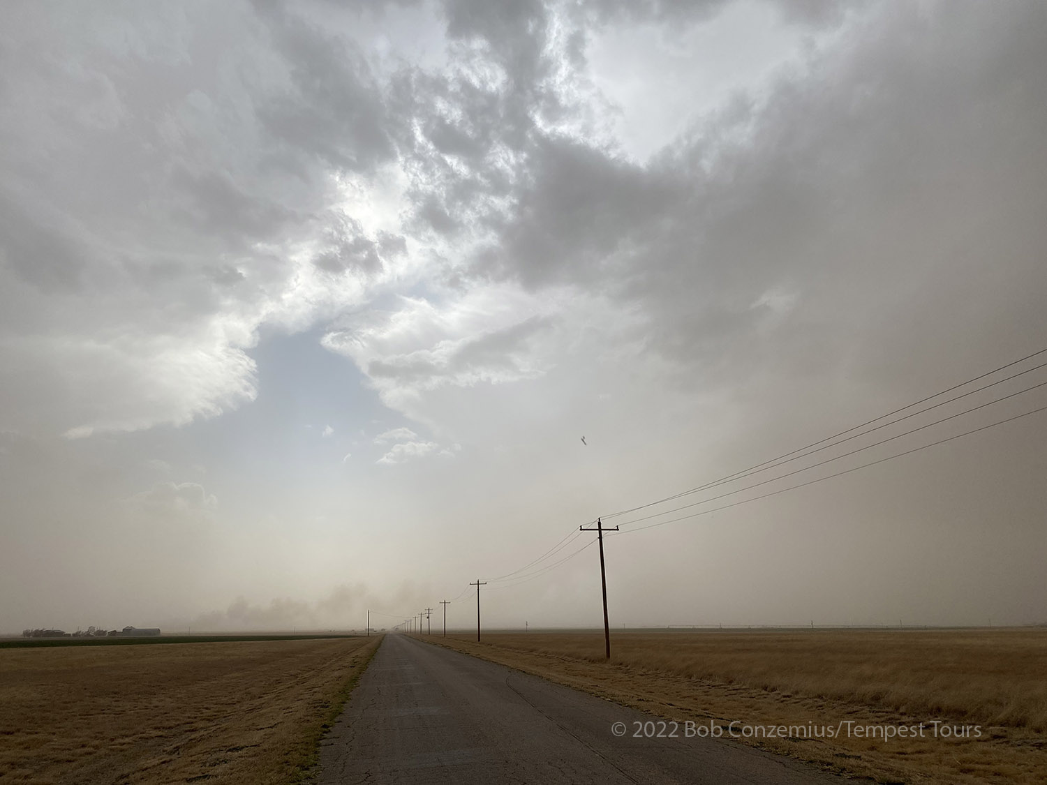
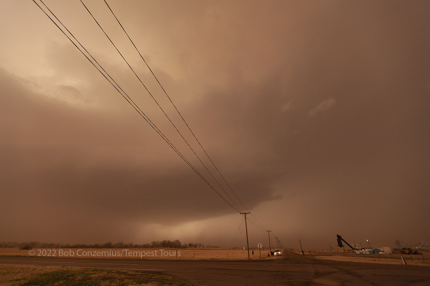
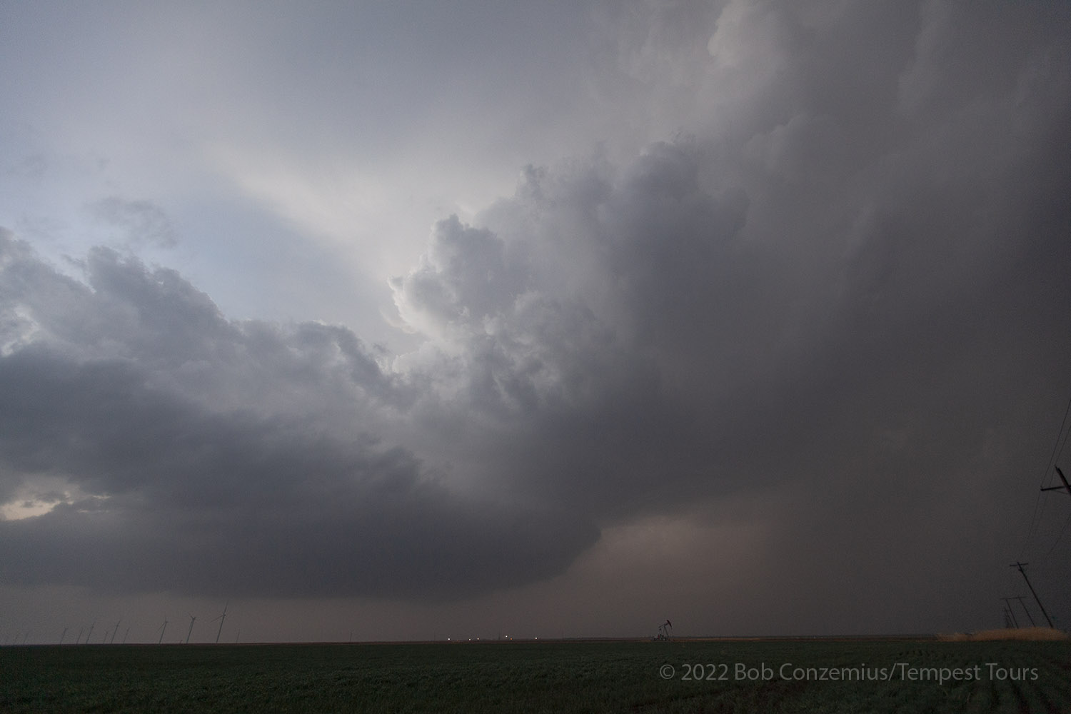
As we drove south, we encountered areas of blowing dust, and it became apparent how dry things were in the southern High Plains. As we continued south, the dust only increased, and we soon found ourselves with limited visibility. Storms were developing to our southwest in the northwest Texas panhandle, but we could not really see them (well, maybe the anvils of they were overhead, but not the updrafts). Perhaps we would see them when we got closer. Radar showed supercells, and if they continued on their initial path, we would not have to drive too far to intercept them. We made a pit stop in Hugoton then headed south toward Guymon, OK where we would go west to meet up with the storms.
We turned west on Highway 7, about 10 miles north of Guymon. The first cells were just to our west, and we threaded our way in-between them. We aimed for a young storm that crossed the highway just to our west, and we would have a good view of the updraft base immediately after that. However, dust obscured our view, and we could not make out any details of the updraft base. It was just a generally featureless dark area. The storm was racing quickly to the northeast, but that was not too much of a problem because there was another storm just to our southwest.
 |
|---|
| The updraft base on the right (north) is obscured by dust. There is another storm to the left (south). |
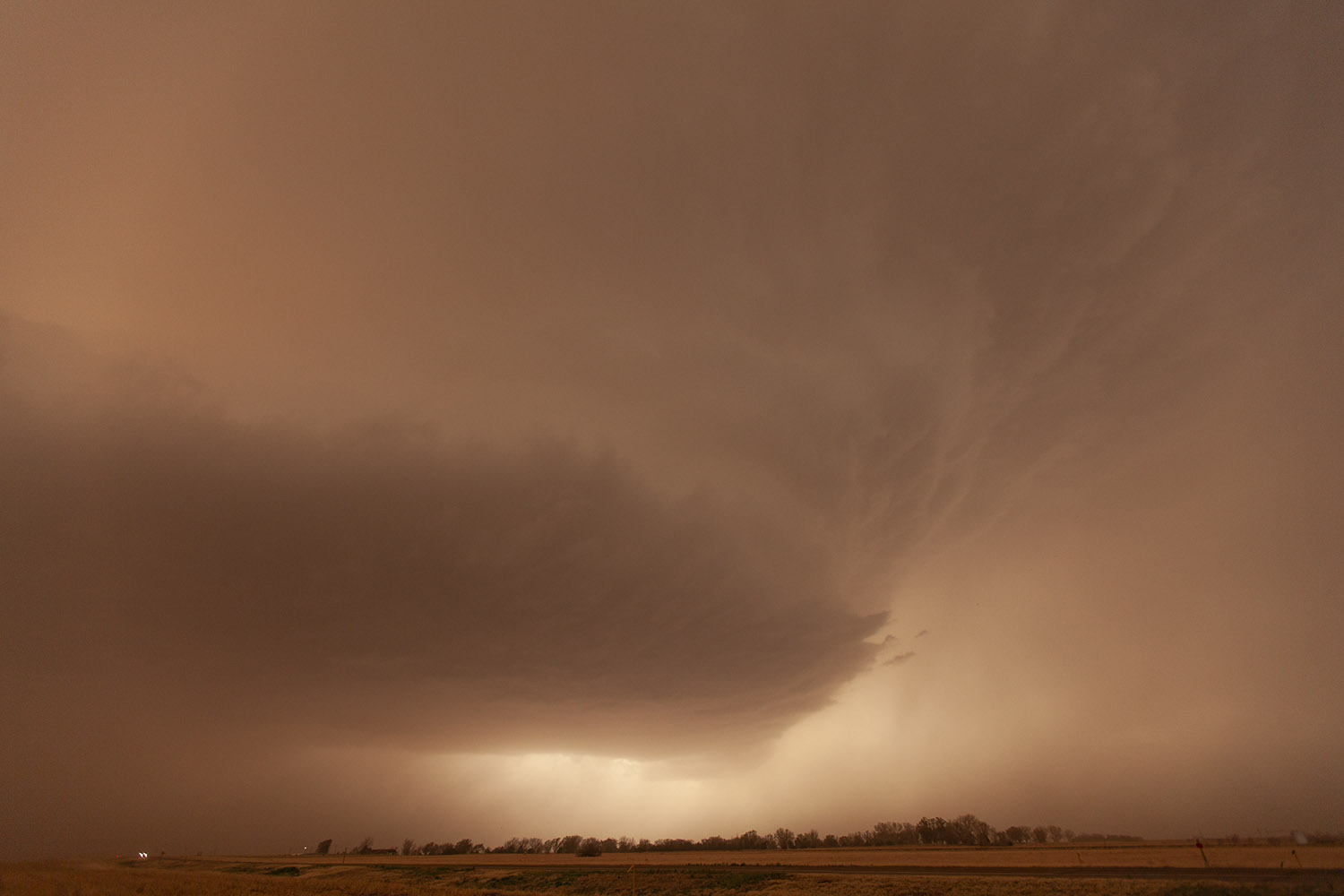
We let the first storm go by and continued west as the second storm came towards us. This second storm had some hail in it, and we found ourselves in the core of this storm, which we followed, more or less, to the northeast in an attempt to come around on it, but we didn't have much success with that.
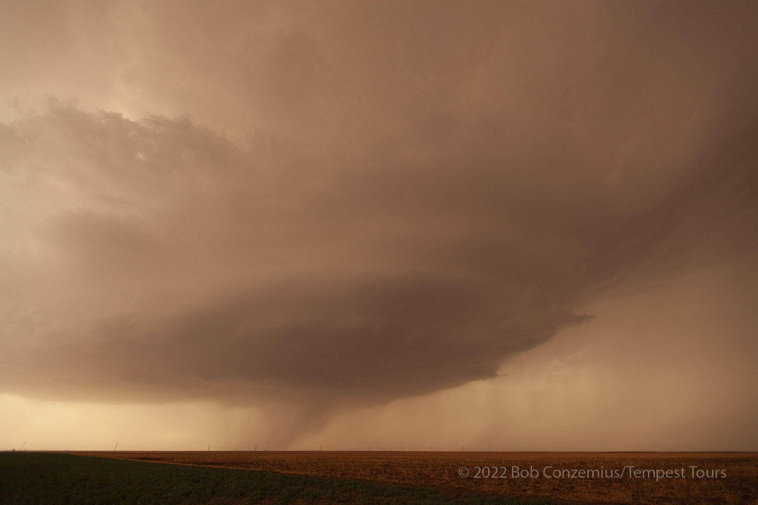
That didn't matter. There were more storms to the south, and we got into position for a third storm. The rain from the first storms had settled a lot of the dust, and although there was still a lot of dust in the air, we could at least now see the storms.
 |
|---|
| Our third storm of the day was not entirely shrouded in dust. |
 |
|---|
| Storm #3 moves out of view to the north. |
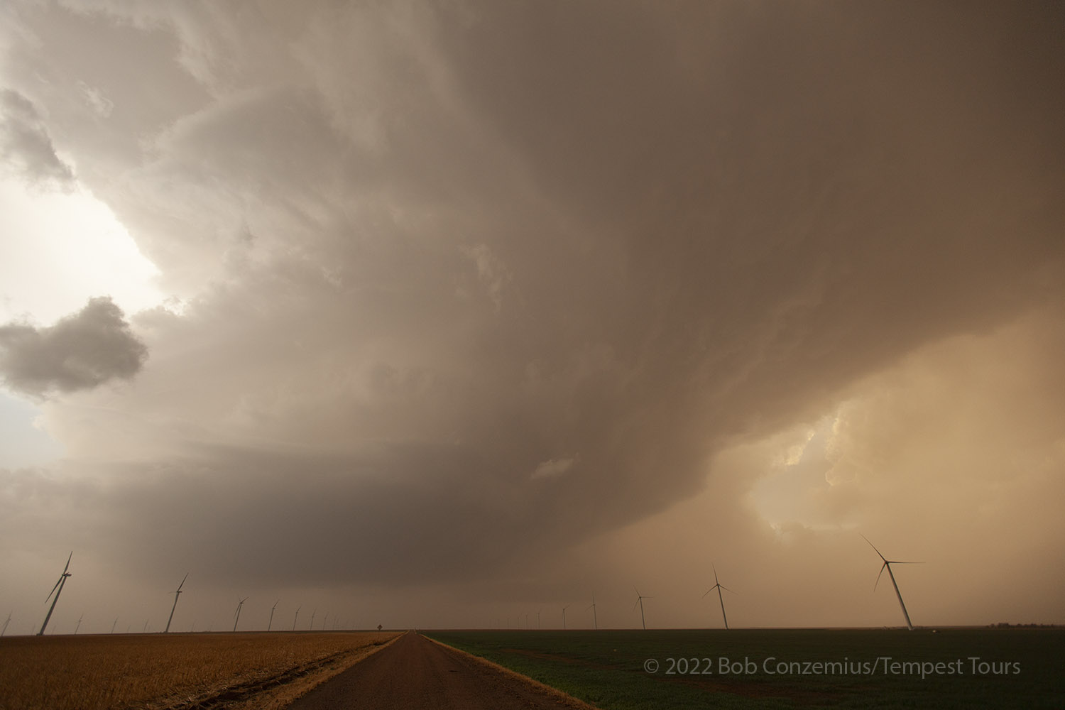
We continued zig-zagging north-northeast as successive storms moved past us. The rain from each passing storm cleared a little more of the dust, so our fourth storm was the most visible yet. It was smaller than the others, but we had a clearer view.
 |
|---|
| Storm #4. |
 |
|---|
| Storm #4 gets to our north. |
 |
|---|
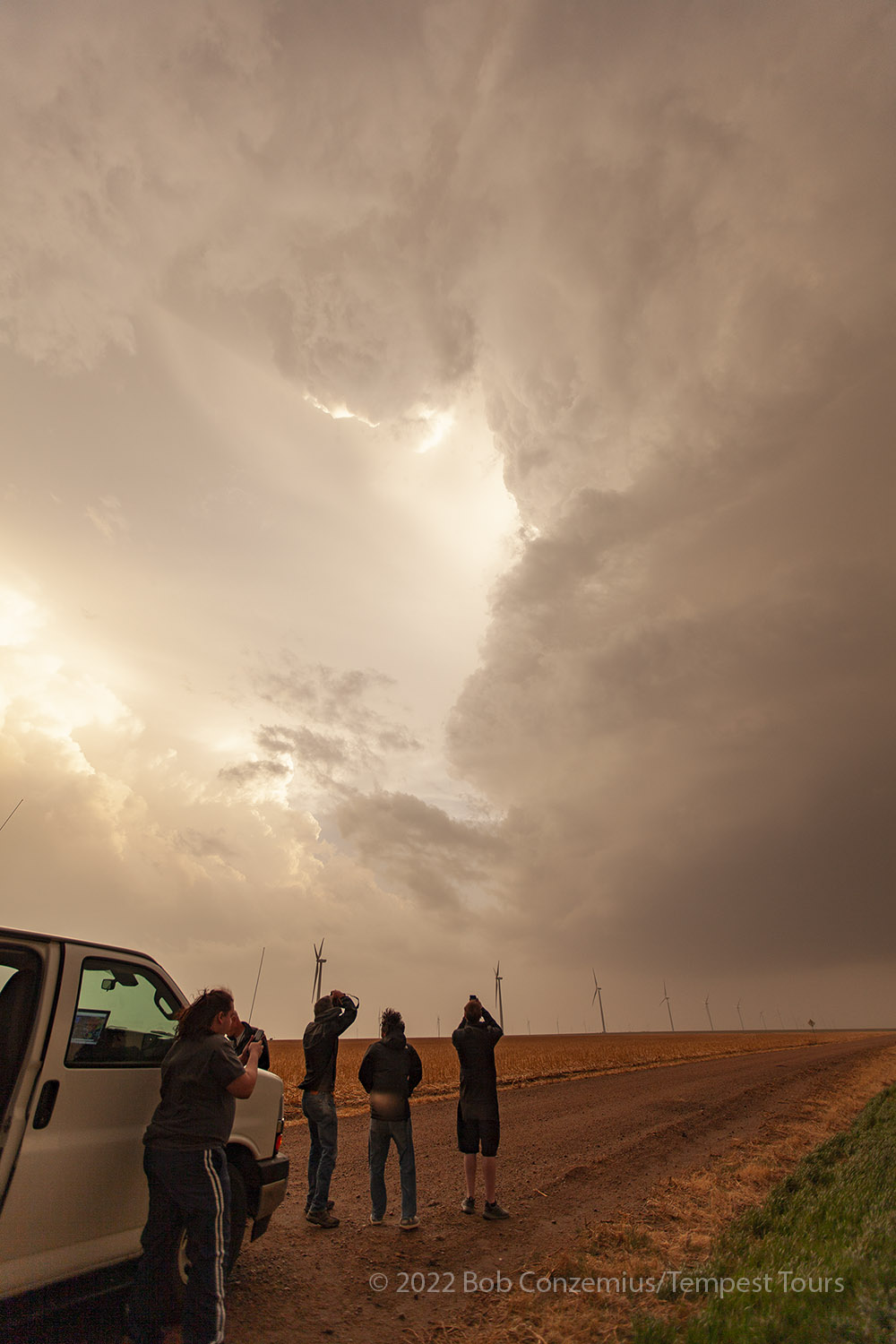
| Guests take pictures of Storm #4. |
Finally, a fifth storm came up to our west, but the sun had set by this point, so we took a few pictures then headed back to Dodge City for the night (at the same Quality Inn).
 |
|---|
| We encountered Storm #5 just after sunset. |
 |
|---|
| This is the text that appears underneath the picture. |
Back to Storm Chases | Home