July 10, 2020 Supercell
Martin, South Dakota
It took a long time for this chase to come together. I initially targeted the area of Nebraska around Hyannis. After a somewhat leisurely morning at the hotel in Ogallala, we headed north toward Hyannis with plans of waiting there until storms initiated. There was a small morning MCS to our northeast along the South Dakota border, but models showed that MCS rapidly weakening and discrete afternoon storms developing a few hours later. However, the MCS persisted and intensified with the cell on its southwestern flank developing some supercellular characteristics. Morning storms like that rarely seem to be photogenic, and that one appeared to be undercut by outflow, but I was having a hard time sitting in Hyannis with this system about 75 miles away with its beautiful, robust updraft taunting us.
This cell continued on its east-southeastward path, and by around 2:00 PM, a line of pretty healthy cumulus developed to just to our west. The cells grew very slowly but never reached a point that we would consider them to be storms. There was rain coming from them, but they were small, narrow, and struggling. I decided we should turn around and go back to Hyannis.
Storms had developed in northeastern Wyoming and were moving toward the Black Hills. They were awfully far away, and since this was our last chase day, we needed to be back in Ogallala that evening so we could make the drive back to Denver in the morning. I decided we should probably drift north because the cumulus fields to the north (between Alliance and the South Dakota border) looked the healthiest, but as we drove that way, those cumulus fields did not grow, and as the sun started to sink closer to the horizon, those clouds began to shrink. Meanwhile, the storm far to our north was crossing the Black Hills.
By 6:30 or so, we made it to Merriman, and it was pretty clear that nothing was really going to happen in Nebraska. We could not even see the anvil of the storm of the Black Hills, so it seemed out of reach, but it was the closest storm (more than 100 miles away), and it was looking Supercellular. We could continue into South Dakota to catch it, but by the time we did, we would be a long way from Ogallala, and there were many road closures around the Pine Ridge Reservation, preventing us from getting close to the storm.
We stopped at a grocery/convenience store in Martin to grab something to eat for dinner and drove west from Martin as far as we reasonably could. There was a tribal checkpoint a few miles to the west, and for some reason, I did not want to mess with that, so we stopped several miles west of the checkpoint to wait until the storm came toward us. I thought we would be pretty close to where the updraft base crossed the U.S. Highway. It was lucky for us that the storm turned a bit right and accelerated a bit. It did not take long for the anvil to show up and block the sun so we could see the distant updraft. By the time we could see the updraft base, it was clearly a supercellular storm. In fact, it was definitely supercellular when it got out of the Black Hills and started to cross the Badlands. We stayed in our spot for over an hour as the storm moved along the western horizon from north to south, and it also came closer. When we could resolve whether or not there could be a tornado underneath the storm, the National Weather Service in Rapid City issued a tornado warning for it.
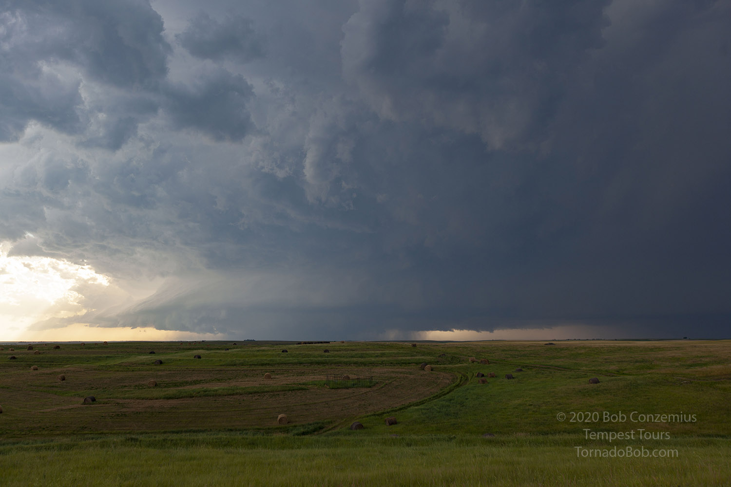 |
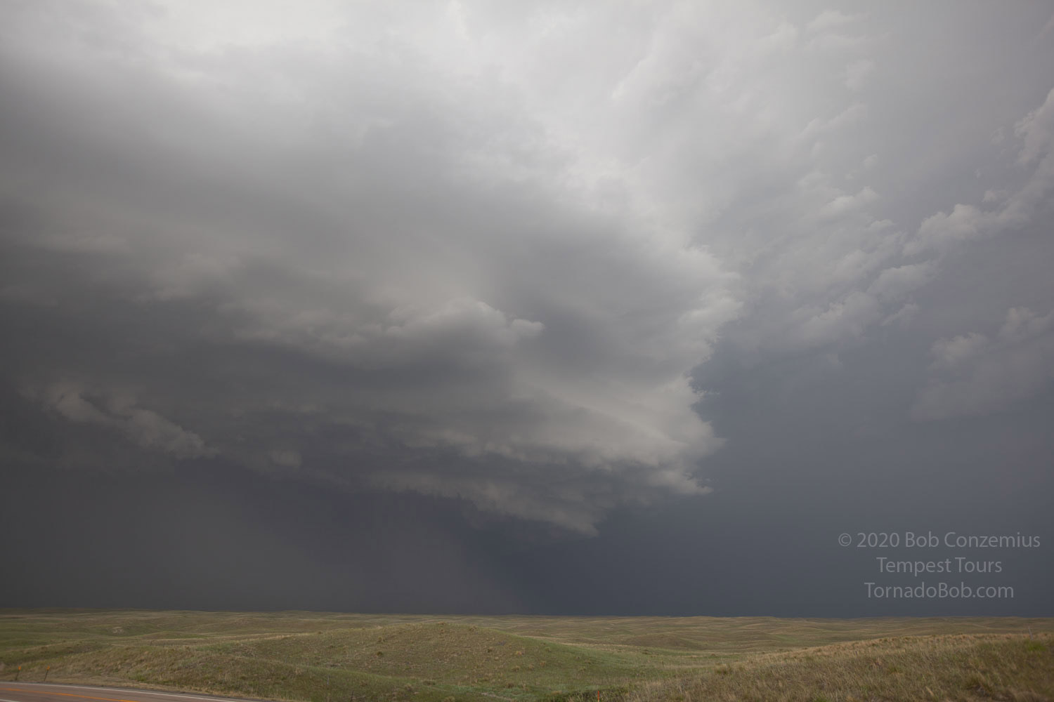
| Storm when it came into view. |
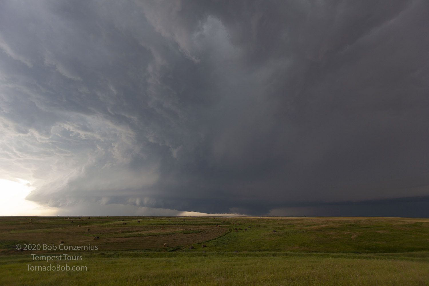 |
| The elongated wall cloud here has a little bit of differential motion underneath it but no concentrated rotation. |
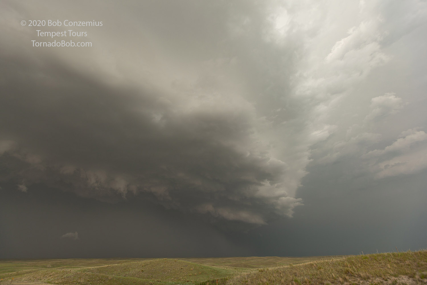
We continued to observe the storm and saw several areas of rotation underneath it, along with dust plumes underneath, but never anything we could firmly identify as a tornado. Overall, it looked like a mostly rain-filled mesocyclone with some areas of more intense rotation along the outer periphery. There were a couple people who were closer and showed some stills and video of brief, small tornadoes, but we could not identify them as such. Perhaps I could have gotten us a bit closer. The storm was moving 40 mph, which meant we had to leave a bit early to get back through Martin and back south toward Merriman so we could continue ahead of the storm. We did this and saw the tornado reports when we got south of Martin. Looking back at the stills and video I saw, I'm pretty sure those tornadoes had happened while we were watching the storm west of Martin, but for some reason, they were never clear to us. I can find one or two suspicious areas on my video, but no condensation funnels to the ground or any dust swirls underneath a definite funnel.
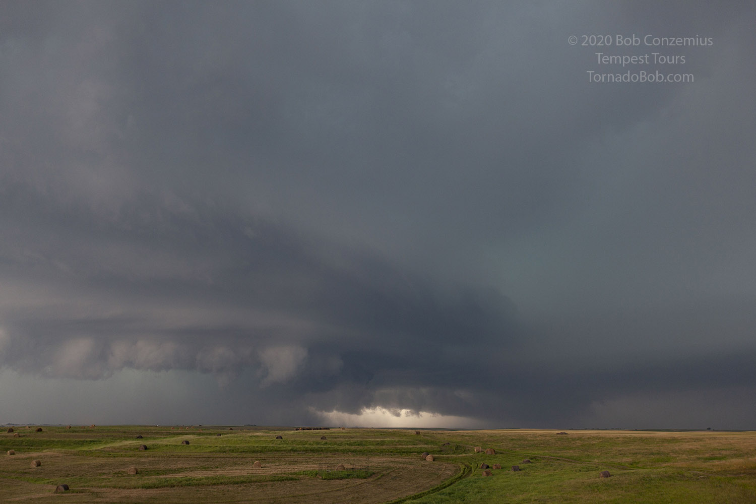 |
| Can you see a couple possible funnels in this picture? These may have been the items that were seen as tornadoes from much closer. |
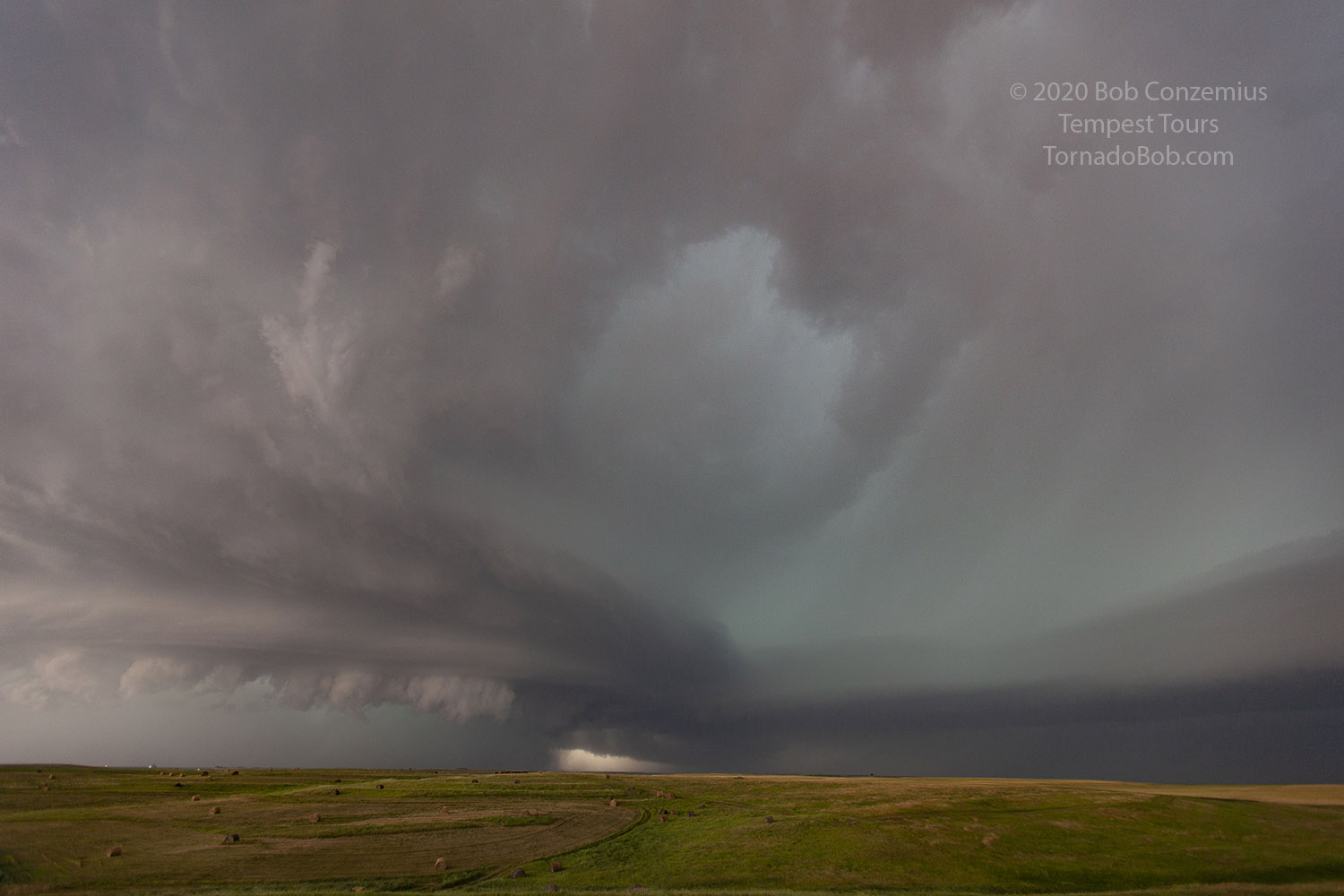 |
| The view right before we departed. |
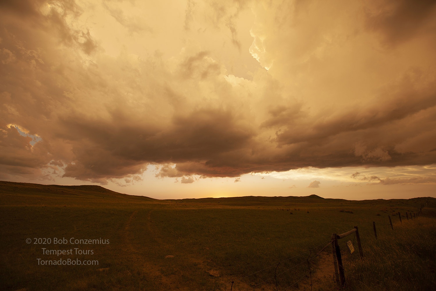
We dropped south on Highway 73 and stopped to observe the advancing shelf cloud while getting a bit of 3/4" hail. We stopped again south of Merriman and watched as the mesocyclone drifted across the roadless area just to our east. From there, we watched the sunset, enjoyed the intense colors, and did a little time lapse work. We drove back to Ogallala and were back around 11:00 PM or so.
 |
| The storm enters the Sandhills. |
 |
| The storm looked pretty mean as we entered the sandhills of Nebraska. |
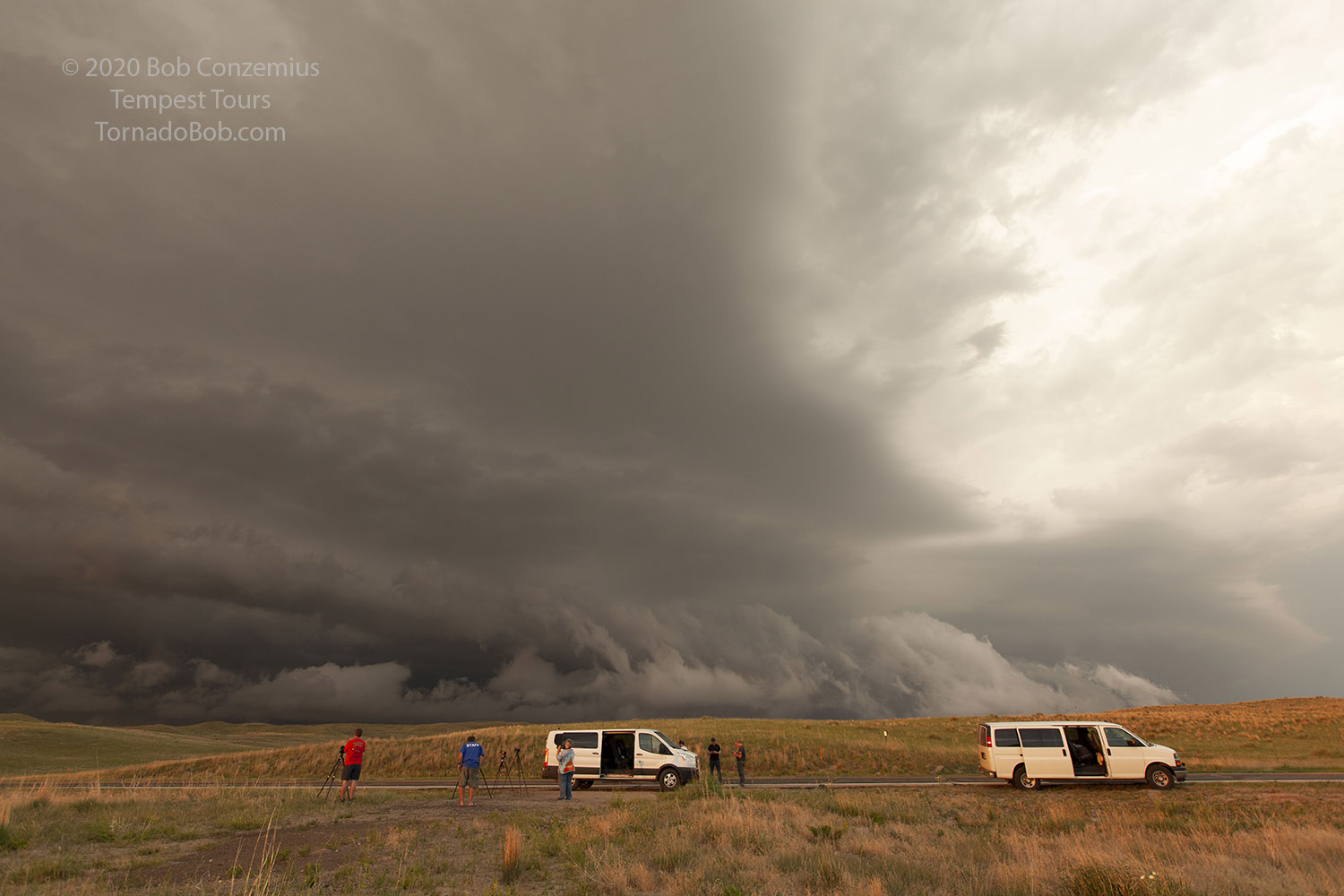 |
| Here are the two vans ahead of the advancing shelf cloud. |
 |
| Clouds get bathed in orange. |
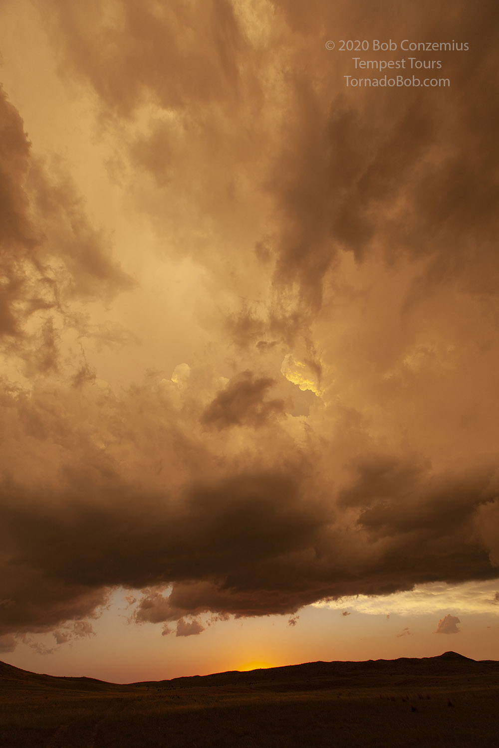 |
| Sunset in the Sandhills. |
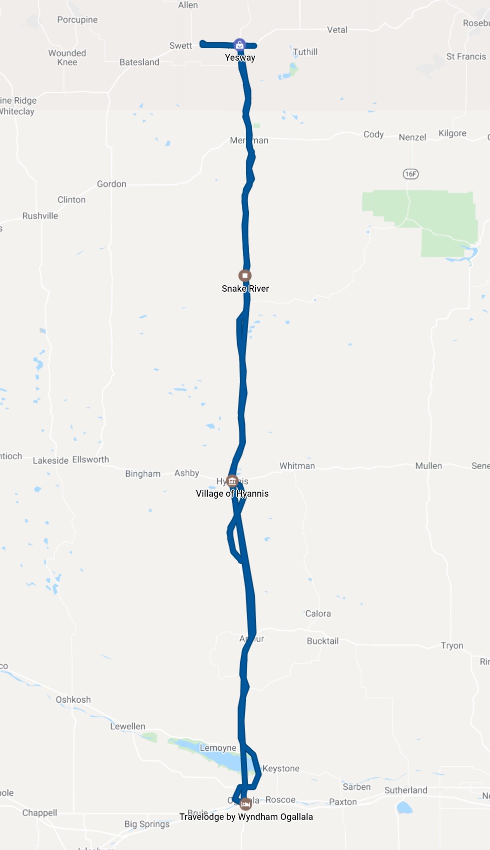 |
| 348 miles of driving for the day. |
Back to Storm Chases | Home