May 29, 2022 Storms
Northwestern Minnesota
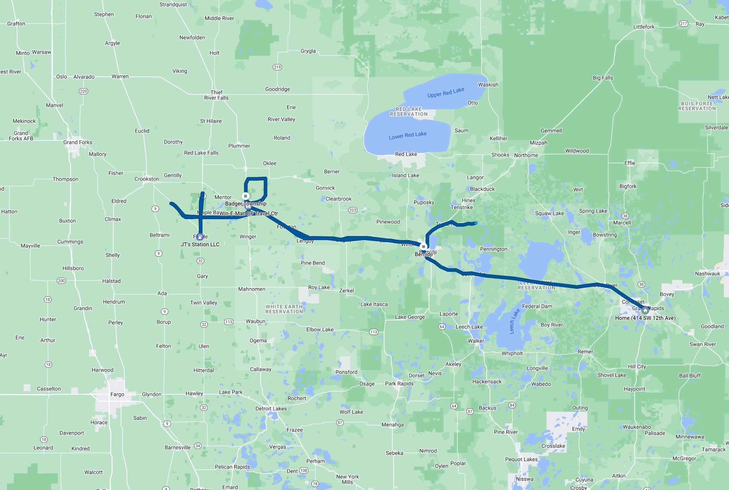
This was the first day of a two day chase on Memorial Day weekend. My initial plans for the weekend were to join family at a rental cabin on Lake Vermilion, but a cool and stormy forecast caused the family to cancel those plans, so I decided to chase instead. The SPC had a slight risk out for most of Minnesota and an enhanced risk for much of the southern half of Minnesota. I thought there was a good chance of interesting storms along the warm front in northwestern Minnesota, so I called my friend (and fellow Tempest guide) Craig Wolter. Craig, his girlfriend Julie, and I met in Bemidji and then drove west into the Red River Valley to find storms.
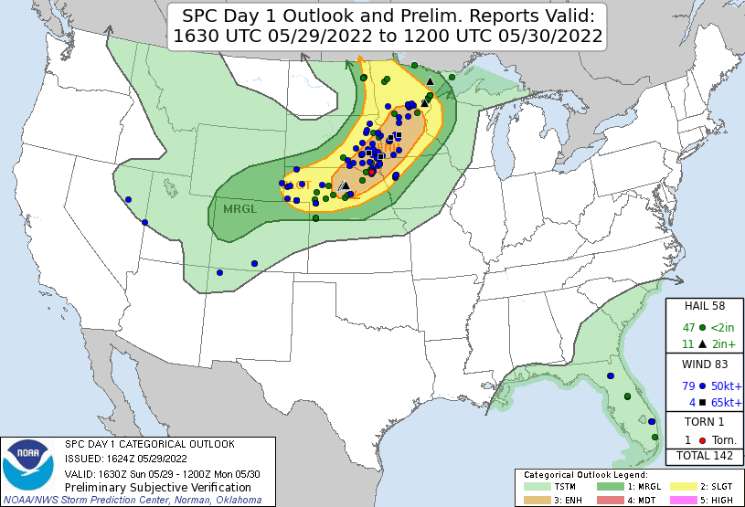 |
|---|
| SPC Day 1 outlook with storm reports. |
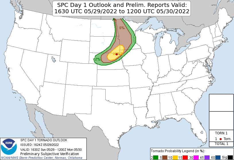 |
|---|
| SPC Day 1 tornado graphic. |
Storms fired a bit earlier than I anticipated. We got to Erskine and already had strong echoes on radar and some decent updraft bases. We followed this initial activity north from Erskine, then east, and then dropped back south (we overshot the storm a bit). The storm had a supercellular looking base for a bit, but then, everything became a bit more multicellular as numerous small cells developed in a southwest-northeast line. This whole storm system was not strengthening very fast, so we drove into Fertile looking for somewhere to grab some fast food for dinner. It was a bit difficult to find anything because most places had rolled up their sidewalks for Memorial Day weekend. We found a small place inside a gas station that offered some personal pizzas and burgers.
When we mostly finished our "meal", another healthy updraft appeared just northwest of town, so we decided to follow this new storm northward on Highway 32. This brought us into the Glacial Ridge National Wildlife Refuge west of Mentor. The storm strengthened to near severe levels, and it also had a bit of interesting structure, but it was pushing a bit of cool outflow, pushing the boundary a few miles south of us. Given no other strong storms in the area, we hung out at our spot, and I looked around to identify birds that were in the area (I think this drove Craig and Julie a bit nuts).
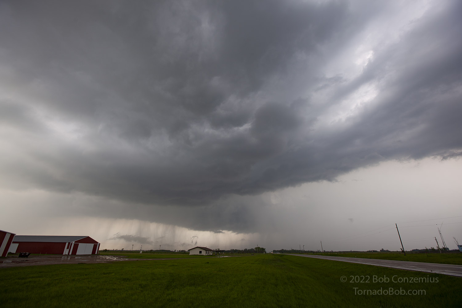 |
|---|
| The second storm of the day. |
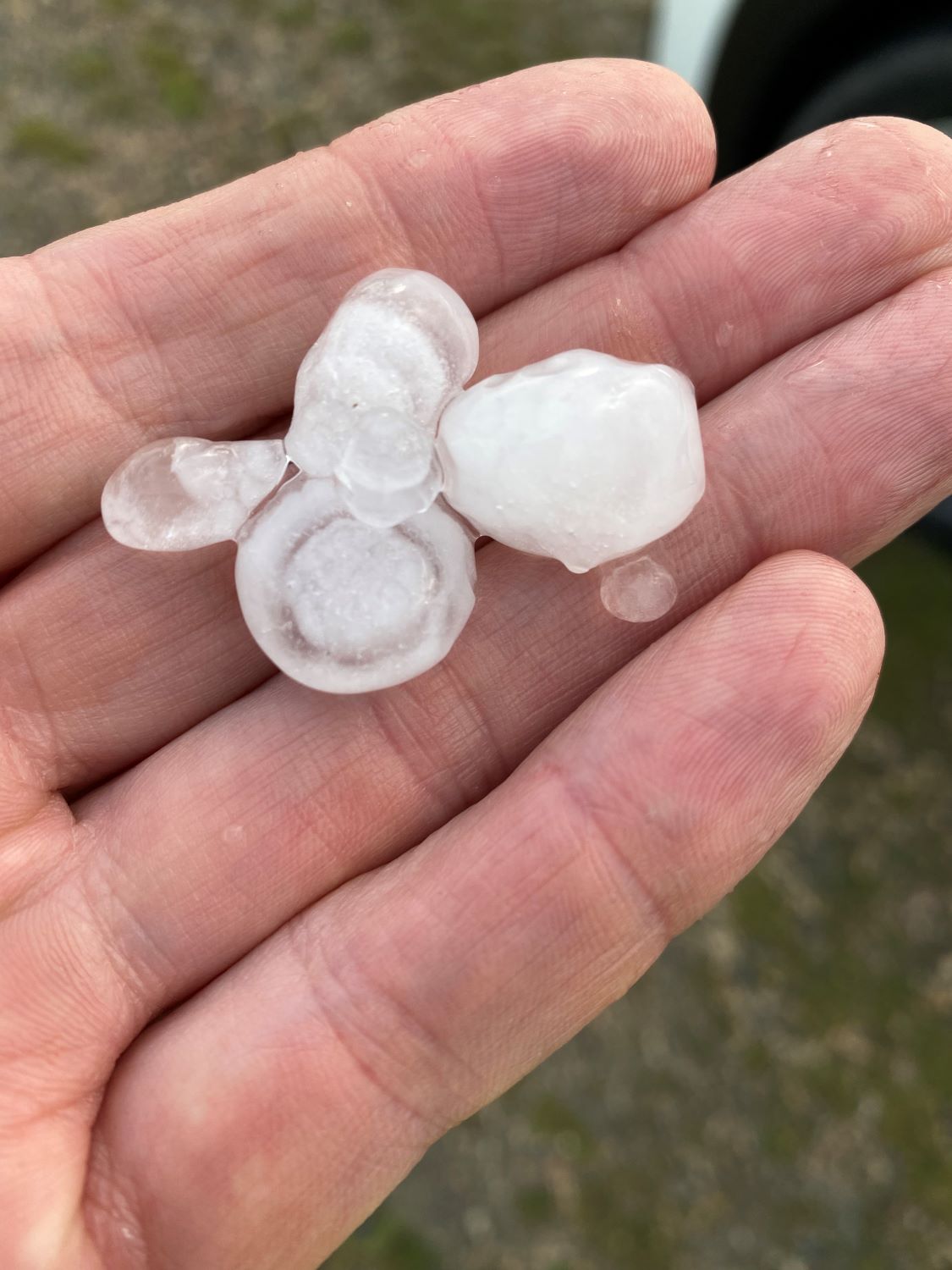
Another strong cell developed to our southwest, so we dropped back south on Highway 32 and then west on County Road 41. We stopped and admired the precipitation gradient with the storm. It was raining and hailing across the field, but we didn't have a drop where we were. We drifted a little bit northwest and found another spot to look at things (this third storm was still not very strong). We found some hail lying on the ground. The largest stones were about 3/4" diameter, but it's possible they were 1" before they started to melt.
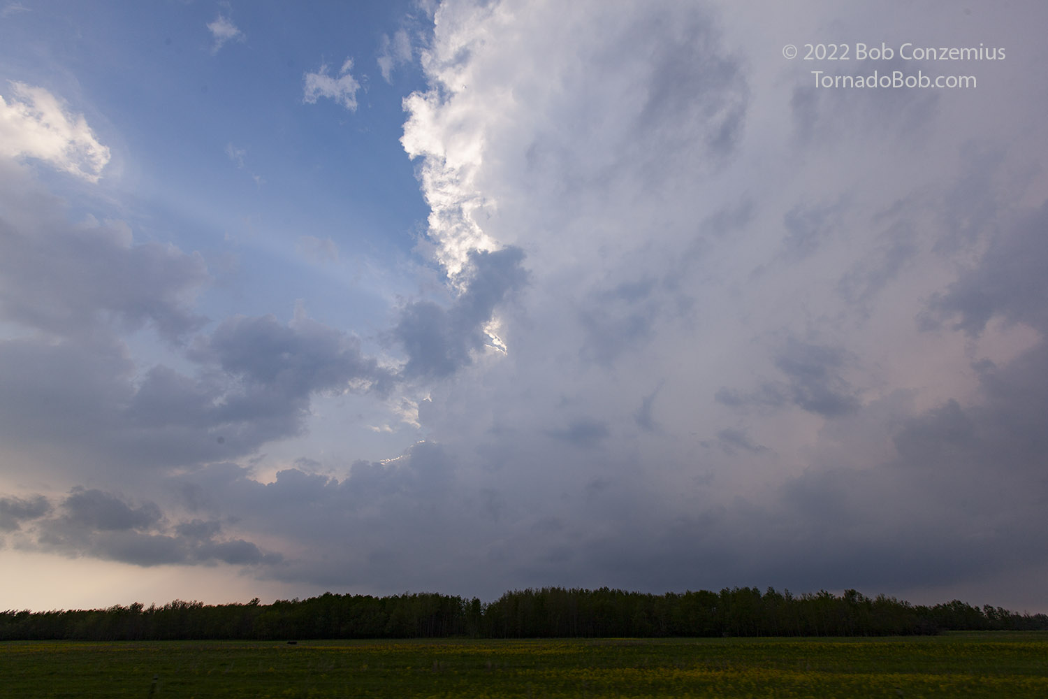 |
|---|
| The third storm. |
After this third storm passed, we didn't have much else to look at, so we drove back to Craig and Julie's home near Blackduck. Because we planned to chase the moderate risk the following day, I stayed overnight at their house.
 |
|---|
| Hail from the third storm. |
 |
|---|
| The route. |
Back to Storm Chases | Home