July 1, 2024 Supercell
Hendley, Nebraska
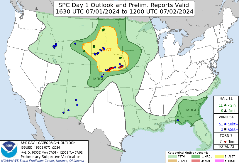
The Storm Prediction Center had a large slight risk area from Nebraska into the Dakotas. A warm frontal boundary stretched across far northern Kansas along the Nebraska border. We set a target along this warm front for our chase. To the south of the front, temperatures were hot with highs near 100 and dewpoints in the 50s. To the north, dewpoints were closer to 70, but temperatures were relatively cool, remaining in the upper 70s under cloudy skies. The low-level shear along the front would be sufficient for tornadoes, but the density contrast across the front meant that the air north of the front might be a little too stable, given the nearby hot and dry air. This was our best target, so we needed to play it.
We left Burlington, eastbound on I-70, then exited at Goodland and drove north to Wheeler. We continued eastward through Bird City. From there, we turned north, I think. I had been hoping to draw a little more from my Google timeline, but Google has changed Timeline and their data collection policies, so in the future, I'll get a GPS log. I do recall driving up through and around Benkelman, passing through the front just before Benkelman. I also remember driving from west to east through McCook. We definitely ended up in Cambridge for lunch. One of the van's battery died, so we had to purchase a new on at the local auto parts store. This did not take long, and we were on our way. Some small cells were beginning to develop back in the hot air to our southwest, and they were approaching the front. It was time to have a look.
 |
|---|
| SPC 1630 UTC Outlook with verification. |
 |
|---|
| First storms developing along the warm front (barely in the hot, dry air). |
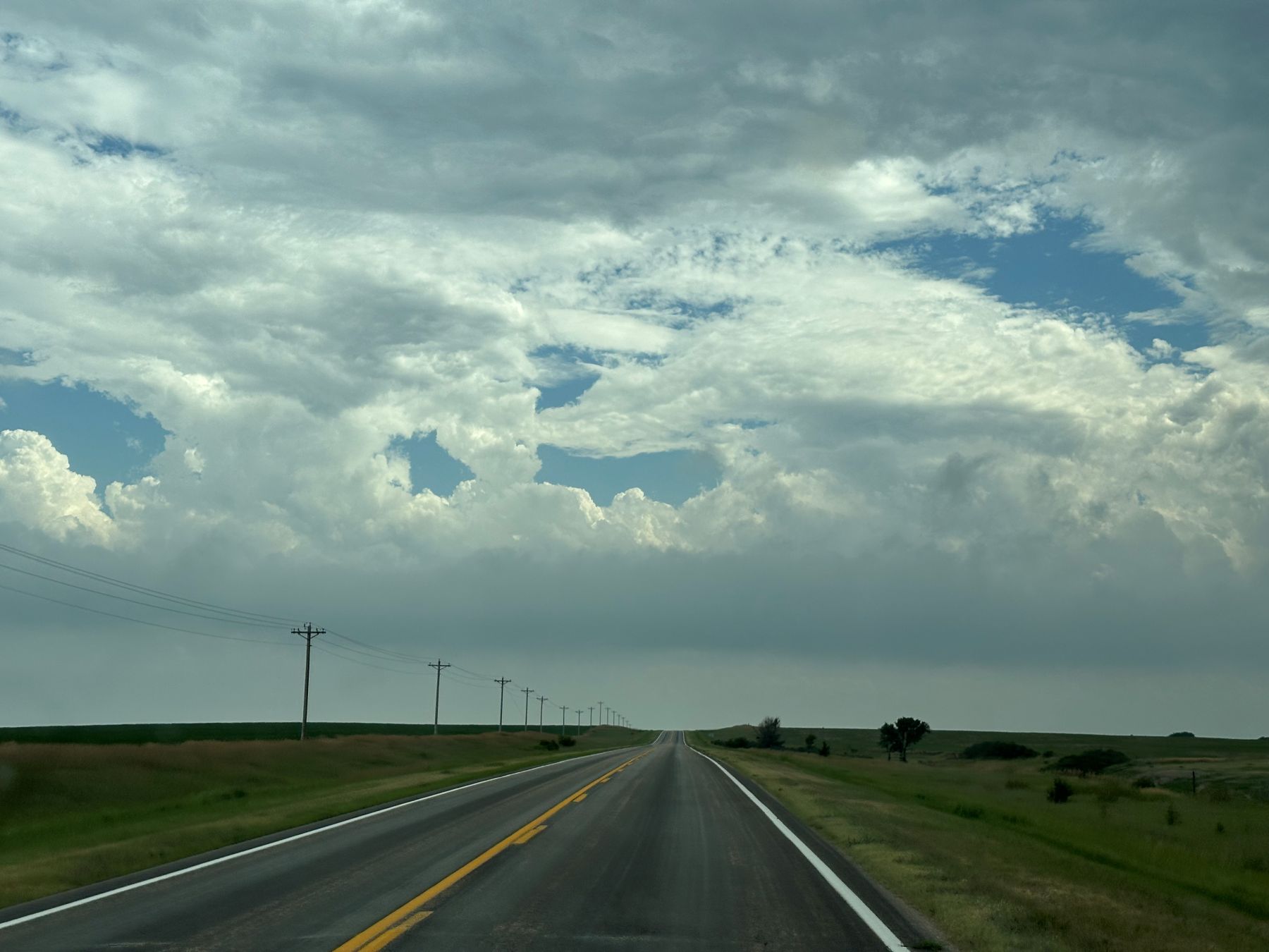
We stopped well to the east of the storm to allow things to develop. That would keep us in a safe position if anything were to explode farther east on the warm front. There were some strong updrafts there, but none of them really became storms. Eventually, a supercellular storm emerged from the haze to our west. Along the RFD gust front was a very long shelf cloud. Actually, it could have been more of a roll cloud because it wasn't clear whether or not the parcels of air that entered the lower part of this cloud continued in the main storm updraft. It looked like they reached the top of the "shelf" cloud and descended on its west side. This shelf/roll cloud then circled around the main updraft of the storm, and a long inflow tail stretched to the north/northeast of the main storm updraft.
| A supercell emerges from the grunge to the west. |
| The storm features a long north-south shelf cloud. |
| The supercell has a nice inflow tail on its northeast flank. |
| It was never very clear how much of the low-level air north of the front was being ingested into the storm. |
We stood at this location for quite some time as the storm approached. We waited until the first gust of wind hit us from underneath the shelf/roll cloud before we got moving back east.
| A guest takes pictures as the shelf cloud approaches. |
While we were moving east, there was a tornado report somewhere on the storm. I never saw anything that looked like a tornado, but I wasn't always looking back at the action area as we were driving east. We had been near Hendley, and we moved eastward through Beaver City, and that's where the brief tornado was reported. There were several brief tornado reports from the storm, but I never saw anything definitive. No damage tracks were found, either.
When we got to the intersection of Highways 89 and 46, west of Stamford, a tornado warning was issued. A velocity couplet had been intensifying, and I thought a warning could be issued sometime soon. The next picture shows what the storm looked like immediately after the tornado warning was issued. You can see a long, low cloud tilting mostly away from the rain (rain is mostly on the right side of the picture). There's a portion far in the distance that looks like it could be an action area with just a little bit of a tail cloud and some lower LCLs. I targeted this area for a closer look and drove north on Highway 46 through Oxford, sneaking up on the main core of the storm from the south.
| Southern flank of the storm as the tornado warning was issued. |
As we got closer to the couplet, it became more embedded in heavy rain. We proceeded cautiously northward, stopping if it looked like we might be close to the center of circulation. Perhaps we could see a slight brightening, which, along with westerly winds, indicated we were in RFD. It was also darker with lower cloud bases to the north, but all features were difficult to discern due to the heavy rain. At one point, I thought we might have a chance to see a tornado, but the circulation was not strong enough, and contrast enhancement of my video showed nothing. Radar showed the velocity couple was weakening.
We reached U.S. 6/34 and headed east. I had intended to continue due east on Nebraska Highway 4, but we made a navigational error and ended up continuing on the U.S. Highway toward Atlanta. I decided to just keep going, and given the lack of any interesting velocity signatures and no big hail, it was okay to keep moving and eventually break through the core to the northeastern side of the storm. However, heavy rain kept us from driving any faster than the storm was moving, so we just remained in heavy rain. When we got to Holdredge, I made the decision to exit southeast. We drove toward Wilcox and quickly got out of the core. There were small areas of rotation along the line of clouds marking the boundary, but there were no vigorous updrafts above them, and these transient areas of rotation would quickly weaken. Perhaps it was these features that got reported as tornadoes. There had been some other reports while we were on our way to Holdredge in the heavy rain.
| Last deployment on the storm near Wilcox, looking north toward Axtell, where a tornado was reported. |
We continued eastward to find a place to stay for the night. There had been no substantial tornadoes from our storm despite the reports. Later in the evening, there were some valid reports (with damage) in the Lincoln area, but we had stopped chasing long before then. We spent the night at the Dragonfly Inn, a very interesting, clean, restored motel with a dragonfly theme. Lots of interesting colors and LED lights. It was probably really expensive to refurbish with that strong a theme, but maybe they'll draw a lot of business. I hope to get back there next time we're close.
| Our approximate route for the day. |
Back to Storm Chases | Home