April 23, 2021 Tornadoes
Western North Texas
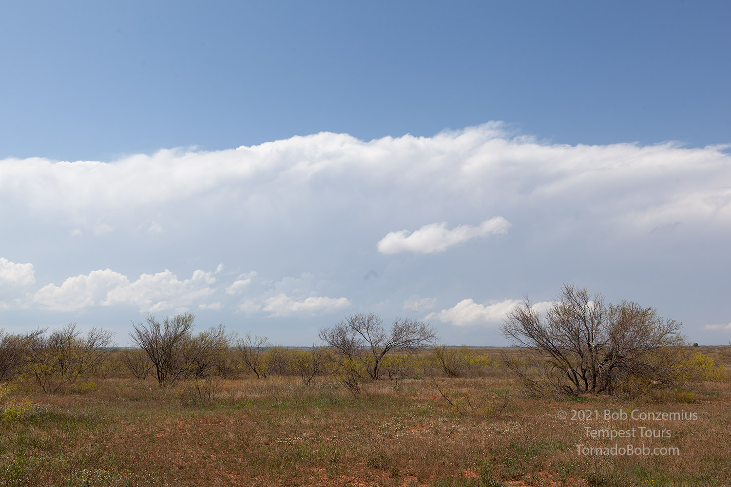
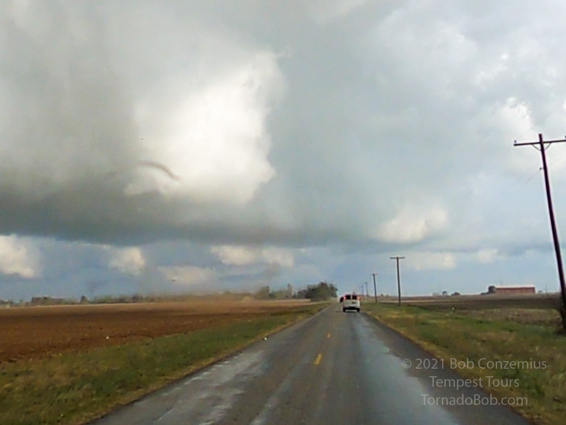
This was the big tornado day for me and Tempest Tours in 2021 (see Bill Reid's chase summary here). We started the day in Clinton, Oklahoma and meandered southwest with a target somewhere close to the Oklahoma/Texas border south of Altus. Along the way, we stopped at the Rattlesnake Festival and had lunch in Mangum (site of the tornado we saw in 2019 on Tour 3). We were north of the warm front, and it was mostly a cloudy, slightly drizzly day.
After lunch, as we headed across the border into Texas, the clouds parted, and we could see numerous towering cumulus developing around us and especially to our west. We drove a little southwest to Paducah, topped off the gas tanks, and picked up some snacks for dinner. We would surely be chasing well into the evening.
 |
| First, distant look at the storm shortly after initiation. |
We headed back northeast out of Paducah to get a good look at the storm. As soon as we could get a view under the base, we could see that it had a wall cloud. The wall cloud came and went a couple of times, but the storm featured a nice inflow band most of the time, indicating it was most likely moving along a boundary (the warm front). It looked like we were on the best storm.
 |
| Wall cloud on our storm. |
 |
| The storm also had a nice inflow band. |
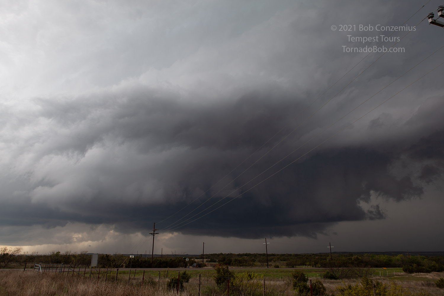
We continued east, but we got a little too far north relative to the storm. We started to get into rain, and we were starting to lose sight of the base. It was time to move south, which we did on Highway 6 out of Quanah toward Crowell. The base had looked less interesting to us because we were in rain, but once we were back out of the rain, we could see that our impressions from the rainy area were accurate. The storm base was rather flat and uninteresting.
 |
| Interesting features disappeared, and the storm featured a rather flat base. |
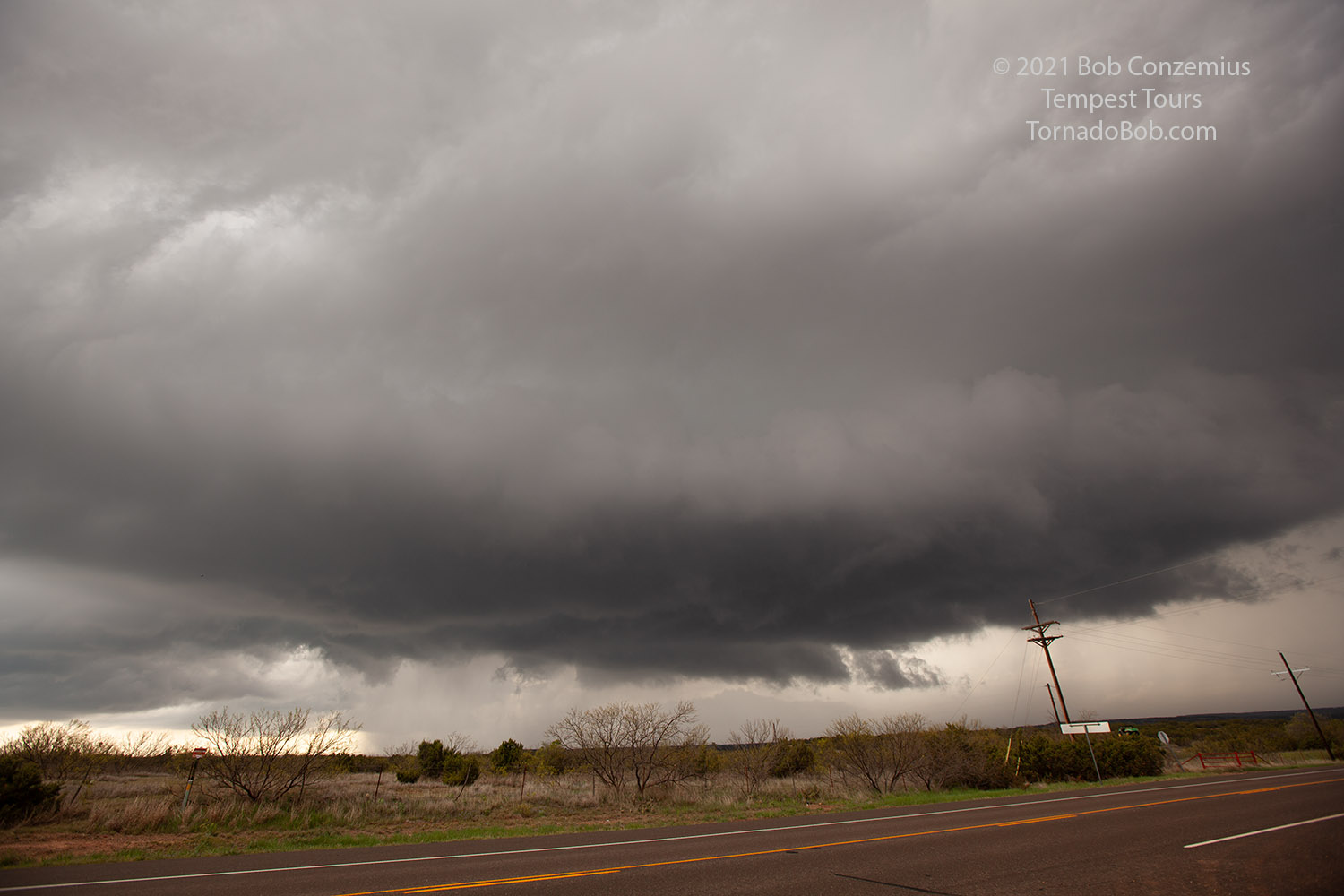
The road network kept us going south for a little bit longer, and when we found a spot with a decent view and not clogged with chasers, we stopped for a look back at the storm. During our brief drive south, it had once again become more interesting. There was an action area, and what looked to me like a funnel appeared right in the middle of it. The funnel dissipated after a minute, and the best area then was a little difficult to locate. However, as the storm moved nearly overhead, we could see the center of the mesocyclone approach. We stayed in hope that a tornado would develop nearby, but it did not, and soon we were getting into golf ball size hail. It was time to leave!
 |
| Interesting features soon reappeared. |
 |
| My last picture of the storm before we got hailed on. |
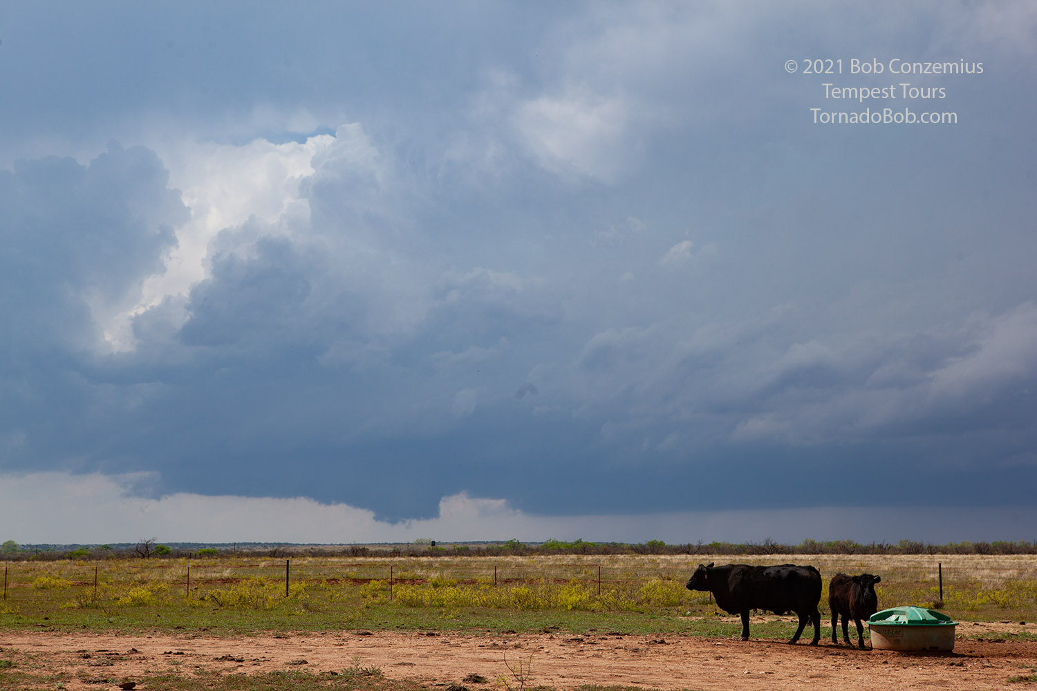
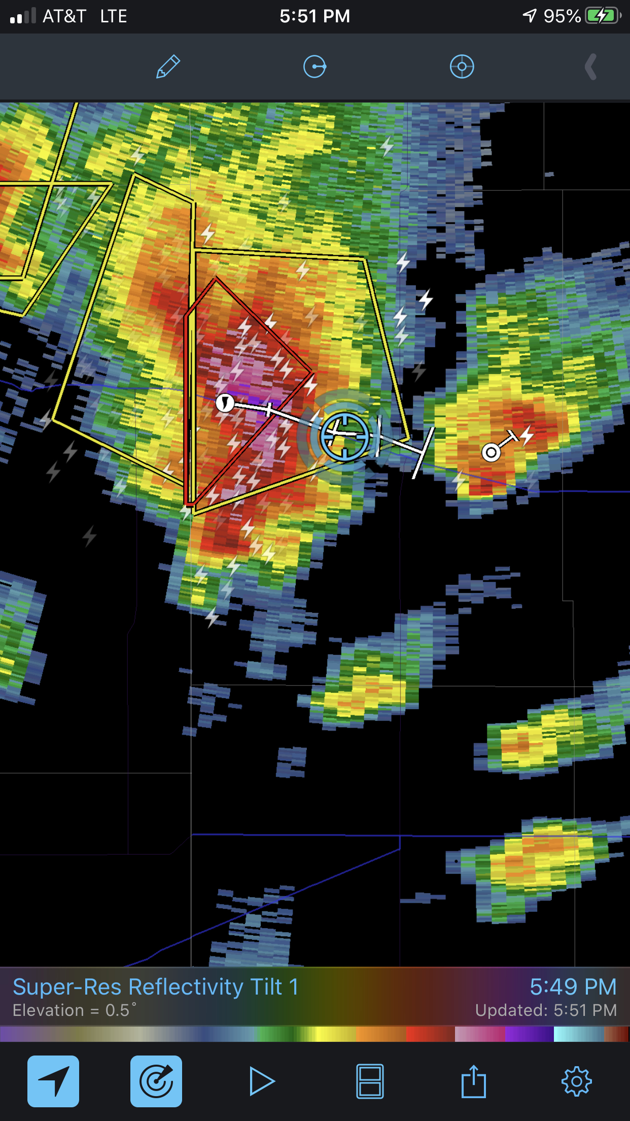 |
| Radar image shortly before the first tornado. |
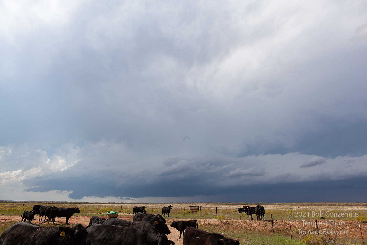
We drove east and quickly got into a chaser traffic jam. Darn! At this point, it looked like it would be difficult to stay with the storm. I could see chase vehicles, bumper to bumper, ahead of us, all the way to the horizon. Traffic would not be moving very fast as long as the storm was nearby.
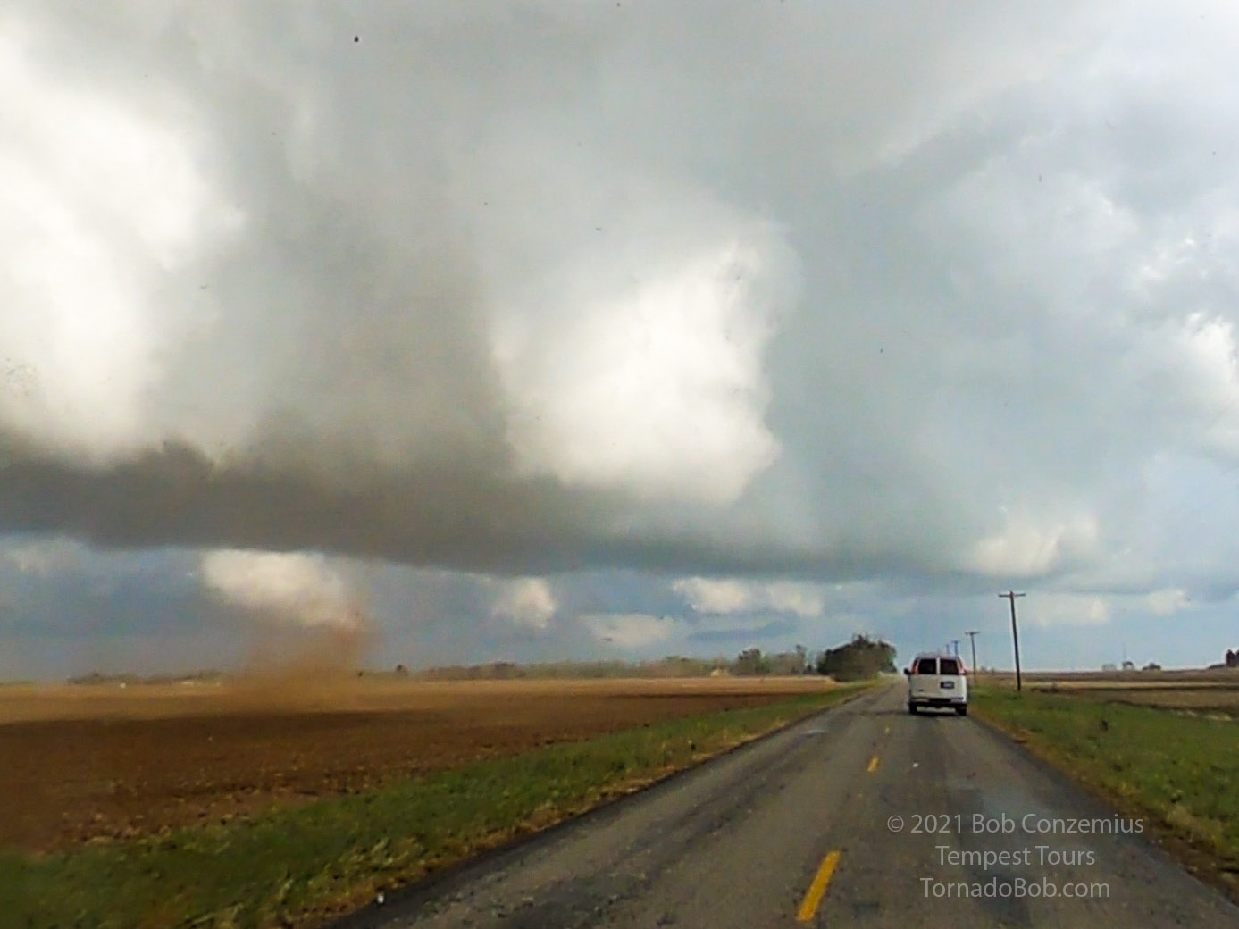
Somehow, the chaser traffic suddenly cleared. I think everyone was pulled over to watch the first tornado develop. We pulled over, looked back to the left and a little behind us, and there it was! I first grabbed my video camera then put the camcorder down and took a few stills. I took a couple stills of the guests enjoying the tornado.
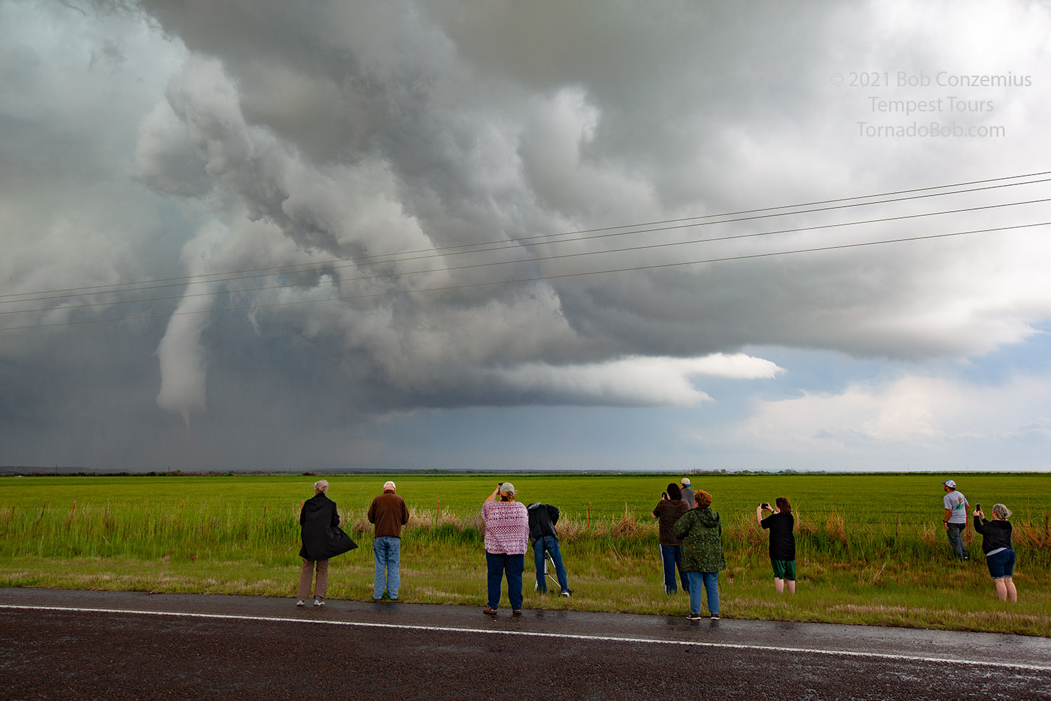 |
| First tornado of the day. |
The tornado looked like it would go into a rapidly dissipating stage, but it persisted for a while longer and reappeared once or twice once I thought it was gone.
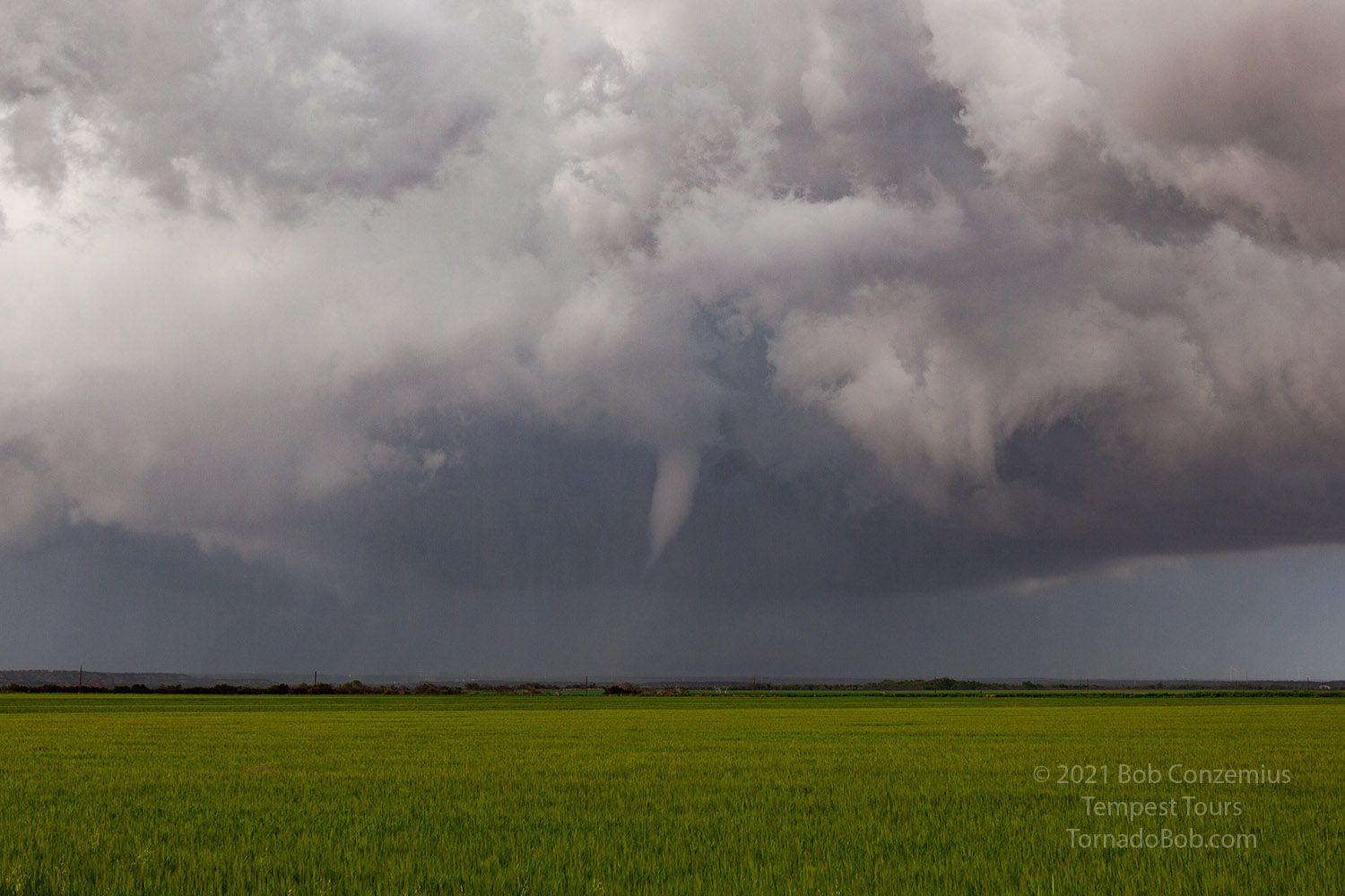 |
| The first tornado persisted. |
From there, we cut north/east on a dirt road and caught back up with the action area. We turned left on a paved road (I was driving so I did not see the map to know where we were), and approached a little more closely. As we paralleled the storm to our left, two dusty tornadoes developed. One was a thin rope, and the other was more of a large cone. Because I was driving, I could not shoot stills or video, and the guests were shooting their own video, so I did not ask anyone to film for me. My GoPro was attached to the windshield and taking video, but the tornadoes were off the frame to the left. Eventually, the dusty mesocyclone entered the video from the left, but by this time, I'm not sure the circulation was intense enough to be called a tornado.
We stayed parallel to this mesocyclone, and we soon saw a narrow cone funnel extend to the ground behind us. We stopped to take stills and video of the fourth tornado of the day. We were just west of Lockett, Texas when we saw this tornado.
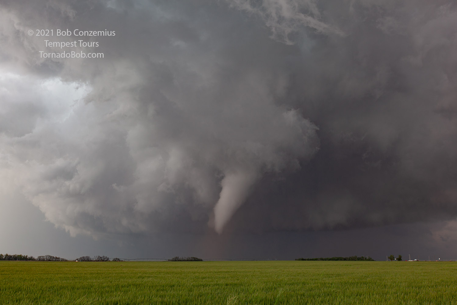 |
| The fourth tornado develops west of Lockett, TX. |
 |
| Tornado number four. |
When this fourth tornado dissipated, we drove east-northeast on the best road available. The road took us very close to the mesocyclone that was now just ahead of us, and soon rain wrapped in front of us. We stopped briefly to avoid driving into any strong circulations, and when the rain cleared, we continued. Looking back on my dashcam video, I saw that we did not notice a rather innocuous looking swirl, which was actually the center of the mesocyclone. Whatever the case, it did not look particularly strong or intense. In fact, looking back at the video, it looked rather highly occluded with little chance of producing a tornado. It slowly crossed the road from left to right in front of us as we caught up to it, and we moved a little past it. Then, our road turned south. As we approached the turn, this little mesocyclone was immediately behind us to our right, and now we were about to move right underneath it again. We had few visual clues to suspect a tornado, as we saw sunshine ahead of us. Literally within ten seconds of the first dirt spin-up, I said that "tornadogenesis does not look imminent". Oh, what a horrible predictor of tornadogenesis I am!
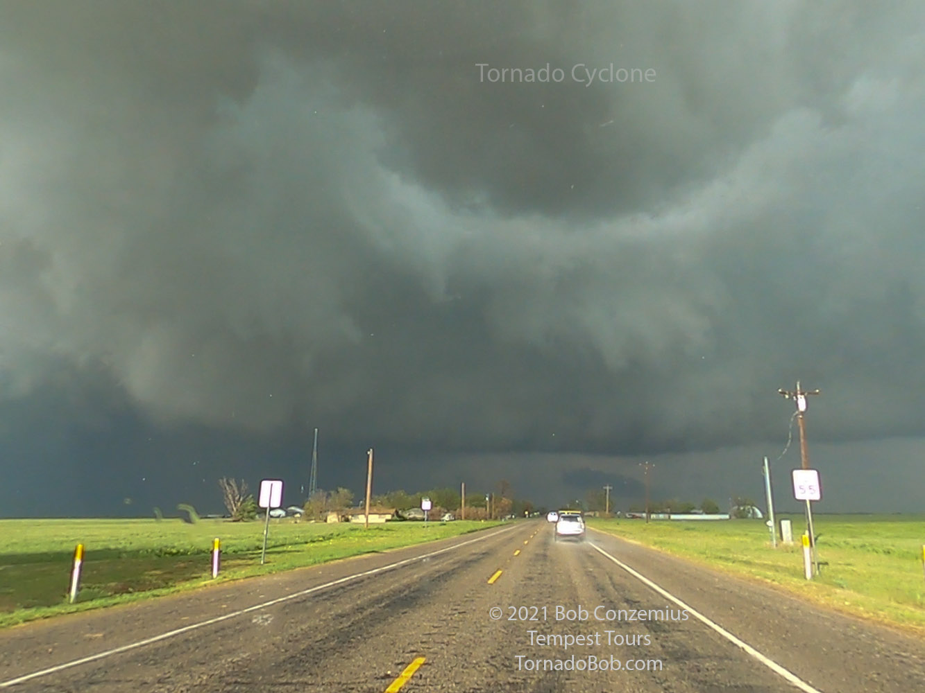 |
| Dashcam video capture of the tornado cyclone we drove underneath without recognizing it. |
The dirt swirl appeared about 50 feet to the left of the lead van and moved into the field. As we drove on, the circulation broadened, and I thought we were experiencing a close-up gustnado, but a surge of westerly winds developed ahead of us as we continued south. This seemed a bit too intense for just a gustnado, but we were still a bit bewildered. Fortunately, I had told the guests (for whatever reason) to look behind us and to the left because that's where I thought the best chance was for a tornado to develop, but I was thinking several miles away, not several yards. A guest yelled out that there was a funnel, and it immediately became clear to me that this was a developing tornado.
 |
| Dashcam video capture of the first dust spinning up next to the lead van. |
 |
| Dashcam video capture of the intensifying dirt swirl. |
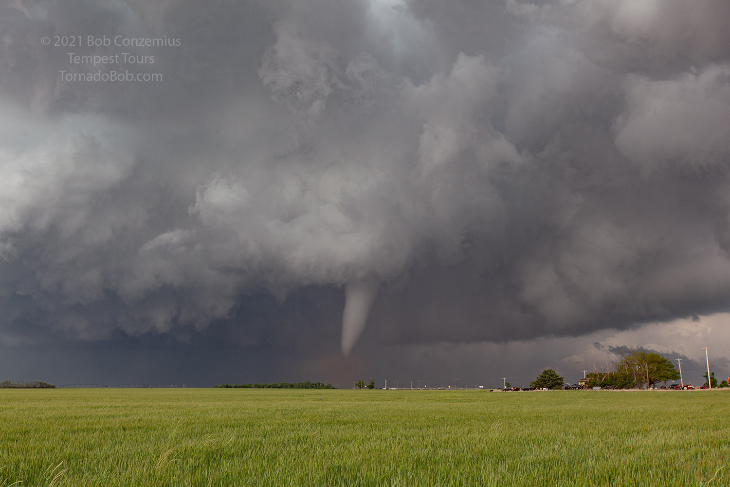
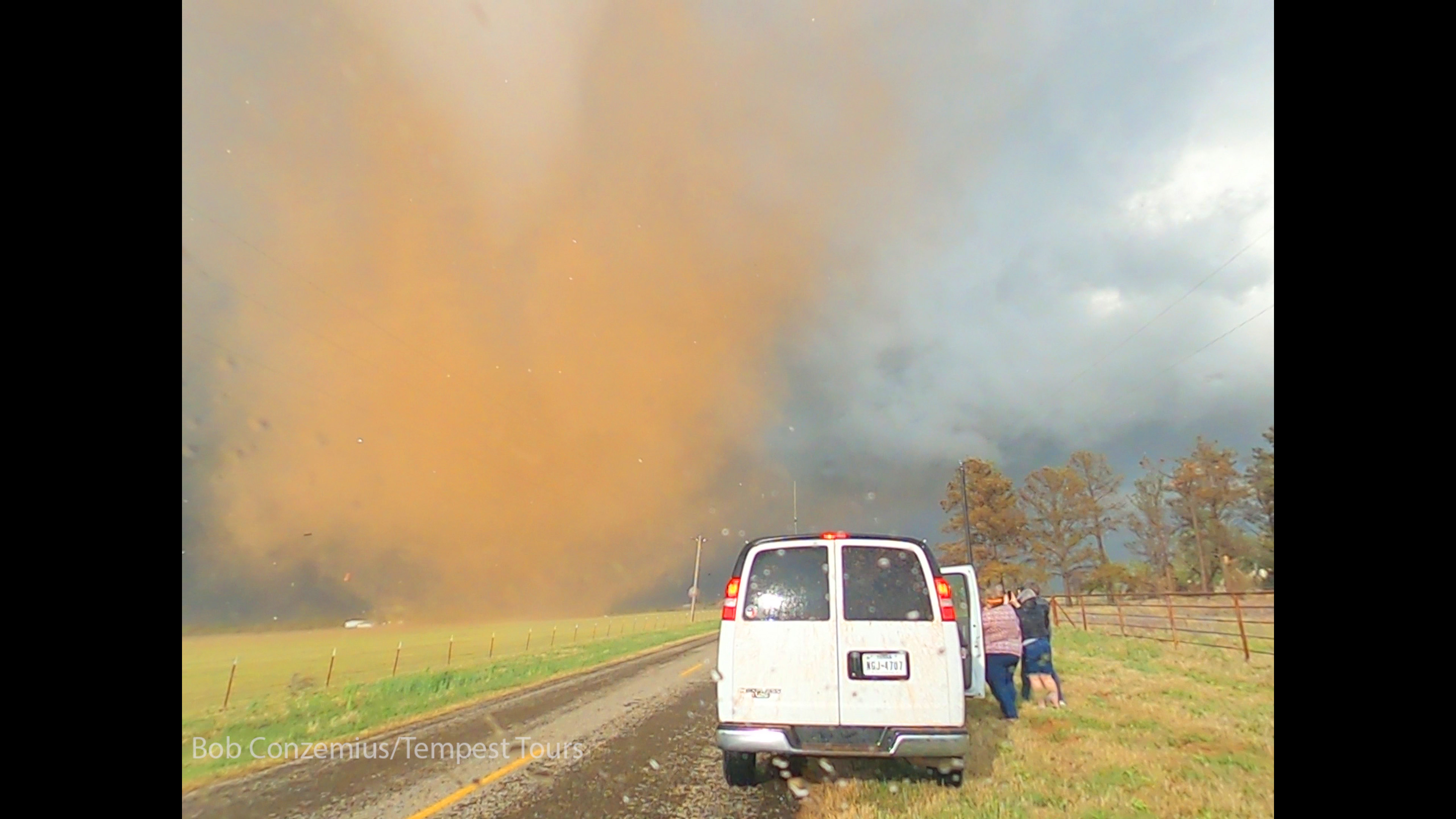
The road turned back east-northeast, and when we made that turn, a fully formed tornado came into view. The condensation funnel did not reach to the surface, but the intense dirt swirl made it obvious. We pulled over, and I grabbed my camcorder to take video. The circulation continued to intensify, and it make a roaring sound in the field. Soon, it began to attack a home and a couple outbuildings about a quarter mile ahead of us. The air was quickly filled with metal roofing material and maybe some siding. This made a rather dramatic scene as the sun was illuminating the red (from the dirt) tornado and shiny roofing.
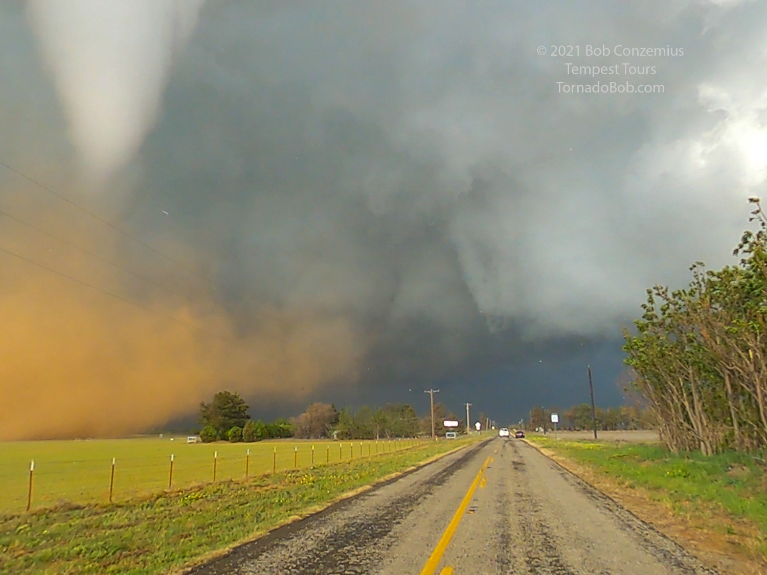 |
| Turning around the corner, we saw a fully formed tornado. |
 |
| Tornado number five develops in the field next to us. |
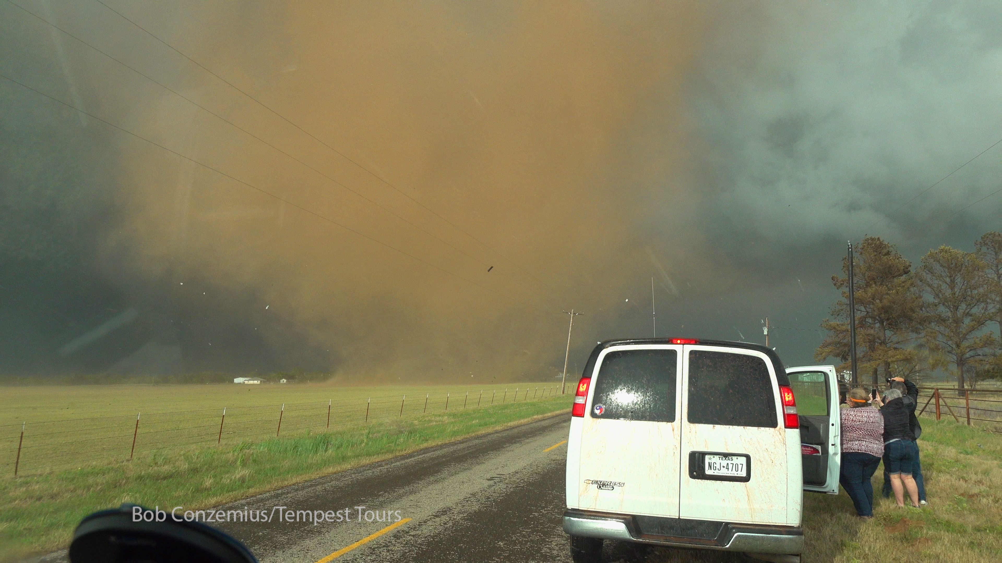 |
| The tornado begins to pick siding off the house ahead. |
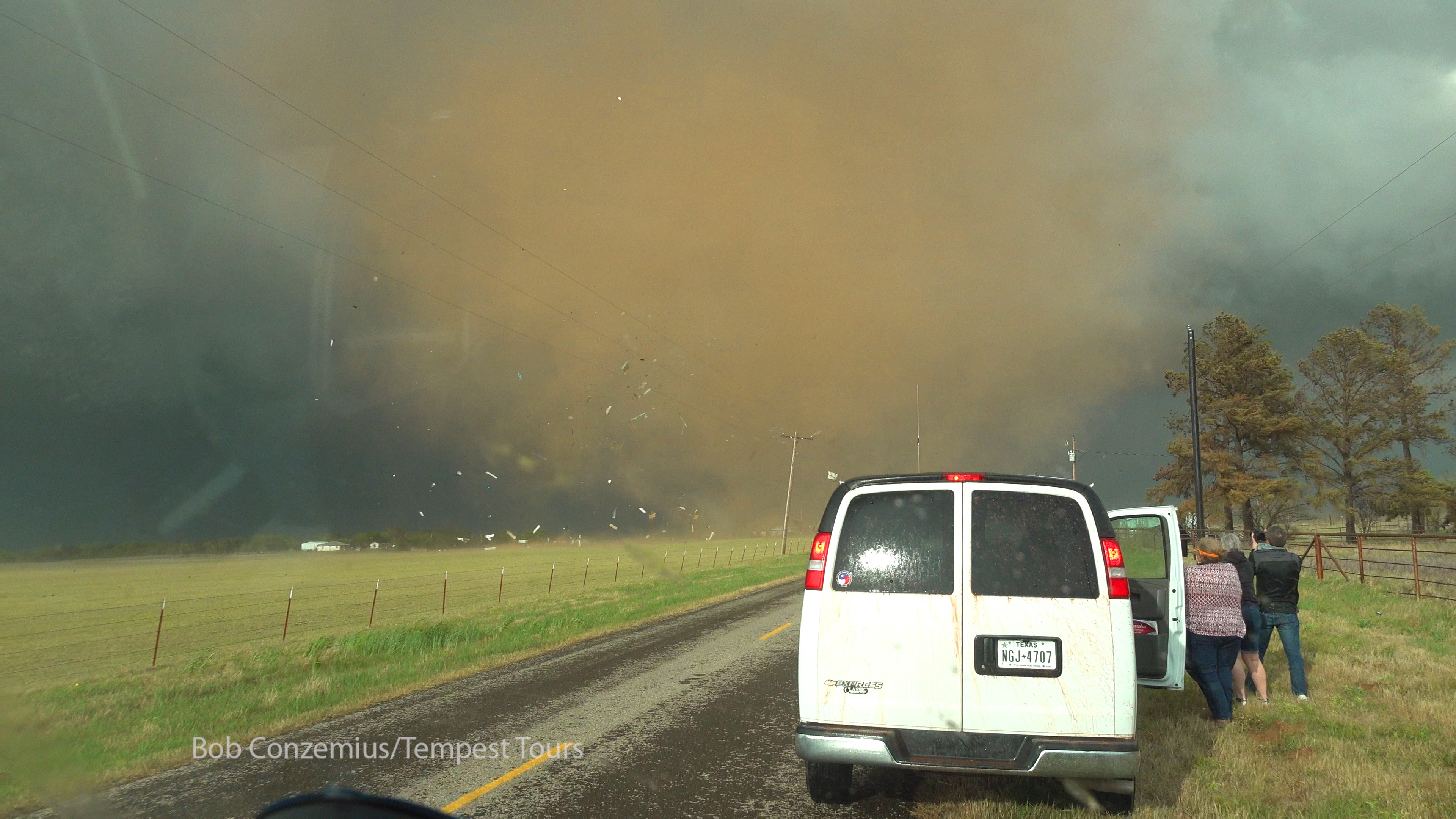 |
| Siding and metal roof material gets lofted. |
The tornado moved southeast, and temporarily somewhat out of view behind the trees to the right of the road just in front of us. We drove ahead to get our view back, but it was slow going as the tornado had knocked down power lines along the road. We had to weave around them to move ahead. After a half mile, we stopped again to watch the tornado in its rope-out stage. It moved into a wind farm (not damaging any turbines that we could see), and a rainbow developed right around the funnel. We stopped to shoot stills and video until the tornado disspated.
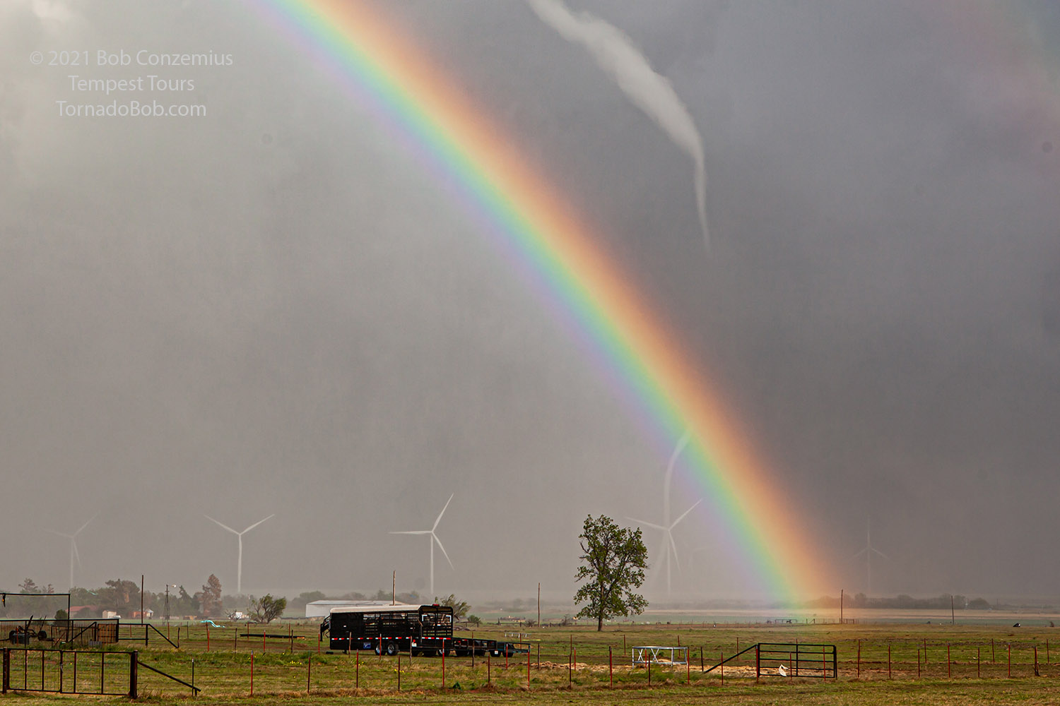 |
| Tornado number five moves into a wind farm with a rainbow cutting across it. |
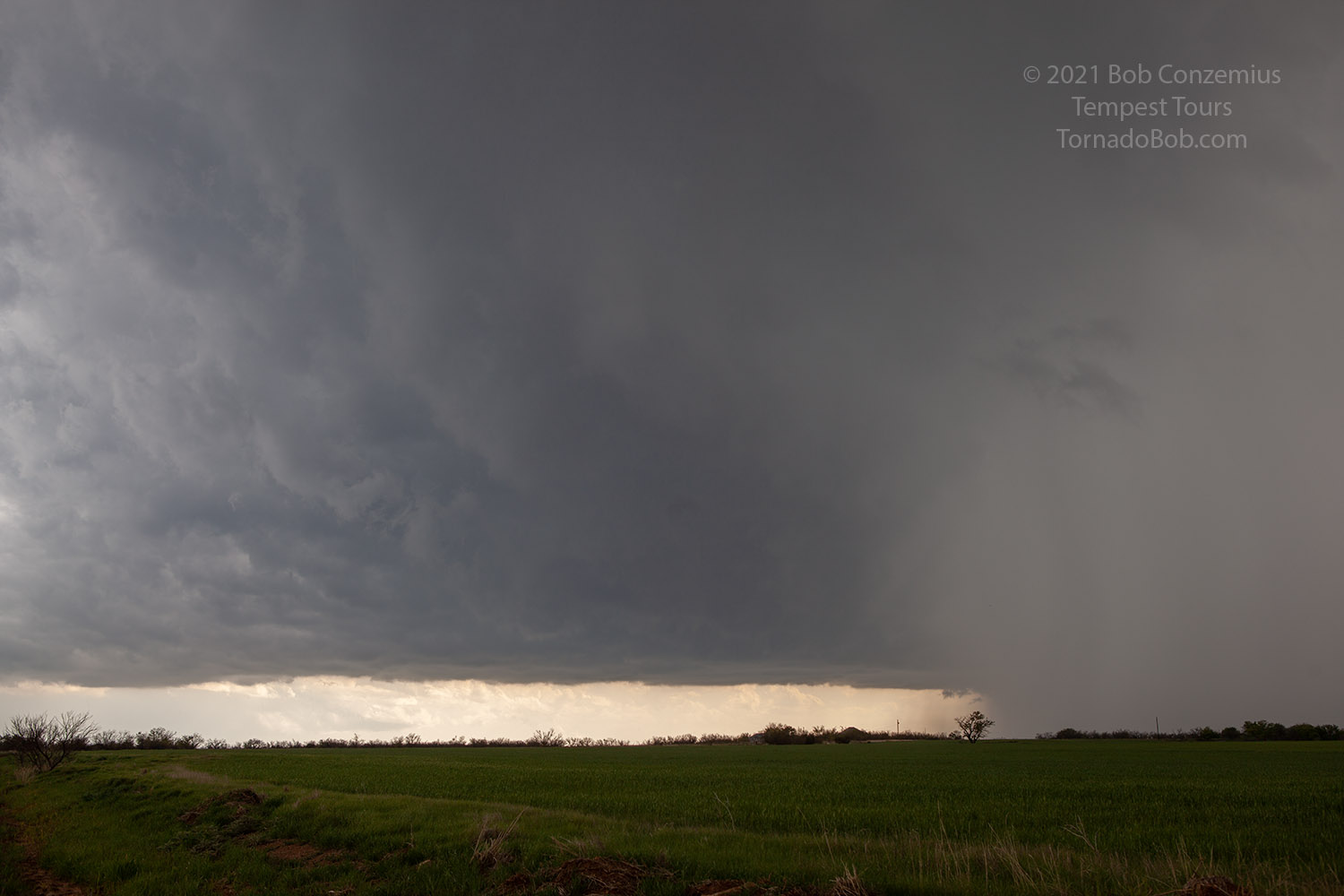
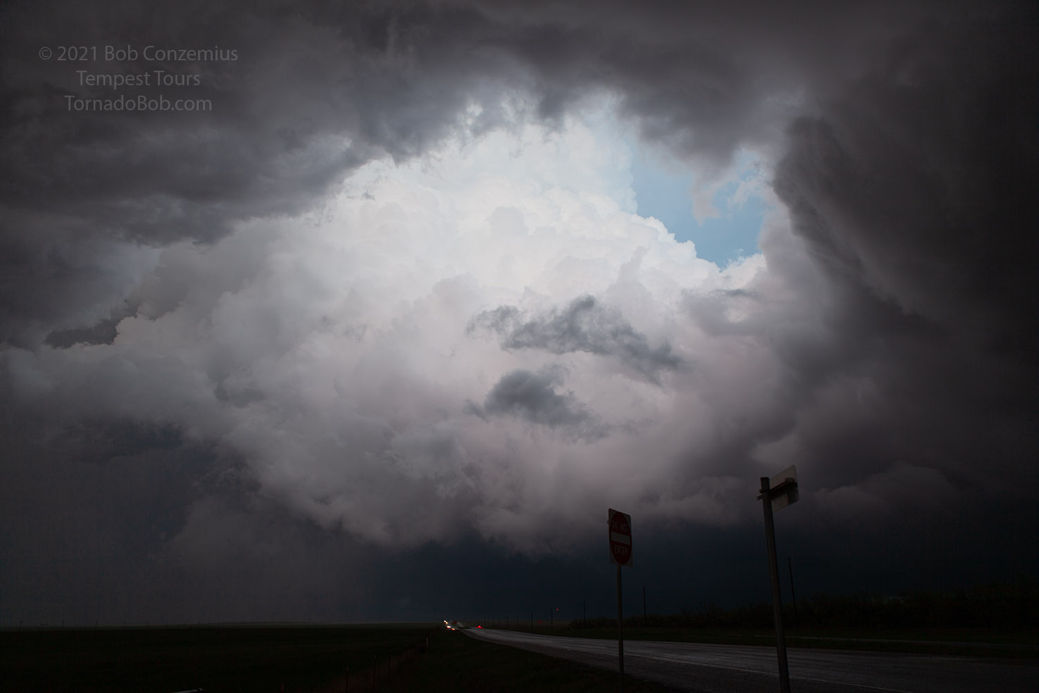
At this point, the storm was done producing tornadoes. We continued with it for a while, but it became quite a bit more linear and featureless. It appeared that the boundary was now moving a bit south, and the air underneath the storm looked a bit stable with stratiform clouds. At this point, we dropped a little southeast and got back south of the boundary. A second storm approached from the west, and it began to look interesting, but the low clouds moved back in as the boundary continued to move a little farther south past us. We let the storm go by, and the RFD behind it gave us enough clearing to create a nice scene to shoot for a minute. Eventually, the skies cleared a bit more as the whole system moved east of us. It was now after sunset, and the storm was going to give us a little opportunity to shoot lightning. Most of it was right at the base of the anvil just ahead of a mammatus field, but enough of it was below the cloud base to make for some interesting shots.
 |
| Another storm moves past us. |
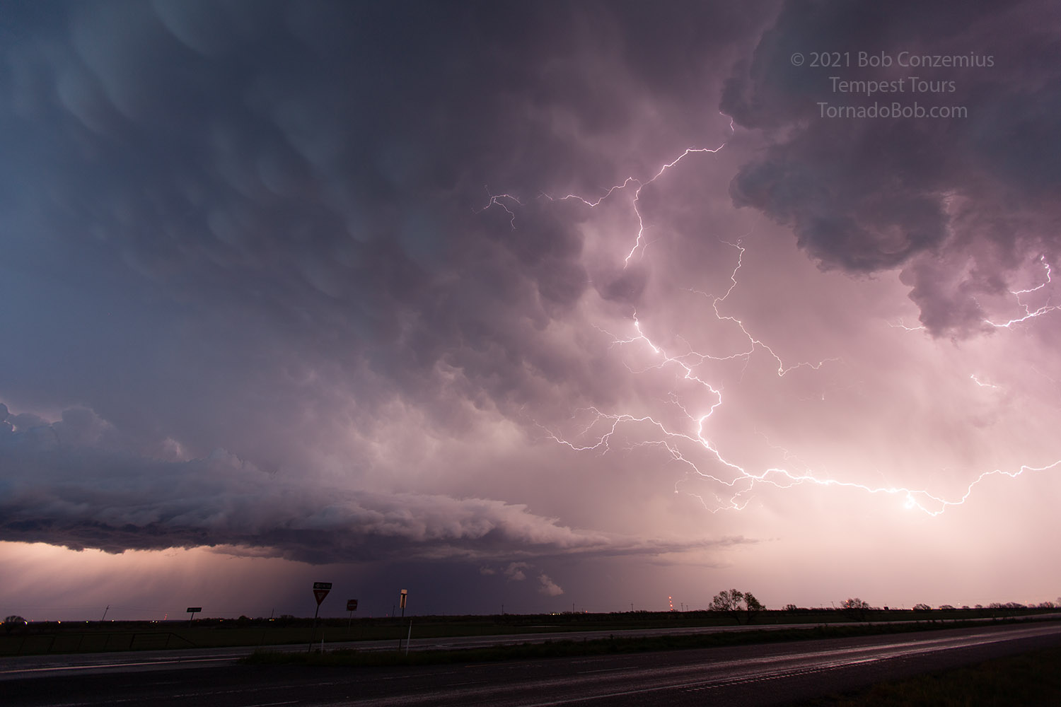 |
| Lightning and mammatus. |
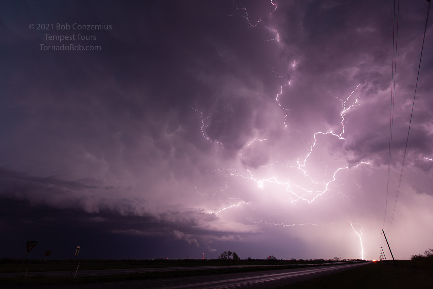 |
| Lightning. |
We contined east to Wichita Falls to spend the night.
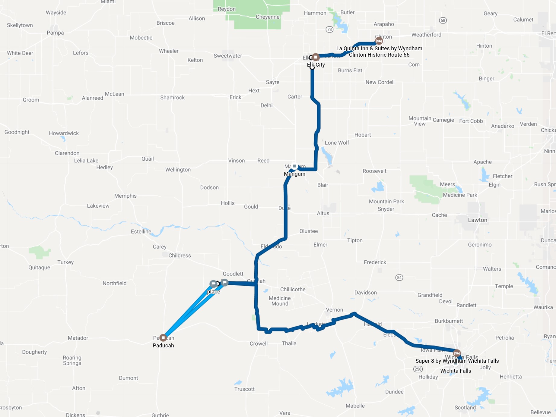 |
| Approximate route for the day. |
Back to Storm Chases | Home