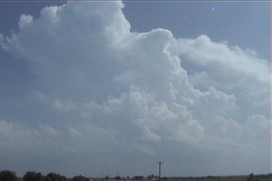
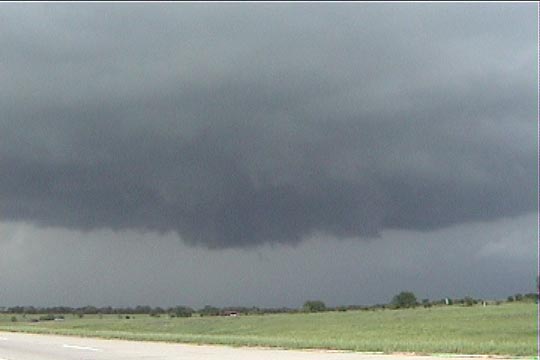
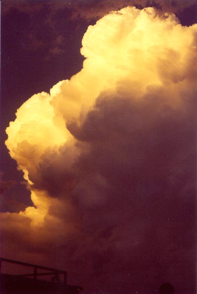
Initiation of a storm just to our south. We are just south of Gainesville, TX.
I was very happy from the start this day, as the setup looked pretty interesting. This was to be my first chase working with the DOW team. Not many chasers were thinking about chasing today, as the "big show" (the Cordell tornado) was yesterday, and the shear was weakening today. However, there was still plenty of directional shear, and an outflow boundary had stalled out just south of the Red River. To the south of this boundary, dewpoints were well into the 70's. We left early in the day thinking initiation would be rather early. The shortwave trough was right on our doorstep, and the cap was pretty weak.
The first storms developed almost right over Norman and became tornado-warned. This was somewhat depressing to most of the crew for obvious reasons, but I expected the first storms to develop close to Norman. The better storms would take a little longer to develop in the slightly stronger cap farther south. Shear was about the same in both places, but the air was much juicier to the south.
Our decisions paid off. The only mistake we made was waiting a bit too long (about an hour too long) to head to the first storms in extreme southern Oklahoma. We missed the better tornado by doing this. However, by being south today, we avoided the EXTREME CHASER CONVERGENCE in Norman with the tornado-warned storm there. Accounts of this convergence are horrifying.
Initiation of a storm just to our south. We are just south of Gainesville, TX.
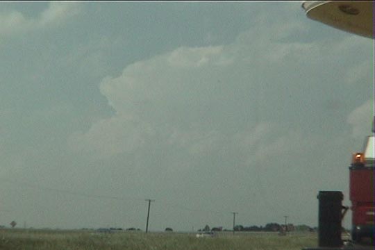
However, the storms just north of the Red River were the main show.
Driving north on I-35 (just south of the TX/OK border), getting closer to the storm.
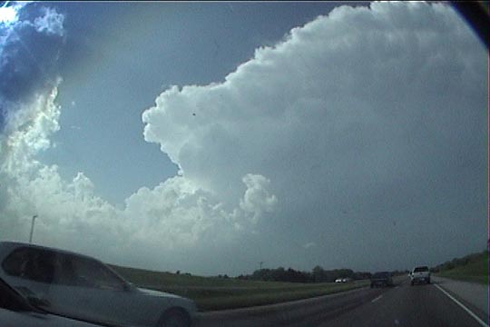
Immediately as we got under the shadow of the anvil (now in OK), we saw the vault and
wall cloud.
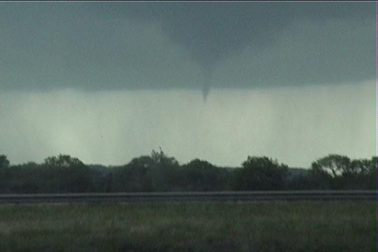
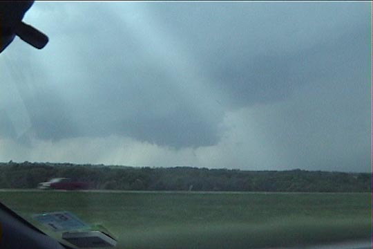
Only a minute or two after we got into position (at Exit 21), a funnel developed. Time-- around 5:06 PM.
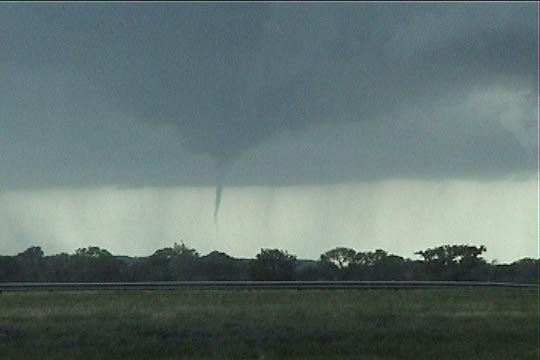
The condensation funnel became much lower. At this point, I called it in as a tornado.
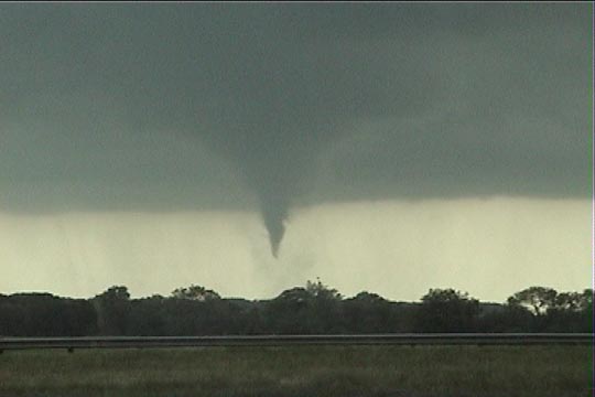
A minute later, the dust cloud under/around the funnel confirms this is a tornado.
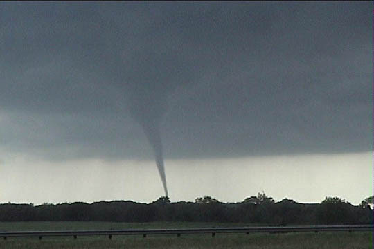
The tornado lasts about seven minutes. The condensation would occasionally reach ground
during this time.
After the tornado dissipated, a second wall cloud formed, but never developed
a tornado. The storm soon became outflow-dominant.
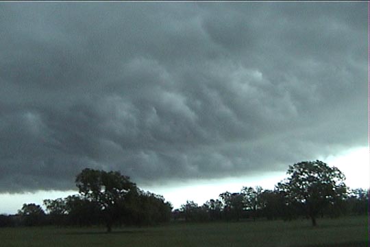
Shelf cloud east of Marietta.
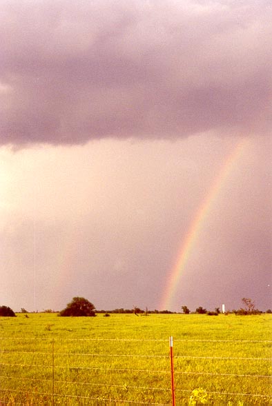
Double rainbow develops shortly before sunset.
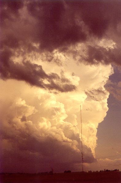
Beautiful updraft to our south.
Another updraft develops at sunset, just to our east.