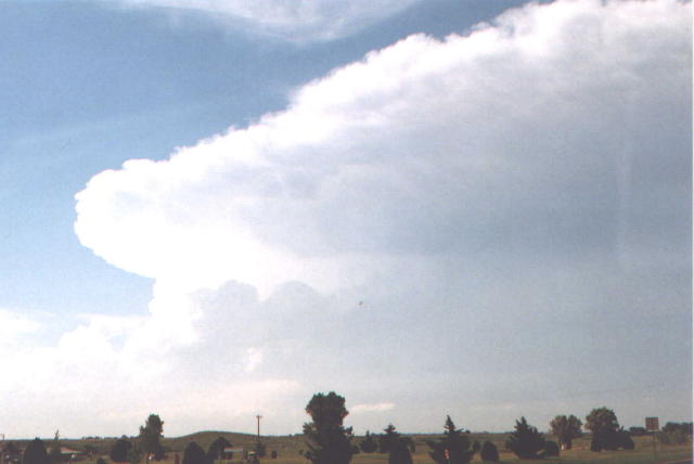
Storm tower as we approach from the south.
Shaun Kelly (N0JDT) and I departed Burlington, Colorado in the morning and drove south to Slapout, OK. From there, we saw the cell go up. We intercepted it and stayed to the east of the updraft. Another cell tried to form immediately to the southeast but got sucked in to the main storm. It developed a second wall cloud. Then, the whole storm seemed to gust out to the south. The tornado then developed.
On May 31, we started in Slapout, OK. The Meade storm exploded convincingly enough that we felt we needed to go north. There was another storm visible much farther to the south (the Lawton storm, probably), and a few moderate/towering cumulus to our southeast. With 25MAY97 engraved in my head, I kept my eye on those towering Cu while Shaun drove north (they never did anything). We took State Highway 23 up to Meade State Park, and instead of drifting west then north from there, we decided that even though we were somewhat far away, we still had a good view of the updraft base, so we went east, then north, up Highway 23. This allowed us to get some decent structure shots from a little farther away, where we could see various inflow bands and parts of the main tower.
Storm tower as
we approach from the south.
View looking
west, from Hwy. 23, just north of Meade State Park.
We continued north on 23 to Meade, then we stayed on U.S. 160
all the way to Sitka. We were very fortunate to have this highway so nicely
follow the path of the storm. As the storm moved east-southeast, the updraft
base/action area slowly got south of the highway. Fortunately, 160 took a short
dive south with U.S. 283 for a few miles, putting us back due east of the meso
again, and giving us some more breathing room to avoid the core.
What was
really the decisive factor in our route was a combination of two things: 1) We
were getting light hail 2) We were thinking 25MAY97. Because of (1), we kept
drifting east ahead of the action area to avoid the larger hail that was being
reported closer to the updraft base to our west. Because of (2), we were
constantly looking for new development to the south to choke off our storm. At
the southern junction of 283 and 160, we saw one of the struggling towers to our
south suddenly take off. At the same time, it was getting pulled into the
updraft of the Meade storm and exhibited an interesting horizontal
roll at
its base as this happened. At this point, I seem to recall making the decision
to get east under the new "storm". We kept driving east either because of this
decision or because we could not find many good, unoccupied pulloffs, or
both.
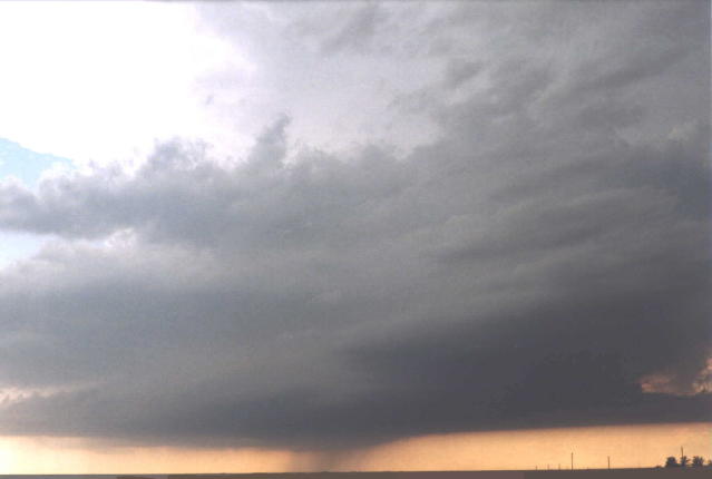
Anyway, we ended up at the junction of U.S. 160 and U.S. 183
(Sitka). There was a good parking lot, and, feeling safely east of things again,
we stopped to take more video/stills. By this time, the second updraft had been
pulled in, so that there was just one very large updraft base, but a second wall
cloud, just to our west, was visible between us and the original Meade storm
action area.
New wall cloud
in foreground (left), old wall cloud in the background (below, right).
View
is to the west.
Up until now, the core had stayed just to our north the whole
time, paralleling us just north of the highway. However, it was becoming
apparent, as we sat at this intersection (Sitka), that the now very mean-looking
core was coming more directly south at us than before, and it was time to take
the south road option. So south on U.S. 183 we went.
Right at this time,
it looked to me like the storm was gusting out, since everything seemed to be
suddenly surging south at us. What I didn't think of at the time is that the
storm could have simply been taking a sharp right hand turn before producing its
tornado.
Everything is
starting to surge southward, looking like things might gust out.
Winds may
have switched more east-northeasterly here for a bit.
The cloud features looked much more ragged, which fooled me for a
bit, but seeing that this "gust-out" was a wet "RFD" cutting in from the north,
what we saw makes more sense. We were able to zero in again on an area of
cylonic rotation amidst the mess. Underneath that area was some rotating dust,
and looking at the video, the initial point of tornadogenesis was probably a bit
farther north than I originally thought. Anyway, with the rain surging faster
south behind this area of rotation, the original action area disappeared from
our view entirely, so it became quite clear to us what we were following. We
wanted to stop and set up for video/stills, but when we tried to do so, the
rapid southward motion of the tornadic area kept us moving south along with
it.
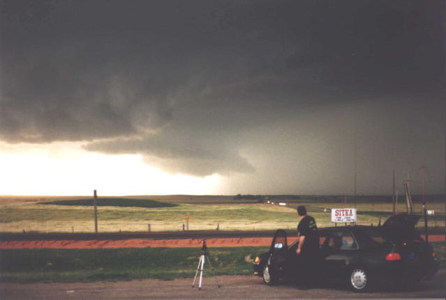
Finally, as the visible condensation funnel formed, we realized this
beast was soon going to cross our road. It was our decision whether it would do
so in front of us or behind us. We chose the latter. It would have been "safer"
for us to choose the former, but I guess I didn't want to get swallowed by core
and take baseballs. I was definitely thinking "turnpike" as we raced south in
front of the tornado, but we made it, and there were even one or two cars well
behind us (1/2 to 1 mile behind) that also made it safely. Their video, if it
exists, is probably more dramatic than ours.
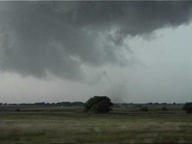
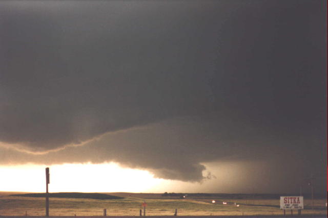
Initial Stage of Tornado - No visible funnel, but
definite rotation in contact with the ground
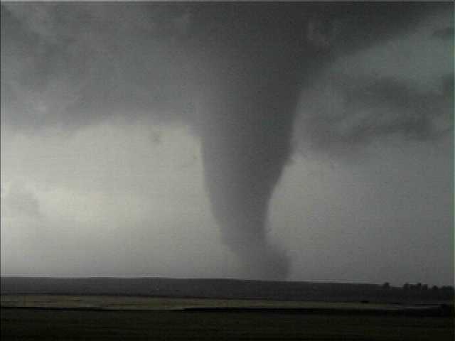
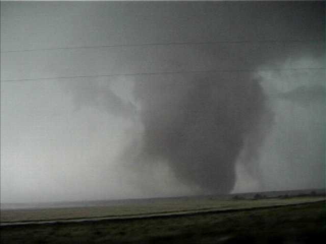
A minute or two later, the condensation funnel is
fully formed.
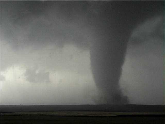
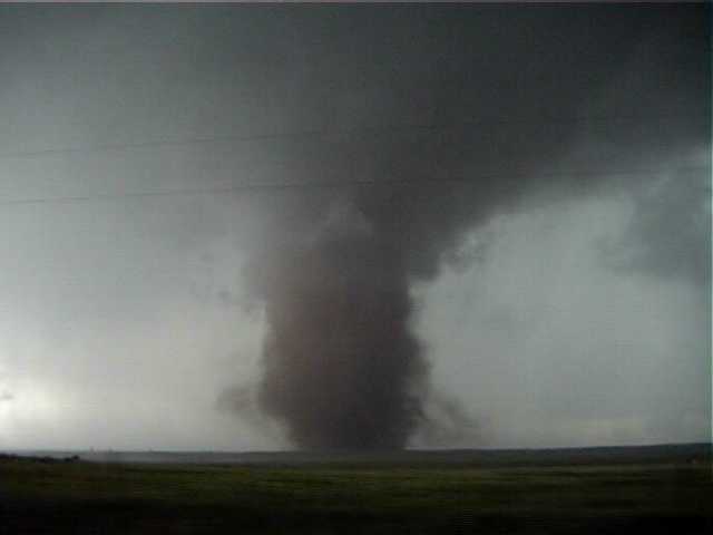
Dust and debris cloud is now making an
appearance.
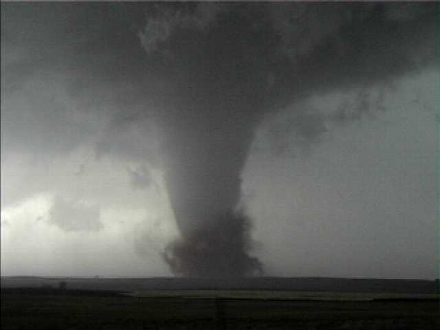
Dust and debri
cloud is fully visible now.
At this point, we are most concerned about
getting south.
The tornado is about to cross our road.
Tornado is getting closer now. Keep
moving!
Next time, we'll probably park it and let the tornado go in
front.
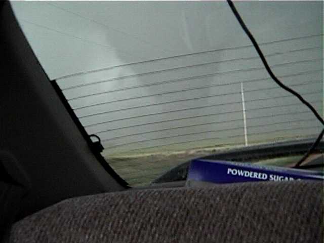
Tornado in rear view mirror, about to cross the
road.
Powdered sugar donuts starring in the
video.
With the tornado now wrapped and behind us, we decided to hang out for a while. We captured a couple more neat images.
A left-moving
storm approaches us rapidly from the south.
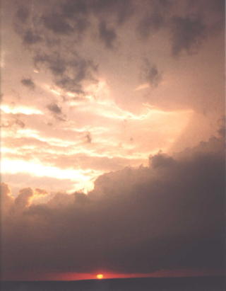
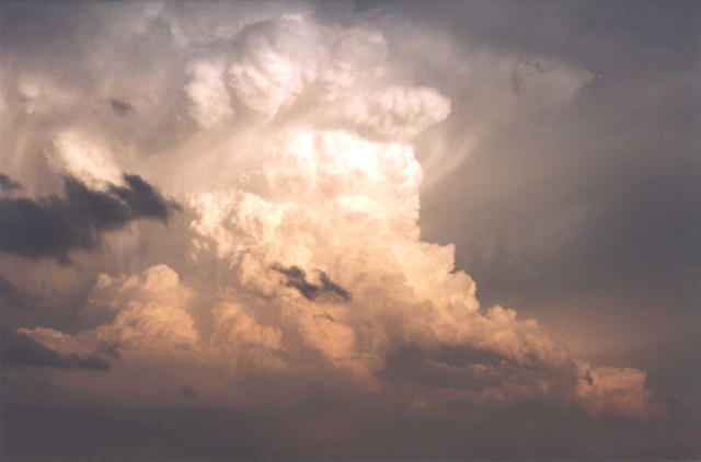
The sun sets on
our chase.