I had to be in St. Cloud to get my air conditioning compressor replaced (prior to my move to Norman) in the morning. I brought the laptop and chase gear along, knowing there was some potential. I wasn't that excited, but I became more interested when it cleared up in the morning. Repair guy took off to lunch before getting the car done, so I was a bit anxious when I saw storms developing immediately to my north at noon.
1.5 hours later, the car was done, and another half hour a severe box was out. It was now time for some tough decisions. 18z surface analysis showed southerly, relatively backed surface winds all the way west to the MN/SD border, but satellite showed my own area (farther east) to be very active. The storm in my area would soon drift into trees and difficult chase territory, but it was showing supercellular tendencies. Farther west, there were already some small cells starting to organize in the MN/SD/ND border area, where the landscape is much more open. This made the decision for me. Drop SW on MN23, then west on MN7, then drop south some more.
I drove southwest to a point about 12 miles west of Willmar, shaking my head as the cell I had just abandoned in my back yard went tornado-warned. However, there were other storms to my west and northwest, but they did not look that great. After getting 21z data via cell phone, I did a surface plot, and the data SCREAMED St. Cloud to Alexandria. Surface pressure falls of 3+mb/3hr were occurring, convergence was maximized, and the theta-e axis pointed here. To my southwest, I liked the better upper-tropospheric flow, but the winds were veering somewhat and pointing more at the storms to my northeast.
I reluctantly turned around, targeting a cell near Alexandria. I thought I saw a nice flanking line building into the main tower of a supercell, but as I got closer, I realized things were looking more linear, and there were several smaller cells forming into a line. The cells to my west were approaching me faster than I could get to the Stearns County cell (which was severe-warned). It was time to drop south again and play with the cells farther south as they drifted east. Met up with Scott and Shaun Kelly (another chase partner) in Spicer, MN.
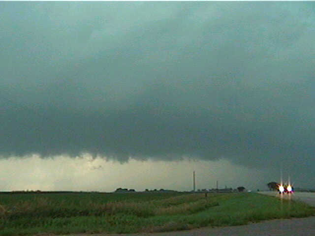
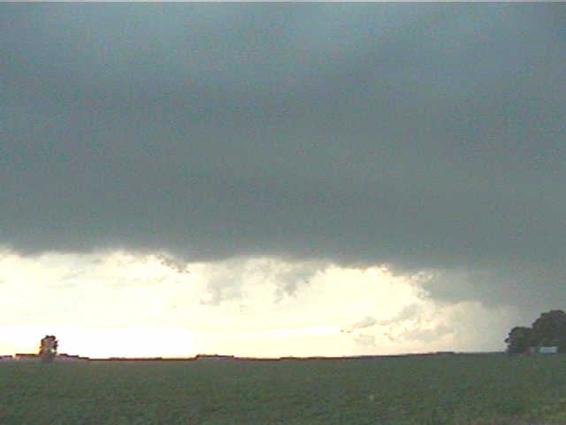
From there, we drifted southwest past a series of cells, which became more discrete as we went southwest. Saw an updraft base just northeast of Willmar and let it go, since we had a severe-warned cell farther to our west. As we approached that second cell near Willmar, we saw core ahead of us and worried about being in it. Alas, we found a south road exactly where we needed it and drove to get south of the core. At this point, I expected to see linear storms with the SW winds, but there was no shelf cloud/gust front. With the heaviest core still a bit to the west, anvil-type precip (anvils were streaming west to east overhead) these were more rear flank updraft (vs. forward flank updraft) storms. Here, we first heard funnel cloud reports over local spotter frequencies, which quickly became tornado reports about 15 miles to our southwest.
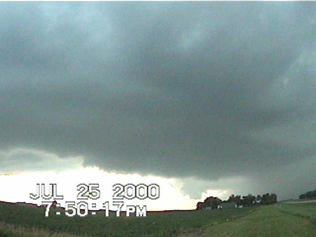
Upon reaching the updraft base of our cell , we realized that either the tornado reports were false, or our cell was not the one producing the tornado. Seeing another similar shelf-free core to our southwest, we decided to continue south. We later realized that the initial tornado reports made things seem much closer-- due to the magnitude of the tornado, spotters in those small communities viewing it from the northeast must have thought it was much closer to them than maybe 10 miles. This was the tornado that tore through Granite Falls. Judging by the reports we heard over radio (at least 10 houses with nothing left but foundation), this could easily get an F4 or so rating.
Scott, Shaun, and I are not too upset about missing this. We got on the storm perhaps 30 minutes later (at most), and except for a good lowering initially it looked pretty disorganized and almost linear (not shown here)-- not like something that had produced a violent tornado just a half hour ago. There was yet another tornado-warned cell to our southwest (Marshall), and seeing this new cell versus our current storm, I was not very interested in keeping with the Granite Falls cell, but road construction lengthened our route to the Marshall storm, so we stuck with what we had.
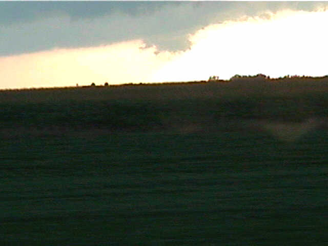
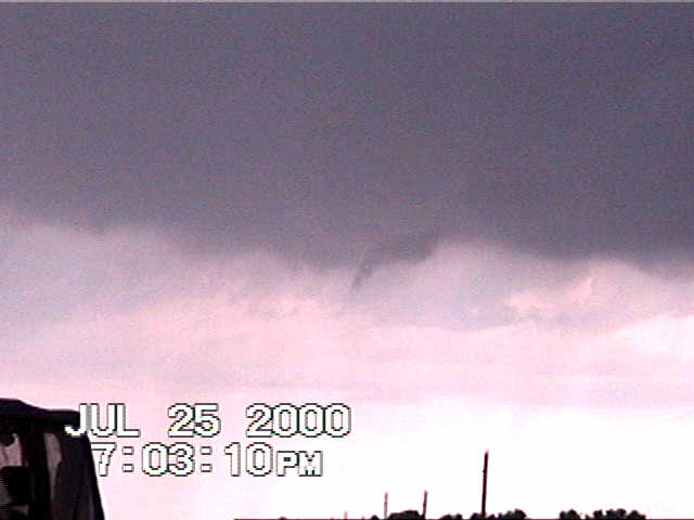
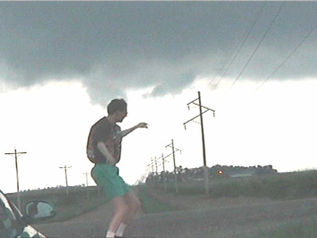
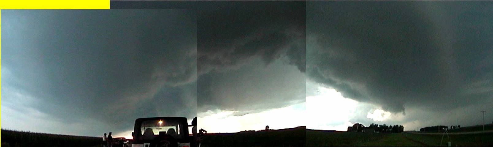
Thank goodness we did, because it started immediately to reorganize. A possible brief funnel developed, and a new horseshoe RFD cut into the base to our north, and the storm acquired a more circular look to it. A slowly rotating, ragged lowering developed, accompanied by upward cloud tag motion (also seen here with flying human). Precip started falling through the RFD (with a good wet microburst ) and the cell quickly evolved into the HP process. We stayed along or just southeast of the notch for a while and pulled over once we got a little ahead of it. Rapid upward rising motion pulled cloud tags into the wall cloud as it got closer to the ground, but too much heavy precip and such was wrapping in, and it eventually died.
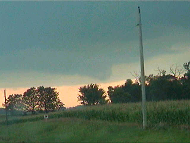
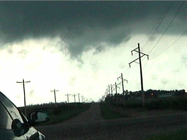
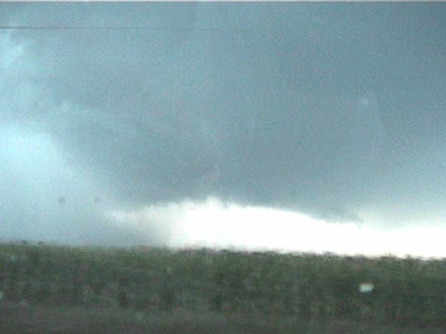
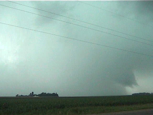
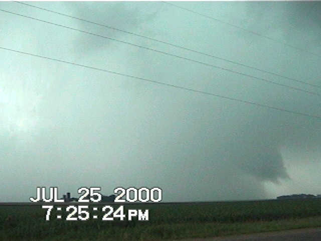
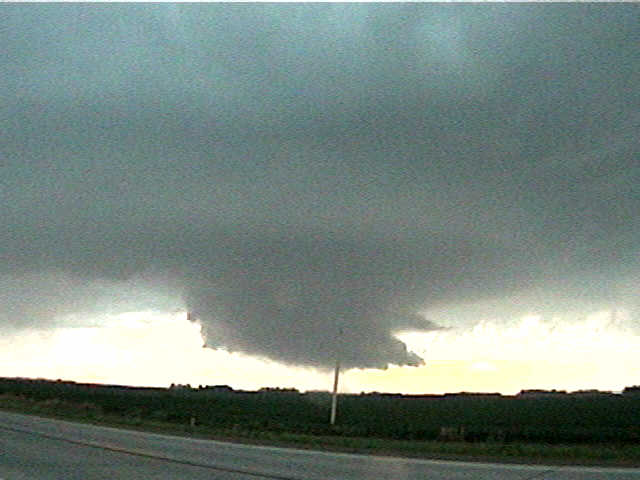
We dropped south after losing all features and another updraft base developed to our west. It rapidly organized into a more circular shape, with a small beaver tail off to the east. Surface winds were backing southeast, and our new updraft base developed into a nice wall cloud with flanking updraft base as seen here. It, too, started to rotate somewhat beneath a lightly banded circular vault. We stopped to take stills, as it was the best wall cloud we've seen in some time. This too, went through the same process and eventually got filled with rain, so we abandoned it and went south again, reaching St. George. Again, winds backed SE and another updraft base developed, with the sun dropping beneath the developing wall cloud! The cell was in the CL process, so we drifted west and got northwest of the updraft base to see the sunset illuminate the back side of the storms. The wall cloud then became quite dark with a very low-hanging inflow tail to the northeast.
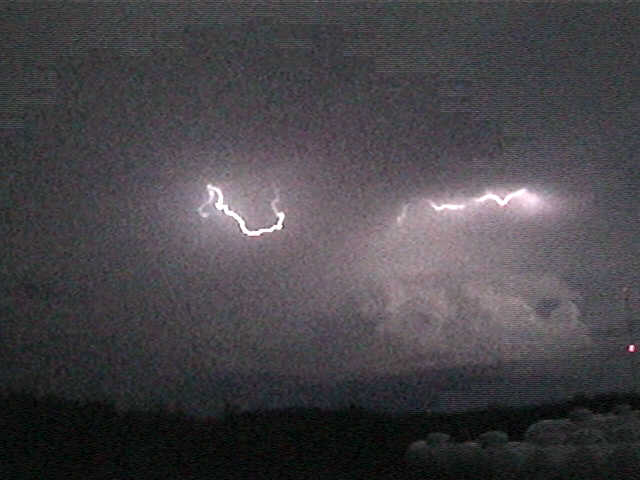
The sun set, and we were now behind the storm, so we called it quits. We stopped near Gaylord to observe some of the best post-chase display of anvil zits (lightning) I have ever seen. The storm was going nuts electically as it slowed down and sat near Mankato.
In summary, we missed the Granite Falls tornado, but we are not too upset, because it keeps our fatality-free tornado streak going. Neither Scott, Shaun Kelly, or myself has ever seen a deadly tornado or even one that does significant damage, even though we have seen some fairly large ones. Once we were on the storm, our maneuvering through the excellent road network kept us right where we wanted to be. It was very interesting to note that the development of features at the cloud base seemed to preceed the doppler-indicated tornado warnings by about 5-10 minutes or so.
For myself, had I not taken that northward jog back to St. Cloud, I'm not sure I would have been on the Granite Falls cell, because the next cell I would have picked was the cell immediately to its north, and there were many other cells to choose from. I may have been exactly in the same position. Sure, I would like to have seen the tornado, but this was a day where you had to be on the exact cell just at the exact time it produced. It was not a clear bullseye situation, since surface features looked better northeast, but upper-tropospheric flow and shear looked better farther SW. One storm in between went nuts.