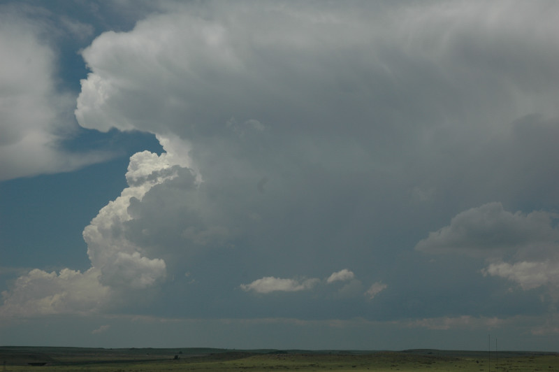
Storm initiates in extreme southeastern Colorado.
Since, on the previous evening, we had planned to drive to the next day's target area rather than chase, we started the day in fairly good position in the Clayton, NM area. We arose in the morning, looked at the weather data, and decided we were in good position, so we took a museum tour in Clayton in the morning, then had a somewhat leisurely lunch. When we finished lunch, towering cumulus were developing just to the northwest of town, so we drifted that way to watch them for further development. Indeed, they grew into full-fledged storms. Although we were a bit disappointed when these storms initially appeared to be evolving into a multicell cluster and were slightly tempted to leave, we decided it was best to be patient and stay with our initial complex of storms. We believed we were in the best area, and hoped a supercell would organize from the mess of smaller storms we saw. Indeed, that soon happened, and the day became much more dramatic from that point.
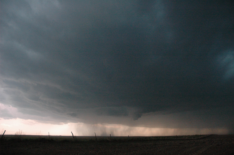
One storm soon dominated, and a swirling RFD developed in its base. This soon produced a funnel-like lowering, and the whole thing then occluded. The storm then became decidedly HP in character, and as soon as we passed through Keyes, OK, the storm swallowed the town, and we stopped to watch the churning core to our north with sirens wailing in Keyes. From that point onward, we drifted eastward on U.S. 64/412, stopping periodically to take stills and time lapse video. On one stop near Eva, the core started to become slightly more translucent, and the cloud base around it somewhat less outflowish. Although the storm had been HP for most of our chase, I could not rule out a tornado. Indeed, that's what happened. As we were driving east between deployments, the precipitation cleared and the circular HP structure shrunk to reveal a ropy, almost horizontal funnel. The end of the funnel was angled doward toward the ground but was obscured by rainfall. A picture taken from a different location to the northeast of the tornado showed full condensation to the ground, and the tornado had been there for some time before we saw it. It's amazing how different things can look from a different angle.
After this bout of excitement, we drove east then watched a new action area develop behind us as the updraft base drifted southeast across the road. Although I thought the storm would produce another tornado, it only produced a brief funnel then became less supercellular in appearance. It caught us near Guymon, so we let it go as it was getting dark. Since rooms in Guymon were booked for the evening, we drove to Amarillo for the night.
Storm initiates in extreme southeastern Colorado.
New updraft is looking healthier.
Viewed from the Oklahoma panhandle, there are now multiple storms, but still a rain-free updraft base.
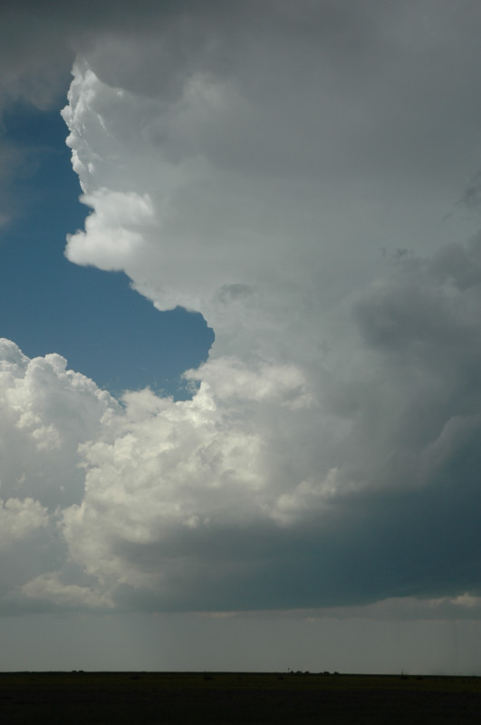
One storm breaks away and starts to dominate, becoming a supercell and producing a funnel.
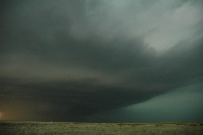
The storm quickly becomes HP and swallows Keyes, OK.
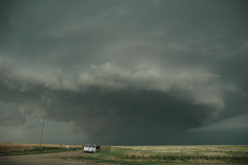
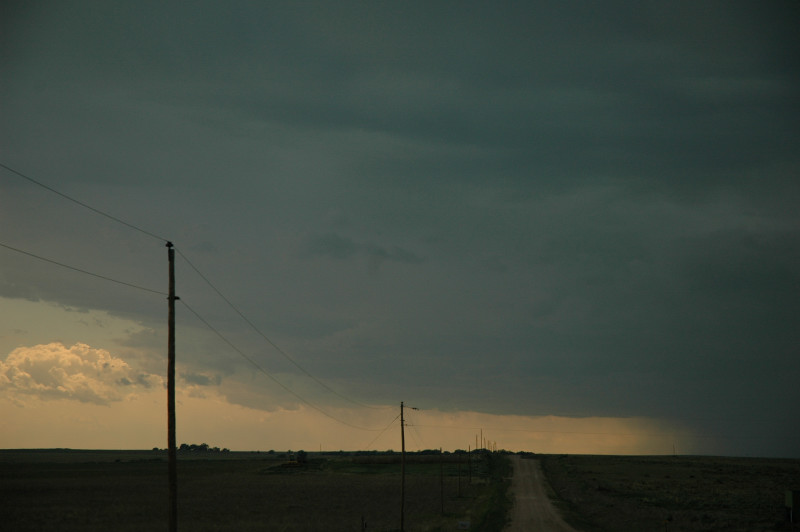
A dirt road east of Keyes.
HP structure and an inflow band on the horizon.
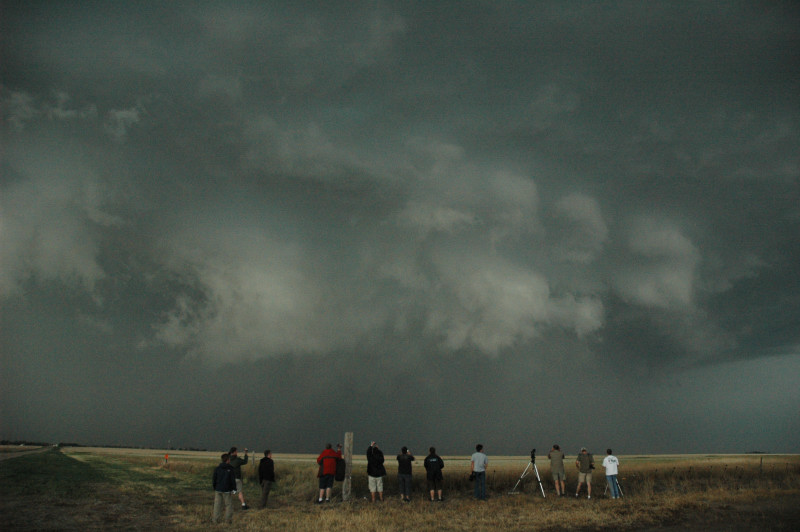
Storm looks quite impressive now.
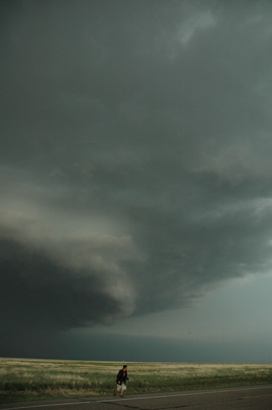
Structure improves, and dirt inflow is faintly visible in lower center of picture.
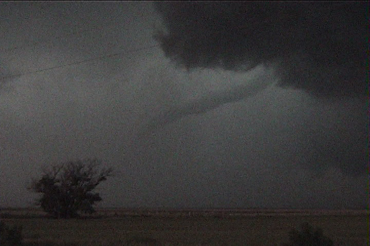
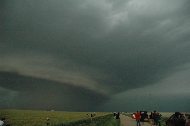
Tornado northwest of Guymon, OK. Ground contact is obscured by rain.
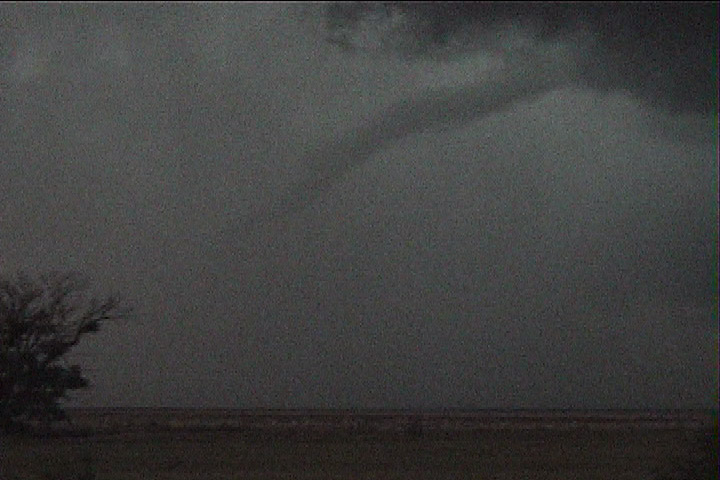
Roping out.