July 19, 2023 Supercells
Itasca and St. Louis Counties, Minnesota
I chased a couple supercellular storms in Itasca County today. The forecast was showing some decent shear and CAPE in northern Minnesota, and the convection-allowing models were showing potential for a big supercell or two moving through Itasca County in the early evening. It doesn't get any better than this for a local chase! I was doing an early morning forecast shift, so I was free to chase relatively early in the afternoon.
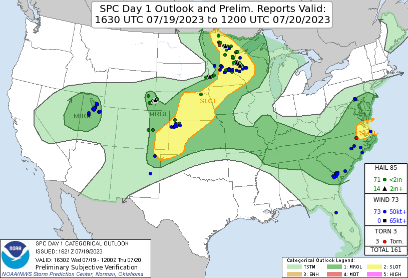 |
| Day 1 outlook and verification from SPC. |
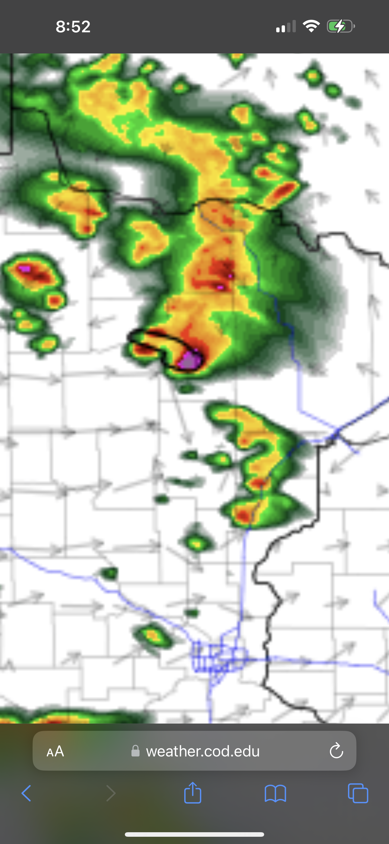 |
| Forecast from convection-allowing models. |
The surface map showed a humid airmass in northeastern Minnesota with south-southeast winds. There was a warm front along U.S. Highway 2 from Duluth to just north of Bemidji. To the southwest of this front, temperatures were mostly in the 80s with dewpoints in the 50s and low 60s-- a bit warmer and slightly drier. Winds were westerly or southwesterly to the south of the front. Some cells had developed in Beltrami County between Bemidji and the Canadian border. They would soon enter Itasca County, so I had better get on the road.
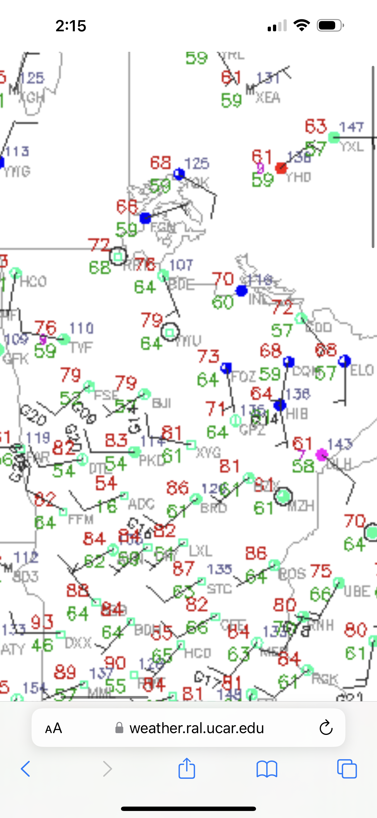 |
| Surface map as I began my chase. |
I took the northwestern route from home and hopped on U.S. 2 and took it westbound. I drove to Deer River and continued north on Highway 6. The first storm would be approaching 6 from the west, so I wanted to be up close and personal. On my way there, the storm had apparently produced a brief tornado near Tenstrike, MN.
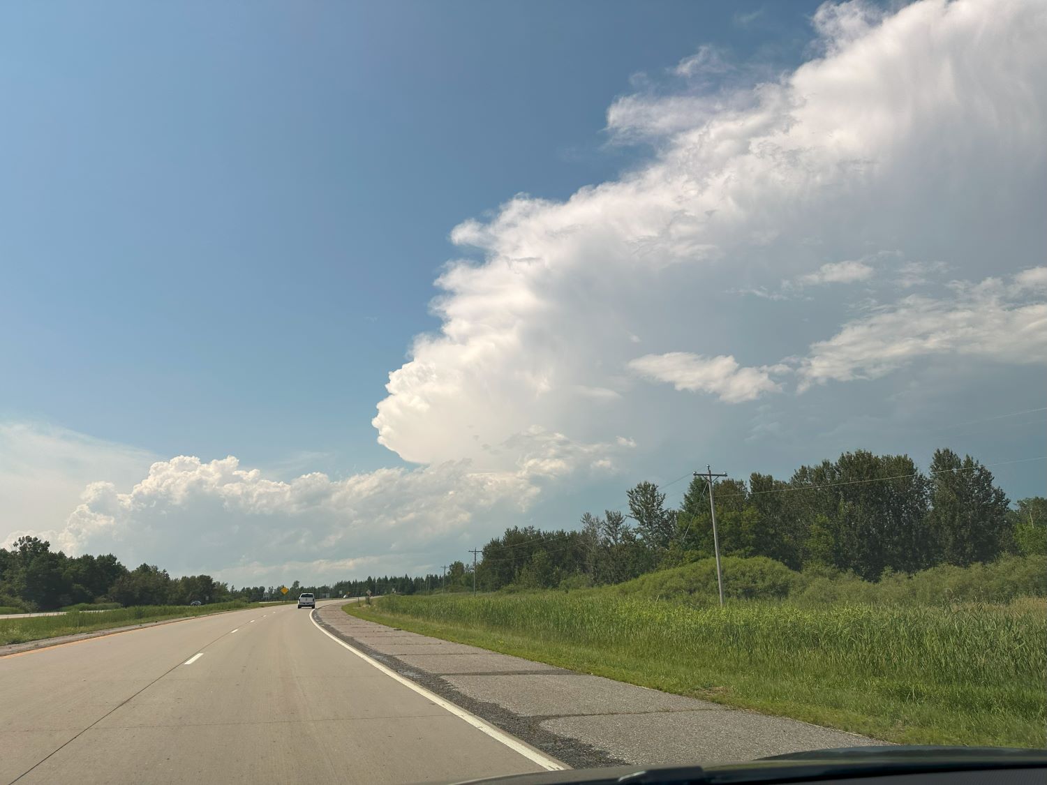 |
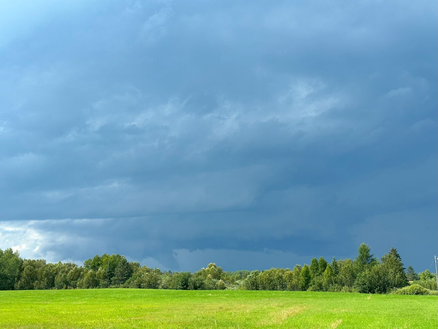
| Initial view of my first storm from the southeast. |
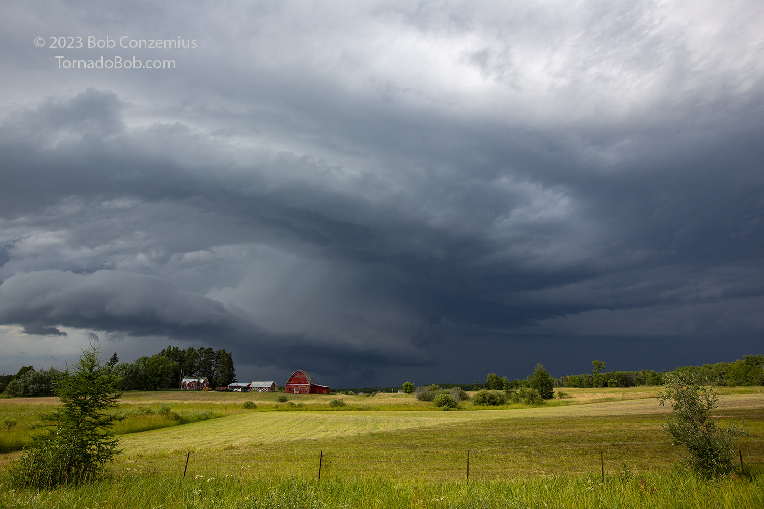
There aren't a lot of good viewing areas where this storm would pass, so I looked to find any views that I could. Initially, there were a couple south of the Bowstring area, but these were too far from a storm, so I would need to venture farther north into an area with only bogs for good viewing areas. I pulled over onto the shoulder. This storm was a supercell! It featured the typical low-level structure. It had an inflow band to the east, a nice, low wall cloud, and a collar cloud above that. My major challenge at the moment was that the storm was a little too close for me to make the next eastbound option to my north. I was hoping to take MN286 east from Talmoon to Marcell, but the storm core was sitting right over that road! I would have to go well south, almost back to Deer River, and take County Road 19 east. There I could become reaquainted with the storm.
 |
| The last good viewing area near Bowstring. |
 |
| The first good look under the base near Bowstring. |
It's a good thing I avoided that north route! It turns out it was getting baseball-sized hail.
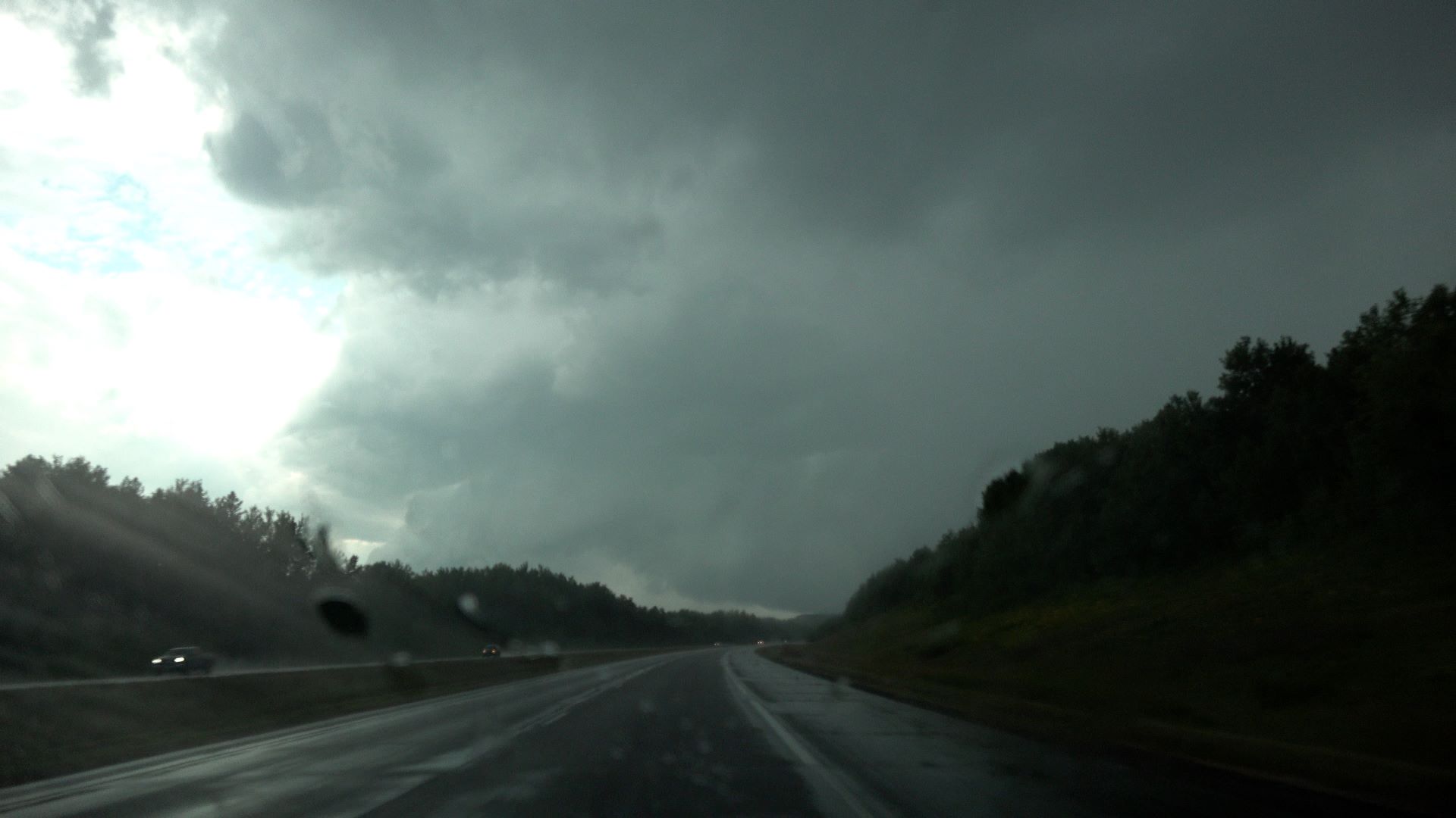
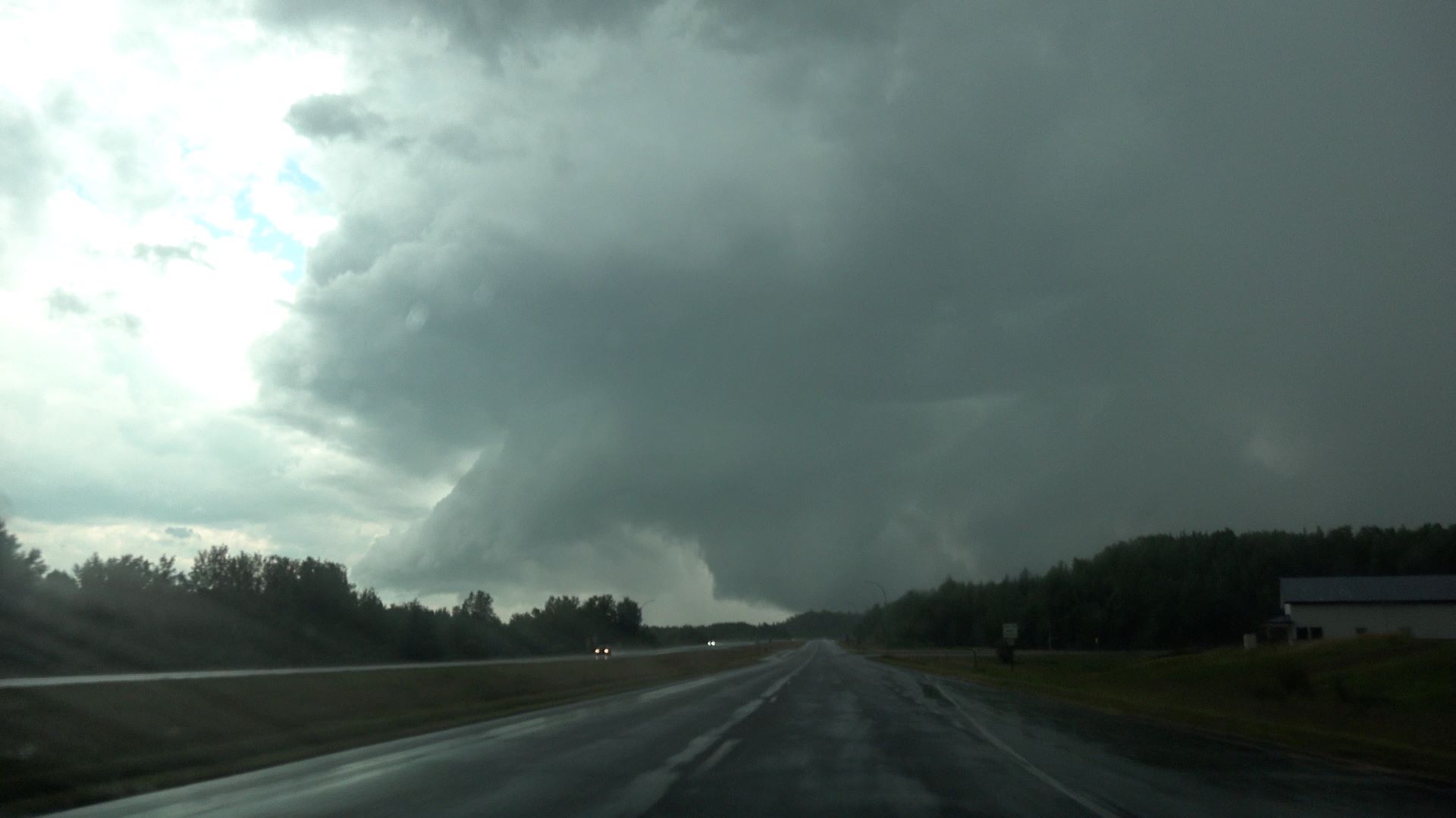
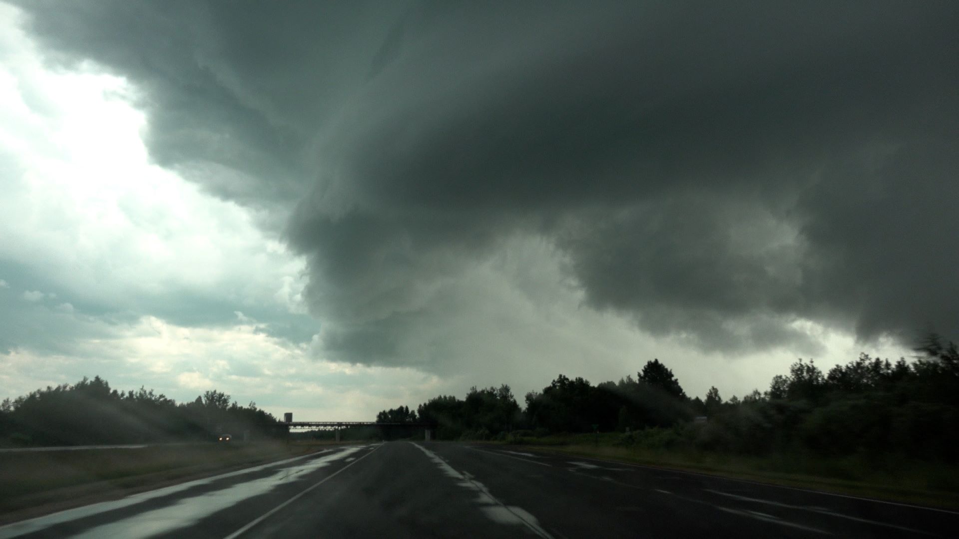
I went south on Highway 6 then turned east on 19. I went past Deer and Moose Lakes and stopped for a bit to see what I could see, but the visibility wasn't that great. I needed to go farther east. I got past Highway 38 and continued east on County Road 60. I seemed to be coming up on the cell again, so I went to Wabana Beach to see what I could see from there. It still wasn't a great view, so onward it was! I kept stair-stepping east and a little north, taking County Road 59 (Wabana Road) then County Road 58, which ran into County Road 8 north of Nashwauk. There, I was able to get a good view again. It still looked pretty good, but I recall the warnings had gone away.
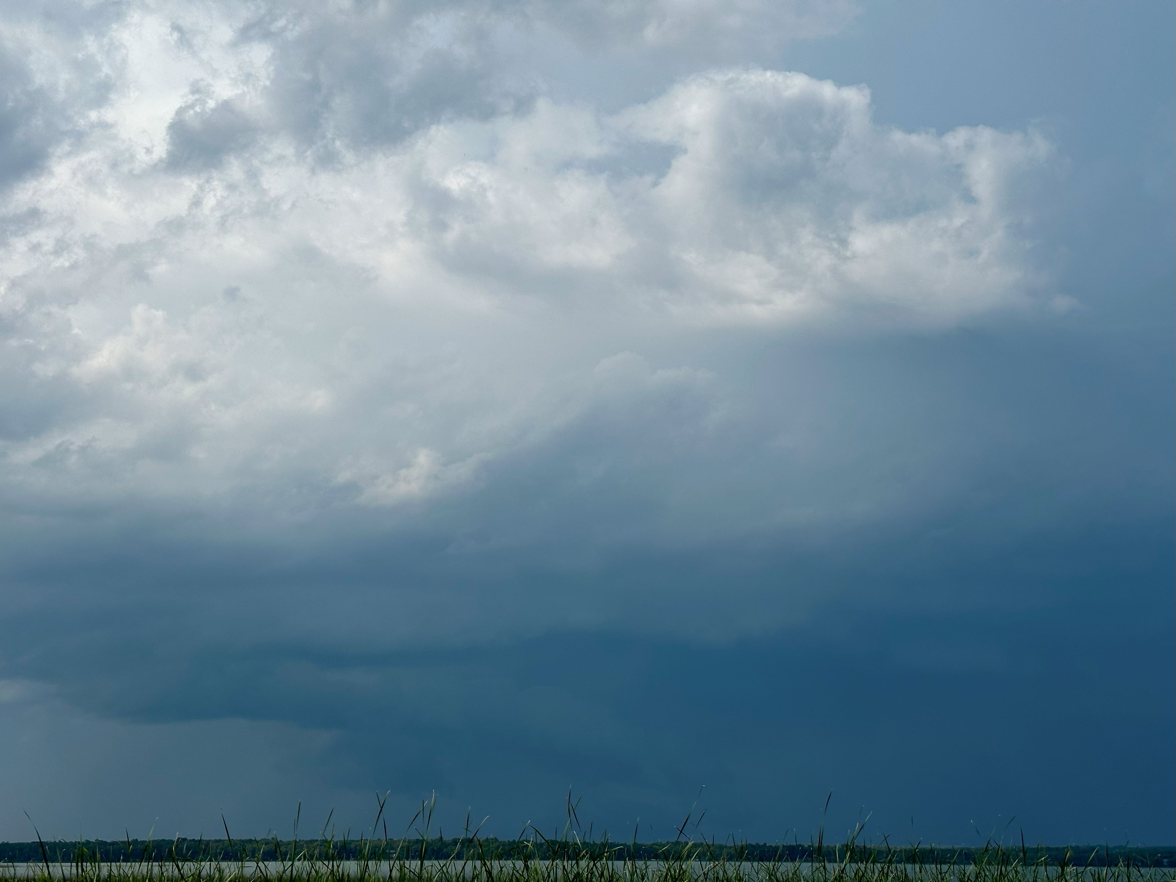 |
| Storm viewed from Moose Lake landing. |
 |
| View from Wabana Beach. |
 |
| Here's how it looked near/north of Nashwauk. |
Right after I took the picture above, the structure went rapidly downhill. Nevertheless, I stuck with it because there was nothing much anywhere else, except for a few small cells closer to home.
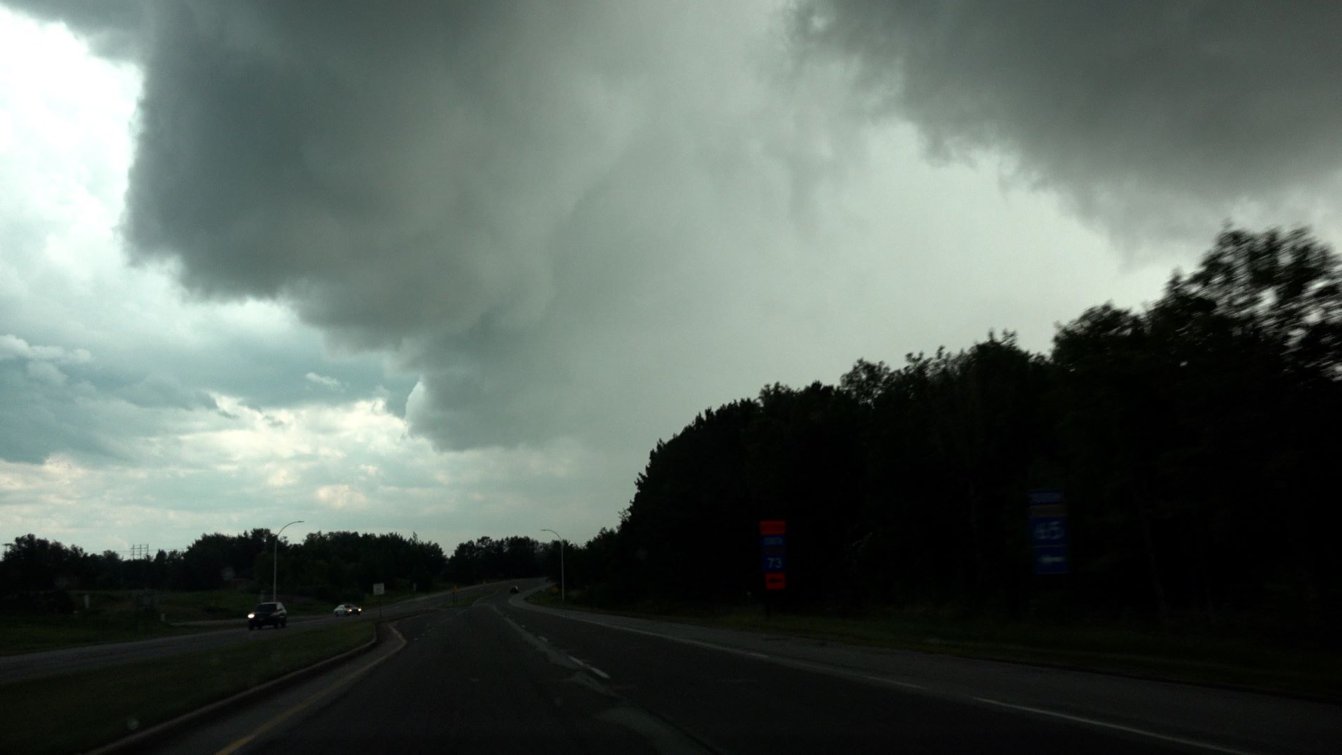
I got to somewhere in the vicinity of Cherry before I noticed the cells to the west picking up a bit in intensity, so it was time to head back towards home. Over the next ten minutes or so, things rapidly changed, and as I looked ahead to the western horizon, I saw a supercell emerge. When I got to the Hibbing Airport, I was able to snap a quick picture of what I saw. I got a few good looks at the storm as I came through Hibbing, and I took another brief video clip on the east side of Hibbing.
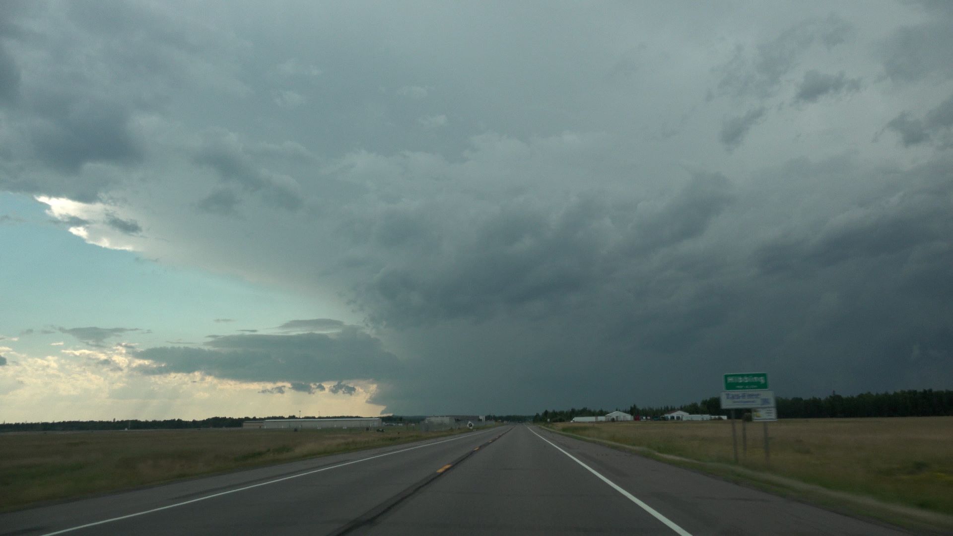 |
| New storm viewed from Hibbing Airport. I like the robust looking updraft and the large anvil. |
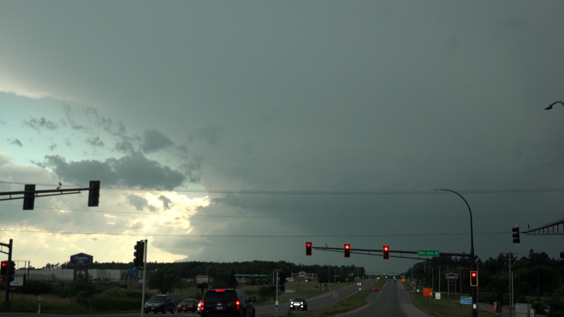 |
| View on the east side of Hibbing. It's looking pretty good! |
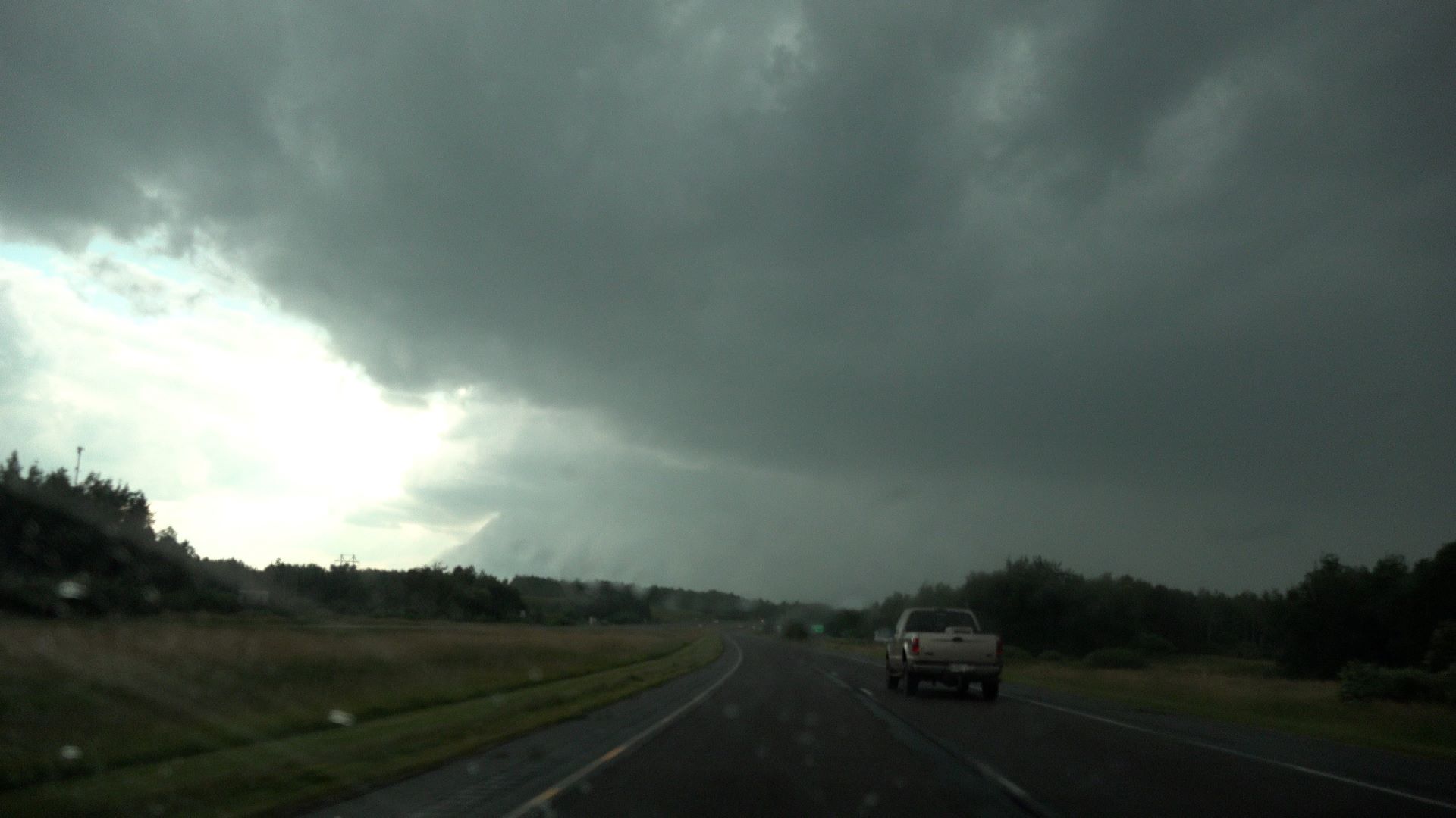
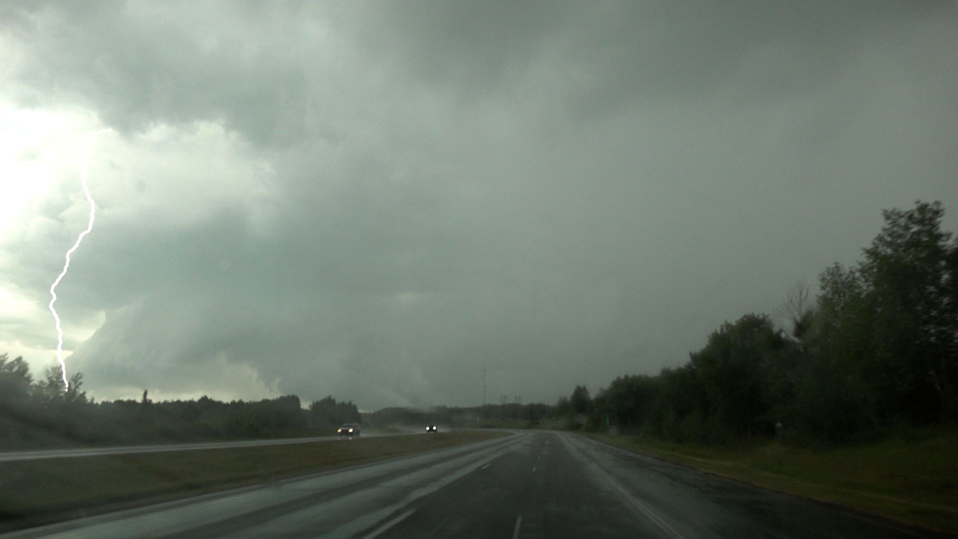
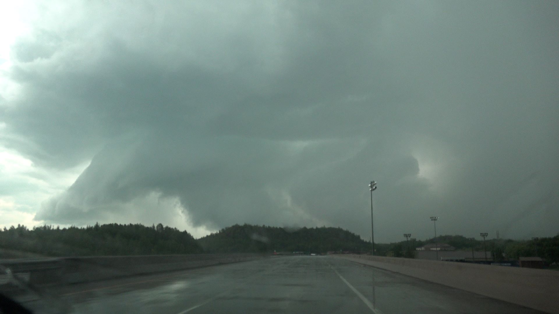
Looking at the road options and radar, I knew this was going to be a tight squeeze. The storm would be coming across U.S. 169 fairly soon, and I needed to find a south option in front of it. MN 73 south from Hibbing was too soon (it was right in front of me in the picture above-- I was still too far away). The next option was MN Highway 65 at Pengilly. I set that as my goal. I hoped I could make it there before any hail arrived, but I was ready to turn around and run back northeast.
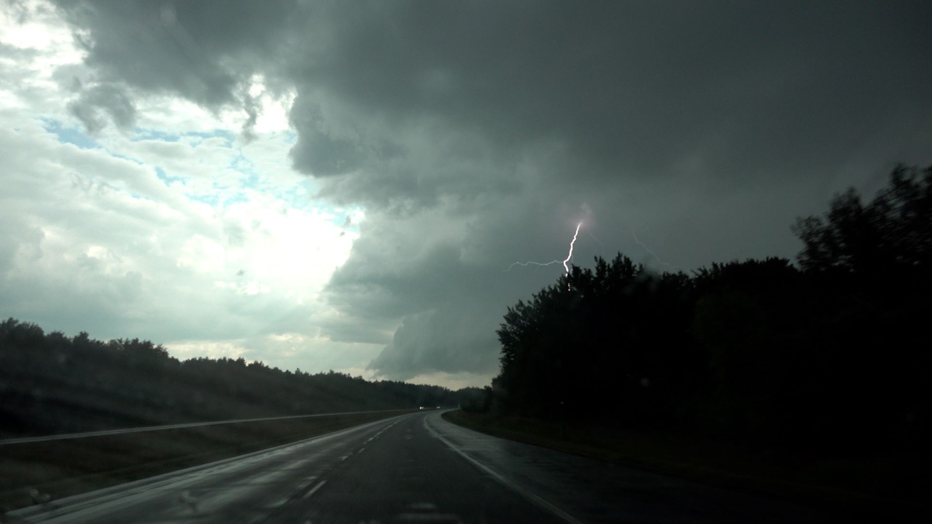
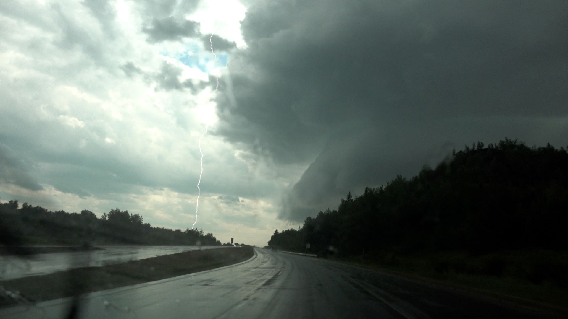
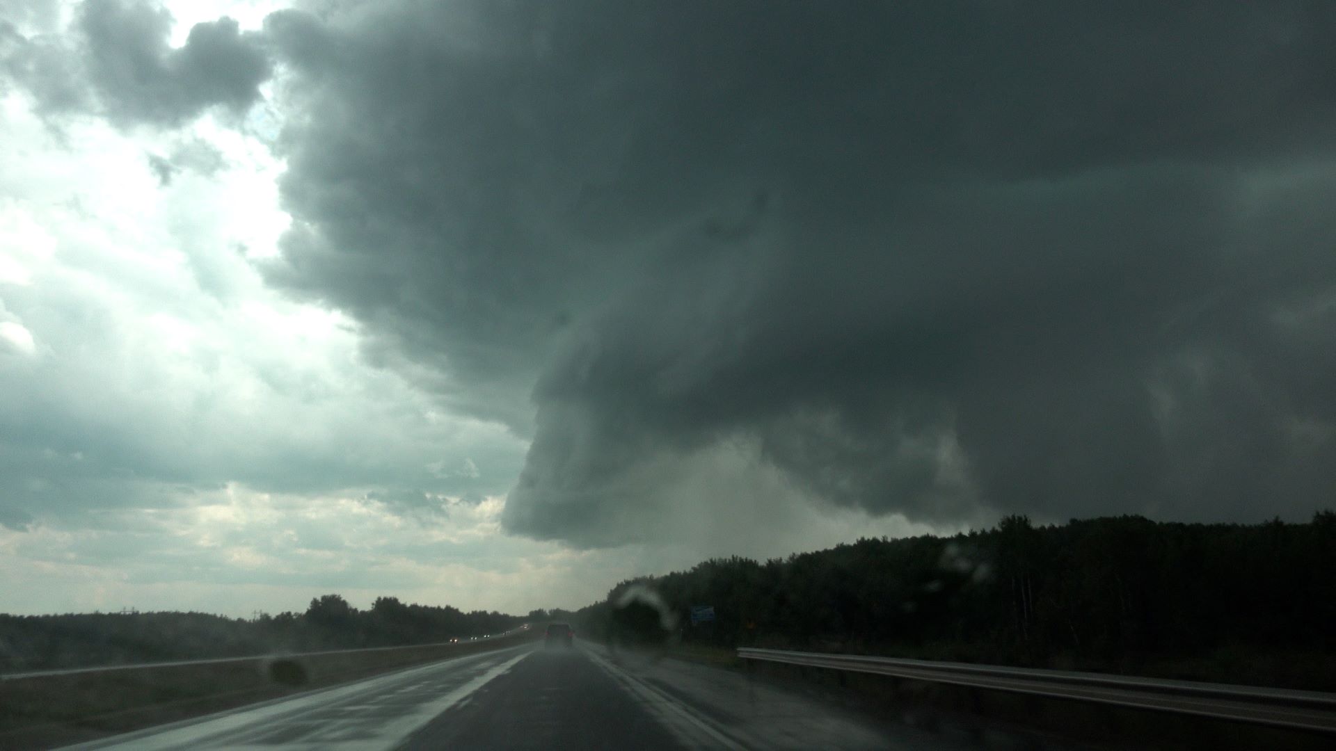
As I proceeded to my goal, the storm began throwing out a barrage of fairly frequent cloud-to-ground lightning strikes ahead of me. Via various clearings along the highway, I was able to piece together a good picture of the storm structure.
 |
| Between Hibbing and Keewatin, a low collar cloud can be seen tilting outward from the rain. Maybe it's outflow-dominant. |
 |
| A cloud-to-ground strike. |
 |
| More of the low-level structure emerges as I drive closer. |
 |
| Another big CG strike! Also, lots of low cloudiness in the action area, surrounded by RFD. A nice shelf cloud at the leading edge of the RFD on the left. |
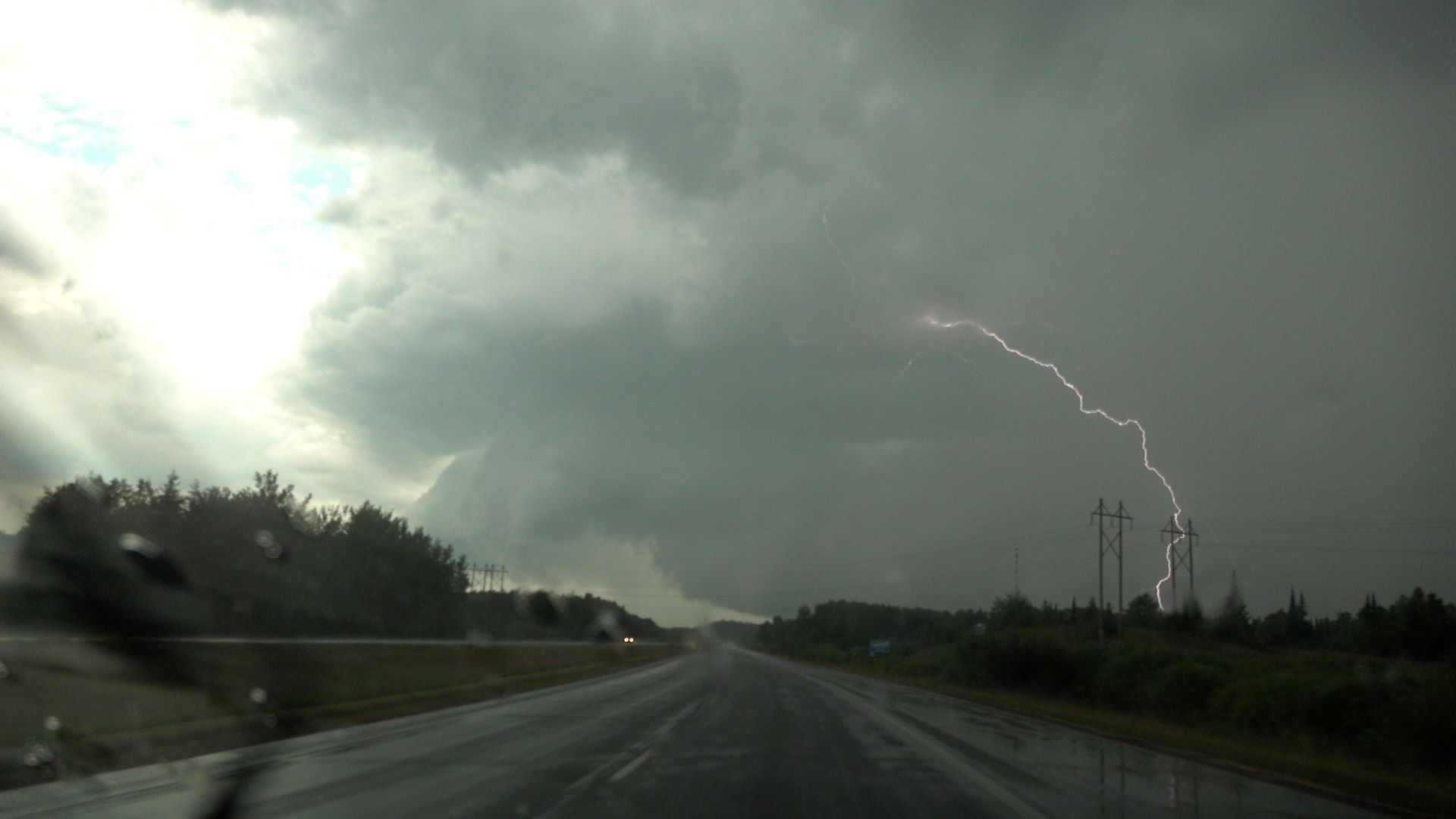 |
| Yet another CG! Just above and to the right of the road is the low cloudiness in the potentially rotating action area (left side of wall cloud). |
 |
| More of the wall cloud structure is visible now. |
 |
| A distinct inflow band is not present-- obscured by rain, but the wall cloud is surrounded by RFD. |
 |
| This, coming over the treetops, and another strong CG, look ominous. |
 |
| The detail of the low-level structure is now more visible. |
 |
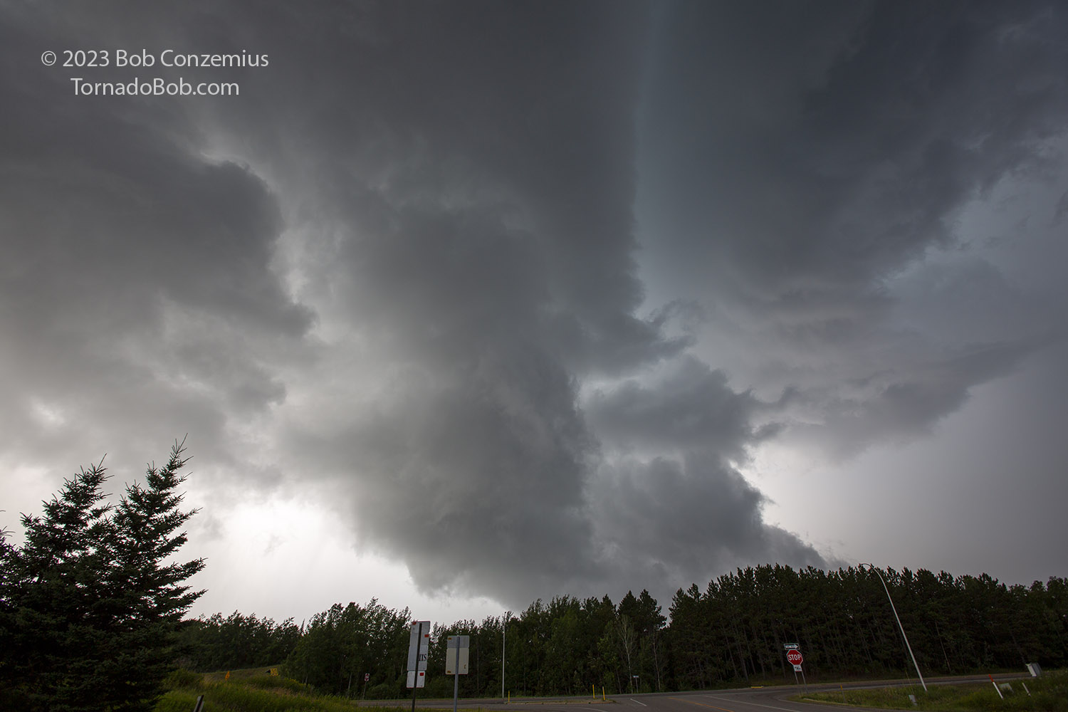
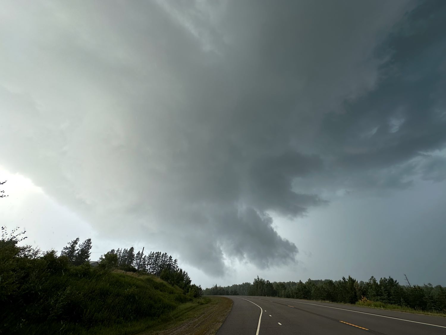
| At this point, it was clear that the wall cloud segment within the RFD (just to the right of the road) was rotating. |
 |
| I've finally arrived at my south road. Not a moment too soon! The rotating area is in the upper right corner. |
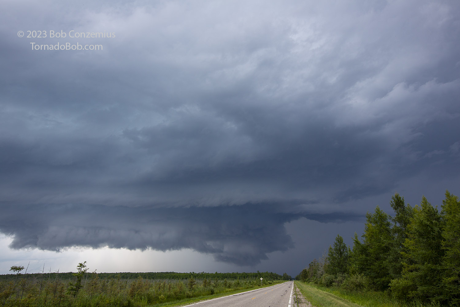
I made my turn, and quickly pulled over to snap a picture while I could see. I got a still image of the wall cloud with my DSLR, then I raced ahead another half mile or so. I hopped out again and snapped a wall cloud picture with my cell phone, and then drove south again as the wet RFD overtook me. There was driving rain and wind along with a few pea size hailstones. I drove south as fast as I reasonably could through the town of Pengilly.
 |
| A wall cloud with rotation right above my head as I turned toward Pengilly. |
 |
| A wall cloud shot with my cell phone. |
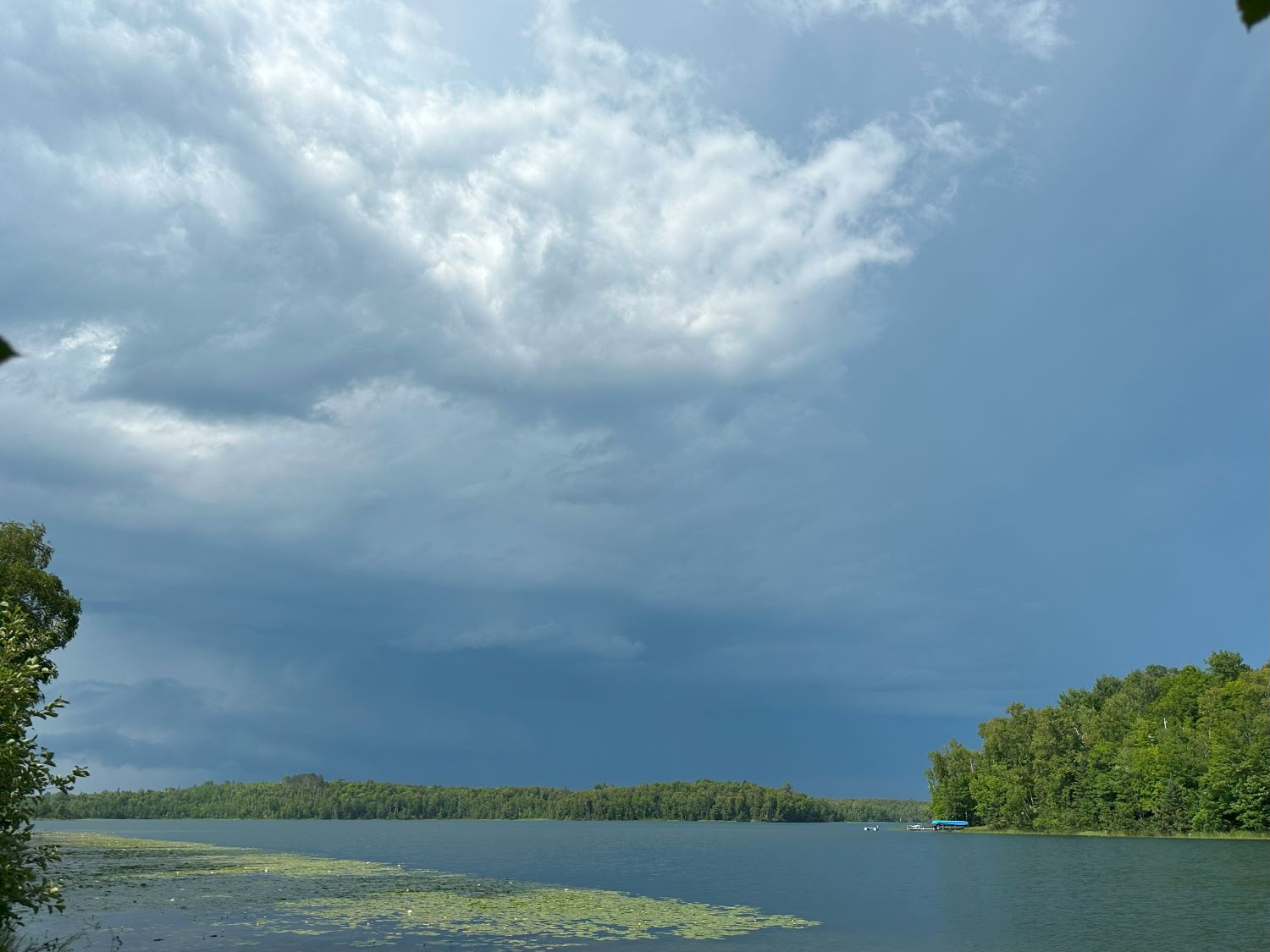
I looked for my next viewing spot to the east as the storm was crossing the road above me. I found the Swan River bridge on the southwest side of Swan Lake. I hopped out with my video camera just as the tornado warning was being issued. I pointed the camera northeast toward the broad rotation. The sun had come out, and there was a nice, bright rainbow!
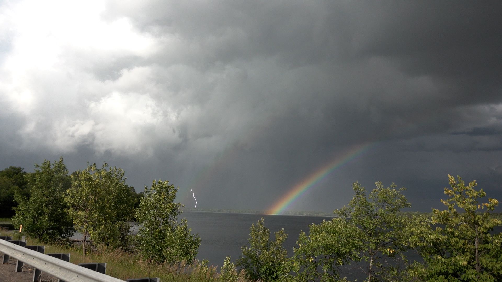 |
| Storm moving away to the east, viewed over Swan Lake in Pengilly. |
The past few minutes had been full of excitement, and I couldn't believe the chase had ended up being this close to resulting in a tornado intercept! As it was, the closest it got was the rotating wall cloud phase. As soon as the tornado warning was issued, the circulation rapidly weakened. A couple radar loops (below) show that rapid evolution. The storm was now crossing through a fairly large swath of forest, and there was no way to follow it now. I met up with a friend and local spotter who was also on the storm, and we chatted for a bit while enjoying the nice view to the east. At this point, the chase was mostly over. I drove a bit north and south through town again to see what damage there might have been and to see if any of it could have been caused by the circulation. It looks like it was probably all RFD-related damage. There was no tornado.
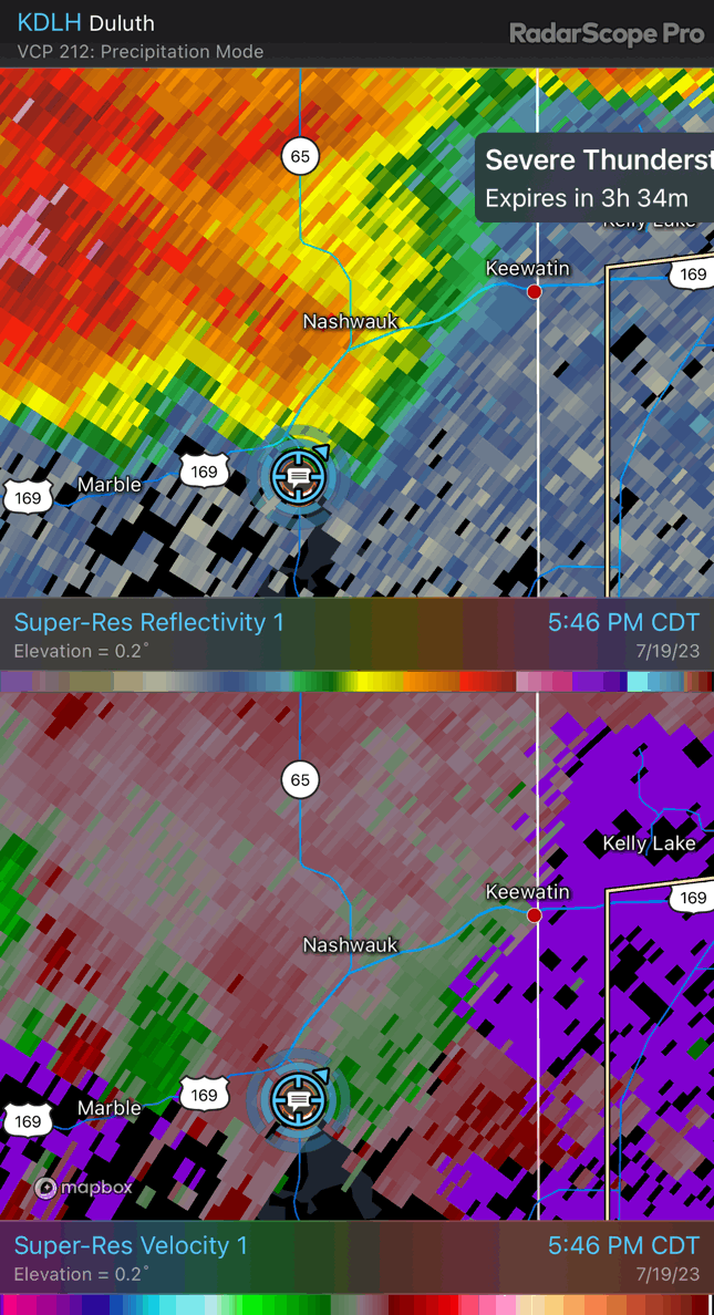 |
| A radar loop captured with the Radarscope app. |
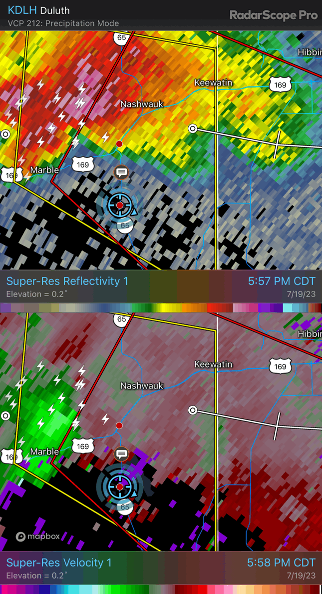 |
| A radar loop captured with the Radarscope app. |
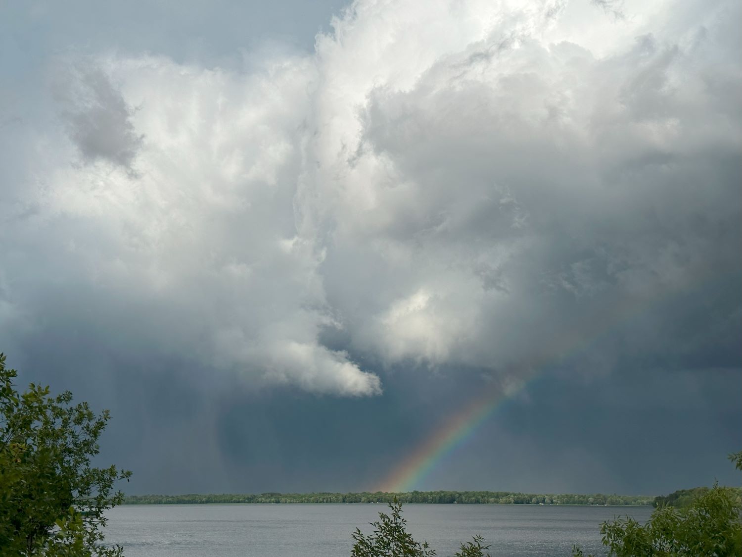 |
| Rainbow over Swan Lake in Pengilly. You can see RFD punch into back of storm. |
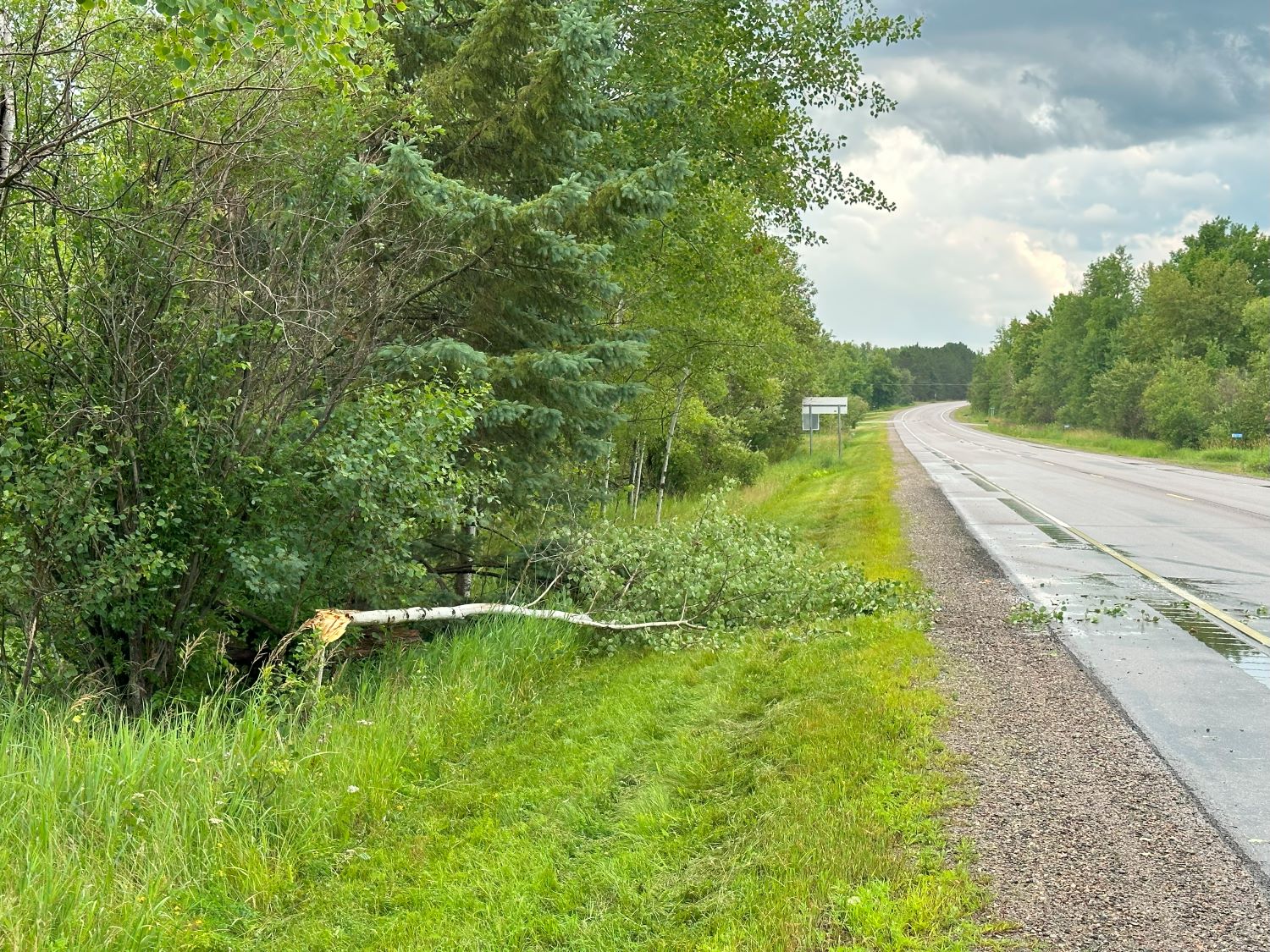 |
| Some small tree damage in the Pengilly area. |
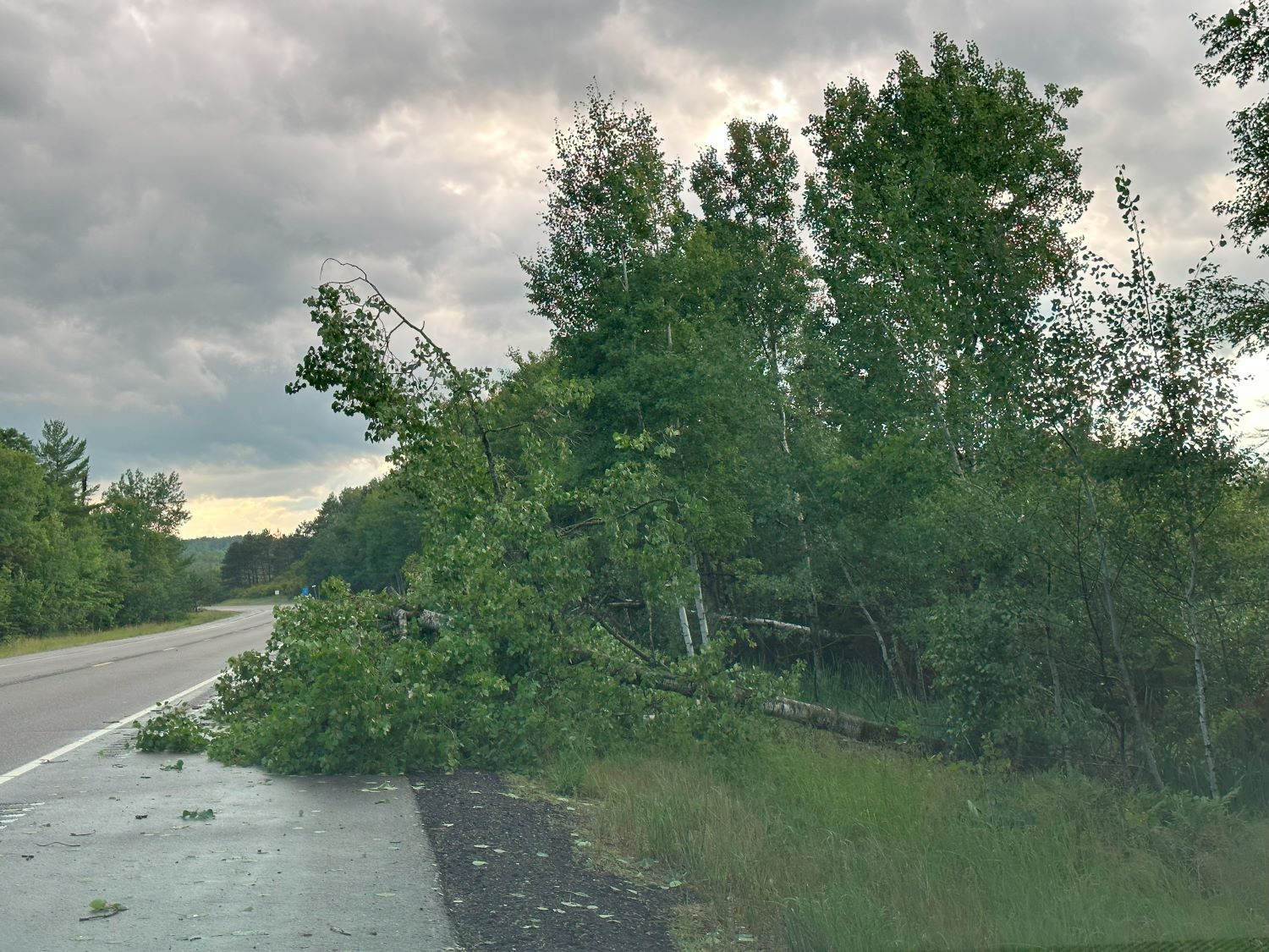 |
| Trees down on U.S. 169. |
From here, I simply drove home. When the opportunity presented itself at sunset, I snapped a few pictures of a storm that was passing by Grand Rapids to the south. That was it. Not bad of a 121 mile chase from home!
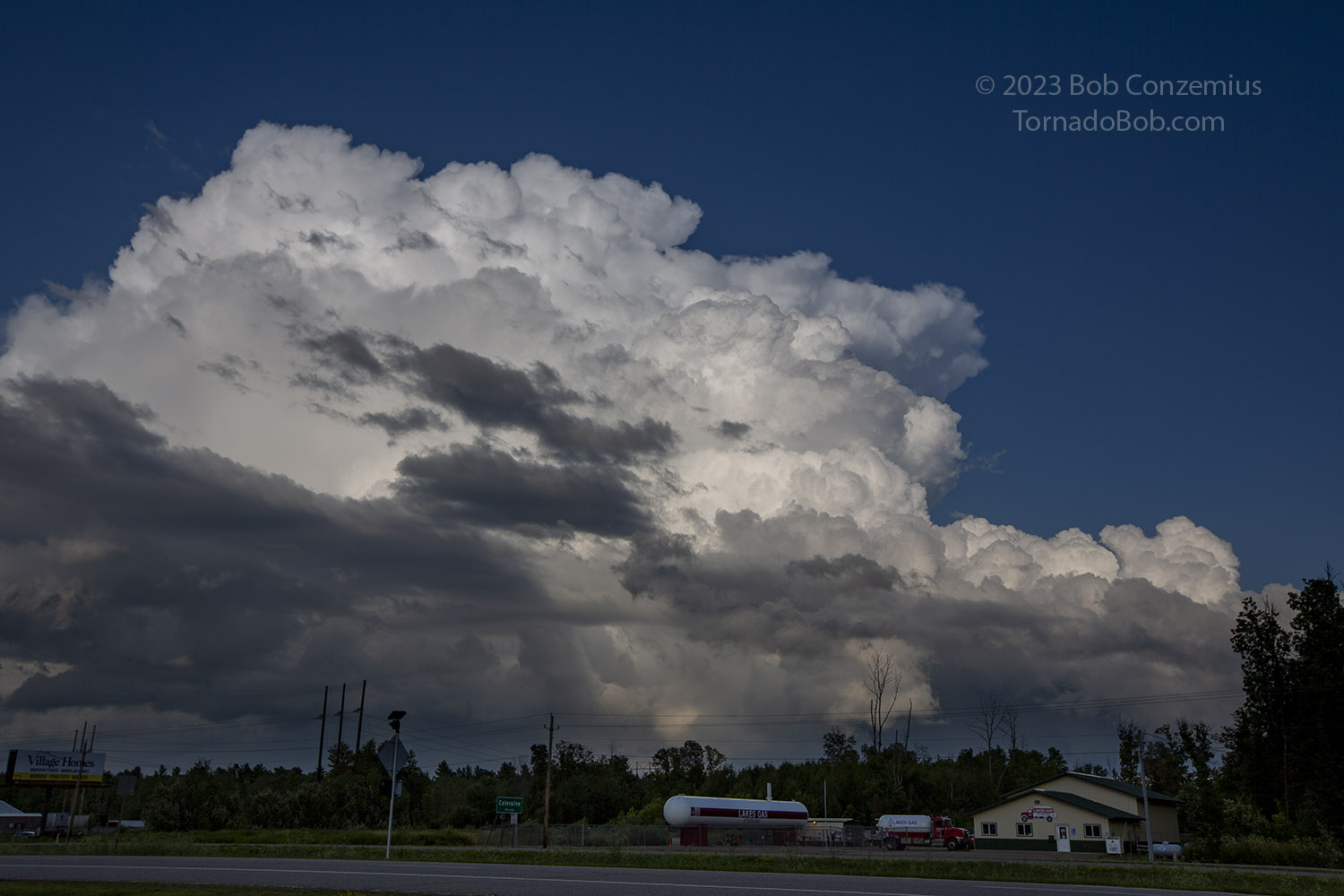 |
| Looking southeast from Grand Rapids at a storm at sunset. |
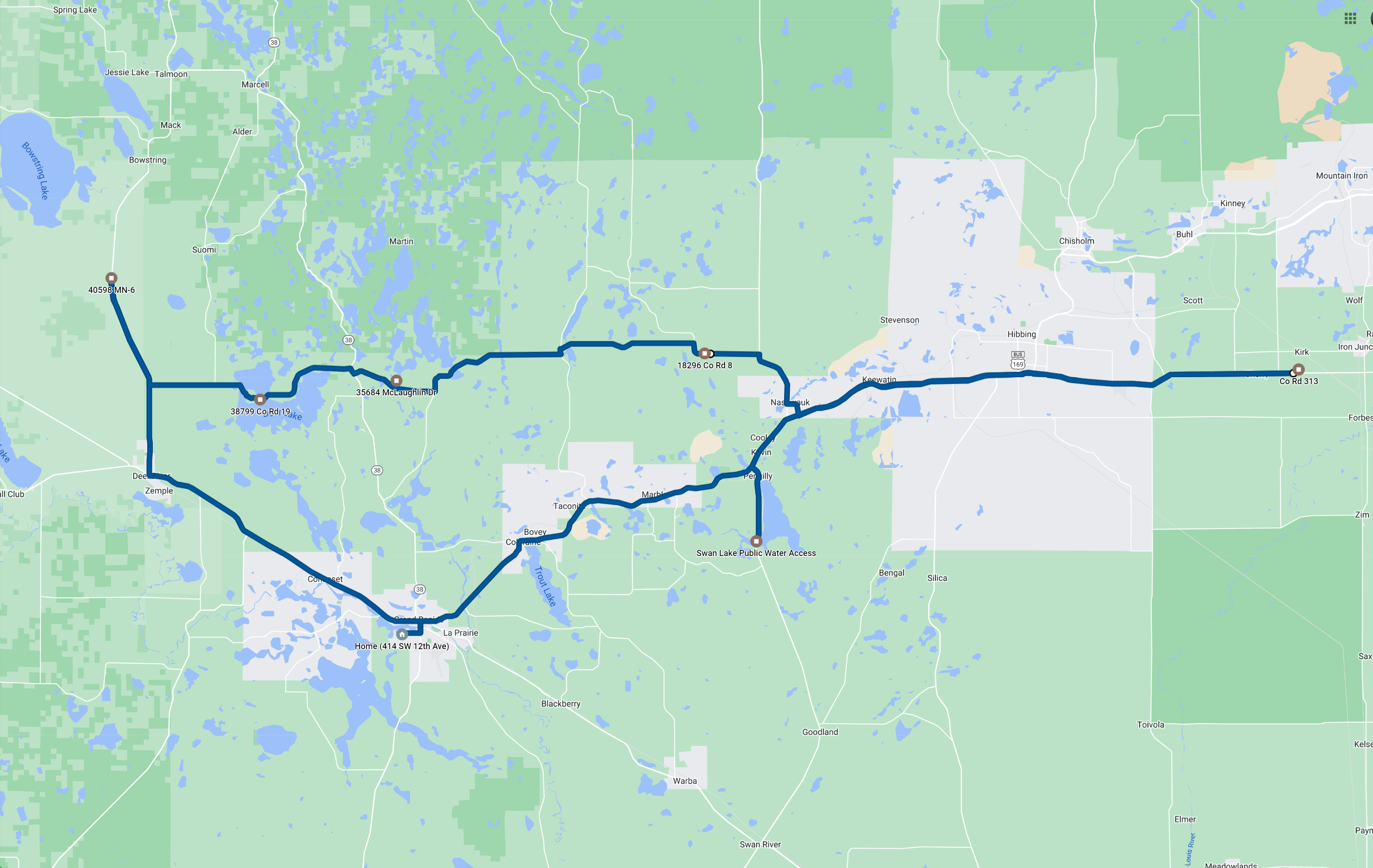 |
| Route for the day. 121 miles. |
Back to Storm Chases | Home