July 3, 2023 Supercells
Eastern Wyoming
 |
|---|
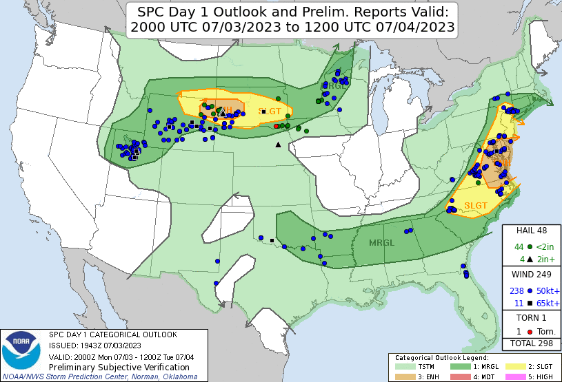
| Day 1 outlook with severe reports for the day. |
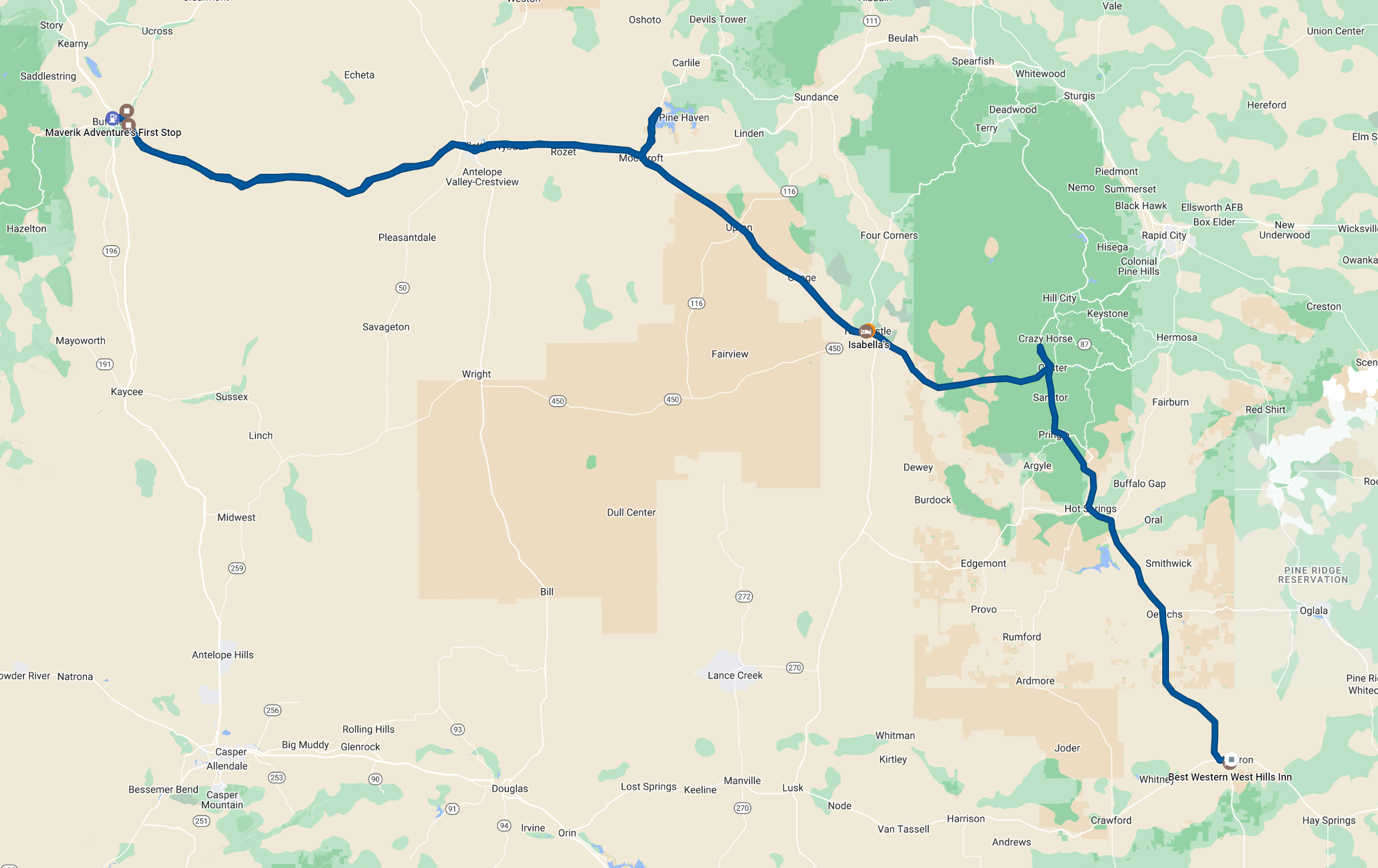
The Day 1 outlook showed an enhanced risk of severe storms in an area from northeastern Wyoming into the Black Hills of South Dakota. Given some nice storms I had seen in northeastern Nebraska on prior years' chases, I thought that area might make a decent target. Additionally, it is difficult to chase in the Black Hills, where mountains and trees obstruct visibility, and traffic can be bad around July 4 with a lot of tourists in the area. Nonetheless, we decided to cut through the Black Hills on our way to the target area because our fastest route went that way. We stopped at the entrance of Crazy Horse Monument but did not go in, thinking that would tie up too much time. We also decided not to attempt to eat lunch in Custer because most places looked really busy and crowded. Thus, we continued to Newcastle, WY, where it was much less crowded, and we found a nice restaurant (Isabella's) to enjoy a sit-down lunch.
We continued westward from Newcastle, and it quickly became apparent we would have to drive all the way to the mountains (to I-25) to see the first storms. Clouds over much of our route looked rather flat and stratiform. It was pretty obvious that surface-based storms would not start here, although there would hopefully be surface-based storms later on. After some waiting at a gas station/convenience store in Buffalo, storms began to move off the mountains. We drove a few miles northeast to the most interesting storm and looked at it a few minutes. The road network did not provide us any opportunity to stay with this storm for very long, and we soon drove back to the interstate to get a chance to go east with the developing storms.
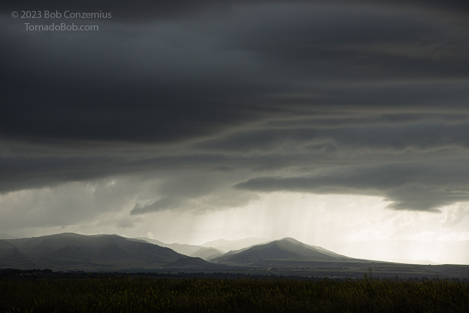 |
|---|
| First storms of the day, coming off the Bighorn mountains. |
It turned out that we needed to go east fairly quickly, so taking the interstate was good. Storms were propagating eastward pretty fast (gravity wave?) as they came off the mountains. The storms were initially multicellular, and new cells would develop east of the maturing cells, developing in the upward vertical motion phase of a gravity wave-type feature moving eastward faster than the wind was carrying the storms. It looked like we would not have much to see if this mode of convection continued. Meanwhile, one supercellular storm had developed over the Black Hills, and I was hoping (for my forecast) that it would not move off the hills. It seemed to be struggling, and it wasn't moving that fast. I was not that happy with the outcome so far, but here we were, so we drove full speed on I-90 to keep up.
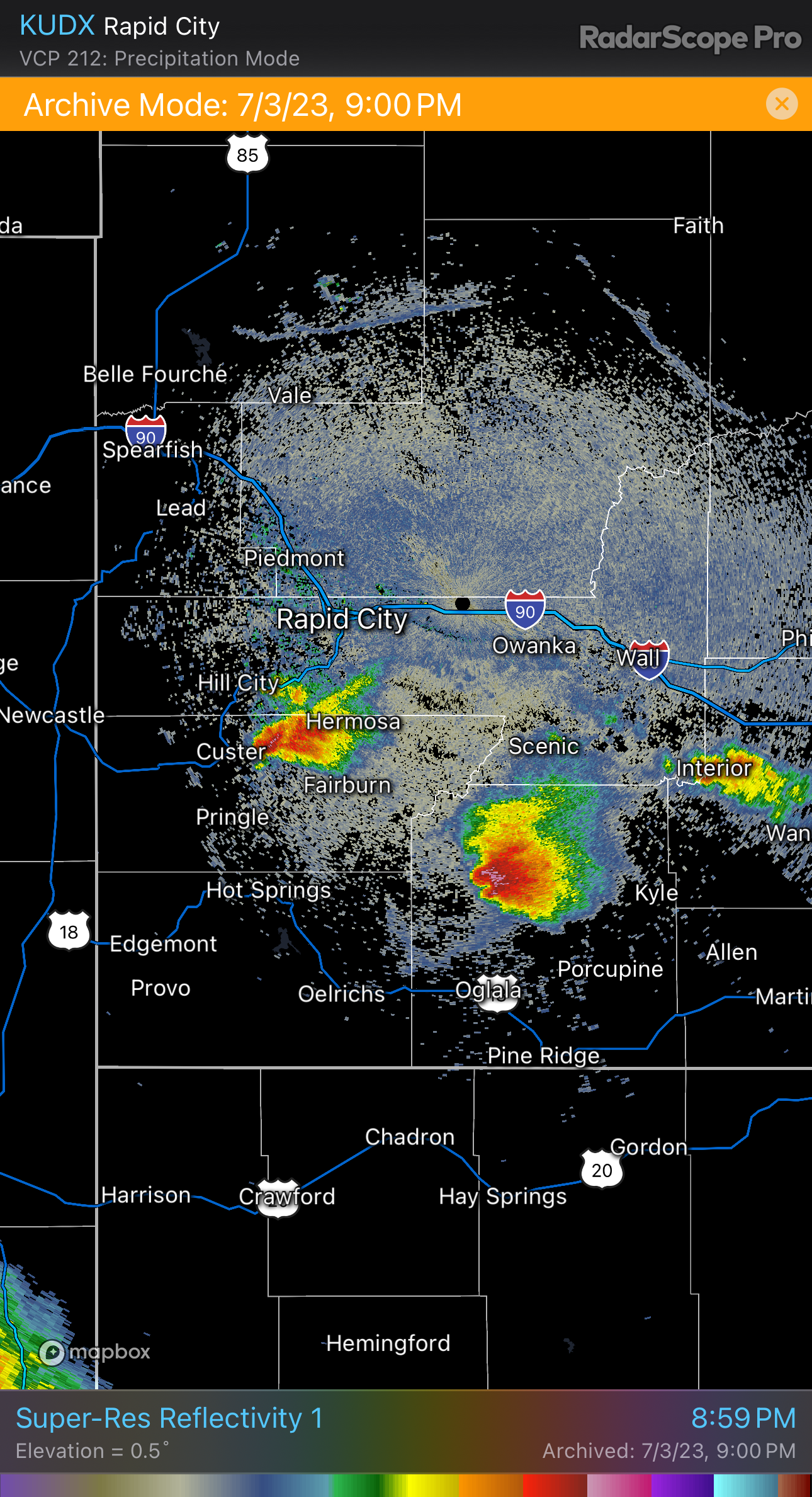 |
|---|
| Radar image of the Black Hills storms. They were looking nice. |
Luckily, whatever feature was coming through the area outran the storms or dissipated. Storms started to become a bit more discrete. The winds were a bit cool from the east. The sky around us was mostly cloudy, but the bases of storms were becoming lower and darker.
 |
|---|
| A new storm with a darker base. |
We continued east as the storms evolved into more of a supercellular state with discrete cells and nice hail cores, but our skies were mostly a dull gray, and we couldn't really see these storms. We needed to get on one of them to salvage anything decent from the day. A storm to our north intensified, and I decided to target that storm. It would make a better target than anything to our south because if things became interesting, and the storm turned hard right, the northern storm would be getting closer to us, and the the southern storm would be moving away from us.
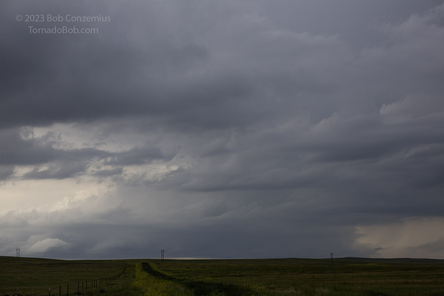
We exited at Moorcroft and drove north until we could see anything resembling storm structure to our west. After we chose a spot with a safe pullout and a good view to the west, supposedly in our storm's path, we were able to see an updraft and base emerge on the horizon. We remained at that spot for at least 30 minutes as the storm moved toward us.
 |
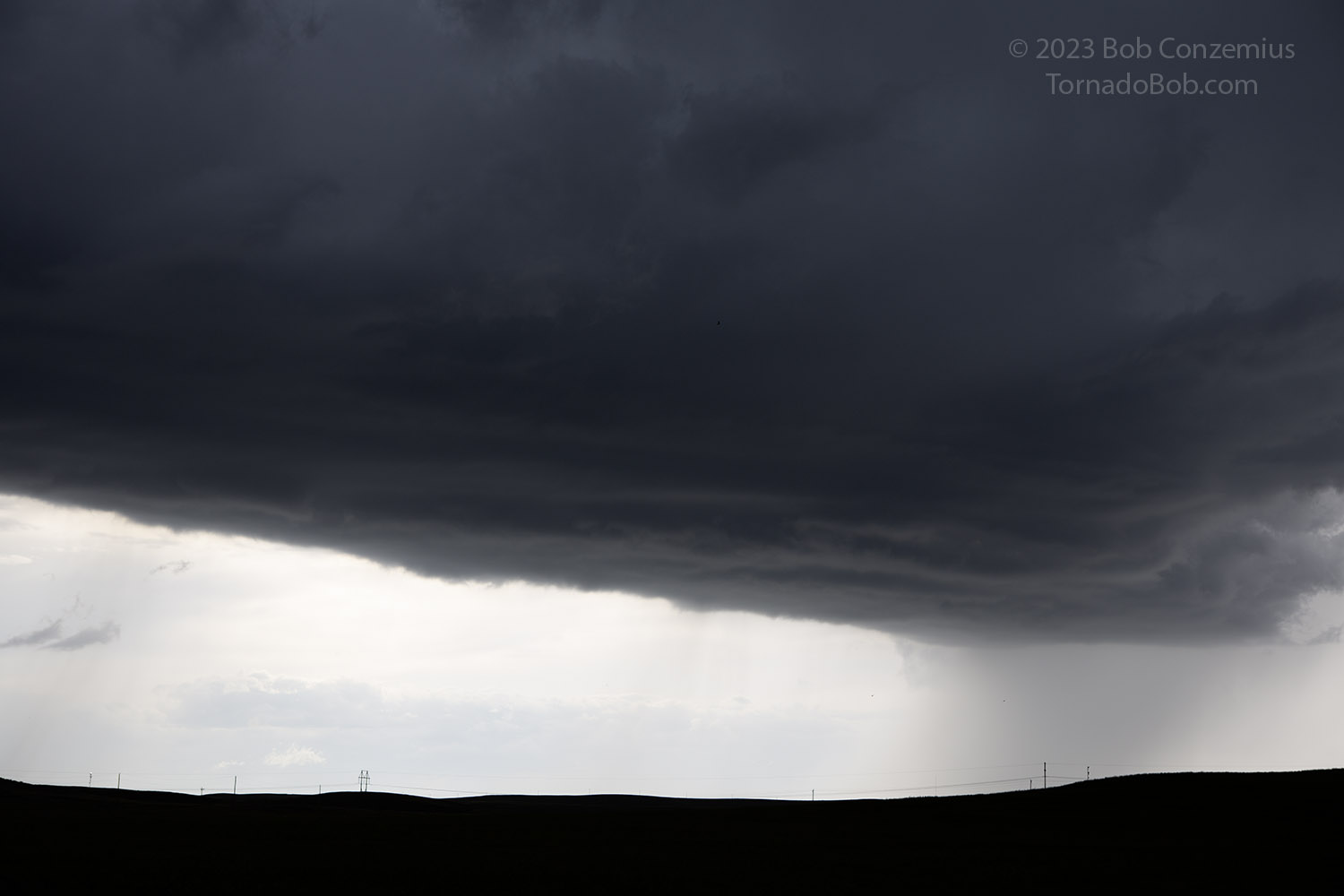
|---|
| Our target storm emerges on the western horizon north of Moorcroft. |
 |
|---|
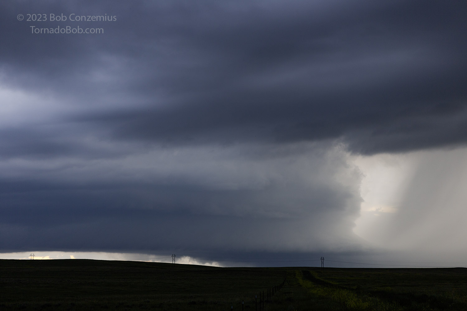
| As the storm gets closer, more structure becomes visible. |
 |
|---|
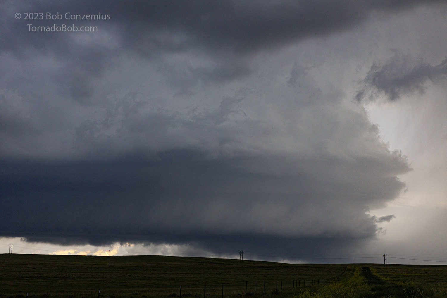
| This is the best look we got. |
After the storm came past us, it appeared to become a bit less organized. We stayed with it as long as we could see it, but we lost it in rain from additional storms. We drove back to Newcastle for the evening. It turns out the Black Hills storm did move out of the Black Hills. There were no other storms or clouds around it, so it would have been a nice storm to see. Nonetheless, I felt happy to be on a supercell of our own.
 |
|---|
| Route we took. About 424 miles. |
Back to Storm Chases | Home