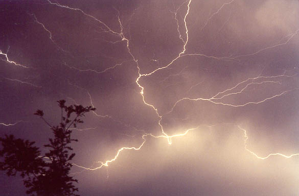
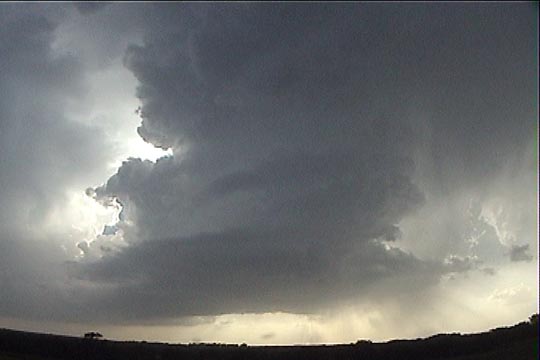
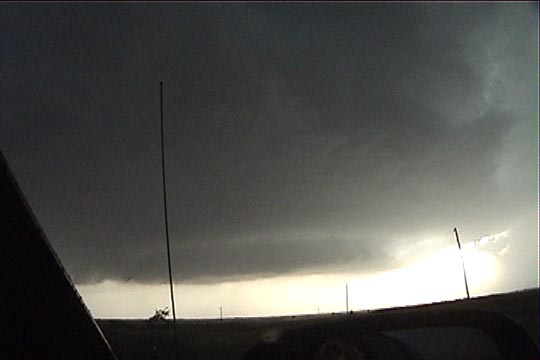
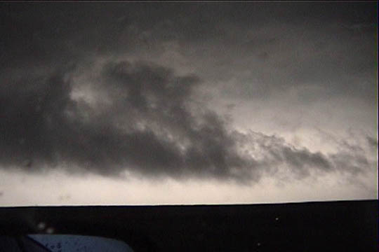
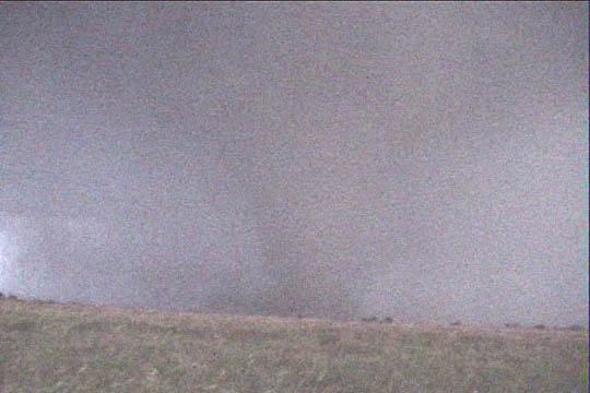
Anvil Crawlers (~3:00 AM) in Norman
This event became interesting a day or two before upon looking at model data from eta. The night before, I pulled some model soundings for Hastings, NE and Salina, KS. Both these soundings really looked great, but the Hastings sounding looked absolutely fabulous, with 3000+ J/kg CAPE, good turning of winds with height (and increasing speeds), and an LFC below 800 millibars. A weak warm front was progged to be in the KS/NE border area, which was a pretty long drive for a one-day chase, so RJ Evans and I decided to get up early and head out shortly after 8:00.
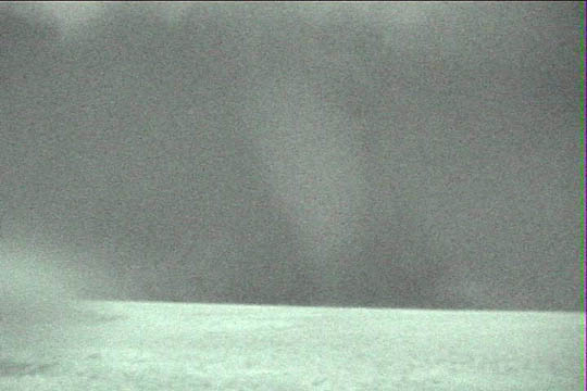
It was a very fitful night of sleep, both because I had the feeling of a big event about to unfold (usually this does not result in a big event), and unexpectedly long-lived thunderstorms were rumbling across central Oklahoma.
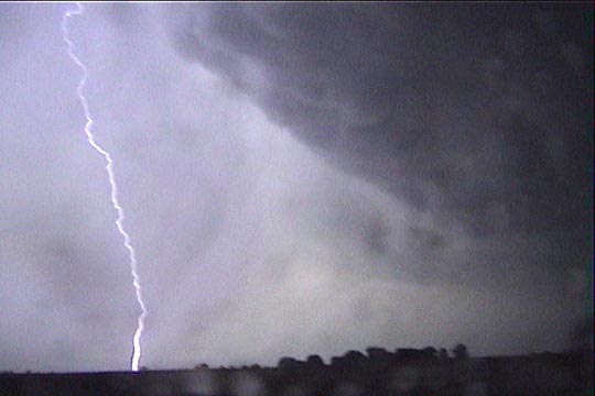
Anvil Crawlers (~3:00 AM) in Norman
We finally left Norman around 9:45 and drove northward into central Kansas by early-mid afternoon. As time went on, the weather pattern seemed to be less favorable for supercells and tornadoes in our target area. The warm front seemed to be washing out or drifting northward, as it was a lot less well-defined in our target area than we thought it would be. With this happening, we stopped in central Kansas, well short of our target, at Coronado Heights Park, just northwest of McPherson, where we could get a really good look at the sky. From there, we could see our moderate cumulus field gradually thin with time. Satellite pictures showed the edge of the Cu field just to our west, so it was not wise to go in that direction. We downloaded surface data every hour to stay on top of the pattern evolving. Unfortunately, it looked like the surface low development in southwestern Kansas and southeastern Colorado was a little slower than we hoped. On the good side, the moist axis was holding on to our east, with low-mid 70's dewpoints hanging on in eastern Kansas. In our boredom, we even downloaded 12z and 18z model data. Both runs of Eta showed convective precipitation breaking out along the Kansas-Nebraska border, but this was to occur after 00z. I was concerned that the show, if any, would be late. RUC showed very little rain in our target area. Rather, it progged just a small amount of rain over our current location, and the overall progs did not indicate supercells or tornadoes. I thought RUC's advertised pattern showed insufficient evolution of both surface and upper air features. It seemed to be too steady-state in its forecast. I was considering going back home, but I put my trust in the Eta precipitation prog for the Kansas-Nebraska border, thinking that with a consistent forecast of convective rain in that area, Eta must be picking up some significant source of lift and showing it correctly through its mass fields, even though I could not see much of anything on surface data or in upper air data. It looked like a late show, but I don't like to give up once I head out (I hate coming up empty-handed) and I had brought an overnight bag along. We were not going to head back. I had to get out of RJ's Durango for a while and walk around the top of the hill a while to burn off the frustration.
Through 21z, the surface maps continued to show much the same thing, with southwest winds throughout much of central and southern Kansas, which were failing to back significantly in the late afternoon. To our east, througout eastern Kansas, winds were still from the south or south-southeast and dewpoints as high as the middle 70's. It did not look like this would get back northwest into our original target area of north-central Kansas and south-central Nebraska. Maybe something would still happen after 00z farther east.
Shortly after 5:00 pm, we spotted a small CB that was barely visible in the hazy distance to our north. We were not even 100% sure it was a CB, but seeing something near our original target convinced us it was necessary to blast north. Towering cumulus and turkey towers were also starting to appear along the dryline to our west. The CB looked like it may be too far away to catch, and it would be heading away from us as we drove toward it, but memories of June 3, 1999 told me we had to go after it until we were certain we could not catch it. If the storms are supercells, they'll probably turn right and slow down. The failing dryline cu to our west and growing CB to our north very much reminded me of June 3, 1999.
We lost sight of the CB as soon as we got back north on I-135, and I was not sure whether it ever really existed at all. Still, we had at least seen some very healthy cu, so north was the way to go.
As we drove north of Salina, other small CB's (this time, more obvious) sprouted to our north, and the dryline cu to our west were growing. We targeted the CBs, which were struggling, but they were leaning over nicely, and they were fairly well separated from each other, so the shear must have been getting better for supercells.
The CBs seemed to struggle for the longest time, so RJ suggested we stop in Concordia to grab dinner because 1) we appeared to have time, and 2) sometimes stopping for dinner causes the CBs to suddenly explode in a rather dramatic fashion. It appears this strategy worked, because when we came out, everything looked quite a bit healthier.
Just north of Concordia, we pulled a radar shot and discovered our storms were farther away than we thought, more than a county deep into Nebraska to our north, and they were moving away from us at a fairly good clip. Since we only had a couple more hours of daylight, it was probably best to keep an eye over our shoulder for anything that might pop to our southwest, which might allow us to see storms with daylight remaining. If we were to take such a storm, my thoughts were that we would probably be eliminating our chances of seeing a tornado, but we would, at the very least, see a beautiful sunset CB to shoot.
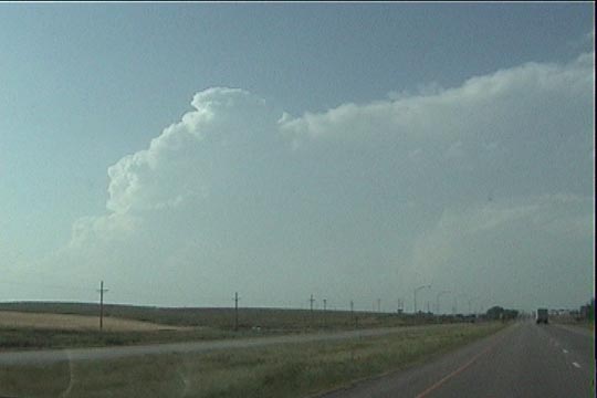
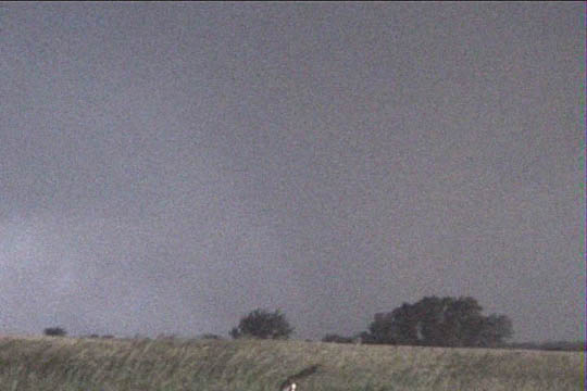
6:25 PM. Initial cells firing in southern Nebraska.
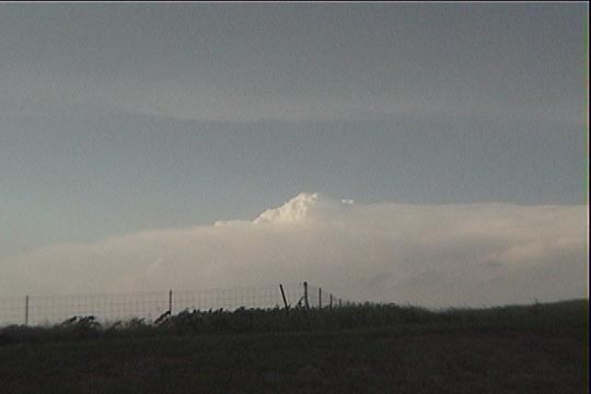
Soon enough, a struggling tower that we had seen just to our west in Concordia suddenly became an exploding small cell, sporting a quickly expanding, solid anvil with knuckles underneath. We stopped for a moment to consider our situation and make our decision. It was time to abandon the "more tornadic" storms to our north and settle for this nice new dryline storm just to our southwest. Our payoff looked better for this storm, as we'd have more than an hour on it before sunset, and we could sit back leisurely and enjoy the storm.
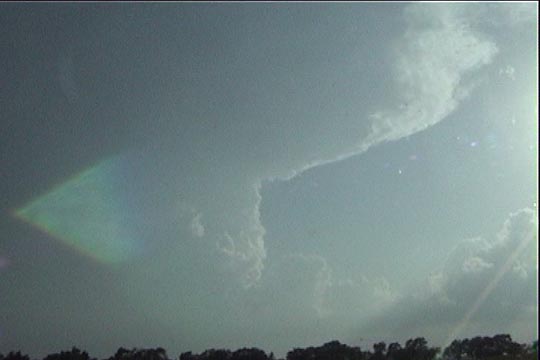
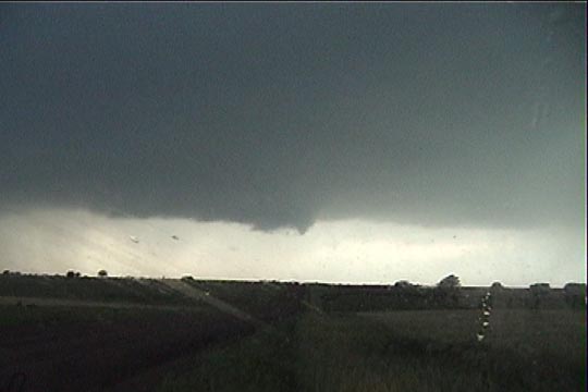
7:00 PM. Initial view of our new target storm
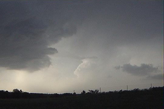
We drove a few miles south, to get in the shadow of the anvil and view the updraft base. As we approached, the base looked far too wide for how deep it was, and hard updrafts were present on the northern side of the storm. This was a split. Visions of May 29 came into my head. Would this storm ever develop a serious right split, or would it just keep shedding parts of itself to the north?
We put ourselves into position to view the slightly smaller southern storm. It was a beautiful LP with a slightly ragged updraft but healthy base. The storm was showing some slow yet definite rotation. It seemed to be moving fairly slowly, so we had plenty of time to watch it, take stills, and shoot a time lapse or two. Another small CB developed just the southwest of our storm. This newer CB appeared to quickly split, with the northern split moving quickly into our storm and the southern split closing much more slowly. Our main updraft still maintained its integrity and continued to slowly rotate. At one point, a small RFD even cut into the base and formed a high-based occlusion. The original left split from our storm was now only barely visible in the distance, and the earlier southern Nebraska storms seemed to be more anchored to our north, displaying wider updrafts and an overshooting top or two.
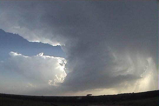
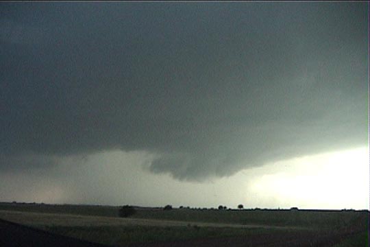
7:14 PM. Updraft of our storm with new cell to its southwest
7:23 PM. Barrel updraft of our LP storm (now severe-warned)
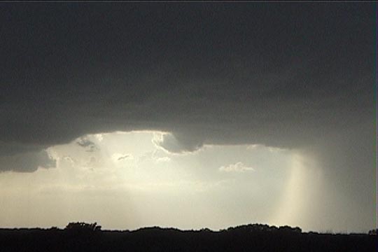
7:23 PM. Overshooting top on Seward, NE tornadic storm (40 minutes before its tornado)
7:32 PM. High-based RFD/occlusion occurring on our storm.
7:39 PM. Left-moving split of our storm in the distance.
Finally, our whole cluster of storms (click here to see panoramic view - 7:45 PM) came close enough that it was time to move east. We pulled a radar shot and were disappointed how linear and multicellular things looked. Surely, our base now looked a bit linear, but it still looked better than what the radar showed. Our cells were beginning to merge together. I was hoping they'd do this in a more supercellular rather than linear fashion, but it looked like the latter might be coming true. Still, there were enough supercellular features with it to make me hold out hope. We drove north then east on a gravel road to a point six miles west of Narka. There, we turned around to watch the storm approach again. It was at this point that things started to dramatically improve.
The light south-southeasterly surface winds turned more easterly and pointed right at the updraft base, which seemed to consolidate into an elongated rain-free base with the precipitation core to its northeast and the northern side of the updraft vault visible above us to our northwest. The base lowered, and soon, a lowering developed directly to our west, and it displayed a very slow, almost imperceptible rotation. Soon, this occluded, and the updraft base suddenly developed quickly southward. Meanwhile, CGs were popping just to our north, and our very light easterly winds increased to the 10-20 mph range.
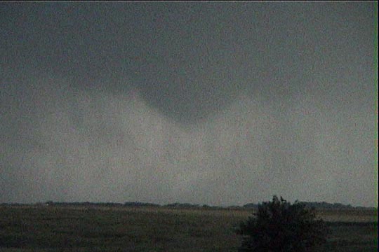
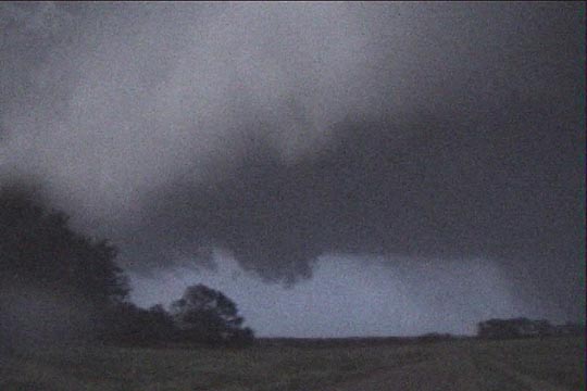
8:14 PM. First wall cloud.
8:28 PM. First wall cloud
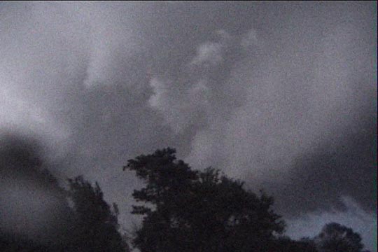
8:37 PM. Second wall cloud
We redeployed a couple miles farther east, and things came together much more quickly. The updraft base continued to lower, and it soon developed another wall cloud with much more definite rotation. Rain wrapped around the back side of this rotation. Our easterly winds began to gust over 30 mph, and occasional 3/4" hailstones bounced off the roof of the Durango and on the road. We called NWS Topeka to report the hail and inform them of the rapid organization of our storm. They informed us of the tornado warning they were about to issue.
In about a minute, the scanner alarm went off informing us of the warning. At the same time, a laminar, cone-shaped lowering appeared at the center of rotation. Rain curtains wrapped around this feature and started to obscure it, but the wide cone funnel persisted. Storm-scale rotation was increasing, warm, moist easterly winds were intensifying, and a scalloped inflow band was now present, wrapping quickly into the back side of the wall cloud from the north. It was time to call NWS Topeka AGAIN. As we were on the phone with them, the first small condensation vorticies appeared at ground level. Tornado! They thanked us for our immediate report and we drove west.
8:44 PM. Funnel.
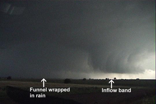
8:45 PM. Funnel wrapped in rain.
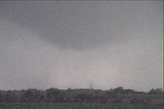
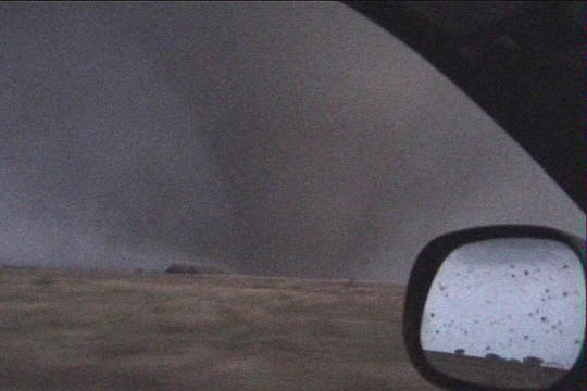
8:47 PM. Tornado.
8:47 PM. Munden-Narka tornado.
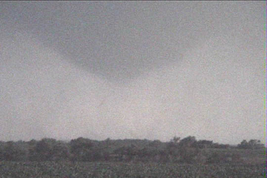
8:48 PM. Munden-Narka tornado.
8:49 PM. Inflow band.
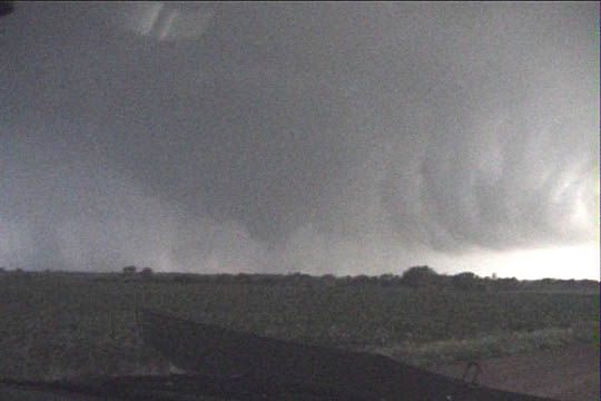
We came quickly upon Keith Brown and the IMAX crew, who had just set up their 70-mm camera to view the genesis of this tornado. It continued to be a wide cone funnel, with multiple small vorticies at ground level, occasionally displaying visible condensation or dust, confirming that it was indeed a tornado. Rain was still wrapping in around the circulation, and at this point, it became heavier and eventually cut off our view of tornado entirely. We were now viewing a storm in the HP process, but we had at least gotten a decent view of tornadogenesis. It was now just past sunset, and bright sky was visible behind the rain curtains (and inflow band) to our west, so maybe it was time to head that way and call it a successful chase. We continued to look to our southwest to monitor the rain-wrapped tornadic area.
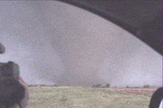
The dark gray rain then thinned slightly, revealing the silhouette of something very wide and large. I wondered if it was my imagination fooling me, but the silhouette persisted, like a black ghost hiding in the rainy darkness. This was eerily surreal. There was no visible movement to this now large stovepipe tornado whose condensation funnel was in solid contact with the ground. There it stood, waiting for our next move.
We moved west toward the light. The inflow band was now racing south-southwestward over our heads. Northeast winds were now gusting over 40 mph. We called the NWS yet again to tell them that this was now a LARGE tornado. The rain continued to thin, and the sunset lighting from the west became bright enough to brighten up the funnel, which now had a wide dust cloud at its base. After we drove through a grove of trees, we realized that the distance between us and it was shrinking rapidly. It was only moving slowly northward, but we had been moving quickly westward. We stopped again with north-northeast winds now gusting up to 53 mph and the tornado now about a mile to our south. We had moved west of the inflow band, so I could look back and see it behind me. Still ahead was a semi-transparent band of rain, and overhead was a slowly cascading waterfall RFD. What a dramatic sight! The whole northern portion of the updraft seemed to be retrograding westward toward us, however, and I soon spotted rapid scud rotation just behind us. A possible satellite tornado was now developing immediately behind us. Time to move.
8:52 PM. Stovepipe tornado.
8:55 PM. Looking south-southwest.
8:56 PM. Tornado near farmstead.
8:57 PM. Looking south-southeast, tornado is a little narrower.
8:58 PM. Looking north. Cascading RFD/Cloud elements.
We stopped one more time for another quick view and then continued west through the rain band and away from the storm. The tornado would continue to move slowly northeast for at least another few minutes before everyone else lost sight of it completely in the rain and darkness. The storm continued to be tornadic at least for another hour as it slowly lifted into Nebraska. Our tornado was only rated F1, largely due to the fact that it never made a direct hit on any human structures. The wind speeds were probably higher than 115 mph.
8:58 PM. Looking east. North side of mesocyclone.
8:58 PM. Looking northeast. North side of mesocyclone.
8:59 PM. Tornado to our southeast. (Nightshot image from camera)