April 28, 2016 Texas Panhandle Supercells
After I went through a nice morning run through some parks and trails in town, we began the day in a rather leisurely fashion. We were already very close to the target area, so we really took our time for the morning weather briefing. It was probably close to 11:00 by the time we left the hotel, and we only drove as far as Panhandle to have lunch. I had Subway, and some of the others in the group ate at Dairy Queen. We wandered around town a bit before seeing some weak echoes on radar and an expanding cumulus field to our south.
Initiation
It was amazing how fast the sky went from completely clear to a dense cumulus overcast. These clouds soon congealed into storms. We saw one potential target well to our south, but 5/29/2001 was in my head. We had the best structured storm of my life near Turkey, TX, but the tornadoes were farther north that day. We stopped on the north side of the Red River, southeast of Palo Duro State Park, on Highway 207, to watch things evolve.
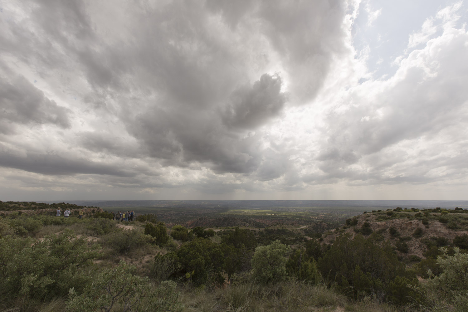 |
| A cluster of storms develops. |
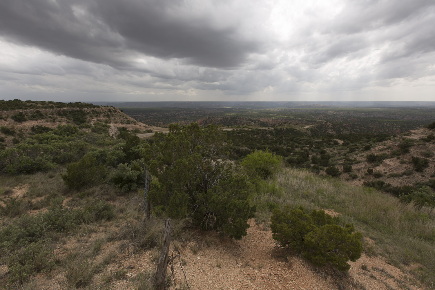 |
| Looking over the valley of the Prairie Dog Town (?) Fork of the Red River. |
The storms to the north of I-40 had a slightly better shape on radar, and the high resolution numerical models had indicated the southern storms would disspate before sunset (this ended up being somewhat true), so we drove north, hoping to intercept a very healthy supercell near Stinnett. As we drove into Borger, we noticed the sky had become rather stratiform with a stratocumulus overcast. That's not what we like for photography and tornadic storms. We continued onward.
 |
| Passing a wind farm with weaker storms to our east. |
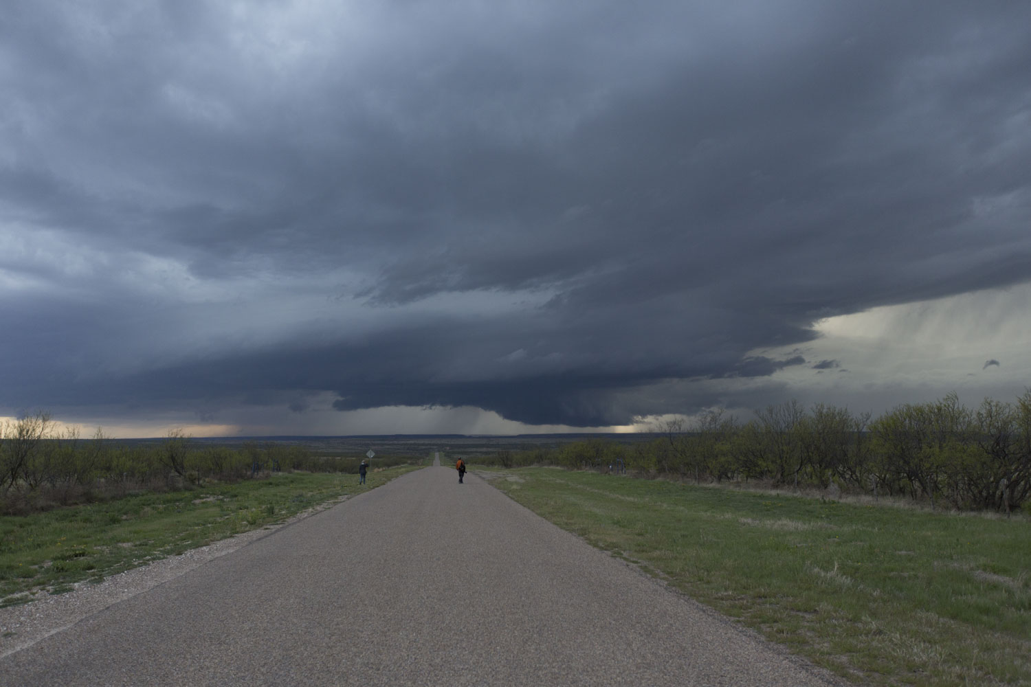
During our drive, the stronger supercell to our northwest was followed by a smaller storm to its southwest. The two were beginning to coalesce into a line. We drove up as two separate cores gradually became indistinguishable, and the system presented a linear view as we stopped on Farm to Market Road 1913 to photograph. After a few minutes, we loaded back up in the van and were ready to drive off, but we spotted some low-level, rotation in the now ragged cloud base to our west. We stayed put, realizing our route back to Stinnett would be cut off by this storm. This was no problem, however, as we had Farm to Market Road 1319 southeast to Sanford. Bill Reid took his van back to Stinnett, but Chris and I decided to take the more direct route southeast. When the rotation weakened (radar showed quite a nice couplet as we were observing the rotation), we drove southeast to stay ahead of things.
 |
| An action area develops between two merging cells. We got some nice rotation here for a few minutes. |
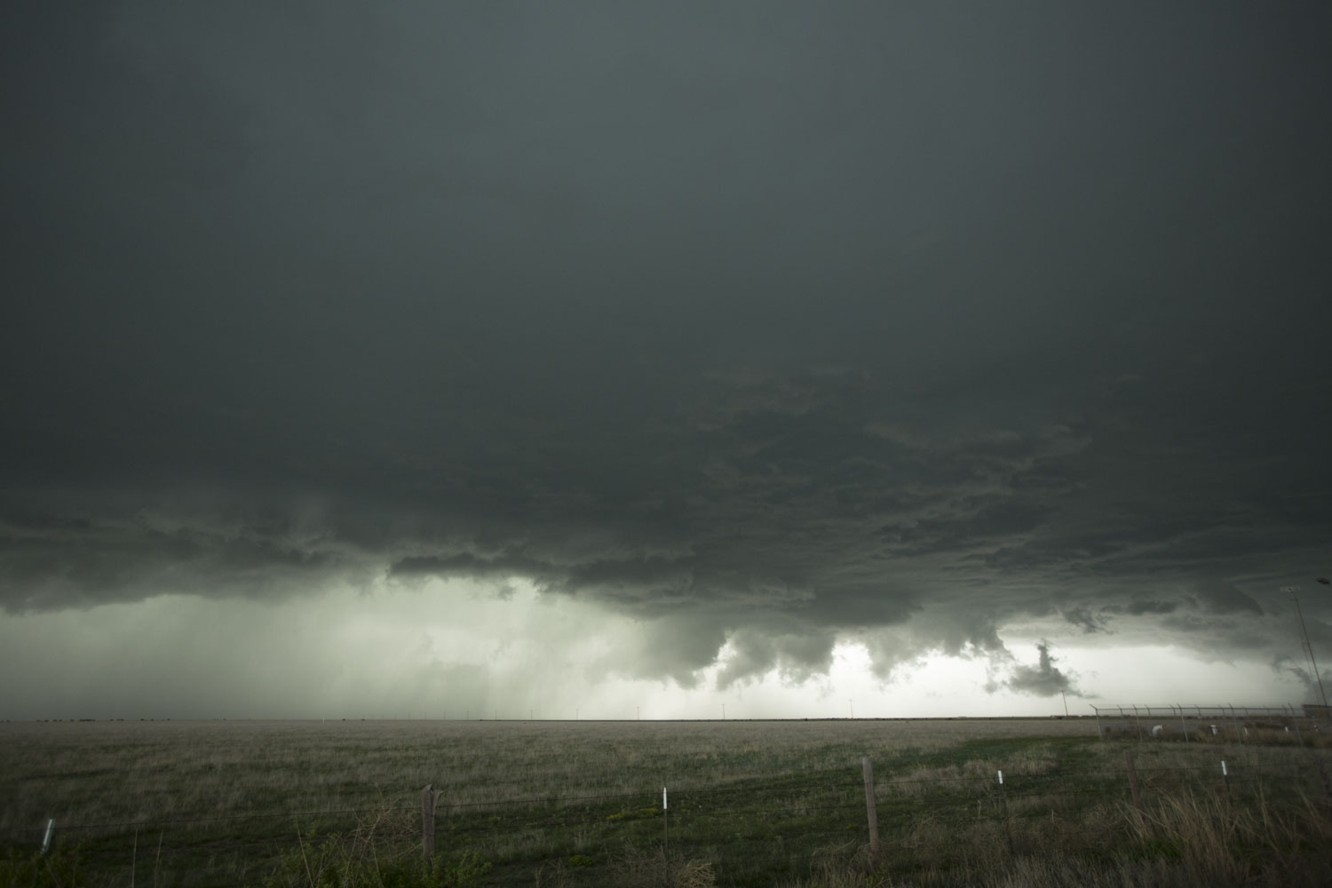
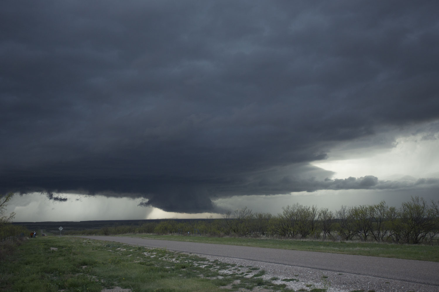
A tail end storm was intensifying south of our short line, and we decided to continued southward to view this new storm. As we cleared the stratocumulus deck near Sanford, we could see a hard tower and expanding anvil along with a lowered base on our new storm to the southwest. My thinking was that we would have some wonderful photography ahead. We never were free enough from the low clouds to see the full storm tower, but the banding in the low clouds provided some nice structure. We continued through Fritch and stopped at Cas Johnson Road and Highway 136 to watch the cell approach over Lake Meredith.
 |
| A nice, thick inflow band heading into Tail End Charlie. |
 |
| This is our farthest south stop south of Fritch and east of Lake Meredith. |
 |
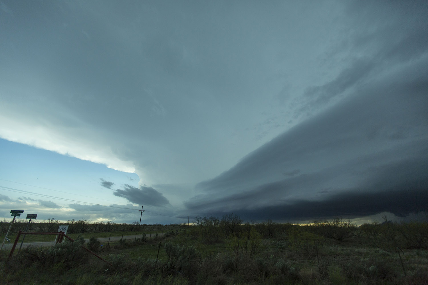
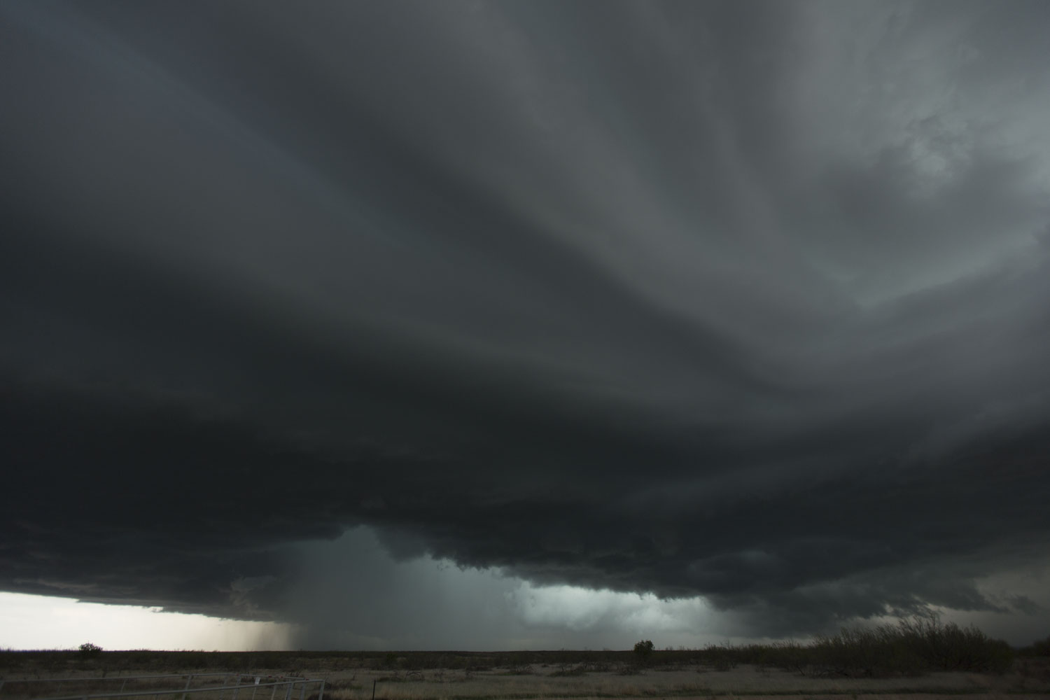
| A nice wall cloud develops on the storm. |
The storm was getting pretty close again, and we had to go through a couple towns, so I decided it was time to pick up and head back northeast. Right before we entered Fritch, I spotted a nice RFD intrusion ocurring, and I thought we may have had a funnel briefly, but I did not have a great view. When we stopped, the mesocyclone had occluded, but the incoming light it had allowed illuminated the action area a ghostly white. We snapped a few pictures of this scene then headed northeast through Fritch to Borger, where we reaquired radio contact with Bill Reid.
 |
| Here's the supercell just south of Fritch, TX. An RFD has eroded the base, and light is illuminating the old wall cloud area. |
We watched the storms for a bit longer, staying ahead of them as the now more linear system drifted southeast. We got ahead of the whole mess just before we reached Pampa, so we stopped for one more round of pictures as darkness enveloped the storm. We headed back to the Best Western Northgate Inn in Pampa.
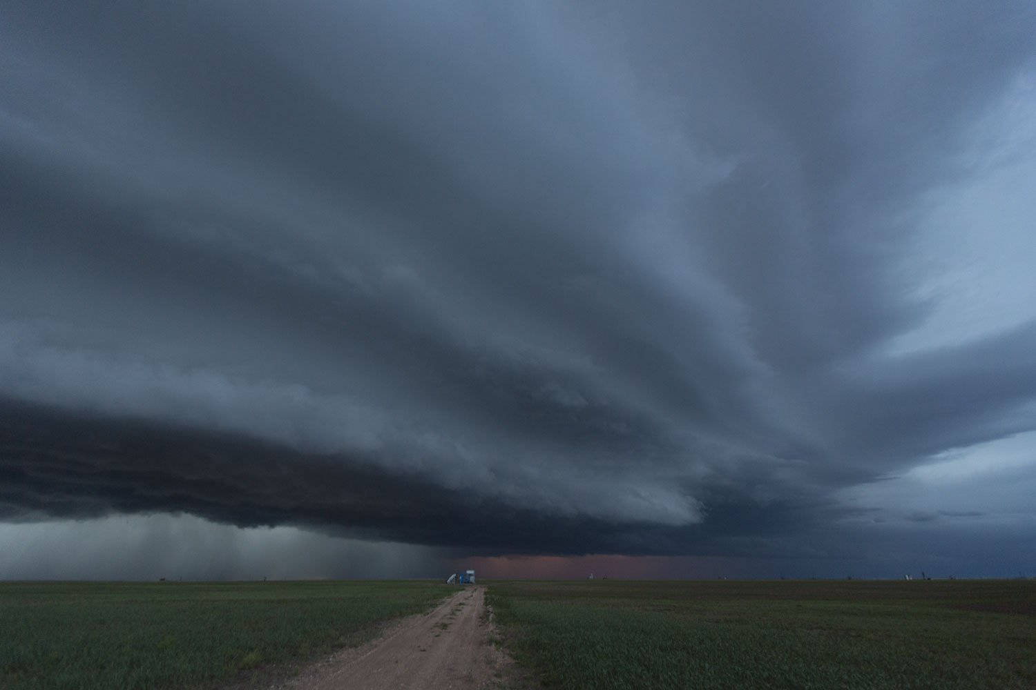 |
| We got just ahead of the storm for a bit before stopping for a final photography opportunity west of Pampa. |
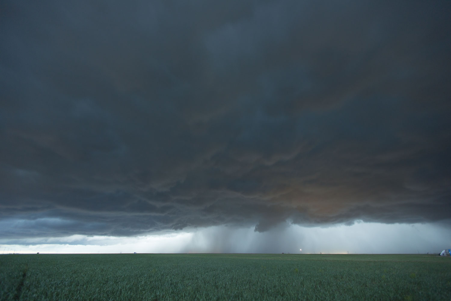 |
| The underside of the line of storms west of Pampa. The orange glow on the cloud base might be from a brush fire. Maybe it was a town. |
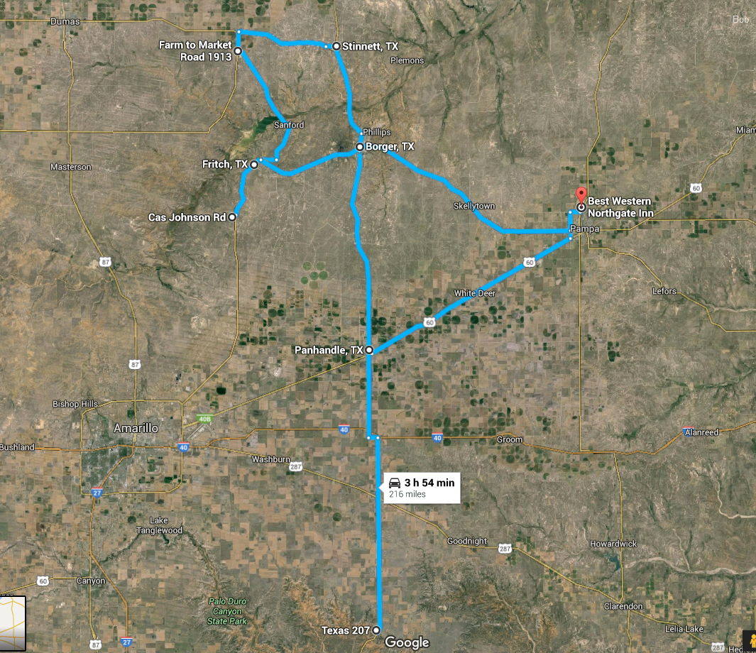 |
| Here's what I remember about the route we took. |
Back to Storm Chases | Home