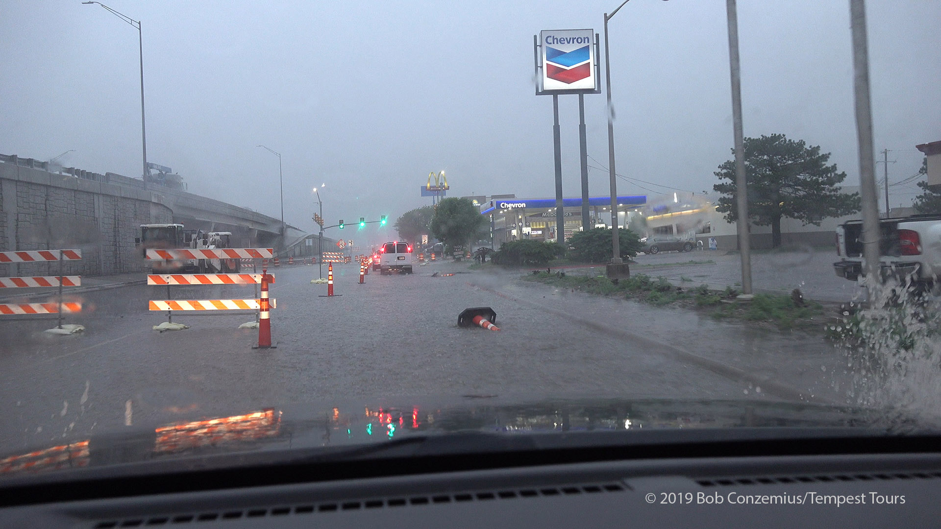
We began the day with severe storms moving over our hotel in Amarillo. It was time for a tire change (safety first, and tires are a priority), so we took care of that in the morning before we departed on the chase.
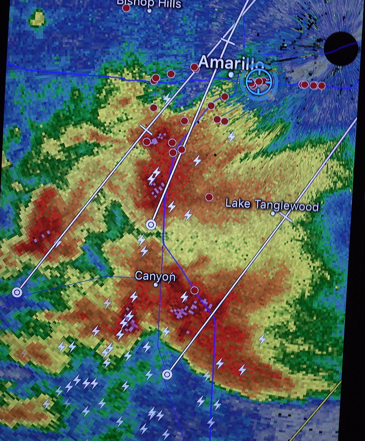
This is what radar looked like when we awoke in the morning.
Morning flooding in Amarillo on the way to our tire change.
We drove east-southeast toward Clarendon in thick stratus and drizzle. We needed to get a little farther south to at least get into a cumulus field. The clouds started breaking up south of Clarendon (we ate lunch at Subway there, but I had a gas station sub), and we soon had storms all around us. A larger pair of storms was a bit farther south, and after taking a look at some storms closer by (near Turkey), we targeted the southern pair of storms. We wanted to stay ahead of the them due to their relatively fast motion, so we proceeded east toward Childress before they arrived.
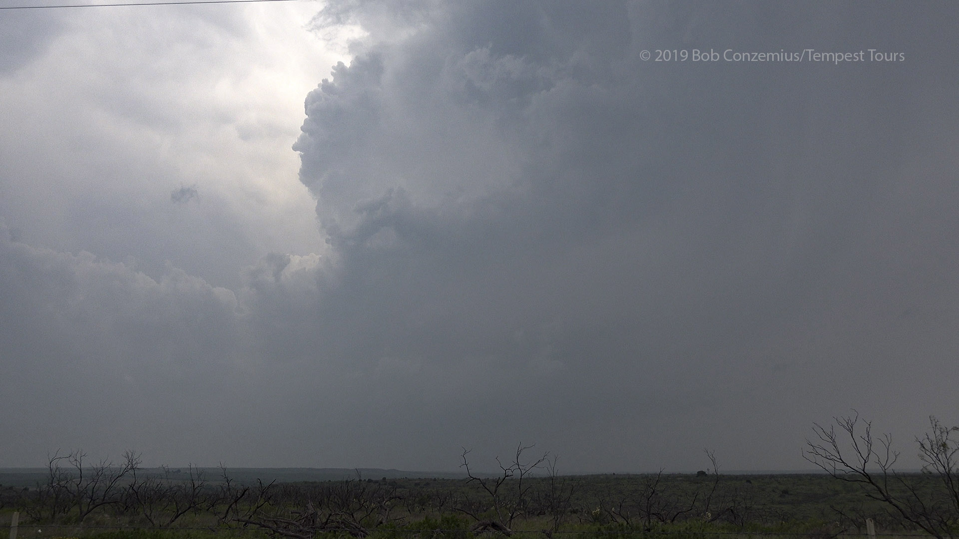
An initial view of the first storms in our vicinity, a bit north of Turkey, TX. It was another hazy day.
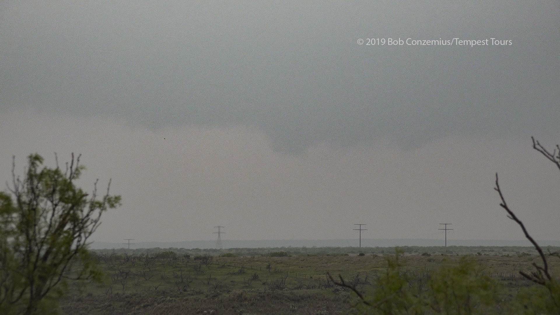
A little lowering on a non-severe storm well west of Childress.
A brief tornado had apparently already occurred while we were still west of Childress, but we thought it better to get ahead and wait on the east side of Childress because we thought the core of the storm would move right over Childress. Once we were a few miles east, we turned around and looked, but we realized we needed to get back a couple miles west to see the bases. The first one went by through the haze, looking unremarkable, yet it was tornado-warned. The second went by and looked even less dramatic. I was starting to wonder whether our tornado prospects were diminishing for the day. A lot more storms were developing about 50 miles west, and they looked like they would form into a line of storms.
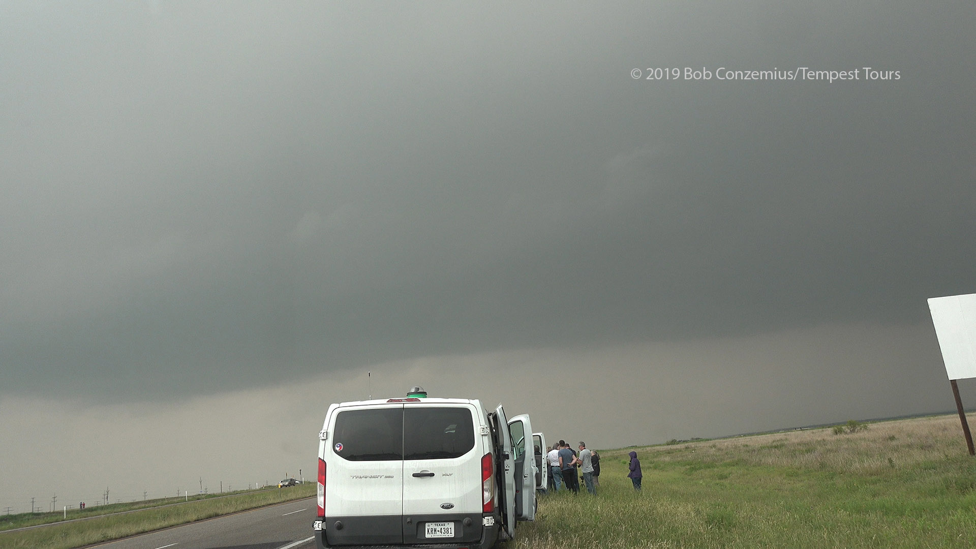
The updraft base of the eastern storm. The circulation prompted a tornado warning.
The updraft base of the western storm in the pair.
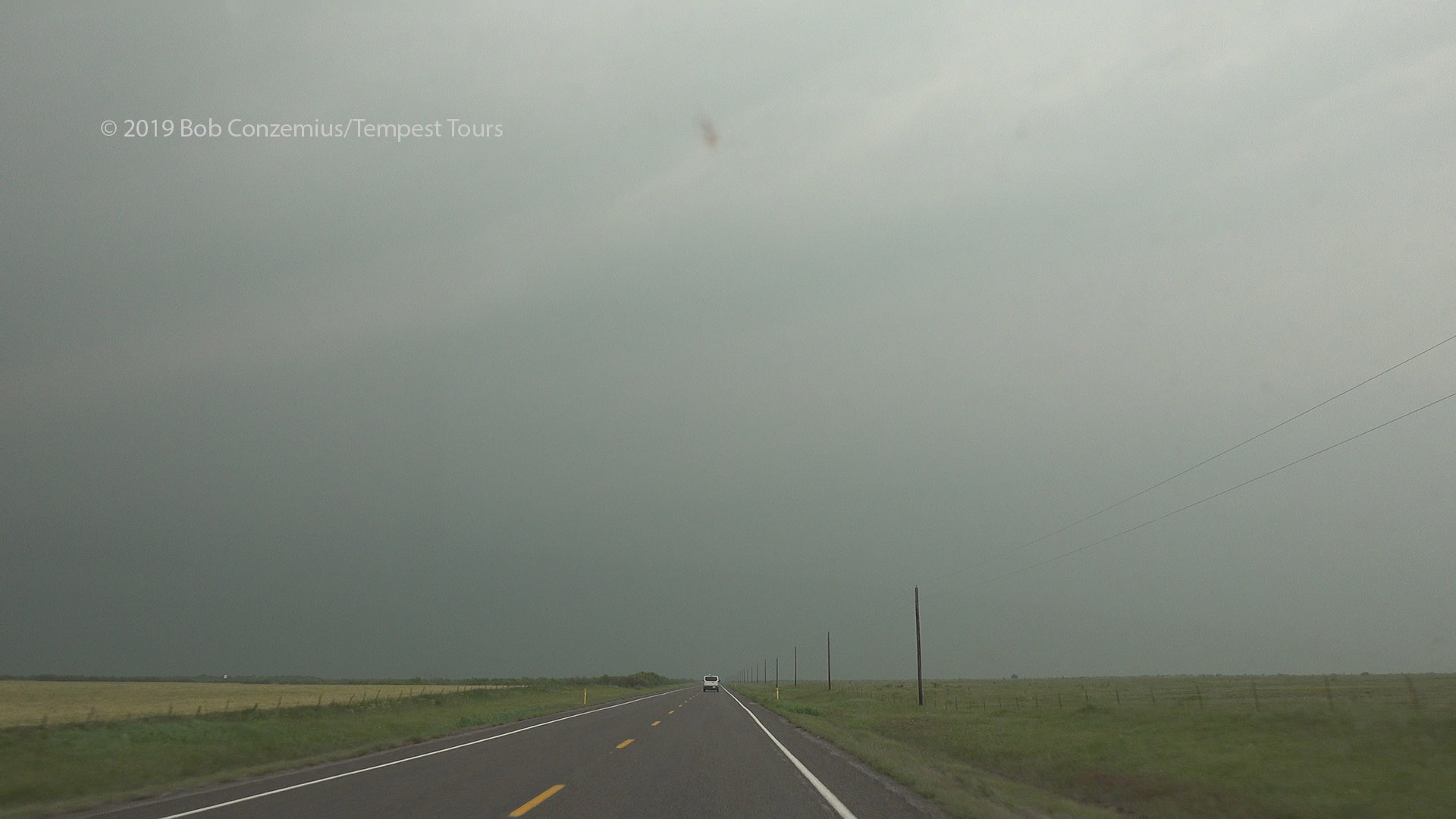
We considered moving back west toward one of the more discrete cells in the line, but I had to stay east because I needed to be in Norman by late evening. That might have influenced the group to stay with our storm. Also, it was the storm that was still closest to us, and it was ahead of the line, so we really had to stick with it. The pair of storms was becoming more of a single storm now, but it didn't look particularly strong. We drove north through the haze to catch back up with it.
Driving north through featurless haze toward Mangum, OK.
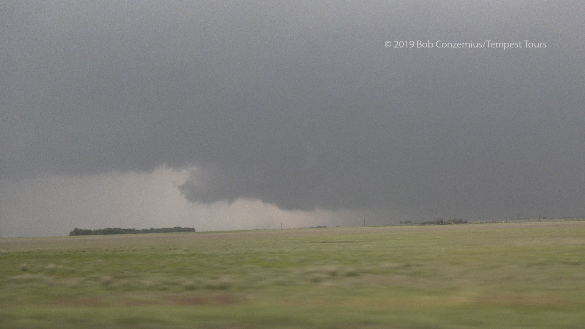
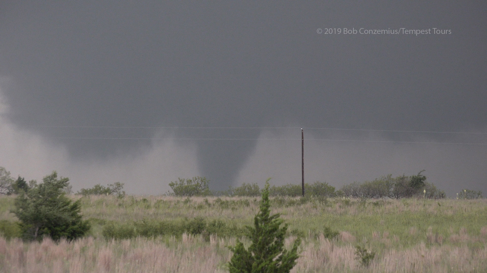
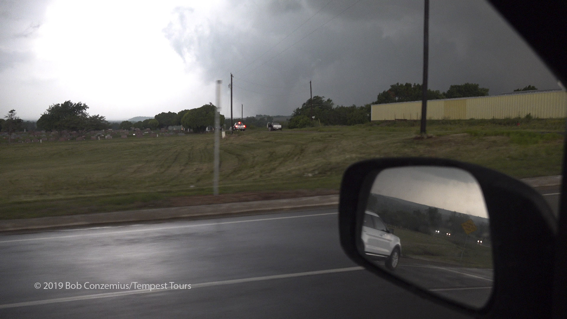
On our way, the storm became tornado-warned again, and a tornado was being reported near Gould, to our west. We continued northward expeditiously, and we saw the base a few minutes later. It looked like it was about to produce a tornado. There was a dark wall cloud, and one or two funnels were visible with it, along with swirls of dust underneath. They soon became a large tornado. After stopping for a couple minutes to take video, we hopped back in our vehicles and paralleled it going northeast into Mangum. The tornado stayed west of the town but came really close to hitting it. It actually did hit one or two residences on the northern outskirts of town. A few small pieces of debris were raining down in town (mostly just leaves).
Funnel with a little dust/debris underneath it.
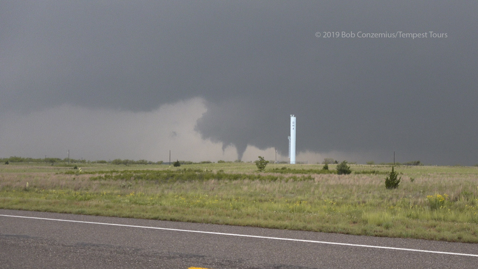
The tornado initially appears to have multiple vortices. I thought, at this point, that it could become very large because of the circulation around it.
It's getting larger.
The tornado is getting pretty large and is rotating strongly.
The tornado quickly disappears from view.
A stout cone tornado to our west and bright RFD behind it.
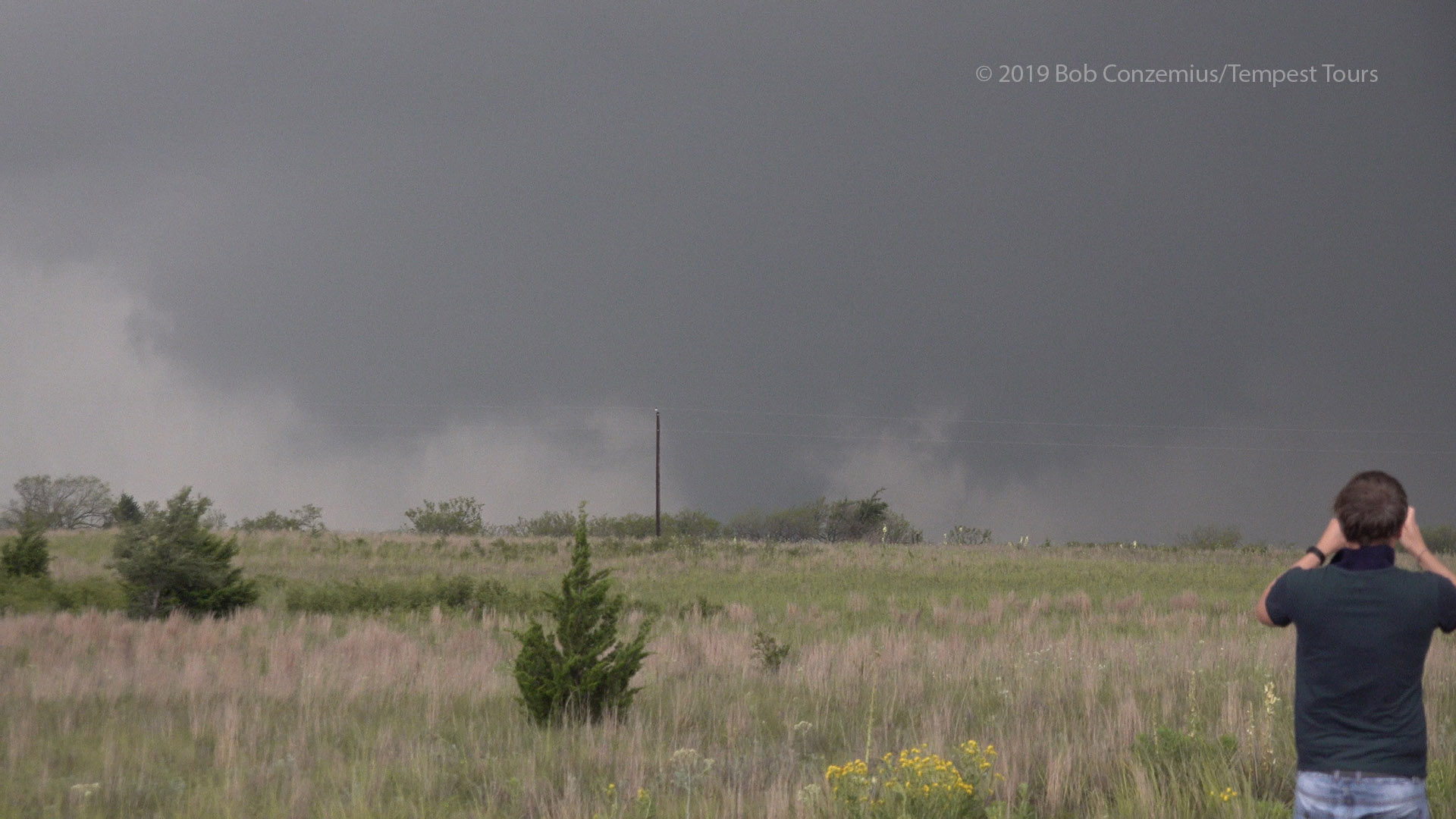
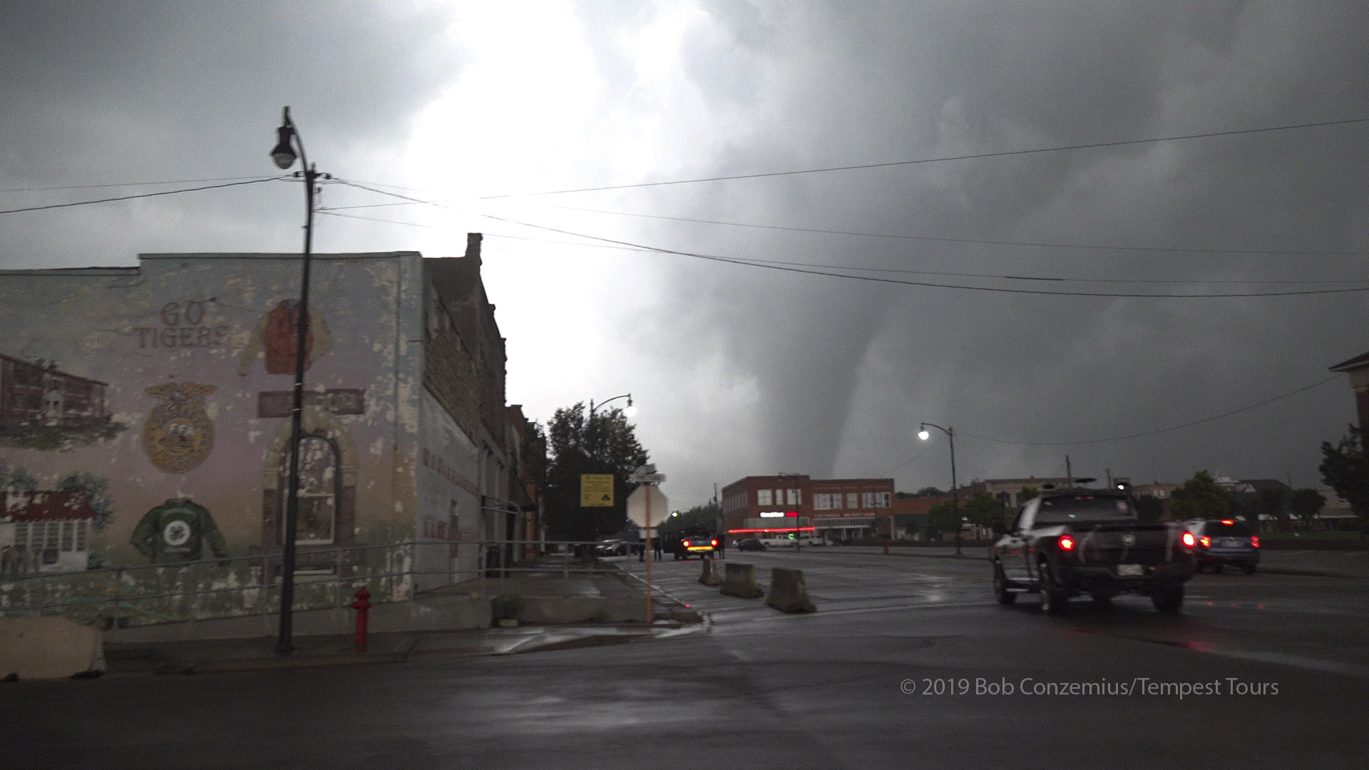
A wide cone tornado as we enter Mangum.
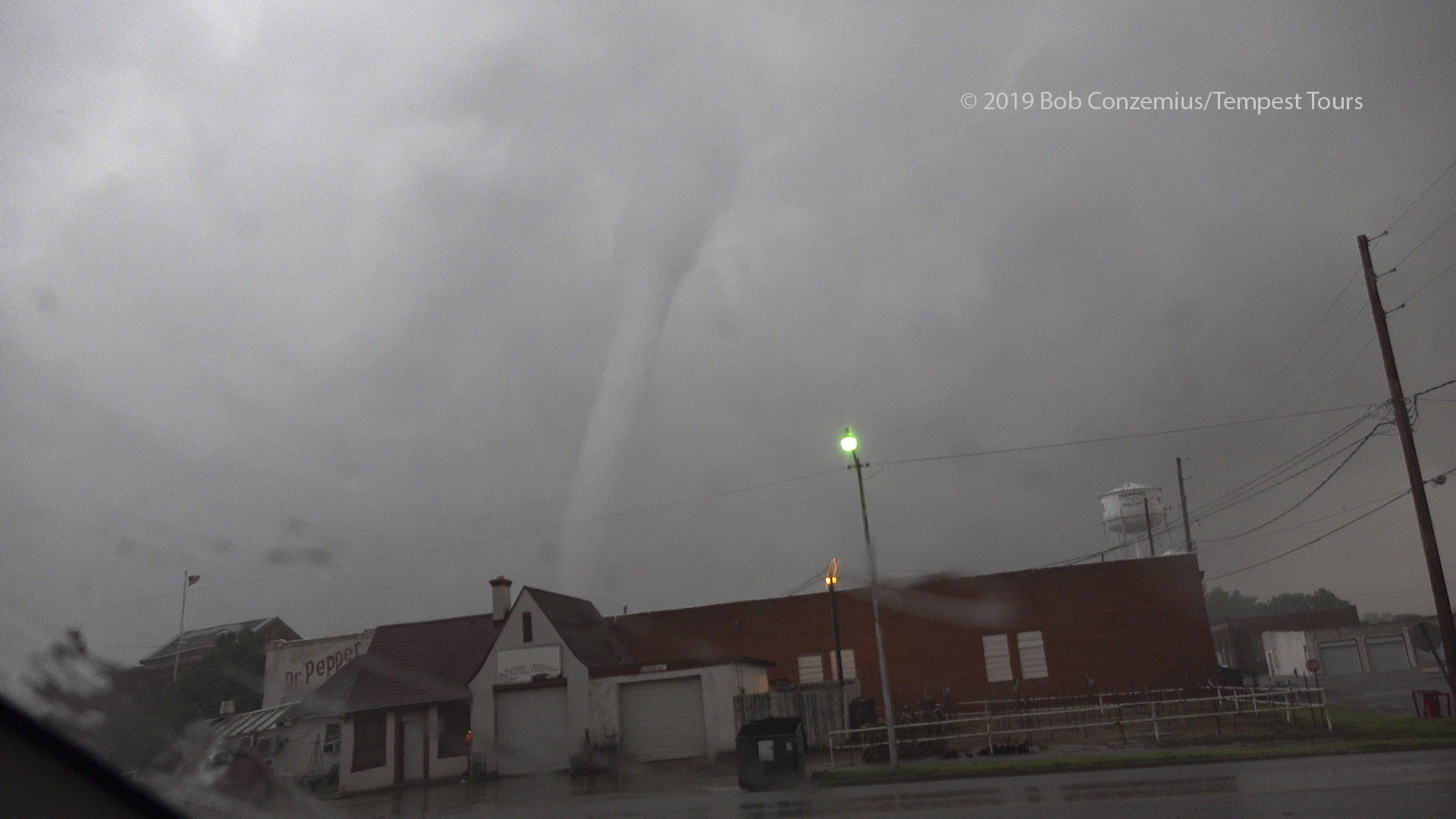
My first look at the tornado from in Mangum.
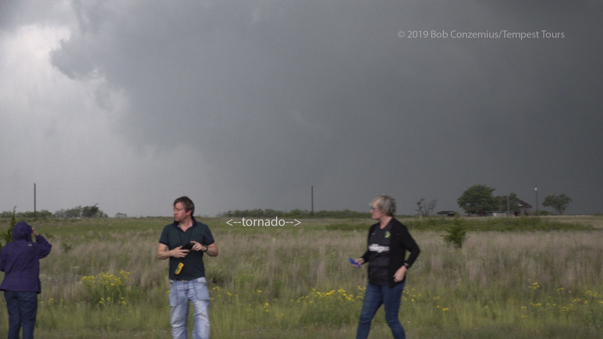
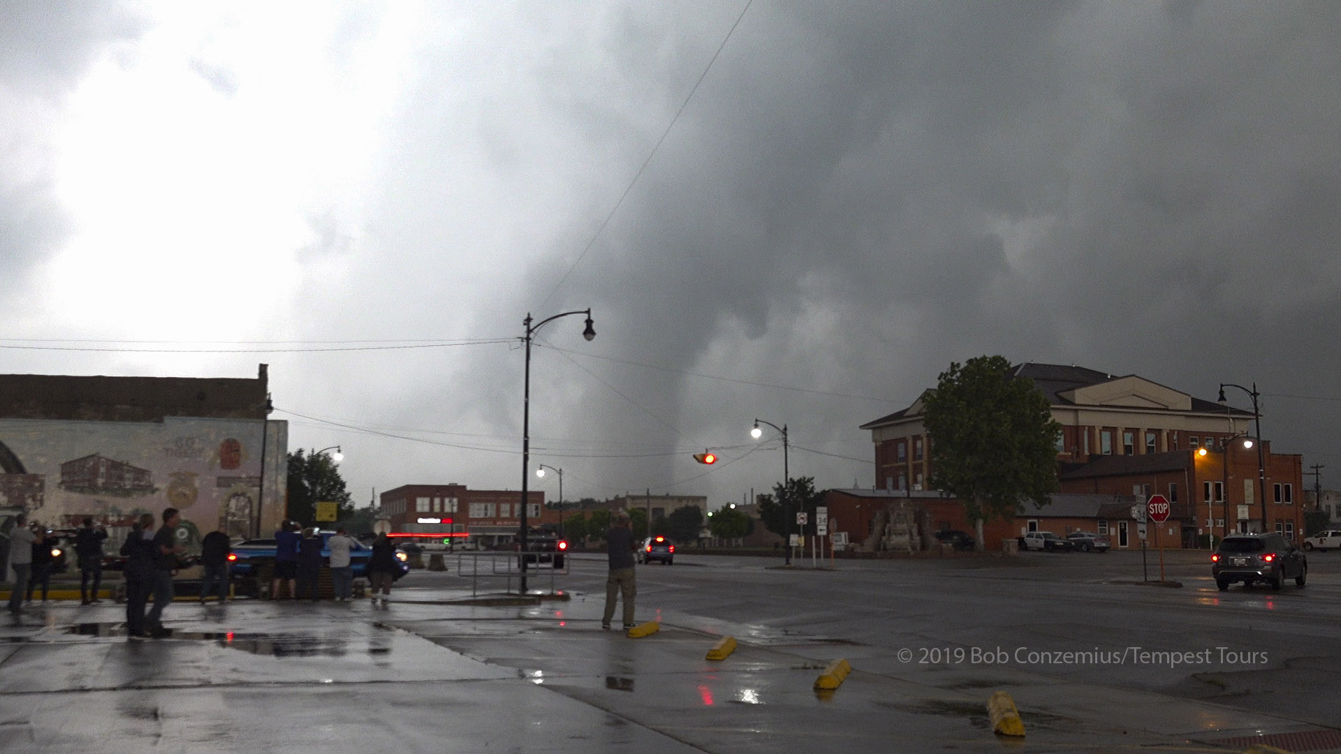
The tornado begins the rope-out stage as it comes closer to town.
The tornado appears to clip the northwestern corner of the town.
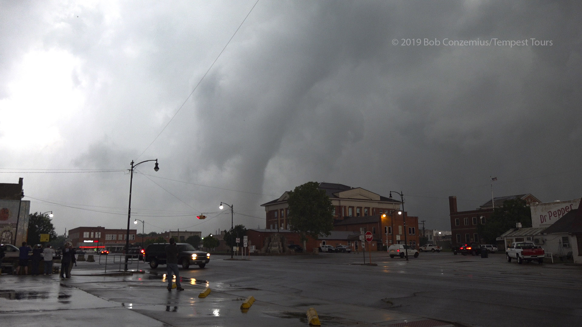
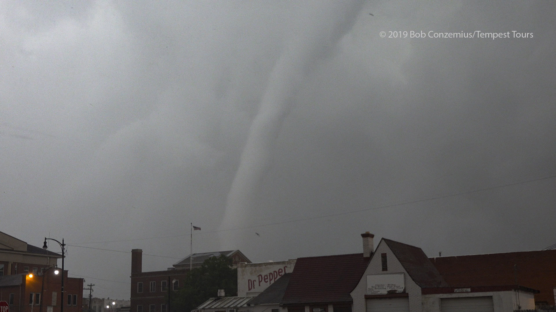
Like a straw sipping Dr. Pepper.
My final video of the tornado.
Once the tornado got north of us and appeared to be roping out, we exited the town to the east. The tornado roped out, and we looked for additional tornadoes. We thought we might have had a developing tornado to our south along the flanking line, but this turned out to be nothing. We then drove north and northeast toward Hobart as the RFD area really gusted out and enlarged ahead of us. This was somewhat obscured by a lot of low clouds that had developed, and another cell had also developed to our south and started merging with our storm. Soon we were in a large convective mess. We got a little bit east and ahead of the precipitation, but we were still in outflow. It looked like the tornado phase was done.
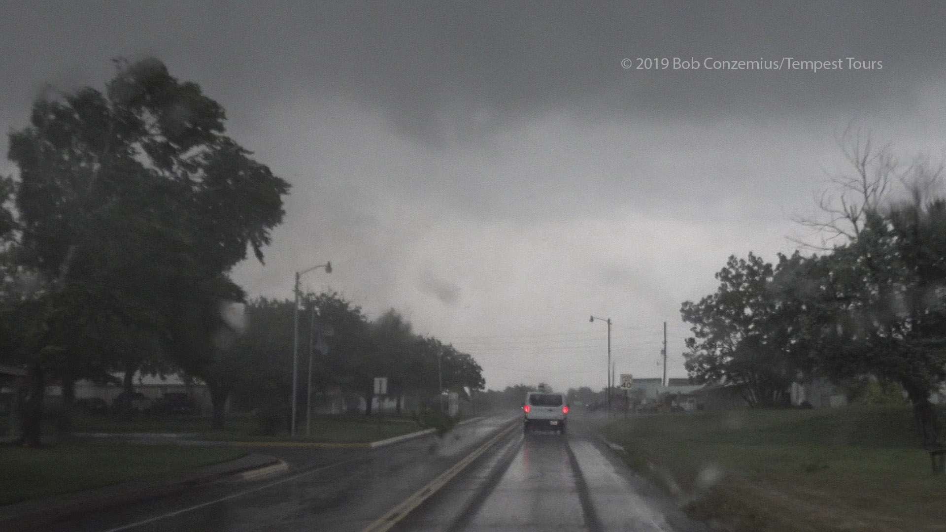
Driving east out of Mangum, large tree branches were flying.
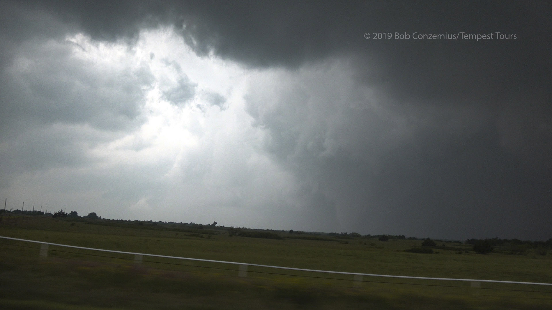
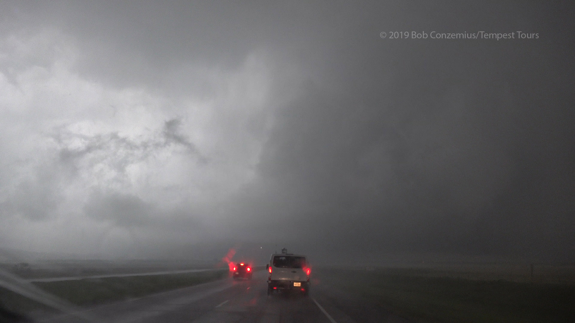
The enlarged RFD area and low base.
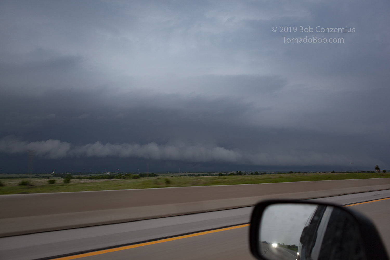
I picked this time to break off from the group and head back to Norman (I was driving Bill's Nissan Xterra). The group headed back a little south to Altus. On my way back to Norman, I got ahead of the storms and then had a nice look at the shelf cloud as I drove up I-44 before exiting at Highway 9 for Norman.
A nice shelf cloud approaches I-44 just northeast of Chickasha.
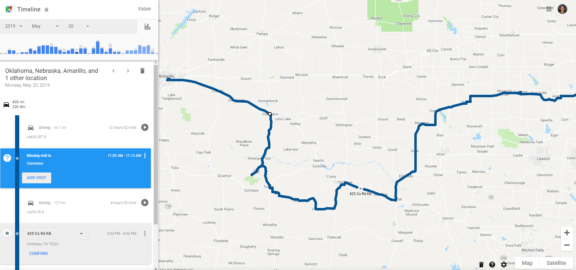
Our approximate route for the day. I left off the last part of the drive back to Norman.