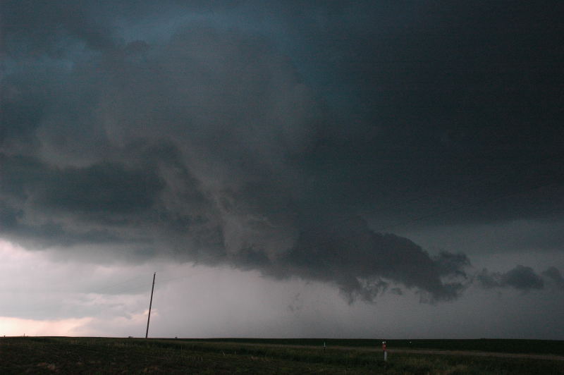
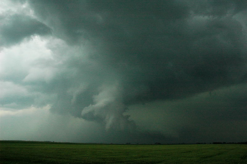
Our supercell when we arrived at the updraft base, showing a nice tail cloud at the lower right.
The conditions appeared best this day in far northern and northeastern South Dakota. An outflow boundary was positioned across the area from the early morning convection. Just north of the boundary, the winds were backed (from the east) and the dewpoints were in the lower 70s. The low-level winds were excellent, and so was the LCL (lifting condensation level). I was pretty excited as we drove through the area just north of the boundary, seeing the clouds just 500 to 1000 feet above the ground. Any storm that had access to these LCLs and low-level shear would probably go nuts and a big tornado day was potentially in store for us. Unfortunately, things usually don't go as planned. A storm developed just south of the outflow boundary and moved north. I thought it would soon cross the boundary and become very interesting, but after nearly an hour, there was no sign of that happening. According to WSR-88d images from Aberdeen, SD, the boundary moved north and stayed ahead of the storm. Suspecting the boundary was retreating, I became somewhat concerned about any storms farther north. Those concerns were realized, as a storm just southeast of Bismarck, ND produced two tornadoes.
Our supercell when we arrived at the updraft base, showing a nice tail cloud at the lower right.
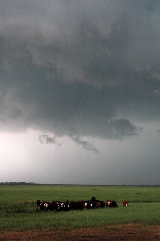
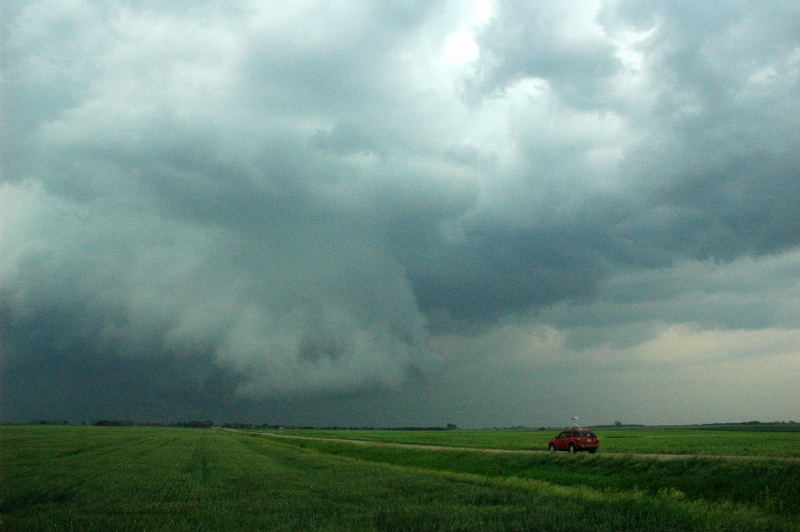
First action area drifts a little north. One of the cattle in the field in front of us has his mind on something other than the storm.
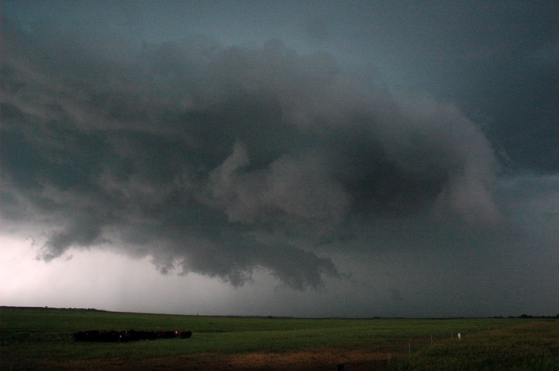
The feature closest to us is displaying some rotation, but this action area looks a little "cold and undercut". We began to feel a rather cool RFD (rear flank downdraft) at this point.
The cell immediately seemed to produce too much northerly surface winds in the forward flank downdraft region, which just managed to undercut any action area that developed. These northerly winds surged behind the updraft base and encircled it somewhat, producing westerly winds on the storm's southern and southeastern flank. The storm appeared to come close to producing tornadoes on at least a couple occasions, but the low-level flow and thermodynamics were not conducive to the intensification of any surface vorticity.
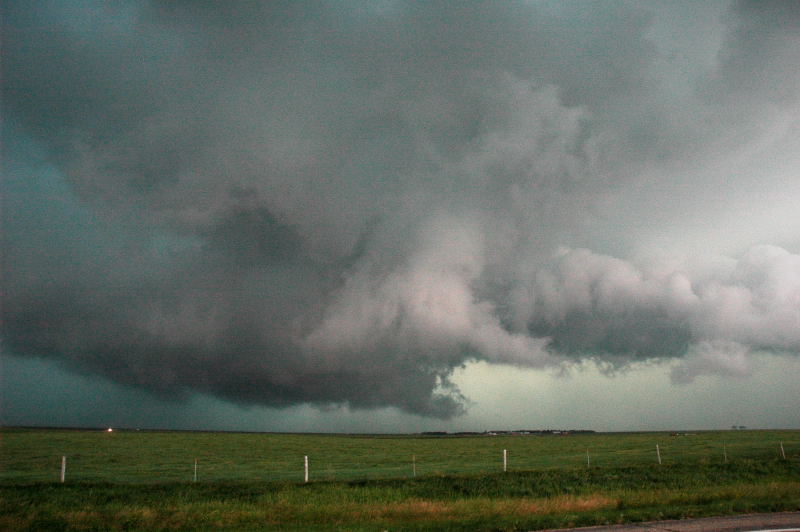
Action area looks like its being undercut by cool air and is rather ragged and disorganized. Still, there is a lot of rotational motion in these clouds.
Storm produces a very weak, disorganized funnel that might be better described as slowly rotating scud.
The storm produced a couple decent RFD surges, marked by the low clouds in this picture.
Our last experience of the storm was a core punch from the rear, near where the RFD used to be. As we got back ahead of the heavy rain, we were in northerly winds, with strong southerly winds ahead of us along the gust front. There was some very nice, differential motion in the rain bands right in front of us for a bit, but it was not going to tighten up into a tornadic circulation. Sunset was upon us, so we decided to call it a day.
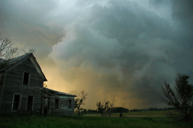
At sunset, we let the storm go and took some pictures of an abandoned farmhouse.