June 17, 2018 Tornadic Storms
Southwestern Nebraska/Northeast Colorado.
These were certainly not high quality tornadoes (and I certainly did not get any images of tornadoes), but there were some tornado reports nonetheless. We started the day in Valentine, Nebraska and drove to our target in the southwestern part of the state. We ate lunch at fast food restaurants in North Platte and then hurried east as a storm developed near Julesburg, CO. It looked great on radar, and soon, a tornado warning was issued.
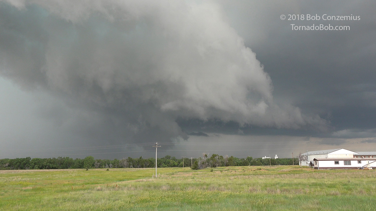
We caught the storm at Julesburg and exited I-76 there. We observed a rear flank downdraft (RFD) descend around a rapidly rotating wall cloud and then occlude to our northeast. The RFD felt pretty cold, so I was not thinking there would be a tornado, but there was some really low condensation in the center of the circulation, and that was reported as a tornado. We held up at Julesburg as the storm threatened to move over I-80 to our northeast. As soon as we had a clear path on I-76/I-80, we proceeded northeast.
 |
|---|
| Rapidly rotating wall cloud as it was being enveloped by RFD. |
 |
|---|
| The circulation occludes and disappears to our northeast. |
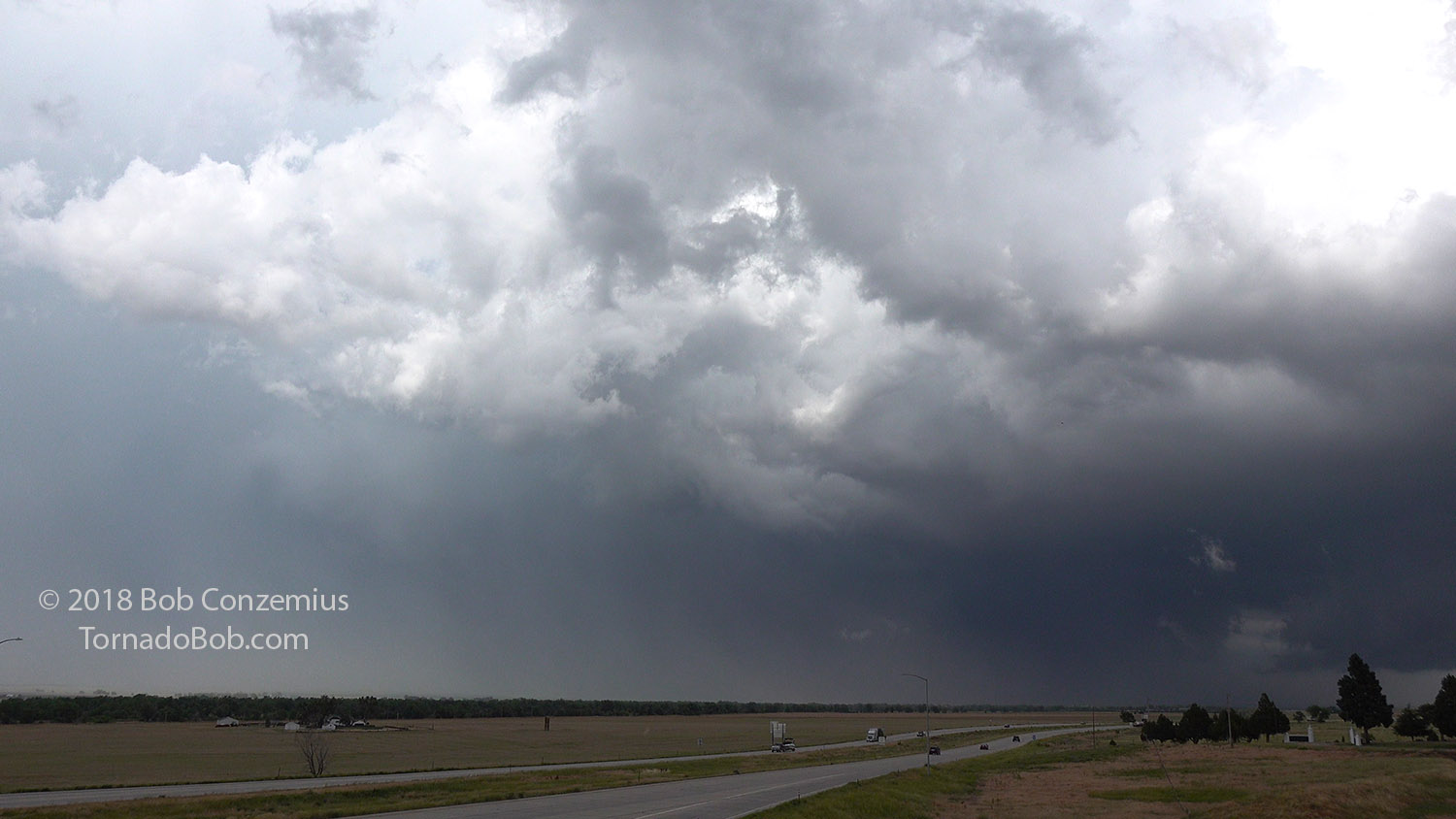
We passed the storm and exited at Ogallala. We drove north from town toward Lake McConaughy, but no roads afforded us a good route ahead of the storm, so we stopped to watch it pass to our north. We observed some lowerings at this point, but I did not see any tornadoes. Other chasers did see some condensation funnels reach close to ground, and so tornadoes were reported. I just did not get a good enough view to make any claims.
 |
|---|
| Another wall cloud on the storm north of Ogallala. |
At this point, we dropped back to I-80 and had to run over to North Platte before we could in front of the storm again. By this point, other storms had developed to the east and were about to either merge with the original storm or continue ahead and cut it off from its warm, moist inflow. Eventually, the original storm weakened, and we decided to target newer storms developing to our west-southwest ahead of a cold front.
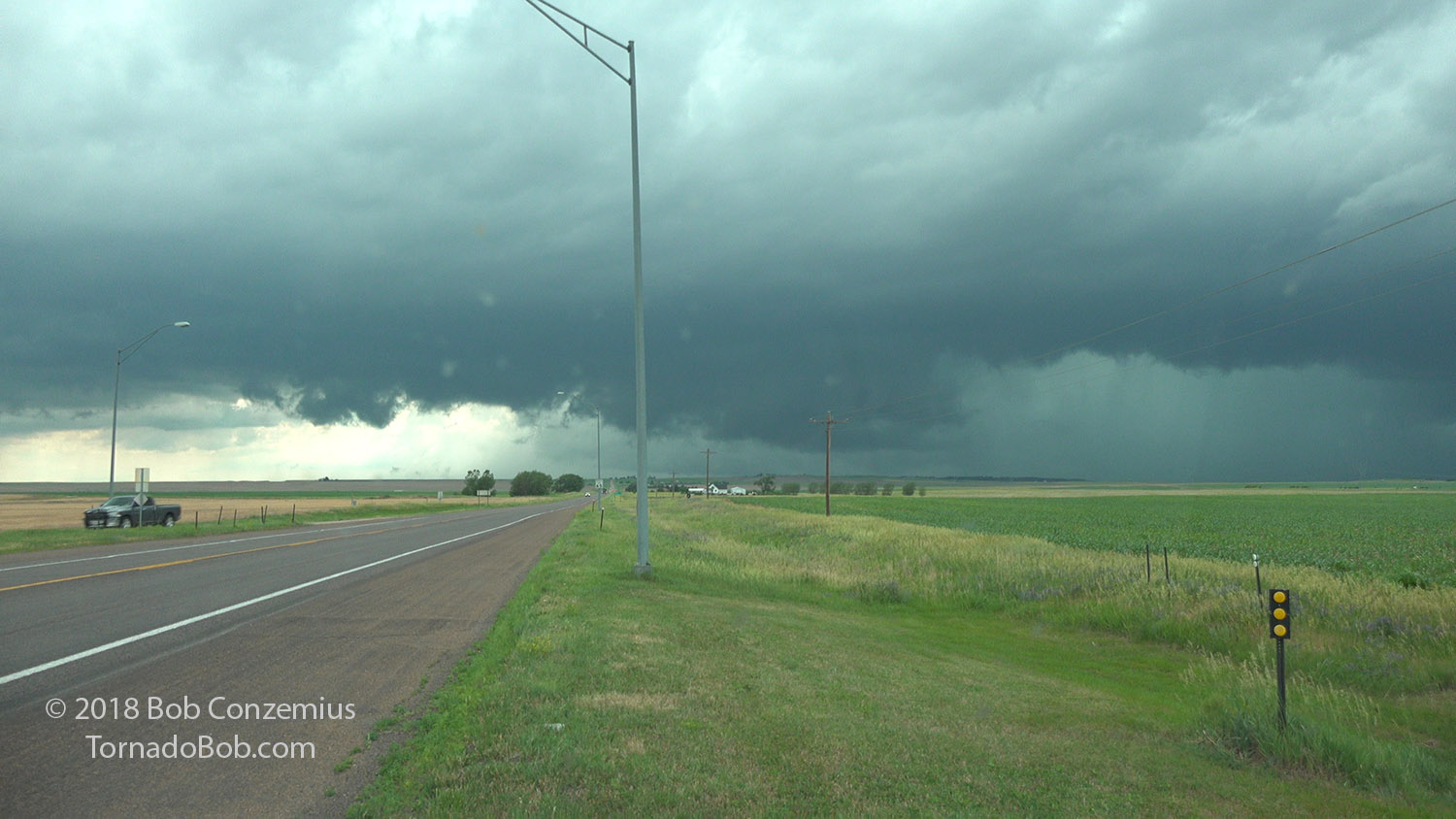
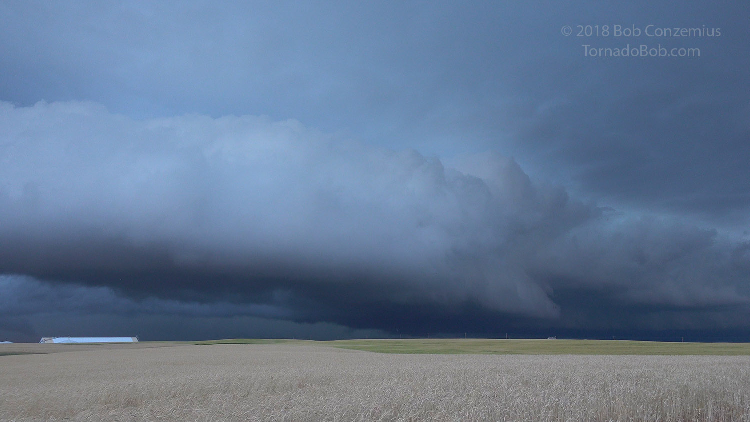
We soon realized that these new storms were right on the cold front and probably had little, if any, tornado potential. We drove south from Ogallala to get in front of the solidifying line of storms. We reached Grant, NE via a couple storms that were below severe limits, and then we turned east on Highway 23. There was a lot of shear along the gust front, and this made us a bit more cautious in driving back east out of the outflow. There were a couple areas of intense rotation along the gust front.
We cleared the outflow at Elsie, and stopped for a few minutes to look back west. While we were there, the National Weather Service called me to ask what we were seeing. There had been a landspout report from the public, and they wanted our description of what we saw. I told them that there was a lot of shear along the gust front, but I hadn't seen any tornadoes. The storm looked a bit stronger to our northwest, however.
 |
|---|
| The shelf cloud to our west and southwest. |
 |
|---|
| Somewhat darker area of the storm to our northwest. |
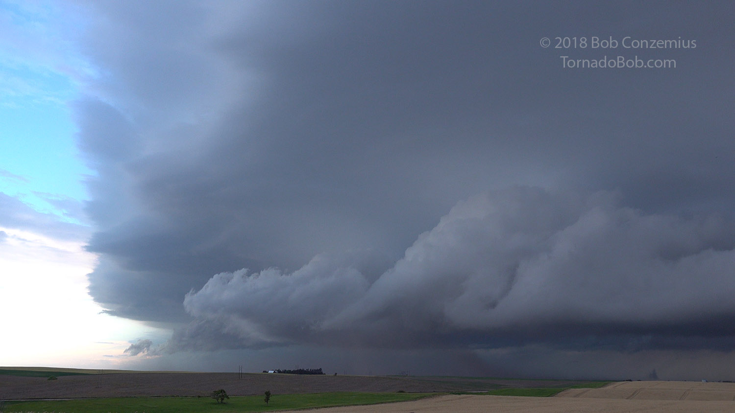
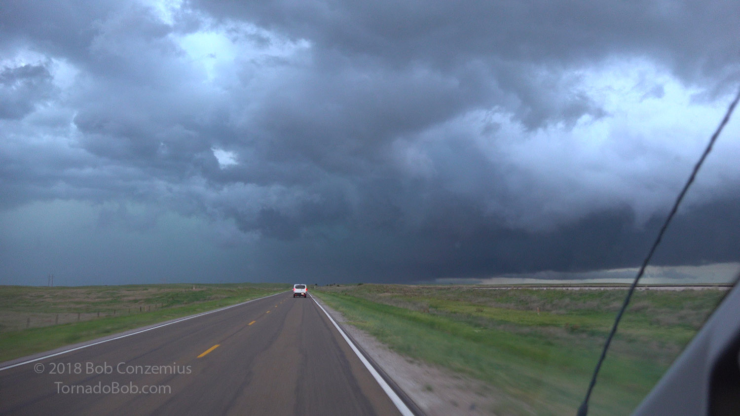
We continued east to Wallace, where the weather service issued a tornado warning on our storm. I checked radar, and indeed, there was a tight circulation to our northwest. We turned north to follow it but could not see any tight rotation as there was rain wrapping around it. We saw a nice shelf cloud to our northeast, which wrapped into the circulation to our north, but it disappeared behind an area of rain, so we could not confirm or deny the existence of a tornado. We drove back to Ogallala and spent the night at the Lonesome Dove Lodge.
 |
|---|
| The circulation that prompted a tornado warning is ahead of us, but it is wrapped in rain. |
 |
|---|
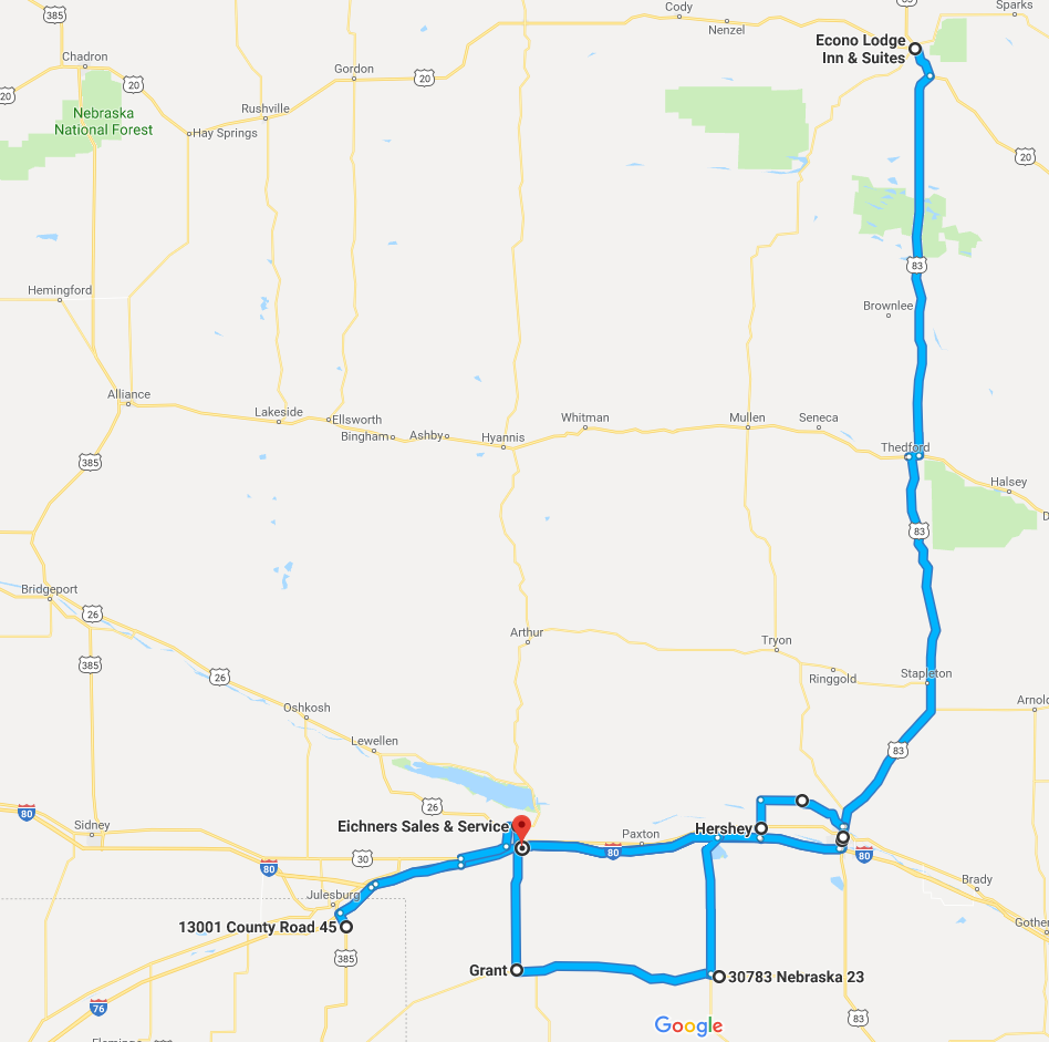
| Our route for the day, starting in Valentine and ending at Ogallala. |
Electric driving: there are no listed charging locations in Valentine, although if you looked, maybe a campground with NEMA 14-50 outlets could be located. From there, it is 183 miles to Ogallala, NE, where there is a Supercharger. The rest of the trip could be done with Supercharging, although this would have caused a delay in chasing storms.
Back to Storm Chases | Home