A kmz file of the tornado locations and triangulation work can be found here. Another one, focusing on the Waubun/Mahnomen tornado can be found here.
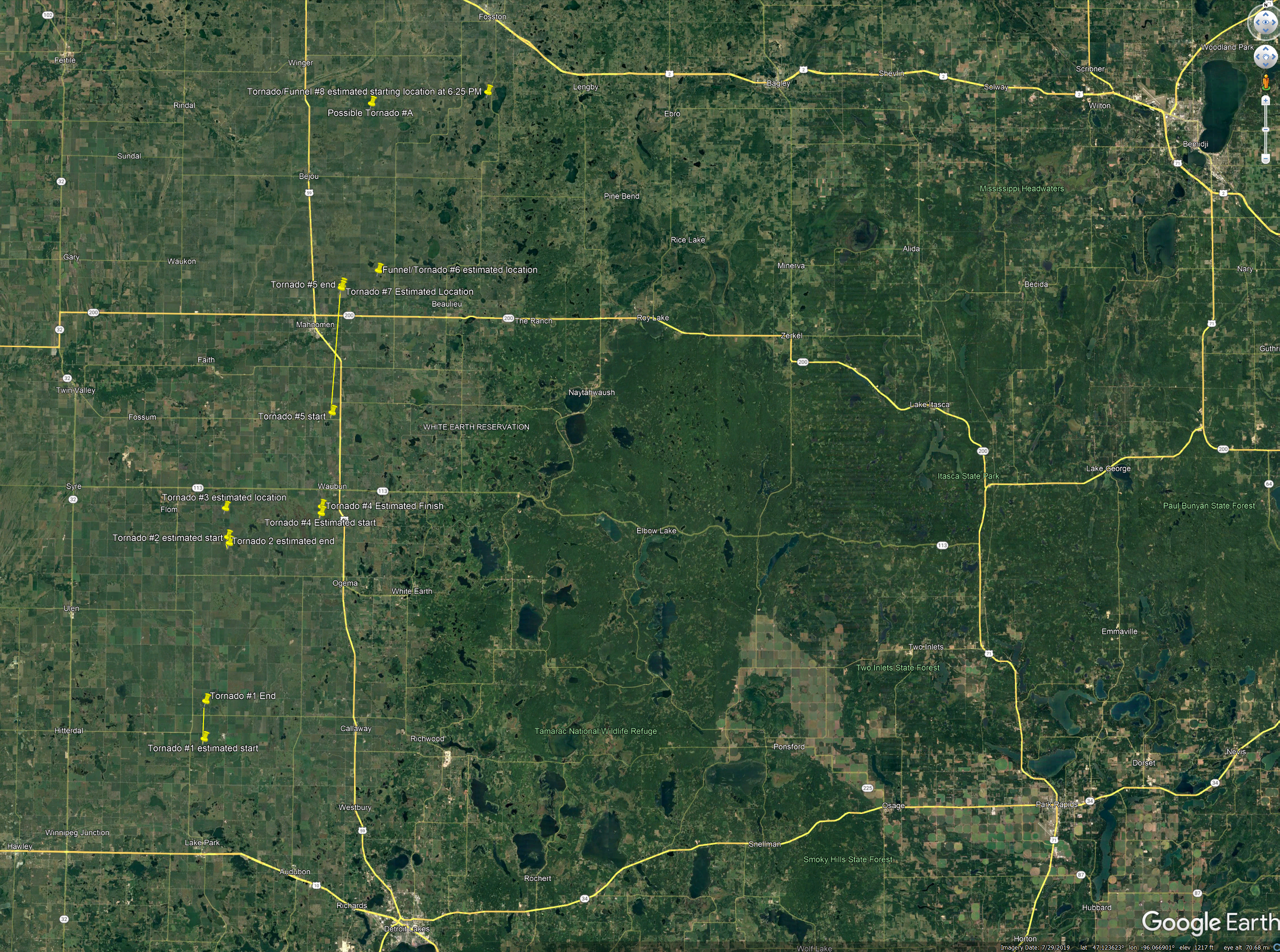
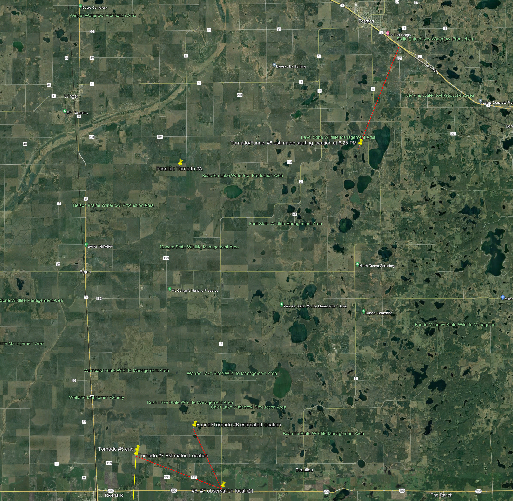
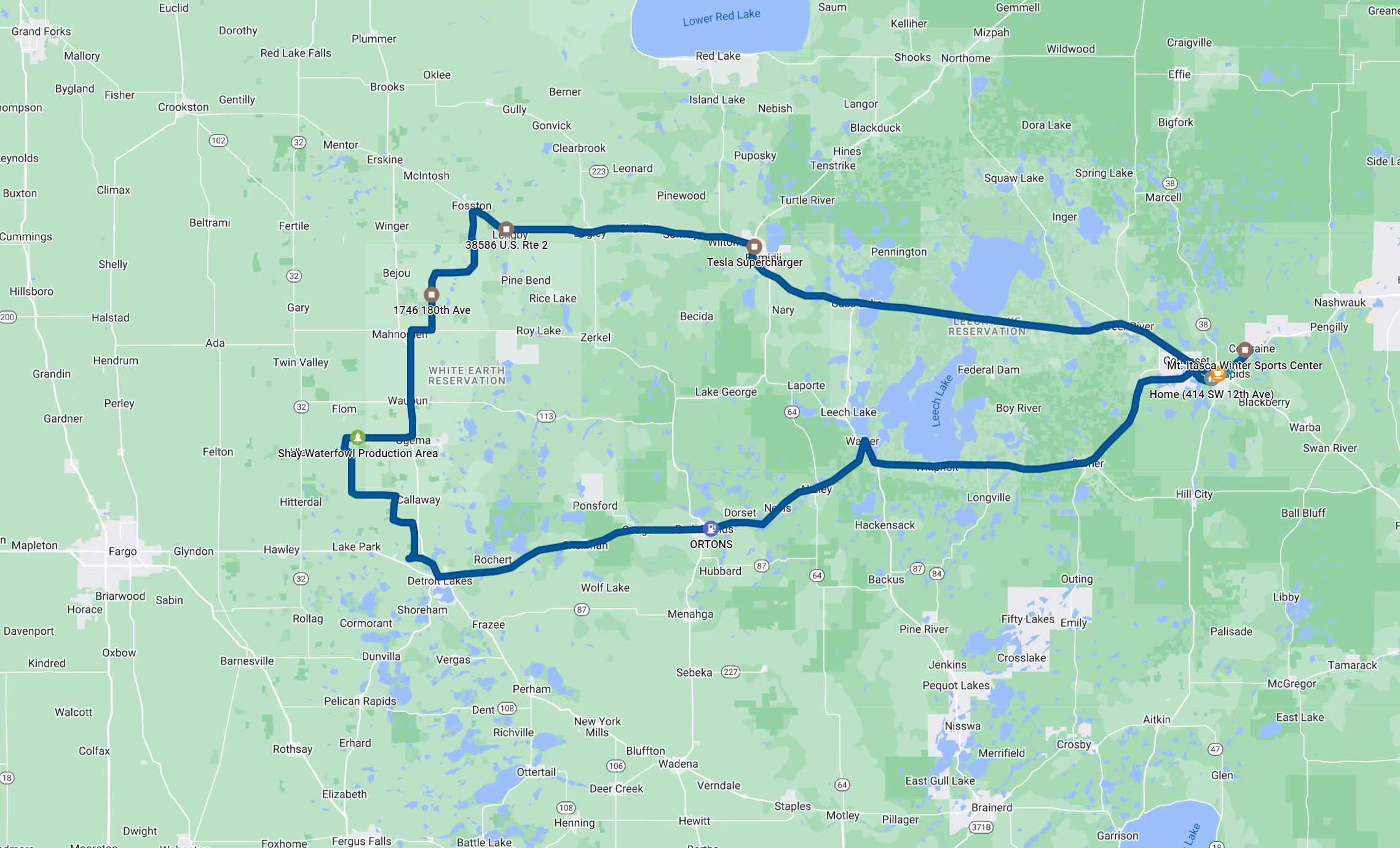
Below is a screen capture of Google Earth with the kmz file loaded, showing a summary of the tornado locations and their paths if I could determine them. Click on the map to expand it if you want to see more detail.
Tornado locations overview.
This was a most interesting chase. A seasonally strong 500mb trough was moving through, and it had brought abundant tornadoes for chasers in Wyoming and Nebraska a day earlier. Today, the trough was farther east, and it would give Minnesota some rainfall, but the supercell and tornado threat certainly looked stronger in Iowa. Deep layer shear was stronger there, and model forecast soundings showed enough low-level CAPE to produce tornadoes. The forecasts for this day had shown considerable doubt about severe weather in Minnesota, closer to the surface low, as previous model runs had shown little destabilization and a lot of clouds and rain during the day, and they also showed little wind shear. However, as the time approached, conditions looked better for a low-CAPE, low-topped event closer to the surface low. This secondary area of concern along the warm front, to the east of the low, was in central/northern Minnesota. In their 1630Z outlook, the Storm Prediction Center added a 5% tornado risk for this area. I had looked at the model forecast soundings the evening before, and the low-level shear was nice, but the 0-3 km CAPE wasn't spectacular. It looked the same the following morning, but then I thought about how many times I had pessimism about the forecast and didn't go, but then storms and tornadoes happened anyway. Since I had no other firm commitments that day, it was probably best that I chase.
SPC Day 1 categorical outlook issued at 1630 UTC (11:30 AM CDT).
SPC Day 1 tornado outlook issued at 1630 UTC (11:30 AM CDT) along with reported tornadoes.
The surface maps (shown below, at the time of the event) showed the low over southeastern North Dakota, and a warm front, separating air temperatures in the low-80s from mid-60s farther north, was just across central Minnesota from just south of Fargo (FAR) to just south of Moose Lake (MZH). One feature of the map that made things a little more interesting was that the dewpoint showed little change across the front, and the temperature-dewpoint spreads were rather low to the north of the front. Also, the winds were nicely backed and reasonably strong, something that I noticed when I was driving west toward the target area.
Surface map at 3:58 PM as the event was underway. Mahnomen, MN is station 3N8 with temperature/dewpoint of 73/67 and east-southeast winds.
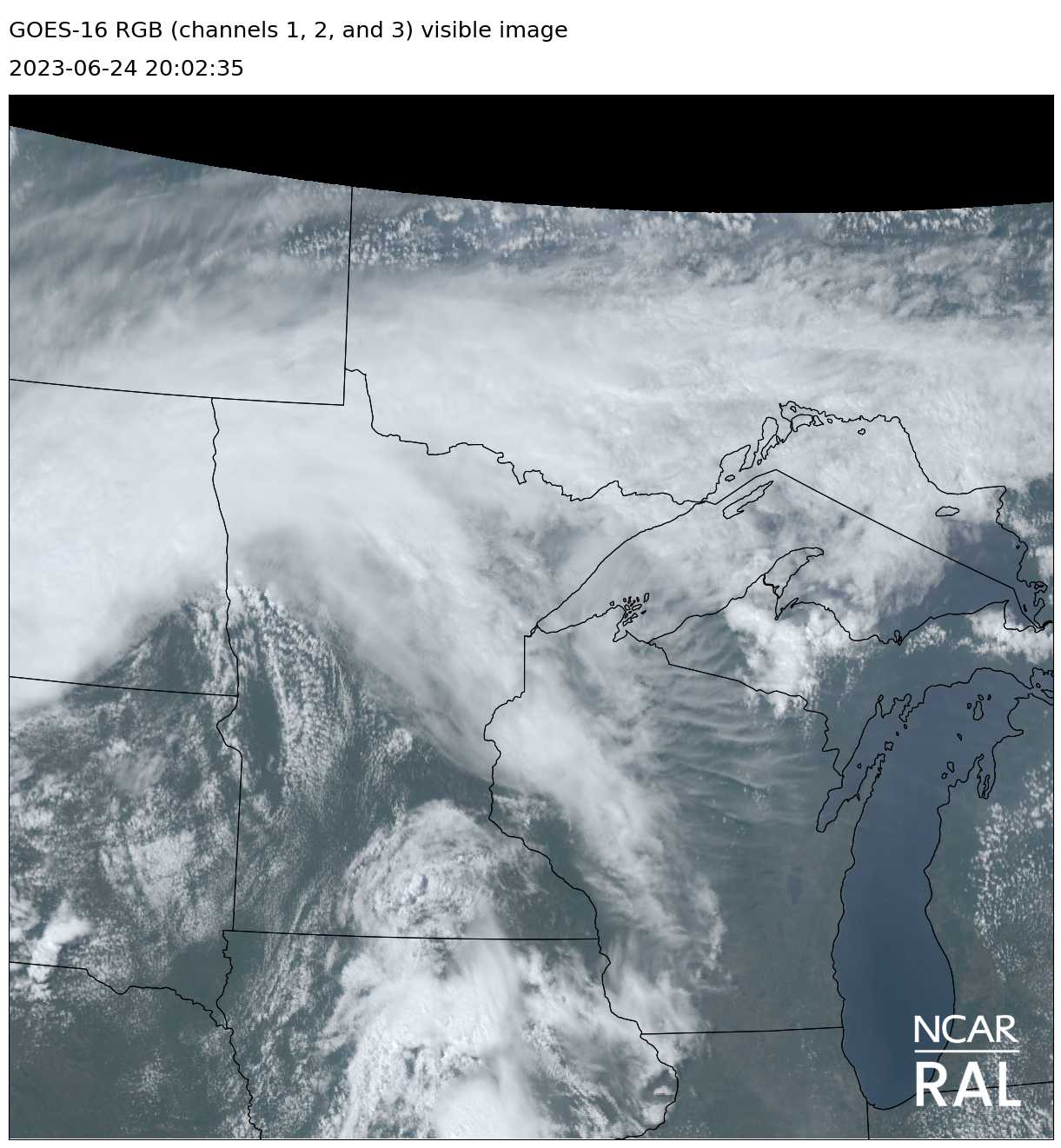
Visible satellite picture. A cumulus field was developing by 3:00 PM. The low-topped storm by Detroit Lakes had already developed.
After looking at model runs and surface observations, I decided that Detroit Lakes would be a good starting point. I procrastinated making the decision to chase and didn't give myself much spare time to get there, leaving just after noon. If storms developed early as they were expected to do, I'd probably have mature storms by the time I got to Detroit Lakes and might miss some of the action, but my delayed timing turned out to be really good. When I arrived in Detroit Lakes, storms had already developed in the Fargo area, much closer to the low, and there was a new, small cell just west of Detroit Lakes. A third small cell had developed about halfway between the two near Felton. I decided to check out the new cell closest to me. As soon as I turned north on U.S. 59 from Highway 34, the cell intensified, and maximum reflectivity jumped to 60 dBz. I had a storm worth chasing.
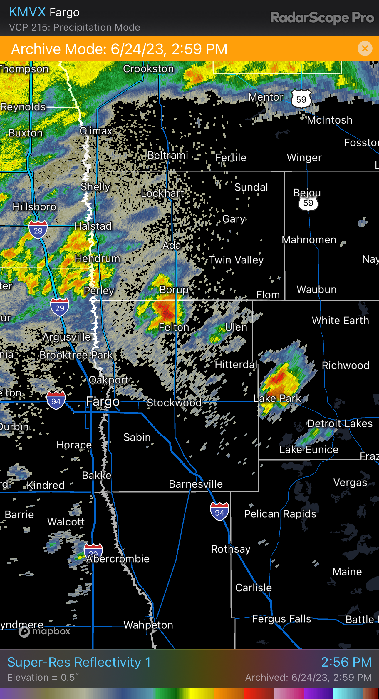
Radar showing new storms as I arrived in Detroit Lakes.
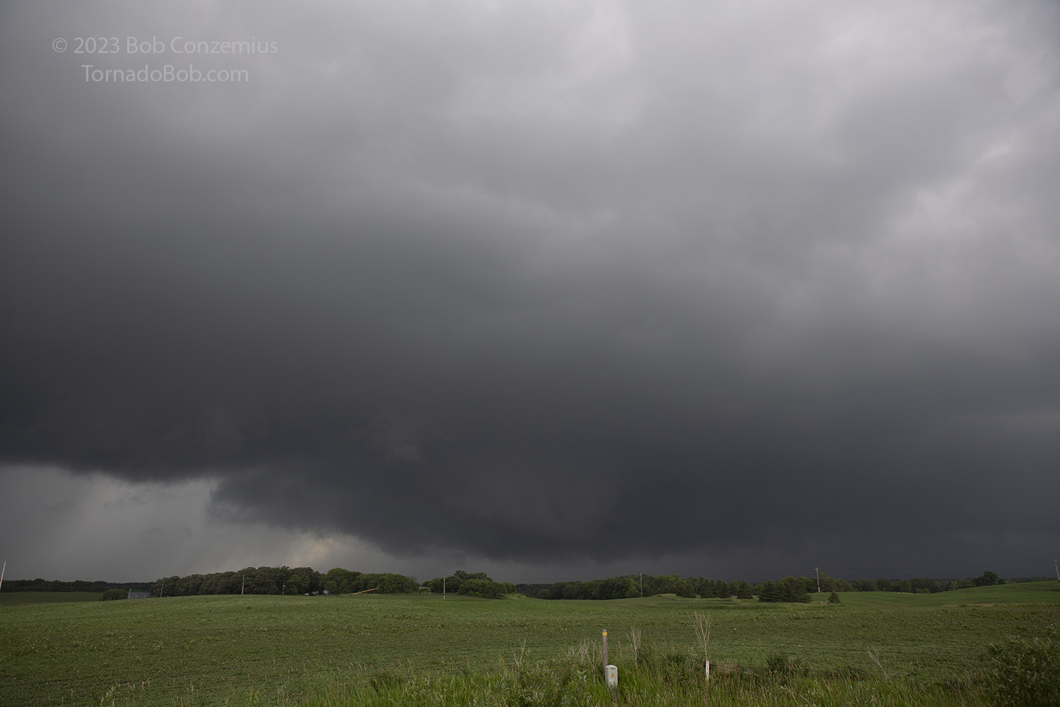
I went a few miles north and then west on county roads to get closer to the updraft base. There were some notches in the base and some small lowerings. My winds were from the east, and the air was humid. Cloud bases were a little higher than they had been on my drive from Grand Rapids, but they were still fairly low, and all the clouds were cumuloform. I stopped on a hilltop so I could assess motion. The low-level shear was intense enough to cause even a small lowering to spin, because it wasn't tough to see that a small lowering on the back side of the updraft base was rotating. It looked, perhaps, a bit too rearward in the base to have to have a high chance of producing a tornado, but I decided I had better get closer to check it out.
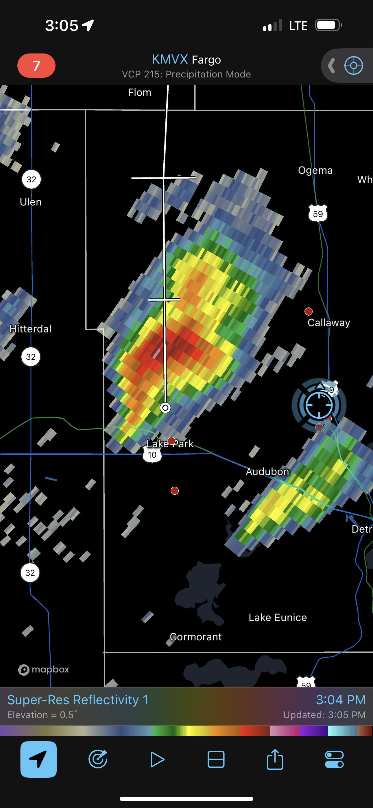
Radar image of the storm shortly before it produced its first tornado.
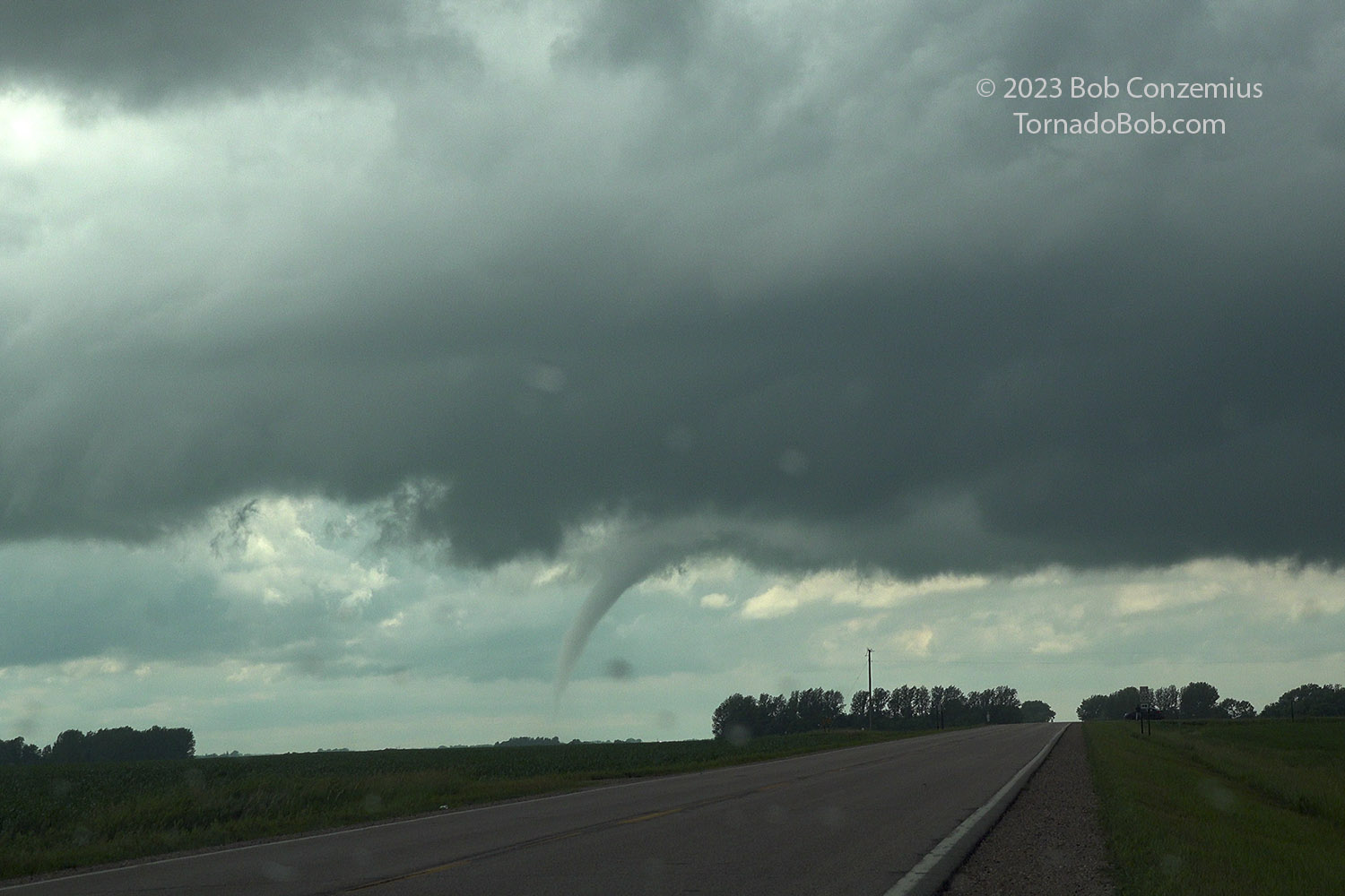
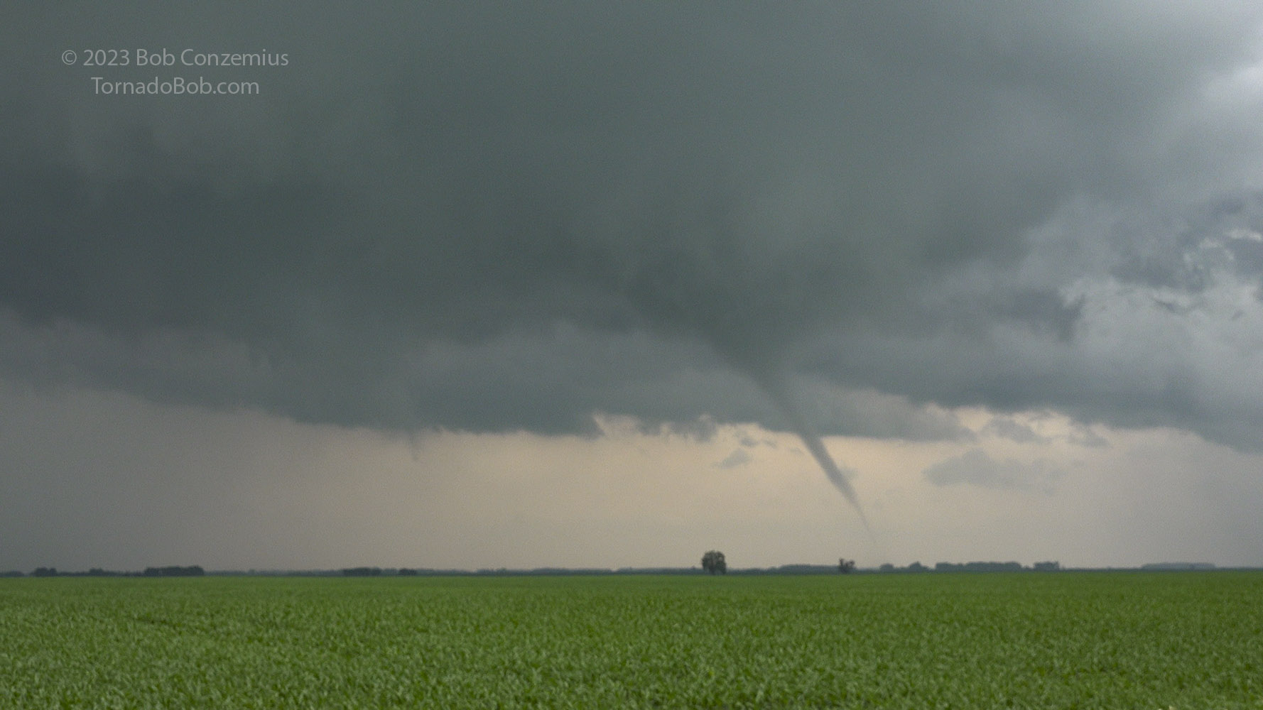
I zig-zagged north and west on county roads-- a little slowly on some because the gravel roads were soft after rain overnight. Once I found a paved road and headed west, it wasn't long before the first tornado of the day developed from that lowering.
Tornado #1
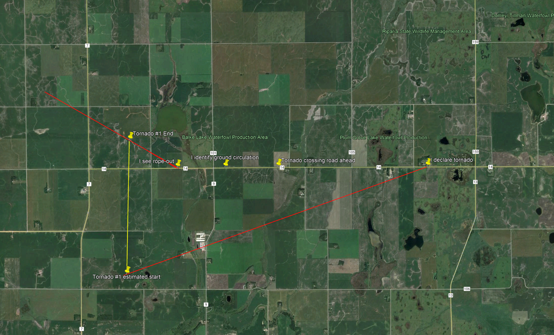
Tornado #1 Map. Tornado #1 was in progress from 3:18 to 3:26 PM.
Radar loop showing storm evolution during the first tornadoes.
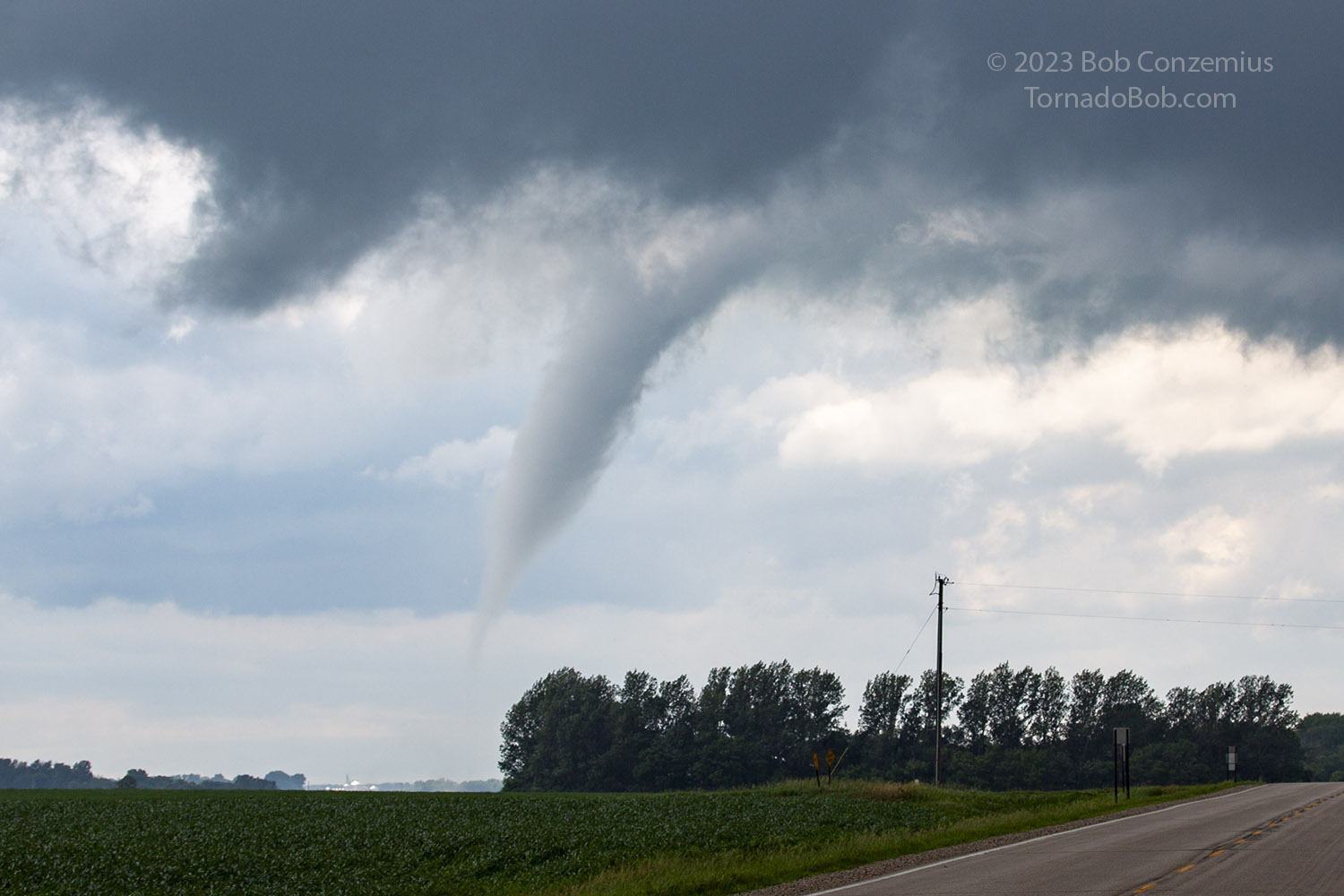
I took some cell phone shots, some stills with the DSLR, and kept my video camera rolling. Condensation intermittently reached ground level, but the tornado, otherwise, appeared to not be very strong. I drove west as it crossed the road ahead then roped out to the north. I was able to see the ground circulation in the field nearby during rope-out, and the video shows ground circulation right as the funnel was crossing the road ahead.
Tornado #1 development: cell phone capture.
Tornado #1 development: video capture 1.
Tornado #1 cell phone capture 2.
Tornado #1 video capture.
Tornado #1 shot with the DSLR.
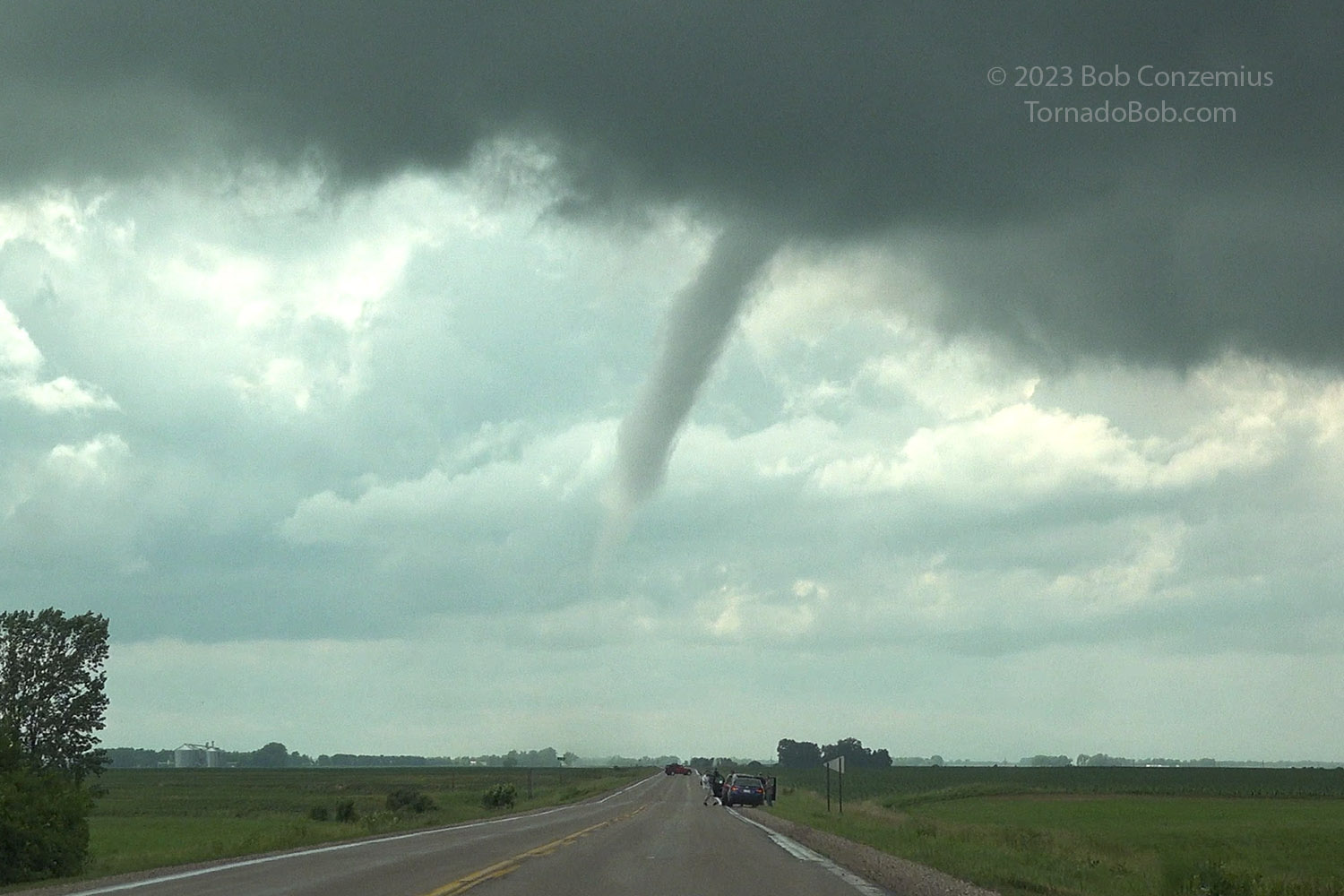
Tornado #1 video capture. It is about to cross the road. Debris cloud is barely visible to the left of the road.
Tornado #1 video capture. Debris cloud is in the field below, just to the right of the bottom of the condensation funnel.
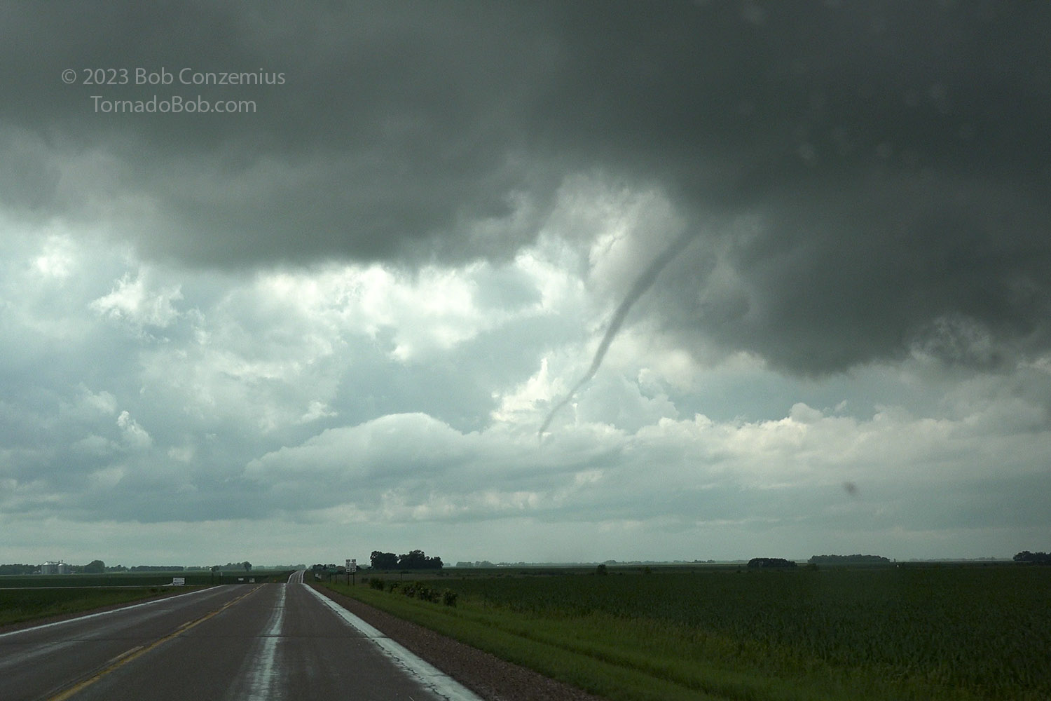
Tornado #1 video capture during the rope-out process. The debris swirl was visible in the field below the funnel.
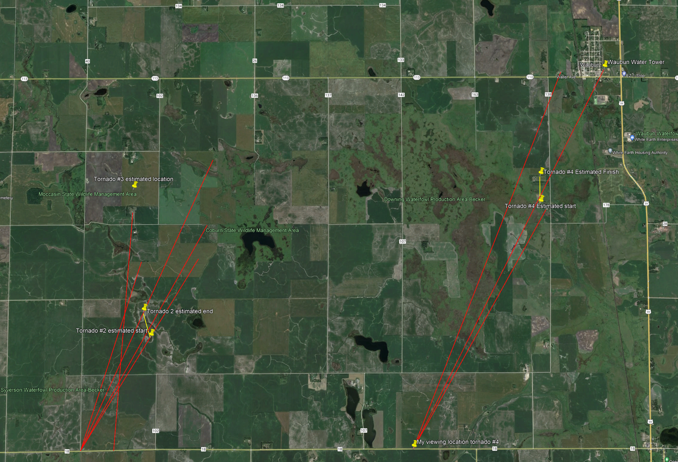
Tornadoes 2, 3, 4
Map for tornadoes #2, 3, 4. Tornado 2 was from 3:50-3:52, Tornado 3 was 3:56 to 3:57, and Tornado 4 was 4:03 to 4:05.
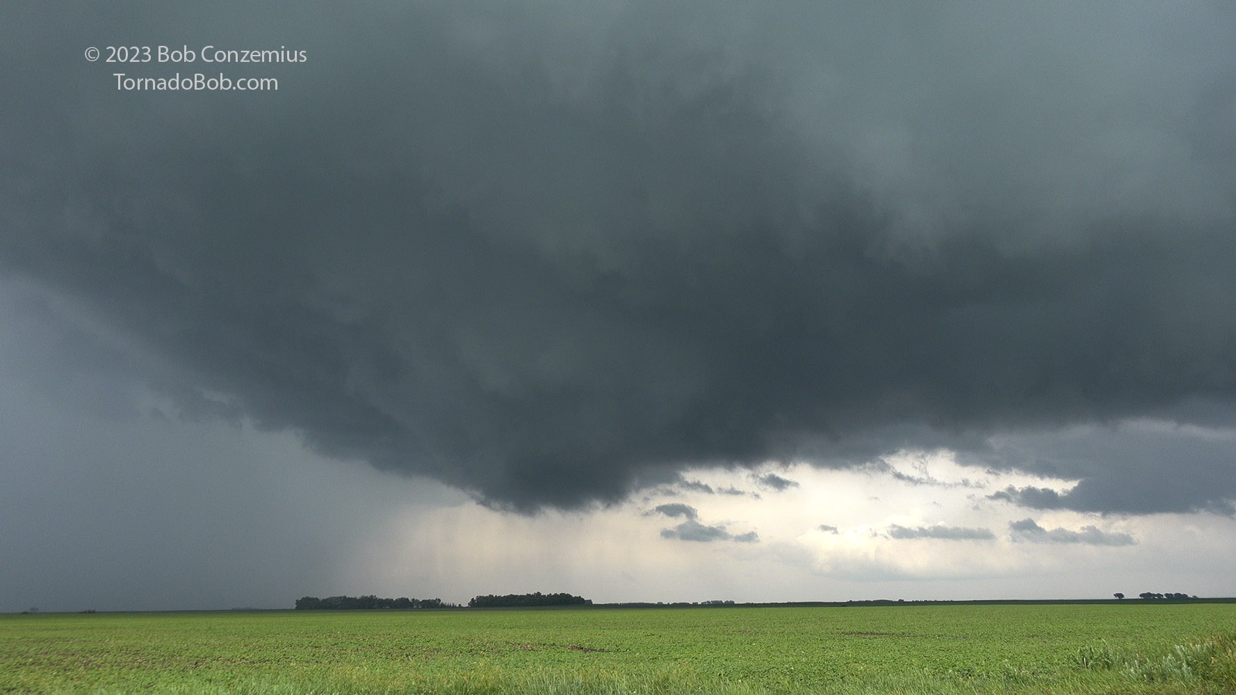
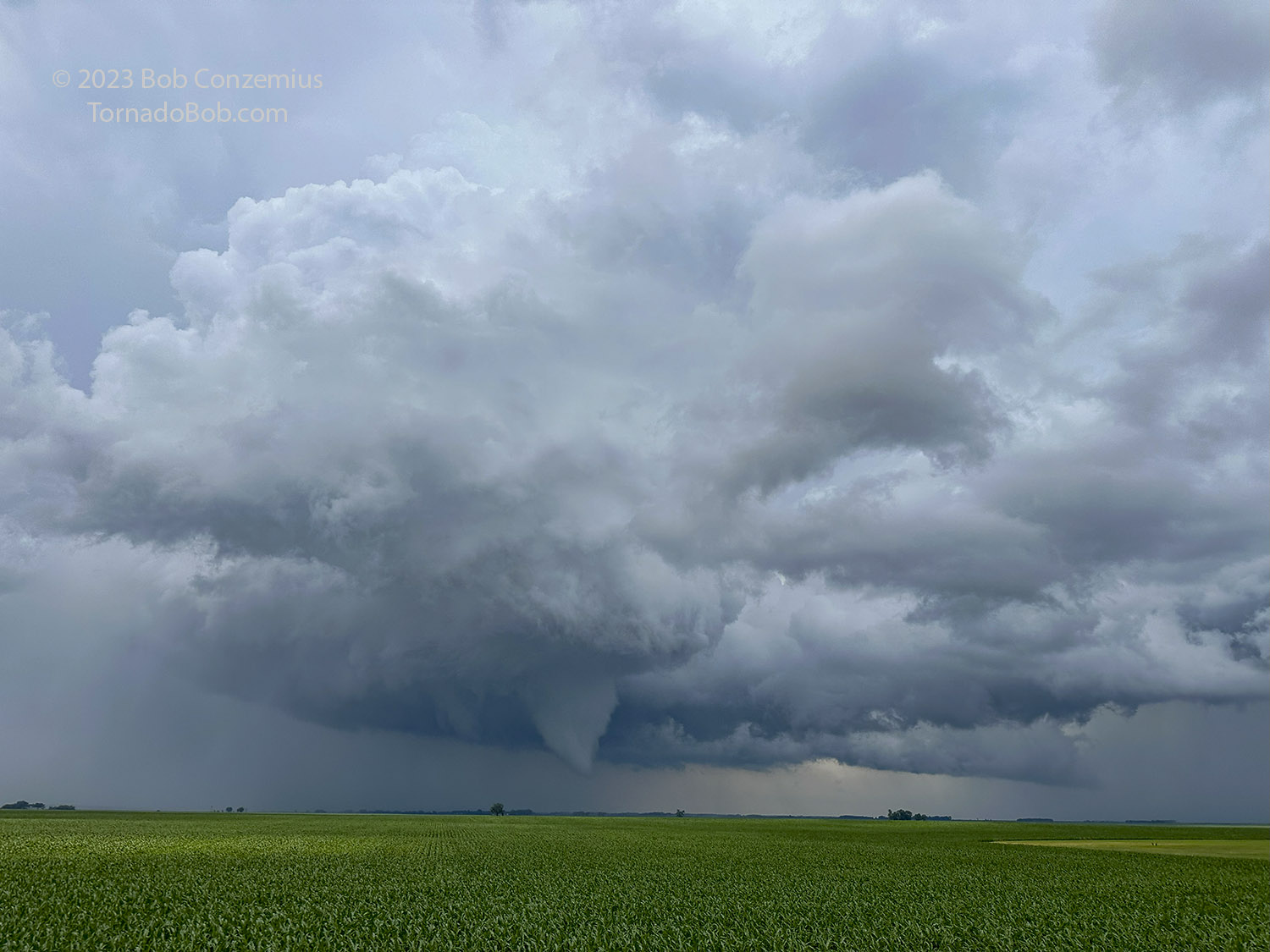
After the first tornado roped out, I was right next to the southwestern flank of a northward-moving storm. I took the next paved road north and opted to be on the western flank of the storm and risk visibility problems from rain (it was presently clear around the updraft base) rather than going back to U.S. 59, where visibility would definitely be restricted by distance. Right away, a new rotating wall cloud developed, and I followed along, keeping it just to my east. I stopped for a few minutes to take some time lapse video and get a few stills.
Rotating wall cloud after Tornado #1 and before Tornado #2.
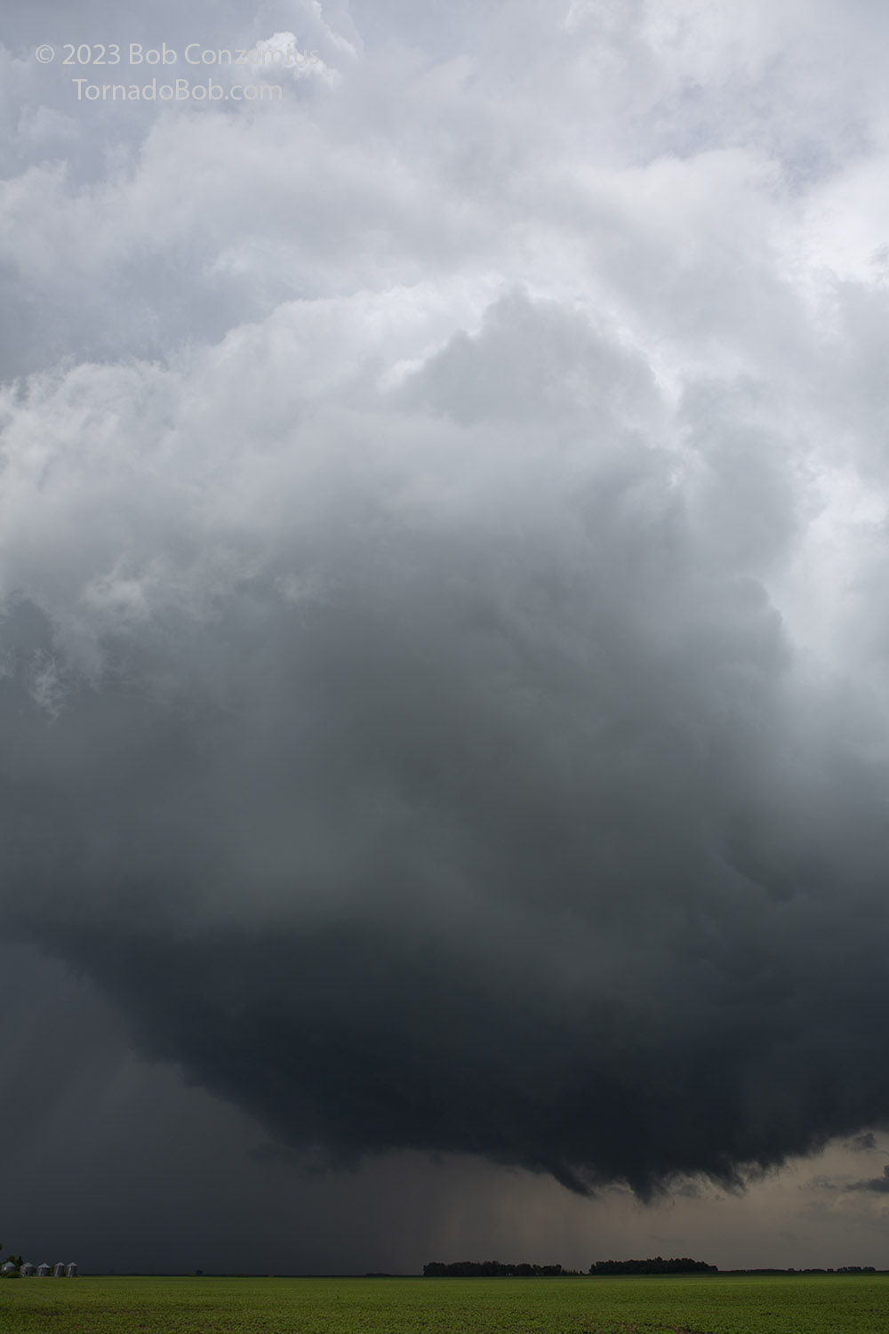
These look like funnels at the base of the wall cloud.
There was a new cell just to the east, and this cell was intensifying, so to keep both in play, I took the next east option and drove, with caution, underneath the mesocyclone. There was now some rain filling in on the west side of the mesocyclone, but visibility was good enough that I would be able to see anything threatening and avoid it if it developed nearby. It was definitely not a fully opaque core. I came out of the rain right under the action area and stopped to watch it drift to my north. Within a few minutes, the second tornado developed.
Tornado #2. I messed up the video camera focus, but the debris swirl was visible at ground.
This tornado seemed to come from a somewhat more complex area of rotation because there appeared to be a second, weaker funnel to its east. Both were embedded somewhat in the same circulation. With time, this tornado turned into more of a broad funnel or maybe just a conical wall cloud. I decided to move east then north to keep up with the storm and had gotten about a half mile down the road when the third tornado developed.
Tornado #2 more of a funnel at this point. Tornado #3 is about to emerge, rotating around from behind #2.
Tornado #3 is emerging as I take a picture with the DSLR.
Tornado #3 in its fully developed phase. Shot taken with cell phone.
Tornado #3 did not last long. I took several still photos, but then it dissipated before I could get my video camera focused on it. The action was, nonetheless, continuing. I looked to the newer storm to my east, and it had a rotating wall cloud that appeared ready to produce a tornado. I also didn't think the first storm would remain strong very long because the newer storm was creeping up on it, stealing inflow. I got several miles east this time before the new storm put down its first tornado.
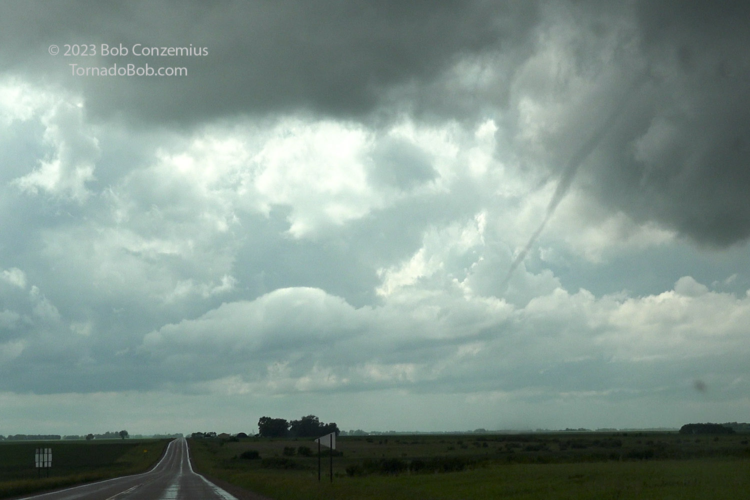
Tornado #4.
Tornado #4 initially didn't appear to last very long (maybe 30 seconds to a minute), but then it reappeared, so I estimated it was in progress for two or three minutes. Once that tornado dissipated, I had only one more mile to drive to Ogema, where I could go north on Highway 59.
Tornado #5 (Mahnomen Tornado)
Tornado #5 map. The tornado lasted from 4:17 to 4:42 (end is 4:47 if #7 was actually the rope-out of #5).
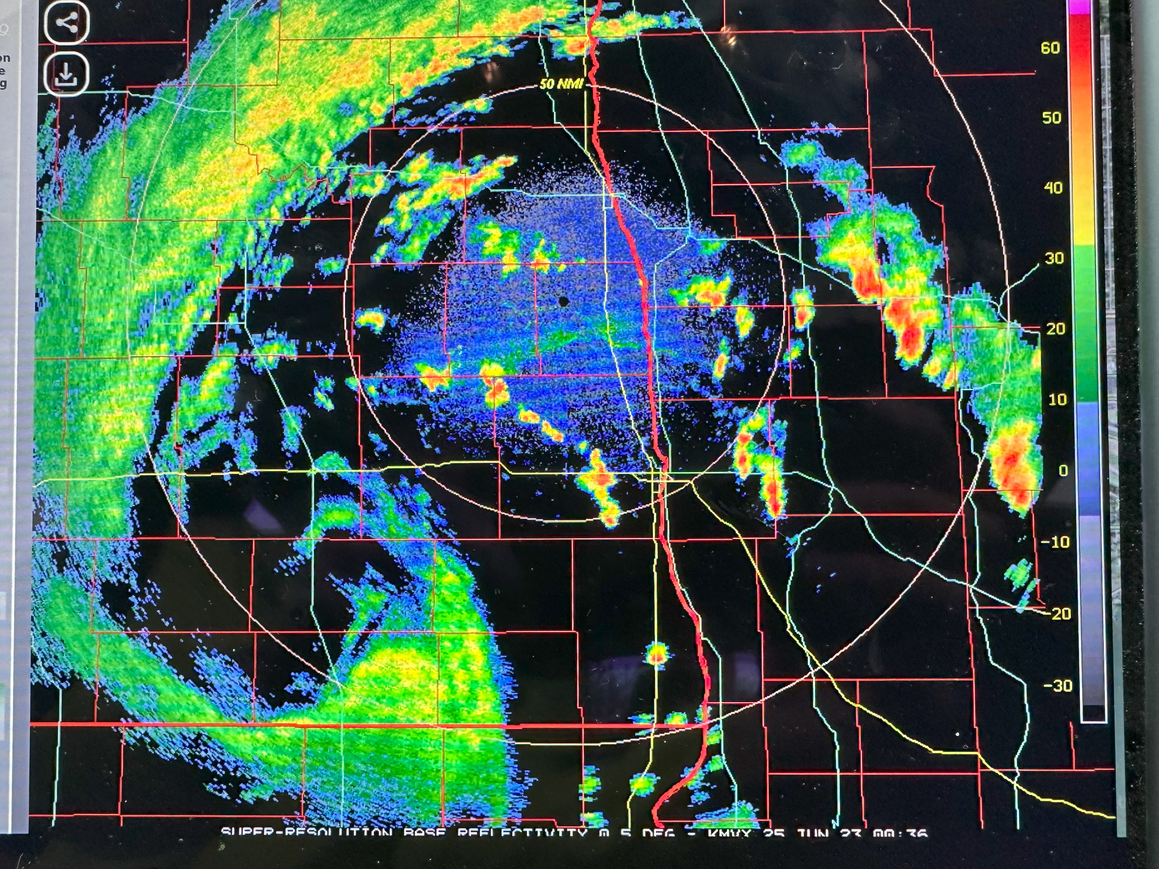
Radar loop showing the storm evolution during Tornado #5.
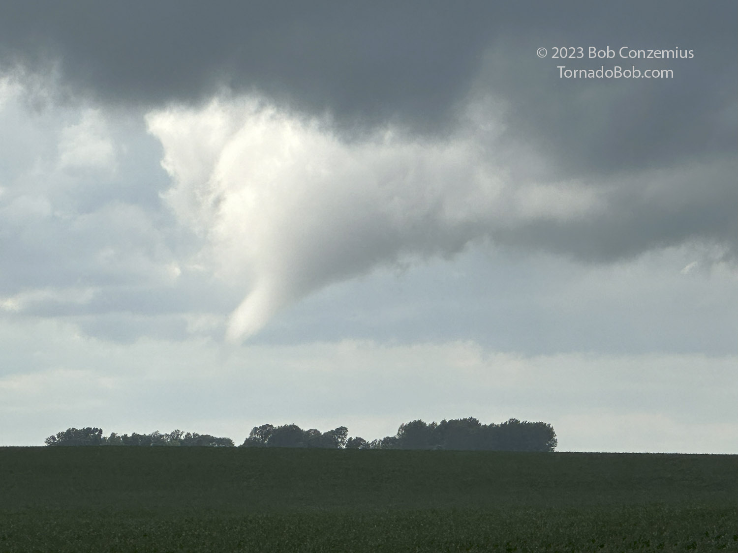
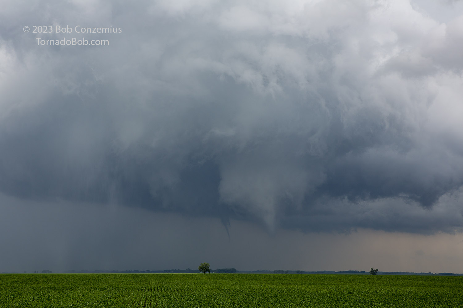
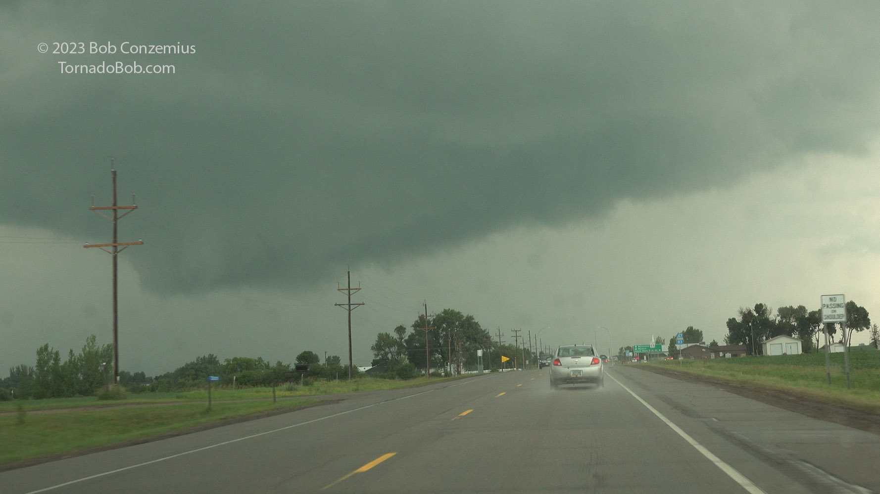
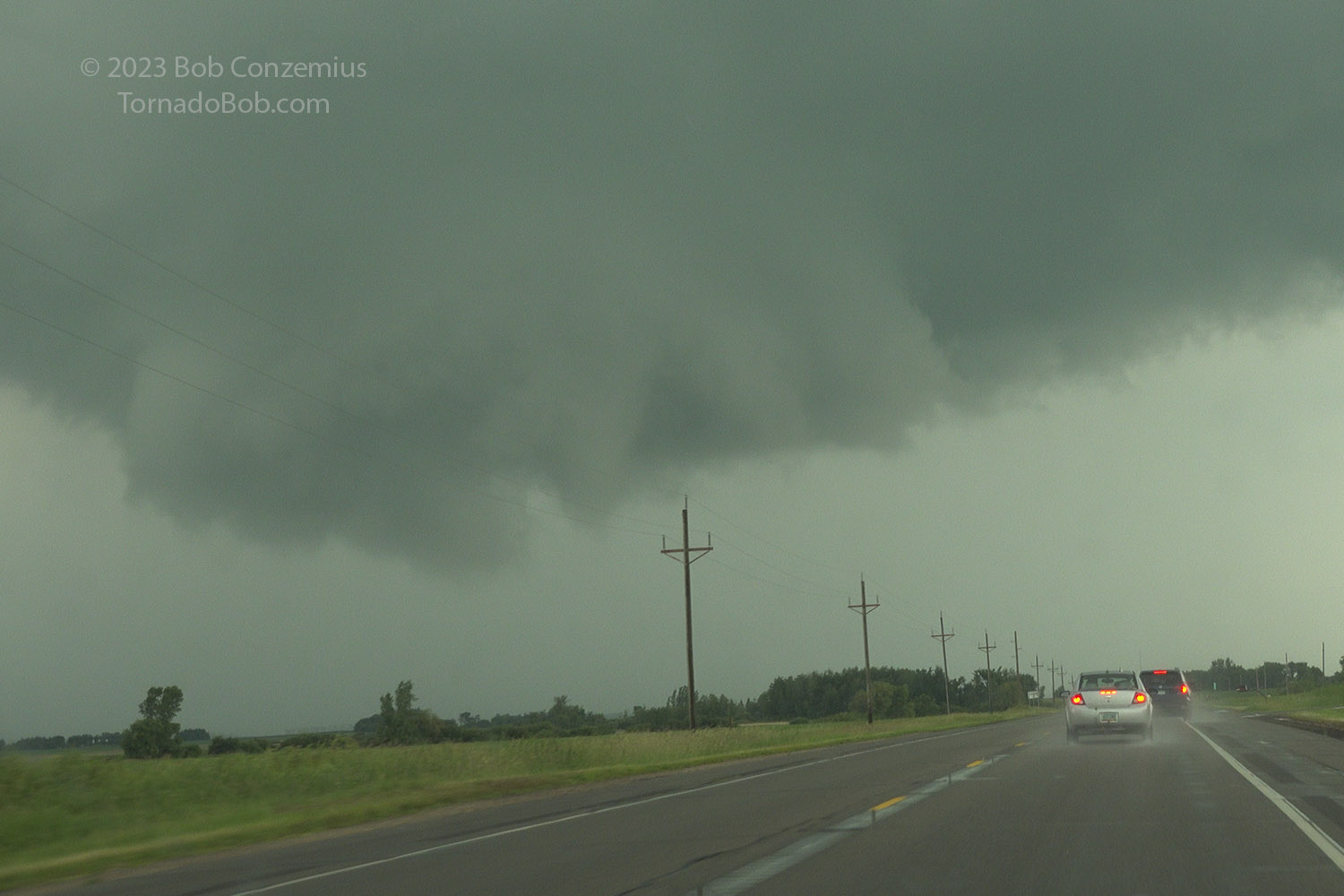
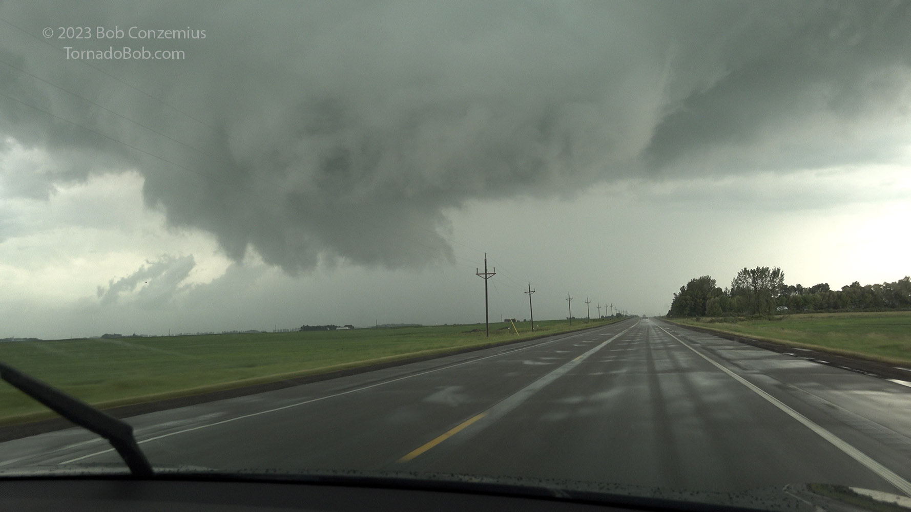
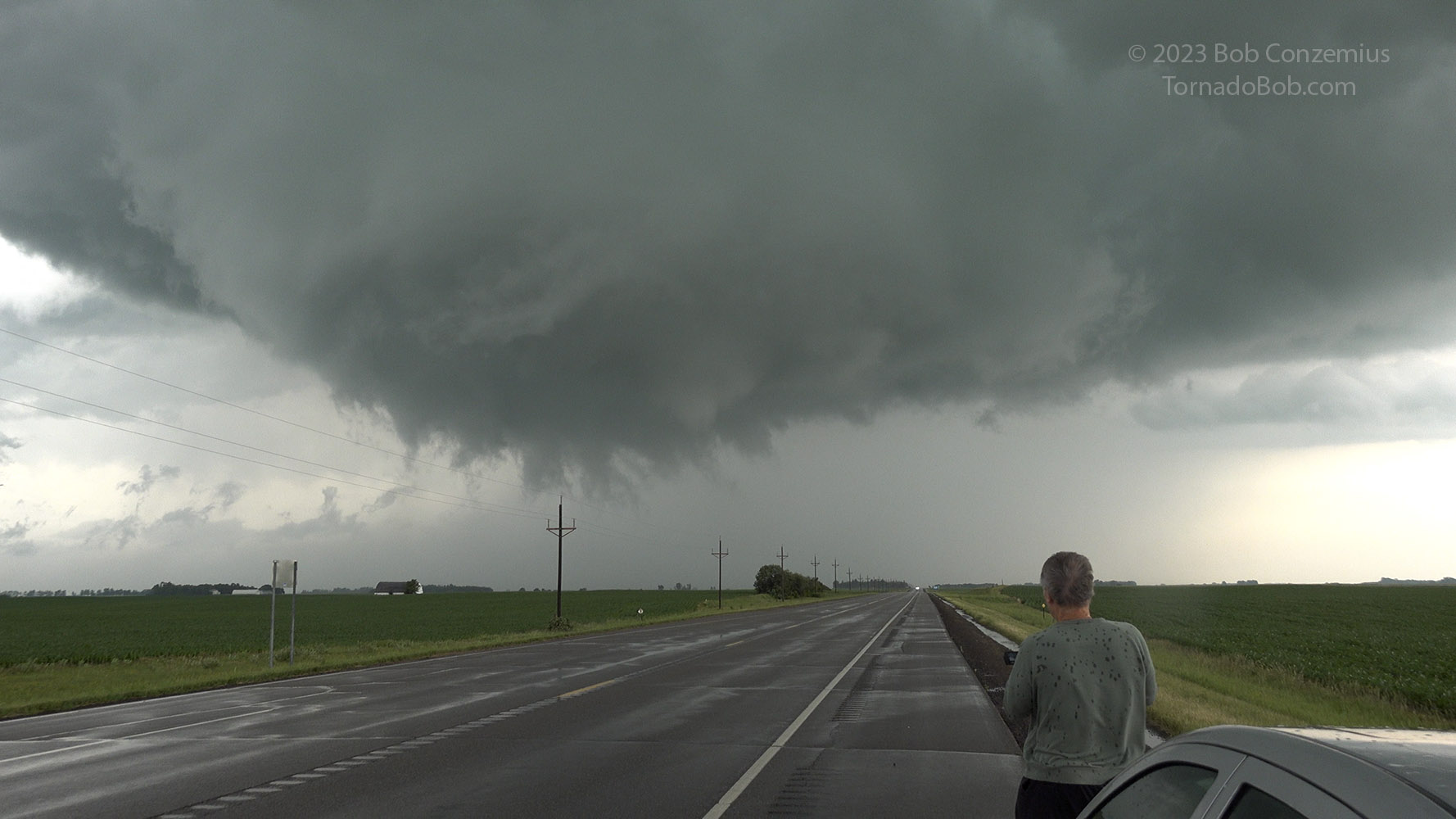
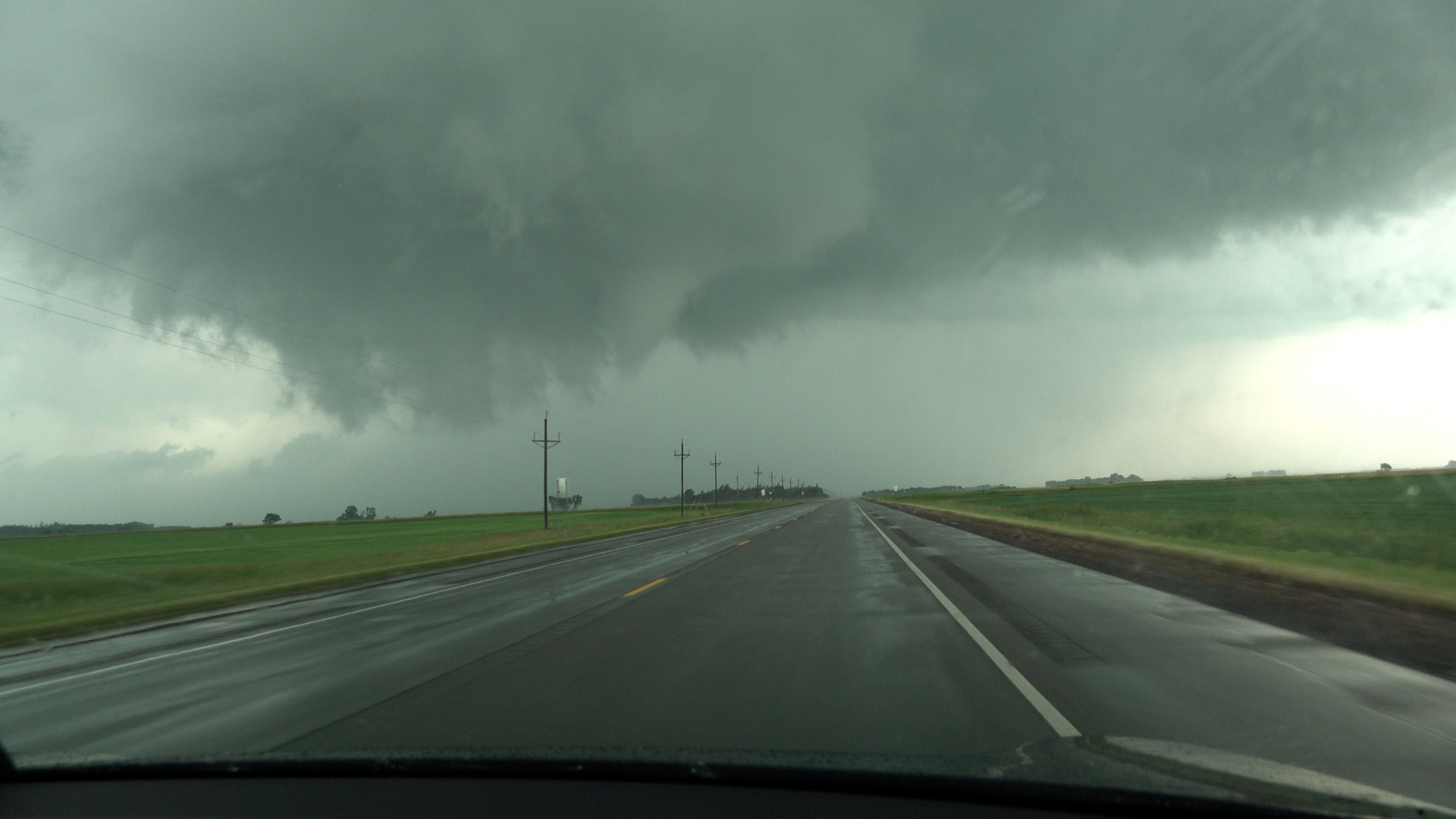
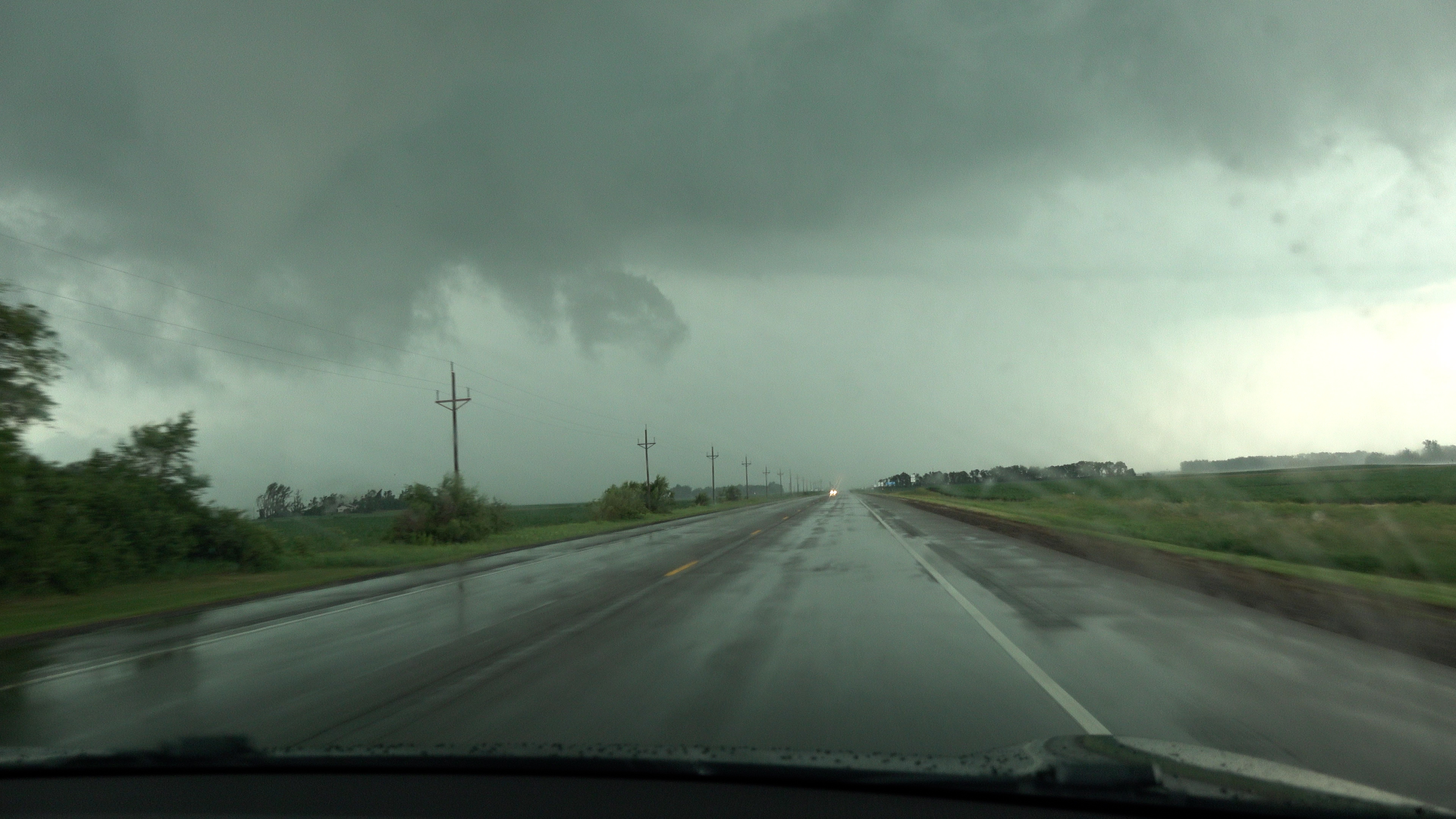
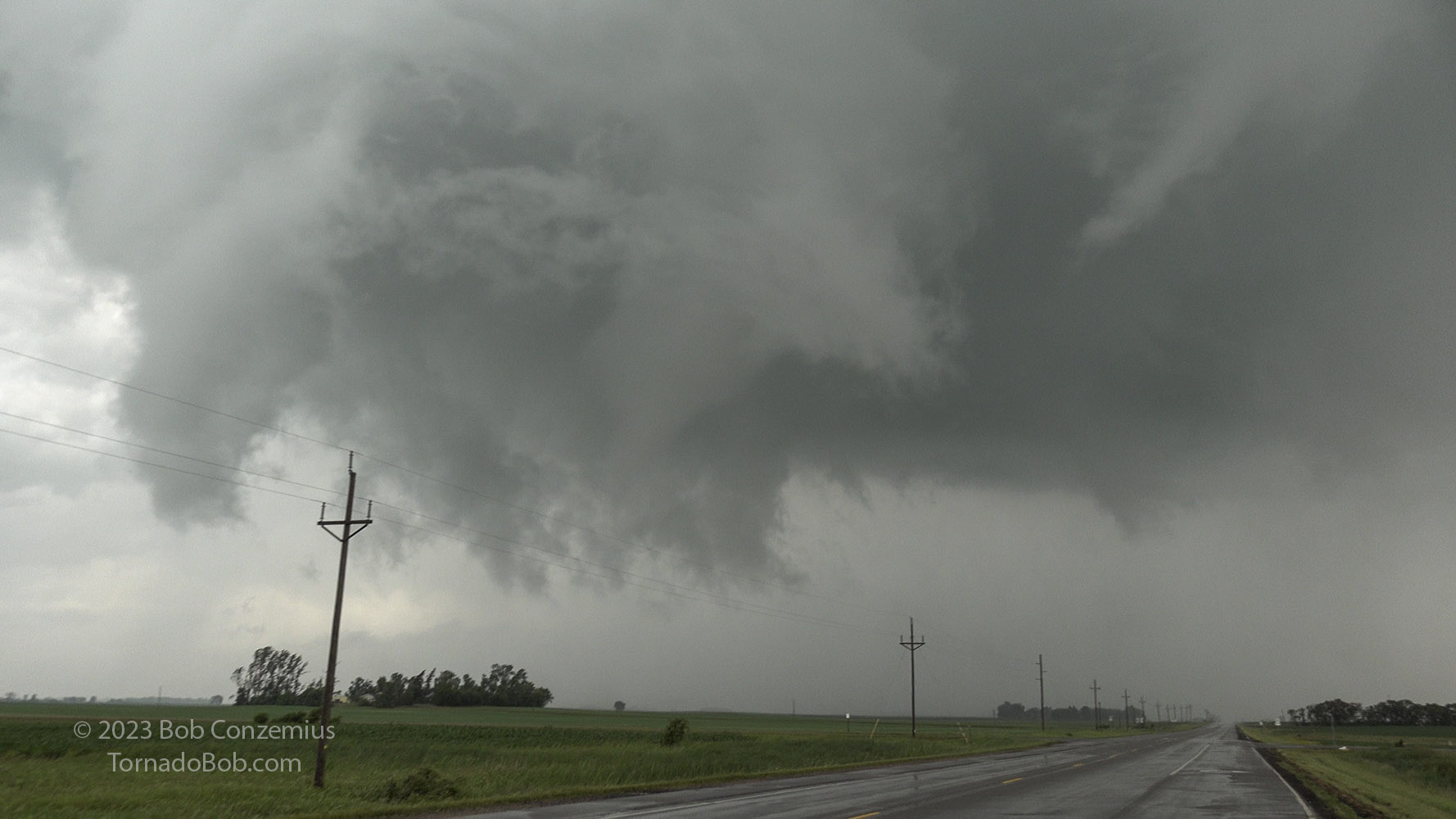
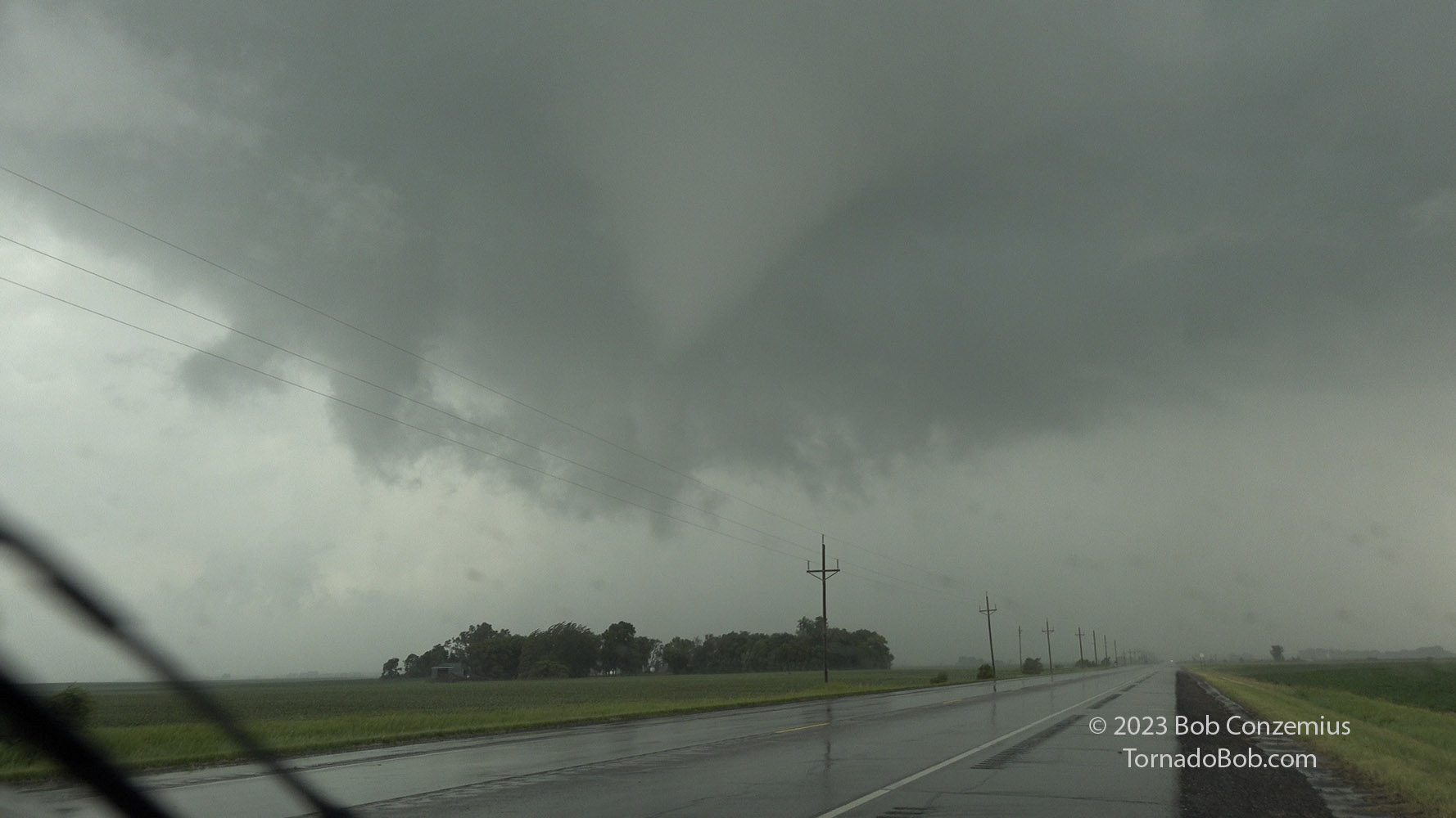
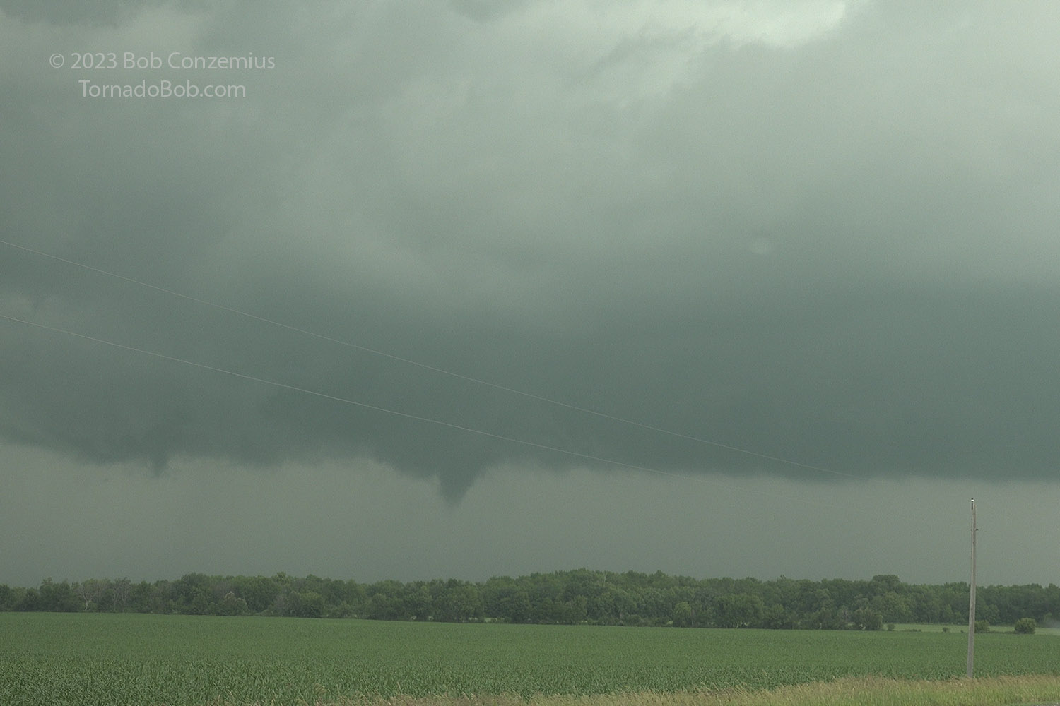
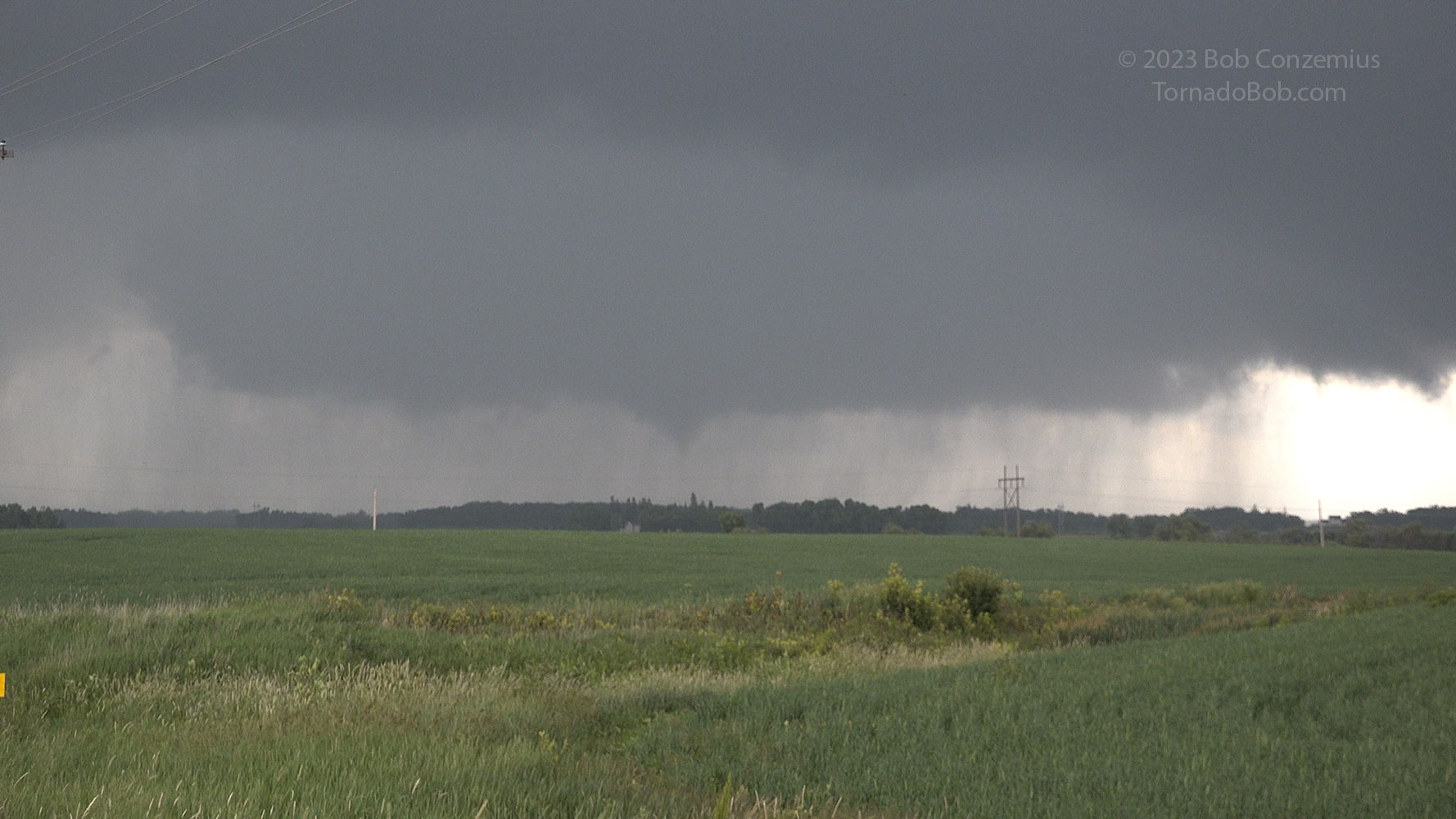
Wall cloud immediately prior to Tornado #5 as I'm driving north through Waubun.
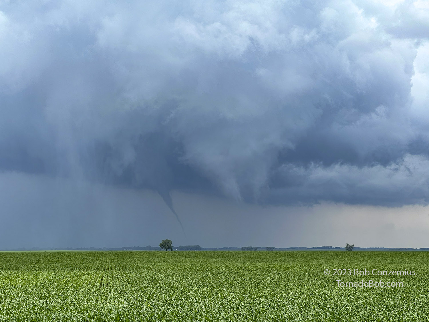
A somewhat broad wall cloud developed (essentially a continuation of the first mesocyclone on the storm). This wall cloud was rotating, and the rotation increased as I came through Waubun. I started taking video. A couple miles north of Waubun, I saw the first ground circulation as at least one funnel developed underneath the wall cloud. A couple funnels would appear on the right side and rotate around, and eventually, one persistent funnel developed right in the center. The due northward motion kept it quite close to U.S. 59, so we had an up-close view the whole way. Unfortunately, it started running through farm yards (and in fact, the first ground circulation on video is at the edge of a farm yard as the ground circulation was exiting the yard), and it was doing some damage. The first clear damage was a few downed trees and a garage knocked over. At the next farmstead, there were just some tree branches. I did not see any structural damage as the center of circulation may have passed just to the west of the farmstead. In a third, small trees were flattened, and a trampoline-like object was flying around, landing then flying back the other way inside the circulation. This tornado seemed determined to hit anything it could.
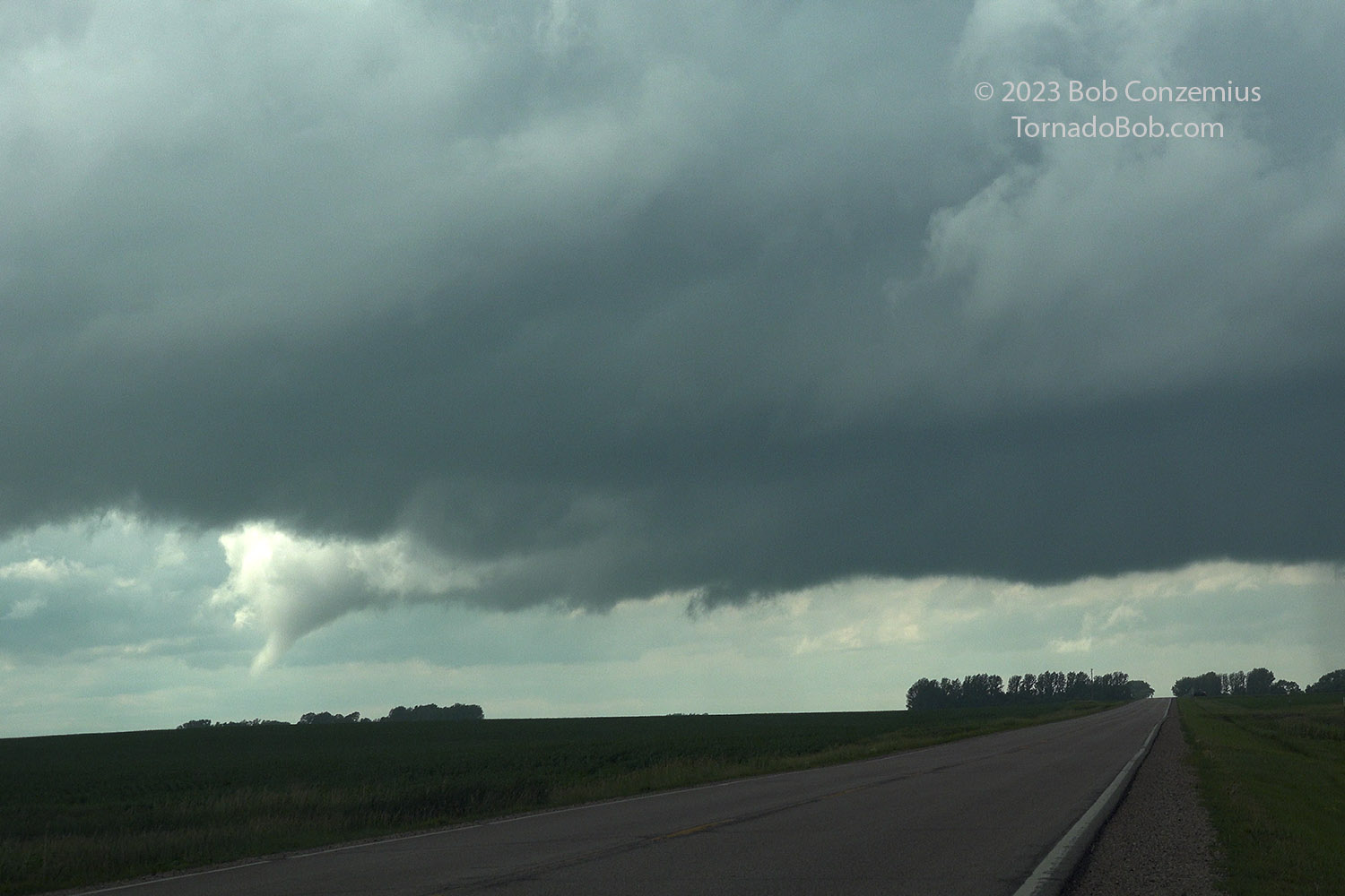
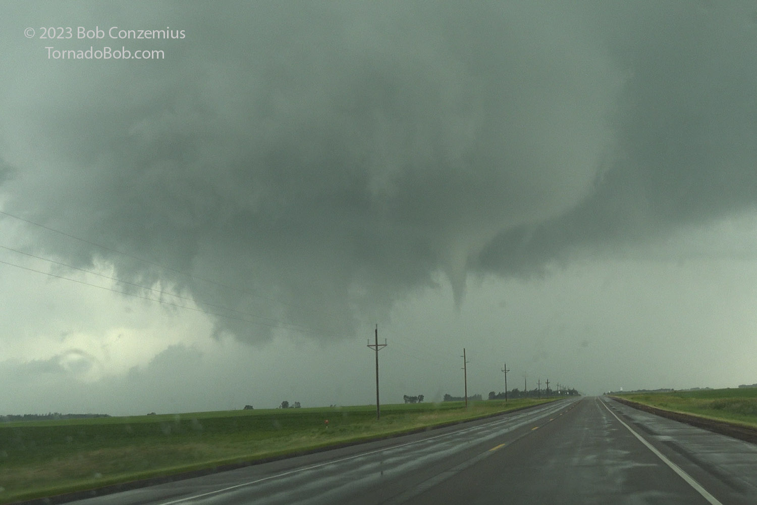
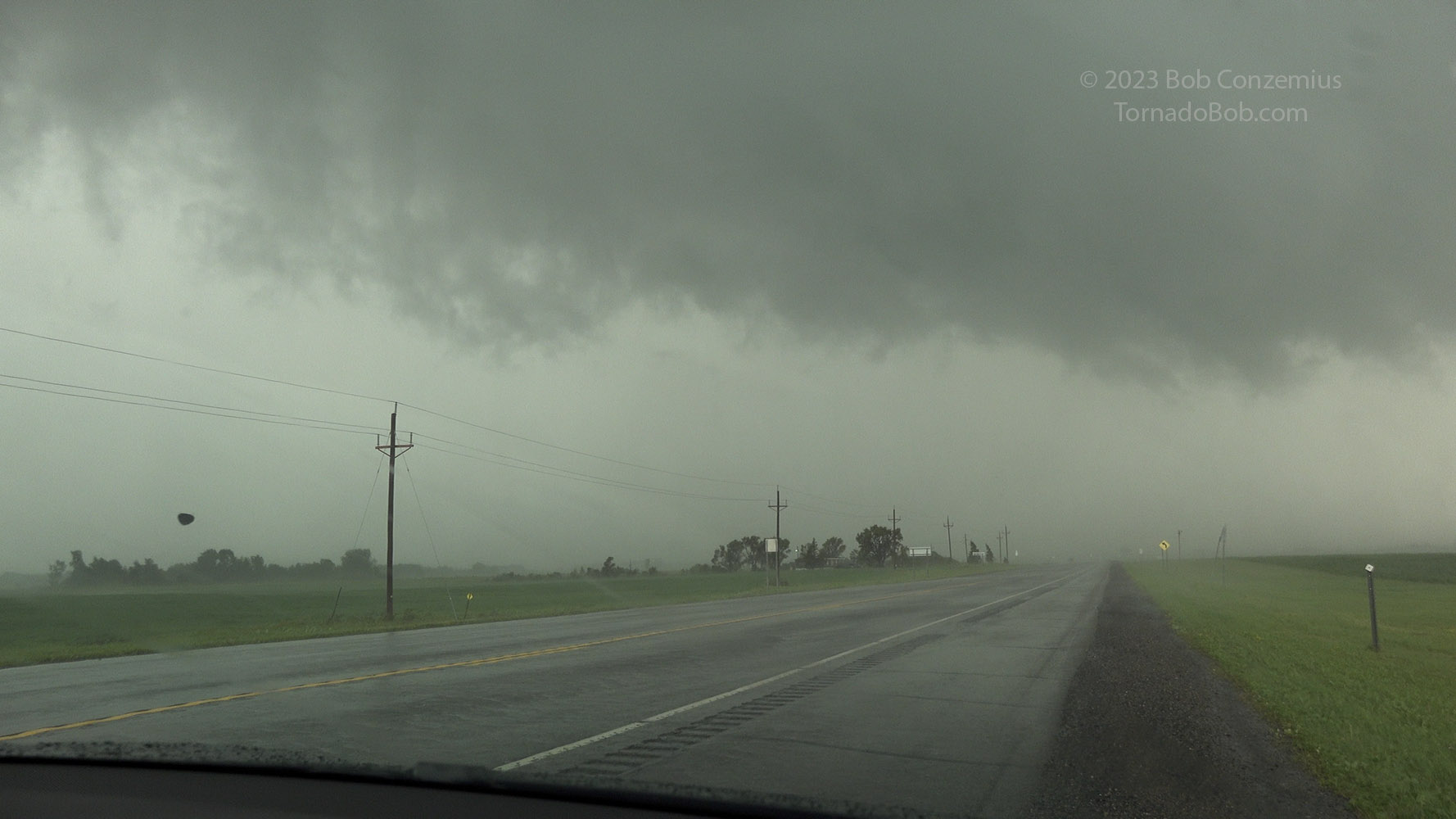
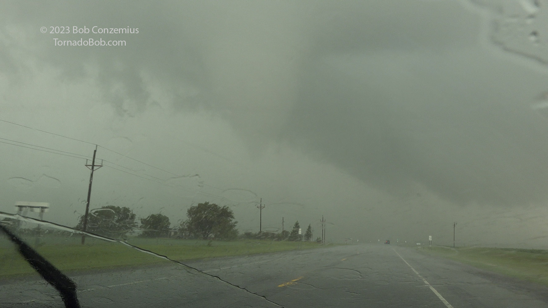
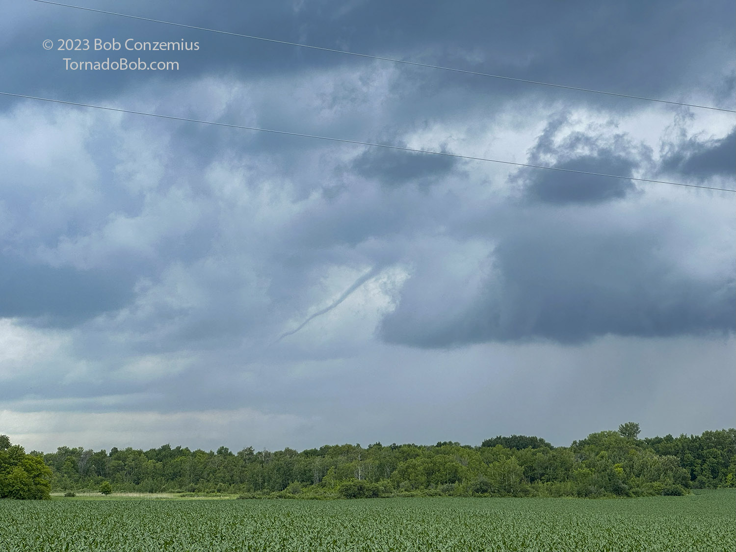
Tornado #5 funnel first develops.
Tornado #5 looks like a rapidly rotating wall cloud at this point. The wall cloud probably obscures the funnel at the center.
Tornado #5 begins to show a funnel at the center of circulation.
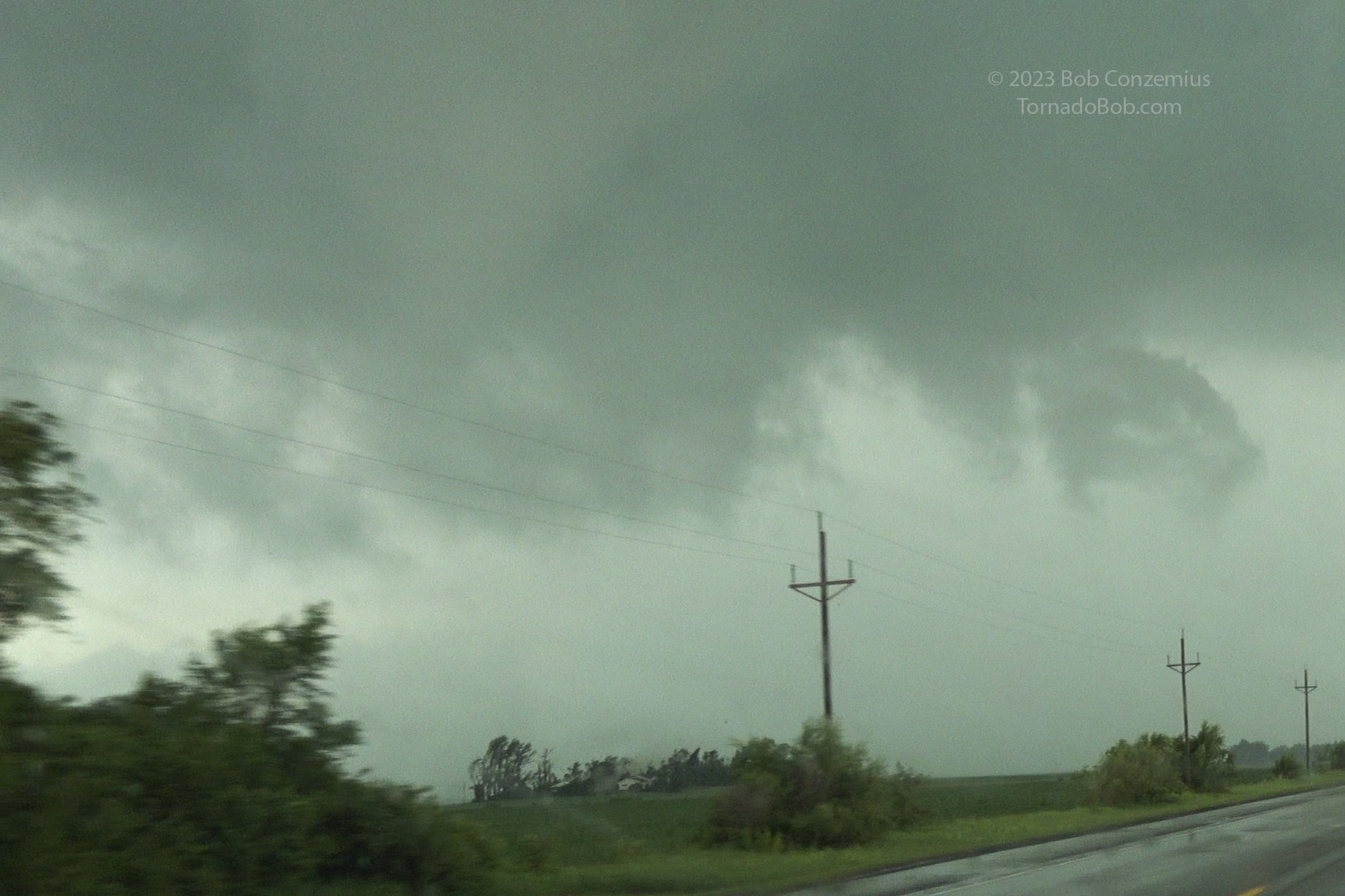
Tornado #5: a funnel on the right side of the circulation. It's about to go into the farmstead immediately below it in the picture.
Tornado #5 about to damage a farmstead. The left edge of the grove is directly below the funnel, and the right edge is behind the next telephone pole.
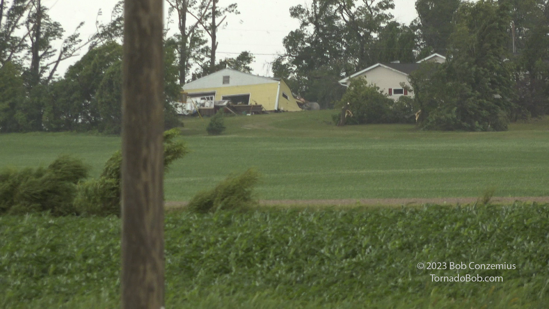
Tornado #5 hitting a farmstead.
Tornado #5 zoomed in a bit more to reveal damaging winds happening in farm yard.
Tornado #5 damage at a farm.
Tornado #5 moving on after damaging a farm yard. A distinct funnel is at the center, and the wall cloud collar is rotating quickly around it.
Tornado #5 gets close to another farm, but this farm appears to suffer only some minor tree damage.
Tornado #5 (flying trampoline or something).
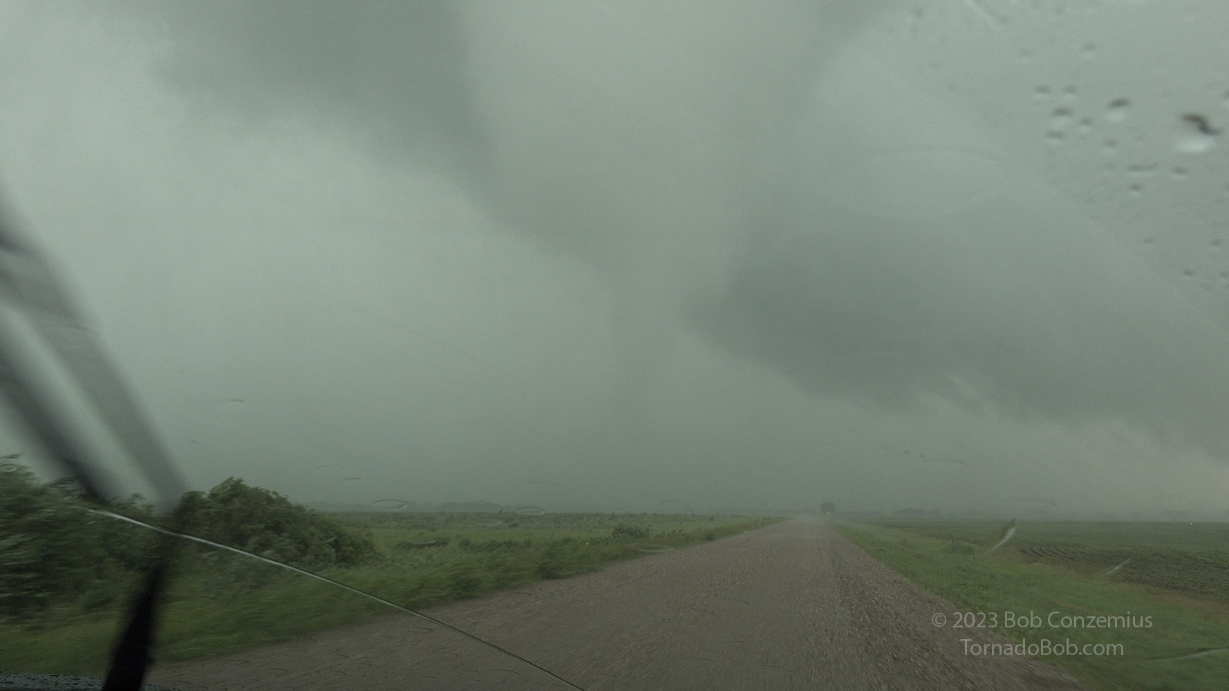
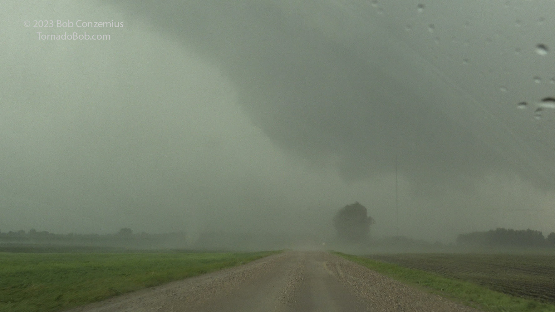
From there, the tornado got closer to U.S. 59, and U.S. 59 curved to the left. Ahead of me was a gravel road, so I continued north on that road. Rain bands were now wrapping around a little more, so I felt I needed to creep a bit closer to get good visibility. The tornado began to cross the road directly in front of me, and occasional wisps of condensation appeared at ground level as suction vortices spun around the main circulation. A got hit with another rain band and decided to keep moving in. I then had a much stronger gust of wind and realized I was probably in an inflow jet. I had gotten a bit closer than I realized. Definitely time to stop!
Tornado #5 moving off Highway 59.
Tornado #5 ahead, about to cross County Road 125/25.
Tornado #5. Suction vortex on the left.
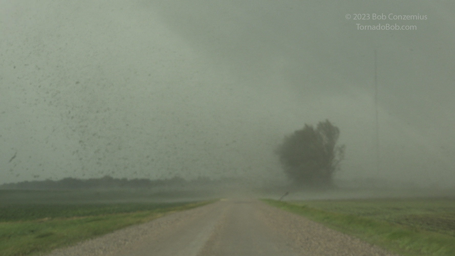
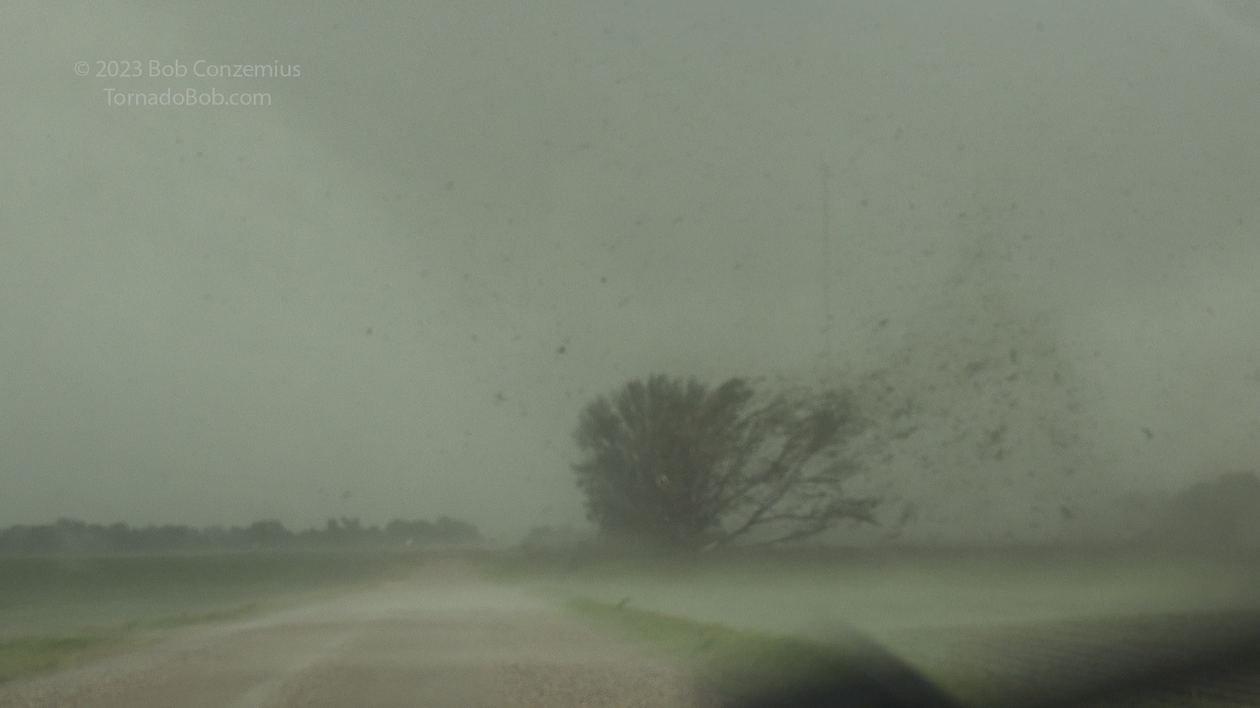
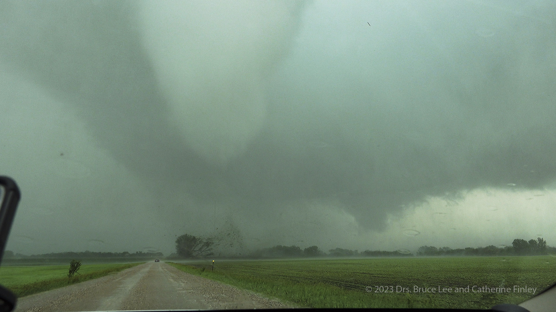
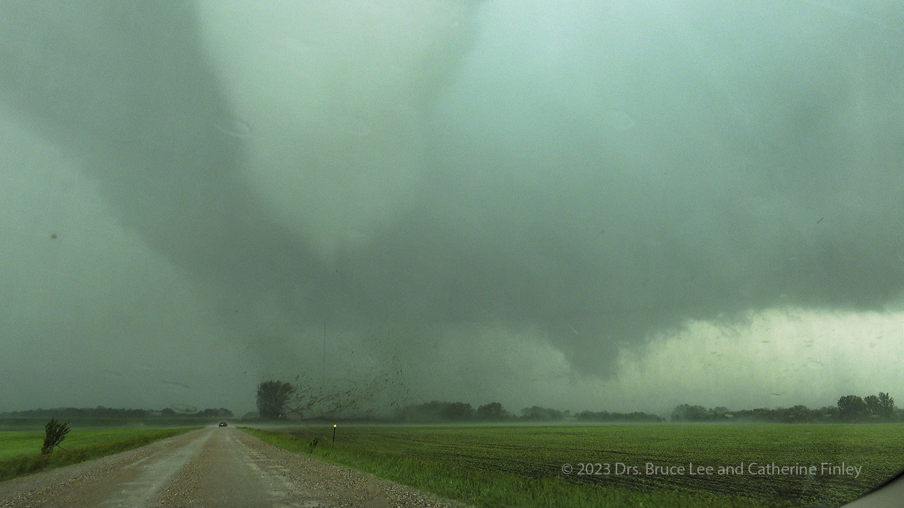
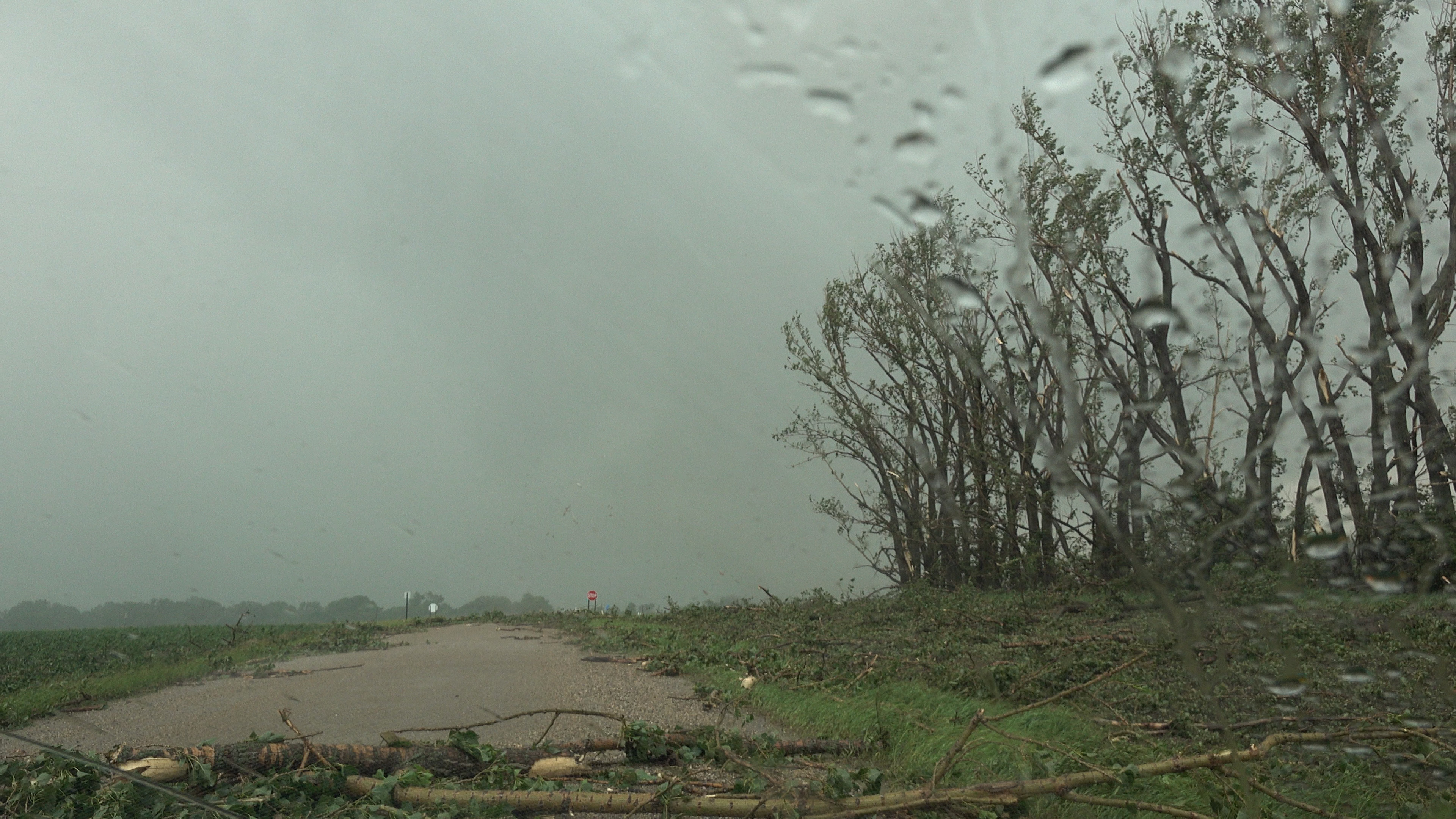
I slowly crept ahead as a row of cottonwood trees started to get shredded right in front of me. It looks like the circulation passed right through this row of trees because the debris exploded westward from the trees initially, then the shredding happened eastward with the southern side of the circulation knocking down whole trees or at least major limbs. The tornado then moved into the space between two rows of trees and proceeded into the next row of trees, shredding those trees as well.
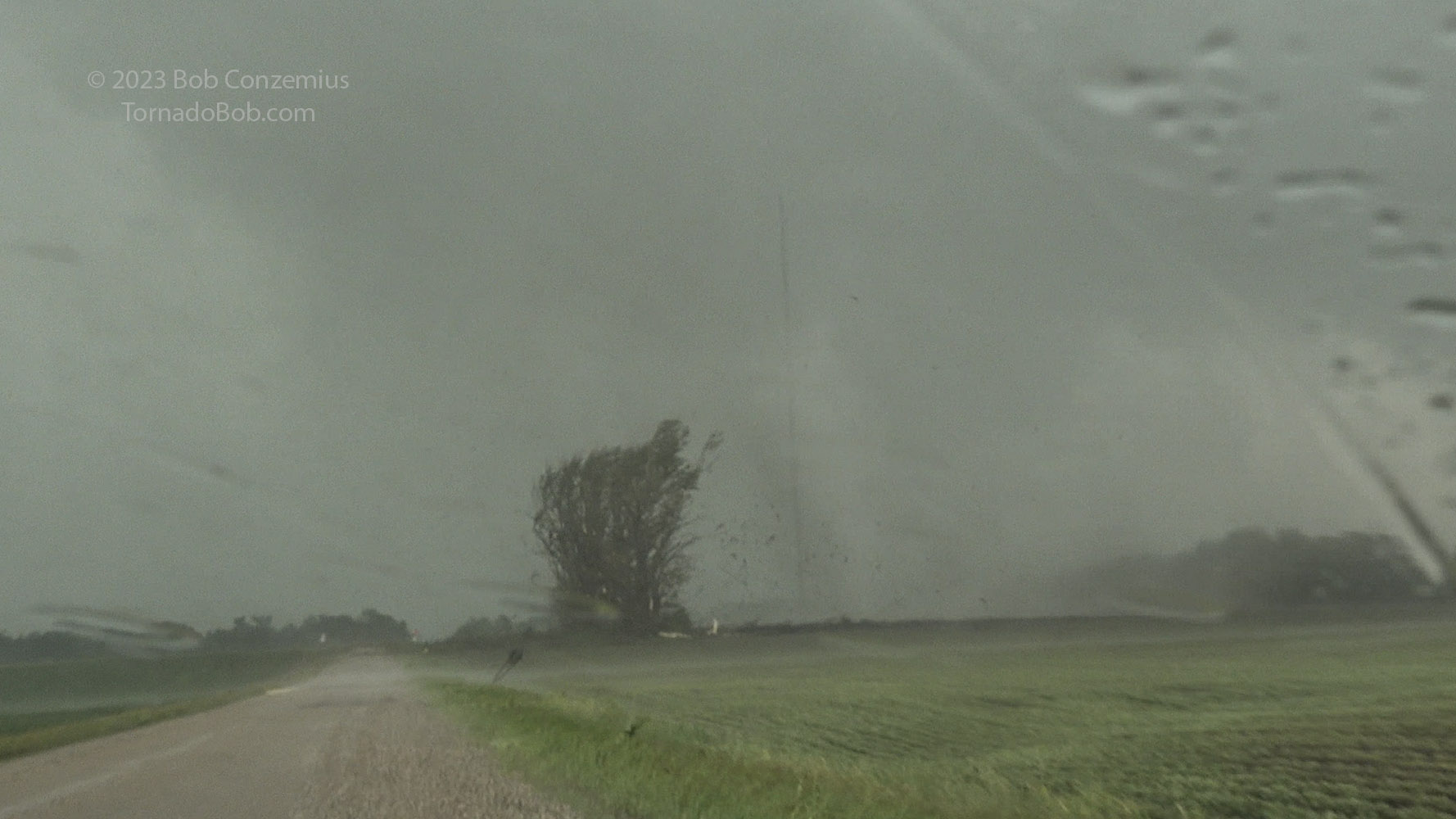
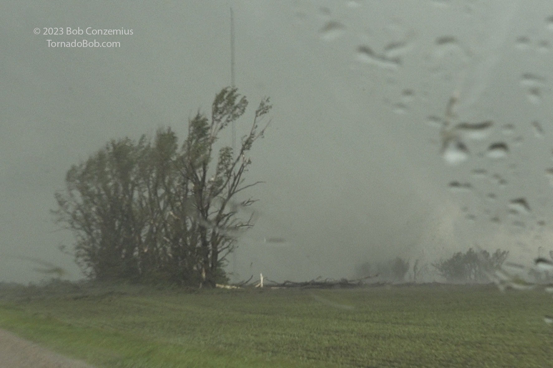
Tornado #5 begins to shred a row of cottonwood trees. First, the debris is blown from right to left.
Tornado #5 passes the row of cottonwoods, and the debris is blown in the opposite direction.
View of me in front of the tornado at the same moment by Drs. Lee and Finley (used with permission).
View of me in front of the tornado by Drs. Lee and Finley.
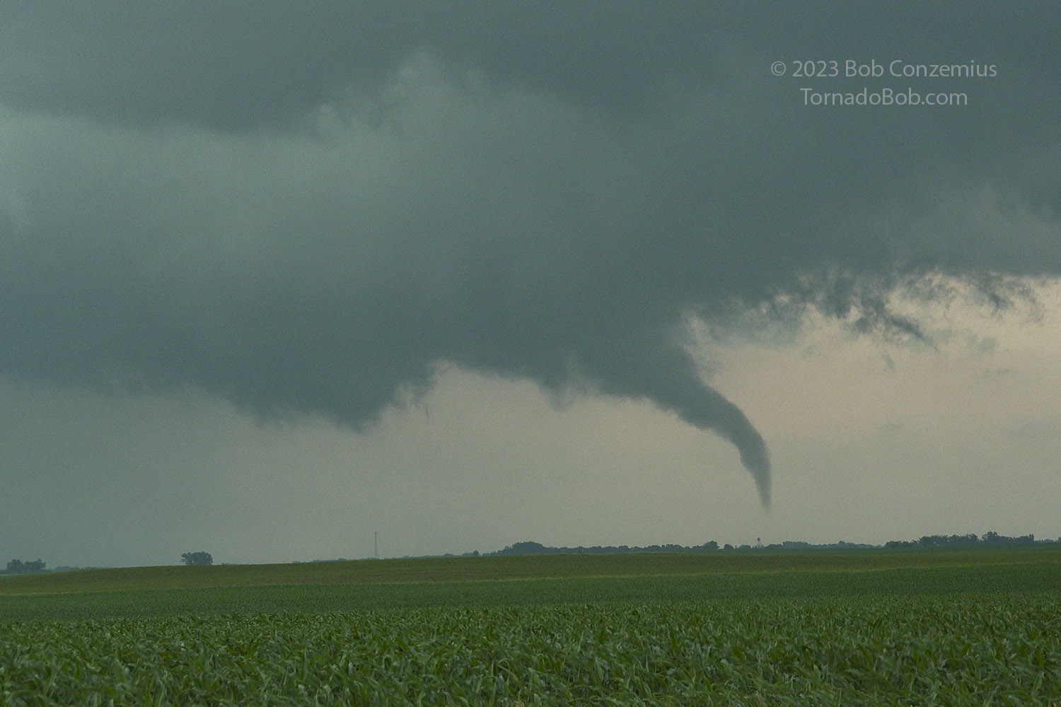
Tornado #5 condensation funnel between two groves of trees. The tornado is probably hitting the tower.
Tornado #5 moves into another grove of trees.
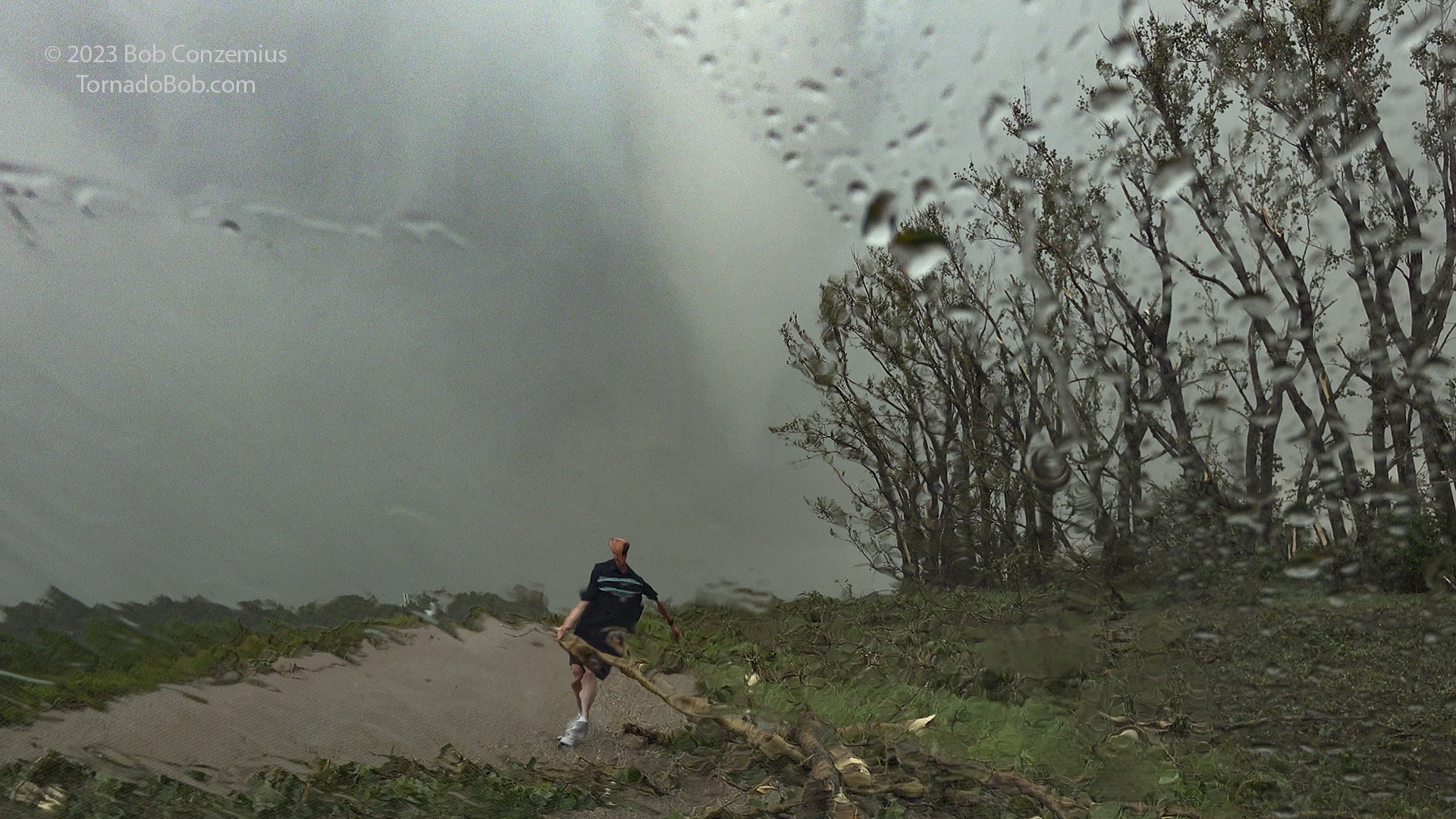
I wanted to continue north, but my road was now somewhat blocked by cottonwood limbs. A lifted pickup might have been able to drive over this mess, but my car only has 5 inches clearance, so it was obviously best not to. Fortunately, all the limbs were small enough that I could move them aside, albeit with some effort. From the way its winds scattered the branches then collected them again in the radial inflow, the tornado constructed small beaver dam-like structures across the road. It was some work to pull everything apart so that individual branches could be lifted and dragged to the side of the road. It was as if the structures had actually been built by a beaver, carefully arranging the branches so they would stay locked together.
While we were clearing limbs, the tornado reappeared in the video, and flying sheet metal could be seen rotating around it. The tornado was doing damage to the farmstead immediately to the northeast. By this time, it was a little east of the road, so it didn't scatter any more debris that blocked the road. Most tornadoes go in-between farmsteads since there is a lot of room between them. This one seemed to hit all of them.
We cleared limbs for several minutes, but the whole time, we could hear the load waterfall roar of the tornado to our north. We could faintly see it as well. It was still doing some damage, apparently. We got back in the car, drove up to Minnesota Highway 200, where our north road ended. There were more shredded trees directly north. It was time to move east. A new rotating wall cloud had developed to the east of the tornado.
Tornado #5: sheet metal flying in the air from a farm in the next section north.
Tornado #5: clearing tree branches while sheet metal swirls in the distance.
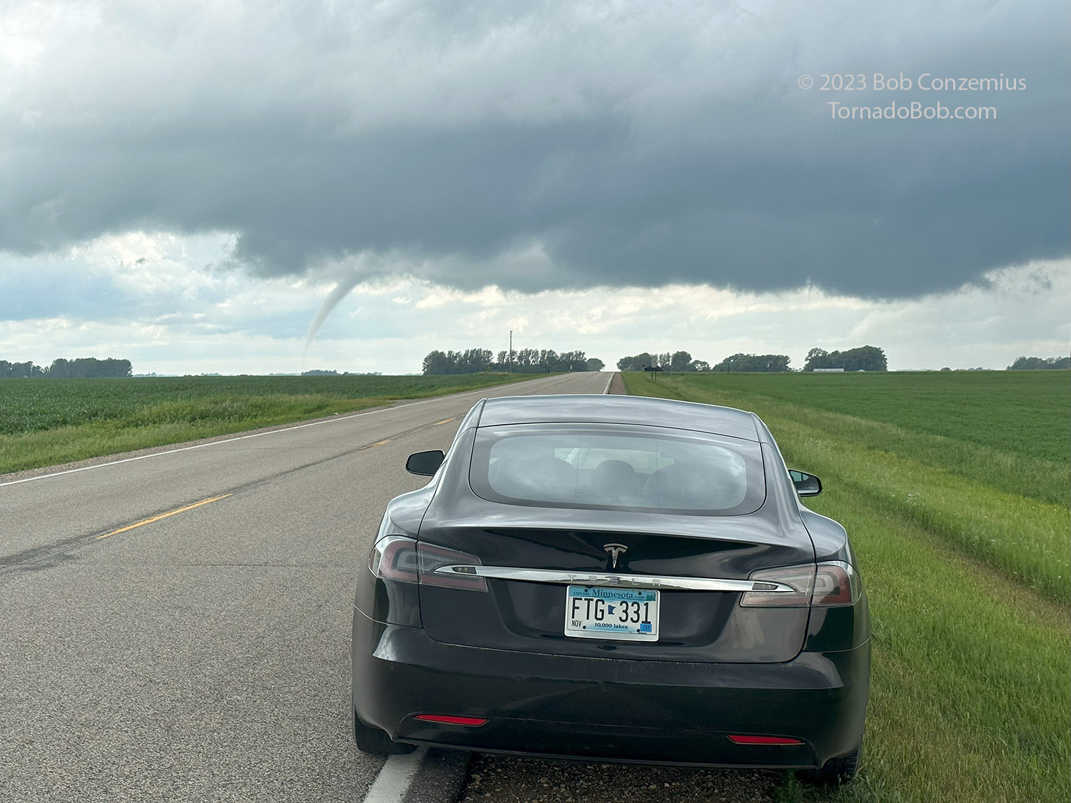
Tornado #5, last view before I think it ropes out.
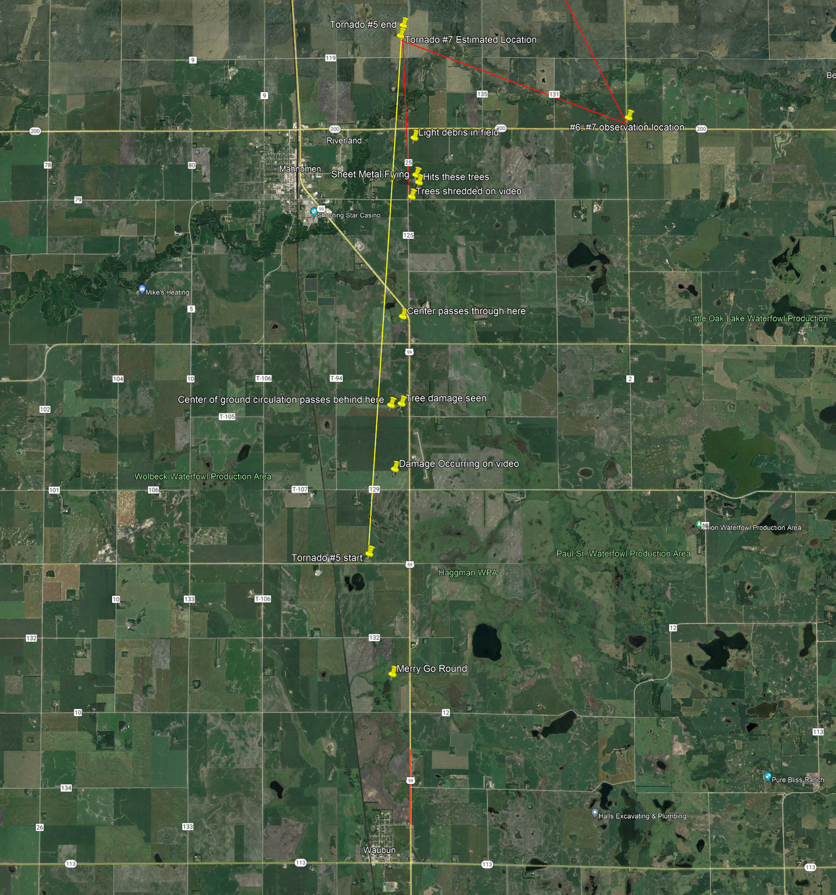
Tornado #6 (and #7?)
I drove three miles east to County Road 2, turned north, and stopped almost immediately. A funnel developed underneath the wall cloud as it moved northward, away from me, to my northwest (I had gotten a little east of it when I was on 200). I assumed this may have been a weak tornado, but I was not sure. At the same time, my colleagues spotted another rope to the west. I initially counted this as a separate (seventh) tornado, but I now think this was the true rope-out of the Mahnomen tornado (Tornado #5). The estimated positions from extrapolating Tornado #5 northward from its last visible position and this rope were almost identical. There had been a lot of rain around Tornado #5 when it began its rope-out, and I'm guessing the rain cleared as I drove east on 200. During the rope-out process, tornadoes can become anchored to the ground below them as the circulation radius shrinks, and ground friction prevents the base of the tornado from moving much. The tornado gets tilted, stretched out, and left behind the storm as the rope-out process finishes.
Tornadoes #6, 7, 8 map. Tornado 6 occurred from 4:47 to 4:49 PM CDT. Tornado 7 was at 4:47 PM. Tornado 8 began at 6:25 PM.
Tornado #6. May have only been a funnel. It occurred from 4:47 to 4:49 PM.
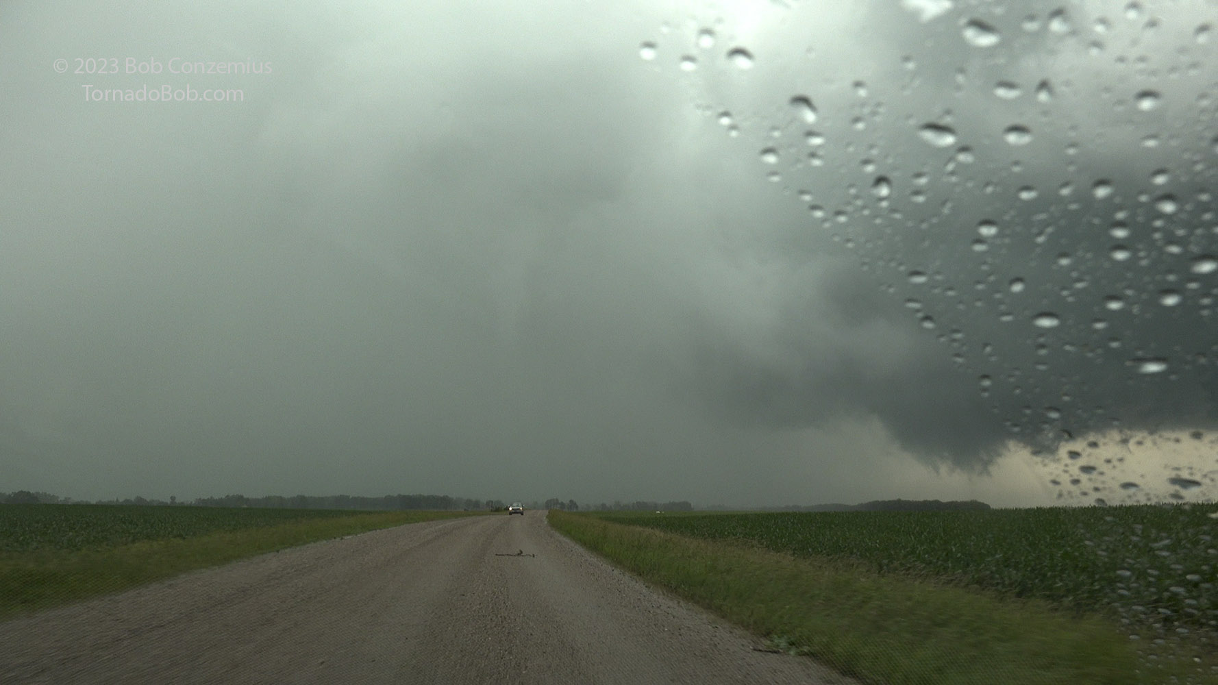
Tornado #7 *or* (more likely) the true rope-out of Tornado #5 (maybe it came out from the rain). Looking west at 4:47 PM.
Tornado (or funnel) #8
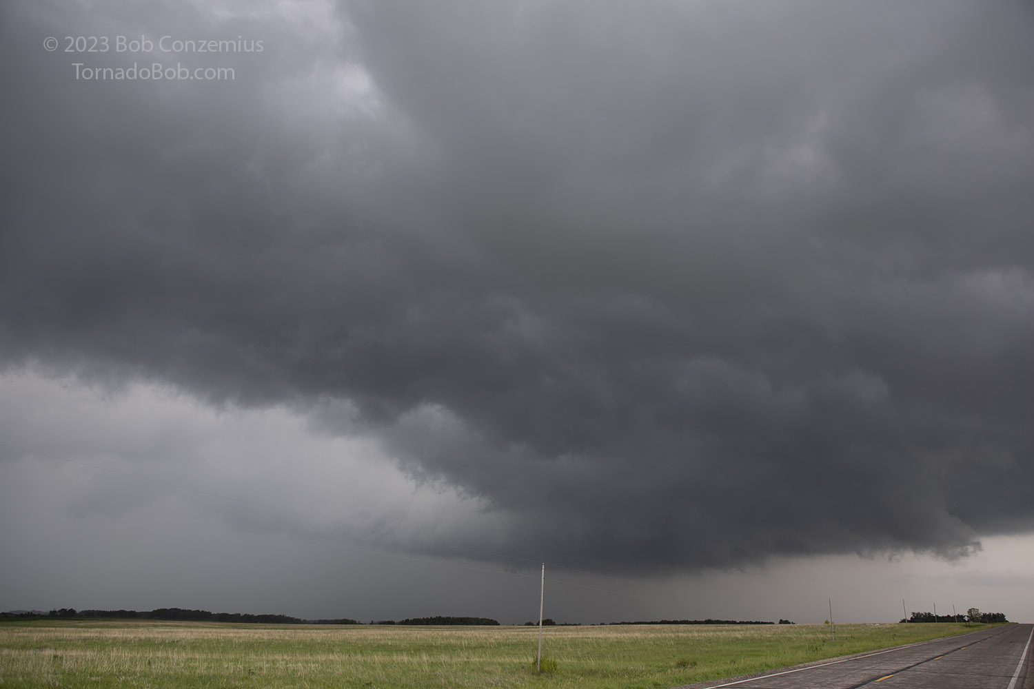
From there, the action areas seemed to lose steam. The cloud lowerings did not have as much rotational motion, and the storms were looking a little more linear. A third storm had developed and crept up from the south and was now merging with the Mahnomen storm. I had followed the Mahnomen storm a bit farther north after funnel/tornado #6 but then waffled a bit and stayed put for a while at Township road 165 and County Road 2, unable to decide whether to continue north or go south toward the new updraft base. A shelf cloud developed west of me and moved east past me, bringing some cooler outflow with it. This, along with nothing paricularly interesting that I could see north of me (although I don't know what might have been around the north side of the precipitation core to my north-northwest) convinced me to move south.
Looking northwest at the Mahnomen storm from the spot where I turned back south. A shelf cloud and outflow have moved past me here.
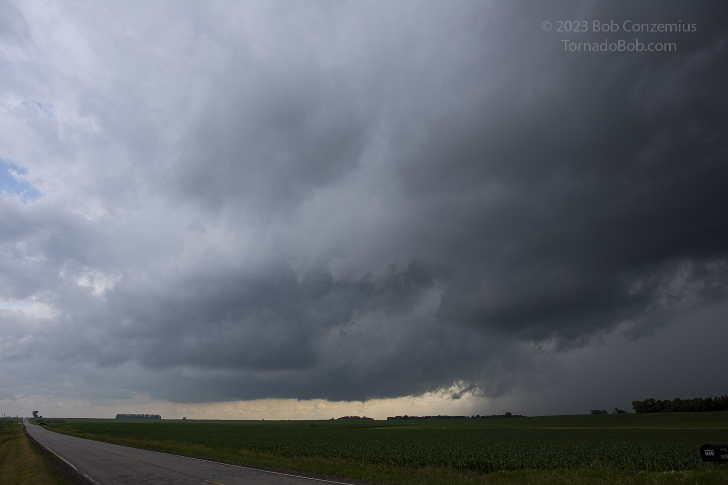
Looking southwest at the new updraft base from the same location at T165 and County Rd 2.
It seemed like it took several miles of southward driving before the wind veered back around from westerly, then northerly, then northeasterly, then finally, easterly again. I got out of the car and thought I had another shelf cloud directly west of me, but I still had humid, easterly inflow. I watched as rotation developed again to my northwest. Time to follow this back north! Bruce and Cathy reappeared around this time. They had continued a bit farther north than I did before they turned around. On their way back south, they had spotted another cone funnel/tornado in the rain behind them.
The storm produced some pretty nice wall clouds on the way to Fosston. They looked like they would produce but didn't.
We stayed up with the storm, and it appeared ready to produce a tornado a couple times, but both times, the circulation weakened. We eventually reached Fosston and decided to part ways. I turned east to go back to Grand Rapids, and they turned west to go back to Grand Forks. I was ready to just put the hammer down and go home, but I decided to stop for one more look-- the radar was showing a couplet to my south, and it would be stupid to pass up more funnels/tornadoes, even though I had seen plenty already. Sure enough, there was a broad mesocyclone to my south-southwest with a nice RFD cut around it. In the center, a funnel developed with condensation halfway to ground. It quickly became rain-wrapped, so I was not able to verify a damaging ground circulation. I reported it on Spotternetwork as a funnel but possibly a tornado. I then continued east, stopping once or twice to see if the rain might clear and reveal a tornado. This time, the core remained opaque.
Radar loop for Tornado #8.
Tornado #8. Possibly only a funnel. Just east of Fosston, looking south-southwest.
I still had some cells coming up from the south toward me, but the skies were looking a bit more stratiform at low levels. I had gotten into some cooler air, and the temperature was dropping into the upper 60s. I attempted a couple more times to get views of another updraft base or two, but both times, the low-level, stratiform clouds obscured my view, and rain was filling in the gaps between cells. At Bagley, I decided it was time to call it a day. I stopped in Bemidji to charge for a few minutes then drove home from there, quite happy I had decided to chase.
End of the chase. Looking at radar in the car while I charge.