July 2, 2023 Storms
Southern Iowa
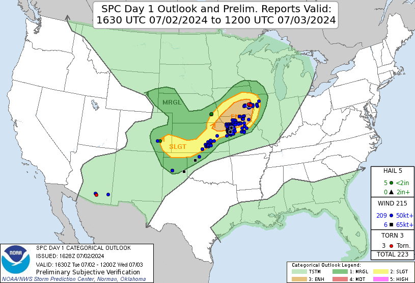
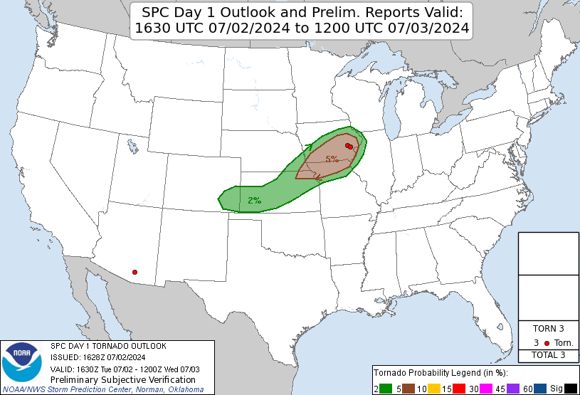
This day featured an enhanced risk of severe storms along with a 5% tornado area. The temperature-dewpoint spreads were pretty low in Iowa, and that brought low LCLs and low LFC (level of free convection). These ingredients were favorable for tornadogenesis. However, the low-level wind field was pretty weak, and so was the low-level shear. Nevertheless, the best area to chase today was in Iowa. CAMs showed cells being a little more isolated early and then congealing into a line of storms. We hoped to get on the first convection before the cell mergers occurred, and with such a strategy, we hoped for the best chance to see a tornado and then go back west for tomorrow's chase around the time the storms become a line.
 |
|---|
| The 1630 UTC SPC outlook with verification. |
 |
|---|
| The 1630 UTC SPC tornado outlook with verification. |
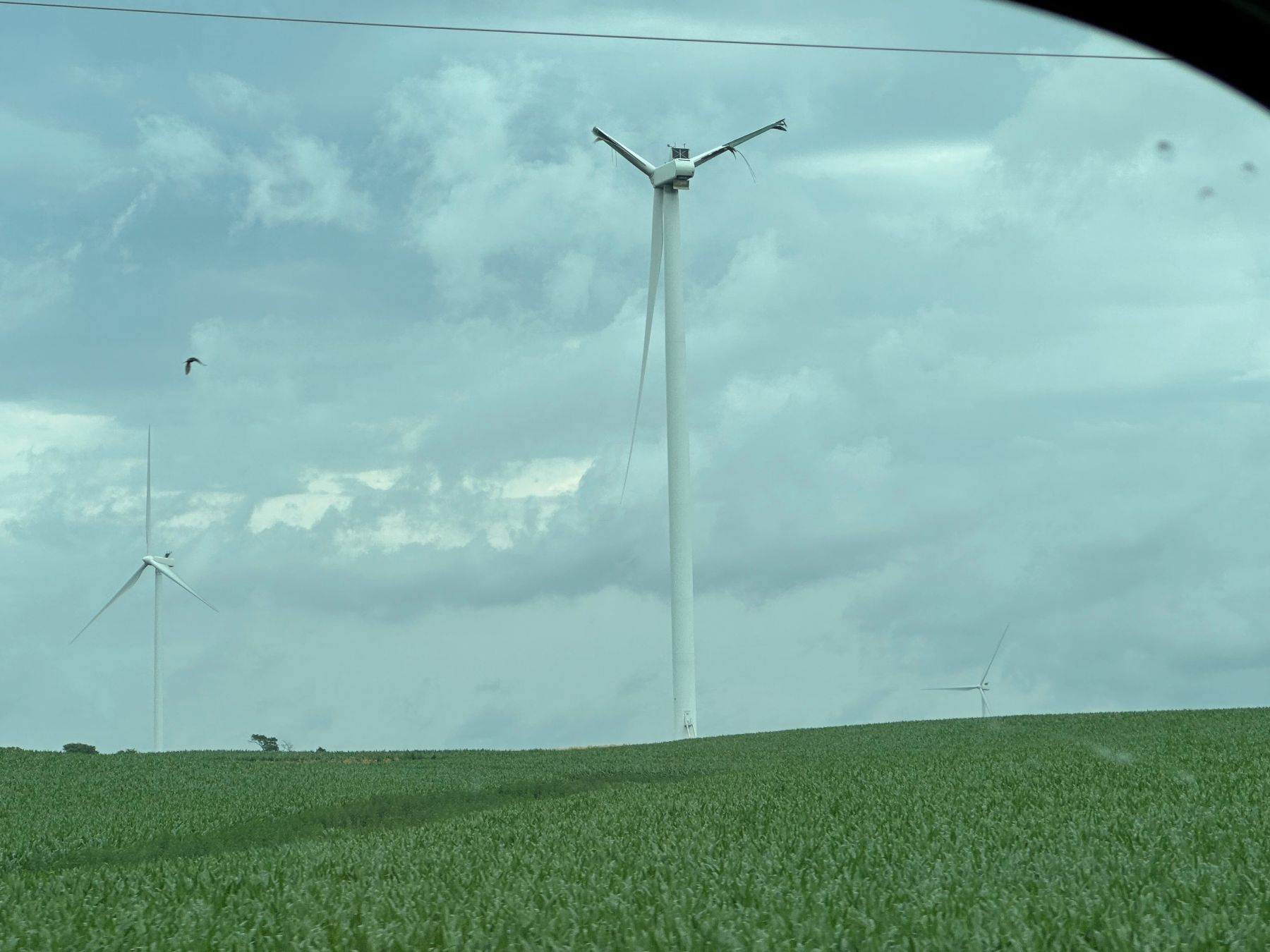
We began the day driving east on I-80 in the general direction of southern Iowa. It looked like the best chance of initiation of storms would be along a subtle east-west boundary across Iowa. It looked like the first storms would fire just south of I-80, so we exited on Iowa Highway 92 as soon as we got into Iowa and drove east. We saw towering cumulus by the time we got to Carson, but it was not clear whether these were surface-based or elevated in nature. We continued eastbound, and rather than drive the Greenfield (the town got mostly leveled by a strong tornado earlier in the season), we opted to go south around the town instead. This allowed us to see the damaged and destroyed wind turbines affected by the same tornado.
 |
|---|
| A wind turbine destroyed by a tornado earlier in the season. |
The towering cumulus got larger, and soon we had some radar echoes just to our west. We made some first attempts to look under the base, but the storms were too young, and it was time for a quick pit stop and grab-and-go lunch. Since we were in a hurry, we split up between two Casey's stations on the northeast and the west sides of town. While my van was waiting for guests to come back out of the convenience store, I looked west as the storm intensified. Some cloud-to-ground lightning strikes started to pop not too far to the west. It was time to get back on the road!
We drove back north out of town on Cherry Street and then east on Rea Road. After going a few miles east to get ahead of the storm, we looked for a place to stop and view. This part of Iowa is not generous with pull-offs and section roads. We just had to pull over on the shoulder as far as we could and look back. What greeted us was a shelf cloud. While we watched this shelf cloud approach, the storm started producing numerous CGs, some of which were getting quite close. This got me a bit nervous, so I told everyone to get back in the vans, and we would put some distance between ourselves and these CGs.
| A shelf cloud greets us, along with a lot of cloud-to-ground lightning strikes. |
We worked our way eastward in search of a cell that was not outflow-dominant. There were many cells around. None were particularly strong, however. The ones that did become stronger were quickly undercut by outflow. We found ourselves east of I-35 and reached U.S. 69 several miles northeast of Liberty. By this time, the terrain was becoming a bit more difficult with low, tree-filled ravines in a lot of areas. We continued northeast and pulled over at 115th Avenue to get a look at what was approaching. It was a long shelf cloud. Every storm to our west was lining out. We took some photographs as this shelf cloud approached.
| A bit farther east. Storms have become definitively outflow-dominant. |
| Looking north at our shelf cloud. |
Once this shelf cloud got close, we hopped back in the vans and began to drive east to find a new storm. However, this search was becoming quite fatiguing. There were no dominant storms around-- just a lot of small cells or else an outflow-dominant line. As the afternoon wore on, the line became more well-established. However, rather than the tornado phase ending completely, it was just about to start. There were a couple tornadoes embedded in rain-filled mesocyclones along the line to our north. There was no real chance for us to see them. We decided to call it a day and drove back west to I-35, up through Des Moines, and then west on I-80 to get into position for tomorrow. We ate dinner at a Barbeque Place in the west part of Omaha (it was hard to find, and Google Maps didn't record my location precisely enough for me to figure out where it was-- near I-80 and U.S. 275) then continued to Best Western Plus Grand Island Inn & Suites to stay the night.
| Our approximate route for the day. |
Back to Storm Chases | Home