June 29, 2022 Storm
Home
The supercell composite parameter was forecast to be in the 20s in west-central Minnesota, and I was wanting to chase surface-based storms in that area, but the convection-allowing models (CAMs) did not show any storms developing in that area. Thus, I did not chase and simply stayed home. At the end of the work day, storms suddenly developed to the southwest of Grand Rapids. They seemed to be lined up to our south and would mostly miss my house, but I would get a look at their north side.
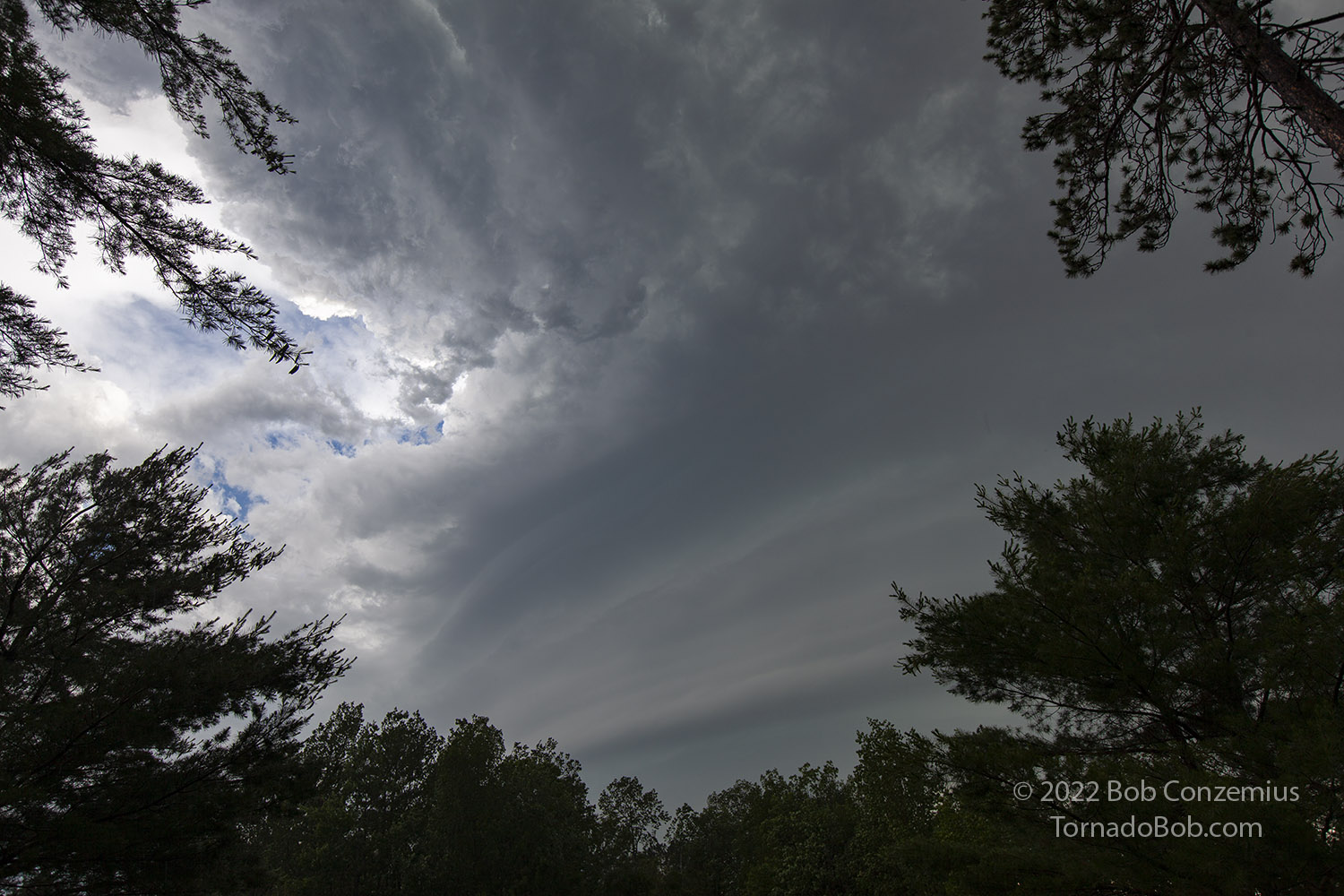
Well, they developed northward, and I soon found myself in nearby cloud-to-ground lightning strikes, heavy rain, and 3/4" hail (probably actually just shy of 1"). A couple cells trained overhead, and I quickly received 1.07" of rain. Just as the rain was coming to an end, I happened to look on radar and saw some interesting velocity approaching my area, as well as a slight hook, so rather than going back inside, I stayed at the front door and looked west. What appeared over the trees was somewhat of a surprise. Even with a relatively interesting radar signature, I was not expecting to see something like that. I took a couple pictures with the cell phone then realized I should probably get my SLR camera.
 |
|---|
| Rear flank updraft of a storm. The rain had just ended. |
I was in my bare feet, but I didn't let that stop me from walking/running down the street to get a better view. I had initially hesitated because there was a bit of lightning close by, but the structure was good enough that I stopped caring about that.
 |
|---|
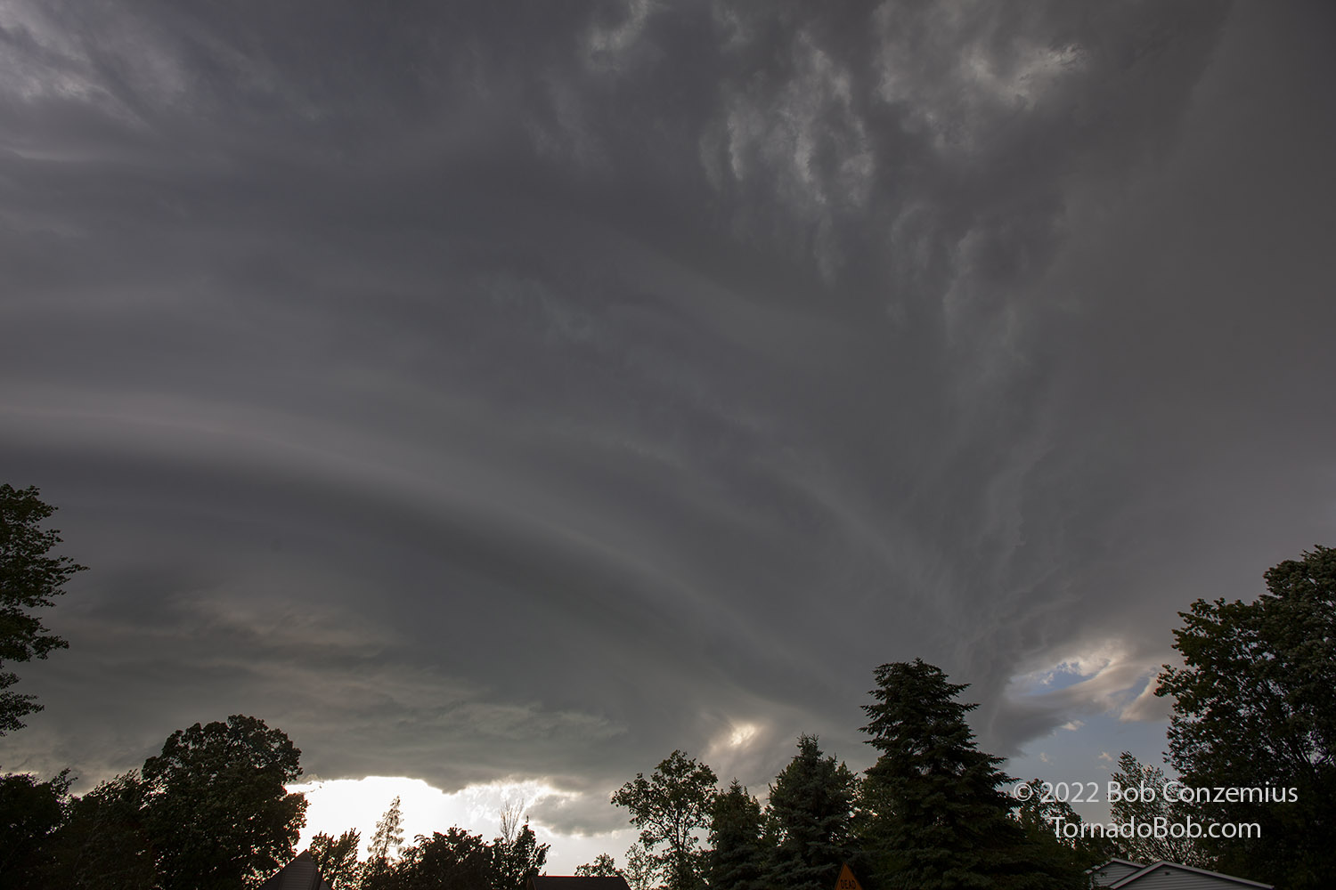
| Mesocyclone of the storm. |
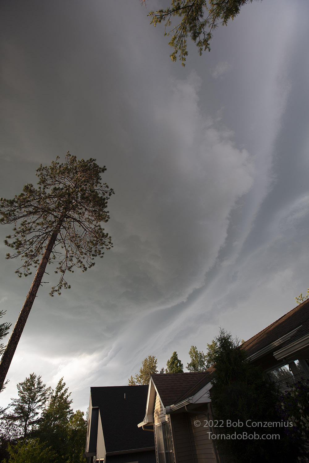
The storm passed overhead, and I snapped a couple more pictures. I was amazed at the cloud motion and looked for any areas of intense rotation, but there were none. There was intense cloud motion upward at cloud base in some areas (oh the south side) and intense cloud erosion on the other side (north). I considered chasing this, but since I was packing up for my storm chase trip, I decided to stay home. I probably witnessed the best part of the storm.
 |
|---|
| Mesocyclone passes overhead. |
Back to Storm Chases | Home