July 2, 2018 Cow-Catcher Storms
Park Rapids, Minnesota
A slight risk of severe thunderstorms, a 2 percent risk of tornadoes, and a free evening after work enticed me to chase storms. A warm front was lifting north through central Minnesota, and storms were expected to fire very late in the afternoon across far west-central Minnesota and move northeast toward Grand Rapids. It would be a nice setup to chase a storm from its origins and get chased by it on my way home.
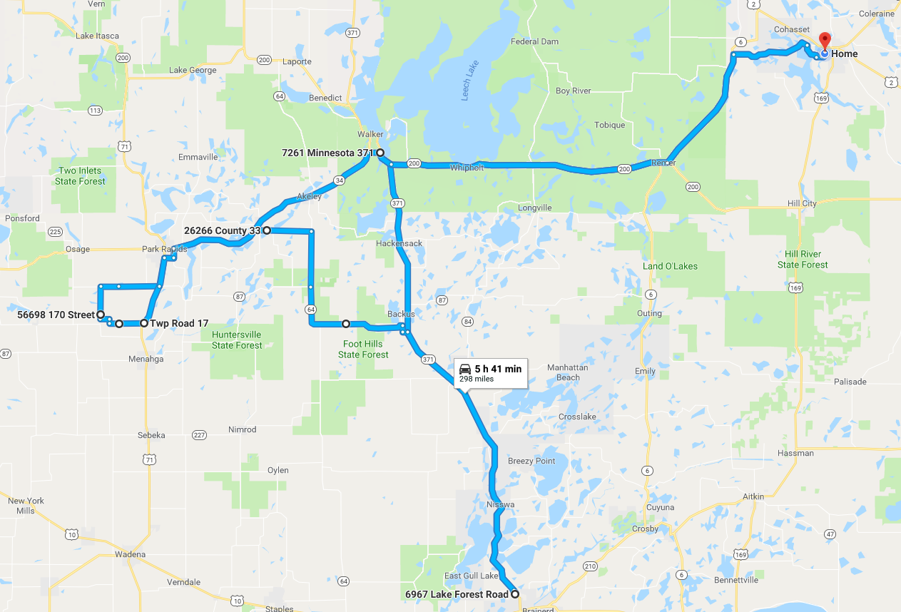
I started with 242 miles of range on my car and set my sights southwest along Highway 200 and then Highway 34 through Park Rapids. I could have started south toward Brainerd and Baxter in order to put on more range when I got there, but I decided it was too far out of my target area to bother with charging. However, when I got to the Northern Lights Casino just east of Walker, no storms had developed yet, and I became concerned about how much range I had and where I would charge on the way back. A trip to Park Rapids and back, along with some deviation to get on whatever storm came through, would be comfortable enough on 242 miles, but going all the way to Detroit Lakes would start to push my range. I decided to do the detour to Baxter and wait for storms to form.
The detour took me south past the area of low-level convergence where I expected storms would form (I had been to its north). This change in route to get to a fast-charging location probably added 60-80 miles to the trip, and in retrospect, I did not need to do this. Furthermore, had storms been ongoing when I was at Walker, I would have skipped it.
When I was done charging, some cells had formed near Pelican Rapids (not so strong) and in a line segment centered on Park Rapids (a bit stronger). I considered going west on Highway 10 but decided back north on Minnesota 371 was best. If I wanted, I could view the storms to my north and move southwest to the other storms later on if they turned out to be better.
That's exactly what I did. My route took me to just south of Akeley, then west to Park Rapids, and then in a loop to the southwest of Park Rapids. The first storm I encountered featured an impressive cow catcher feature under the base. I drove north toward it for a bit, but then I decided that I'd see what was farther west. It turns out the storm just to its east moved up toward Boy River and became tornado-warned. I would have been in better position to see that warned storm had I followed this first storm, but the warning wasn't issued until about an hour after sunset.
I drove by a second storm with a less well-defined cow catcher feature, but then continued west-southwest through Park Rapids. By the time I got to the storm that had originated near Pelican Rapids, it was pretty dark, and the storm had weakened quite a bit. I briefly attempted some lightning photography as there were some pretty nice cloud to air bolts ahead of the storm. However, I was in a rural area with a lot of farms (farmers tend to be pretty suspicious and move quickly to find out what you're up to), and the lightning faded by the time I found an open spot to take pictures.
I set my sights for home, stopping at Whipolt and Cohasset along the way to do some nighttime storm photography.
 |
|---|
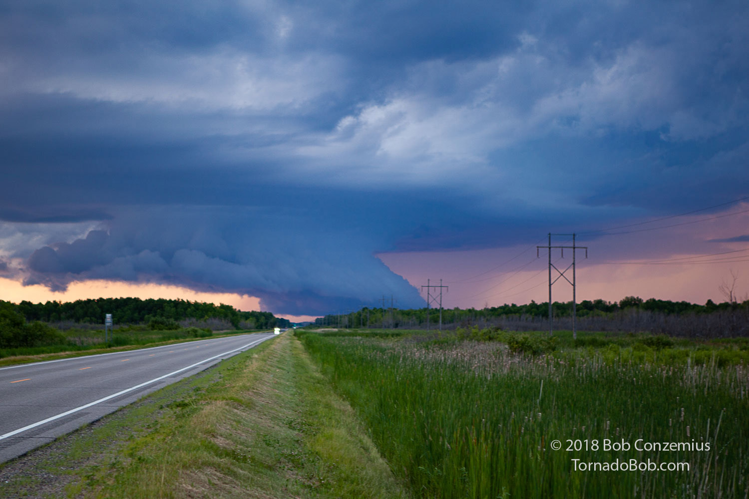
| Cow catcher cloud on a storm just south of Akeley, Minnesota. |
 |
|---|
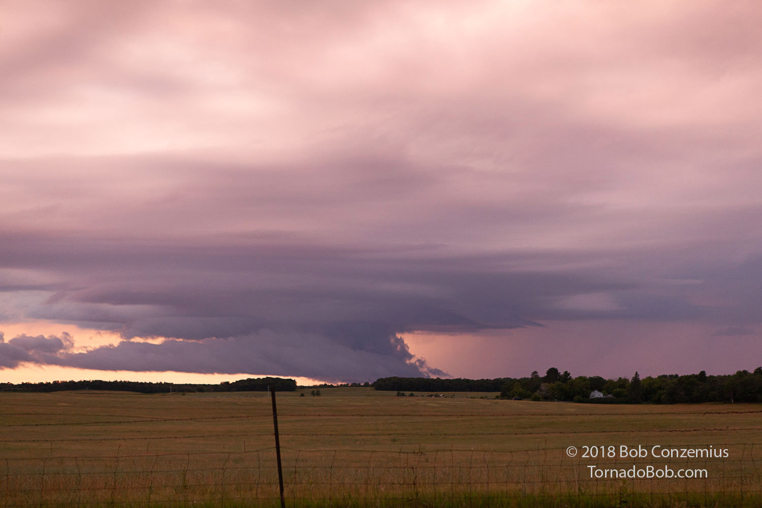
| Second updraft of the day between Nevis and Park Rapids. |
 |
|---|
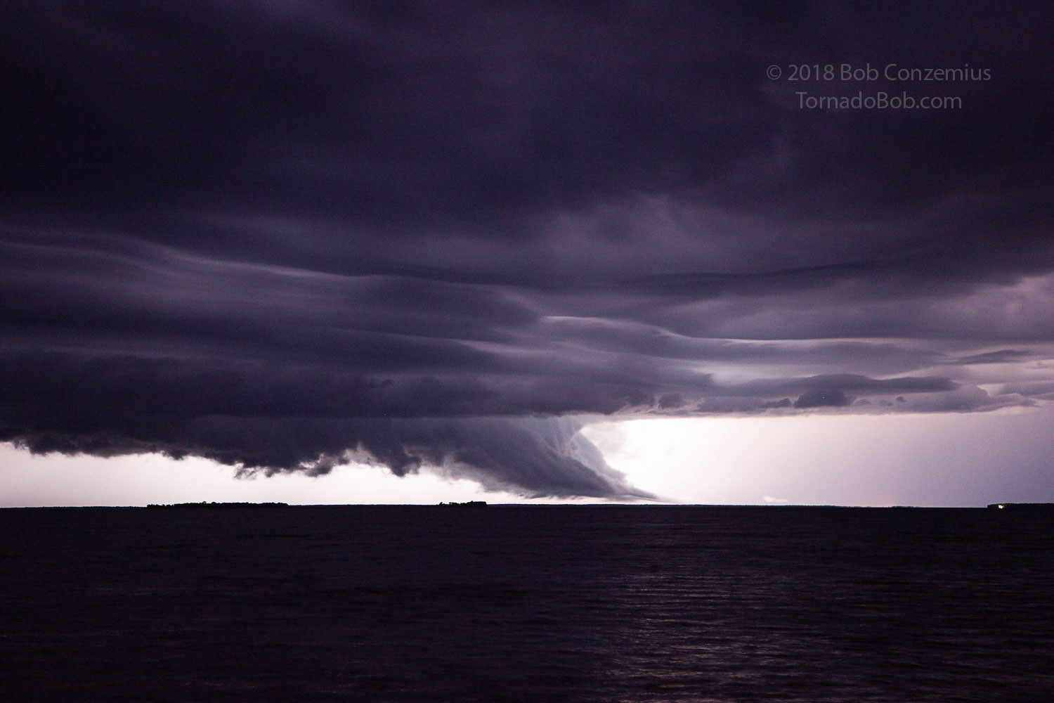
| Storm over Leech Lake viewed from Whipolt, MN. |
 |
|---|
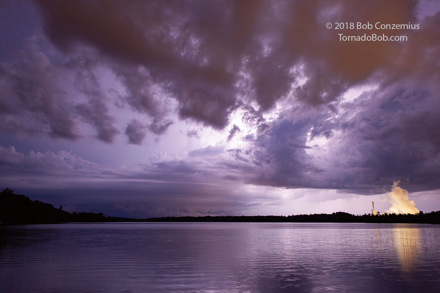
| Back near home: updraft base passes over Deer River (city lights cast an orange glow on the cloud base). Clay Boswell power plant in Cohasset is on the right. |
 |
|---|
| Route of the chase. Had I not decided to charge in Baxter, the route probably would have been closer to 230 miles (within my range when I left home) |
Back to Storm Chases | Home