June 12, 2016 Severe Storms
Western Minnesota
I had a rare day with nothing on my calendar. I had things I could get done in my free time, but I tend to squander this type of free time relatively efficiently, and there was a risk of severe storms to my southwest, so I decided to chase rather than stare at the computer at home.
Another reason for going was to investigate my ability to chase in an electic car. No, I did not take the electric car because I did not want a limit of range to influence my decision making. Rather, I took the 1999 Jeep Cherokee and simply drove the route I wanted, making sure I drove past the high speed charging location on my way to the chase and coming back from the chase. I would measure the mileage in-between and see if it is within my vehicle range.
Storms were forecast to develop in the eastern Dakotas around 3:00 PM and move into western Minnesota by 4:00 PM. If I left around 12:30 PM, I could get there in time for the first development. I plotted a course to Foxhome, MN, but the storms developed early, so I readjusted my target eastward as I drove toward the intensifying storms. I had been hoping for supercellular storms in a narrow region between a deeply mixed, hot air mass to the south of a warm front near the Minnesota River and a relatively cool, dry air mass to the north. The hot air mass was characterized by temperatures in the mid 90s (Canby hit 100 degrees, but I suspect that thermometer has a warm bias) and dewpoints in the mid 60s, and the cooler air mass featured temperatures in the 60s and dewpoints in the mid 40s. In-between was a region of dewpoints in the low 70s and temperatures in the upper 80s. I was hoping for storms to interact with these temperatures and dewpoints and have a narrow window of opportunity to become tornado-producing supercells.
That did not happen. It appeared the storms were rooted in the deeply mixed layer to the south of the warm front. The bases were not particularly low, and on radar, their movement was not indicative of the 0-6 km shear. Much less shear was present over the deeply mixed layer to the south of the warm front, and these storms looked very multicellular on radar. The cells also generated a fair bit of outflow like might be expected in a deeply mixed boundary layer. As I approached the cells to the north of Alexandria, I saw a long shelf cloud to my west. I navigated to a position a little closer to the storms and found myself on a road between two lakes that afforded an excellent view of the approaching shelf cloud and an easy escape route back east. I found a parking lot between Lake Carlos and Lake Le Homme Dieu and decided to stay there for a while to take a time lapse while the storms approached.
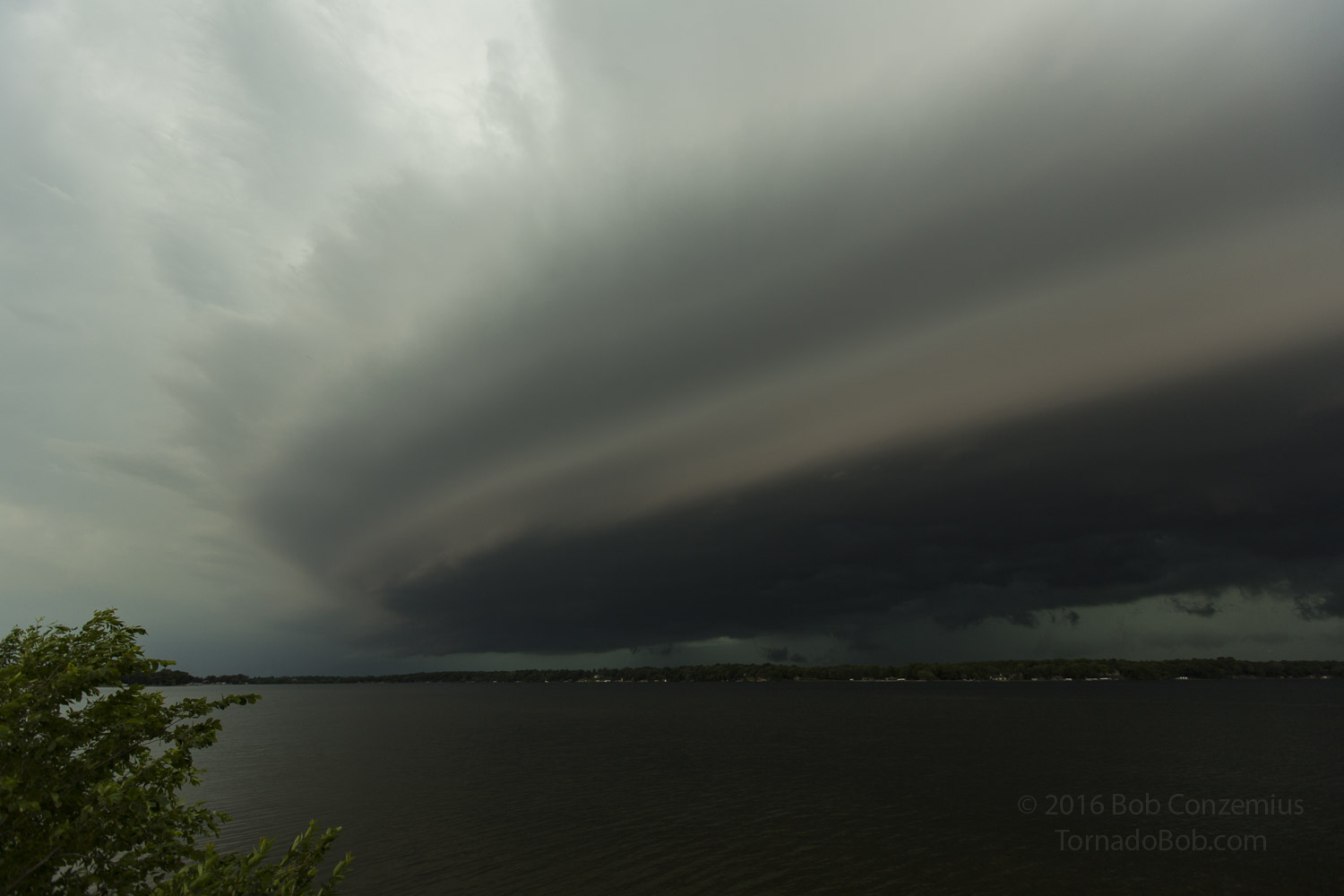 |
|---|
| Shelf cloud over Lake Carlos near Alexandria, MN, looking west. |
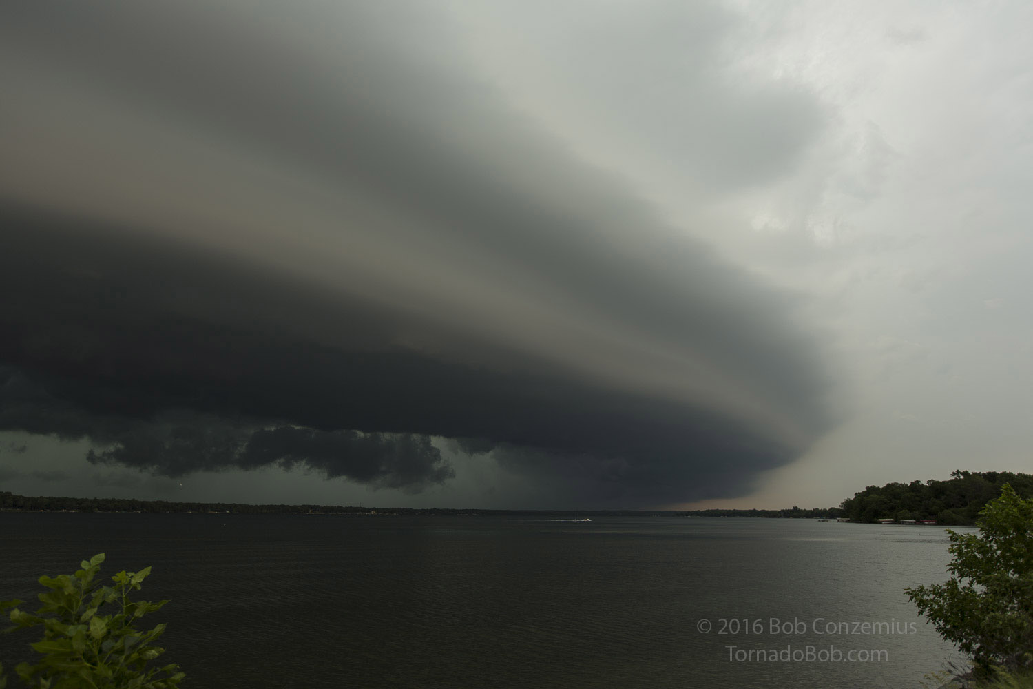 |
|---|
| Shelf cloud over Lake Carlos near Alexandria, MN, looking north-northwest. |
Once the shelf cloud was overhead and the dramatic view was behind me, I picked up and moved east. Looking on radar, I thought it would be a good idea to get to the south, in front of the tail end storm. I was still a little north of the zone of highest dewpoints and lowest temperature-dewpoint spreads. As I drove south, however, more cells developed ahead of the whole system, providing a less dramatic view. Instead of a single, large shelf cloud in one direction, there were cloud bases everywhere, some of which were filled with rain. I continued to push south to Brooten, but by that time, a considerably larger number of cells had developed ahead of the line, and the line was making a "jump" east. Rather than trying to stay ahead of everything and trying to pick my way in between heavy rain and small hail on my way home, I decided to exit out the back of the system and hope for sunset-illuminated clouds on my way home.
I drove back past the Brainerd/Baxter area and recorded my elapsed mileage. It turns out I could have done the entire chase with my electric vehicle, which has a range of 270 miles. My round trip from and back to Baxter had been 240 miles.
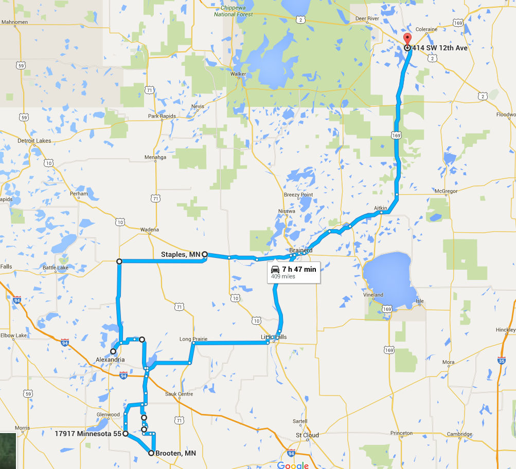 |
|---|
| My route for the day. |
Back to Storm Chases | Home