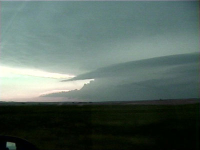
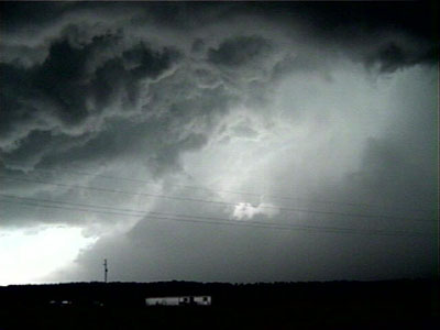
Approaching Oglala storm, from near Martin, SD,
Looking west-southwest toward Pine Ridge
For information on the synoptic setup for this storm, as well as damage surveys, please see NWS Rapid City's page on this storm.
We started the day from Holdrege, Nebraska. Having been successful the evening before, we were relaxed about finding anything today. Nevertheless, the setup looked good, so we were anxious to get out again.
We looked at surface data in the morning, and again in the early afternoon, eventually drifting up to a fire tower in the Nebraska National Forest, where we sat for a while. Constantly plagued by the desire to keep moving, and feeling a slight drop in the dewpoint, we elected to move east to put ourselves in better moisture. Had we stayed put, we probably would have been able to see the Thedford tornadoes from the tower. Stupid. Even more stupid, we had been observing an area of cumulus and apparent mid level instability approaching from the south-southwestern horizon.
We continued east and north, with things looking really capped. There was hardly a cloud in the sky. Using the tactics from the day before (moving north when things look capped), we continued, and headed up U.S. 183 to Winner, SD. There, we finally saw images from KELO radar, which showed the nearest cells developing in the southwestern-most county in South Dakota and northeast of Aberdeen. They did not show what was developing farther south where we had just been. We decided that although it was a long shot, it would be best to target the SW South Dakota cell, so west on 18 we went. It took quite some time before we got under the anvil, and we commented about never being this late without getting on a storm.
What made us really upset along the way was seeing the storms that had exploded somewhere well off to our south, where we had just been. We did not know that these were moving north and that we, perhaps, could have targeted them.
We approached the storm from the west on U.S. Highway 18. We observed sort of a double-barreled structure, with one vault area off to our north, and what appeared to be the main storm tower, off to our west-southwest. We were confused by this initially. We did not realize at the time that these were perhaps two cells in the process of merging (see NWS Rapid City NEXRAD images). With paved road options being best to the Pine Ridge area, we targeted the southwestern "barrel."
Approaching Oglala storm, from near Martin, SD,
Looking west-southwest toward Pine Ridge
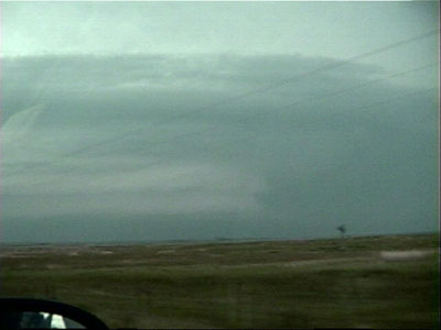
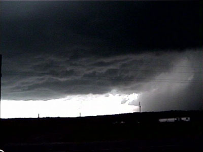
Looking northwest at the vault area.
This area likely produced the tornado(es) that hit Oglala.
Poor road options (and confusion) kept us from targeting this.
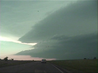
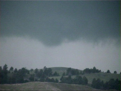
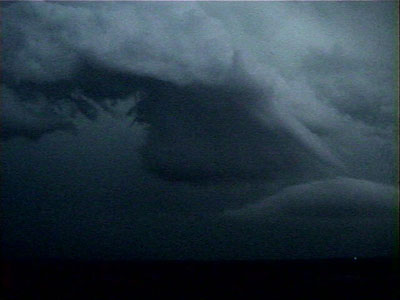
Closer to Pine Ridge, more banding on the storm.
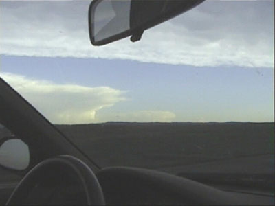
Meanwhile, we can see the Thedford storms to our south.
These storms produced tornadoes observed by the DOWs.
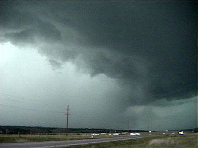
Upon our arrival, we could see the wall cloud to the west-northwest of Pine Ridge. We observed this for a few minutes as the storm transitioned rapidly into the HP process. We arrived around 7:10 pm MDT and left around 7:20 pm MDT. We observed the low level mesocyclone and wall cloud area. The wall cloud produced a couple of brief funnels, but we were not very optimistic about tornadoes, since we were experiencing weak outflow. Inflow may have been better farther north in the notch. Soon, a massive wet RFD wrapped around the meso, obscuring it from view. Off to our west was an absolutely MASSIVE rain foot, and the whole feature was gusting out quite rapidly at us, so we decided it was time to get out of there rather quickly.
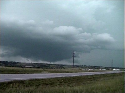
Photo from just northwest of Pine Ridge.
Wall cloud produces a brief funnel.
Rain is starting to wrap in from the left.
Zoomed in under the wall cloud.
Motion is rapidly upward here.
A minute or two later looking west-southwest.
Rain area to the right is starting to gust out.
A couple minutes later, rain has wrapped around our action
area, obscuring it from view. We could have been farther
northwest in the notch, but the rapidly approaching RFD
kept us from thinking about such a course of action.
Looking west-southwest again.
Wet RFD with a MASSIVE rain foot!
We went east on U.S. 18, hoping to catch our action area again, but everything seemed to be gusting out and blasting east very quickly. Also, we had to make frequent pullovers for emergency vehicles that were heading to Oglala in the wake of the tornadoes there.
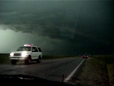
Bailing east on U.S. 18. We had to make frequent stops
for emergency vehicles heading to Oglala.
As we headed east, we discovered that we were surrounded by storms. Perhaps they were popping everywhere. Perhaps the storms that had been near Thedford had come north into our area. Trying to get a fix on where things were by listening to the radio, we planned an escape route. With so many tornadic storms around us during approaching darkness, it was time to get away from everything. The best route was due south on Nebraska 61. On the way, we looked back at the storm complex, illuminated by frequent lightning.
Coming back to Martin, SD, another storm blocks our path.
We are looking southeast at it here. This storm produced
damage on the south side of Martin.
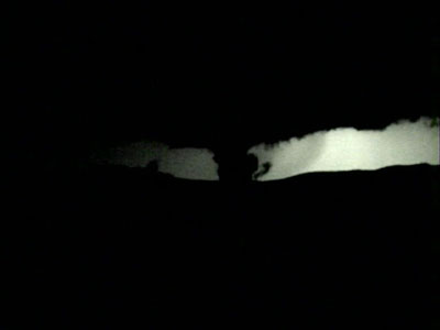
This photo taken between Merriman and Hyannis, NE.
View is to the north, after dark. An outflow feature is doing
its best imitation of a tornado, backlit by lightning.
The nearest hotel ended up being in Ogalalla, Nebraska. We had to drive until about 1:00 am or so before we could sleep.