July 8, 2023 Brief Tornado
Eastern Colorado
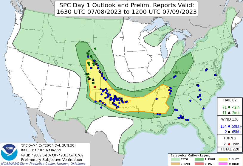 |
| SPC Day 1 outlook and storm reports. |
This was the departure (back to hotel) day of the tour. Most of the guests would be heading back home. However, since this looked like a good chase day, I decided the offer the guests an opportunity to chase with me in the van. Craig and Julie were out as were Sharon and Jack. Catriona, Shannon, and Alberto were in. It looked to be a possible Denver Cyclone day. In fact, the center of the vorticity zone was position not far to our northeast, apparent on radar loops. We had a quick lunch at a chicken place (Slim Chickens) and drove northeast on I-76 to the Hudson, CO exit.
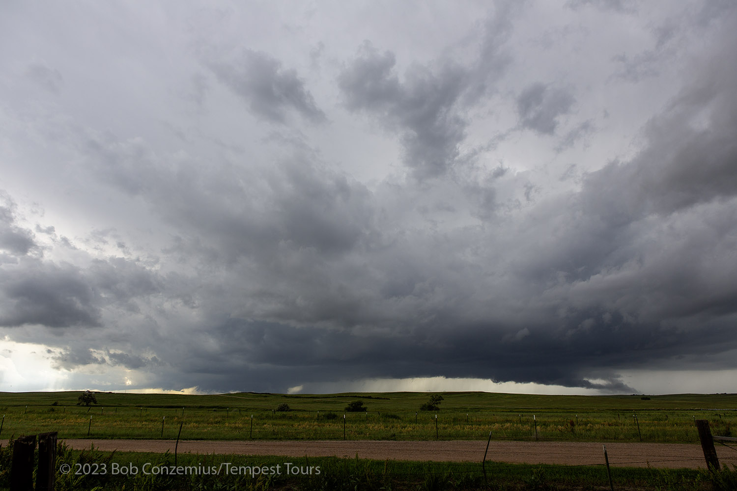
When we arrived, a new storm was already in progress, and it had a nice wall cloud. We parked at a busy intersection and took stills and video for about 20 minutes or so while the action area approached. The wall cloud had some slow rotation, and it looked generally pretty well organized. We watched for about 20 minutes as the wall cloud evolved, and the action area got closer. Once it was nearly over us, we headed a bit south.
We stopped again, and the rear flank downdraft caught us. There was swirling dust all around us, making me wonder just exactly what was happening. We were in the midst of the action area, so I wanted to get east and reassess the situation.
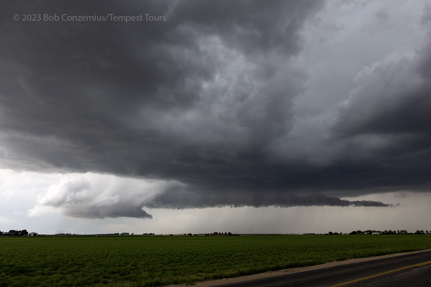 |
| Wall cloud on our first storm of the day. |
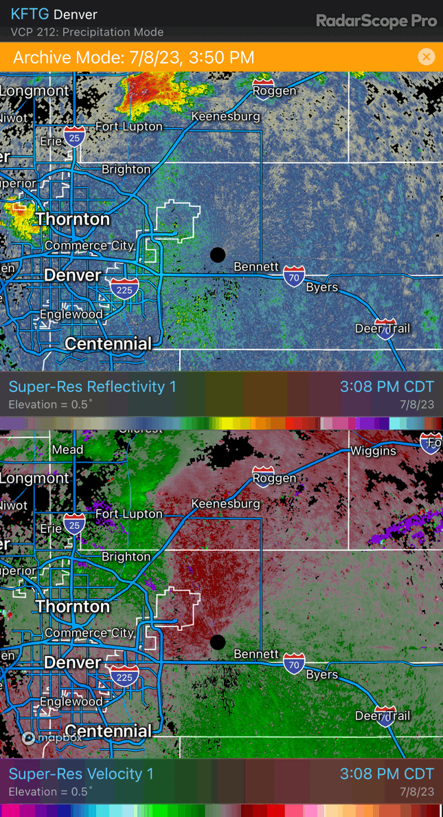 |
| Radar loop of the early phase of the storm. |
It turned out that there was nothing major going on. What we did notice, however, was that things were starting to surge a bit south. We continued south as new updrafts developed ahead of us. We repositioned to get ahead (south and east), then we'd be caught by northerly winds again. All these areas seemed to coalesce indo a single boundary, now to our south, so we kept heading in that direction. At one point, we noticed a strong gustnado in front of us. I got a little too excited and called it a landspout (a weak, dusty tornado), but looking back on my video, it did not appear to be connected with any rotation at cloud base.
 |
| Radar loop as storms propagated forward and merged. |
 |
| A gustnado appears on our way south. |
All this reposition soon got us to I-70 east of the airport. There were now numerous updrafts to our southeast, and rain was beginning to fall out of many of them, so I hopped on I-70 eastbound, which would be the fastest way to get ahead of this whole mess. We had to drive fairly close to the speed limit but occasionally slowed down to prevent hydroplaning. We soon came around to the east of the main storm complex, and we could see a large and ragged barrel-shaped updraft.
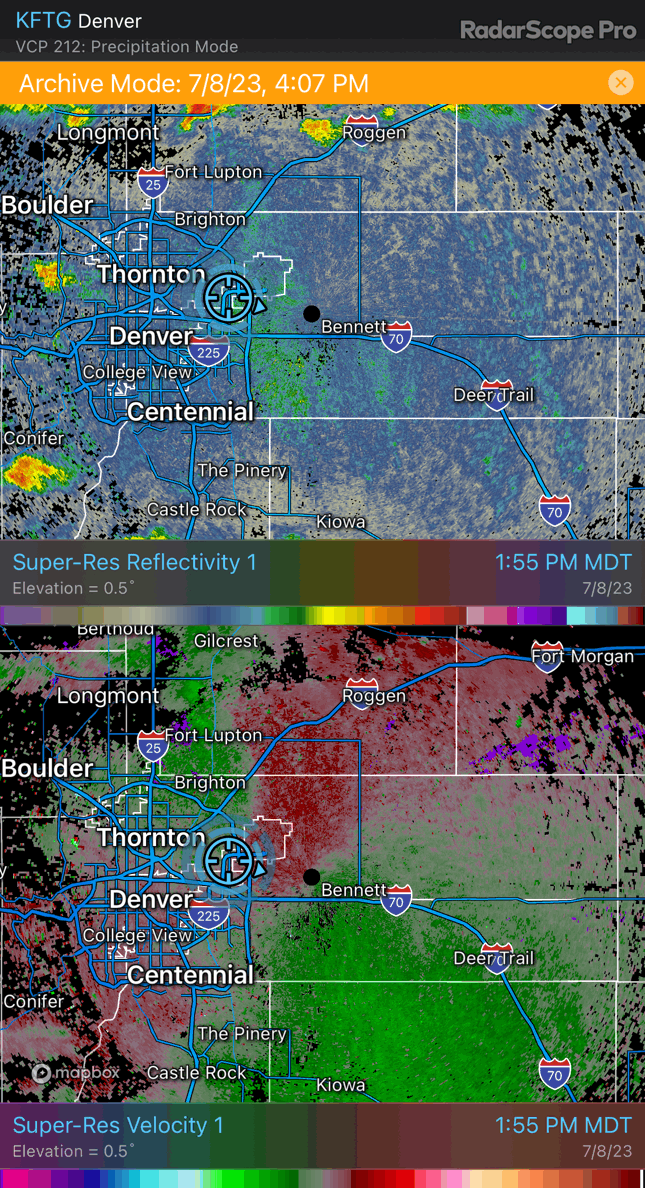
 |
| Radar loop showing development of the storm with rotation. |
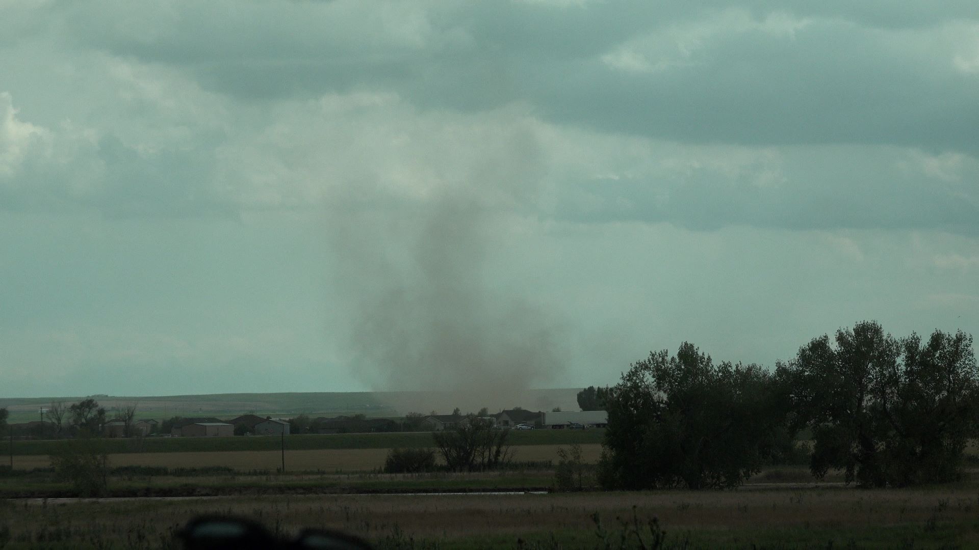
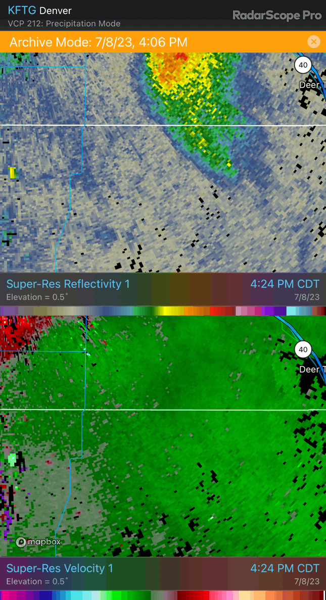
We exited between Deer Trail and Agate and drove west to get a closer look. Once we were headed west on the nearest dirt road, I stopped for a second to assess the motion. I could make out some large scale rotation with a low-level inflow band circling into the storm from the northeast and the closest portion of the barrel rotating a little back to the north. This was very much a supercell. A look on radar confirmed an intense core and a velocity couplet. As we continued west, a tornado warning was issued. We found the nearest hilltop and decided to enjoy the view from there rather than get closer. The next few miles would take us into a relatively low area between ridges, and our visibility of the horizon would be worse than it was on our hilltop.
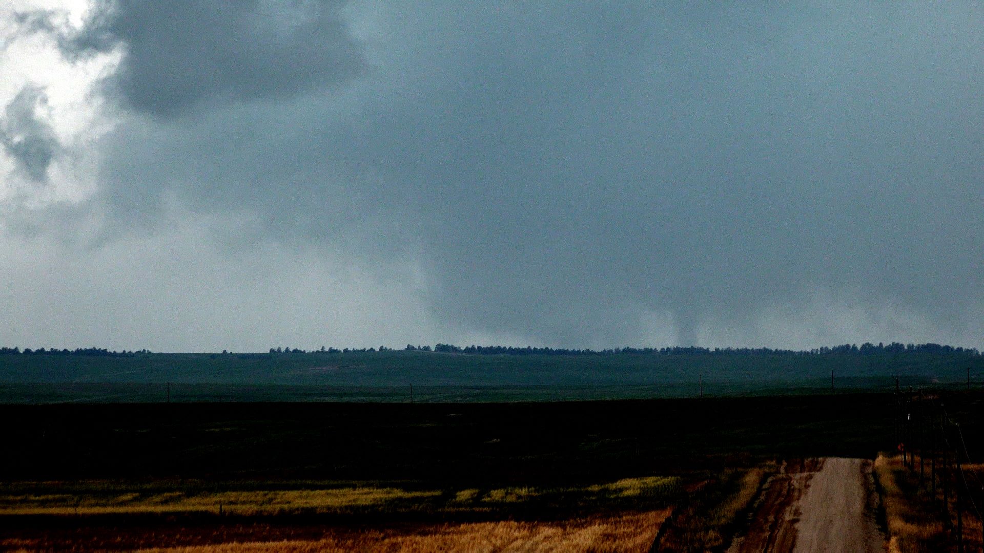
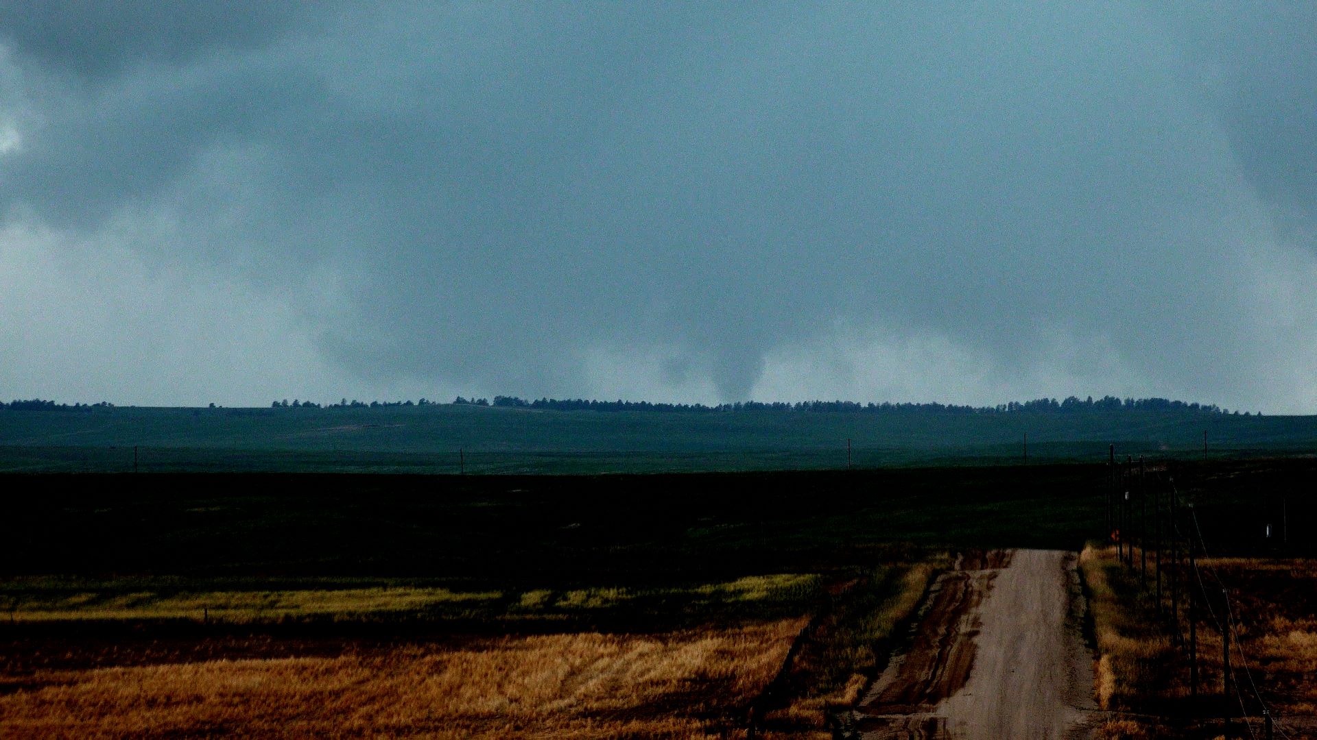
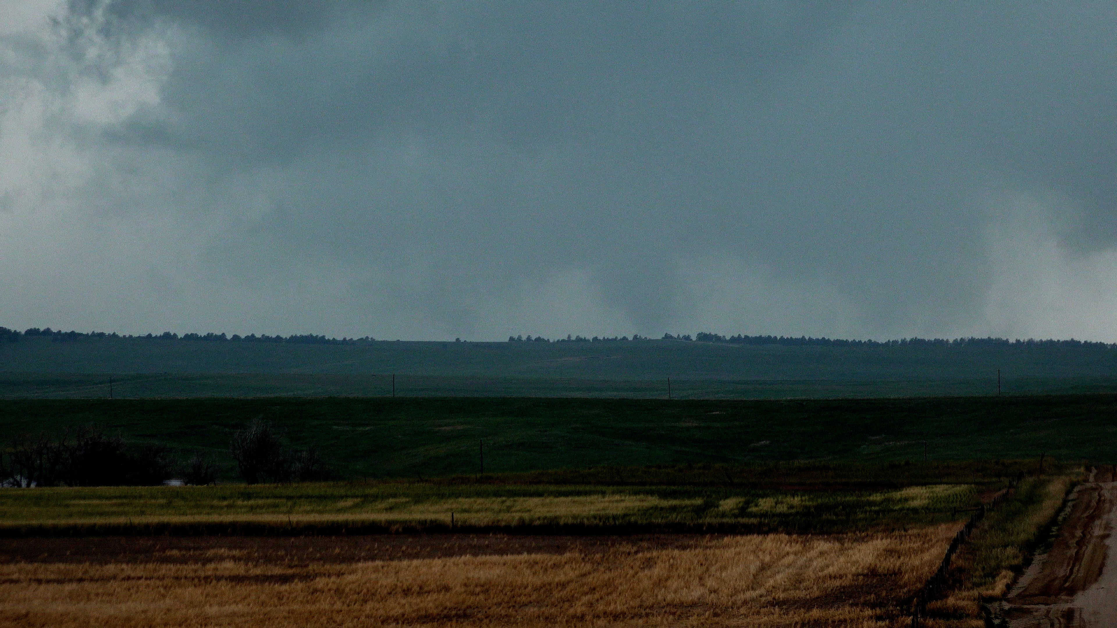
I zoomed the camera in underneath the updraft base, and a narrow cyclinder of darker condensation appeared in an area of strong differential motion. We were 12 miles away, so the contrast wasn't great, but I called it a tornado. This condensation widened a bit, and its base was at least down to the horizon. Unfortunately, nobody was close enough to confirm or refute ground circulation with this item, but it looked convincing enough to me that I reported it.
 |
| A narrow cylinder of condensation appears within a larger area of differential motion. |
 |
| Condensation funnel gets wider. |
 |
| Another screen capture from my video. |
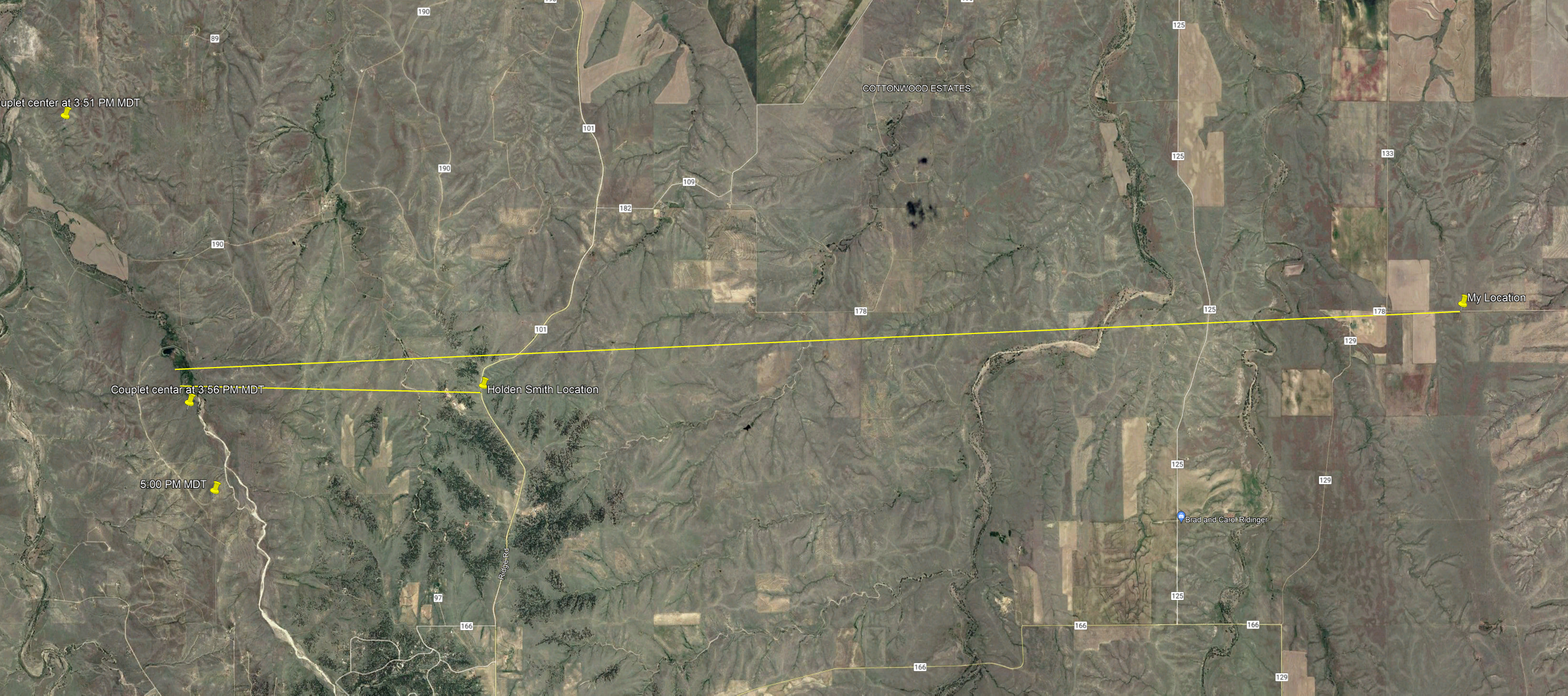 |
| Viewing locations and the circulation locations. |
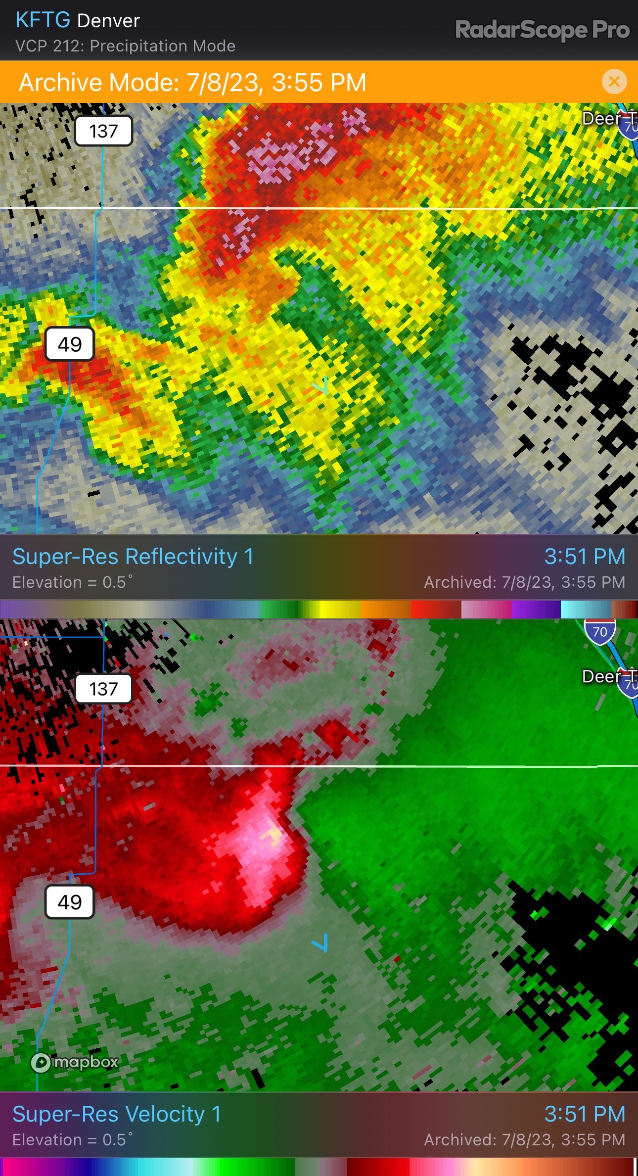 |
| A radar view of the storm at time of peak rotation. |
One thing that's interesting about the rotation is that, on radar, it looks a little broad. Within the couplet, the strongest velocity difference is not gate-to-gate in nature. It is spread across several azimuth gates. There appears to be enough shear there that a funnel tornado could have briefly developed. Indeed, that's what we saw. It was not there for more than a minute. Shortly thereafter, contrast got worse, and the whole thing fell apart. It evolved that way on radar, too.
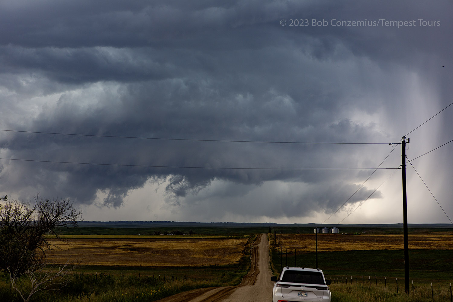 |
| A look at the tornado-warned storm from our hilltop location. |
From there, we hopped back on I-70 to hopefully come back around on the storms again. By this time, a line had developed, and there were various strong cells within the line, some of which were warned. We drove southwest on U.S. 24 toward Colorado Springs, viewing what we could along the way. We didn't have time to chase any farther than Colorado Springs, and from there, we turned back north and drove to the airport.
 |
| Another storm near Ramah, CO. |
 |
| Another storm near Calhan, CO. |
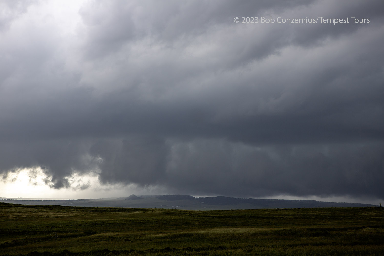
On our way into Colorado Springs, we could look to the south and see a supercellular storm. This storm likely became the tornado producer near Kim, Colorado later. Since this was the end of the tour (and, in fact, a bonus chase day), we could go no further. We all had to get back to Denver.
 |
| A storm . |
Back to Storm Chases | Home