September 17, 2022 Supercell
Leech Lake (Minnesota)
There was a slight risk of severe storms, including supercells capable of producing tornadoes, so the SPC had a 5% tornado contour around parts of northern Minnesota. Given that it was late in the season, and I might not have an opportunity to chase until Spring, I decided I should try to find what I could. Additionally, it was a Saturday, so it was a good day to do something fun. I had some things to do at Mt Itasca in the morning, and when that was finished, I headed back home, charged up, then drove southwest to where I thought storm initiation would occur.
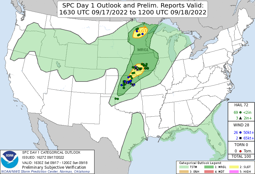 |
| The 1630 UTC SPC Day 1 outlook with overlain storm reports. |
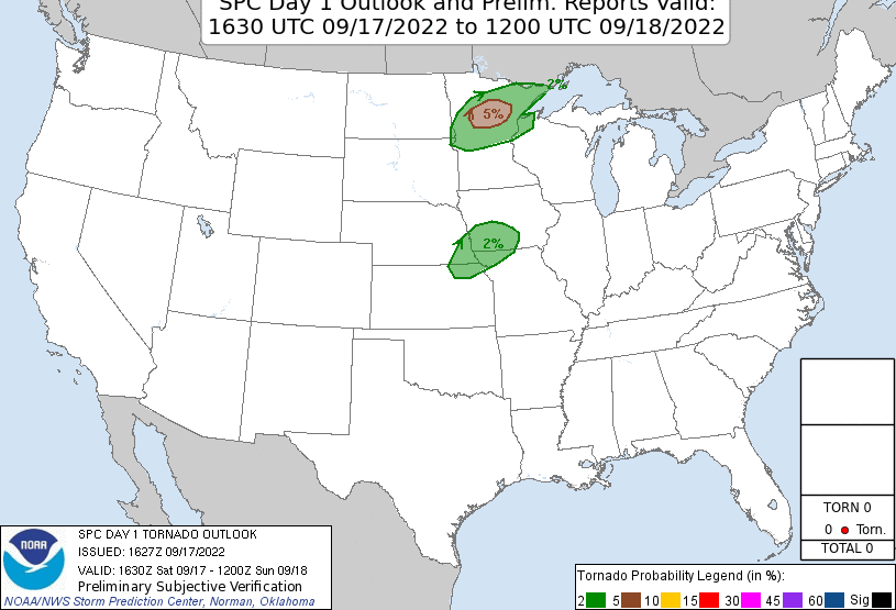 |
| The tornado probability graphic for the 1630 UTC Day 1 outlook. There were no tornadoes reported. |
This brought me to Park Rapids. When I arrived at Park Rapids, towers were going up to the southwest, and radar echoes were beginning to present themselves. I drifted south to Menahga, then came back north and watched a small cell approach. It had a decent shape, good separation between the rain and the updraft base, and it may even have had a little bit of a rear flank downdraft (RFD), but the storm was struggling a bit. It was not strengthening very quickly.
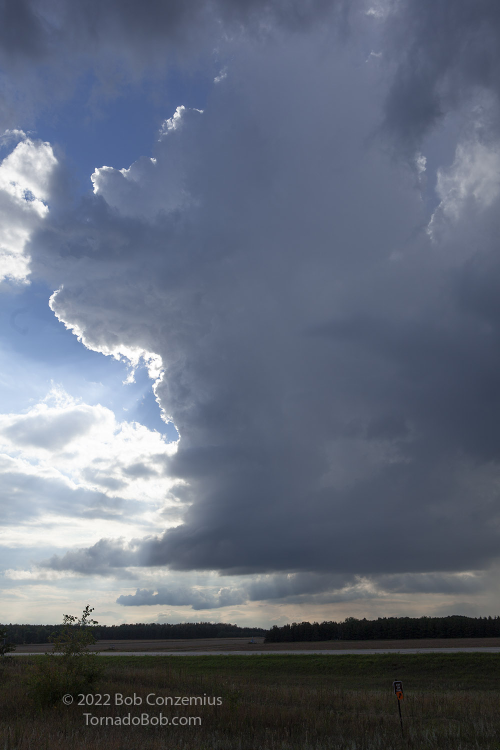 |
| First storm develops south of Park Rapids, MN. |
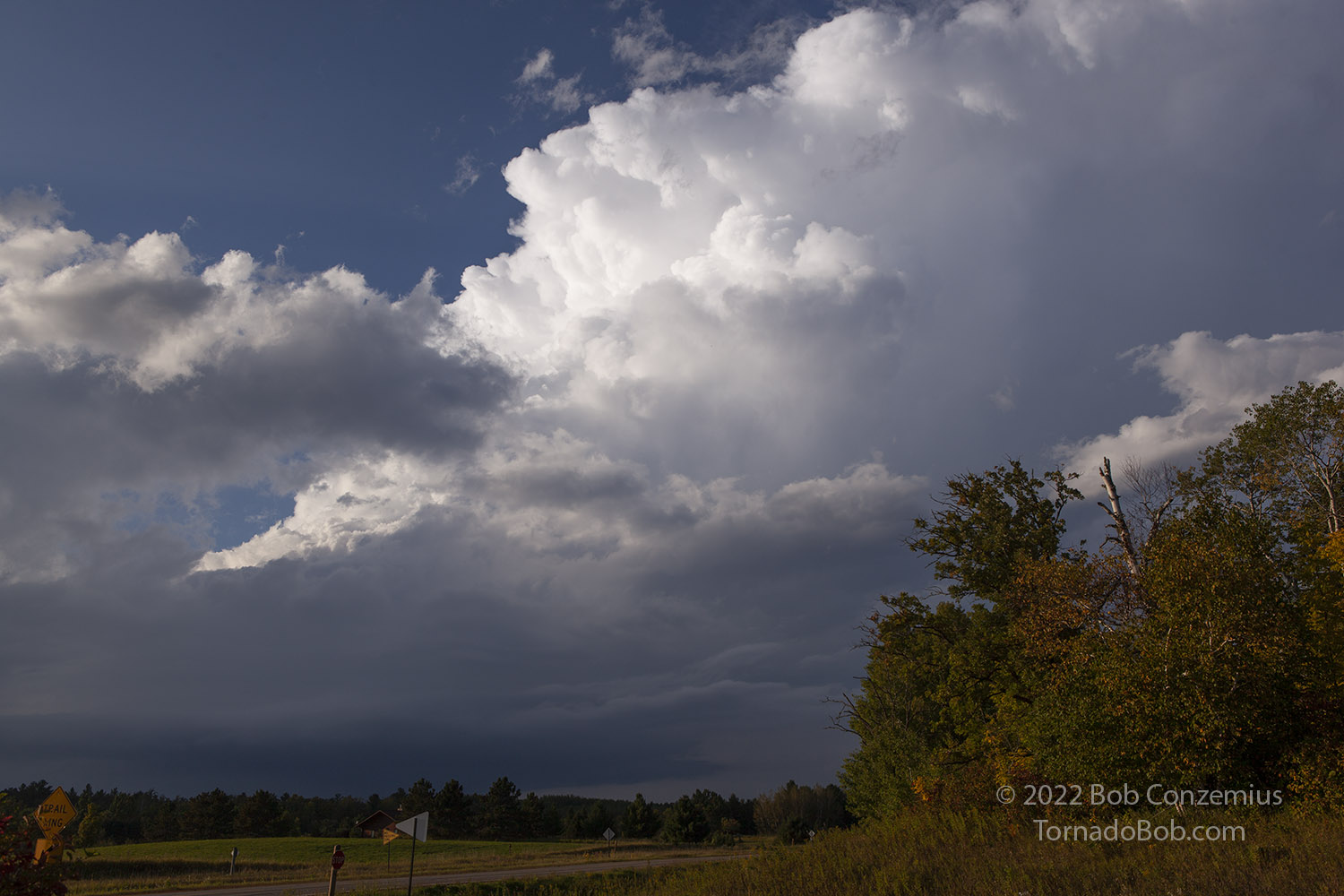
A cluster of storms gradually took shape to my north, so I drove back to Park Rapids and drifted northeastward from there. The multiple storms were now consolidating into one dominant storm north of Park Rapids. I targeted this storm as it became severe-warned, and I came up to the updraft base just north of Emmaville. There, it featured a wall cloud with some slow, low-level rotation. I began to follow it east, but the storm drifted across the Paul Bunyan State Forest, and I would have to drop back south and take a county road southeast. This took me away from the updraft base. This was okay because the storm lost a bit of its organization as I drove away from it.
I got back to Highway 34 and turned back east-northeast to try to get back within view of the updraft base. Finally, between Akeley and Walker, I was able to stop at a trailhead parking lot and snap a couple pictures of the storm. It looked pretty healthy again. I decided to get back in front of it if I could.
 |
| Co Rd 87 and MN Hwy 34 between Walker and Akeley, looking north. |
I parallelled the storm over to Walker and took the road on the south side of town past the sewage treatment plant. The plant was located on a hill south of town, so there was a pretty decent view from there. The storm came back into view with a decent wall cloud and a collar cloud around the main updraft base. I sat here for a while, took some stills, and attempted a time lapse (all set up except I forgot to hit the record button).
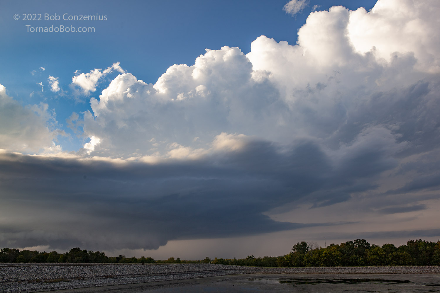 |
| South of Walker, MN as the storm was about to cross Leech Lake. |
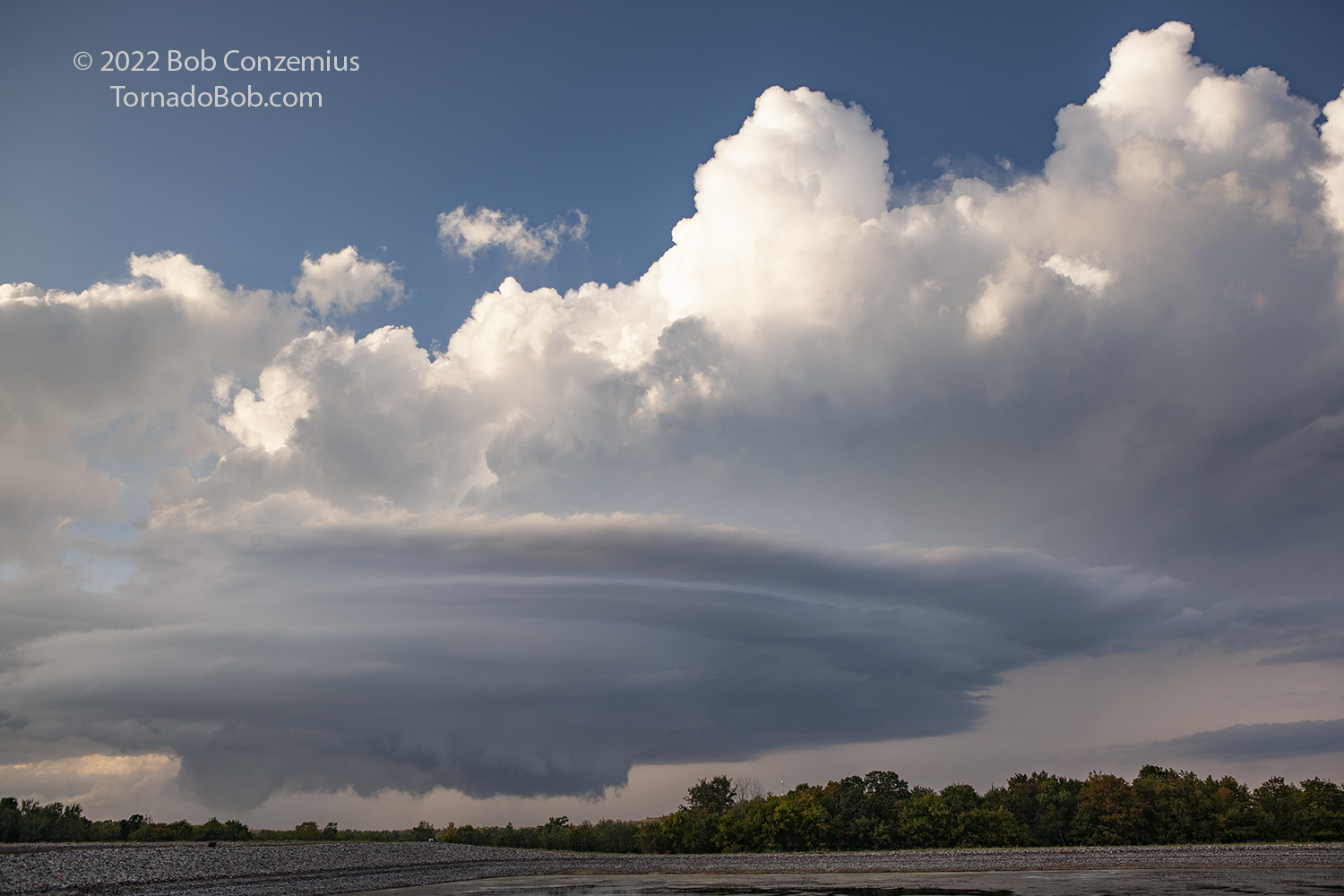 |
| The storm shows som interesting features at low levels. |
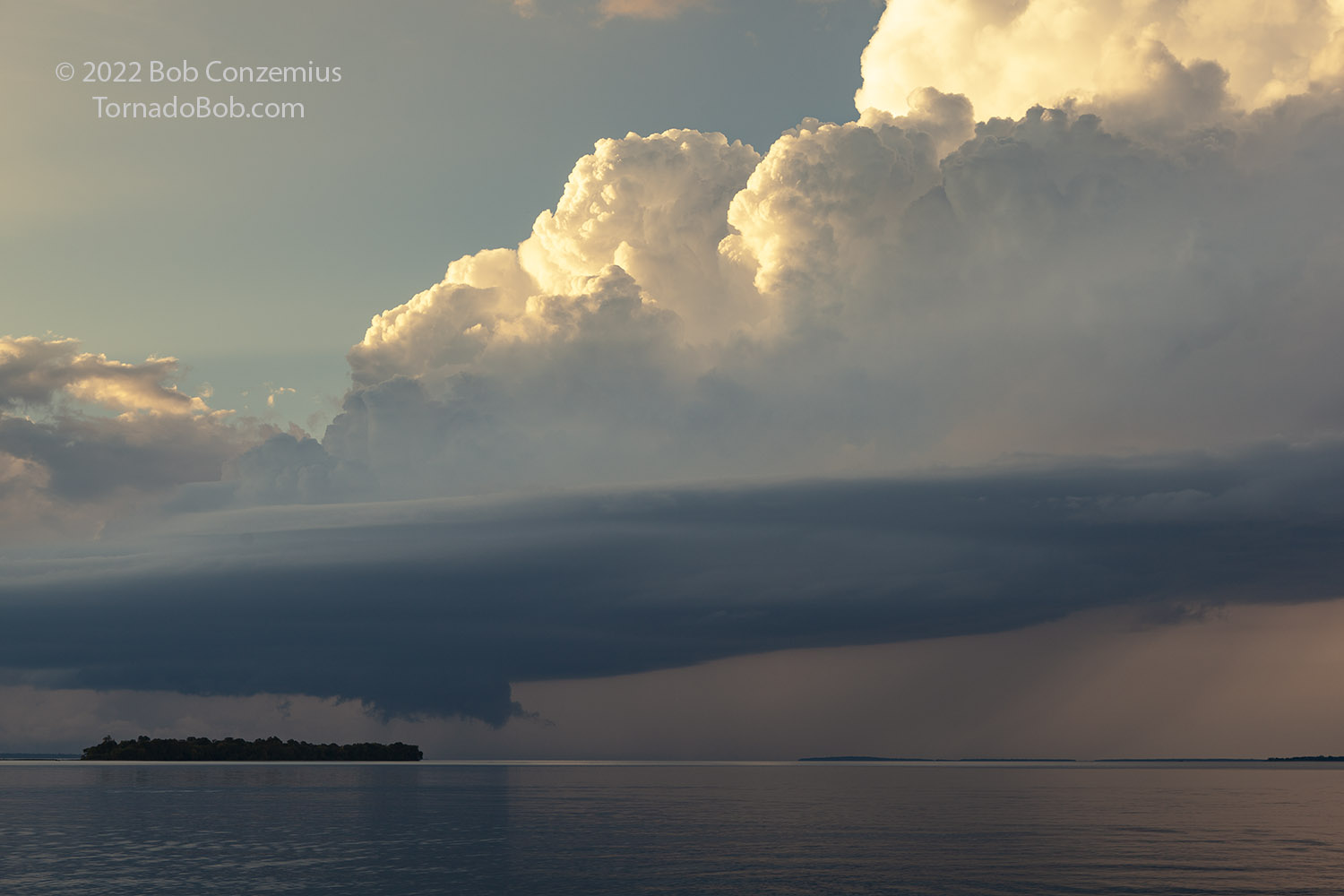
With the updraft base now getting a slight bit east of me, I decided to head east to Whipolt, where there was a nice view to the north and across Leech Lake. The storm would track right across this great view! I dove east and set up a timelapse. I also took quite a few stills of the storm. Aaron Jayjack and I watched this storm for about 30 minutes from the Whipolt beach.
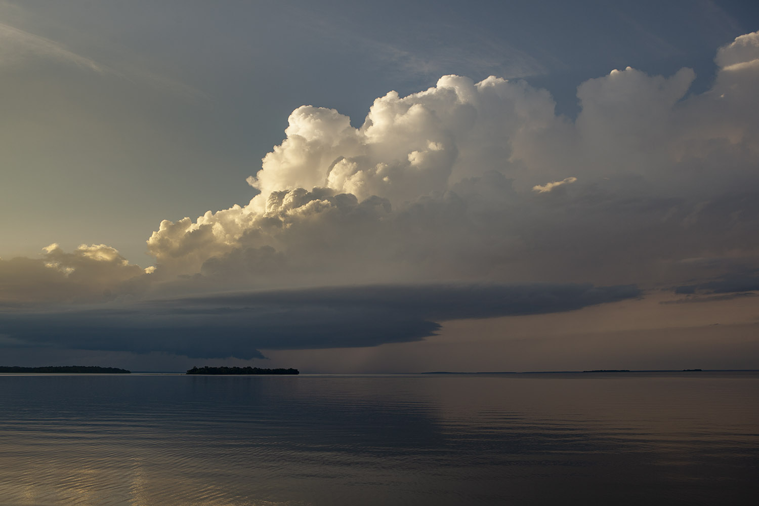 |
| The LP storm viewed from the wayside rest at Whipolt on the south side of Leech Lake. |
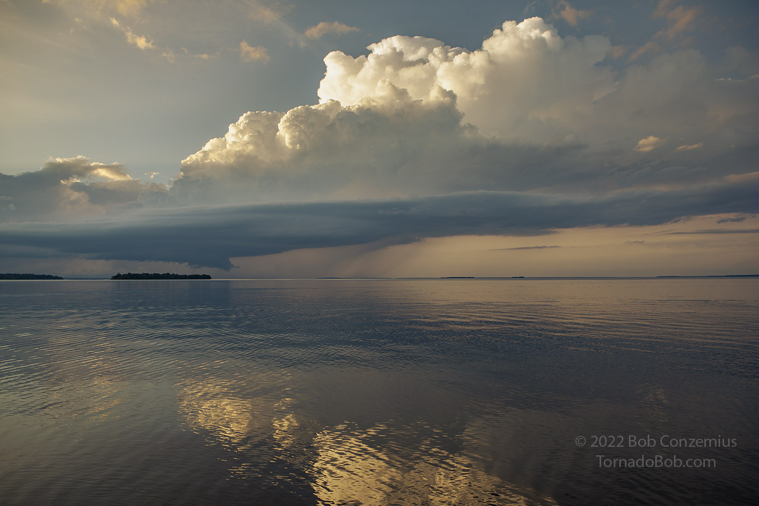 |
| Strung out but still with a wall cloud. |
 |
| Persistent as it slowly moves from southwest to northeast. |
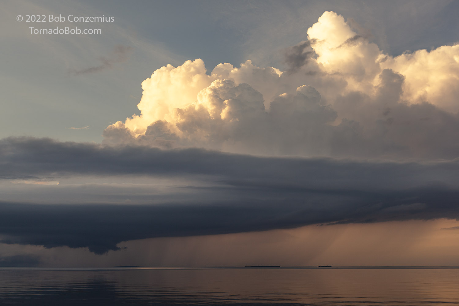 |
| Last image from Whipolt. |
After our viewing, I took off to the northeast (closer to home), and Aaron drifted back south to another strengthening storm. The sun set, and I had a harder time following the storm visually as the sky around me became mostly overcast. I followed the activity northeastward toward Deer River where radar showed I had another chance at intercepting the storm. However, it was beginning to lose its supercellular characteristics. I continued past Deer River on Highway 6 and turned east on County Road 19, which took me east to the land bridge between Deer Lake and Moose Lake. I set up a tripod pointing north over Moose Lake and took a few pictures of the storm as it transitioned into more of an outflow-dominant storm. After a few pictures, I headed home. Other storms had developed farther southwest and were now approaching Grand Rapids. I arrived home just as these storms hit. That ended the chase for me.
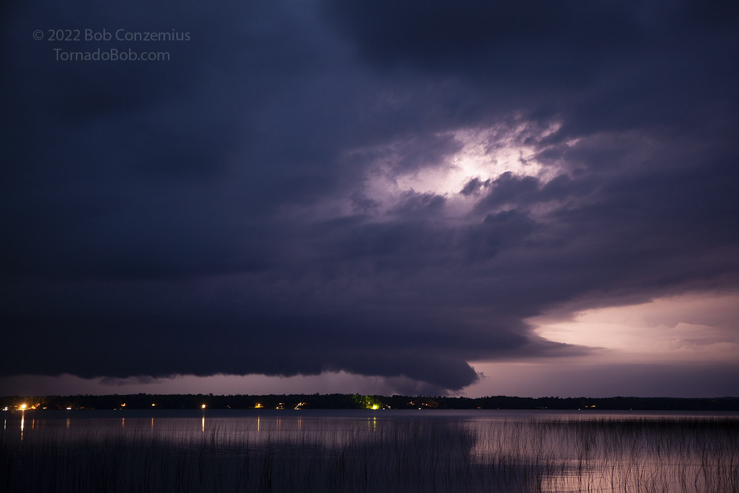 |
| Storm crosses north of Moose Lake, north of Deer River, MN . |
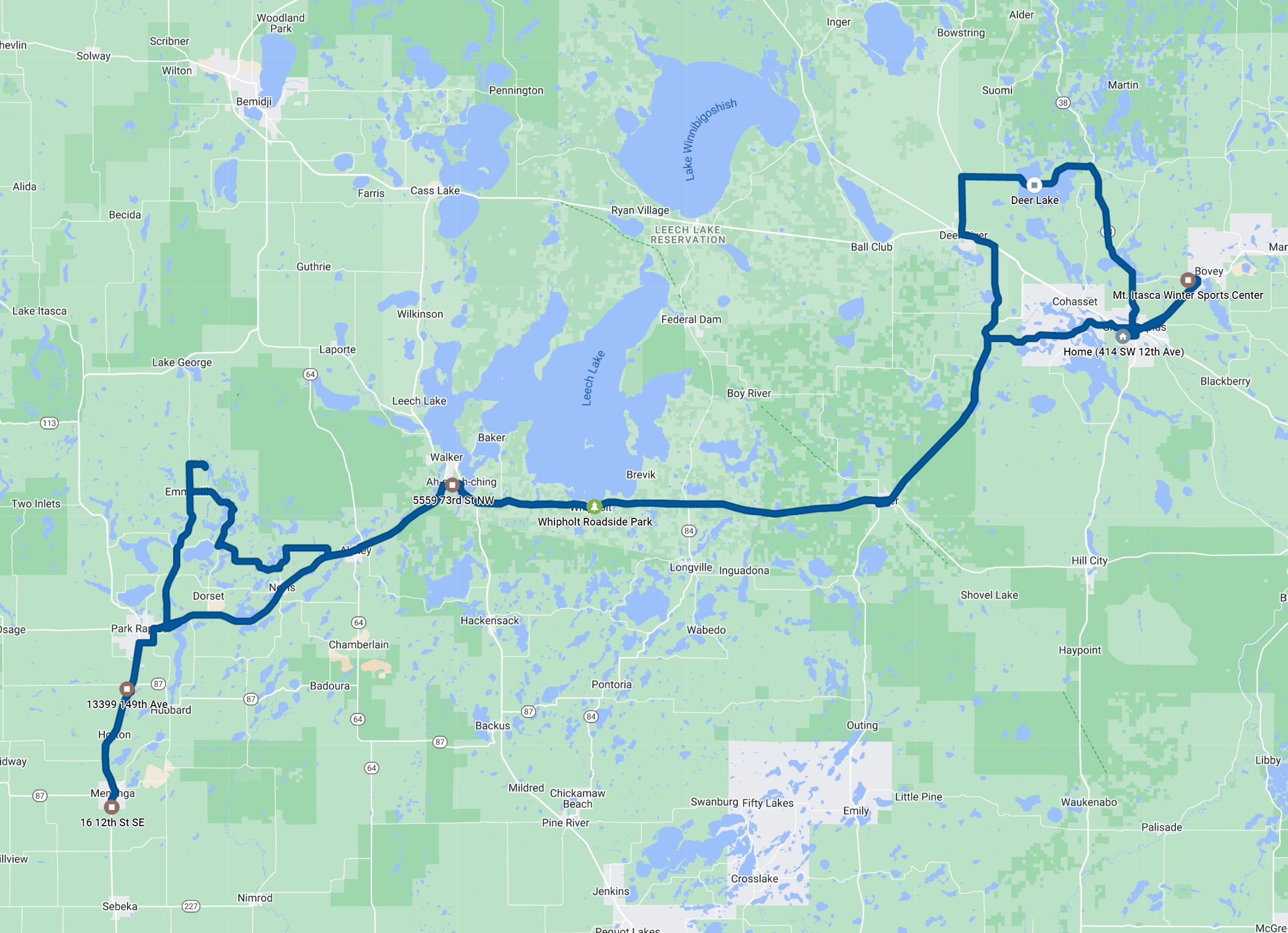 |
| My route for the day. 248 miles. |
Back to Storm Chases | Home