July 8, 2018 Supercell
Vergas, MN
This was more of a storm observation than a storm chase. I had driven to Vergas for other reasons, and the atmosphere decided to put on a show, providing us a view of a supercell that went by in such a way that we didn't have to drive anywhere to get a good look at all its features.
I had driven to Perham and then to Vergas to spend the day with some friends who come up to Ottertail County's lakes to spend a week relaxing. The week that they choose to visit generally is the peak of severe weather for Ottertail County. Approximately around July 4, the area from near Fargo down to the Twin Cities lights up with strong storms, such that I've come to name it the I-94 Storm Corridor because a lot of storms start in southeastern North Dakota and move east-southeastward toward the Twin Cities area. 2019 was no exception. On this afternoon, storms were expected to develop in the Minnesota/North Dakota border area and move southeast.
During the late afternoon, cumulus clouds grew into towering cumulus. The first echoes appeared on radar just before suppertime, and by the time supper rolled around, we were looking at an anvil stretching overhead.
 |
|---|
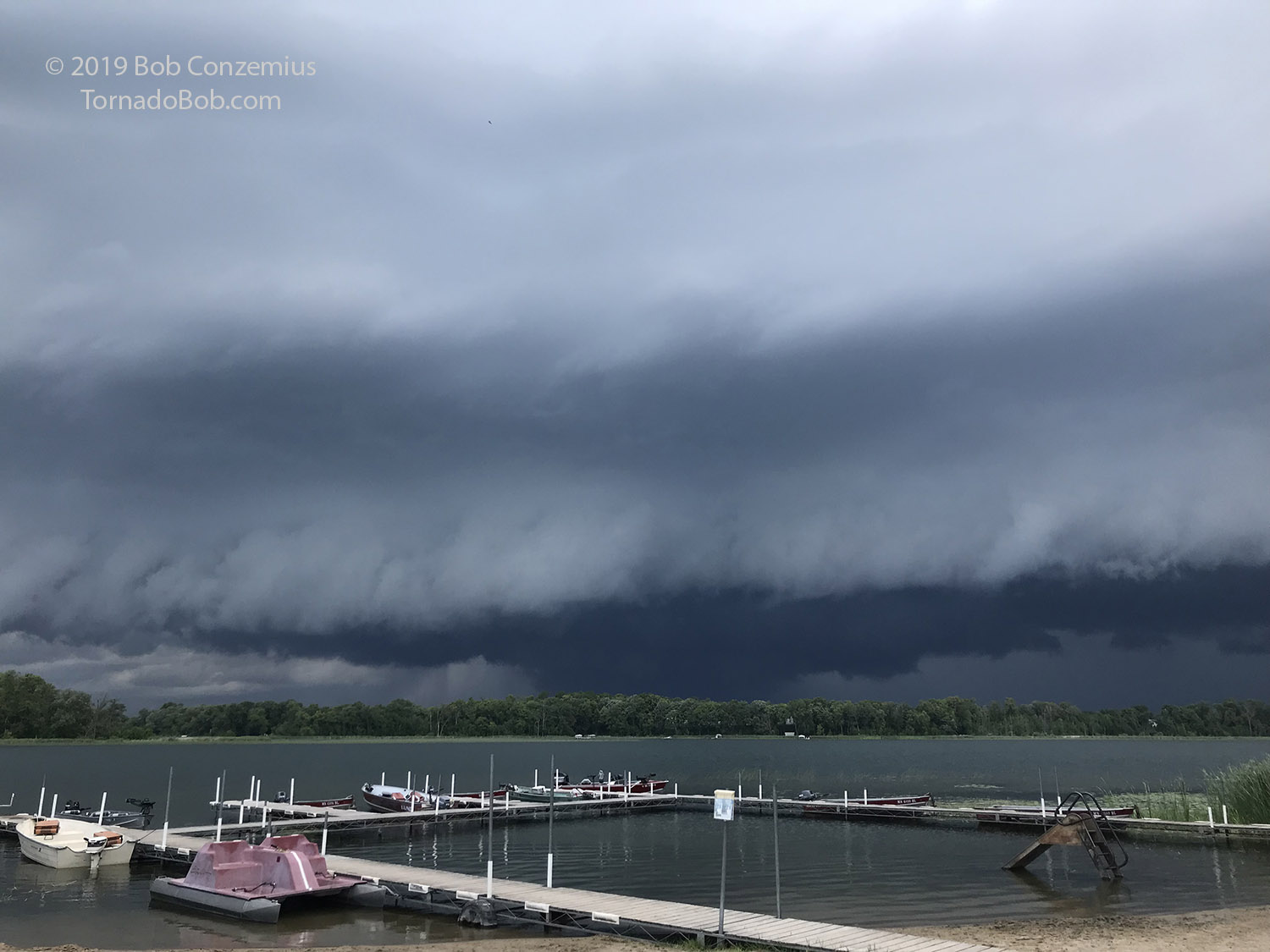
| 6:17 PM. An intensifying storm is visible to the west-northwest. It looks like we'll have a great view as it either passes by or hits us. |
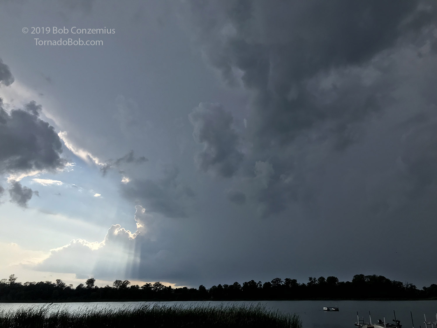
I wasn't really in a mood to leave my friends and head out on a chase, and the atmosphere cooperated. The storm rolled by to our north, affording us a view of the wall cloud and any potentially tornadic area without getting "cored"-- just the way I would want to do it on a chase. The storm approached just the way I would choose to approach it with a view of the updraft and the core of the storm just to the north. Soon, the updraft base came into view.
 |
|---|
| There were some nice crepuscular rays as the storm approached. |
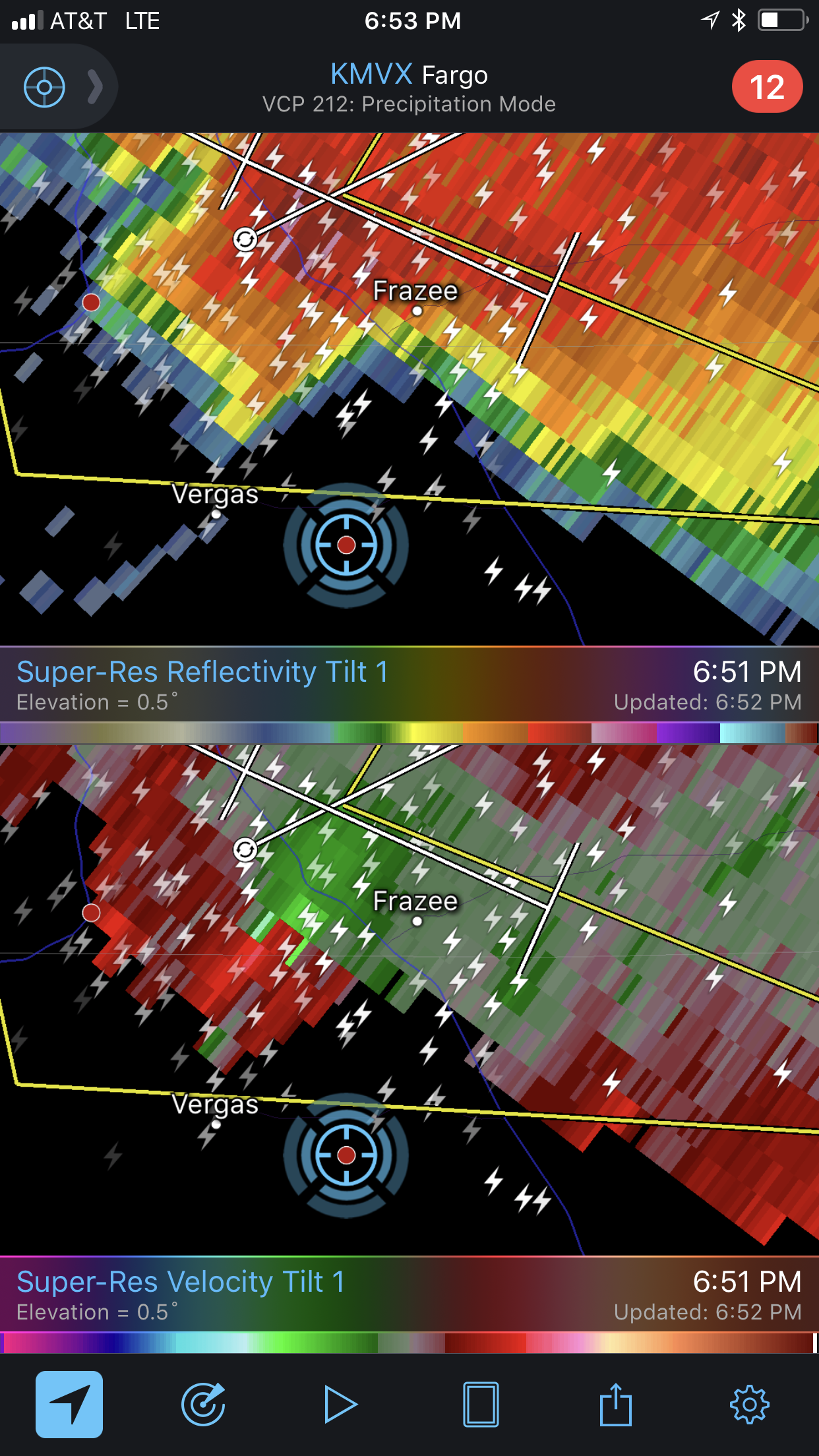
Radar was beginning to look interesting. There was an appendage of higher reflectivity appearing on the southwestern flank of the storm, and there was a bit of a weakly convergent velocity couplet as well.
 |
|---|
| The storm looked really nice on radar, and it even had a couplet. It was spinning! I did see some rotation. |
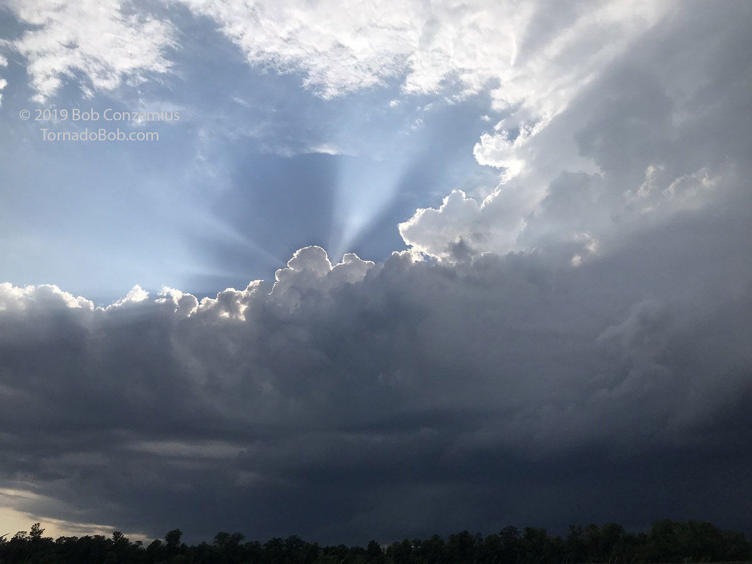
I walked up the hill, away from the lake, to get a better view. The wall cloud came into view, but I could also see a bit of a shelf cloud just in front of it. There were indentations in the shelf cloud, and at least one of these was rotating pretty nicely. Overall, I wasn't thinking the chances of tornado development were very large, but it storm certainly did look interesting!
 |
|---|
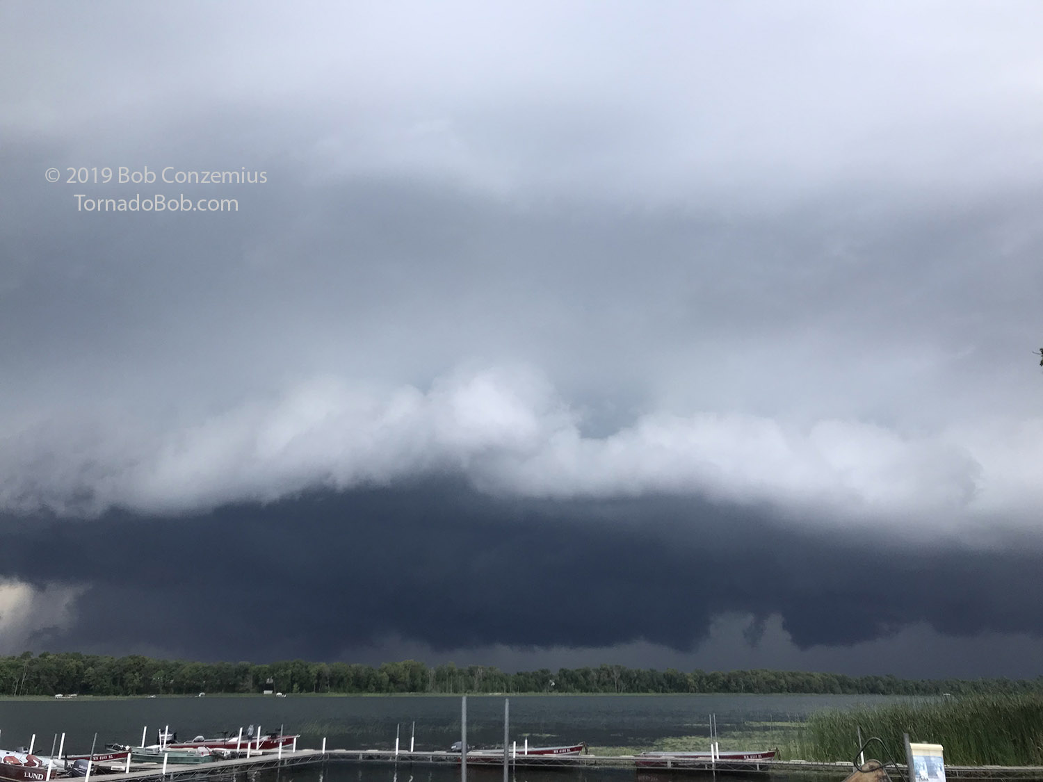
| At 6:46 PM, this big wall cloud appeared. The leading cloud edge, to the left of the darkest lowering, was rotating pretty nicely. |
 |
|---|
| A few minutes later, the area looked pretty mean, but I could not see significant rotation at this point. |
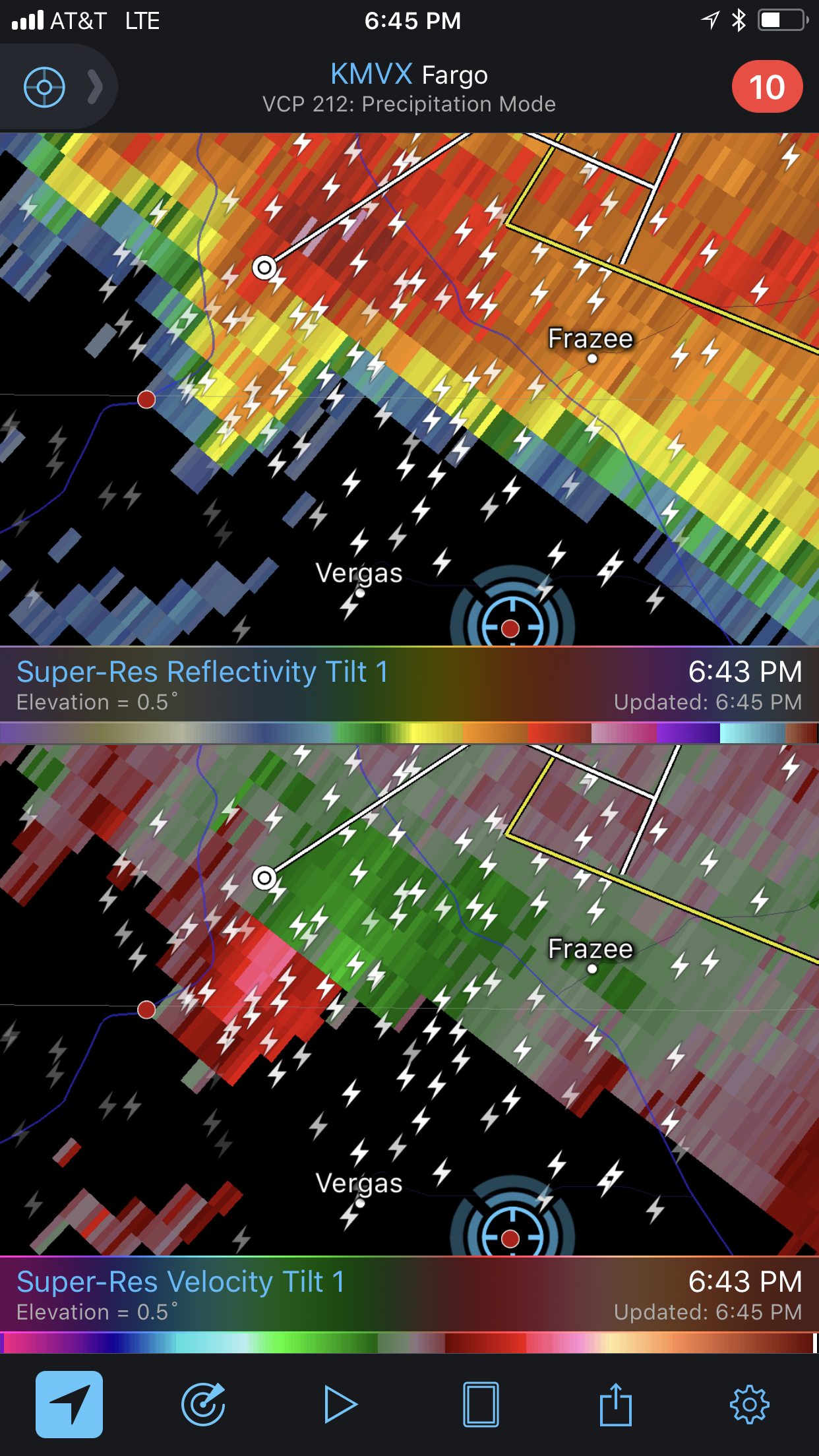
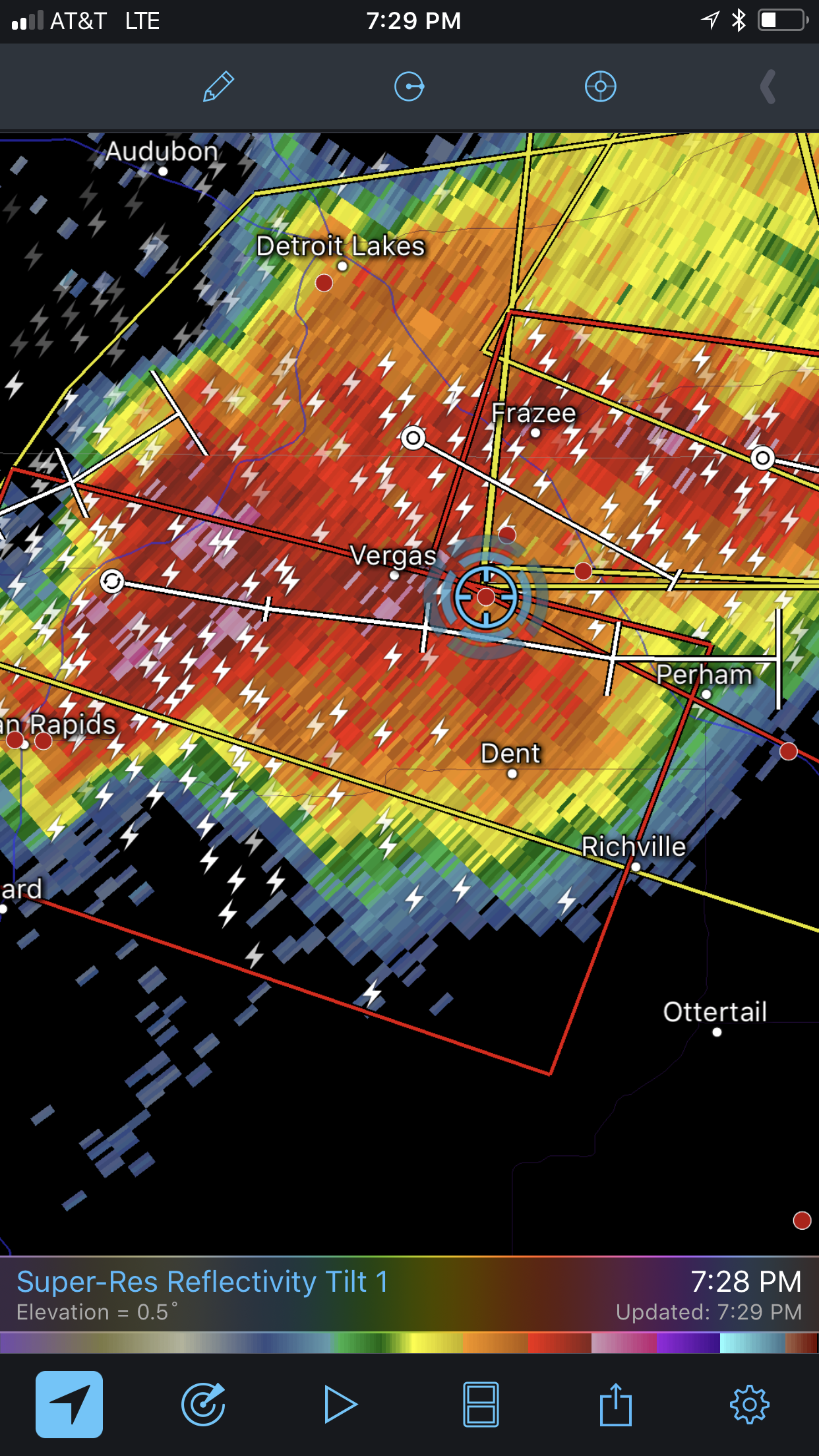
The next radar update showed a stronger couplet, but there was no visible rotation around the main wall cloud. Radar reflectivity showed a fine line extending from the southern flank of the storm, indicating the outflow might be racing ahead of the updraft base. That definitely appeared to be the case visually.
 |
|---|
| No visible rotation at cloud base, but the couplet was looking stronger. |
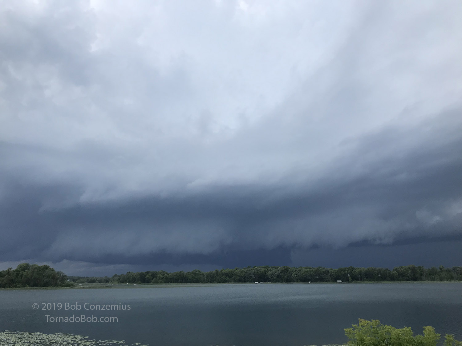
The wall cloud passed to our north, and soon, we were hit by a cold rear flank downdraft (RFD). We did not really get hit by this storm (except a few sprinkles), but another storm quickly strengthened to our southwest, and it moved in and gave us a nice, long downpour of rain and a little pea size hail. We at supper during this heavy rain. A tornado warning was issued as the first storm was directly north of us (and we were in the cold RFD), and a second tornado warning was issued for the southern storm while we were eating. It was clear, looking at radar, that any tornadic area in that storm would pass to our south.
 |
|---|
| On the far left side of the picture, an RFD is evident. We would get hit by cold RFD in about two minutes. |
 |
|---|
| Tornado warnings were issued for our cell and the storm to our south. We received mostly heavy rain and a little pea size hail. |
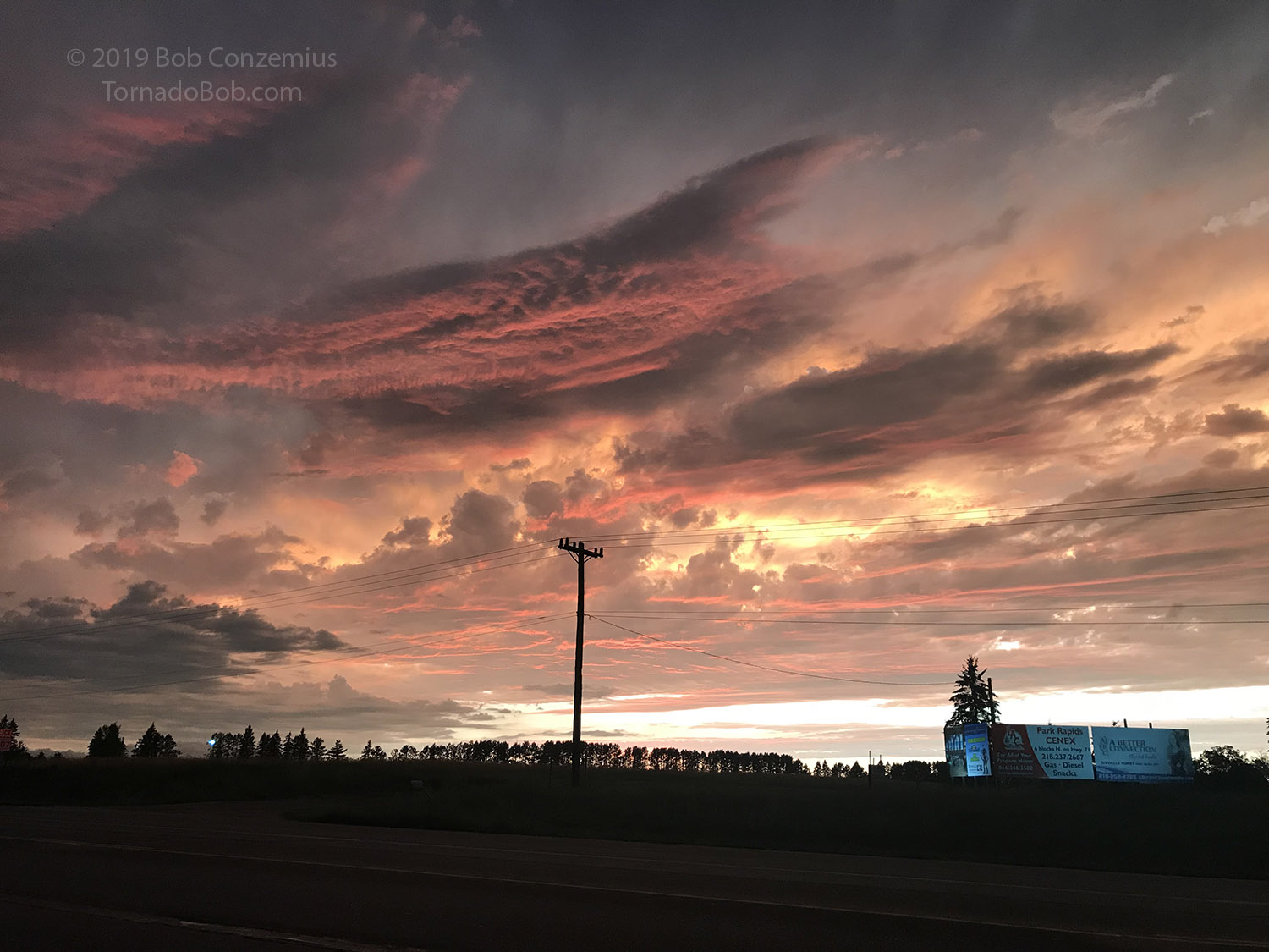
After nearly two inches of rain, the second storm moved east, and another one popped up to its southwest and began to affect us. It looked like the cells were training a bit. I took advantage of a brief pause in rain to get in my car and start the drive home. I chose my route to be out of the rain a bit because the range on my car was getting a bit low (there were no fast charging stations within easy reach), and I did not want to deal with decreased efficiency driving on wet roads. This gave me a nice view of the sunset, and I also watched storms to my east as I drove home. A line had developed between home and Alexandria.
It was my last "chase" for 2019, but it was a nice one.
 |
|---|
| Here's a look at the sunset on my drive home. |
Back to Storm Chases | Home