April 29, 2016 Oklahoma Squall Line
We left Pampa on a very cold, rainy morning and drove through thunderstorms, which were filling up the pothole lakes in the Panhandle. We cleared this rainy mess while deliberating whether to chase north or south of the Red River (Oklahoma or Texas). We chose the north option and proceeded to Altus, OK, where we were back ahead of the cold front and felt much warmer, more humid air. We ate lunch at a Billy Sims Barbeque restaurant in town. By the time we finished, new storms were popping along the front, and we had cooler air in town. It was time to move east and chase!
The Chase
We got ahead of the storms, but for the most part, they appeared to be undercut by outflow along the cold front. We hoped for new development ahead of the front, but that never happened anywhere close to use (it did happen around the Dallas-Fort Worth metroplex). We stayed on one cell for a bit to the east of Altus and just to the south of the Wichita Mountains.
 |
|---|
| The storm looks nice with a low base, but it is undercut a little bit by outflow. This first cell would eventually produce the Ninekah, OK EF-1 rain-wrapped tornado. |
We say another storm just to its south, so we targeted that storm. We were hoping it would be a little ahead of the boundary, but as it neared, we could see its position with respect to the boundary was not much different than with the northern storm. We continued slowly in a generally eastard direction and had both of these storms in range for pursuit, but we found outflow just about everywhere ahead of the storms.
 |
|---|
| For a while, this second, southern storm had some interesting structure underneath the base, but it, too, had outflow. |
We looked along the shelf cloud for any inflections and action areas that would indicate rotation, but we had nothing that looked particularly interesting. Actually, Chris pointed out at one point that an action area to the north of the road looked a little better than one to our south, but I couldn't see anything more interesting about it myself. We let it go. About 15 or 20 minutes later, this northern storm became a lot more interesting, and a tornado warning was issued for it as it was clearly a supercell. Any tornado would be rain-wrapped, and in fact, the only two chasers that saw the first of two tornadoes it procuced had to drive right through the heavy rain in the hook to get a 30-second glimpse of the tornado. We would not have seen it, but I think the chase *might* have been a little more interesting had we stayed with that cell. It was headed up I-44 toward the Oklahoma City metro area, so that wasn't really a good way to drive, anyhow.
For the rest of the day, we drove along the leading edge of a line of storms that produces some very nice "whales mouths". This took us all the way to Ardmore, OK where the storms weakened, and we called it quits for the day.
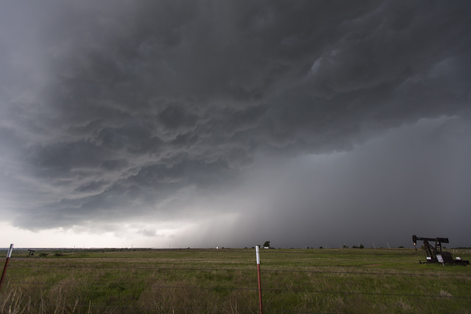 |
|---|
| A shelf cloud bows out over an oil rig. |
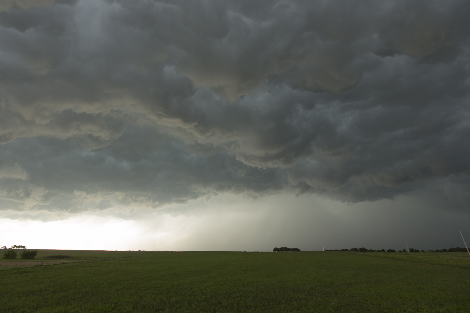 |
|---|
| Backlit shelf cloud against a green field. |
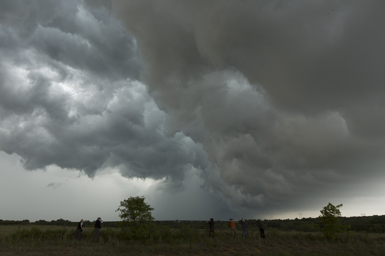 |
|---|
| Guests take pictures of the whale's mouth. |
 |
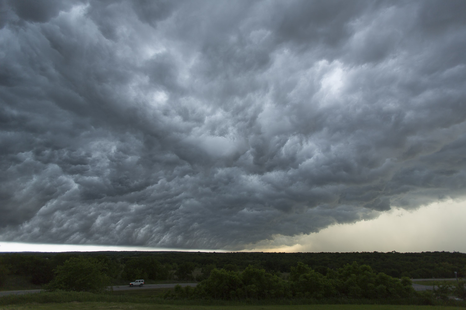
|---|
| Nice lighting underneath the shelf cloud. |
 |
|---|
| The boiling sky as we ended the chase in Ardmore. |
Chris and I took our private tour to the Quality Hotel in Ardmore where we stayed the night as we had to bring a guest to DFW airport in the morning. We ate a nice dinner at the Two Frogs Grill. I had Red Snapper--delicious.
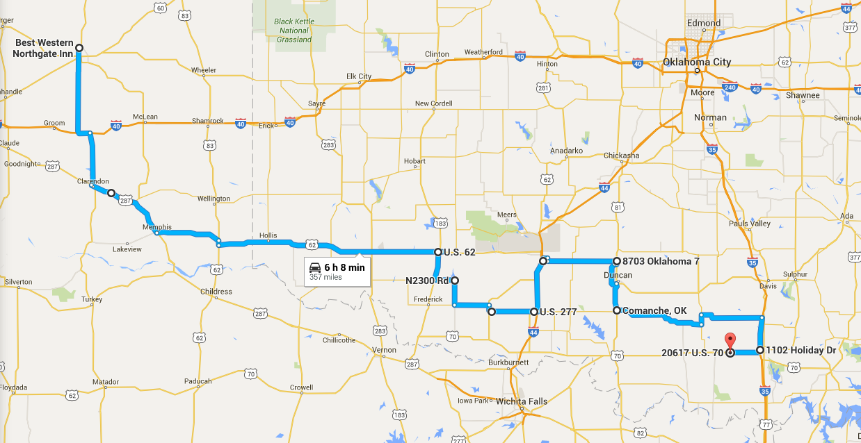
Bill took his van to Wichita Falls to have a shorter Day 2 drive for getting to the Day 3 target. Unfortunately, it turned out that they had left two pieces of luggage back at the Best Western in Pampa. Bill Schuessler had to take the van up there, stay overnight, and bring back the luggage in the morning.
 |
|---|
| This is the text that appears underneath the table. |
Back to Storm Chases | Home