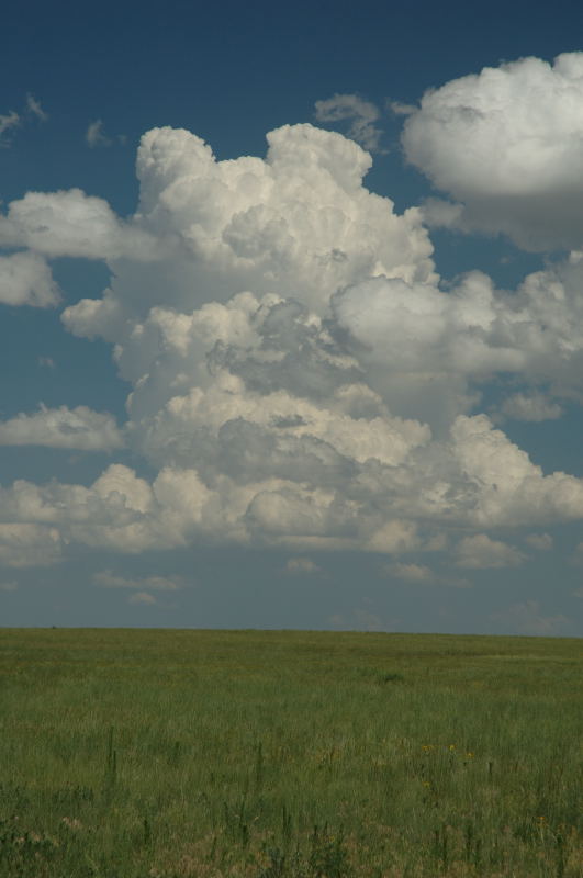
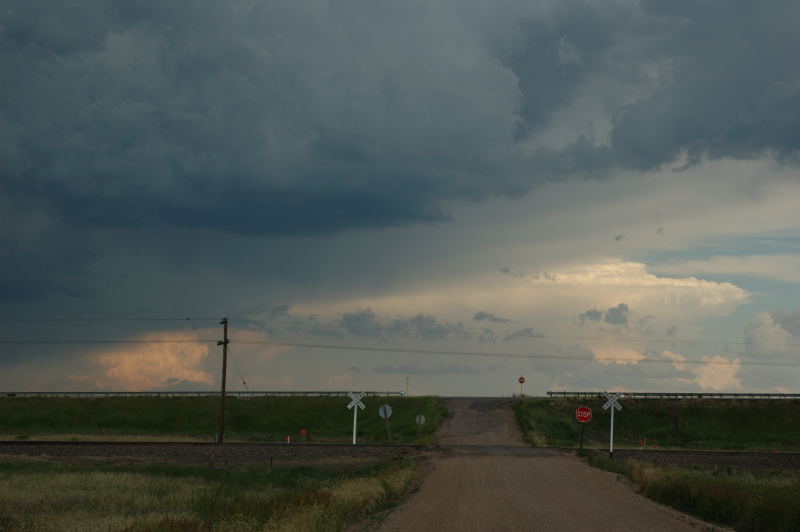
Storm tries to develop near Briggsdale (looking east).
I decided to chase today because the opportunity existed for a nice storm at a pretty close range. I had to be back in Fort Collins in the evening, so I did not drive too far. I stopped on Highway 14 between Ault and Briggsdale, hoping for something to develop close to me.
Storm tries to develop near Briggsdale (looking east).
Looking north at the storms near Cheyenne, WY.
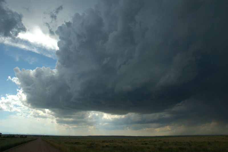
A storm to my northwest, dropping southeastward out of Wyoming, intensified to severe levels, so I chose this particular storm for an intercept. A few minutes after I arrived on the storm, the warning was dropped. It was therefore probably the best-looking non-severe storm I've seen in a while. I thought it looked pretty good. Looking on radar after the event, it did not look nearly so good, so I can understand why the warning was dropped. A new warning was issued a bit later as the storm intensified. Interestingly, this storm developed supercellular characteristics (visible evidence of rotation in the updraft, wall cloud, RFD occlusions, cloud base rotation) while the storm was not warned and not looking very strong on radar. Visually, I called it a supercell, but the radar presentation (other than looking LP) suggested otherwise.
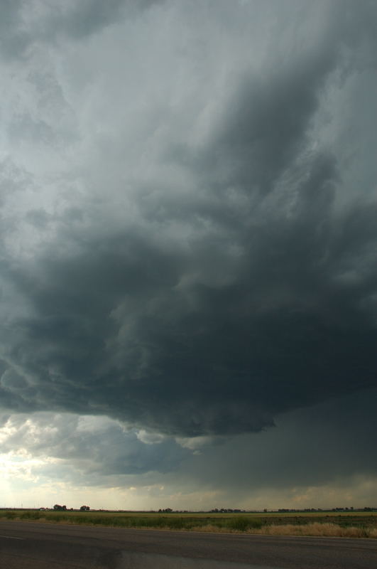
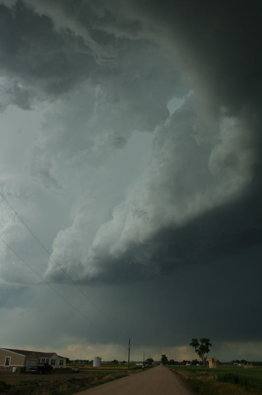
A more dominant storm develops and becomes severe-warned, so I move to intercept.
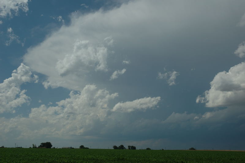
A healthy updraft is visible as I approach.
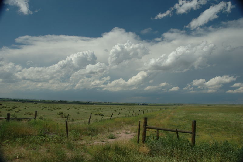
Other storms visible to the east.
Slow rotation was evident in the updraft at this time.
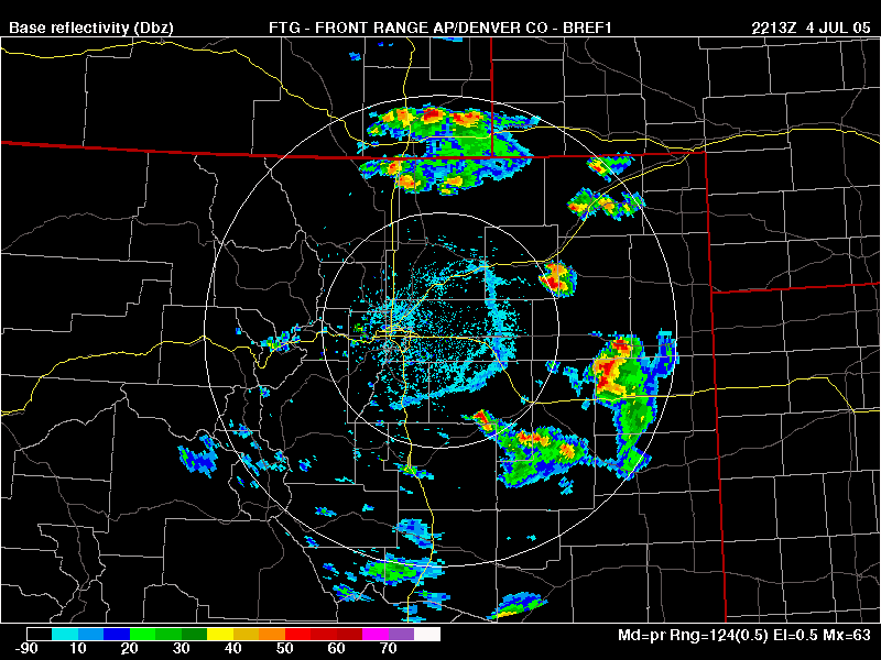
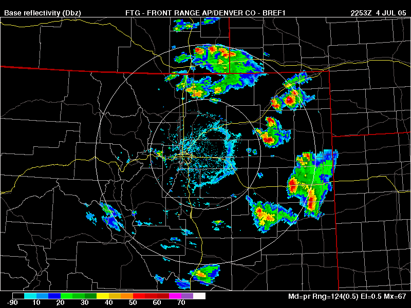
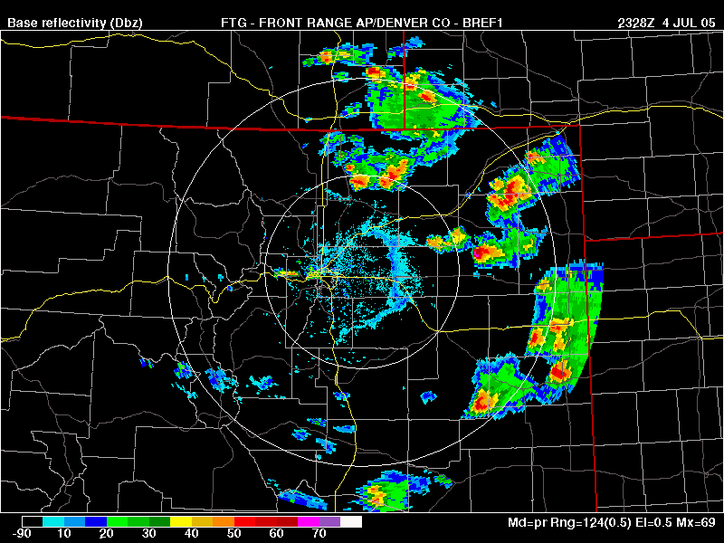
Meanwhile, the storm looked something like this on radar (look at 350-deg, just beyond the 50-mile range ring).
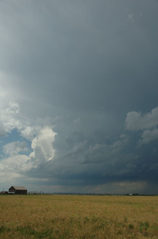
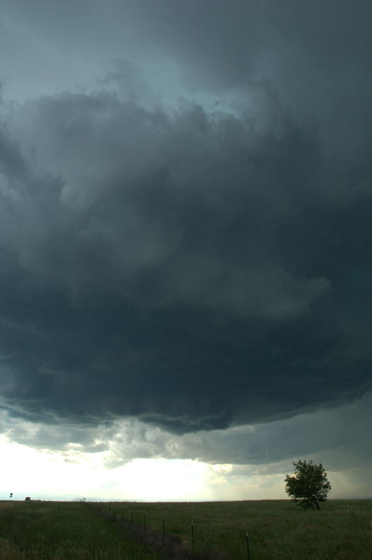
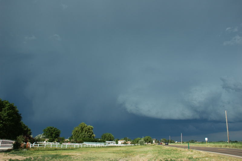
East of Ault, a wall cloud develops (looking northwest).
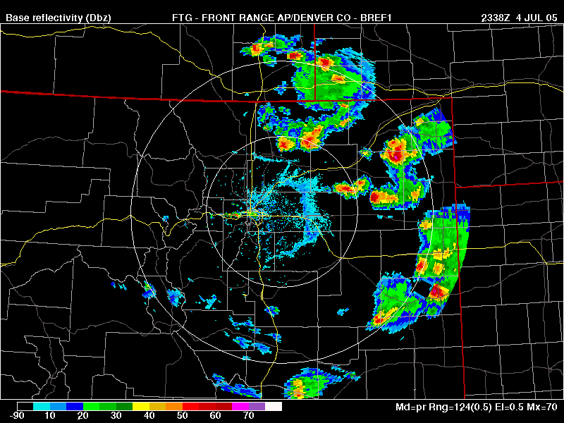
Radar shot three minutes after the picture above.
Once again between Ault and Briggsday on Highway 14, looking west. A weak RFD develops.
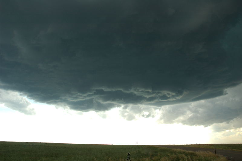
RFD swirls into the base, and the center part is now rotating.
Radar reflectivity at the same time as the picture above.
After a few more minutes, the RFD has eroded much of the base, and the updraft is now in the
shape of a backwards "C".
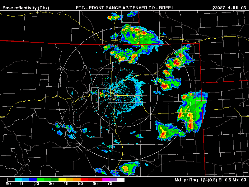
Radar reflectivity two minutes later (look at 360-deg, just inside the inner range ring).
Here's the last view I had, looking east, as I returned to Fort Collins.
Radar reflectivity one minute later. Outflow has surged south of the updraft. After another 26 minutes, my storm soon weakened, and the one just to its intensified.