May 20, 2001 (CoreFest!! 2001)
This was sort of a tough day
for me to get out. I liked a target of
southeastern Oklahoma or northeastern Texas along the Red River, and I was
about to leave shortly after noon, but when I did a surface analysis, it showed
that the winds across northern Texas and southern Oklahoma were veering. I wondered if the shortwave trough that had
fired the overnight convection would take all the moisture with it. Because of this, I stayed home another two
and a half hours, continuing to analyze data.
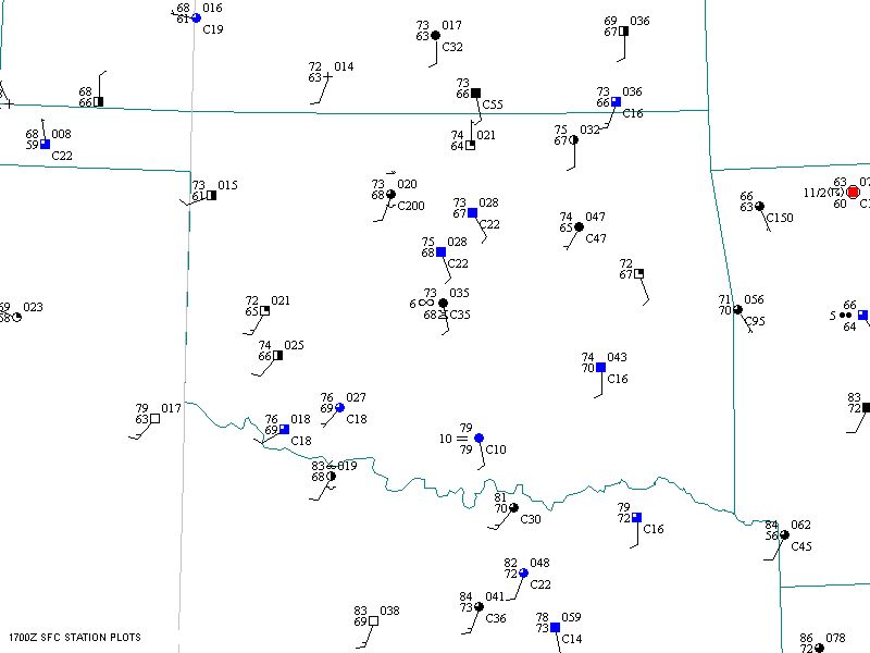
Figure 1. 17Z surface map (made with Digital Atmosphere)
Fortunately, the veering
came under control, and the winds stayed sufficiently backed east of I-35 in
Oklahoma, so my fears were unfounded. A
check of Mesonet data revealed an area of mid-70’s dewpoints in southeastern
Oklahoma moving steadily northward. By
19z, I decided it was best to drift east on Highway 9, and when I saw towers
developing out my window to the southeast (accompanied by a decrease in cumulus
to the west), I decided it was time to leave.
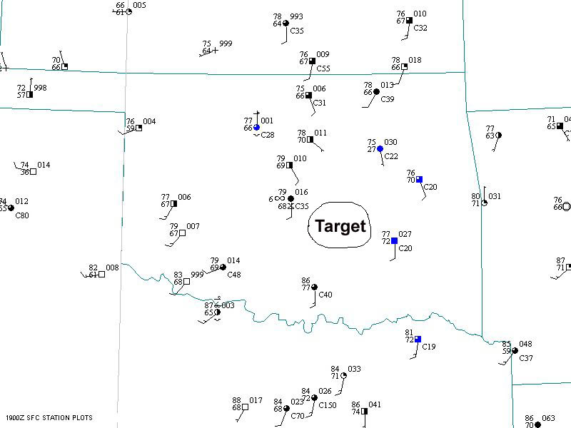
Figure 2. 19Z surface map (made
with Digital Atmosphere)
I drove east on Highway 9,
which goes due east from Norman, as towers rapidly built to my south and
southeast. Eventually, two separate
storms formed. I did not have a great
view of the one to my southeast, since it was partially blocked by the one
directly south of me, but it looked a little stronger, with a pretty solid,
narrow/dominant updraft. At this point,
I felt like the hero of the day, since the storms were developing farther north
than most people had thought, and my wait had paid off. I called the DOWs to inform them of my
visual observations, and I called RJ Evans to tell him things looked good up
north. Both groups were in south
central Oklahoma and had to come back northeast.
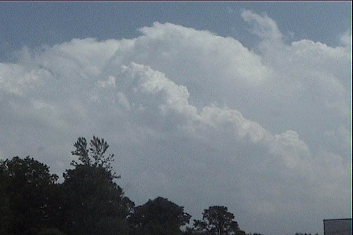
Figure 3. Initiating storm
viewed from just east of Lake Thunderbird on Highway 9.
I was uncertain about which
storm to choose, but a severe thunderstorm warning was soon issued for the
closer, southerly storm, which was now almost right on top of me. I decided it's better to get on a storm
sooner than later, so I aimed at the southerly storm, near Seminole. At this time, Meredith called with a radar
update and said there was rotation on the closer storm, even though the other
one looked a little more intense. It
turns out that as the DOWs were coming north, both storms had great hooks on
them, but the eastern storm showed a far better velocity signature with a
distinct ball at the end of the hook.
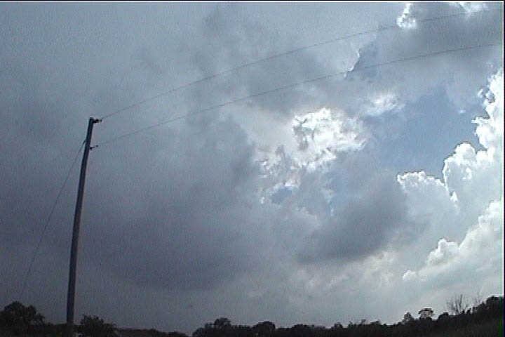
Figure 4. Pottawatomie County storm to my southwest
I dropped south to Bowlegs
to let the updraft base come to me. It
was tough to find a good clearing with visibility to the west. Finally, I could see
what looked to be a ragged
wall cloud above the treetops.
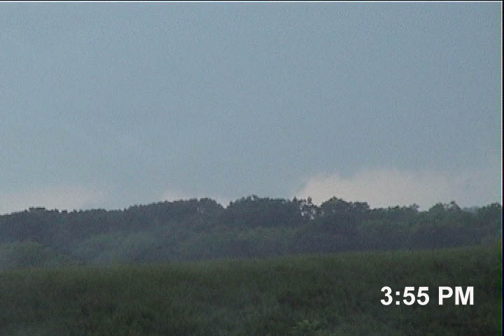
Figure 5. Wall cloud to my distant southwest viewed
from a spot near Bowlegs
Meanwhile, the storm to the
east of me really looked pretty good, with a single, dominant updraft tower
that was looking pretty hard through the rain from my cell.
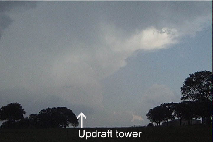
Figure 6. Updraft of eastern Seminole County storm
It began to rain and pea
(hail), so I ducked a couple miles south, only to discover a rapidly developing
mother-of-all-shelf-clouds approaching rapidly from the northwest.
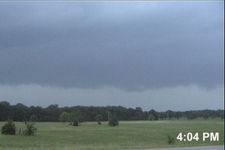
Figure 7. Developing shelf cloud, looking northwest.
I zipped back north to my
east option, found an high spot, and confirmed this was indeed undercutting the
action area, so I turned east and essentially decided to abort this storm and
head to the one to my east. (Meredith called a couple more times thinking I
might already be seeing tornadoes, and to relay info about a TVS on the storm
to my east). The view below shows the
shelf cloud from Bowlegs, OK, looking north toward the northern end. It was arcing around to my west and
southwest, and the northern end appeared like it could transform into another
wall cloud. At this point, the storm
was simply going through the HP process, with outflow undercutting the center
of circulation. The center of the hook
was immediately to my west-northwest (to the left of the picture).
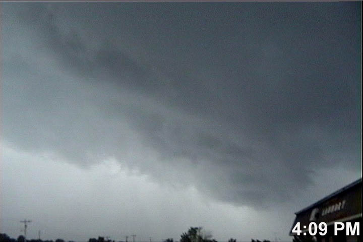
Figure 8. Looking north at the northern end of the
shelf cloud. Center of hook is to the
left of this picture.
I was ready to abandon this
storm for the one to my east, but after talking to the DOWs (relaying my
visuals), I learned that a tornado warning had been issued on my storm. I looked back, and at the northern extent of
the shelf cloud (which had just bowed out to the south) was a developing wall
cloud. I continued east a bit to find a
place I could see it and set up on tripod.
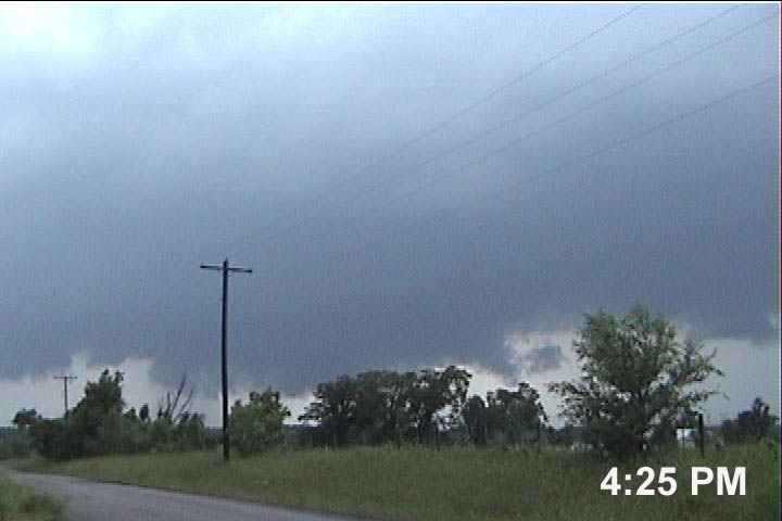
Figure 9. Second wall cloud near Wewoka, looking
west-northwest.
I was at the end of
someone's driveway (avoiding the other side of the road because it was filled
with poison ivy). Immediately, the
people who lived there (husband, wife, and young daughter) came down the
driveway in their sport utility vehicle.
It turns out that when they heard the tornado warning, the husband
decided to go out for a drive. The wife
wanted nothing to do with this and literally freaked out at the sight of the
wall cloud, which I had decided was quite lame/non-rotating and not about to
produce a tornado. Additionally, it
would go to the north of us, so it was not a significant threat. I explained all this to the couple, but the
woman continued to freak out, almost going into an outright panic. Finally, I told them to leave, so they left
and drove down the road to the east.
At this moment, I had the
storm all to myself and the 4Warn Storm Team helicopter and a competing
station's helicopter right above me.
The 4Warn Storm Team SUV then drove by.
Since I was now back in weak outflow, it was time to move east.
My road became narrower,
and suddenly, over a hill, it became gravel, then dirt/mud. I decided this didn't much matter (I didn't
learn Bill
Reid/Martin Lisius' lesson
from yesterday), so I blasted east with hopefully enough momentum to avoid
sinking should I find a softer spot. My
road soon ended right where I needed it to continue east. I had a five mile trip to find my next east
option. Took 48 north to Hwy 9
east. DeLorme software was quite
helpful.
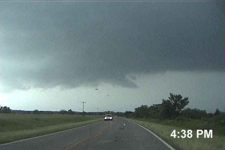
Figure 10. Driving north on Highway 48 to Highway 9.
I drove north into CORE #1,
then east. Hail was up to 1", and
radar-indicated tornado was to my southeast.
A somewhat dangerous move, but it worked. I broke out and continued east-- no tornado on my storm. I set my sights on the storm just to my
east, hearing many reports of a large, damaging tornado.
I continued east on 9, but
suddenly, my GPS software died, and I no longer could instantaneously see where
I was. Time to get out the paper maps.
I could soon see the
tornado-producing action area to my northwest, but I needed to get east of it
to see it. I got to U.S. 69 at Eufalia
and was barely east of it, so I headed north to get swallowed by the now
heavily undercut meso. CORE#2!!
I headed east on a small
road east through Texanna (along the north side of Lake Eufalia) to get back
ahead of the core, which I did. Since
other storms were coming up from the SW, I decided to drive east, then to the
south side of the lake and wait for them to arrive. This drive took an eternity.
The road was really deep in the trees, and it was extra special to see
the sky above me. Finally, I went south
at Porum, and stopped at the first available clearing to see what was coming.
What came was a long,
north-south oriented, vertically-standing shelf cloud/HP meso-hybrid beast with
solid core behind it and streaming inflow
above. Winds were from the east, at my back,
blowing into it. CG's struck to my
north, and I heard a continuous growl of thunder from the clouds above me to me
northwest. This was cool. The pictures below show the view of the
whole storm. The first is a view of
what I believe to be the mesocyclonic part of the storm, which showed a very
decent hook on radar. Behind his
feature, winds were increasing and would reach 100 mph in the next 20 minutes. The second and third pictures are panoramic
shots, showing the mesocyclone and the extensive forward flank shelf
cloud. The third shot covers the entire
storm, with a viewing angle of about 135 degrees.
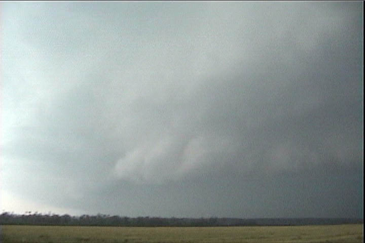
Figure 11. Mesocylone of storm over Enterprise, OK.
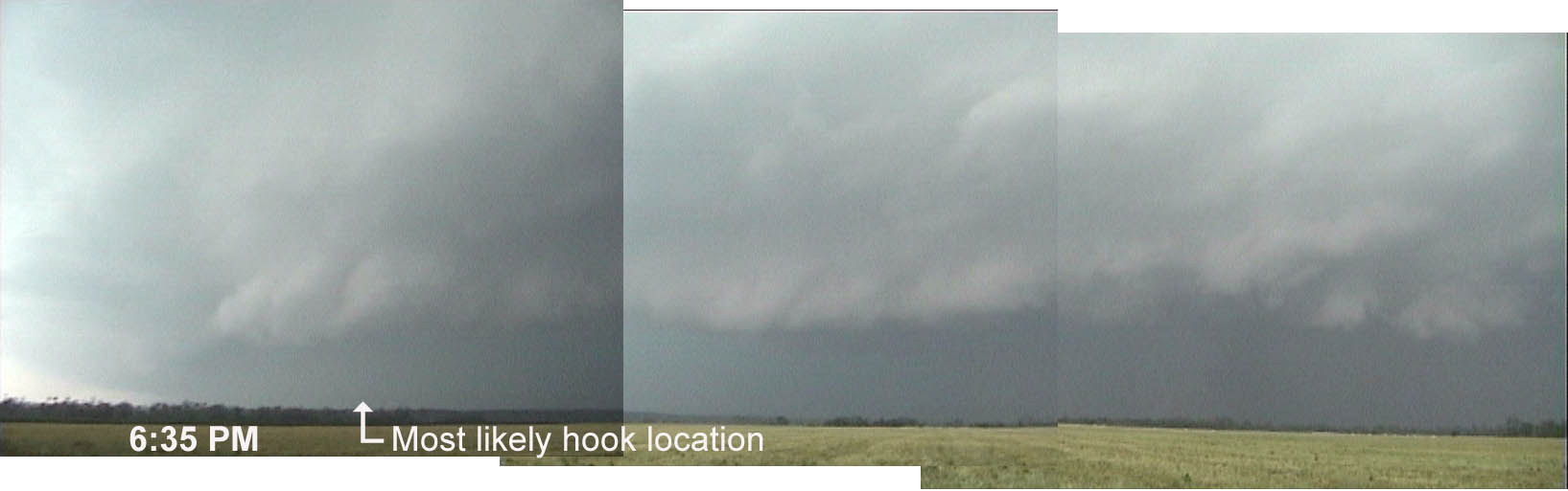
Figure 12. Wider view of mesocylone (left) and forward
flank shelf cloud
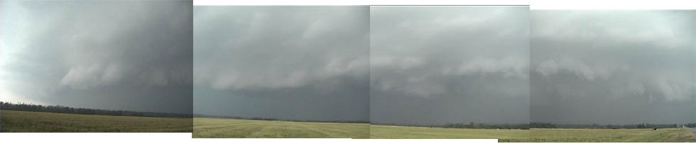
Figure 13. Yet a wider view (135-degrees) of storm
encompassing entire shelf cloud.
I soon understood that this
beast was racing southeastward, so off I went. At Whitefield, I turned east on
9 (about to go to Stigler) when RJ Evans spotted me and called me on 146.52,
telling me to come south with he and Bobby Prentice on Hwy 2, which I did. As I turned around, the southern end of the
hook overtook the town, and the winds and heavy rain blew in with force from
the northwest. The big HP beast was
eating me, and it soon became a somewhat scary drive, with tree branches flying
through the air (none very large) and a black lab crossing the road right in
front of me (I was able to avoid hitting it).
CORE #3!
This beast soon produced
the Stigler tornado, just 6 miles to the east.
I would have seen it had I: 1) continued east in Whitefield, and 2) been
*in* the tornado.
Soon finding ourselves out
of position on this storm, we headed southwest to intercept new ones. There was a tornado-warned storm near
McAlester, so we targeted it, but we turned south too late and missed it (CORE
#4). The view from the back side was
nice, though.
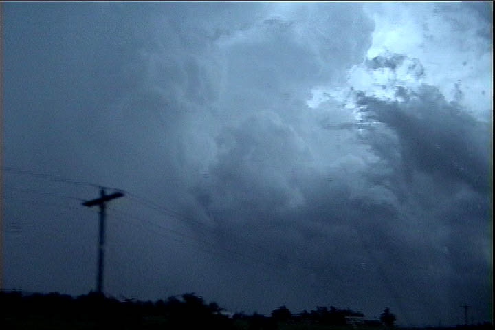
Figure 14. McAlester storm from Behind.
A final storm moved through
Coal county, which we also targeted and missed. CORE #5. At this point,
the sun was setting, and there were no more storms off to the southwest, so we
called it a day. Before heading back to
McAlester, we shot some stills and video of the storm to our east.
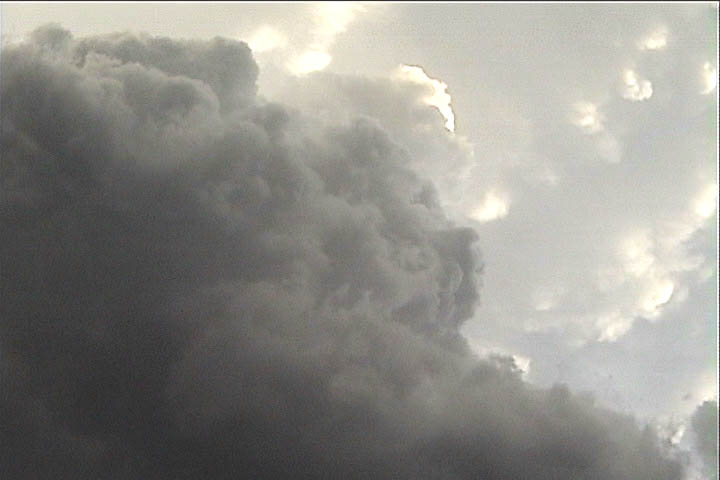
Figure 15. Mammatus above cumulus.
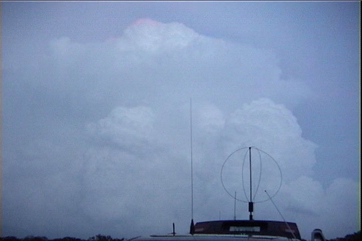
Figure 16. Final shot looking east.
We ate steak dinner in
McAlester since RJ and Bobby caught about 2 frames of video of the Dustin
tornado.
On the way home, another
storm intercepted us on the Indian Nation Turnpike (CORE #6).
All in all, events
conspired to make me miss the tornadoes today.
Still a fun chase.