July 8, 2021 Supercells
Western South Dakota
We awoke in Forsyth, Montana after spending the night at the Sundowner Inn-- a nice, traditional roadside motel. It's nice to take a break from the traditional chain motels once in a while, but it does require, perhaps, a little extra research because these non-chain motels don't have the same uniformity the large chains offer. Google reviews are pretty important. Some of them can have some pretty simple rooms, yet they are very clean, and everything works. Others can be very "interesting", and you may not know what will be in your room when you first enter. This one was definitely in the category of the former, and it was nice to be in a comfortable, quiet location. I went for a run through the town in the morning before the morning briefing. It was interesting seeing what is in a small town like this. The most interesting thing I observed was the variety of birds in the town. In particular, there were a lot of red crossbills. I had not expected to find them this far south. I had thought of them as a northern bird that came into northern Minnesota during the winter (I had seen quite a few in my neighborhood over the previous winter), but they are pretty common in other parts of the northern U.S. during the summer.
The severe weather risk was a bit farther east, and we needed to get at least over to the Montana/North Dakota border to find some chase-able storms. We took I-90 east and then got onto U.S. 12 at Miles City. We stopped at 'Getim Here' Cafe in Baker, Montana, where we enjoyed some delicious subs. I would recommend this place to anyone traveling through Baker. We spent a fair bit of time here because it was right in the area where we expected storms to initiate. The owner was friendly and was very interested in our group and where we were all from, and we had a decent amount of time to talk while we were waiting for the storms to develop.
After about three hours here, the cumulus around us were finally growing to the point that we considered it best to get the east so we could then find a dominant storm that would develop out of this field of cumulus. We continued east on U.S. 12, keeping an eye on various updrafts around us and checking radar to see what might be the biggest. When we reached Bowman, North Dakota, we found ourselves a bit east of all this activity and decided to make a pit stop there to be ready to spend several hours on the road without a break (there didn't appear to be many major towns along our most likely route). When we were done, the storms had advanced on us, and we needed to continue farther east.
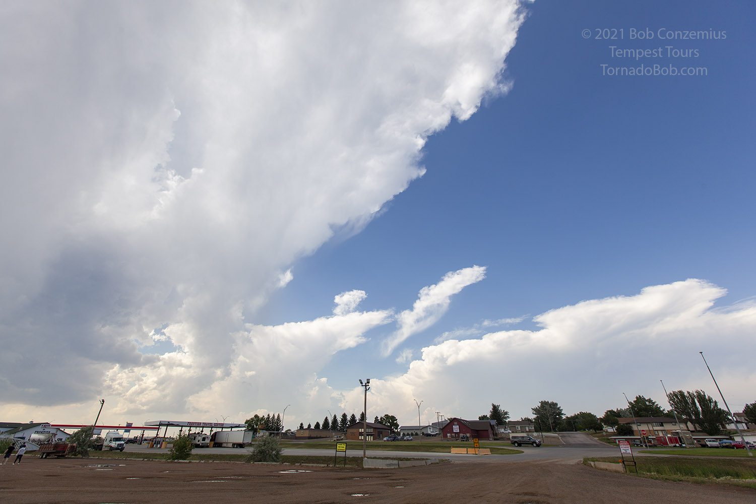 |
| Storms developing as we take a pit stop in Bowman, North Dakota. |
We got to about Reeder and saw a nice storm developing to our west-northwest. We initially decided to let it approach us, but then it developed a nice wall cloud, so we decided to drive back west. The wall cloud looked pretty nice for a while, and we decided to take another group picture in front of it. We stayed with this first storm for a bit, but we were watching at least one other intensifying storm to our east. Our storm was looking like the largest, but the one to the east had an interesting shape. Neither was particularly dominant. This would be the theme of our chase over at least the next couple hours.
 |
| A wall cloud develops with our storm in North Dakota. |
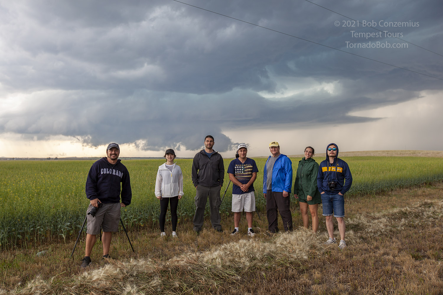 |
| We moved closer to get a group picture. |
 |
| Wall cloud without people in the picture. |
 |
| Last picture of the wall cloud before we moved south. |
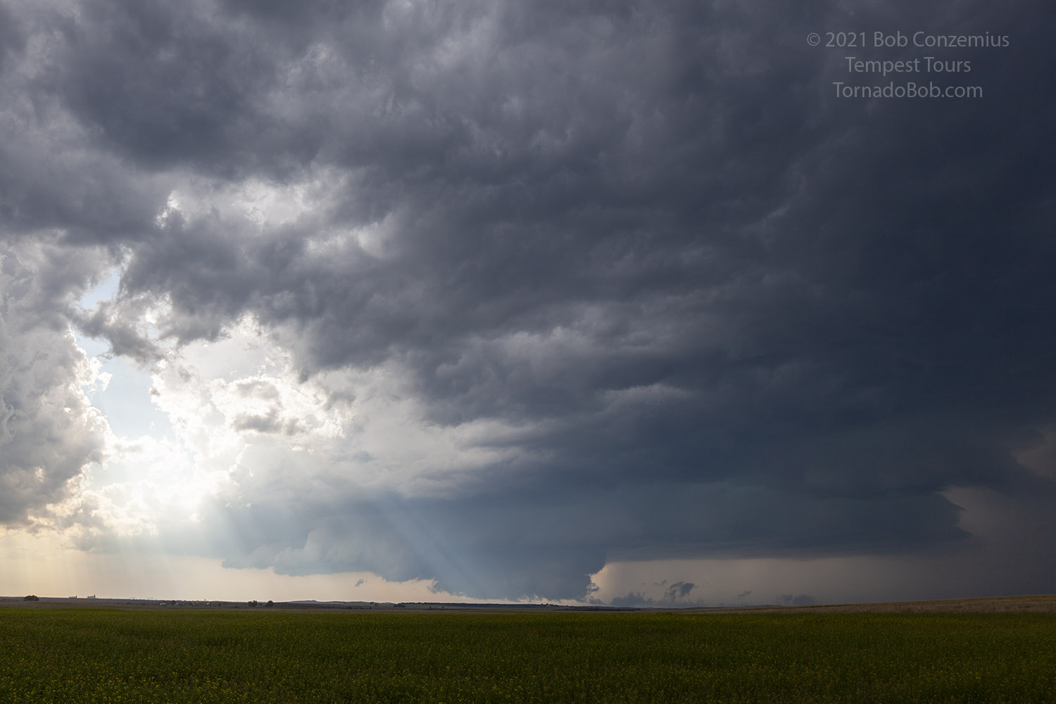
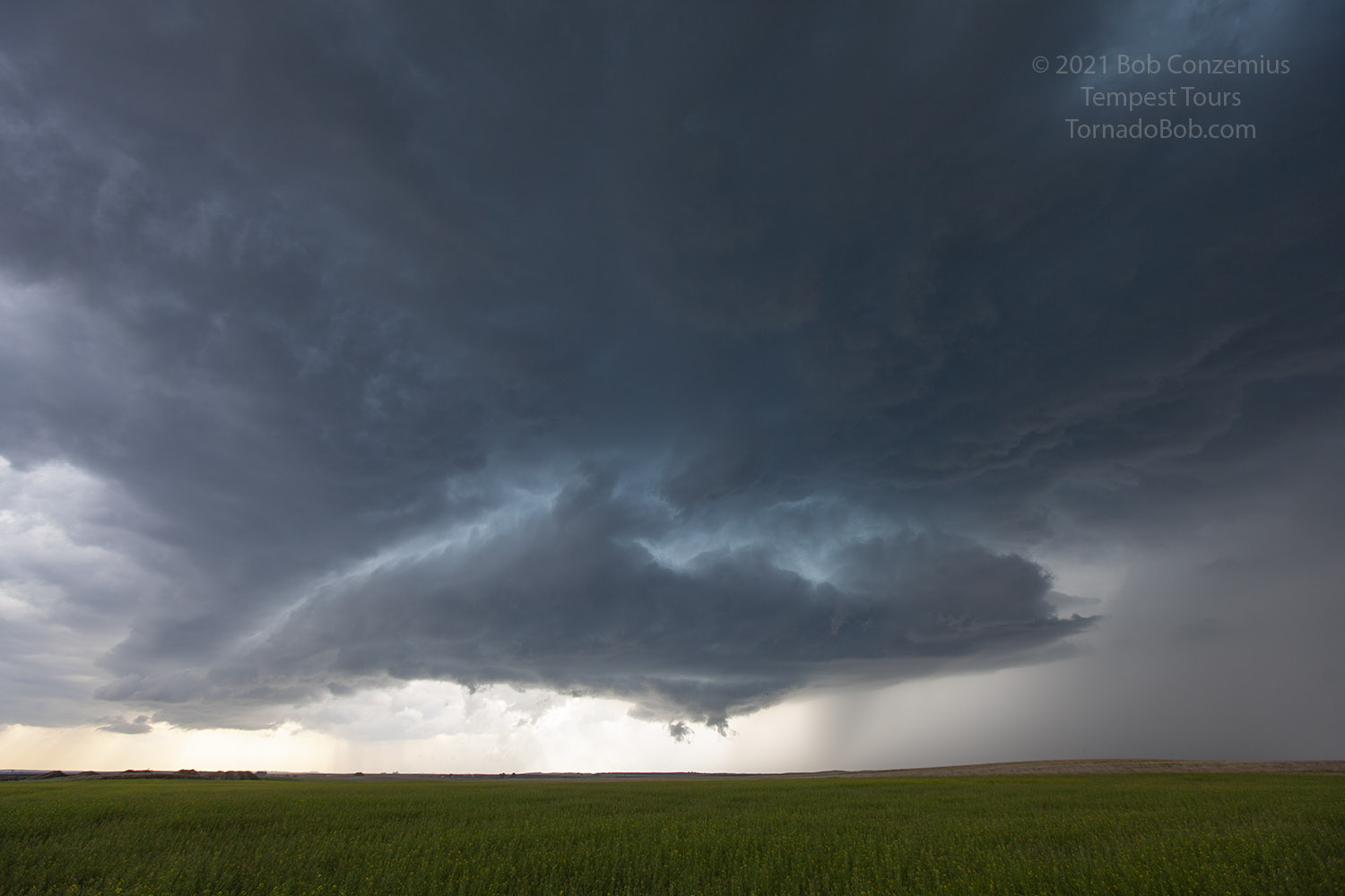
Both of the storms showed somewhat deviant motion to the south, but neither one really became larger than the other. We were somewhat in-between both of them. One was off to the east, and the visibility on that storm wasn't too good. Another storm developed quite a bit to our west, and that one looked quite interesting, but was it in a good enough position to get high CAPE air? Would the eastern storm stay just far enough in front to keep the western storm from becoming very strong? We could see a wall cloud on the far horizon with the western storm, and it looked pretty decent on radar. The eastern storm was not looking spectacular, but it had the best CAPE in front of it. It was time to just generally follow things south.
 |
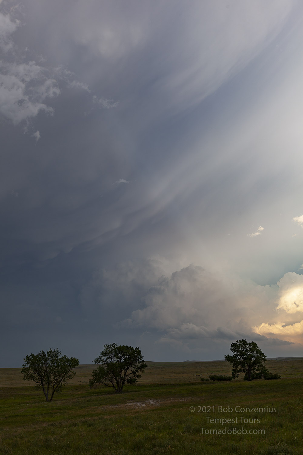
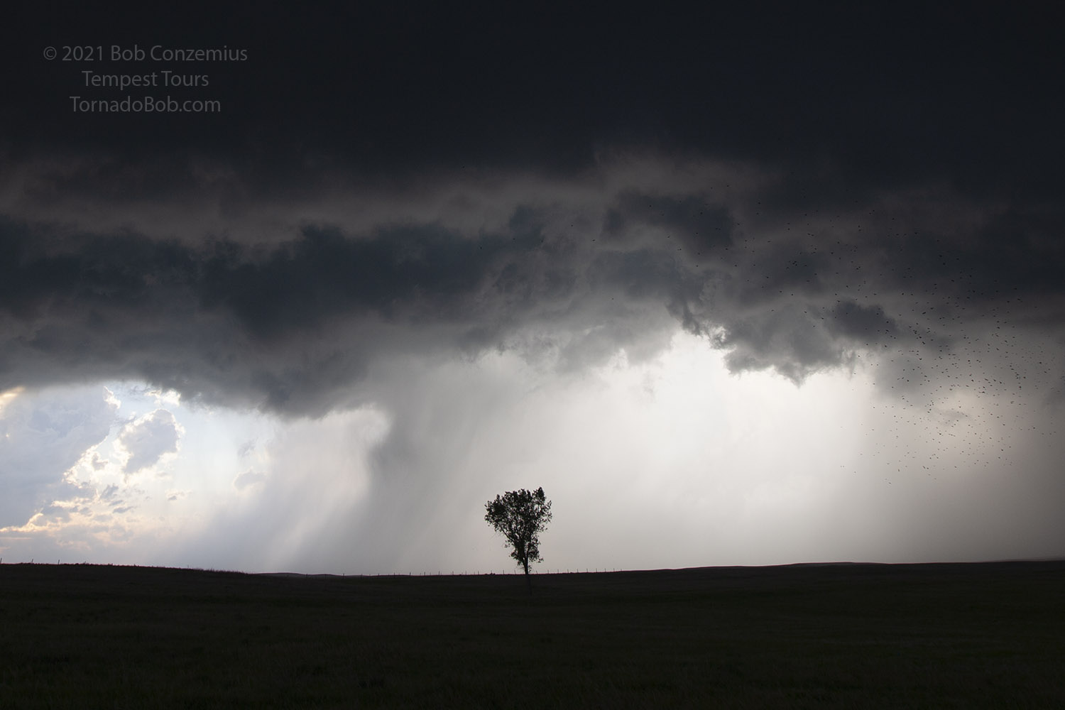
| Now in South Dakota, a shelf cloud forms between two supercells. |
 |
| Shelf cloud in the foreground and base of the western supercell on the horizon. |
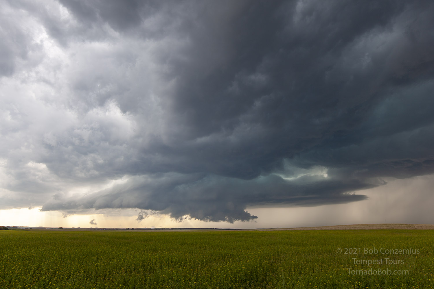
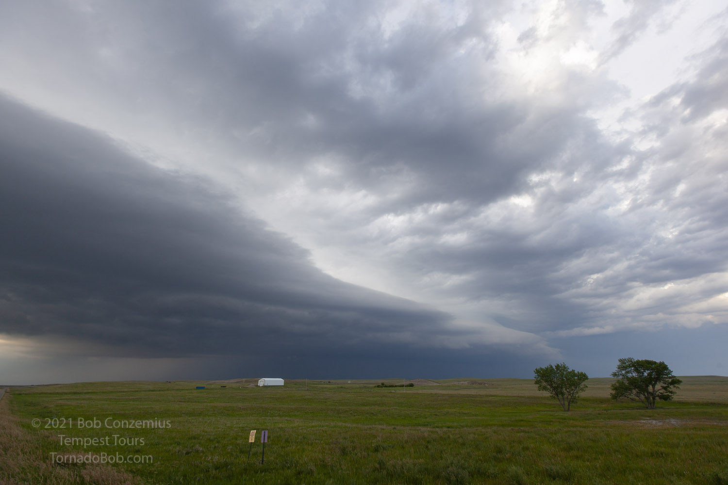
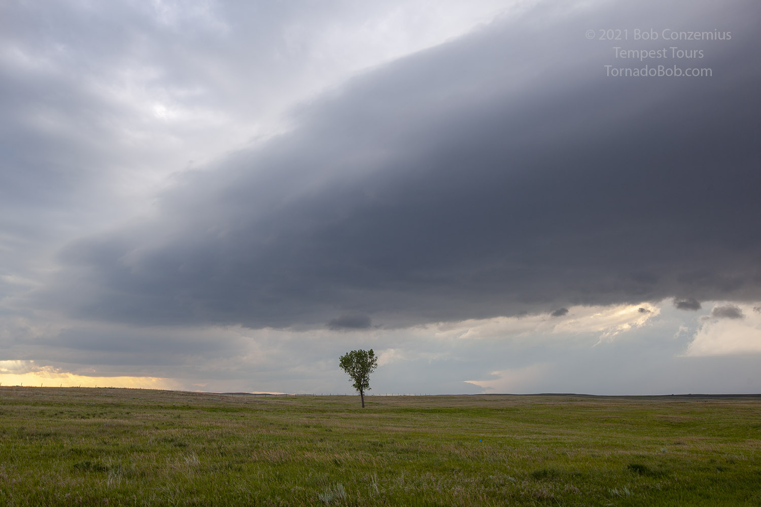
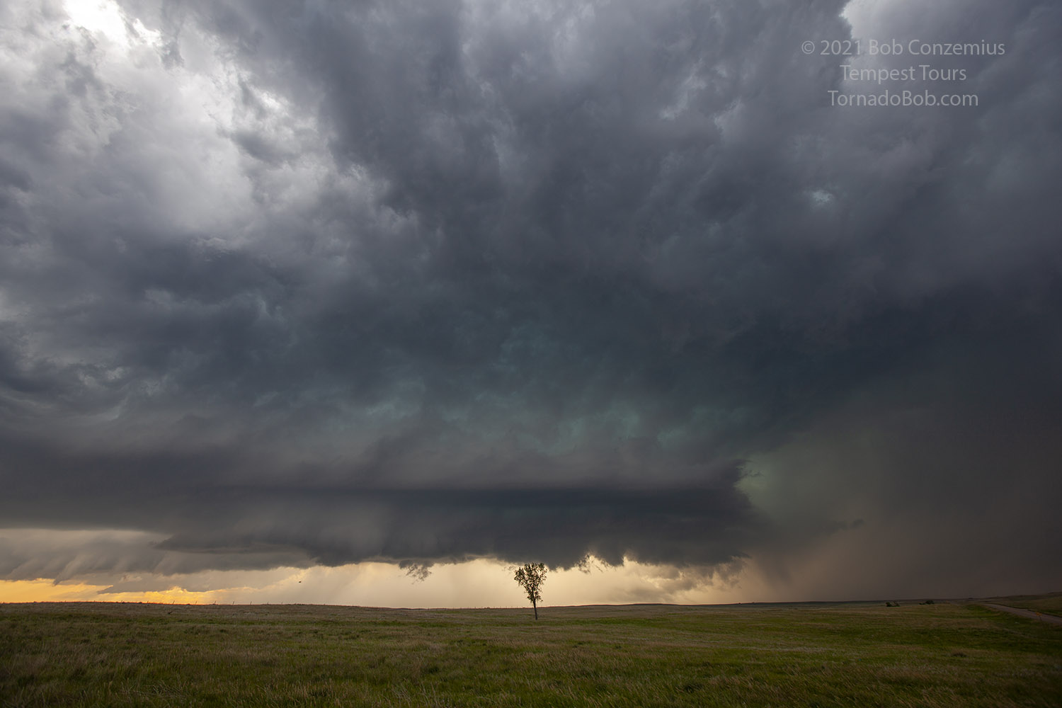
Perhaps due to road options not being great elsewhere (we were on quite a nice north-south road) or becuase of indecisiveness on my part, we stayed put while the western storm approached. I was interested in the wall cloud to the west, and since I couldn't see under the eastern storm, there was nothing I could see that would draw me in that direction. Over a period of an hour or two, the western storm slowly dropped southward to a latitude where I was more confident its inflow was not contaminated by the outflow from the eastern storm. I felt happy to stay put as the western storm approached. Plus, we had a pretty decent shooting location, and the lone tree in the field nearby made a nice foreground subject.
 |
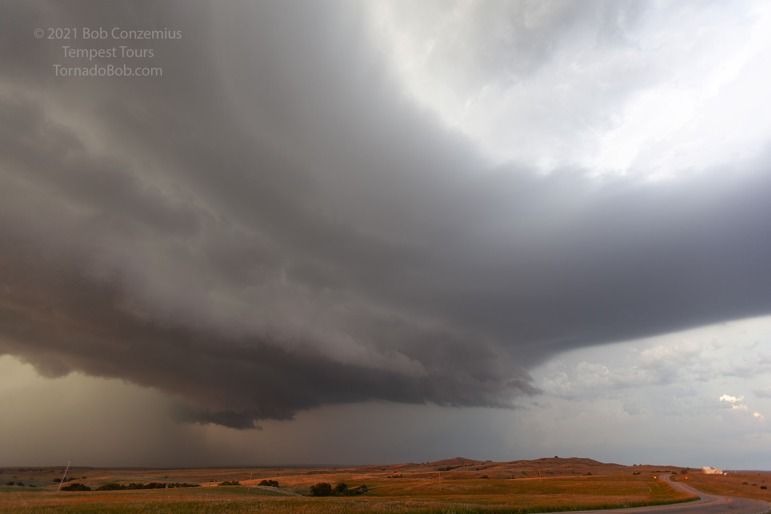
| The western storm now is clearly in view. |
 |
| The eastern storm is also looking strong. |
 |
| Gradually, the western storm moves south into higher CAPE air. |
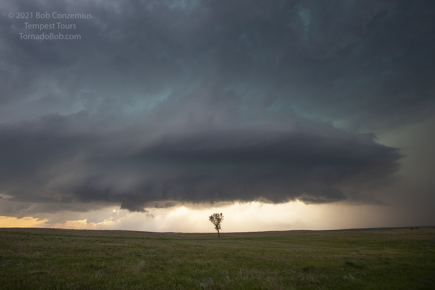 |
| More laminar looking layers around the updraft base. |
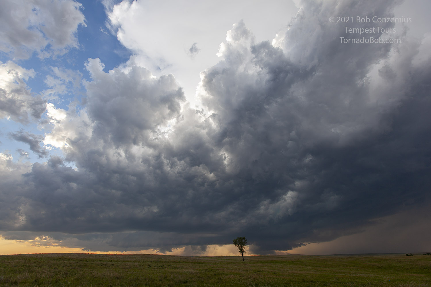
 |
| The wall cloud and updraft base become more robust. |
 |
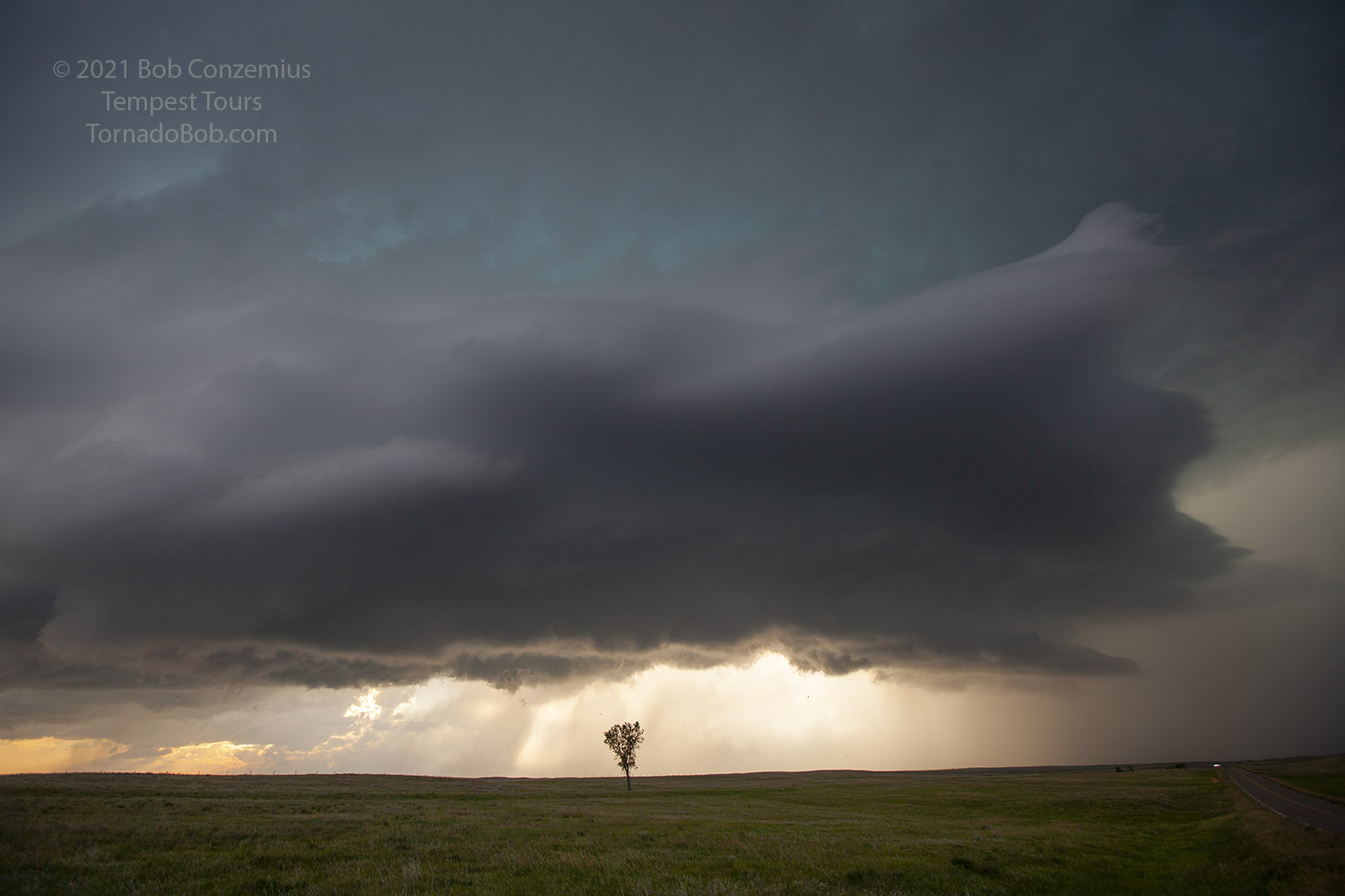
| The base moves overhead, and the light changes. |
After an hour or so at our location, the base moved overhead, and it was time to move east and south. We stopped a bit to watch the storm just to our east-northeast as it developed some low-level rotation for a little bit. We didn't want to miss any tornado that might develop here. The outflow/RFD was rather warm and humid.
 |
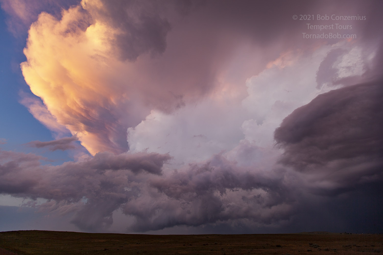
| Now east of us, the base is lit by the setting sun. |
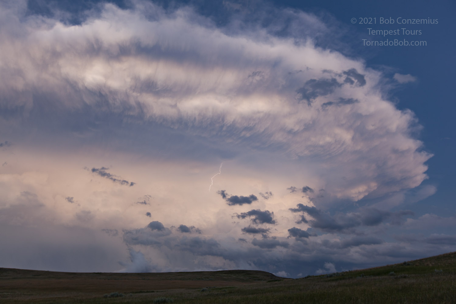
We then had to make a pretty quick drop south and then east to stay ahead as the storm seemed to be accelerating a bit to the southeast. We could not drive that fast because we were moving through an area with a remarkably large population of mule deer. They were seemingly everywhere. When we had a chance to move east, it was already clear that the storm would be giving us a nice sample of its largest hail if we drove on our planned route. It was also about time for sunset, so we decided to let the storm go. We were rewarded with a variety of colors as the setting sun illuminated the back side of our storm. We did not know, however, how good the view was from the east. Other chasers posted their views on Twitter, and from the eastern side, the storm really looked incredible! We still had a great view of lightning and a nice look at the updraft. When we had had our fill of photography, it was getting late, and we needed to find a hotel. We stayed the night at Murdo.
 |
| The storm cut off our road options, and we stayed back for the sunset. |
 |
| Beautiful view from this side. Structure was awesome viewed from the east. |
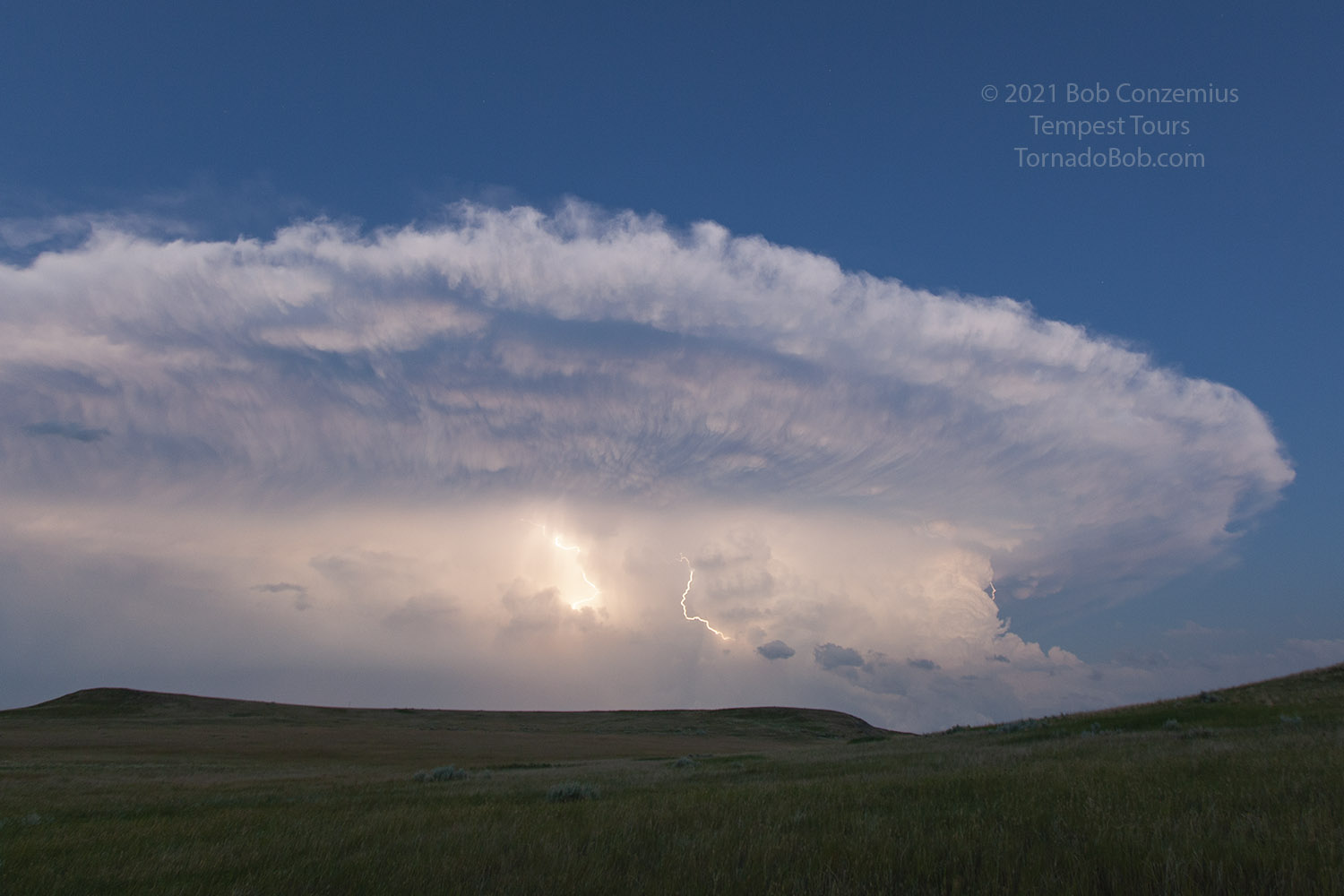 |
| Lots of intra-cloud and some cloud to air lightning. |
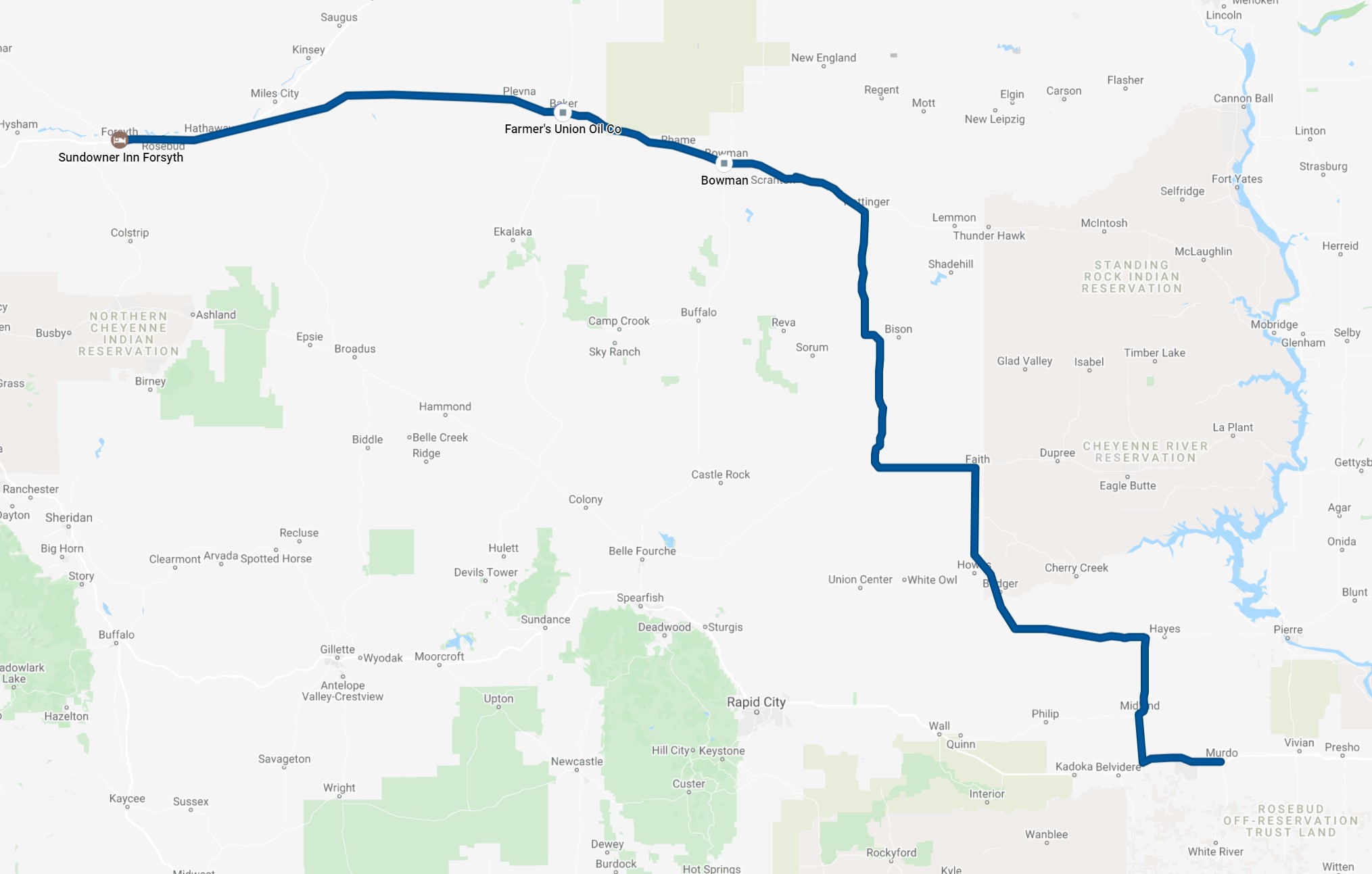 |
| Our route for the day. |
Back to Storm Chases | Home