Dissipating storm over Lake O' the Pines.
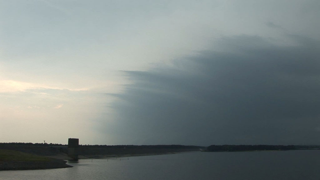
Storms were firing mostly behind an advancing cold front during the morning, and our only shot at a surface-based storm was to get ahead of the cold front in far northeastern Texas or far western Arkansas. The front advanced eastward as we tried to catch up to it, but eventually we overtook it east of Texarkana, AR. I picked a location along the now nearly stationary front where I thought storms would most likely develop-- Lewisville, AR. Could this be the only day of the tour when we chased a storm outside of Texas? Alas, it was not to be. The storms developed back in Texas, farther southwest along the cold front-- not exactly where I thought they would. One storm became supercellular and got a tornado warning on it as we raced back southwest towards it. Since this part of Texas was completely filled with trees, we decided to find a good viewing spot from Lake O' the Pines and watch it approach us. Within 10 minutes of deploying at a location with a wonderful, panoramic view to the southwest, it was apparent something was wrong. There was absolutely no storm structure emerging from the murk, even as the rain was starting to arrive over portions of the lake to our northwest. I walked back to the van to look at radar, which confirmed that the storm was dying. It was time to look for a new one. Another storm quickly intensified a little farther to the northwest of the original storm. We got underneath the very dark updraft base of that storm, and the radar velocity showed a very nice couplet in our vicinity, so we started to get a little more excited, but the storm started to weaken and eventually became just a rain shower. We headed back to Texarkana to stay the second to last night of our tour. The last day would be spent driving back to Arlington since there were no viable storm chase opportunities.
Dissipating storm over Lake O' the Pines.
Video summary of Tempest 2011 Tour 1: