April 28, 2025 Storms
Isanti County, MN
There was a moderate risk of storms over Minnesota with a chance for strong tornadoes. The tornado prospects busted. I saw a thunderstorm. Stronger storms were to my south in southern Minnesta. Several EF0/EF1 tornadoes were found to be embedded in the squall line-- a typical Minnesota mode of severe convection.
It turned out that it would have been far better to go to southern Minnesota and be on the line of storms down there. However, it was a work day for me. The following day was also a work day. I did not feel like arriving back from Iowa late in the evening and then being tired at work the following day. Also, the storms in southern Minnesota looked linear from the start. When I saw somewhat more isolated storms developing north of the Twin Cities, I thought that would be the way for me to go. First, it was a shorter drive. Secondly, there were so many chasers in southern Minnesota that I knew there was no chance of any tornado being undocumented. The roads would also be crowded. Third, a tornado warning was issued for a storm in Sherburne County, moving toward Princeton. The velocity signature on that storm was getting pretty good. Even though there could be issues with stable low levels north of the Twin Cities, I decided to take a chance.
As I continued north on I-35, the velocity signature continued to look pretty good, albeit a bit broad. The storm remained strong and tornado-warned. However, about 30 minutes before I arrived, it began to weaken, and by the time I got there, not much was left. Other weaker storms developed, but they never became severe. I played with the updraft bases for a bit then decided to head back to White Bear Lake. I was back there by 7:30 PM.
 |
|---|
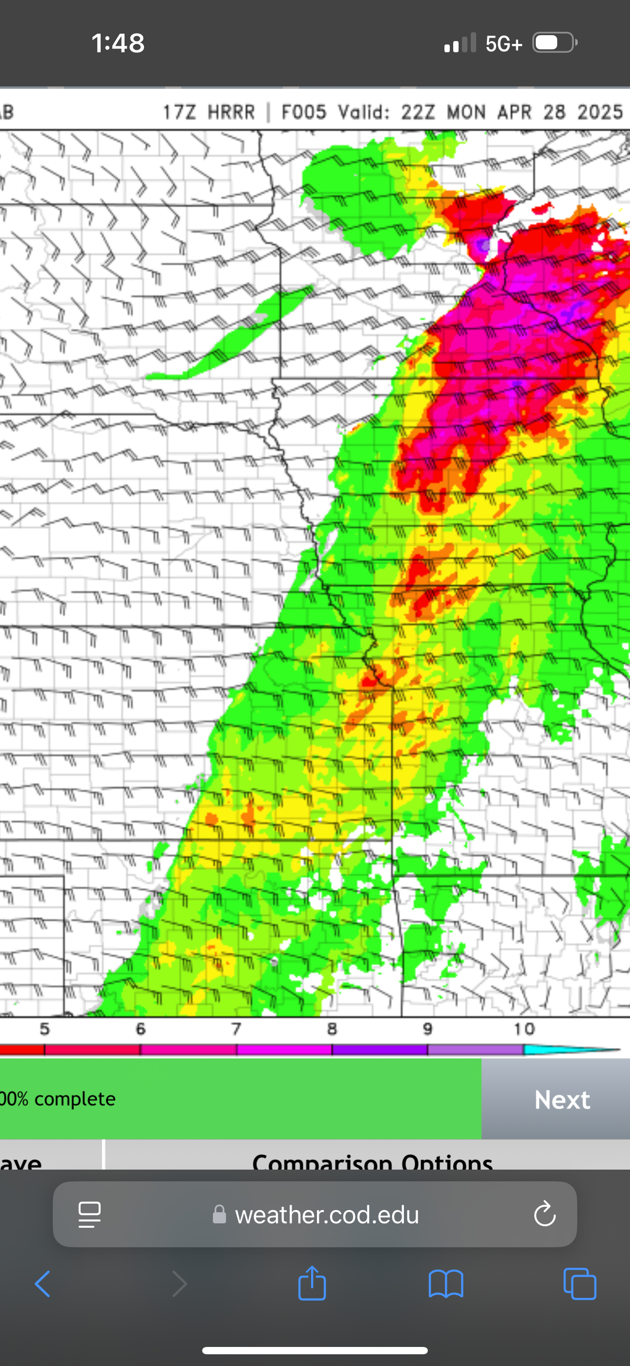
| The significant tornado (SIGTOR) parameter was forecast to be pretty large over southeastern Minnesota. |
 |
|---|
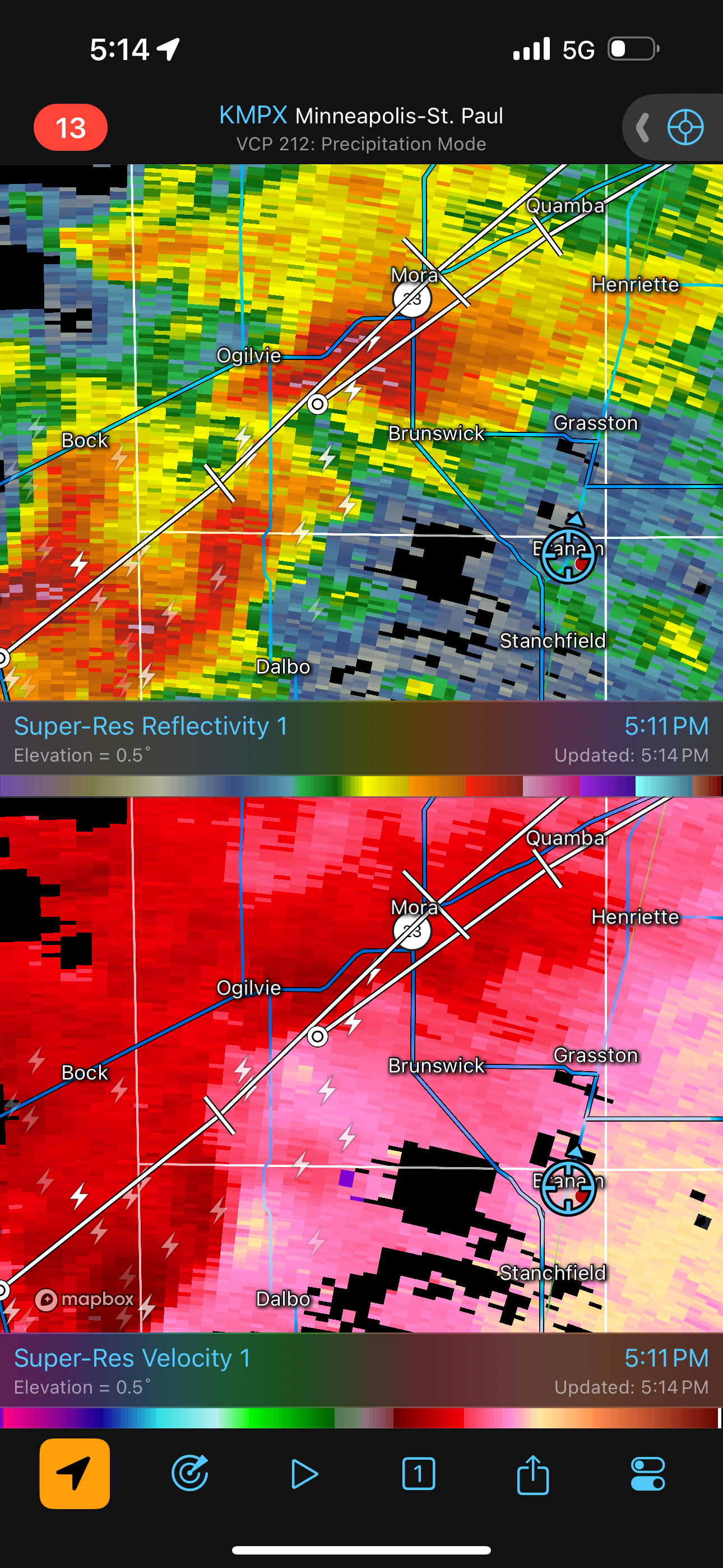
| Radar shot of the storm as I was getting close. It had looked much better an hour before this. |
 |
|---|
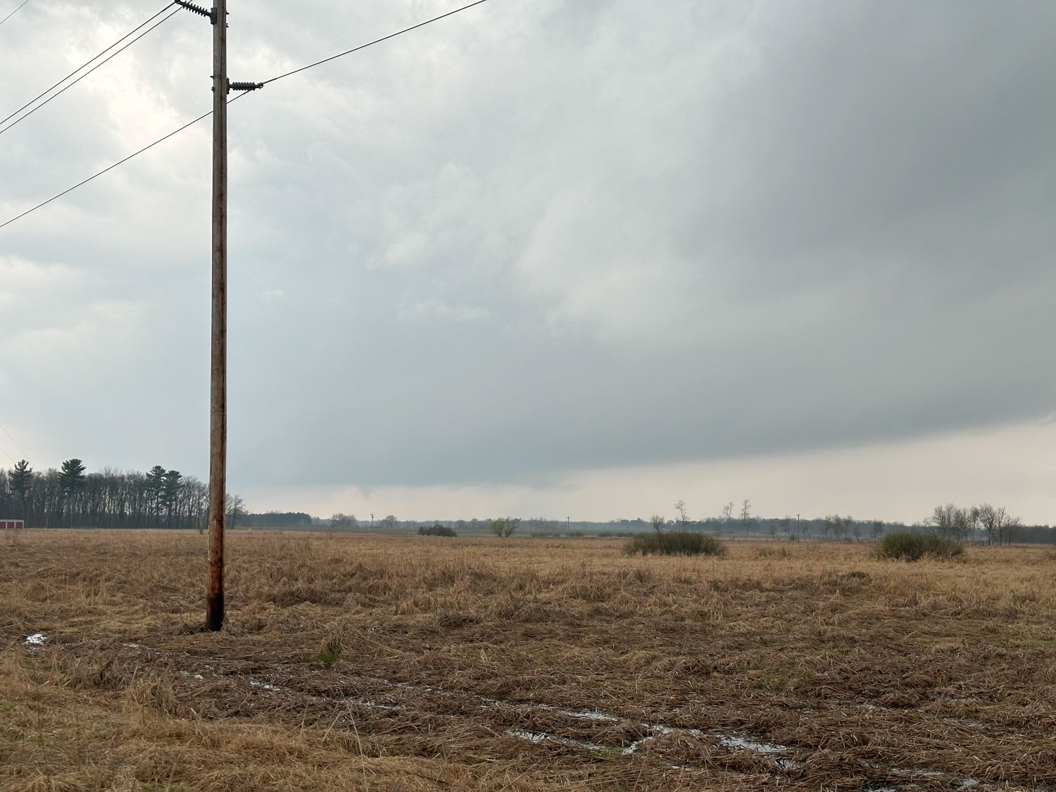
| The base of a non-severe storm that had produced a funnel cloud earlier and had been tornado-warned. |
Back to Storm Chases | Home