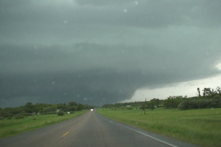
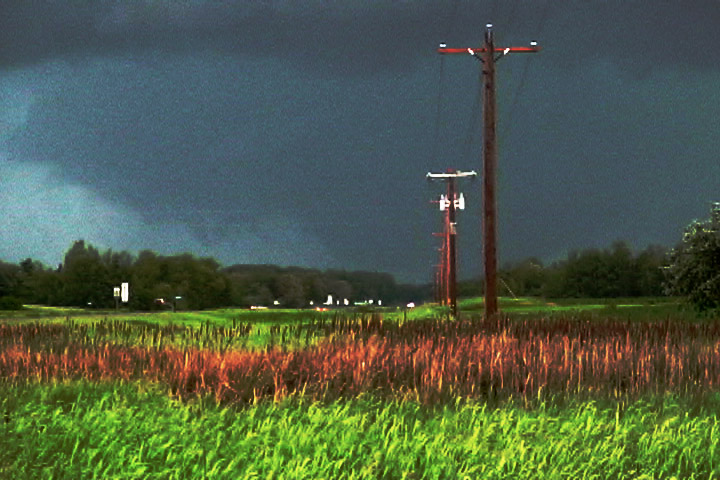
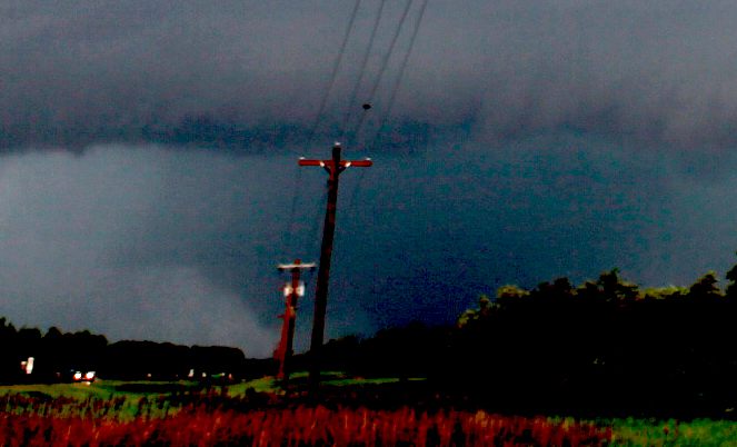
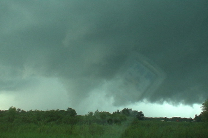
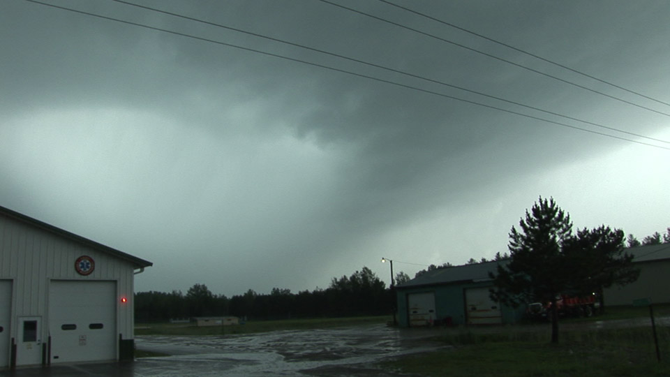
Here's what the storm looked like as I approached from the east on MN 210 just west of U.S. 71.
Targeted the Fargo-Grand Forks area. Wandered a little south on I-29 to get food-gas but that's not a good area to look for either. When the first echoes appeared to my southwest, I started racing east into MN, but was thinking things could still be good north in the "bent back" region (indeed they were, as witnessed by Aaron). Actually, somewhat frustrated and indecisive at first, but I got far enough east that I became committed to getting to the dominant TEC storm. Went through Wadena, dropped south on U.S. 71 as some new convective junk started moving in on the TEC from the southwest. I was starting to think I would not have anything to see by the time I got there, but when I turned west on MN Hwy 210, there it was. Quite the beast of a mesocyclone. As I continued west, a really low-contrast wedge tornado came into view-- not enough time to stop to confrm tornadic motion, but I could see the back end with condensation to the ground. This was the one that formed near Parkers Prairie, was reported as wedge tornado 2S Deer Creek on storm reports. I followed that mesocyclone/tornado north (parallelling it to its east) until it became completely rain-wrapped, and I couldn't see it any more. I'm thinking this might NOT be the tornado that hit Wadena-- I think it was too far west, but I'm not sure. Fired off a couple stills and took some video, but it won't be worth much. I dropped south when I saw the next cell intensifying on ThreatNet. As I got on the storm, I saw a suspicious item on the southwestern flank. I thought I'd better stop and look to see if it was rotating. Indeed it was. The funnel reached about 2/3 down, I suppose, but it was hard to see in the rain (low contrast). I called in a rather unexcited weak tornado report. It appeared really weak, but another circulation developed immediately east of me-- not tornadic strength yet. Started to followed that north on County 75 toward Wadena, but I was getting too close to wet RFD and decided to bail out. I'll have to check my video and GPS timestamps to piece things together, but I think this actually may have been the circulation that hit Wadena. Continued after the storm after bailing back to Hwy 210 then east through Hewitt, then zig-zagging northeast through Verndale, Poplar Township (took a few hail hits west of there), then Maple Township, then Pine River as the cell continued just to my northwest. Then went east to Fifty Lakes. Tornado reports near Cross Lake had me dropping south briefly, but I couldn't see anything, and got info about new circulations farther south, so I went over to Emily, where I saw a not-too-impressive meso with rain wrapped in it. I started south on 6 but soon ran into core again. Just after that, another tornado report near Emily. I saw nothing but heavy rain. Winds switching to the west then north had me thinking the mesocyclone passed overhead-- got a call from WFO DLH because of my Spotternetwork icon location was very close to a (?) TVS. Nothing that bad-- winds weren't even very strong. Another tornado warning got issued just to my east, but I was out of roads (a large area between MN Hwy 6 and U.S. 169 in Aitkin County has only sandy forest roads). Thus, was essentially the end of my chase. I stopped west of Grand Rapids a bit to see the next line move in, then went home.
Here's what the storm looked like as I approached from the east on MN 210 just west of U.S. 71.
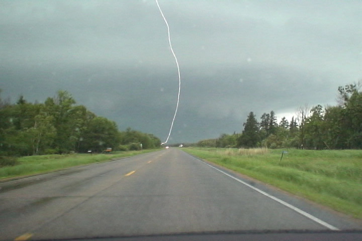
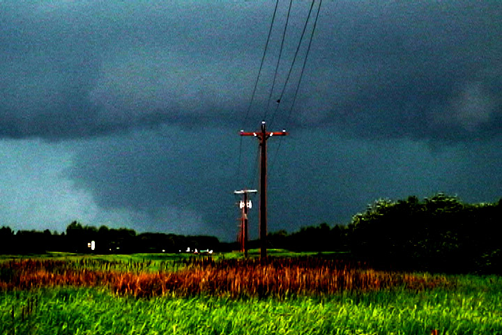
The storm was producing frequent cloud-to-ground strikes around me.
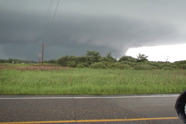
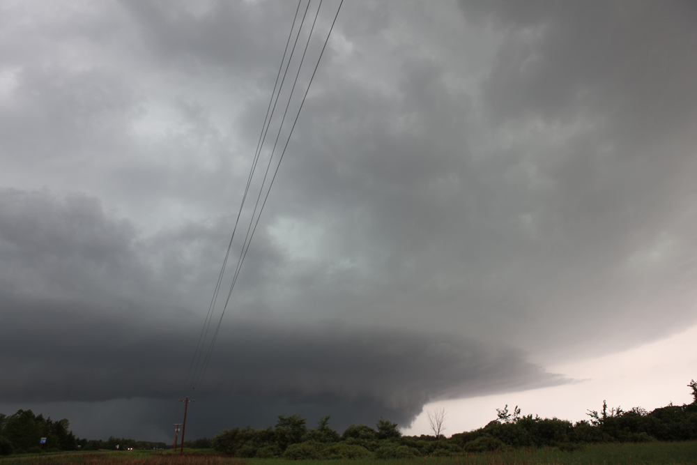
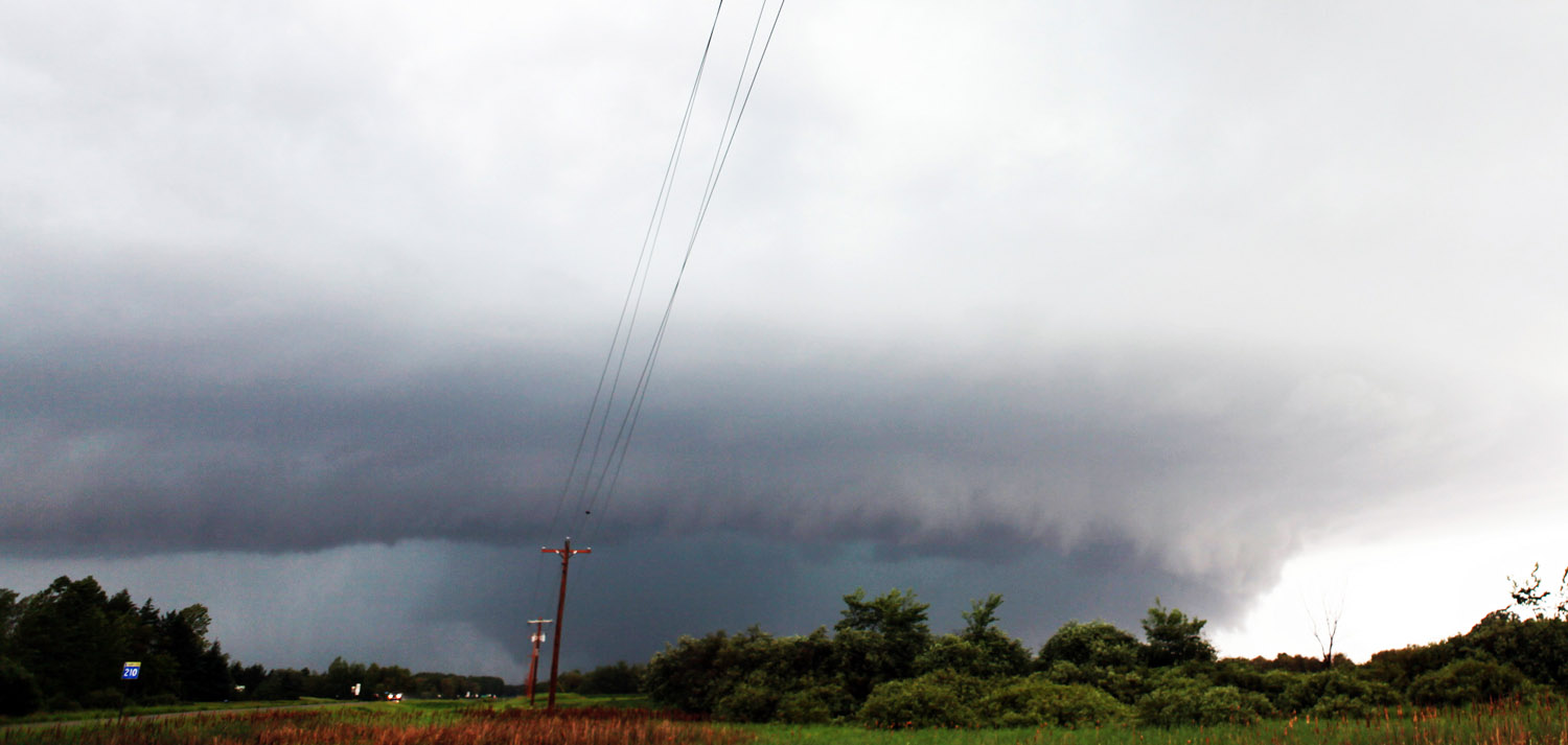
Stopping at the intersection of MN 210 and Ottertail County Road 75, I was able to notice the wedge tornado about six miles to my west. It's barely visible to the left of the telephone poles (actually, also to the right of the phone poles, too).
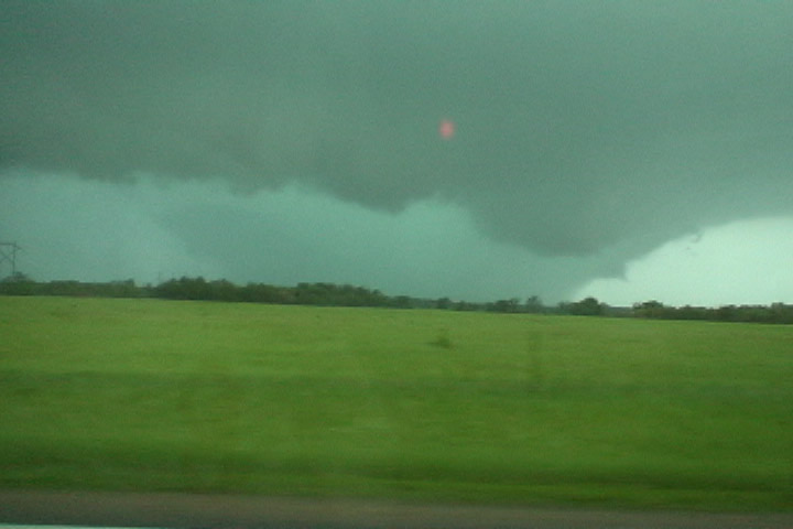
I zoomed in with the video camera. This is an extremely contrast-enhanced video capture.
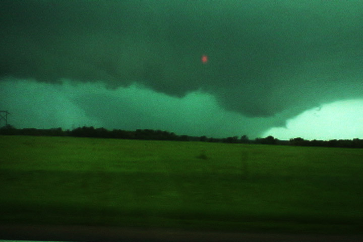
Another contrast-enhanced video capture.
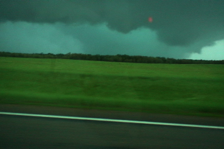
Final video capture before I put the video camera down and pick up the still camera.
Still photo at 24mm full-frame. Taken at 4:17 PM CDT
Crop of the previous photo, contrast bumped up.
A smaller crop with contrast really increased.
Video capture as I drove north on County Road 75.
Same shot, higher contrast.
A little farther north on 75 near County Road 50. I dropped back south after this became fully obscured by rain
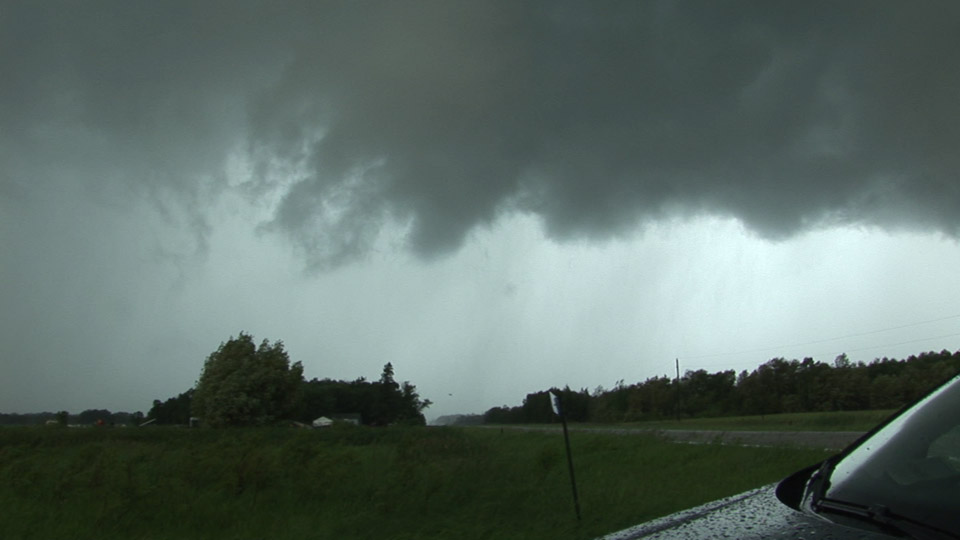
Weak tornado on the next storm. I am on Highway 210, 1.5 miles west of County 75.
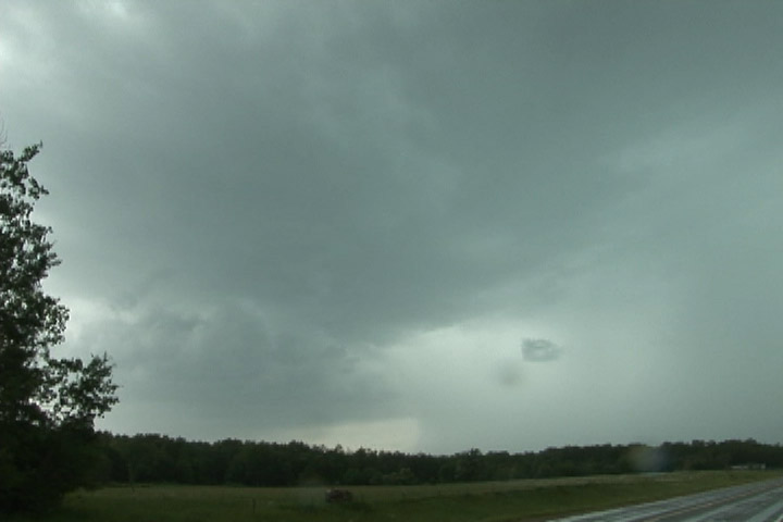
Another area of rotation develops to my immediate west. I failed to notice my small "tornado" was rotating around a much larger, parent circulation. Rear flank downdraft soon wrapped around, which effectively removed me from viewing the Wadena tornado, but this is where that tornado started.
Northeast of Wadena, east of Nimrod, another mesocyclone.
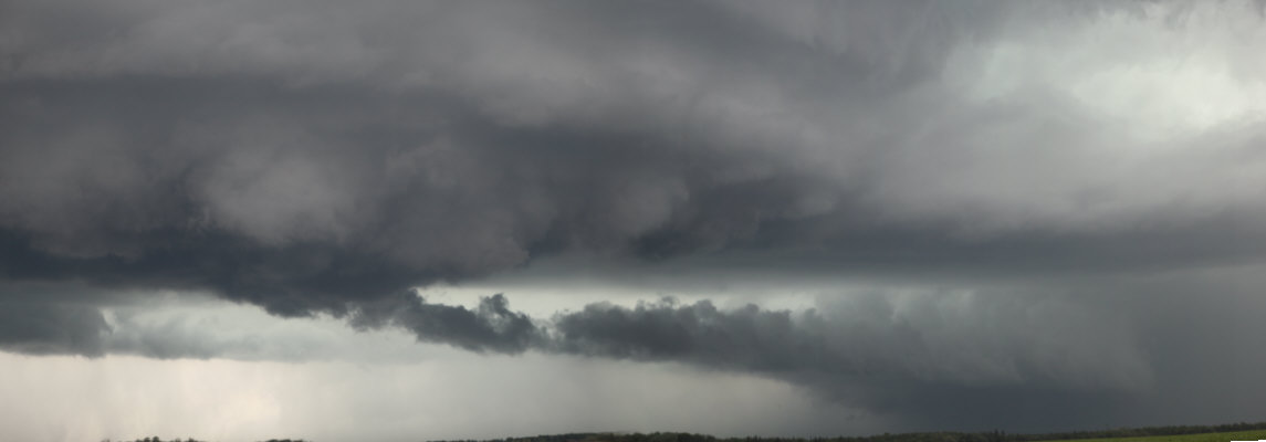
Once I clear the rain again, I see a flat base near Poplar Township.
Mesocyclone viewed in Emily, MN, looking south. This circulation may have produced the Cross Lake, MN tornado.
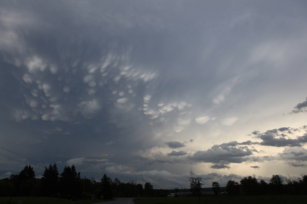
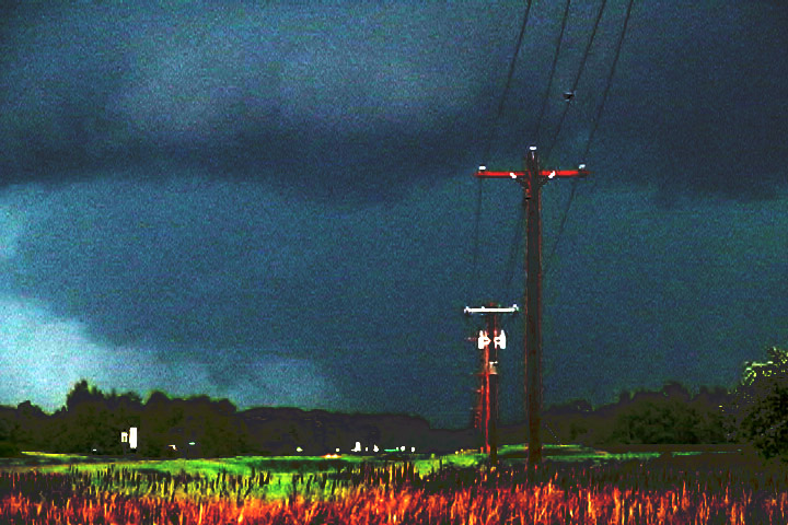
Mammatus near sunset 11 miles west of Grand Rapids.