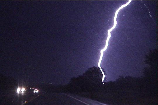
Cloud to ground strike ahead of us (beyond the tree).
Ernani deLima Nascimento, Andy Taylor, and I left Norman after classes around 3:45pm, headed somewhere south in TX to try to greet the rapidly returning moisture. Surface data we got via cell phone around 22-23z showed we had to get nearly to I-20 to get in the high theta-e air. The winds in the northern two or three tiers of counties were backed (east-southeasterly), with southerlies south of I-20, and dewpoints climbing through the upper 60's. We decided to head around the northwest side of DFW area, then head west, because this was just northeast of the surface low at the northern edge of the high theta-e.
When we arrived in Decatur, all warnings for the broken line of storms had expired, and we were in general light rain with no significant storm features to look at. The radar we could see at the time made the storms look like they were weakening. Looked like this was going to be a non-event, and I started thinking "What the @*#@#! is it with Texas?" I've busted there more times this year than I think I can count. This time, Texas had made a non-event out of something that initially looked very promising. It's frustrating when you target cells and they die when you reach them, only to have new ones pop somewhere else, or the cells, which were moving toward you, suddenly decide to retreat and move the other way when you target them, so they always stay away from you.
Anyway, we decided to target a cluster of small cells approaching Palo Pinto County. It was getting dark, so we were hoping just to salvage a crappy lightning shot or two out of this chase.
This is when the storm intensified. We saw a fairly decent looking updraft, but a lot of lower clouds soon obscured it, and it was getting dark. Soon, we arrived at the updraft base just east of Perrin. We were greeted by a low, arcing shelf cloud that was not yet extended out far from the core of the storm. There appeared to be a notch on the north side, and I looked at this area for rotation, but I saw very little. After spending a brief 30 seconds or so watching this, it was time to blast east, as we were now being chased.
Much to our dismay, our road took a rather long north jog, allowing the gust front to catch us. A couple gusts, probably severe, tried to push us off the road, but I gripped the steering wheel going 70 mph, as I was very intent on beating this baseball-producer to where the road turned back east (thanks Dan Miller for the hail info). The last bit of daylight afforded us a view of the underside of the shelf cloud for a brief moment, and it appeared to curl out from a vertically standing tower just northwest of us-- the meso???
The road finally turned east, but we seemed to have a hard time getting back ahead of the storm. We were making some progress on the shelf cloud (hanging overhead like a sort of Frankenstein), but the outflow (RFD?) winds were still very strong, and leaves/twigs and small branches (not trees) were flying through the air. Heavier rain began to envelop us, but we managed to drive out of it.
As we arrived in Bridgeport, the mesocyclone appeared to be directly behind us to the southwest. It had now tightened up to a more obvious mesocylonic shape from its earlier arcing shelf cloud appearance. The storm had now turned into a big HP gorilla. I looked over my shoulder a bit, but there didn't seem to be enough time to stop and take video. We kept moving.
Up until this time, there had been a number of pretty dramatic CG's (very powerful flashes with continuing current/bead lightning), but not too many of them were very close. When we were in Bridgeport, the CG show intensified into an all-out barrage. They started popping frequently within a mile of us, and most were fairly substantial bolts, and they were close enough so you could tell exactly where they were making ground contact. Quite a few had lightning--> thunder times under a second. I've never had so many lightning bolt images etched into my retina at once. I wanted to find a place to stop and observe the mesocyclone, but the intense CGs followed us. A few miles east of Bridgeport, they finally let up, so I thought we had gotten ahead of things, but they started up again with the same intensity, and getting even closer. One of the strikes was an instantaneous "pop", which we all *felt*, and for a moment, I thought the car had been hit, but the radios were still on and everything was functioning fine. We couldn't seem to get ahead of this electrically active area-- it finally settled down on its own.
Cloud to ground strike ahead of us (beyond the tree).
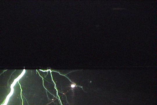
Cloud to ground strike somewhere off-frame.
Cloud to ground strike right next to the car.
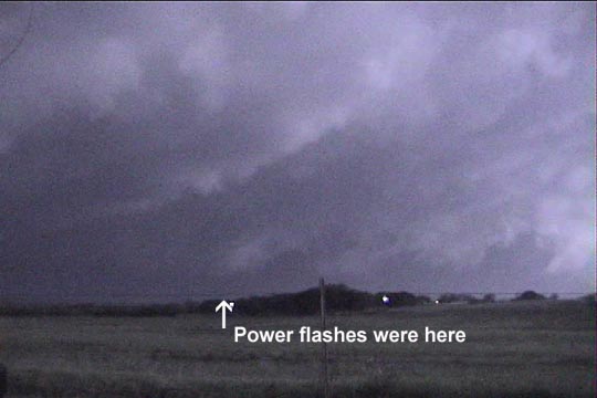
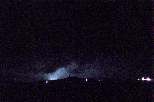
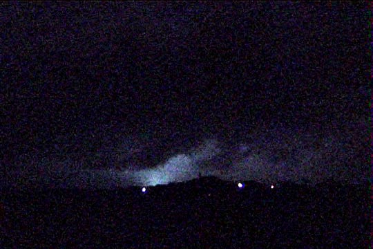
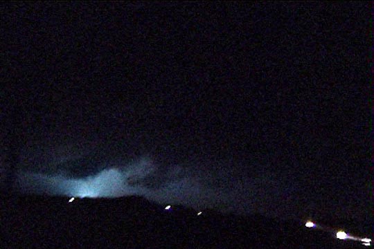
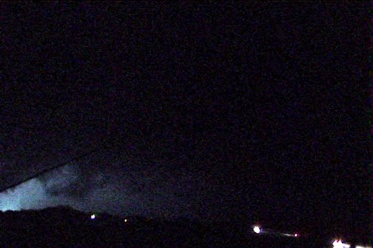
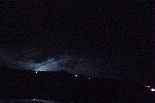
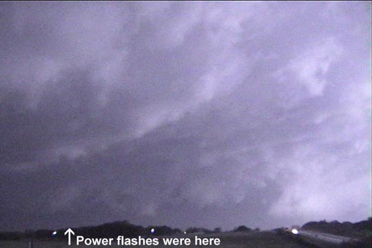
I could look over my shoulder and see either the north side of a banded/striated mesocylone or a series of inflow bands, but it was hard to see. When we finally were able to stop and look back, 10 or 12 miles east of town, the lightning illuminated the updraft base of the mesocylone, which seemed to taper town in a conical fashion to a rain core that itself was tapered inward. The flickering of lightning illuminated the rain core from within, casting a bluish-green glow to it. After a few seconds of admiring this, I realized this was not lightning. I was witnessing power flashes. Unable to judge distance very well at night, we didn't know within a factor of two or three how close we were or how fast the storm was moving on us, so it was time to move east again.
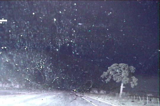
Lightning-illuminated mesocyclone.
Power flash in Decatur (#1).
Power flash #2.
Power flash #3.
Power flash #4.
Power flash #5.
Lightning-illuminated mesocyclone.
Just then, a local pulled up to us and began to chat. Seeing that we were storm chasers, he was curious what was going on. We were very near his house, and he said we were welcome to stay and watch things from there for a while, but we politely declined, telling him that the storm was tornado-warned and the rain-wrapped tornado was coming right at us. I advised him to take shelter. Hope the guy is okay, as he never seemed convinced he was in any danger.
We continued due east on 380 and the storm headed more *north*east, so we got separated from it. Caught up to it again on I-35, but it seemed to have evolved into more of a line by this time. We stopped at an exit, let the hail-free core pass over us, and called EOC.
Stopped at Braum's in Gainesville to eat, then headed home.