May 15, 2020 Storms
North Texas
Bill Reid's summary of the storm.
I did not have a much of a chance to take stills or video of these storms. After a relaxing (stationary) chase the evening before, we drove southward into southwestern Oklahoma to target what would likely be a line of storms moving out of the Texas Panhandle into north Texas. That's essentially what we got. We were hoping for some discrete cells early, but the storms were rather numerous from the start and didn't have much separation between them. At some point, we decided it was best to target the healthiest looking storm and hope that it did something.
We crossed the Red River into western North Texas and got on the strongest storm we could. The squall line had not yet congealed at this point, so there was time to stop and take pictures and video.
 |
|---|
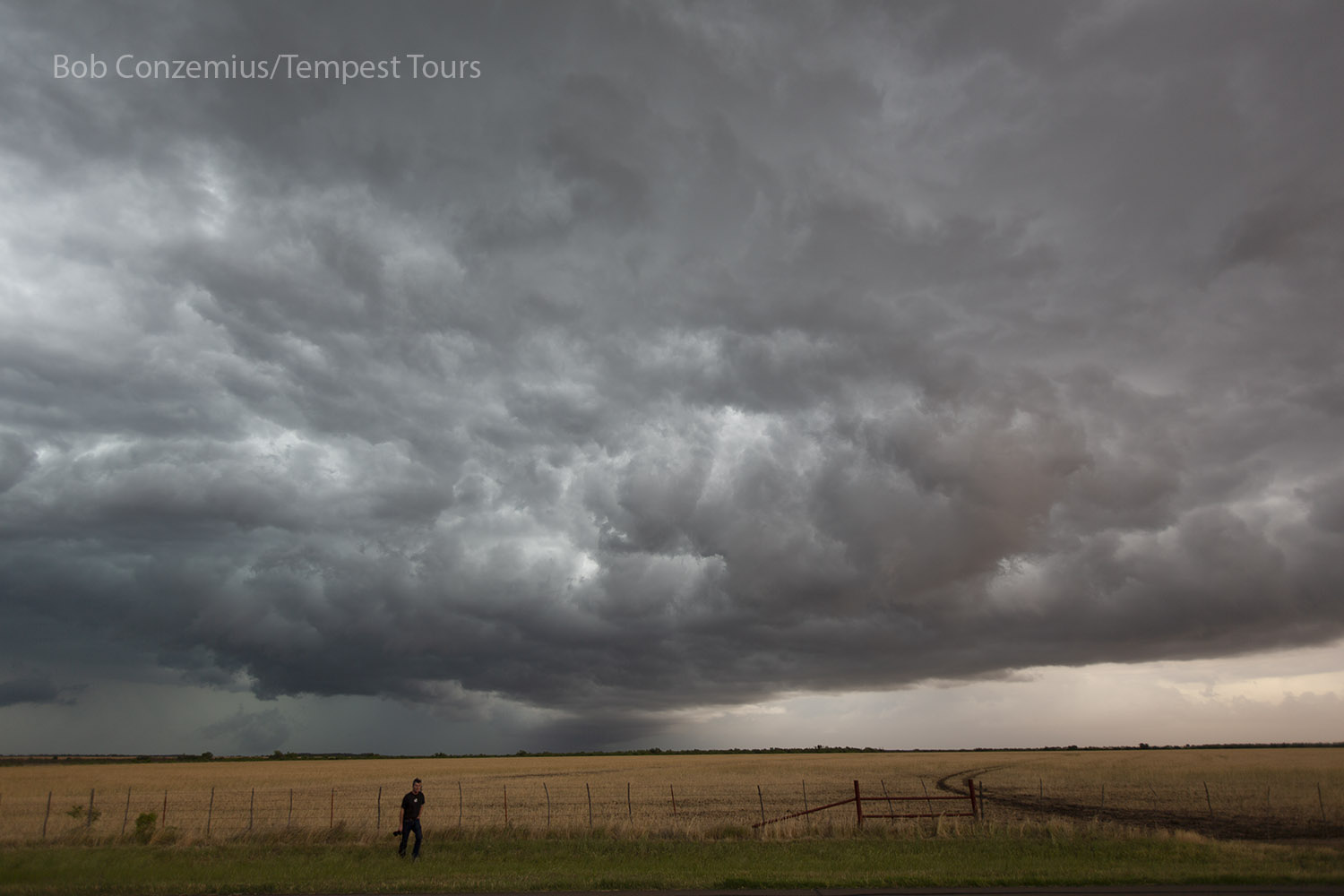
| Tour director Bill Reid returns to the van after snapping a few still pictures. |
 |
|---|
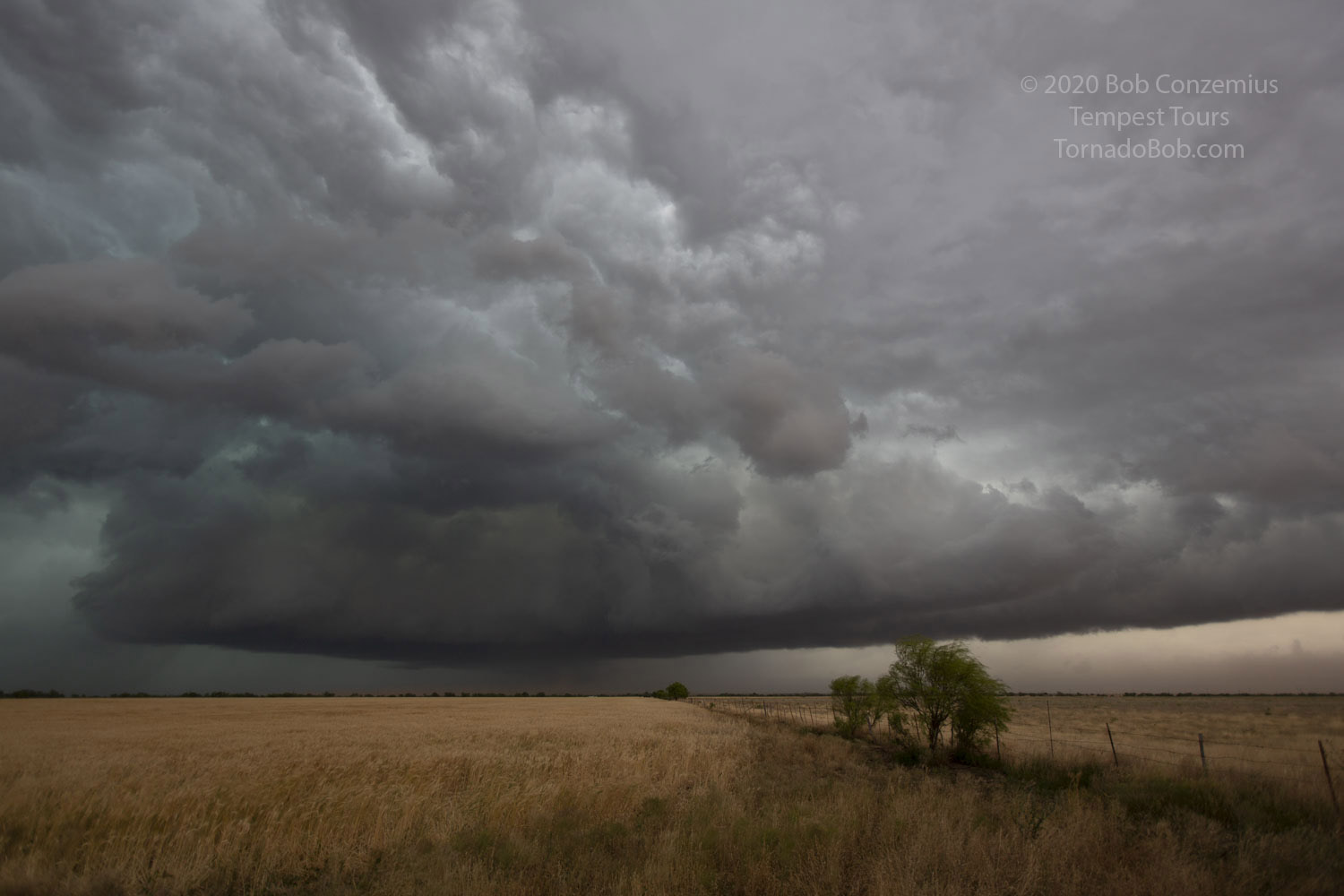
| There were some more interesting features along the line of storms, as pictured here. |
As luck would have it, we did happen upon a tornado-warned storm or two. We had been looking at one or two stronger cells along the line, and we raced east to get back ahead of the outflow boundary. That's when we noticed a more intense storm to our southeast. Could we get ahead of it? The roads took us east-southeast, and the storm was heading east, so there was a chance. Soon, a tornado warning was issued. We got a fair bit closer to the action area of our new storm, but we were in rain and a bit of wind. The mesocyclone looked somewhat interesting, but we could not get in a good position to view it, especially if we wanted to stay dry. Our road went southeast while the storm moved east-northeast, and that took the mesocyclone very close to us, but it passed just in front.
Then, it turned quite dark. Sunset was quickly approaching, and the race was on to stay ahead of the heaviest core so that we could have a chance of getting back ahead. We had, at times, a road that led us more in an easterly direction, and that gave us hope that we could get back in front, but these were farm-to-market roads, which aren't the smoothest. We were in and out of moderately heavy rain as we flirted with the leading edge of high reflectivity. The skies were getting darker. With the light that we had coming in from the eastern horizon, it illuminated neither the landscape nor the road very well. What I had, as a driver, was a low contrast darkness in front of me. I drove as quickly as I could given the reduced visibility, and that meant about 45-50mph-- just barely fast enough to creep slowly out of the advancing rain core when the road was going the right direction.
Suddenly, a subtle yet large shifting motion appeared immediately in front of us, heading for the middle of the road. Instinctively, I stood on the brakes, causing everyone inside the van to lurch forward against their seat belts. The silhouettes of five black angus cattle rolled by like train cars in our headlights as they crossed the road. I'm not sure what would have happened to our van had we hit those at 50 mph, but it probably would have disabled us.
We continued east. It got dark, and when we got to Wichita Falls, we looked for rooms and a restaurant. Unfortunately, once we got to our hotel, the power went out as the power line to the hotel was arcing in a tree nearby. We went to a fast food place to get some supper, which we had to do in very heavy rain because we got to the place just as the heaviest part of the storm arrived.
 |
|---|
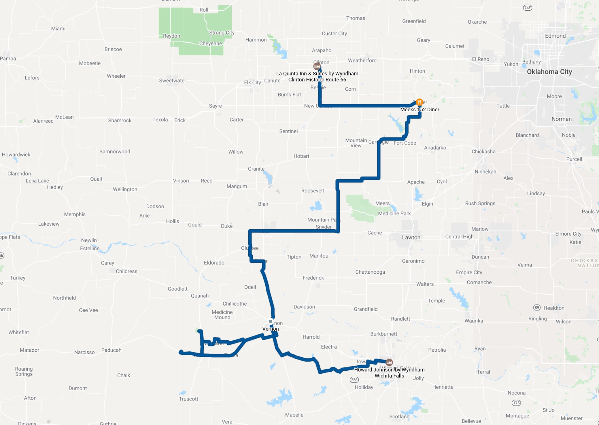
| Our 307 mile route for the day. |
Back to Storm Chases | Home