June 3, 2013 Perryton, TX Supercell
Today was Day 1 of Tempest Tours 2013 Tour 5. The tour started at Denver, Colorado, and had 12 guests. After the El Reno tornado three days prior, there was a lot of anxiety among some about chasing, and probably all the guests had heard of the trajedy involving several storm chasers who were engulfed by the growing tornado. A good description of the causes behind these chaser deaths can be found on Skip Talbots YouTube channel: El Reno Tornado Analysis - Understanding a Chase Trajedy. Tempest Tours 4 and 4b were also near that tornado and managed to escape to the south. That event has probably had the single biggest impact on peoples' perception of storm chasers than any tornado in storm chasing's relatively young history. The two weeks prior to the El Reno tornado were also very active and included an EF-5 tornado that struck Moore, OK on May 20.
Any, now it was my turn to lead a tour, and the weather pattern looked a lot quieter, at least in terms of the risk for tornadoes. The flux of deep tropical moisture via the Gulf of Mexico into the central U.S. suddenly shut off, partially due to a tropical depression that had moved into the Gulf, and the mid-level trough in the western U.S. lifted out, leaving somewhat more northwesterly flow. Still, there was some moisture present as well as sufficient shear to form supercells at least on the first couple days of the tour.
Day one presented us with the opportunity to catch storms developing on the High Plains and drifting southeast. Typically, these storms favor areas of higher terrain that protrude eastward from the Rocky Mountains. The Cheyenne Ridge lies mostly along the Wyoming-Colorado border to the north of Denver, the Palmer Divide lies between Denver and Colorado Springs, and the Raton Mesa is oriented along the Colorado-New Mexico border. Today, it looked like storms could develop in all three of these areas with the Raton Mesa most likely to produce the strongest storms. However, if we targeted those, we also ran the risk of the storms developing early and moving southeastward to fast and too early for us to catch them. THe deciding factor in the matter was that driving toward storms initiating on the Raton Mesa would put us in better position for Day 2. Since most tours get rather tired of driving, any choice that, all other considerations equal, presents an opportunity to drive LESS is usually a better choice. I explained the situation to the guests, and we started east and southeast on I-70.
Indeed, when we got to Limon and turned southeast on U.S. 287, we could see storms developing along the Raton Mesa. I was a little concerned about the early development, but we kept driving through Lamar, then east on U.S. 50/400 to Garden City, then south on U.S. 83 to Liberal. The guests were great and required relatively few pit stops, and the storms cooperated by not accelerating as they strengthened, so we reached the cluster of storms just north of Liberal. Nothing really looked great, and it was rather tempting to stop and make room reservations for the night (they are harder to find in some places than they used to be), but new storms were developing off to the southwest, and we would not have far to drive to investigate them.
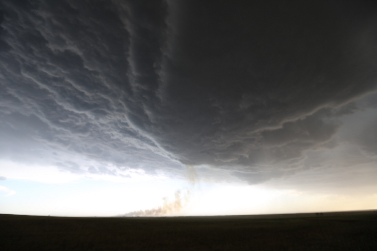
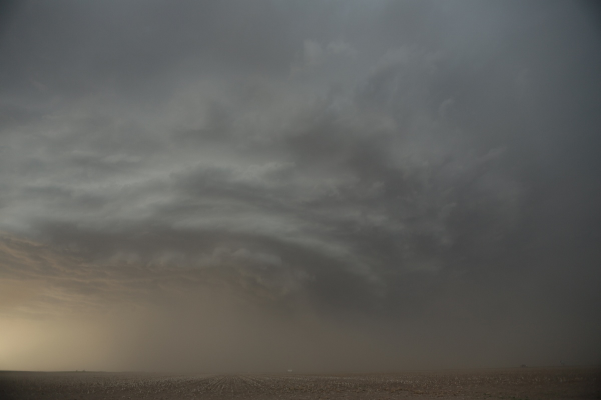
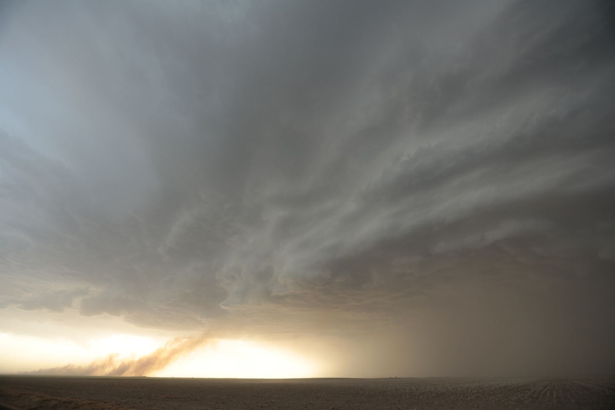
We continued south on U.S. 83 and were soon greeted by a nicely sculpted updraft base on a storm. To provide a more dramatic visual appearance, a plume of smoke from a grass fire was rising into the updraft base. We got far enough south to clear the rain and get into the warm, moist inflow to the storm. Due to recent dry weather and persistent drought conditions, we were greeted with rather dusty conditions in the inflow, which reduced visibility. I picked a spot to let the guests get out and take pictures.
 |
|---|
| Storm ingesting smoke from a fire. |
 |
|---|
| South of the storm. It's pretty dusty here, but nice structure is appearing. |
 |
|---|
| Ingesting both smoke and dust. |
Soon, the outflow caught up to us again, and it flipped off my hat and sent it into the adjacent field. I ran to catch it and didn't notice the electric fence strung out low in front of the field. It caught my foot, and I almost did a face plant into the field, but somehow, I received no electric shock. It must have been turned off. We hopped back into the vans to drop south again.
After one more viewing of the storm, with the sun setting, we decided to call off the chase and head back north to Liberal. We would not get there before attempting some lightning photography and getting one of the vans stuck on a slick road. Luckily, a nearby farmer was willing to pull us out of the ditch using his double axle pickup and our tow strap.
In order to perform my duties and make room reservations, I did not take a lot of stills or video of the storm, but the guests enjoyed it, and it had a pretty nice structure. Here is a nice time lapse video taken by someone who was chasing it-- initially from the same vantagepoint we had, then from farther east after we were about to return north: Supercell Timelapse.
Back to Storm Chases | Home