July 5, 2023 Supercells
Raton Mesa
We began the day in Burlington, Colorado in cool, overcast conditions. I went on a morning run, ate some breakfast, and gave a quick weather briefing for the day's storms. Our target was the Raton Mesa area. This would be an initiation point for storms that I thought would be the best of the day.
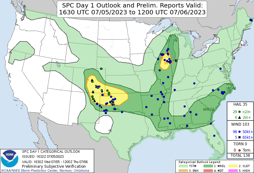 |
| SPC Day 1 Outlook graphic and storm reports. |
We got on the road, drove southwestward, and reached Trinidad, Colorado in time to have a relatively quick, sit-down lunch. To save time, we split our group between two restaurants, according to our individual preferences. I looked at Google Maps to select a couple places that looked decent, and we picked a time to meet back at the van.
We got to our Mexican restaurant and found only one person working there beside the cook. He was seating people and waiting on all the tables. It might take some time. We decided not to pick a new restaurant because we could not guarantee it would be faster (plus, we would chew up more time going to a new place). We stuck it out where we were. As it turned out, it did take a little longer than usual, but the storms were giving us time. Nothing developed until we were finished paying for our meals.
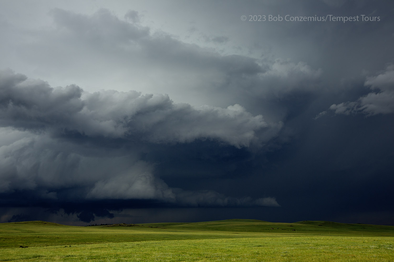
A couple interesting storms were developing, and both looked to be about the same intensity. One was pretty close to us, just west of Trinidad, and the other was about 50 miles south. The southern storm would be moving off the higher terrain and might not have as much support, so I was not motivated to make the 50 mile drive to get there and catch up to it from behind. We let this one go.
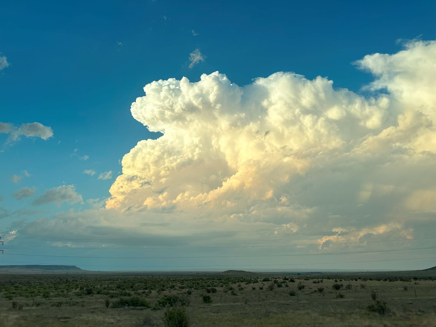
We drove to a good viewing location at the south end of town and pulled into a large convenience store and gas station parking lot to watch the storm drift toward us. I was pretty excited about it. It had an early supercell shape, featuring a corkscrew/barberpole updraft and a small wall cloud. The storm looked to have some potential! We let the updraft base drive over us while I monitored radar, hoping to avoid large hail. Some small, dry hail fell on us there.
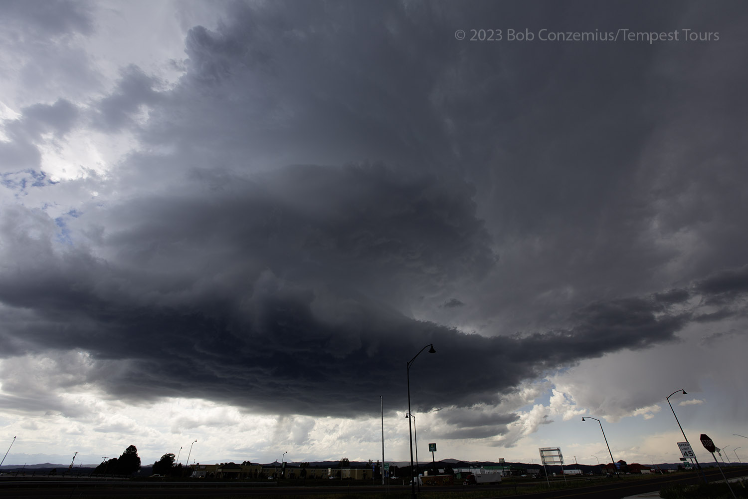
 |
| Our new storm just west of Trinidad. |
 |
| The updraft base approaches our location at the I-25 interchange on the south side of town. |
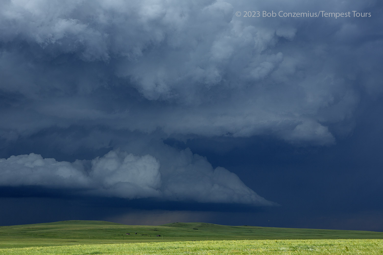
With the updraft base now getting to our east, we needed to find a way to get back ahead of it, but it was drifting out over the roadless part of Raton Mesa. We would have to go over Raton Pass and into the town of Raton before we had an east option. Meanwhile, the storm to our south was intensifying. The road options for that storm did not look any better than ours. We would have to go south of it then east, or else take the east option to the north of the storm then drop south through the core. We already had a severe storm nearby, and both storms were warned. I continued east.
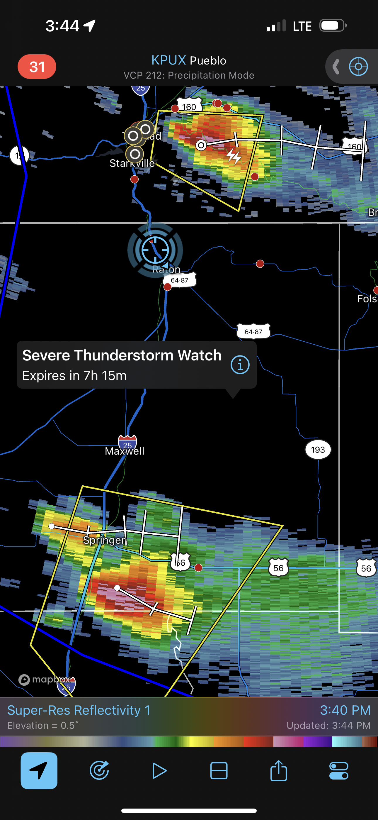 |
| Radar image of the storms while we were driving east from Raton, NM. |
We got on top of the mesa and back within visual range of our storm. By the time we found a good place to park, we could see that the updraft had shrunk slightly, although the form still looked good.
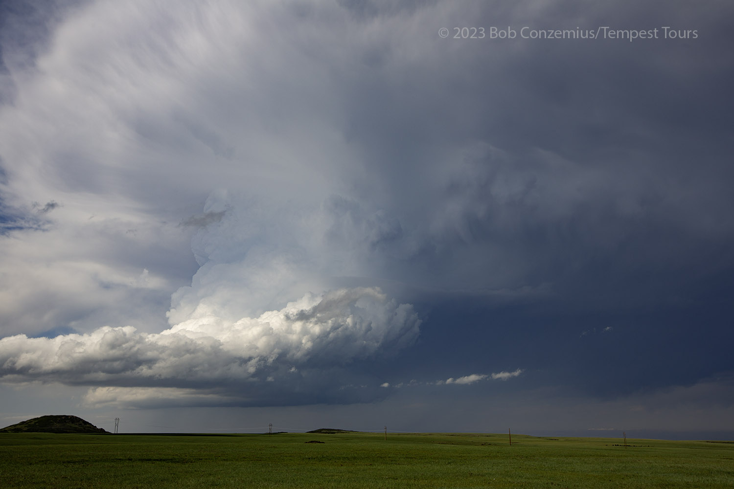 |
| Our original storm, now to our northeast. |
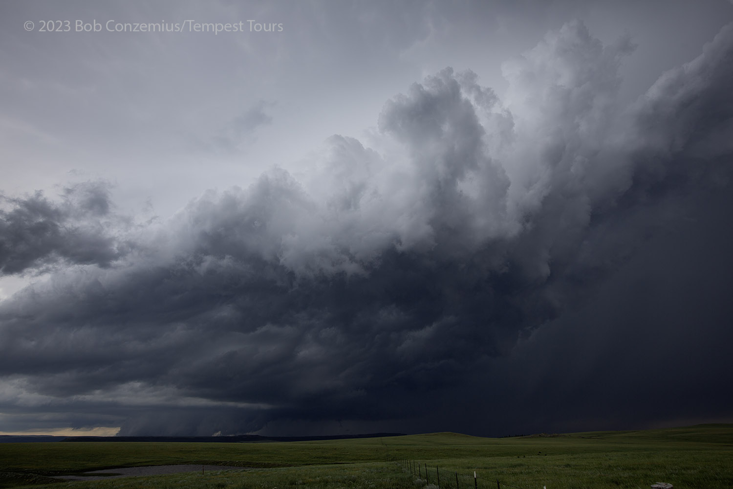
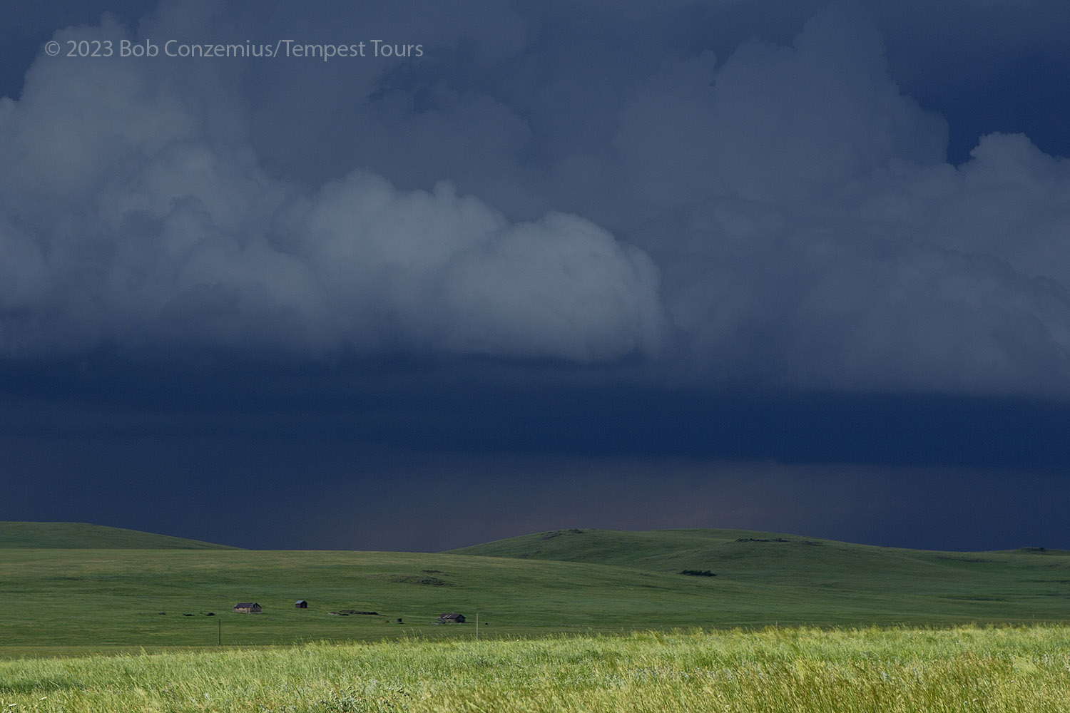
The southern storm still looked good, and in fact, it appeared better than ours. The good news was that additional updrafts were developing west of Trinidad and rapidly intensifying. We could just stay put and watch them go by. Our visibility was great, and the structure was good, and the clean air made for high contrast.
The newer storm over Trinidad continued intensifying, and after about 30 minutes, it had a tornado warning. We strained our eye to try to see underneath the updraft base, but it was completely dark to the horizon. There was too much terrain in the way to see what might be happening. We simply waited because we would lose our visibility in any attempt to get closer. Eventually, a shelf cloud emerged on the horizon on the rear flank of the storm. It looked like this was not a tornado producer.
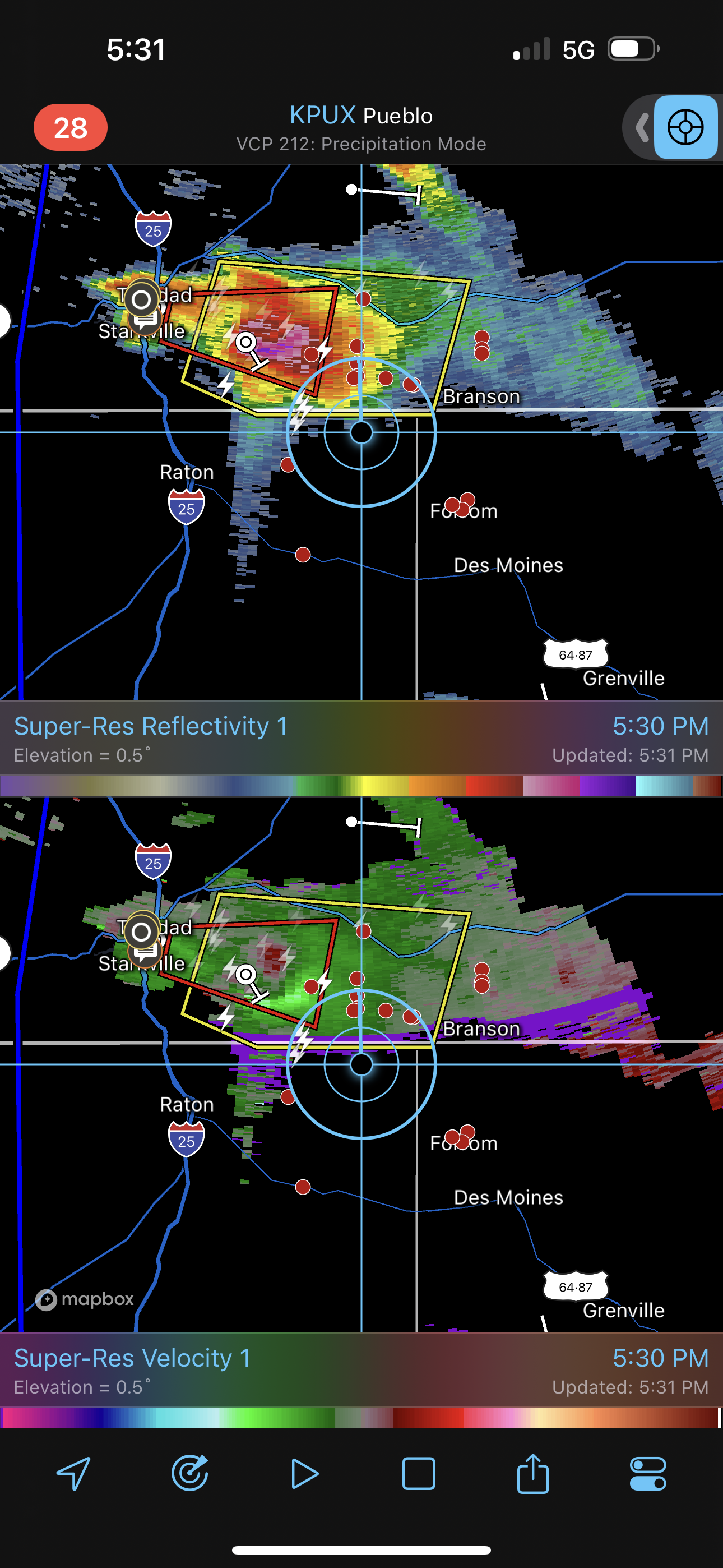 |
| Radar reflectivity and velocity on our tornado-warned storm. |
 |
| Our new, tornado-warned storm over Trinidad. |
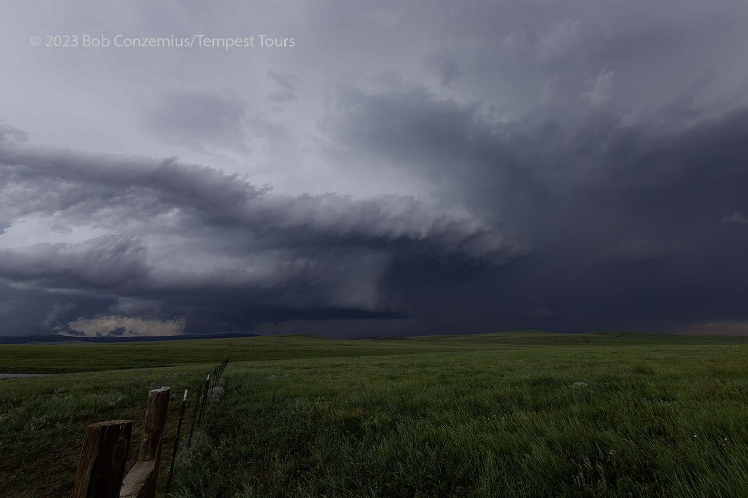
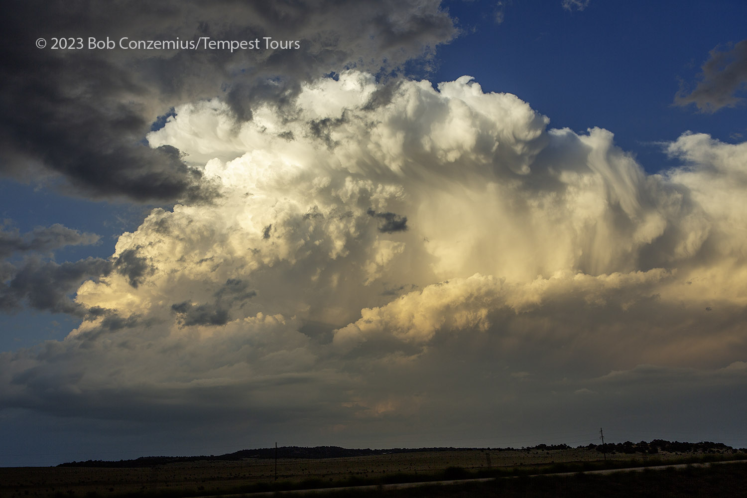
Nevertheless, the structure improved. The shelf cloud dissipated, and a wall cloud formed in its place. There didn't appear to be much low-level rotation, but the mid levels had a lot of nice shear in them. We stayed put and enjoyed the show! The rolling green countryside made a wonderful foreground for our storm images. It was a scenic location to photograph, and a parade of storms to our north allowed us to enjoy storm photography without moving
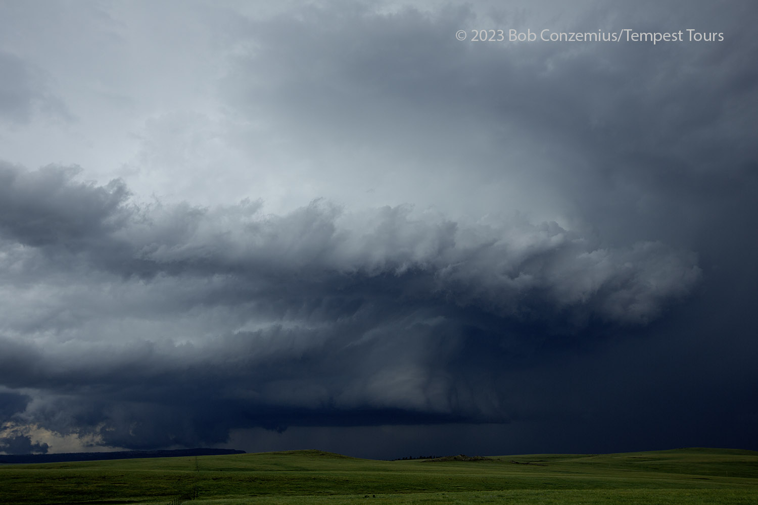 |
| The structure improved as the storm emerged onto the mesa. |
 |
| Wider look at our second storm. |
 |
| Another new storm. |
 |
| Third storm. |
 |
| A zoom into our third storm. |
Eventually, the new storms developing near Trinidad did not look as robust. That storm to our south continued to hold together, and it remained a severe, discrete storm for a long time as it rolled into the Texas panhandle. It would have been a good one to see, but we would have had more driving to keep up with it. I was happy with what we saw, and we had a shorter drive for tomorrow's target.
We drove back to Trinidad and took a pit stop. We also made a stop to grab some food, and I booked rooms at Colorado City, which would be closer to our Day 2 target. On our way up to Colorado City, we viewed a couple storms developing over the foothills to our west and moving out over the plains to our east. This provided a nice sunset storm.
 |
| Storm east of I-25, on our way to Colorado City. |
 |
| Cell phone capture of our sunset storm. |
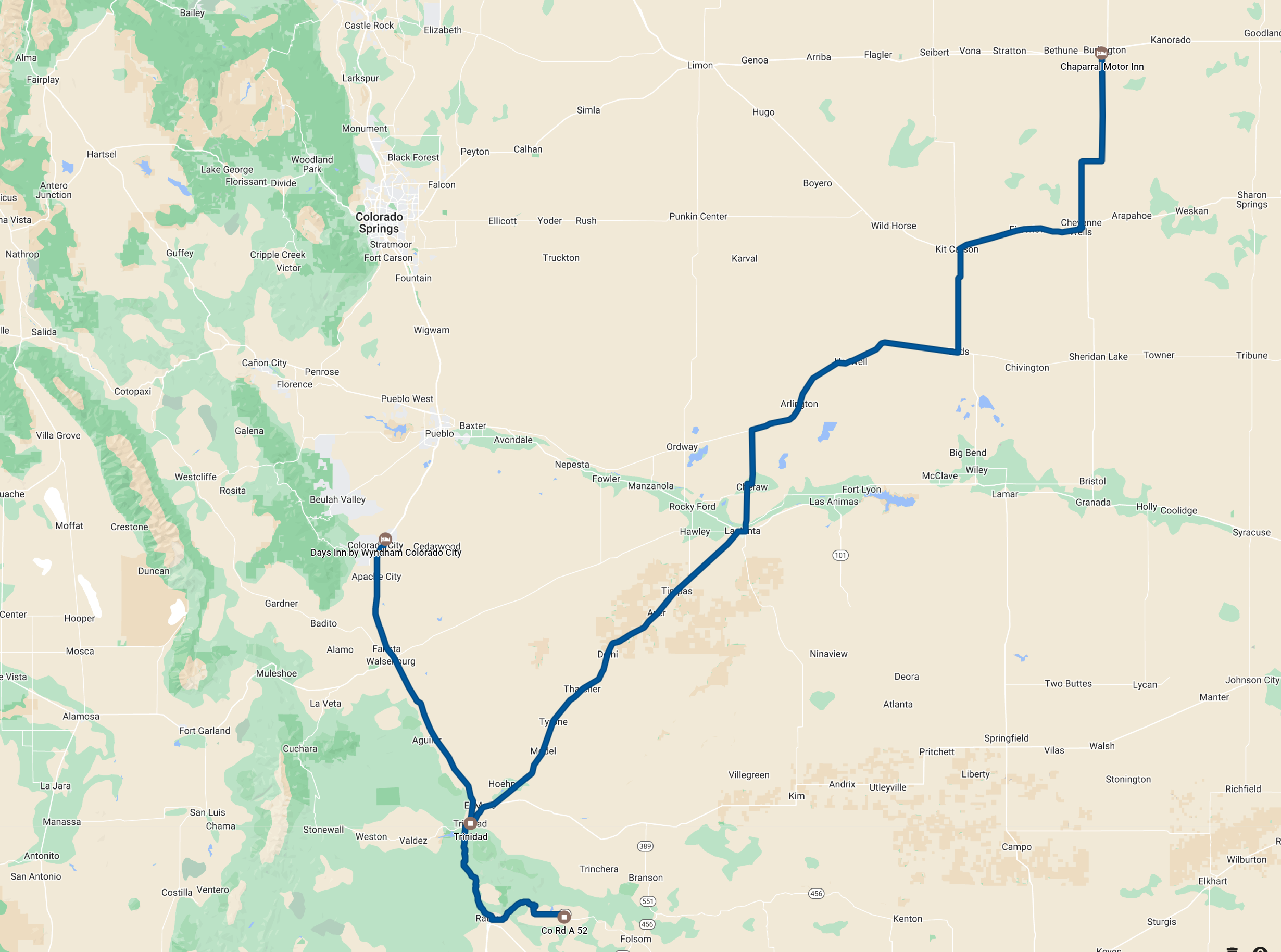 |
| Route for the day. 296 miles. |
Back to Storm Chases | Home