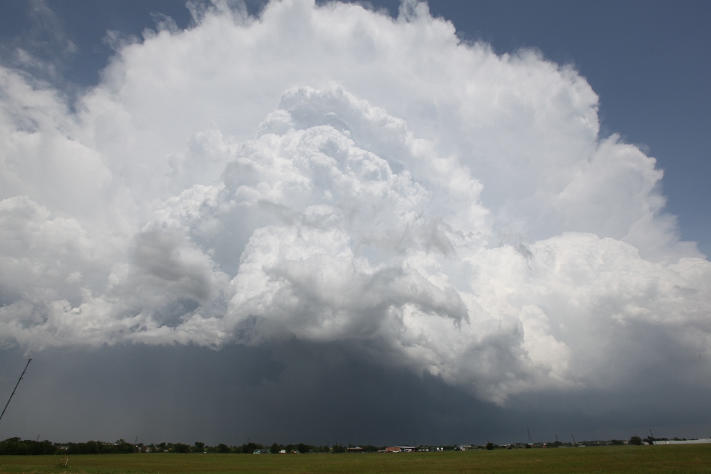
Initial updraft base of the dryline storm as it interacted with the outflow boundary. It had a somewhat ragged appearance underneath.
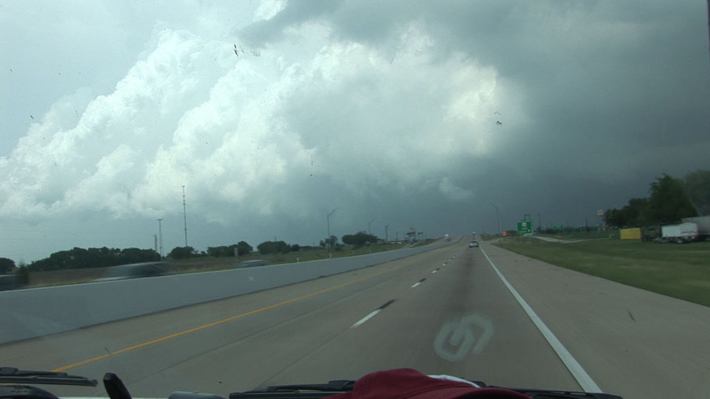
We started the day again in Greenville, TX. We drove south to Kaufman where we had lunch at a nice barbeque restaurant and waited for storm initiation. Our lunch location was right on a warm front/outflow boundary. About 30 minutes to an hour after lunch, some cumulus started to grow along the dryline just south of Cleburne, so we opted to go southwest toward the new development while evaluating cumulus congestus along the outflow boundary on the way. Our target storm became tornado warned just as we arrived on it at Milford, TX. I decided to go north on I-35E to take the most direct route to the updraft base rather than take Highway 34 northeast from Italy, which would have afforded us the best opportunity to stay with the storm. I thought there was enough time to go up to Waxahachie and then come back southeast to get back in front of the storm, but we ran into a road construction traffic jam, which cost us at least 10 minutes (in addition to what we lost due to my less storm-parallel route). The storm quickly got in front of us, and it also seemed we were moving really slowly on just about any road we chose. We did get back our storm-parallel route and continued east on Farm to Market 85 east of Ennis, but the storm was outrunning us, and soon we were closer to the storm that had developed behind us, and we continued to lose ground on the storm ahead of us, so back west we went, despite the fact that I wanted to get east.
Initial updraft base of the dryline storm as it interacted with the outflow boundary. It had a somewhat ragged appearance underneath.
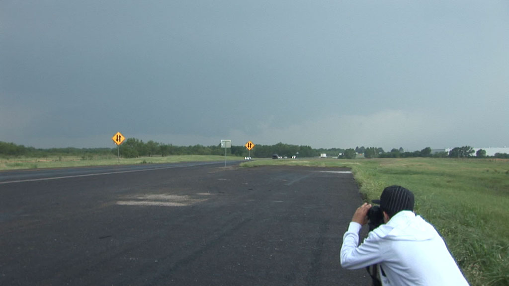
Storm viewed from I-35E in a traffic jam south of Waxahachie, TX.
We drove back to I-45 at Ennis and stopped at a gas station there for fuel and pit stop. There, the second updraft base approached quickly from the southwest. It had a nice, low-level inflow tail ramping upward into the updraft base from the northeast, but it was clear that the storm was drawing its true energy from the air overlying the rain-cooled (from the previous storm) airmass we were in. Nevertheless, the low-level features continued to improve visually, and the storm seemed to pull harder on the rain-cooled air as the low-level cloud base expanded. Then, the low cloud base started to rotate, greatly raising my level of interest in the storm. I moved to get the group back in the van to depart, but a television crew and a radio crew were there and had started interviewing nearly everyone in our group. That slowed down the process to the point that, given our relatively slow progress on the roads, we would not be able to get in position. I opted for storm number three, which was gaining strength to our southwest.
We quickly came up on Storm Three (tornado-warned) and stopped to watch it, but it had very low contrast base along with very little interesting motion. It also had very little room between it and the next storm to the south, so we had to let Storm Three go in favor of Storm Four, which had much more room to its south and was more likely to become a tornado-producer.
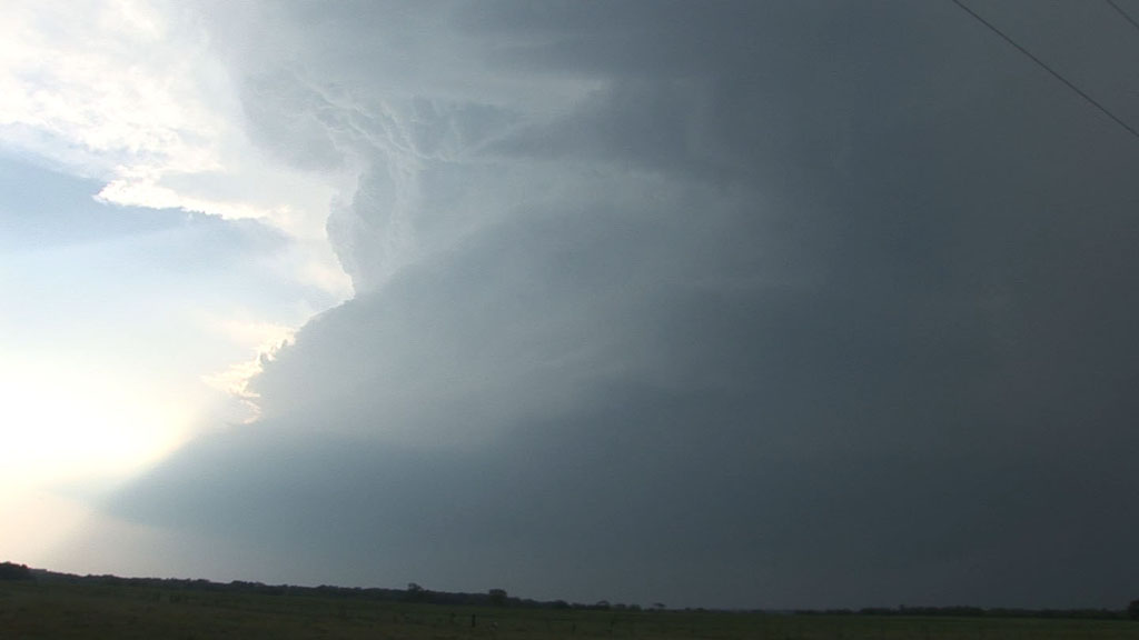
Third storm of the day a few miles south of Ennis, TX.
Indeed, as we came around to the southeast Storm Four, we found a nice, hard-sculpted updraft, the entirety of which was rotating quite visibly. Martin was ahead of us already looking at funnel clouds on the storm. This looked like a good one, so I decided we should follow it east away from the interstate and get in a good position to view the updraft base.
Storm number four near Corsicana, TX.
Just as we reached a nice viewing location, Martin called to say he was abandoning the storm and heading for a new one near Waco. I was not too happy. Indeed, as our updraft base approached us, we could now see, as Martin had just seen, that it looked less impressive, but now we found ourselves in a bad position. It would take us at least 15 minutes to get back to the interstate just to start driving south. That would put us 20 minutes behind Martin and also force us to take a longer, more easterly route to get into position. The best route would have been to take I-45 south then exit on Highway 14 south at Richland, then take that south through Mexia, but the storm would block that route, so we would have to stay on I-45 southeast at least to Buffalo and then track back west, thus causing us to arrive at the storm base at least 45 minutes after Martin. As it turned out, even Highway 164 west from Buffalo was in the core, so we had to take U.S. 79 southwest toward Jewitt and wait there.
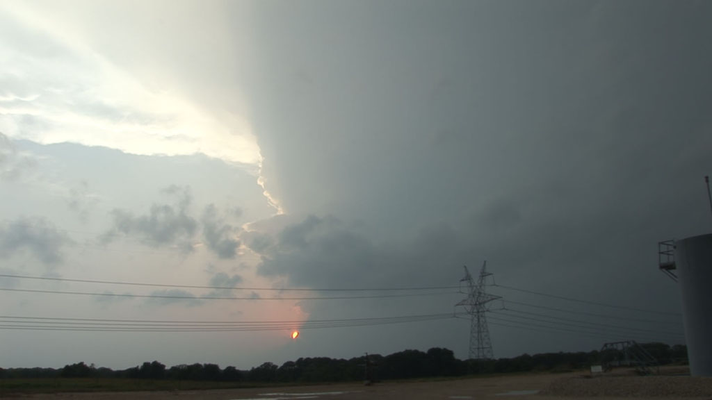
Storm number five viewed at sunset near Jewitt, TX.
We never saw the updraft base of this storm. While still out of reach, it produced a tornado over Groesbeck and then quickly died. Martin saw this tornado and also had a much closer view of this storm than we did. It we rather disappointing that we did not get in a similar position. By this time, the sun had set. I got us into position for two more cells as it was getting dark, but the timing just did not work out on these, and all we saw was a little bit of rotation even though the storms were still occasionally producing tornadoes. At the end of the day, we were quite a bit farther southwest than we would have been had we been able to keep up with Storm One (which also was the best tornado producer of the day). Had we stayed on that storm, we would have been in much, much better position to chase on April 27. However, from the location where we actually found ourselves at the end of the day, I just didn't think we had a good shot to get there in time. We would have had to drive at least six hours to arrive no earlier than 2 PM at a spot where I thought things would initiate at least two or three hours earlier than that and move very quickly east. Thus, we stayed back. As it turns out, assuming we chose the most optimal route to the storm (something that rarely happens because you don't know where the storm will be before you choose the route), we actually could have gotten to the trailing storm of the historic 4/27 outbreak. AND had we found a good viewing location (which is very difficult in most of Mississippi and Alabama), we might have seen an EF-4 tornado. Overall, 4/26 was a pretty frustrating day, but there were some very nice storms around. The roads in rather quick storm motions made it difficult to enjoy them the way I wanted.
Video summary of Tempest 2011 Tour 1: