May 9, 2022 Storms
Itasca County
Some instability and shear brought a slight risk of severe thunderstorms to northern Minnesota and an enhanced risk of severe storms to portions of east-central and southeast Minnesota. Additionally, in the late afternoon, the significant tornado parameter increased to approximately 10 over portions of Itasca County, right around home. My problem was I had a board meeting to attend at 7:00 in the evening, but the storms were developing just to my west, so I might have a chance to look at them before the board meeting.
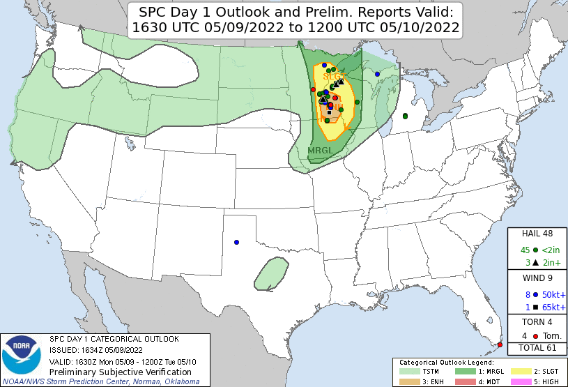 |
| There was a slight risk of severe storms in my area. |
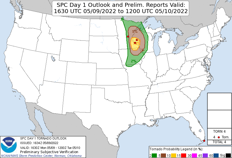 |
| There was a 5%-10% tornado risk. |
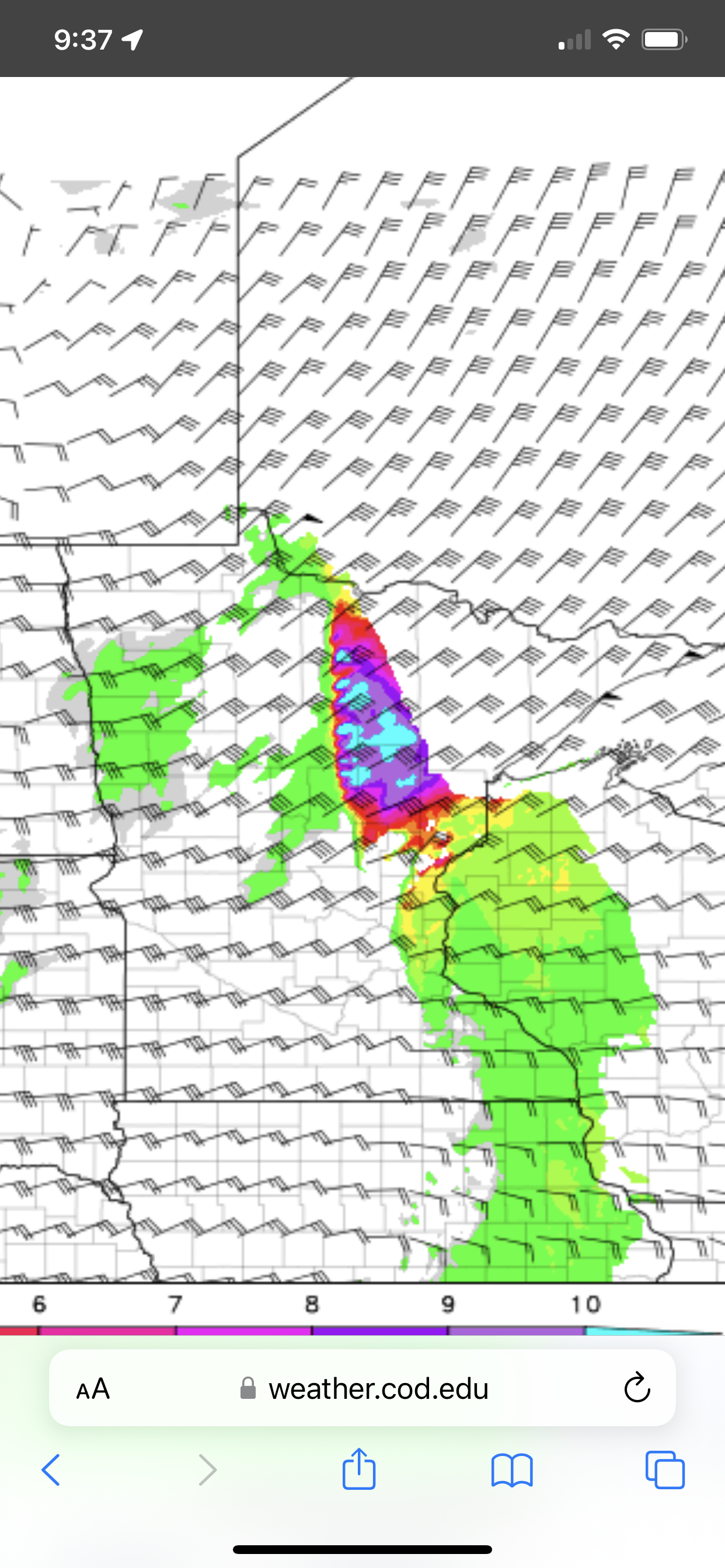 |
| HRRR showed large values of the Significant Tornado Parameter. |
The first storms developed farther south over central Minnesota. These storms rather quickly became severe, and they looked capable of producing tornadoes. The ones to my west were a bit slower to develop, but the environment was pretty good in terms of CAPE and shear. Perhaps the lift was a little lacking in northern Minnesota.
 |
| First storms developed south, and they looked capable of producing tornadoes (a bit of shear on radar). |
 |
| Storms then developed west of me. |
The storms were a little stronger to the north, and they tapered a bit toward the southern side of the line that was approaching. Given this variation in strength, I drove up 38 to the southern boundary of the Chippewa National Forest. I found a storm with a relatively low base, but it was also kind of small, so it wasn't very strong. I watched it approach from the Cedar Creek Grille, and then, as it started to get a little east of me, I drove to the boat landing on Pughole Lake so I could get a better view to the northeast. The weak storm did manage to produce a wall cloud, but I could not discern any rotation. The motion at cloud base, both in terms of upward vertical motion, and rotational motion, was very weak. After I snapped a couple pictures of the wall cloud with my cell phone, I departed and headed back to the board meeting.
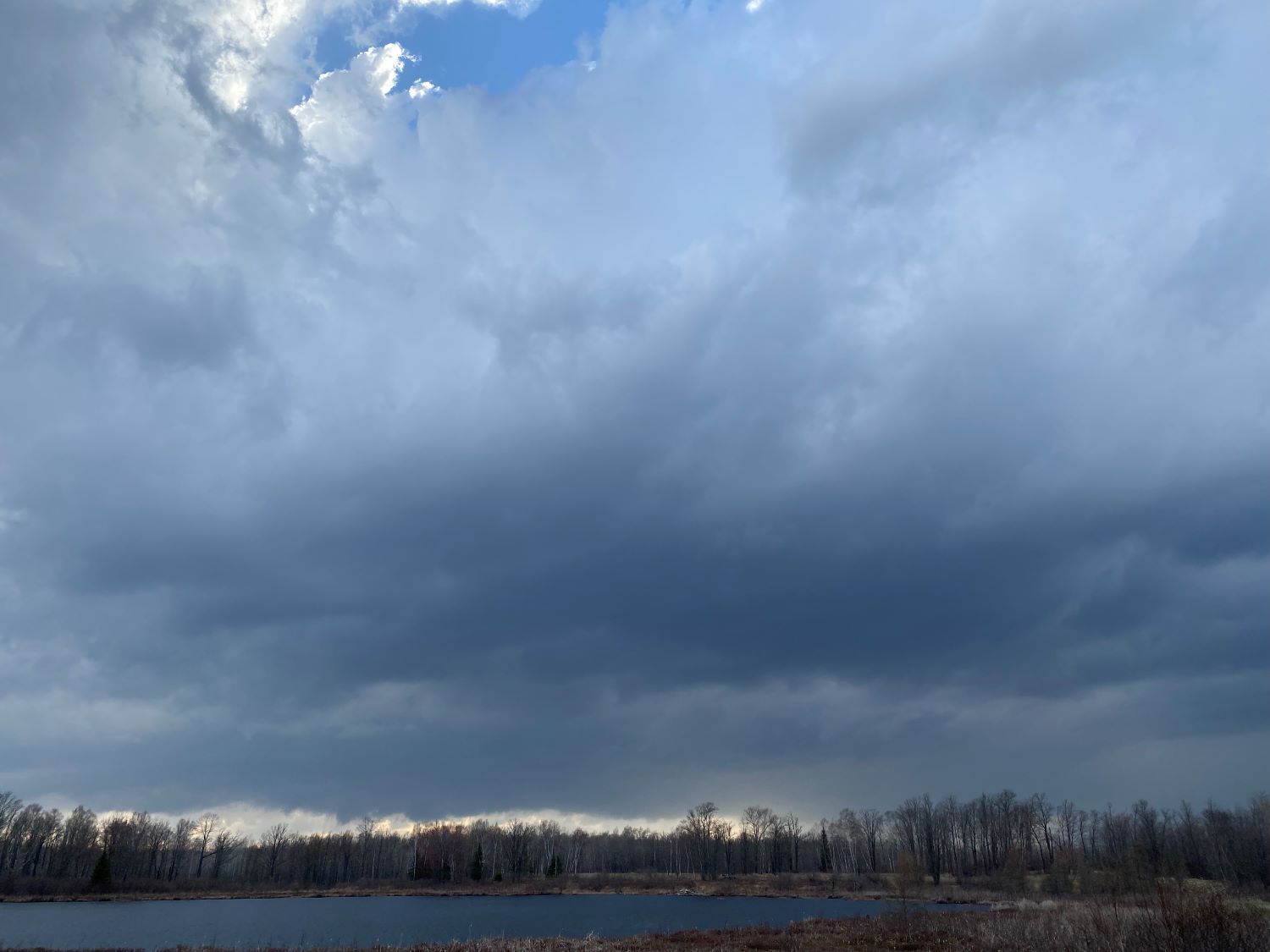 |
| Looking west from Highway 38 near Cedar Creek Grille. Base was low but not extensive. |
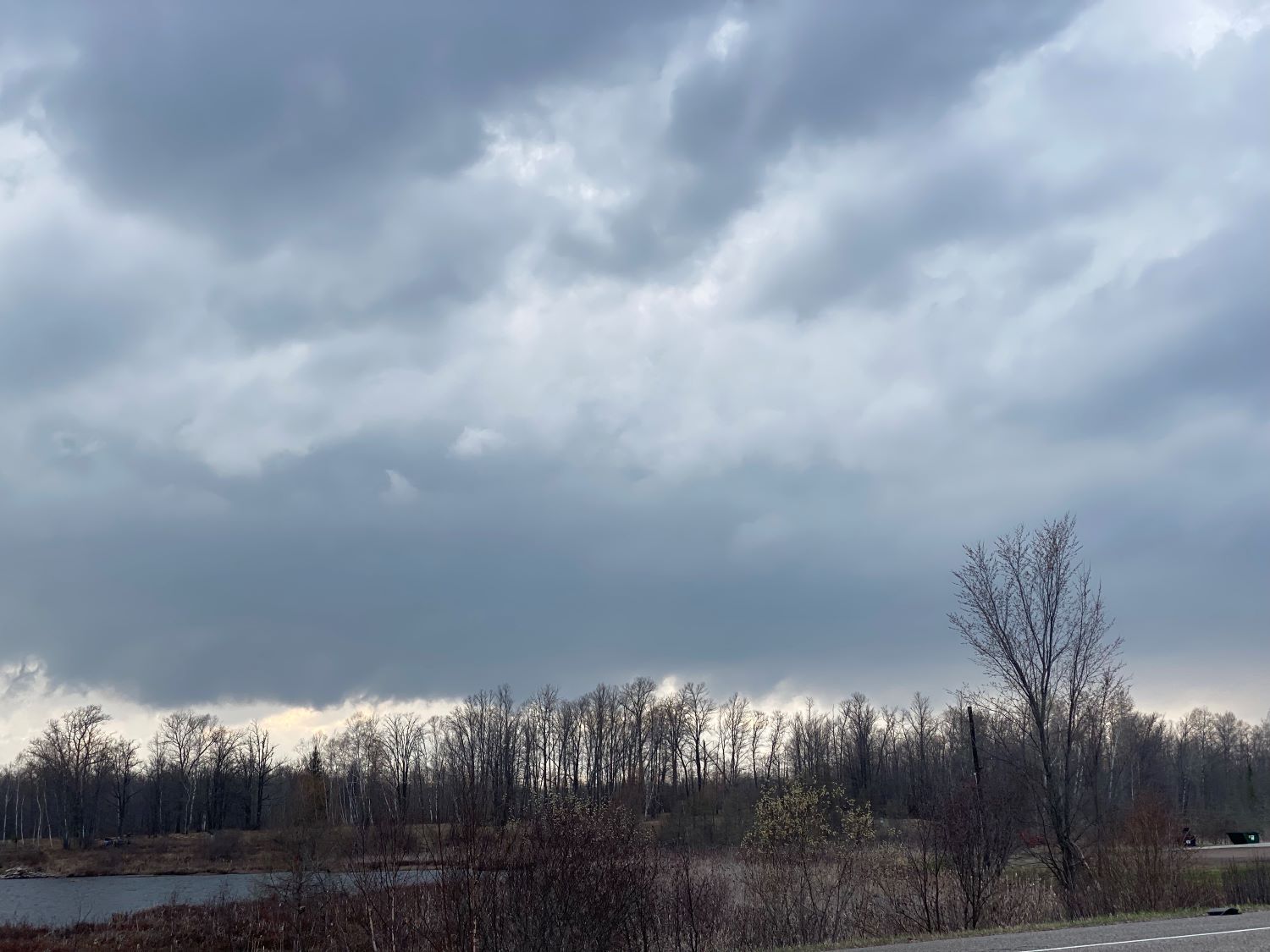 |
| A closer look at the base. |
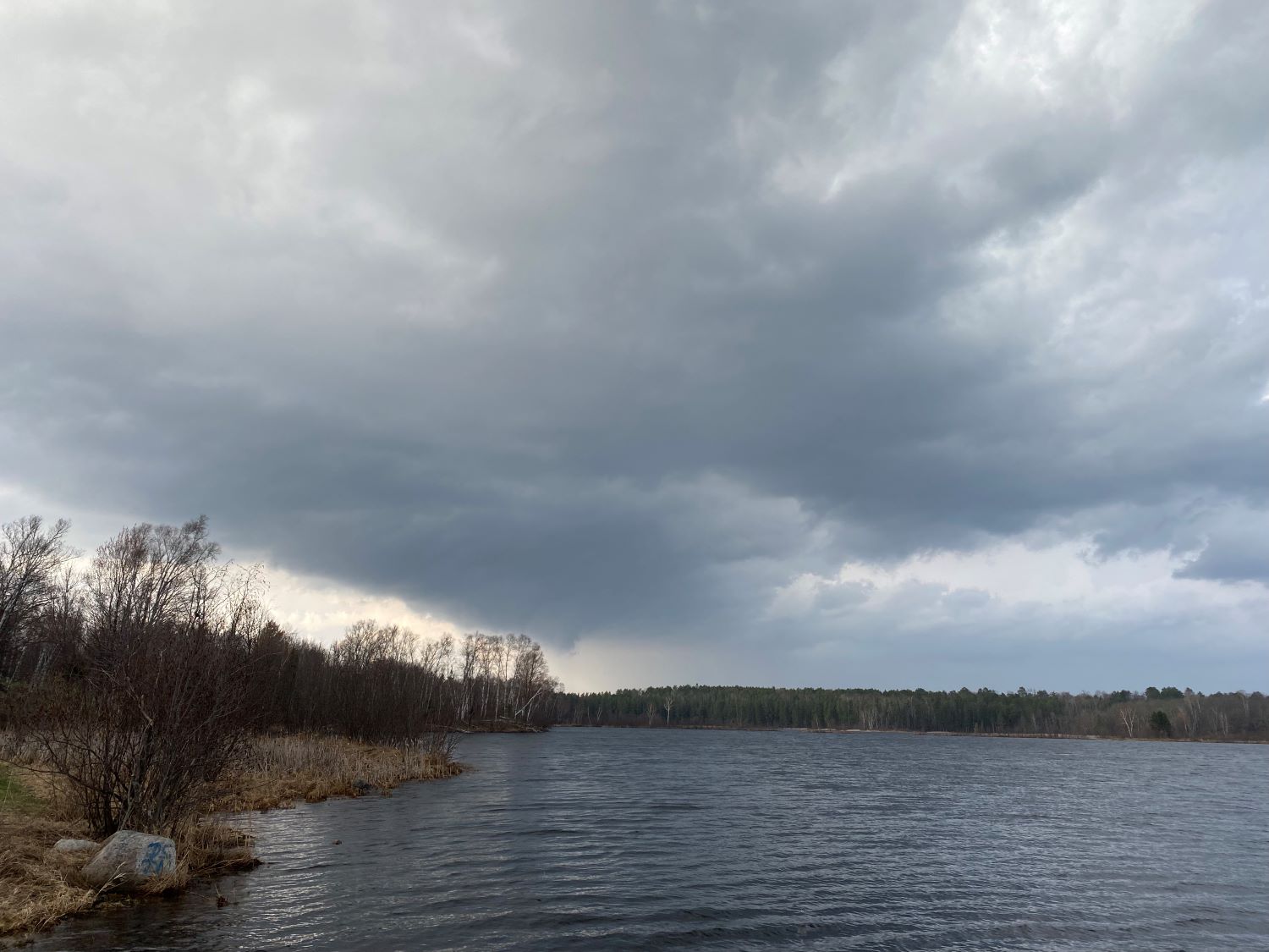 |
| A wall cloud develops over Pughole Lake. I had to leave after this. |
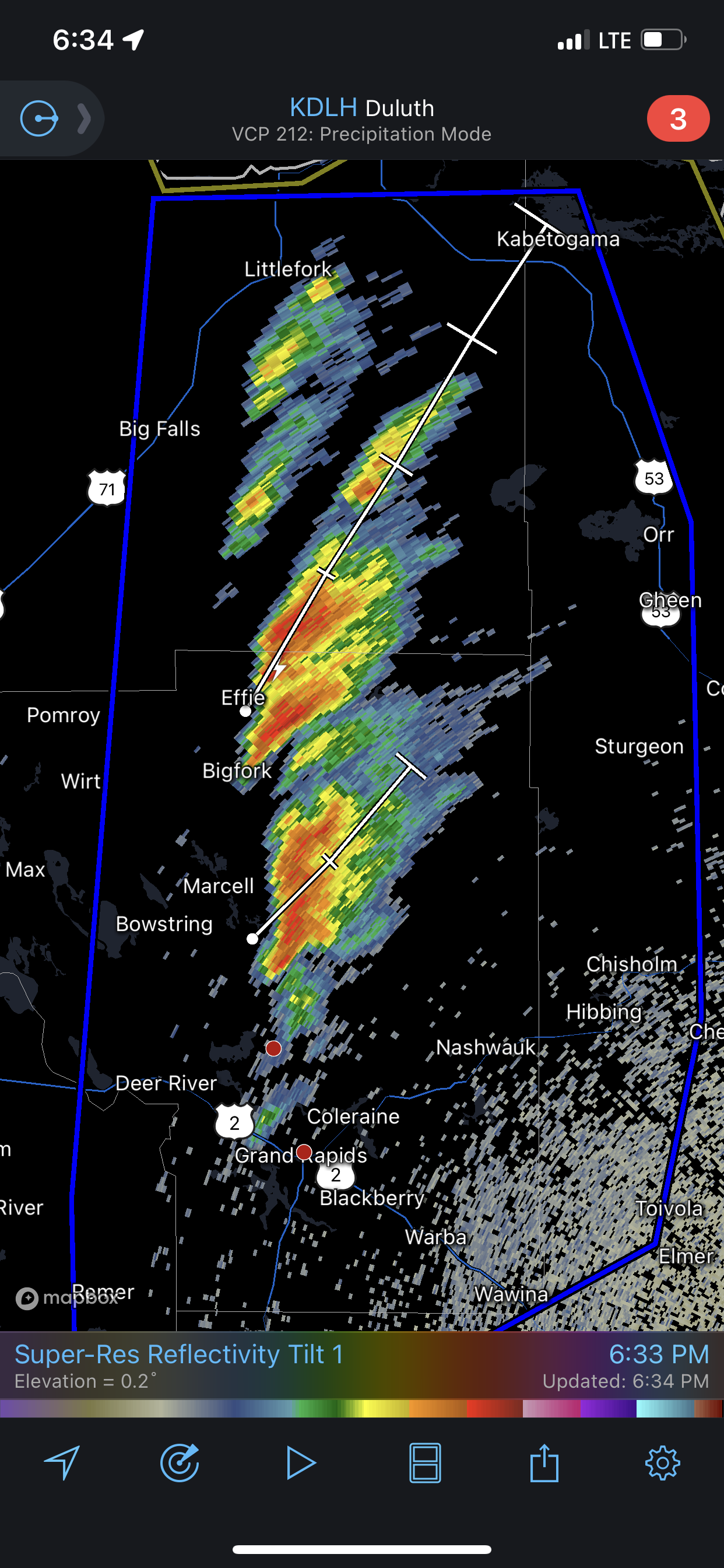 |
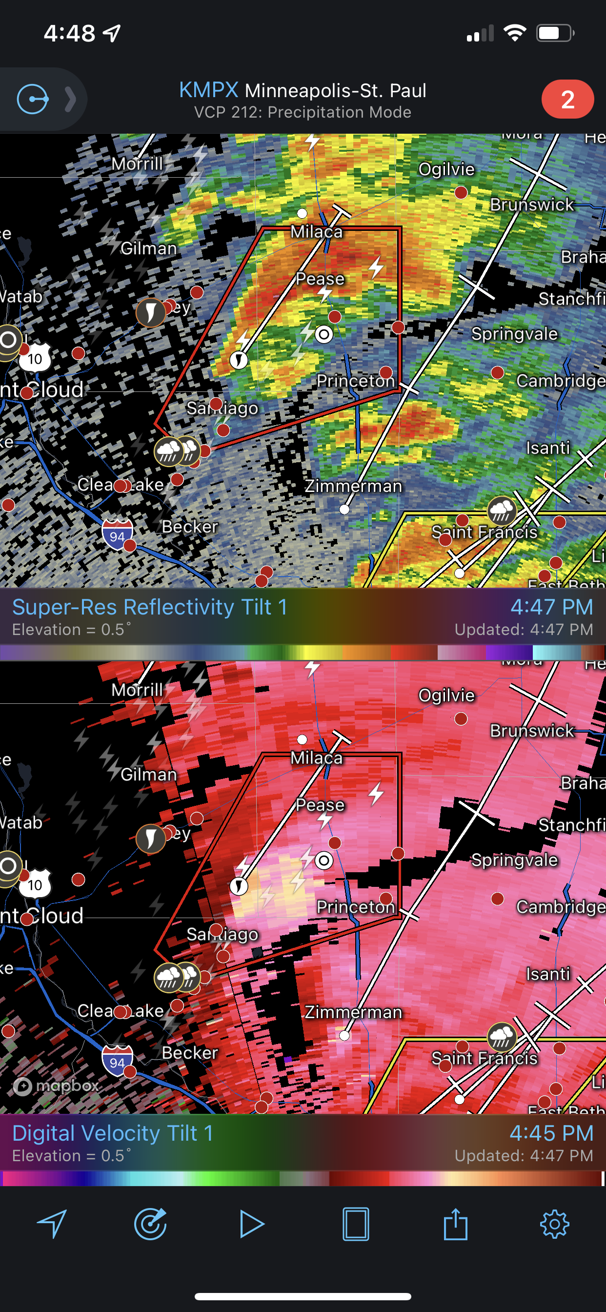
| A last look at radar. |
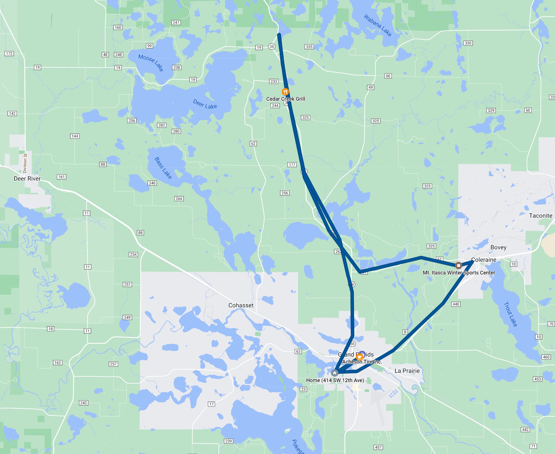 |
| This is the route of my relatively short chase. |
Back to Storm Chases | Home