July 4, 2021 Supercell
Northwestern Kansas
Today was the start of Tempest Tours Tour 9 2021. We had a slight risk of severe storms across a portion of the high plains in a generally north-south line from Nebraska to the Texas Panhandle (as I remember it). It was a little bit of a tough decision where to go because, of course, I'm worried about missing a great storm on Day 1 when planning out how to optimize the storm intercepts over the course of the Tour. There are always some trade-offs and compromises. It's easy to miss a great tornado event on Day 1 if you think about the drive to risk areas later in the week. Is it best to live one day at a time and drive to the maximum risk area each day? Those maximum risk areas can be far away from each other, and it can tire out the guests (as well as the tour guides) and make it easy to miss a storm on any given day.
It didn't look like too huge of a severe weather day anywhere, so my choice was to drive straight east into the risk area and take a shot at whatever was closest to our latitude in the line of storms that was forecast to develop. From Denver, that meant going east on I-70. This would be the quickest route to take us into Kansas. We did our tour orientation and then headed east, stopping for a fast food lunch in (I recall) Burlington. It did not take long to see towering cumulus to our east, and we targeted the closest storm we could find, which appeared to be relatively healthy.
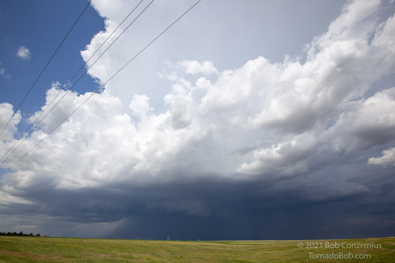
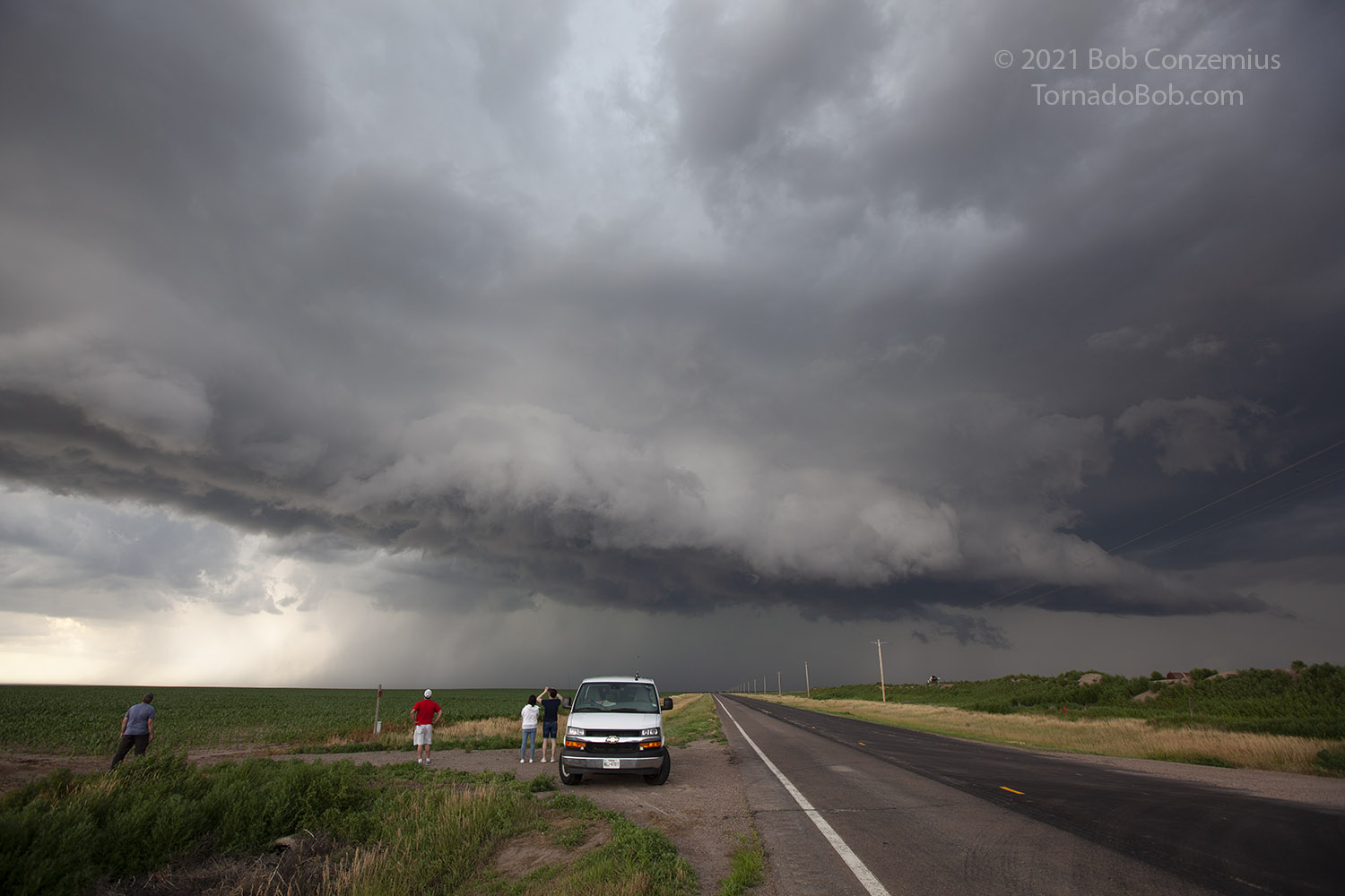
This took us past Goodland to just south of Grainfield, Kansas. There, a robust, discrete storm was developing, and we moved in to get a closer look. The storm intensified at a steady pace, and soon we had a severe thunderstorm warning for our area.
 |
|---|
| The first close look at our storm. |
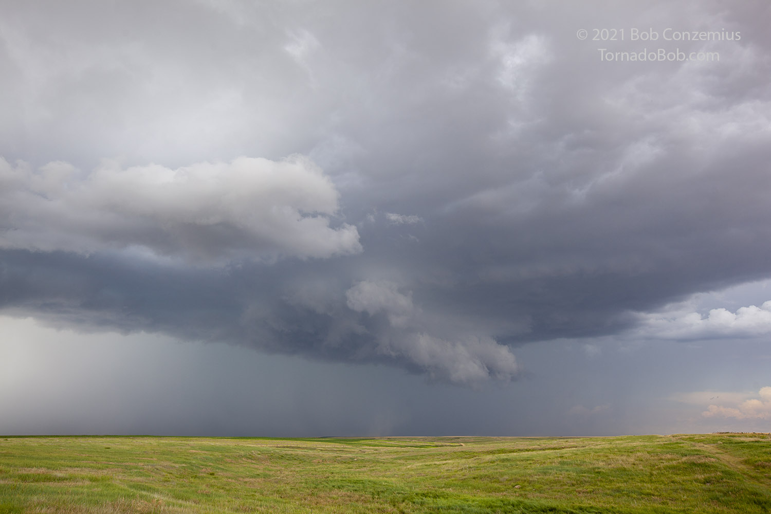
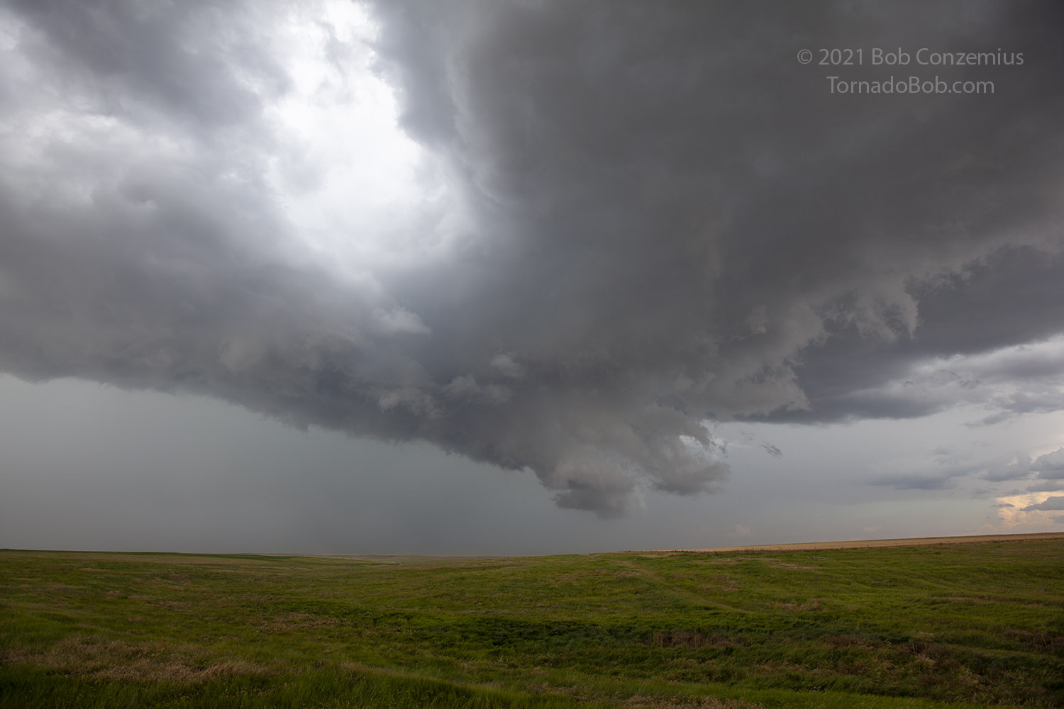
The storm motion was a little bit atypical-- toward the south-southwest. We pulled up to the southwestern flank of the storm and watched a wall cloud develop. The wall cloud even started to rotate a little bit. However, the wind profile was not really conducive to supercellular tornadoes, and we soon saw outflow dust getting kicked up and moving underneath and past this feature. We waited until strong outflow got to our location and took a few minutes for the guests to enjoy it as we weren't getting in any heavy, blinding rain.
 |
|---|
| A wall cloud develops on our storm. |
 |
|---|
| The wall cloud becomes lower and begins to rotate slowly. |
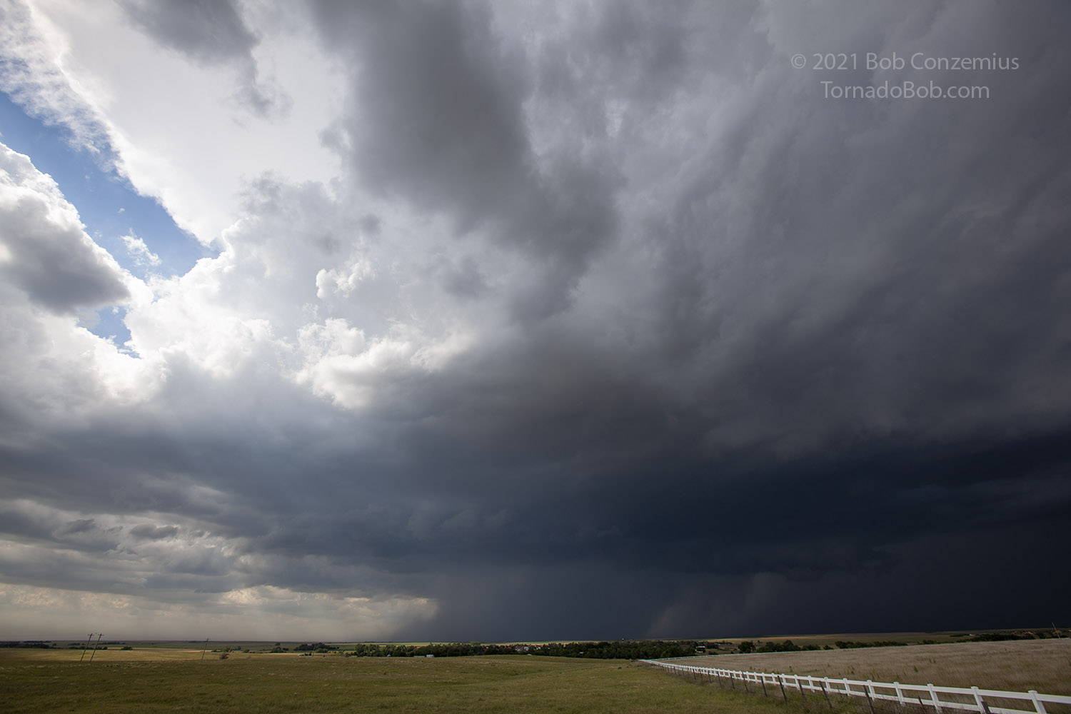
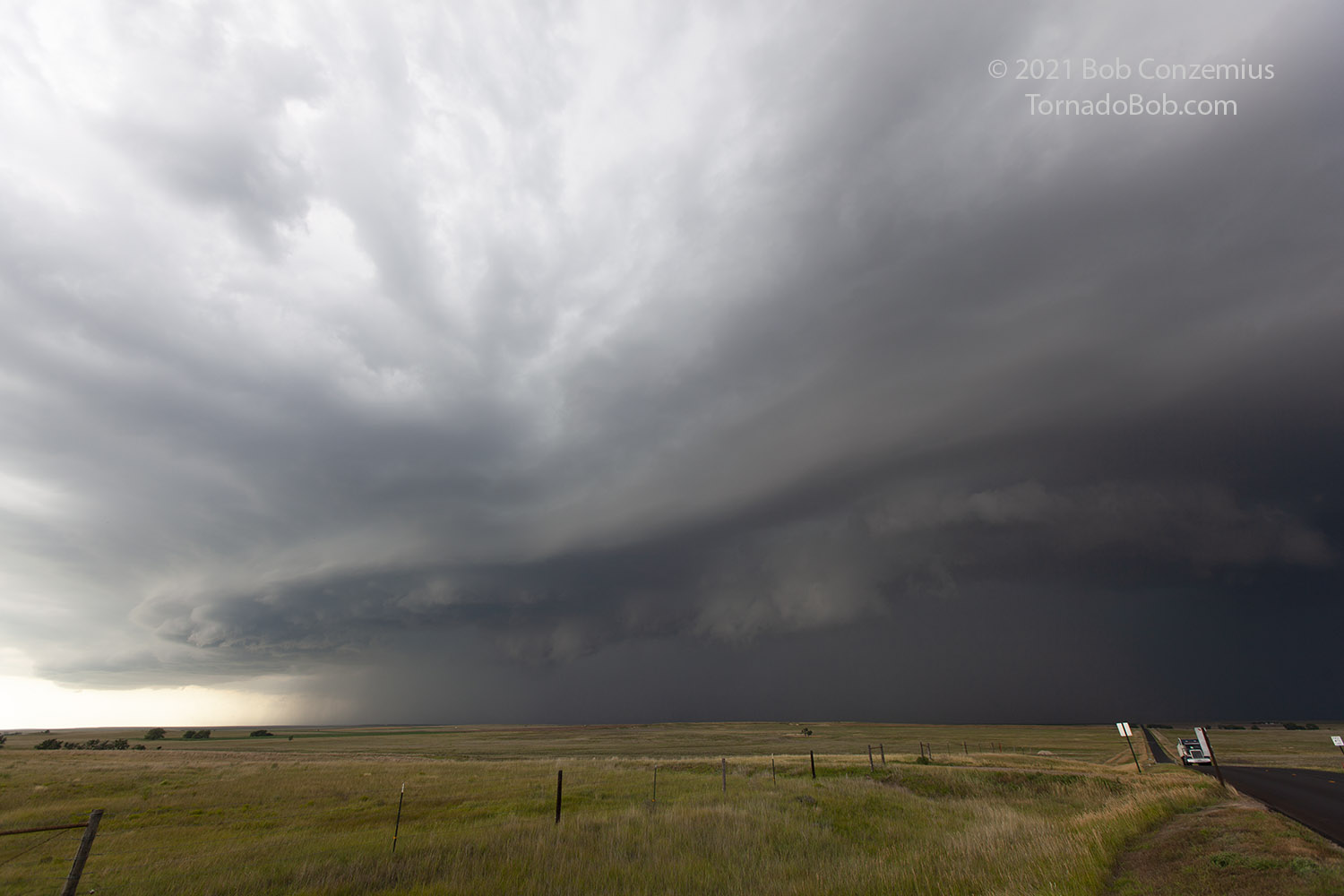
Once we had had our fill, and the wall cloud started to get ahead of us a little bit, we dropped south on Kansas Highway 23. The storm was building south, and updrafts ahead of us were growing and merging into the storm. We would have to keep going south for a while and get far enough in front so we could have enough time to spend for photography with the storm. We continued through Gove City and found a nice hill to the south of town, where we could look back north. The storm developed some darker, heavier rain/hail cores as it approached our location. When the winds got to us, and the precipitation threatened, we got back on the road again, headed south.
 |
|---|
| Just south of Gove City looking north. |
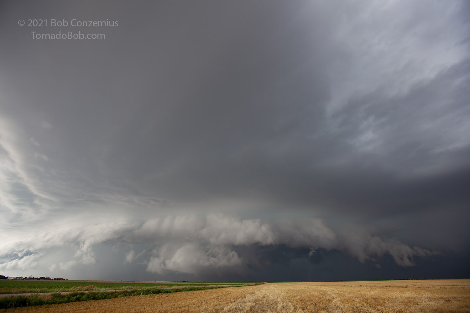
At this point, it became apparent that the storm was really backbuilding westward as well as being pushed southward by its outflow. We were able to stay with the newer, vigorous updrafts on the storm's western flank, and that brought us farther south on Kansas 23.
 |
|---|
| Continuing south, a wall/shelf cloud hybrid approaches. |
By the time we got to Kansas Highway 4, the area of vigorous updrafts was far enough west that we decided our best view of the storm would be found by going west on 4 rather than jogging east then continuing south on Highway 23, so west we went. Once the storm crossed 4, we would not have a good look at it for a while because the next south option was quite some distance west. We drove west through Healy and found a good place to stop and photograph the semi-circular shelf cloud coming at us. We spent quite a few minutes at this spot and then decided to find a location along the line of cells that would provide the lowest probability of damaging hail, or maybe see if we could make a run for it and get to U.S. 83 and have some more time with the storm.
 |
|---|
| The storm developed a somewhat double-barreled look as we turned the corner at Shields. |
 |
|---|
| Between Shields and Scott City, we were treated to a large shelf cloud. |
We decided to sit and wait out the core-- gotta get some taste of heavy rain and pea-sized hail at some point in the trip. It took maybe 20 or 30 minutes for all of it to pass by our location. By that time, the storm did not look sufficiently interesting on radar to warrant a further south excursion to stay with it. In fact, the storm looked to be weakening a bit. There were also some storms farther northwest, approaching Goodland, that looked moderately interesting. I booked rooms in Goodland, and we set our sights on the northwestern storms.
We got into the Goodland area about the same time the storms did, but nothing looked particularly impressive, so we drove to our hotel and checked in. Since it was July 4, we asked the hotel about where the July 4 fireworks would be. I mentioned this to the guests, but we decided to take a shot at lightning photography instead, and others were a bit weary from a full day on the road. I tried some lightning photography but got nothing particularly good. Called it quits around 10:30 or so.
 |
|---|
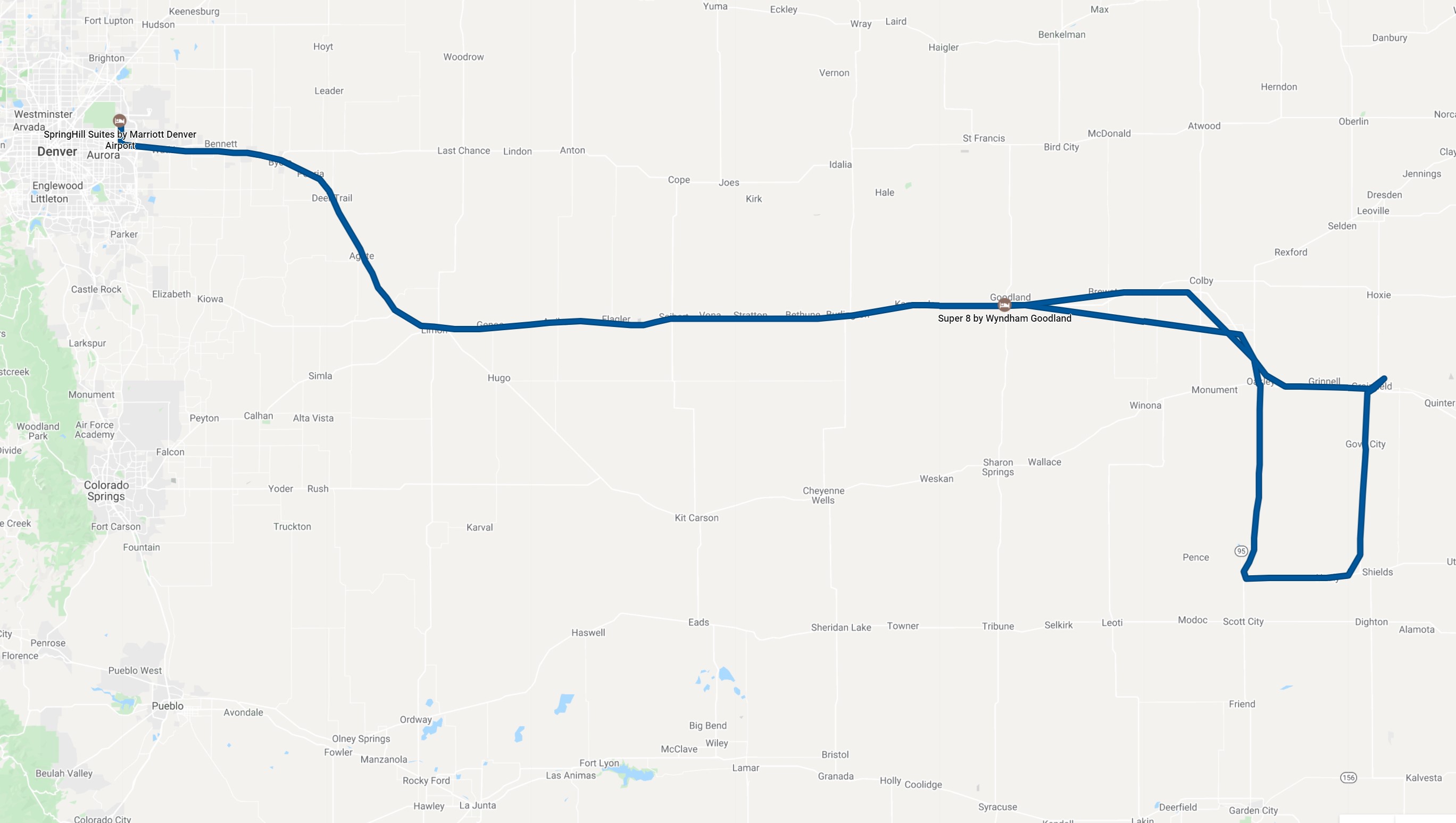
| This was our approximate chase route for the day. |
Back to Storm Chases | Home