Reed Timmer shot some amazing drone video of the tornado. View it here.
As luck seems to typically have it, this was the day in-between Tours 1 and 2 for Tempest, and we would normally be driving back to Oklahoma City and dropping off guests, doing van maintenance, resting, and preparing for the next tour, not chasing. However, a couple days in advance, we realized the weather conditions for this day were more favorable for tornadoes than any of the regular chase days of Tour 1. Not to pass up our best chance to see a tornado, we asked the Tour 1 guests if they would be able to stay an extra day on the tour. We also asked the Tour 2 guests if there was anyone arriving a day early who would like to ride along. Of course, only some of each of the Tour 1 and Tour 2 guests were available to chase, so we had to work out some transportation logistics. We were finishing our April 28 chase (a bust) in the far northeastern Texas panhandle, and the target area for the next day appeared to be somewhere in Kansas. Since Oklahoma City was quite a bit out of our way for us to reach this Day 2 target, we decided to split up the tour. Bill would take the Tour 1 guests, who could chase, in the lead van and drive them to some place in southern Kansas, close to the Day 2 target. I would take the other van back to Oklahoma City with the guests who could not stay on, drop them off, and pick up the early Tour 2 guests.
A majority of the Tour 1 guests could chase, so I loaded up the remaining two guests, headed southeast, and arrived at the base hotel in Oklahoma City in the late evening. I got up in the next morning and took care of as much van maintenance as I could. The van did not yet need an oil change, but we usually like to have things clean for the guests, so I took it to our regular car wash. Apparently, the van was too tall to fit through the wash (strange-- I had taken it there before). I didn't have the time to seek out a new car wash place. We would not have a squeaky clean van for our bonus chase.
I returned to the base hotel, met the Tour 2 guests who were available to chase, and provided a quick orientation. We were on the road by 1:30 PM, heading north toward Wichita on I-35. My initial thought was to get as far north into Kansas as we could because the tornado probabilities appeared best in northern Kansas or far southern Nebraska. We could get close to I-70 for an early show and still make it back to Oklahoma City late in the evening. This plan seemed to be working well because we saw towering cumulus develop to our west while we were still in Oklahoma. These towers would move quickly northeastward into Kansas, and the convection-allowing models (CAMs) showed they would become the main show. They would take us toward Topeka or Kansas City, where we would hopefully see a tornado and then have time to make it back to Oklahoma City by late evening so we could get the required rest before the official start of Tour 2. Our timing had worked out perfectly to be with these storms from their initiation, and I planned to be follow them, lockstep, into the highest tornado risk area.
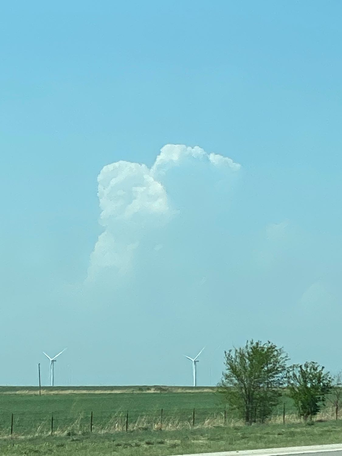
The first dryline cumulus (3:05 PM) as we drive north on I-35.
Early dryline towering cumulus (3:45 PM) as we drive north on I-35.
Bill Reid was in the lead van, waiting for us just north of Wichita. Not wanting to delay, I would let him know when we were getting close so he could pull onto the freeway just ahead of us, and we would keep our position on the developing storms. When we were within radio range, I called him up and told him we were almost there. To my surprise, he announced that he was considering driving south into Oklahoma. Somewhat bewildered, I mentally set my own plans aside for a moment to assess what he was looking at. Being focused on the very first storms, I had missed something potentially important.
The Storm Prediction Center had suddenly become very concerned about storms developing in Oklahoma, and they had just issued a mesoscale discussion. CAPE and shear were both strong, and towers were now developing much farther south along the dryline. It looked like the Oklahoma City area could be under a threat of tornadoes if the convective trends continued in this direction. This evolution of the weather quickly brought back memories of May 8, 2003, when I brought the DOW crew from Norman, OK north to I-70 in Kansas, only to have an EF-4 tornado develop and hit Moore, Oklahoma, only ten miles from Norman. I did not want to repeat that mistake. Since we needed to be back to the base hotel in Oklahoma City by late evening, it would be silly to be up in northern Kansas when there were tornadoes happening near the base hotel.
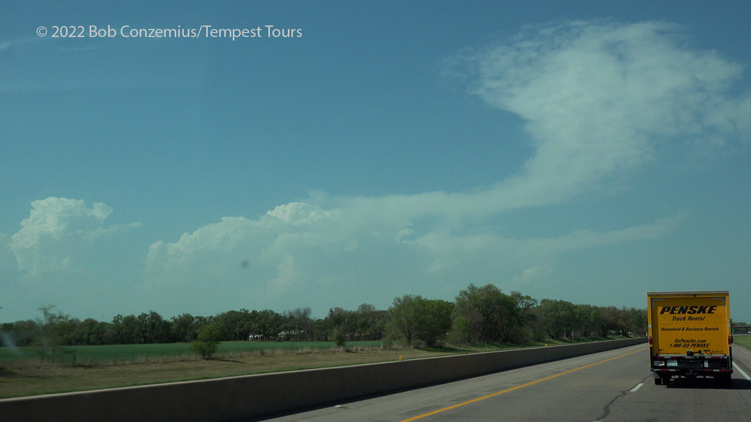
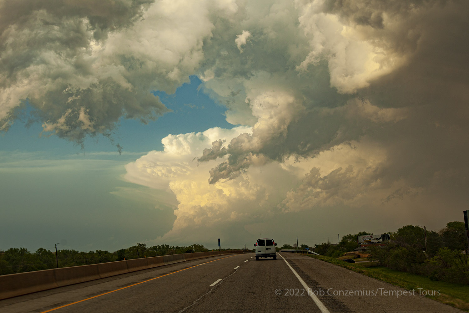
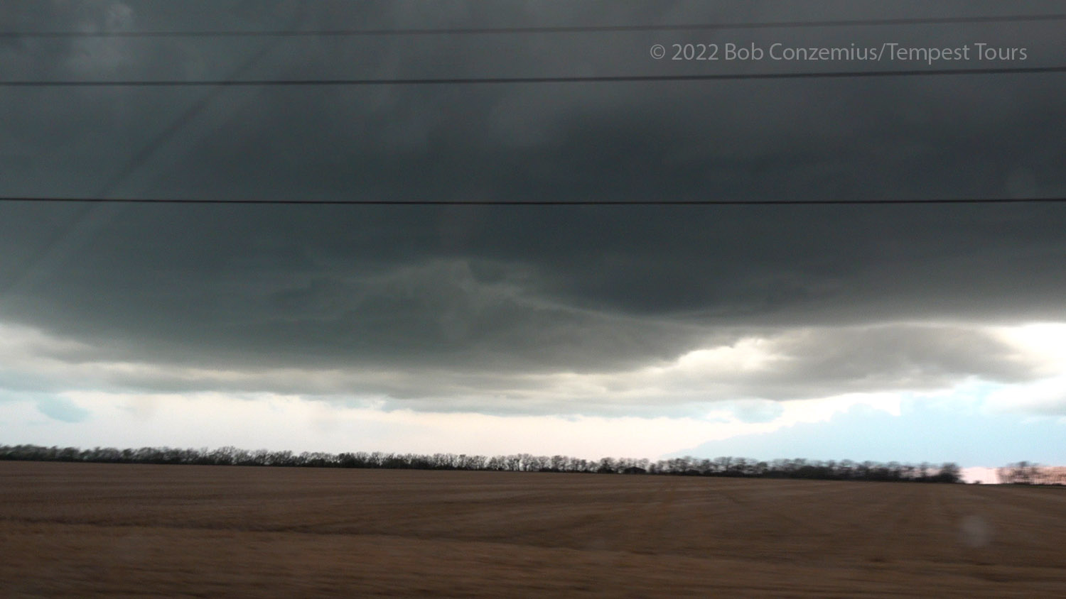
We drove back south into Oklahoma as towers built along the dryline to our southwest. The Oklahoma scenario really appeared to be coming together quickly, until it wasn't. The first precipitation was falling from the dryline towers, but they weren't growing into bigger storms, and then they started to dry up. We continued south, a little past Blackwell, and did a pit stop to assess the situation. The clouds were evaporating in front of us (maybe outrunning the dryline?), and we could see no further development along the dryline to our west. The dryline was not advancing like it typically does on big severe weather days. Meanwhile, the first storms I had targeted were now in central Kansas, out of range for us, and although they were not yet severe, they were strengthening. It was starting to feel like a failed chase. With nothing else to do at the moment, we decided to drift west with the slowly retreating dryline and hope for more development.
We got to Lamont and turned north to find a good place to stop and look at the sky. It was a bit hazy, but there appeared to still be some bulkier cumulus to the northwest. Since there were no longer any towering cumulus to our south, our only chance at seeing storms was to stick with these last bulky towers and hope they would grow instead of dying like the rest of the storms around us. To chase this last hope for storms meant turning around for a second time and driving back to Kansas, where we had turned around the first time. Back north on I-35 we drove.
This was a good decision because the towers to the northwest were getting larger and more numerous as we followed them north. They looked a bit multicellular, but it was early. We could see one very healthy, supercellular updraft a bit farther north into Kansas, and I felt like I wanted to be there, but we were too far away to catch that one before dark. Other new storms were much closer and to our west. We just needed be patient, stick with them, and wait for them to intensify.
New dryline storms develop near the Kansas Oklahoma border.
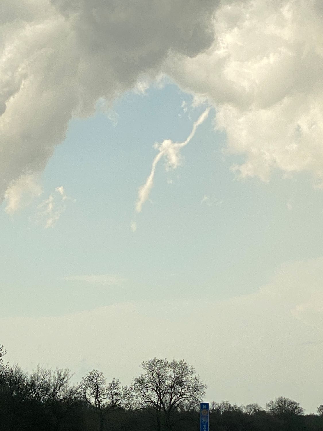
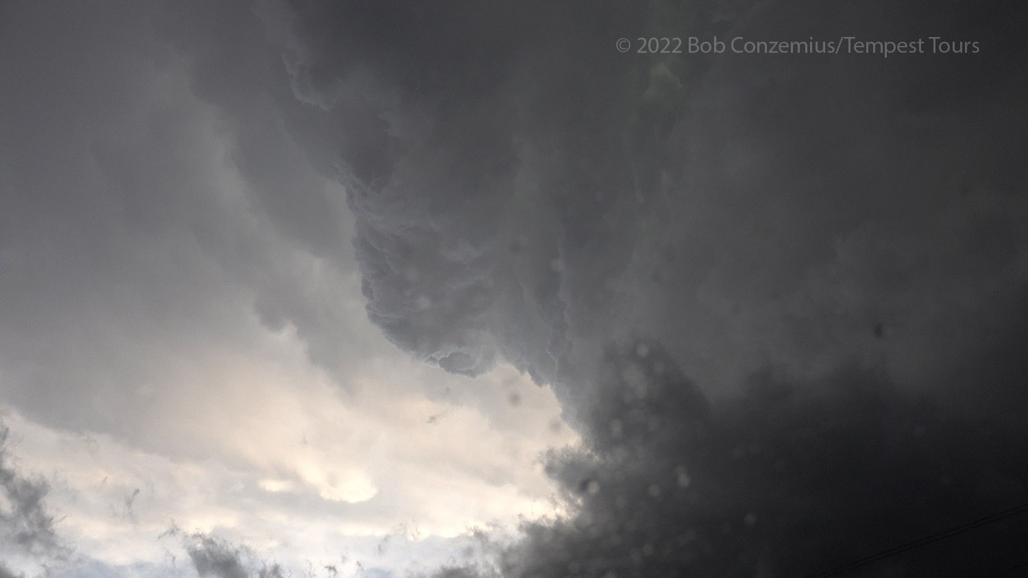
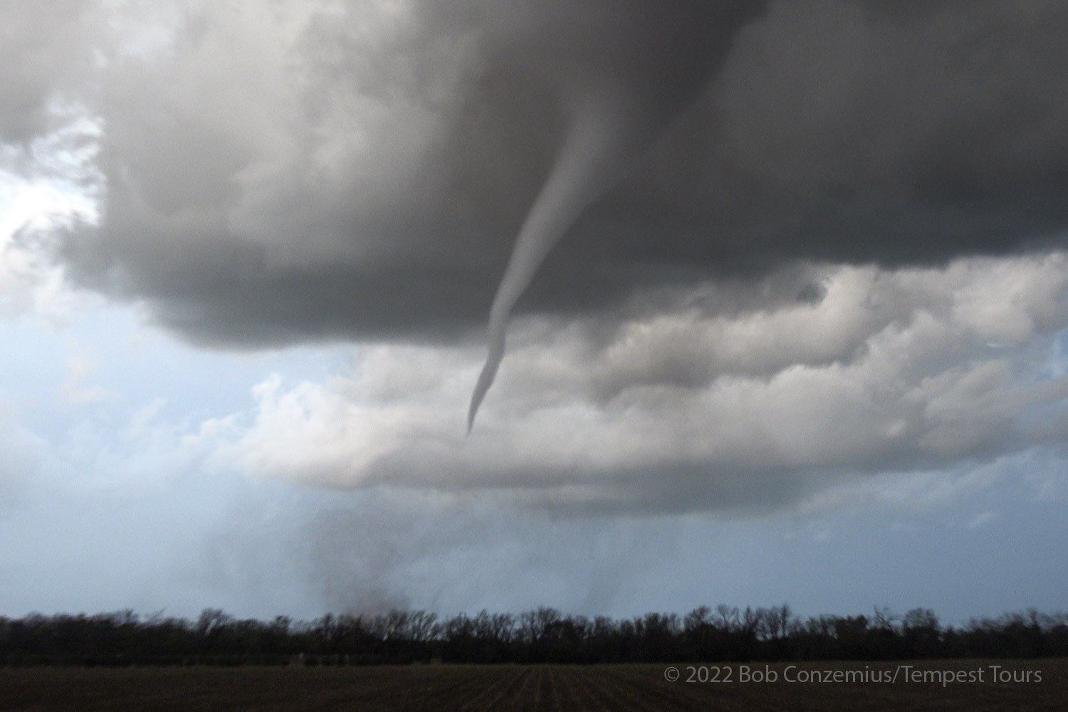
A mid-level funnel develops.
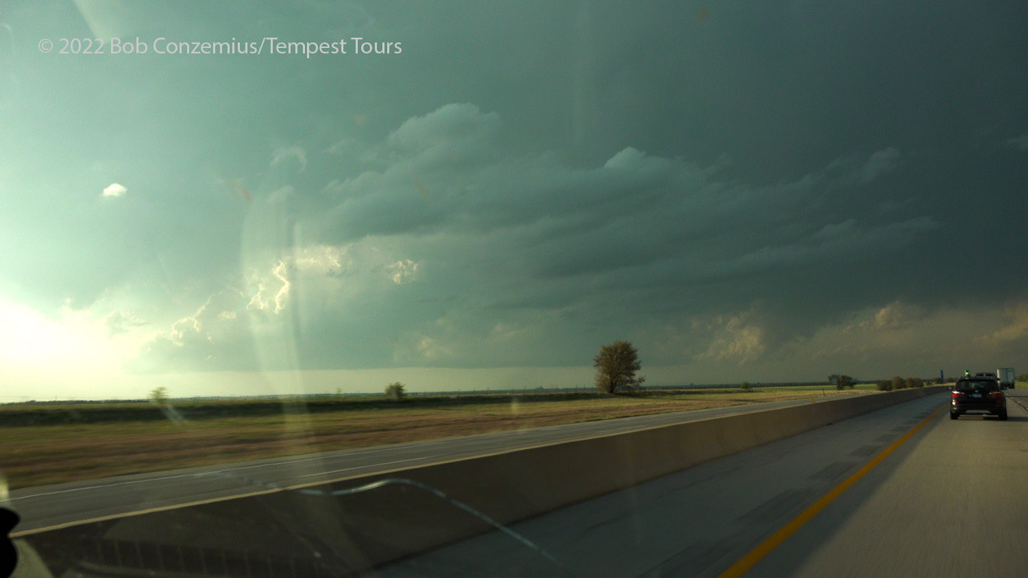
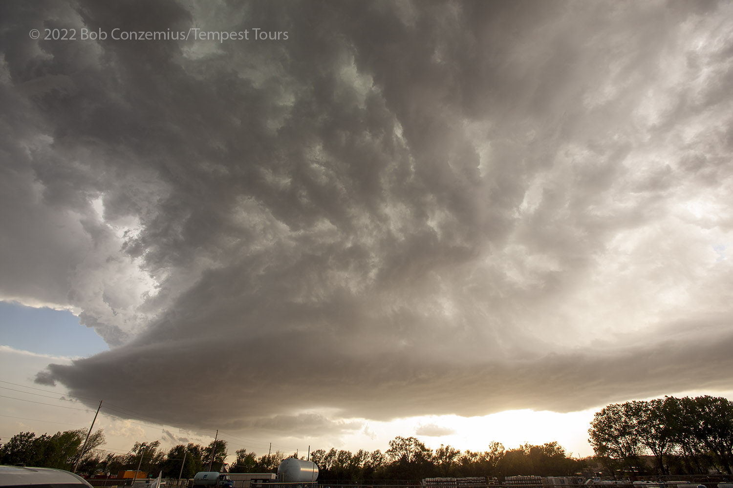
We got into the south part of Wichita and had a good look at the base of the closest storm as it caught us. It had a bit of an RFD swirl on its back side. Large raindrops were falling, and the sun was shining from behind the updraft, creating a bit of a semi-translucent look. That made it look a bit weak, but it had a really nice shape. The storm was getting east of us, so we got back on I-35 north, made the northeastward turn in central Wichita, and looked for an east option to get back in front of the updraft. As we were navigating the maze of roads around Wichita, I noticed we were in the 7:00 hour, and I announced on the radio that it was tornado time! 7:00 seems to be the magic hour in Kansas for me, and we had strong storms around us. The base of our storm, now to our southeast, was looking quite healthy yet somewhat flat underneath (meaning not immimently tornadic).
A look as the storm when we stopped on the south side of Wichita.
Driving through eastern Wichita, a storm to the northeast looked interesting.
We needed to get back ahead of this storm (looking southeast), which was our target.
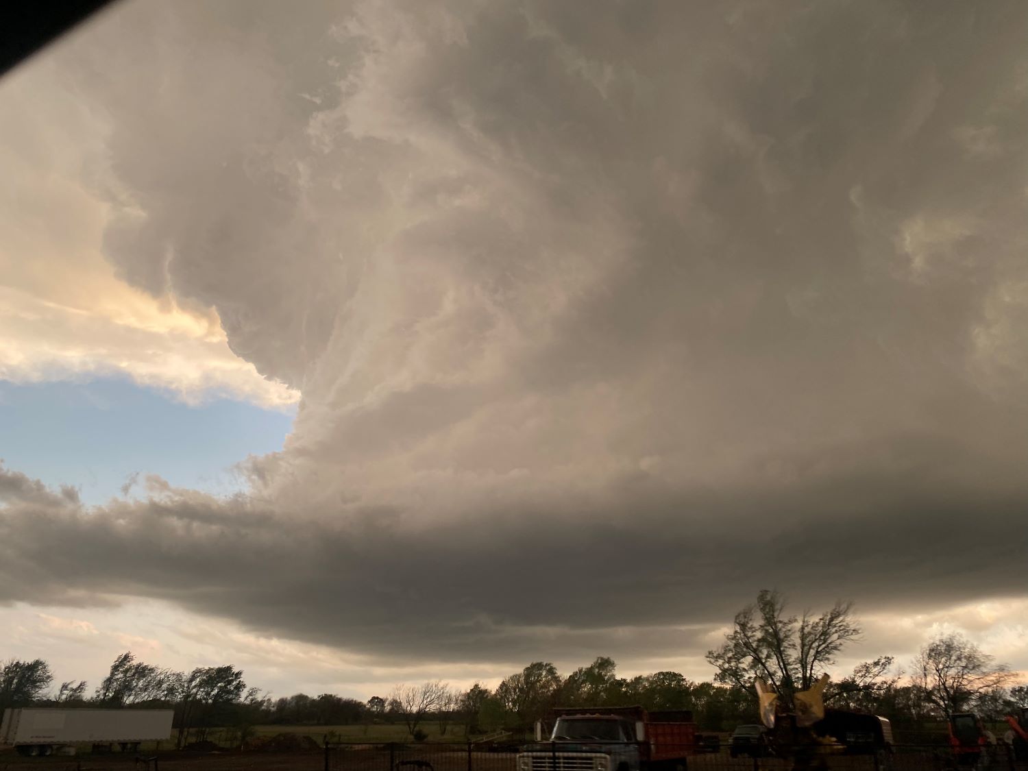
After a little time navigating to figure out a complicated pair of freeway interchanges, we found U.S. 400, which would be a good east road to stay with the storm. We were still a bit north of the updraft, so we took Andover Road south to get in better position. Four miles later, we were directly east of the updraft base and had a great view of its structure. The updraft had a rock solid look with knuckles folding into the anvil, and the base had a pronounced cinnamon-swirl RFD into its center with maybe even a hint of a broad funnel.
We are now driving south, and the updraft starts to come into better view.
Cell phone shot of the storm.
The updraft base has a cinnamon swirl RFD and maybe a hint of a funnel.
The south side of the updraft looked really healthy! I call these "anvil knuckles".
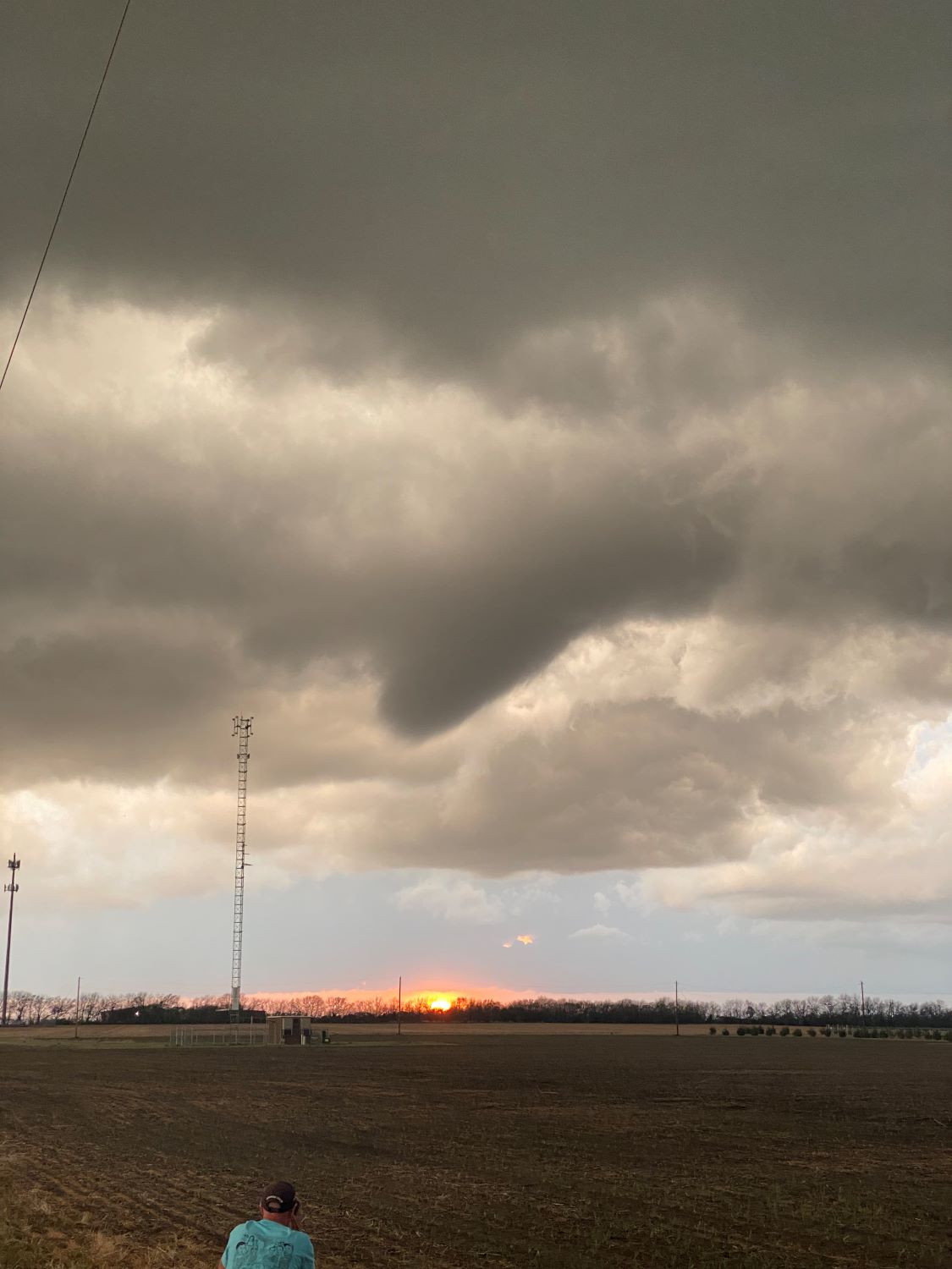
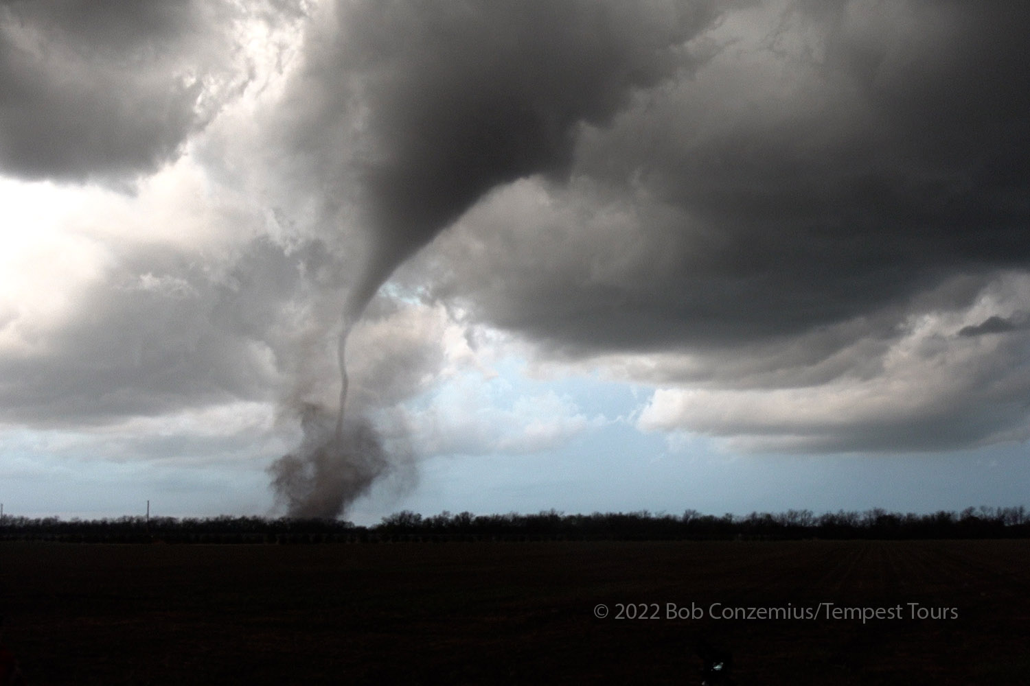
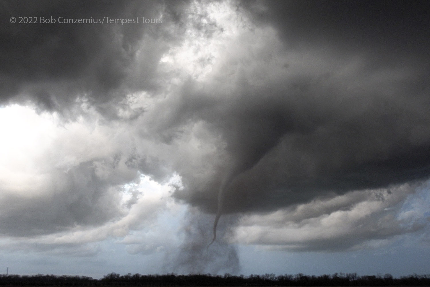
It was not long before the hint of a funnel became a definite funnel, which was just north of due west of our location at Butler Rd and 148th St. Since there were a few trees around us obstructing visibility, and the storm was drifting north, we returned to an open field we had just passed about a mile back. We needed to have an open view ASAP!
We stopped at SW Butler Rd and 148th Street. A funnel formed in front of us.
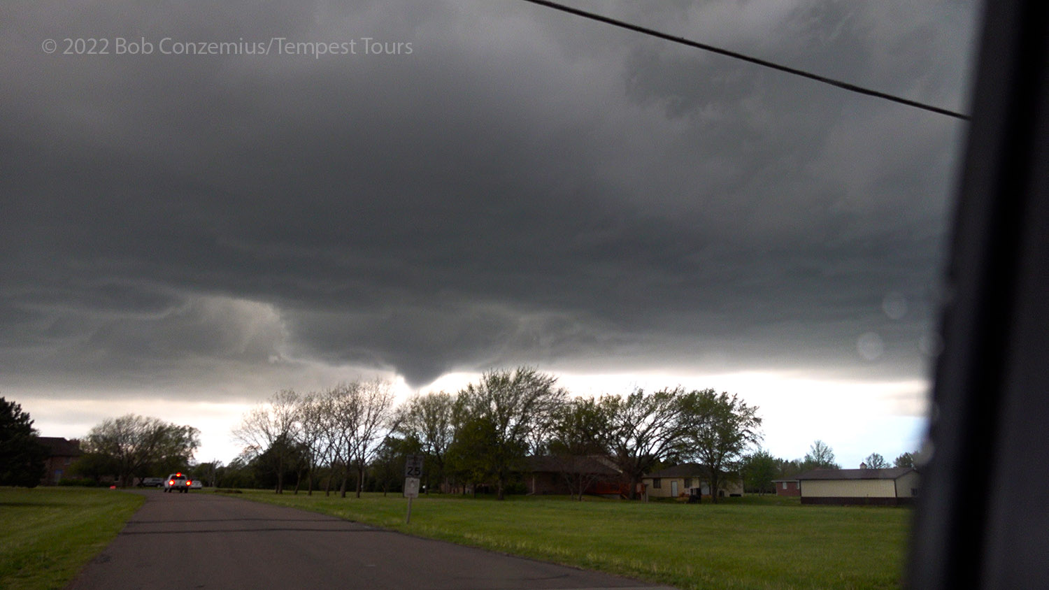
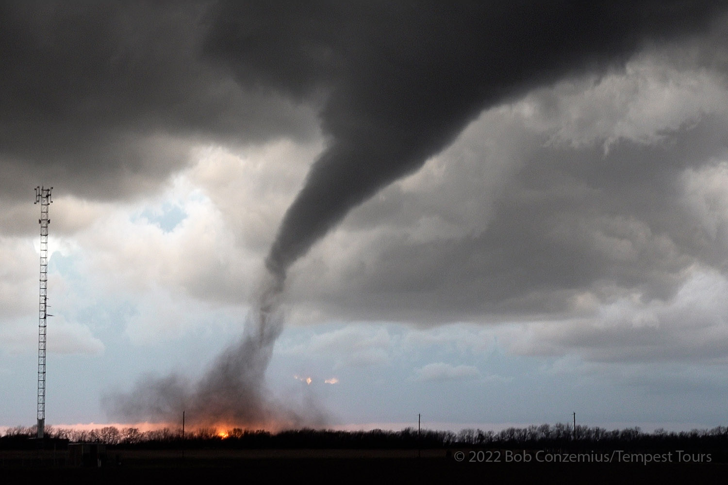
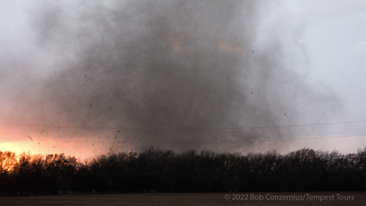
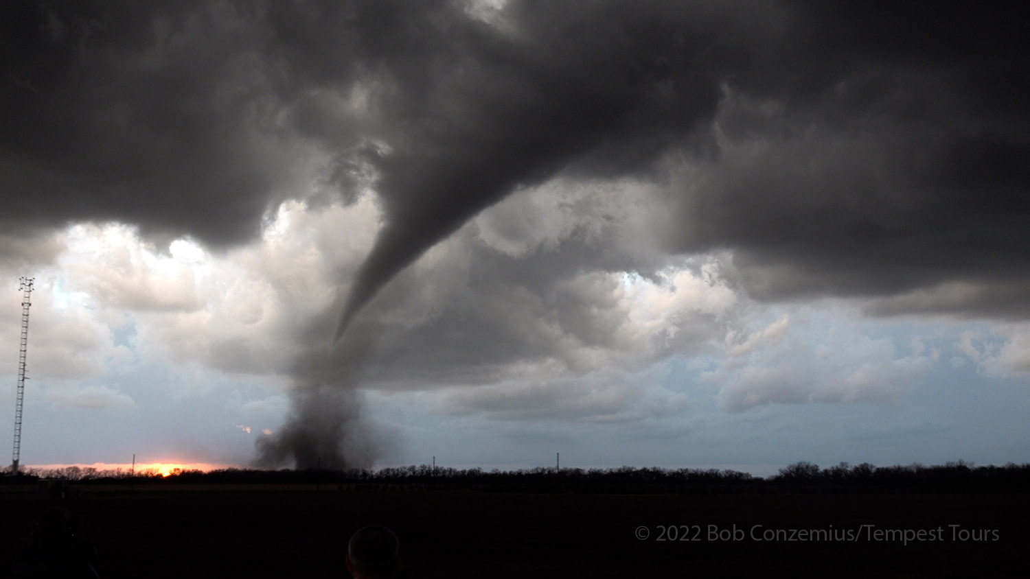
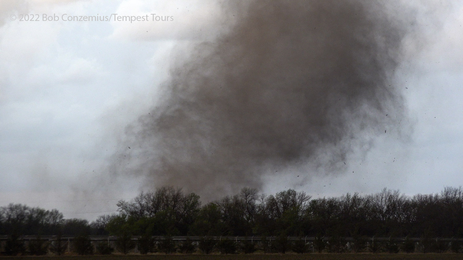
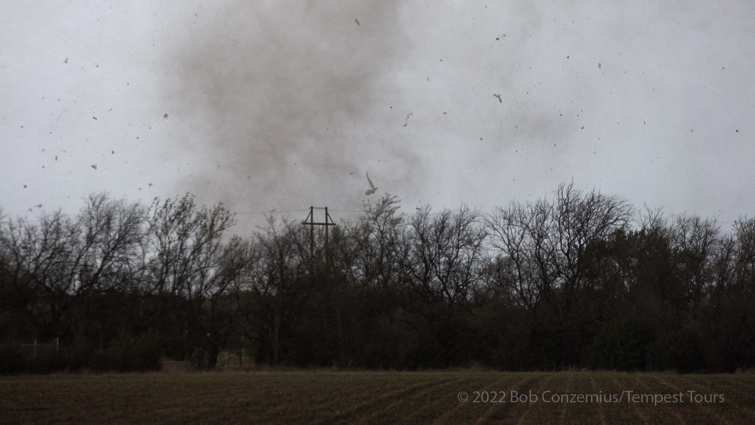
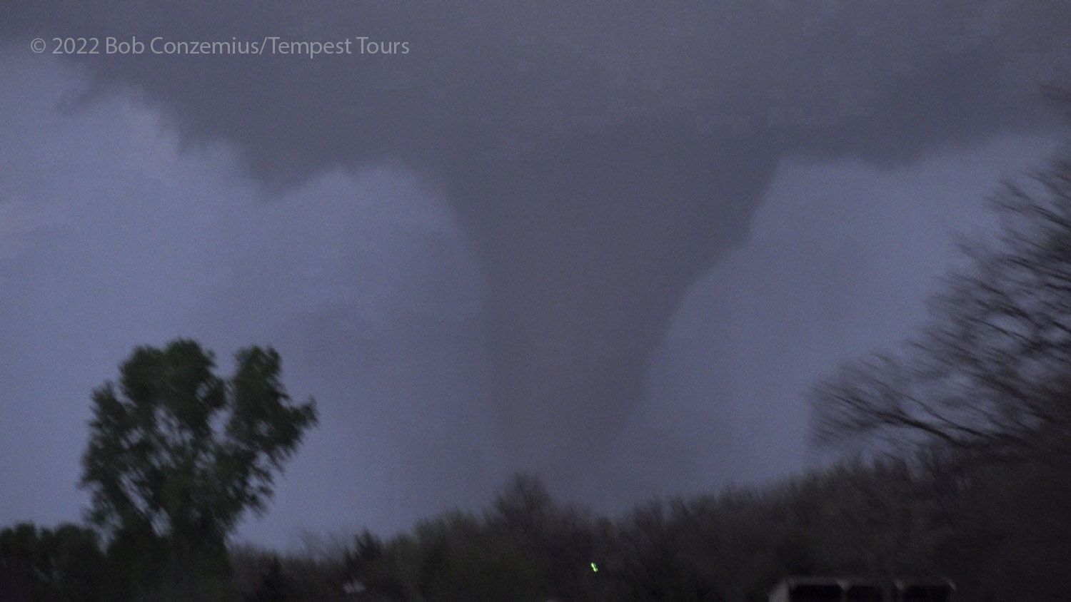
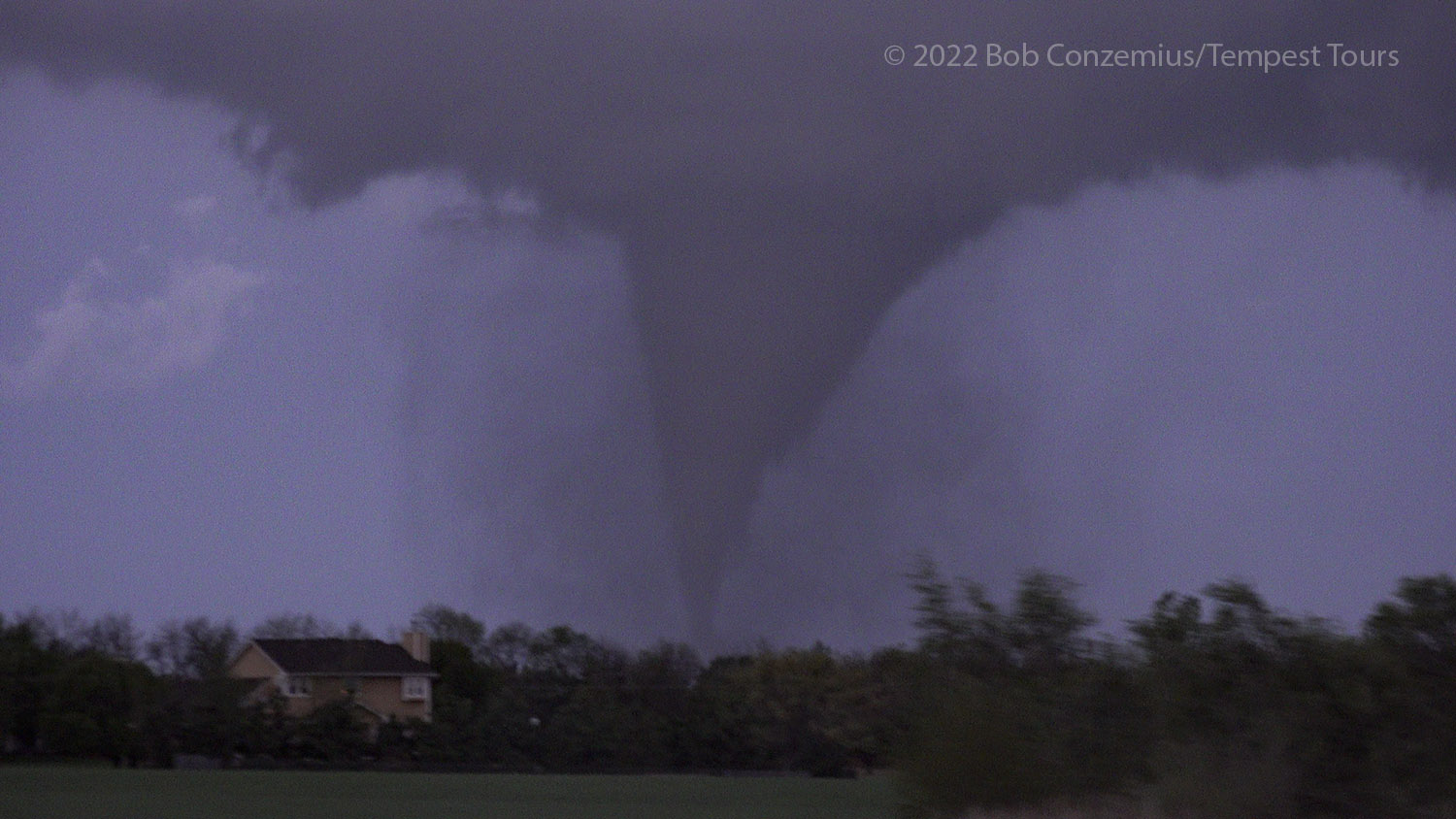
As soon as we pulled onto 140th Street and got out of the vans, we had a tornado in progress! The condensation funnel, for the most part, did not reach the ground, but there was an intense debris swirl underneath, often filled with lofted pieces of buildings or whatever else was in its path. We watched for several minutes as the tornado moved across our northern view, its condensation funnel retreating toward the cloud base at times but always having a debris cloud underneath. Dense clouds of debris emerged periodically, revealing the true strength of the tornado. Emergency vehicles soon began to race northward on Andover Road to respond to whatever damage it was doing to Andover. When the tornado got east of Andover Road, the condensation funnel reached fully to the ground and was frontlit by the remaining daylight. Since our view was limited by trees to our northeast, we decided to move closer for better visibility. We avoided going north first because the roads that way might be blocked by downed powerlines, trees, or other debris.
Our first look as we got out of the vans. The funnel was still there.
A tornado was now in progress (exactly over the sunset)! Time is 8:10 PM.
You can see a hint of a very narrow condensation funnel inside the debris cloud.
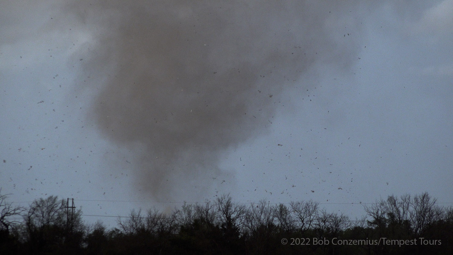
A dark debris cloud forms.
A denser debris cloud forms.
Is it dust and debris, condensation, or both?
A snaking funnel and an ascending debris cloud.
A narrow funnel with a wider debris cloud.
There are some larger pieces of debris here. The tornado is still not in the main part of Andover.
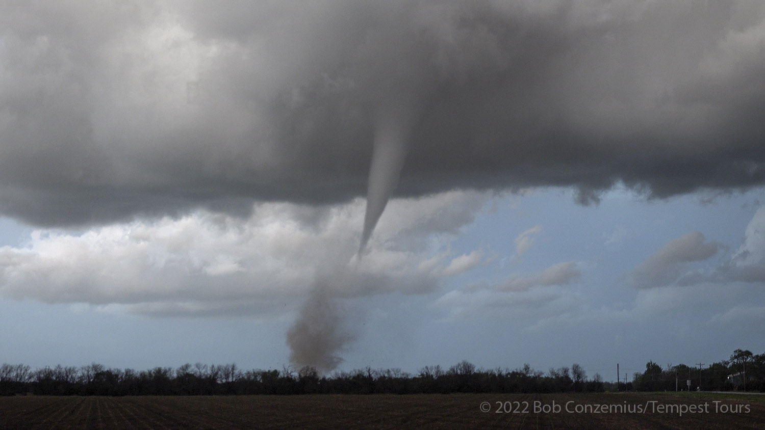
The funnel is narrow but intense at the surface.
The tornado pulls up another debris cloud.
Still a lot of debris.
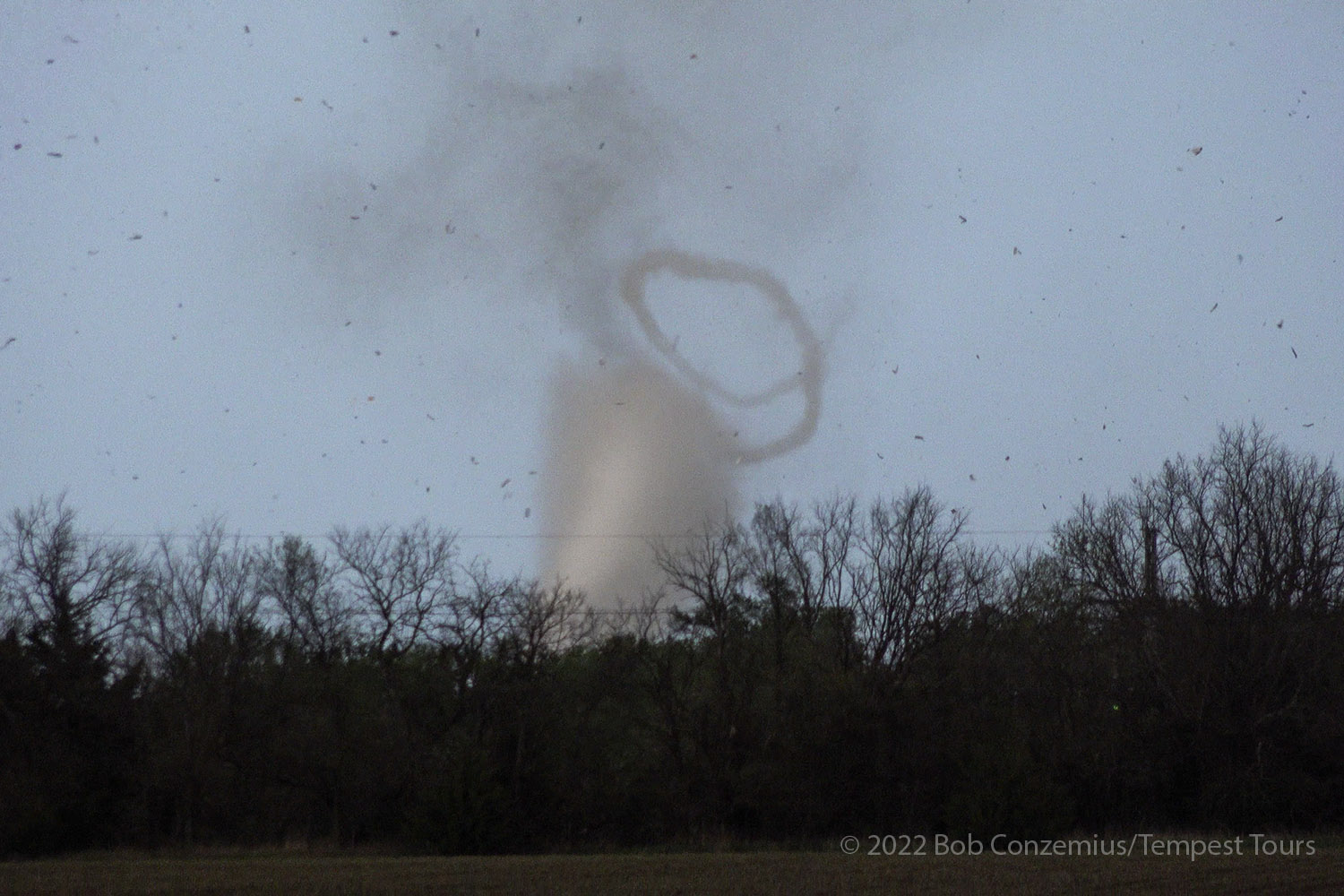
Helical vortices form near the ground around a wider condensation funnel!
Progression of helical vortices.
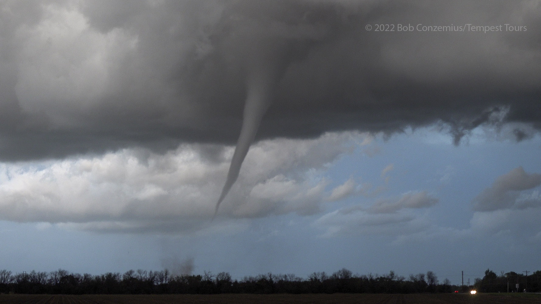
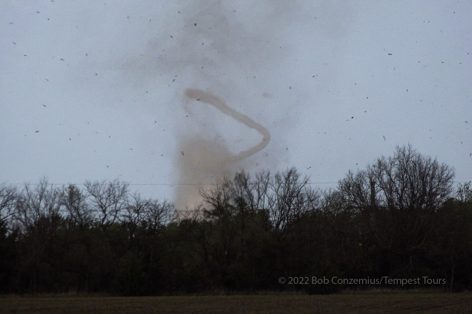
A tornado begins to form a fuller condensation funnel.
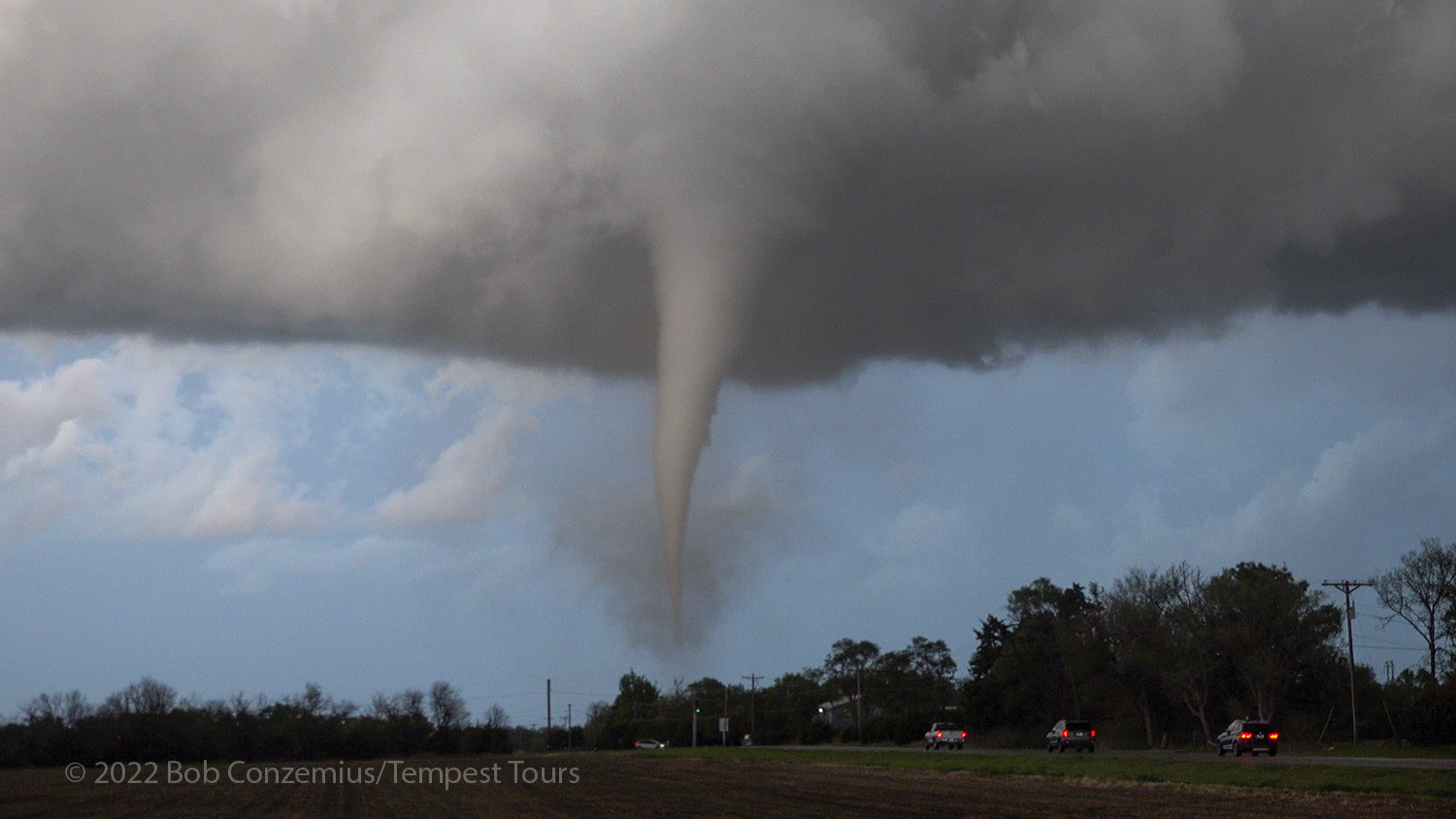
Here's my best still picture of the tornado.
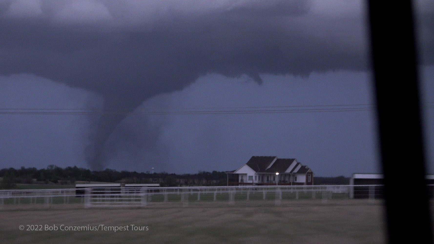
We drove back south on Andover/Butler road and then east on 150th Street. While we made this move, the tornado became quite a bit larger, and it was probably around this time that Reed Timmer got his dramatic drone footage of the tornado lifting roofs off homes in an Andover neighborhood. We drove east on 150th street as the tornado continued to look stronger and wider. Until this point, I hadn't realized how northward (as opposed to east-northeastward) its motion was. Once we turned north on SW Santa Fe Lake Road, I could see how far away it really was, and it was a bit west of our north road. We were catching back up to it, but the tornado was starting to weaken and rope out. After losing visibility a couple times while we passed through groves of trees, we reemerged the second time to find the tornado had dissipated.
The condensation funnel becomes much wider as we're circling the roundabout at 150th Street.
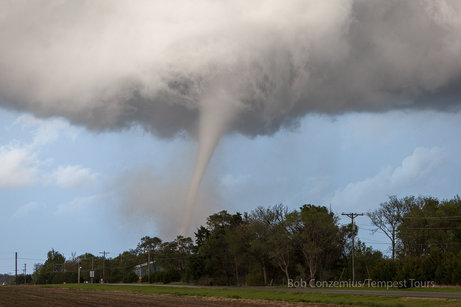
A better view shows the funnel tapers quite a bit near the ground.
The funnel narrows a bit but remains very intense in appearance.
Now going north on SW Santa Fe Lake Rd.
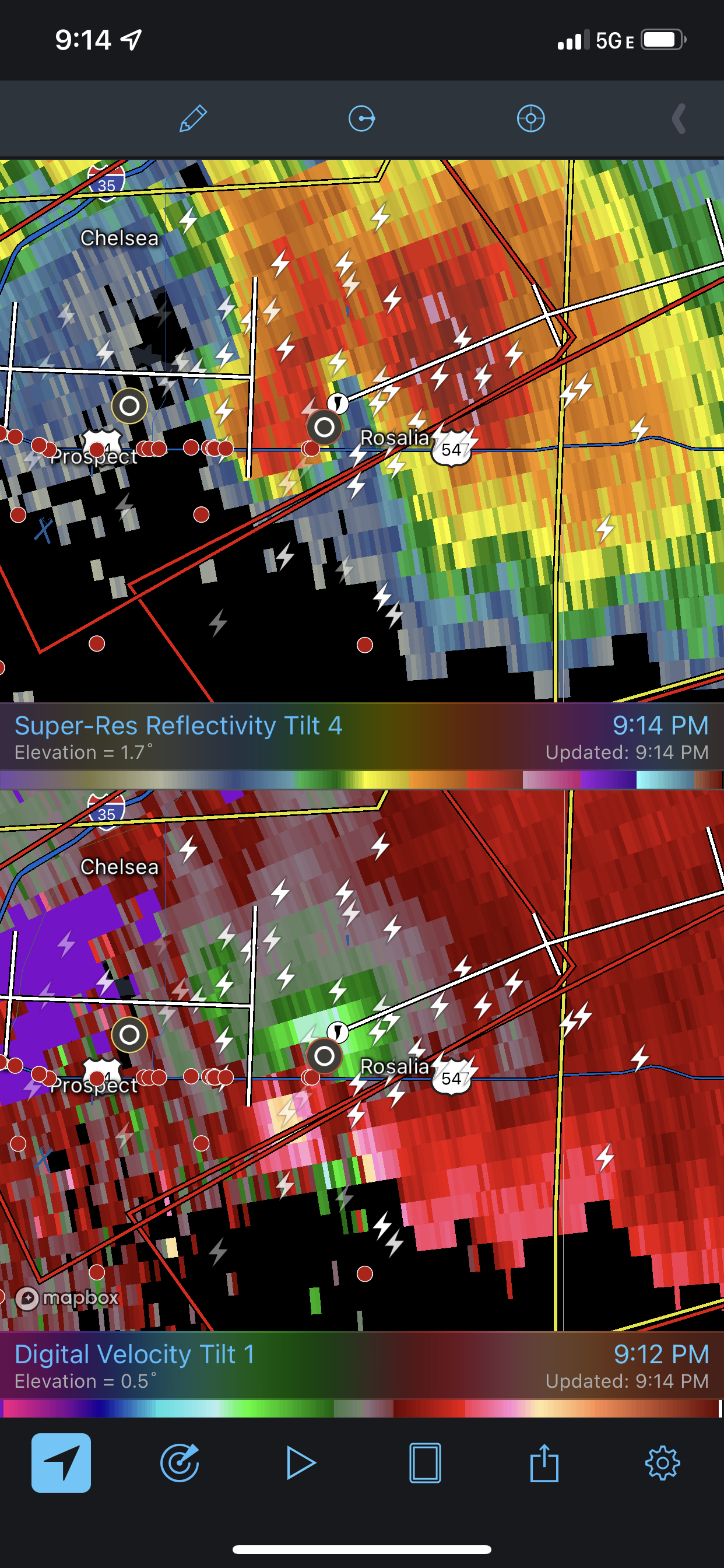
A radar loop of the storm during the Andover tornado.
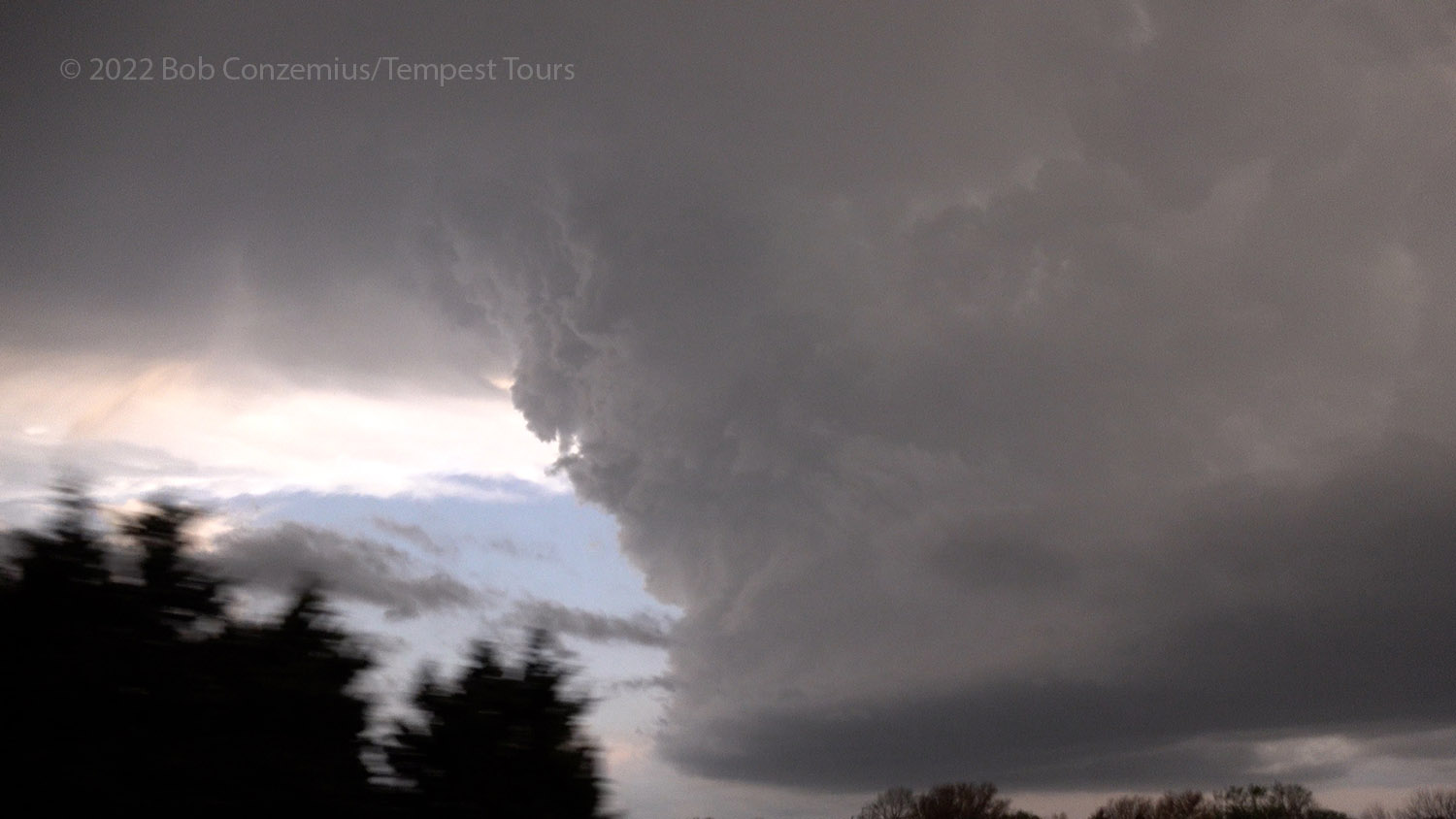
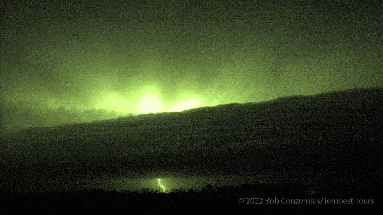
Given there was still a little daylight, and we were now back at U.S. 440, we turned east to stay with the storm. We drove through Augusta and stopped at the intersection of Haverhill Road, due south of El Dorado. It was now fairly dark, and the storm was quite electrified, so we stayed to admire the lightning show while still being close enough to get a good look underneath the storm. I got out of my van and stared north to see if I could identify any lightning-illuminated features in the updraft base. I saw what I thought was a funnel just west of the road, so I pointed the camcorder in that direction. I had a hard time seeing the funnel because the lightning was relatively infrequent around that part of the storm, but indeed, lightning-illuminated frames in the video revealed a persistent funnel on the left side of the video (the camcorder was pointed a bit more due north, not directly at where the funnel was). Soon thereafter, a tornado report came from El Dorado.
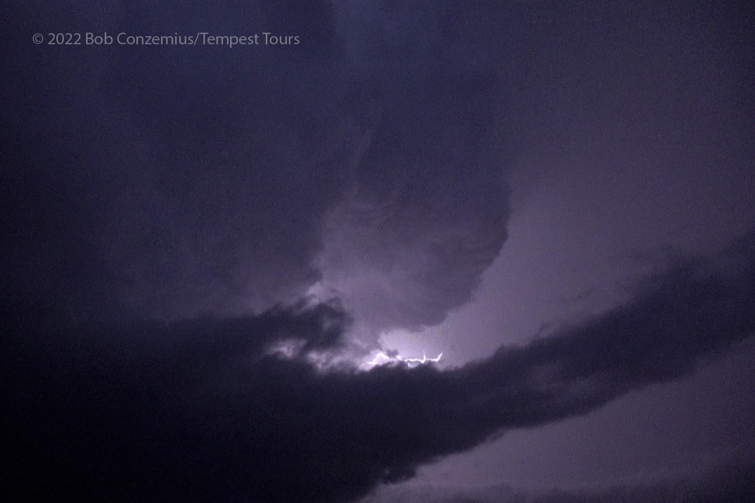
Our supercell storm, south of El Dorado, illuminated by lightning.
There is a funnel on the left side of this image.
I put the camera in nightshot mode to see the cloud features better (funnel still present on the left).
A very pronounced funnel on the far left. It was reported as a tornado (brief, in open field) at this time.
The initial Wichita National Weather Service survey (here) did not indicate a tornado, but the storm database shows a brief touchdown near Petrolia, at 8:47 PM, right where the video showed the funnel to be. This funnel then dissipated, and we could only really see a flat base to our north and north-northeast. That would be the last tornado we would see.
Behind our supercellular storm, there was now a pretty strong squall line approaching from the northwest, and if we wanted to have dry roads and a safe drive back to OKC, now was the time to leave our tornado-producing storm. As it turned out, this was a fatefully good decision because a tragic accident would happen later on I-35. A car carrying three undergraduate OU meteorology students who were chasing that day spun out after hydroplaning in heavy rain, hit the center barricade, and was hit by a semi, killing all three. Unfortunately, this was not the only fatal semi-storm chaser collision in 2022. Less than two weeks later, another such accident happened in Minnesota.
When we got moving back east on U.S. 400, I rolled video, looking back northeast at the action area as we drove away from the supercell. The video I shot was from 9:00 to 9:01 PM, and at 9:05 PM, the Rosalia tornado developed (according to storm reports). The action area I saw clearly indicated the beginnings of the Rosalia tornado.
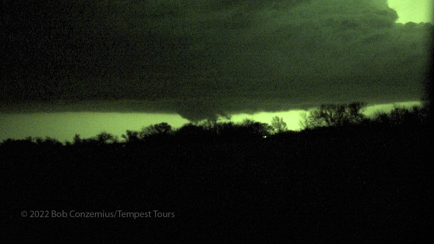
A wall cloud near Rosalia, KS. A tornado developed about 4 or 5 minutes after this video frame was recorded.
The last lightning-illuminated frame of the Rosalia action area. A benigh lowering is on the left and the precursor to the Rosalia tornado is on the right.
Radar image of the storm near Rosalia.
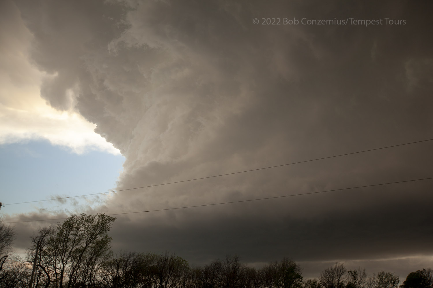
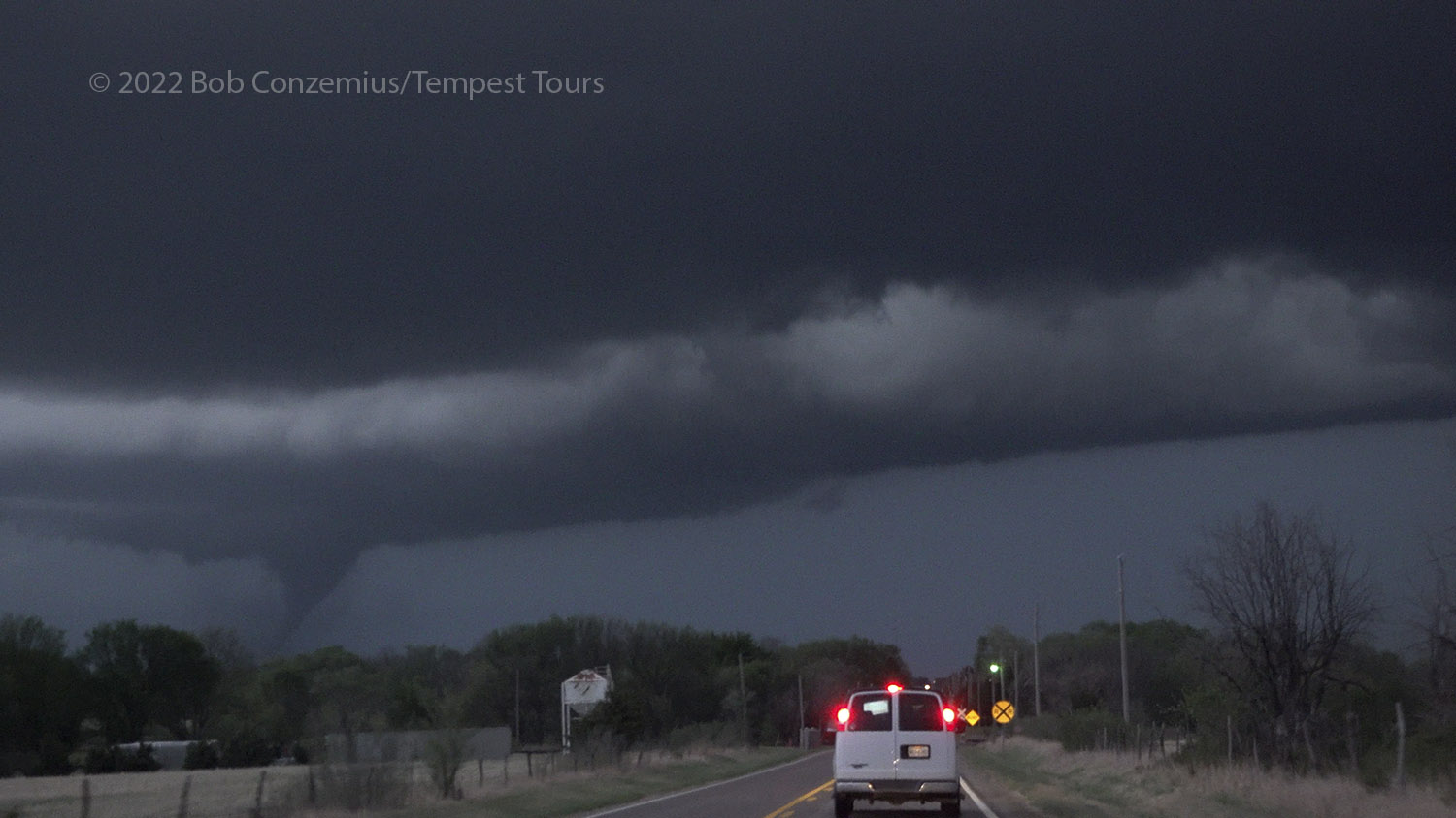
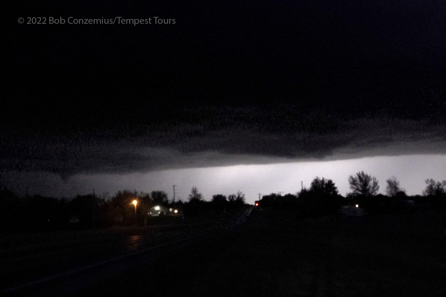
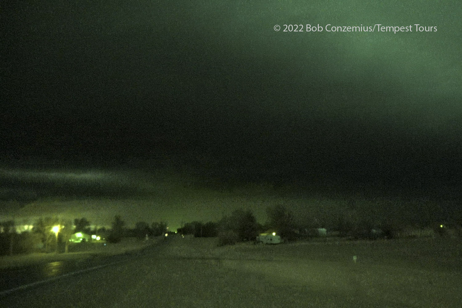
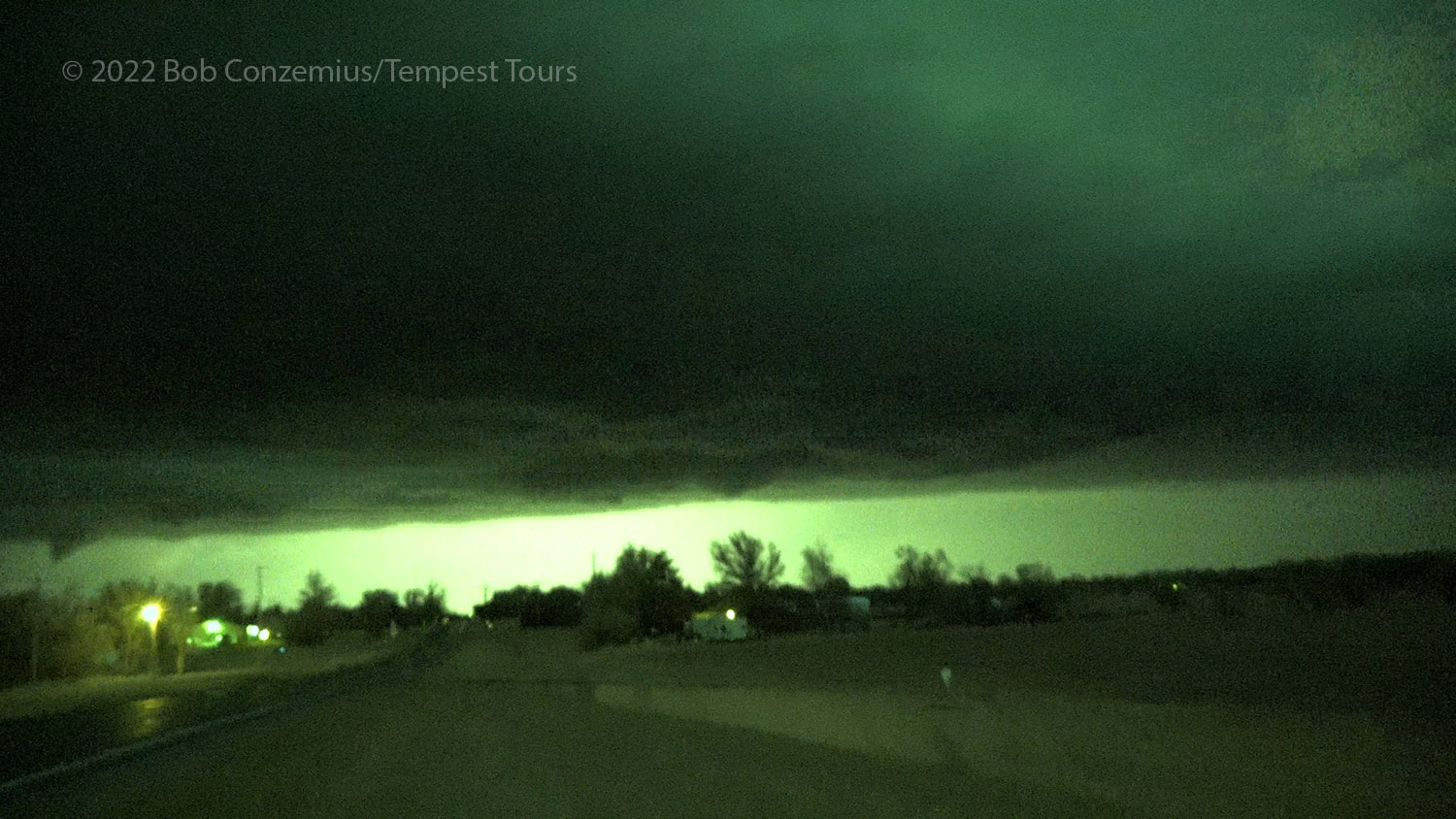
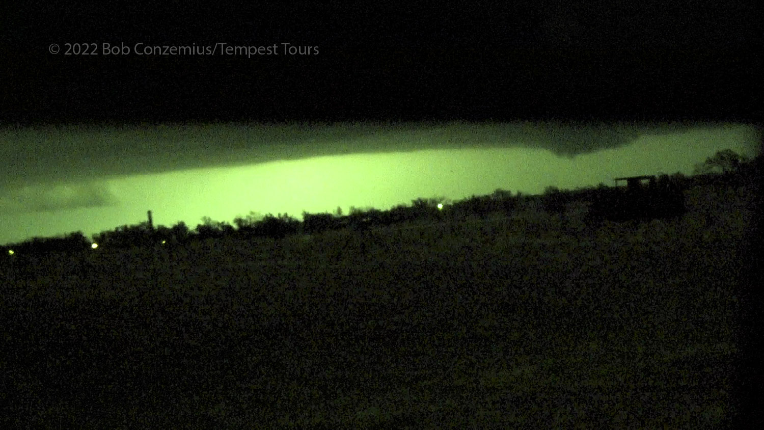
Because the squall line was approaching pretty quickly, and to avoid the navigation through Andover (which had damage) and Wichita (that complicated U.S. 400/I-35 intersection), we turned south at Augusta to gain a little southward distance on the squall line. We turned west at Arkansas City, and quickly, the squall line came into view. I turned the camcorder on and recorded the shelf cloud for a bit before we turned south on I-35, barely staying in front of it. We had a dry drive back to our base hotel.
The line of storms is approaching fast. The shelf cloud is now in view.
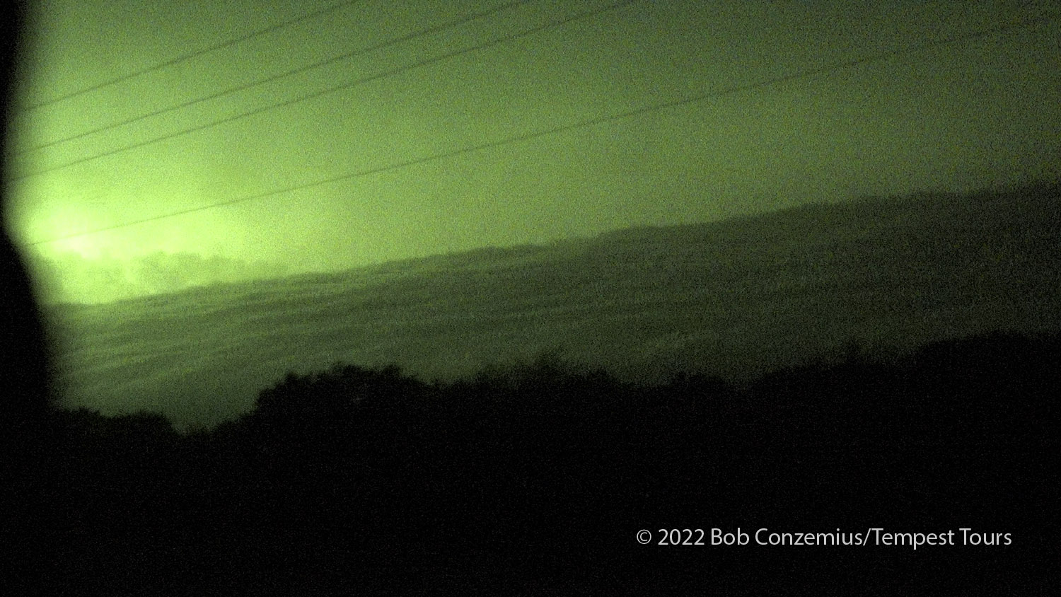
The underside of the shelf cloud is made visible by a lightning strike.
All in all, it was a successful chase, and I'm glad I stayed an extra day to chase. I had delayed plans in Norman with friends to chase this event, so I'm glad we had a good catch. Although the tornado hit Andover pretty hard, there were no human fatalities from the tornado.