I chased two supercell storms in eastern North Dakota on the evening of June 20, 2025. These storms produced multiple tornadoes, including the first EF5 tornado in the United States since May 2013. I was able to unambiguously capture three of them. After thorough looks at my stills and video, maybe I got a couple more, but I guess I'm not one to count every possible tornado I saw. All in all, there were six tornadoes that I could have seen, but due to my positioning, which reverted back to my typically distant view from the east, sunset, and some tornadoes becoming rain-wrapped, I didn't see all of them.
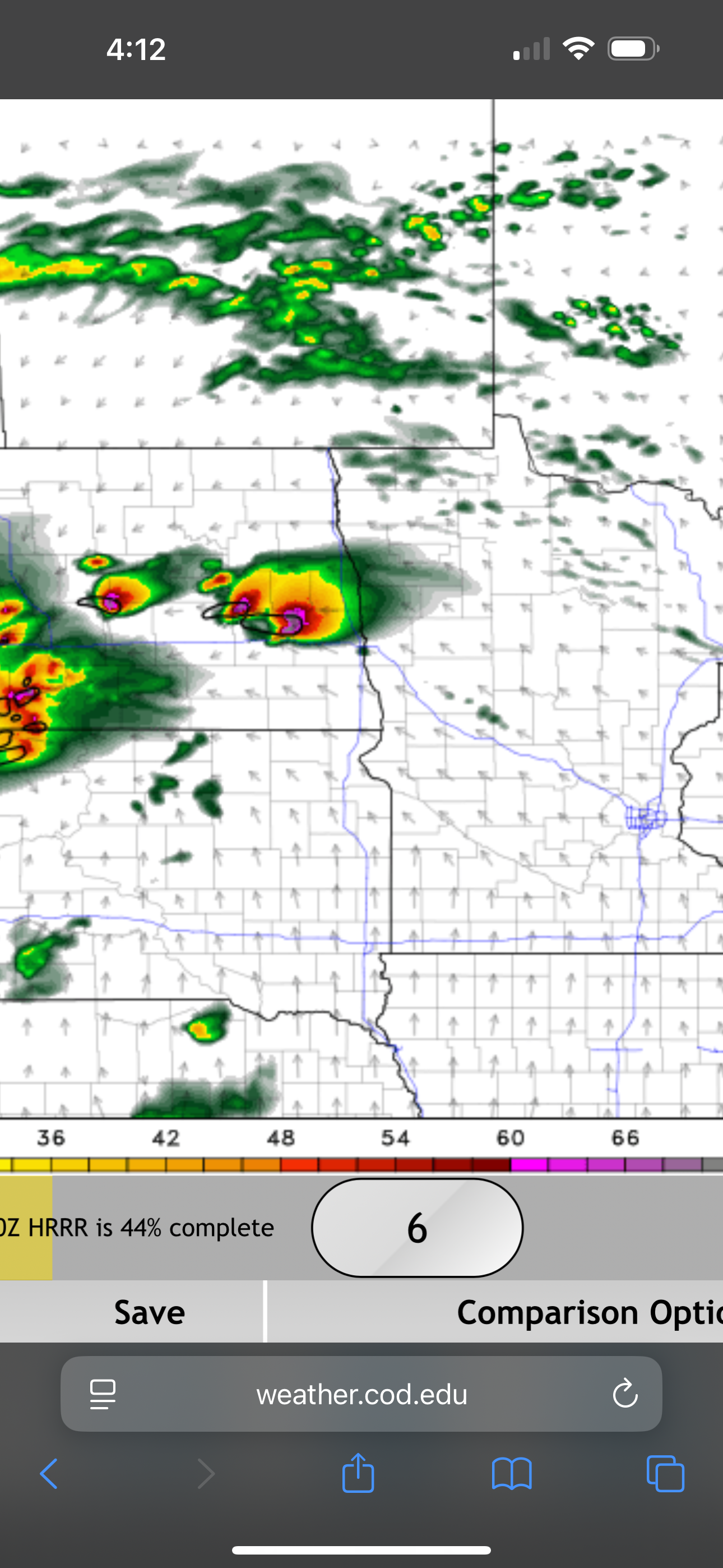
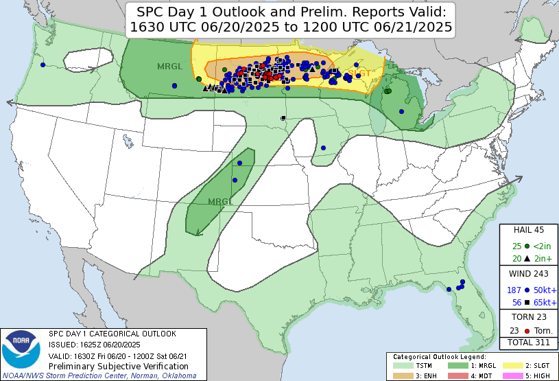
Convection-allowing model runs had been forecasting some strong supercells in eastern North Dakota beginning in the evening and continuing into the nighttime hours. Additionally, the Storm Prediction Center had issued an enhanced risk of severe storms from east-central Montana to the Duluth-Superior area. This enhanced risk contained a hatched area of ten percent or greater chance of EF-2 or stronger tornadoes from eastern north Dakota into northern Minnesota. Thirdly, it was the 68th anniversary of the Fargo tornado of 1957. This was a significant date, and climatology favored severe weather over the Upper Midwest. Finally, it was Friday. I had a full day of work so I would not be able to leave until at least 4:00 PM for a minimum four-hour drive to get to the target area. Normally, this would preclude chasing, but this was the summer solstice, and sunset would not occur until well after 9:00 PM. Since the CAMs showed supercells well into the nighttime hours, I figured there would be some great nighttime structure and lightning opportunities (ala August 26, 2016, when I saw an awesome nighttime supercell and had just missed a tornado by about 15 minutes because I hesitated to chase) so I was willing to stay out really late. Given my previous experiences with Red River Valley events (chase versus stay home), I knew hesitation would bring regret. That area almost always has something great when the forecast shows it. This was simply a "get your butt out there" type of event.
Convection-allowing model runs showed strong supercells in eastern North Dakota.
Storm prediction center Day 1 1630 UTC outlook with verification.
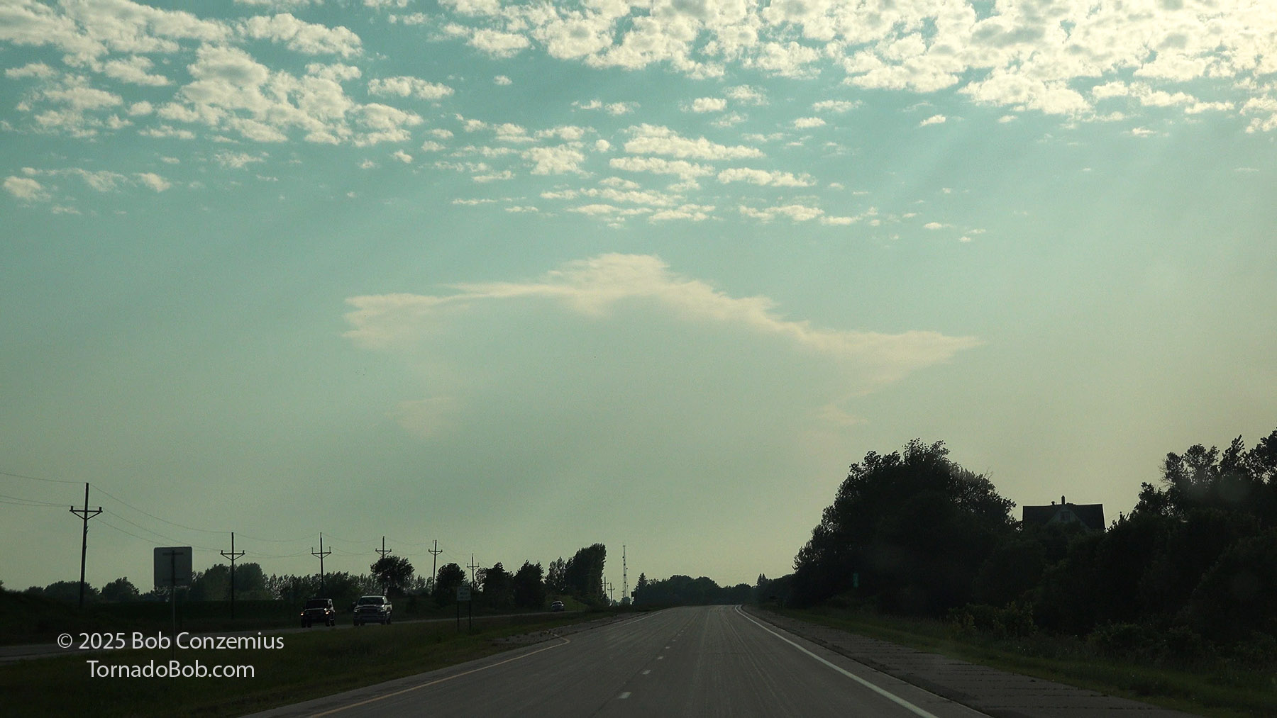
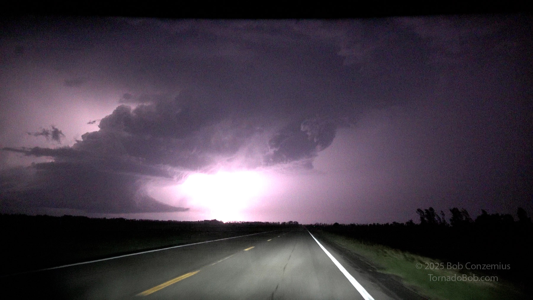
I left home shortly before 5:00 PM and took my favorite route to Fargo, which mean heading out of Grand Rapids on County Road 63, taking Minnesota Highway 6 to Remer, then heading west on 200 through Walker, to Detroit Lakes, where I would proceed westward on U.S. Highway 10 into the Red River Valley. Storms were forecast to develop around 7:00 PM, and this development occured essentially right on time, popping out of a narrow stratocumulus field right along the warm front. Supercell storms were going by 8:00 PM when I arrived in Fargo. I could see the first anvils when I was about 120 miles east of the storms.
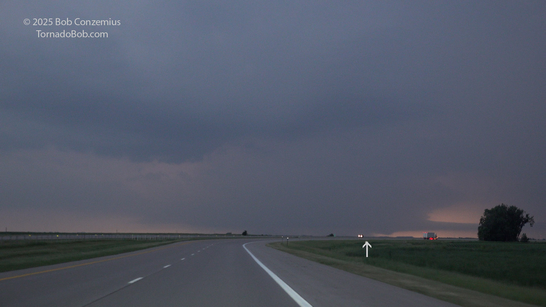
First sighting of the anvil of the storm (near Hawley, MN) at 7:25 PM, storm is about 115 miles to my west.
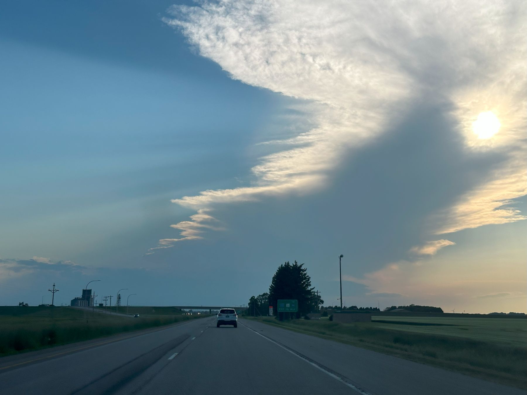
Anvil of the Jamestown storm viewed from just east of Moorhead, MN at 7:46 PM.
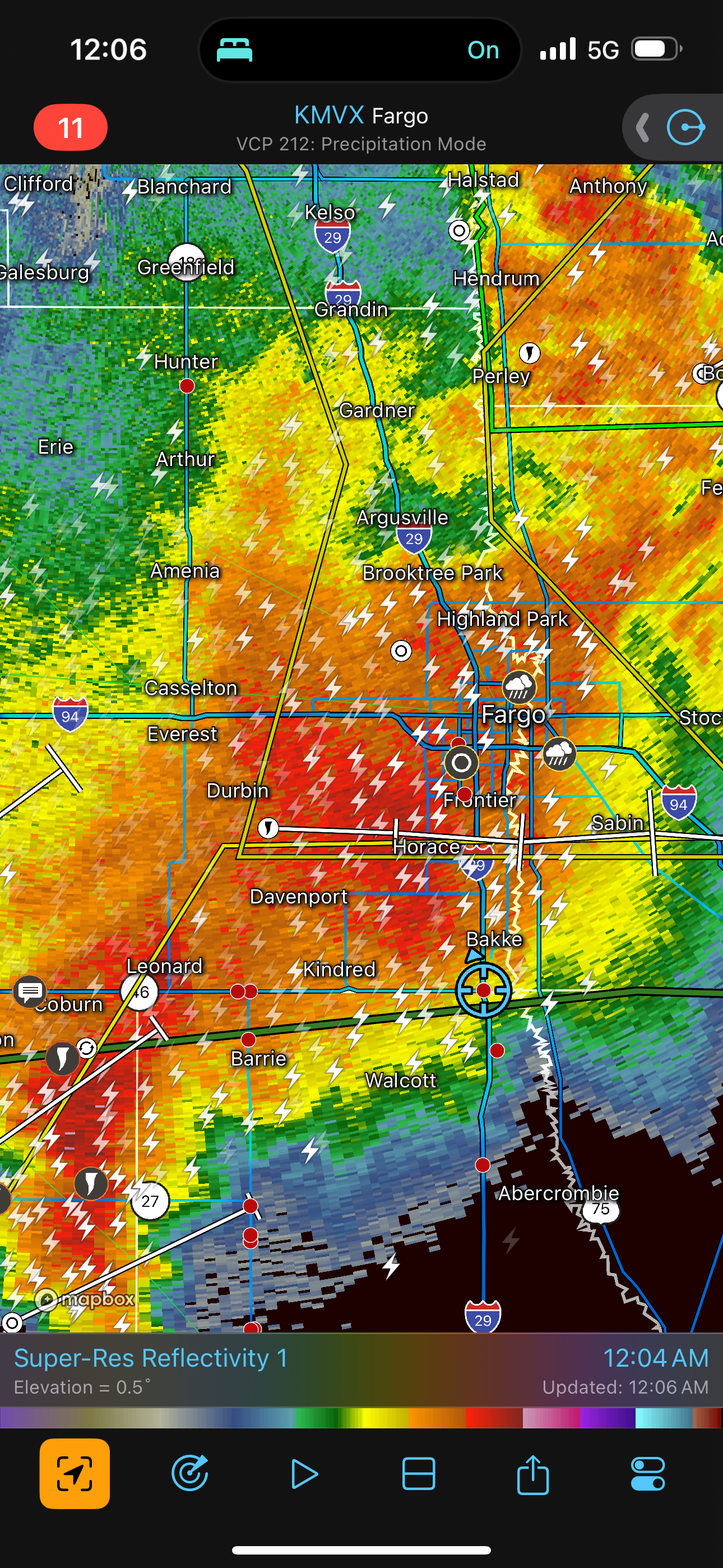
I stopped in Fargo at the most convenient Supercharger and added enough charge to give me a comfortable 200 mile range in heavy rain. This took a good 20 minutes or so, during which time I exchanged messages with the Tempest tour directors. Matt Phelps had just returned to Alaska, and Bill Reid, sadly, was stuck in Denver for the down day between tours. Chris Gullikson was on the Jamestown storm with Tour 7B/8B. His images showed a nice, new, isolated supercell with a typically flat base for a storm that young. He reported that it looked too stable at low levels for tornadoes. Looking at his images, I thought the same. He elected to take his tour group to a second storm just to the south to improve their chances of seeing a tornado. The southern storm's updraft base did have more of a tornado look, so I felt pretty confident they would see something soon. For myself, I was pretty sure I'd miss at least a tornado or two due to my late departure from home, but I would soon be on my way, and the conditions looked good for a multiple tornado event lasting more than an hour.
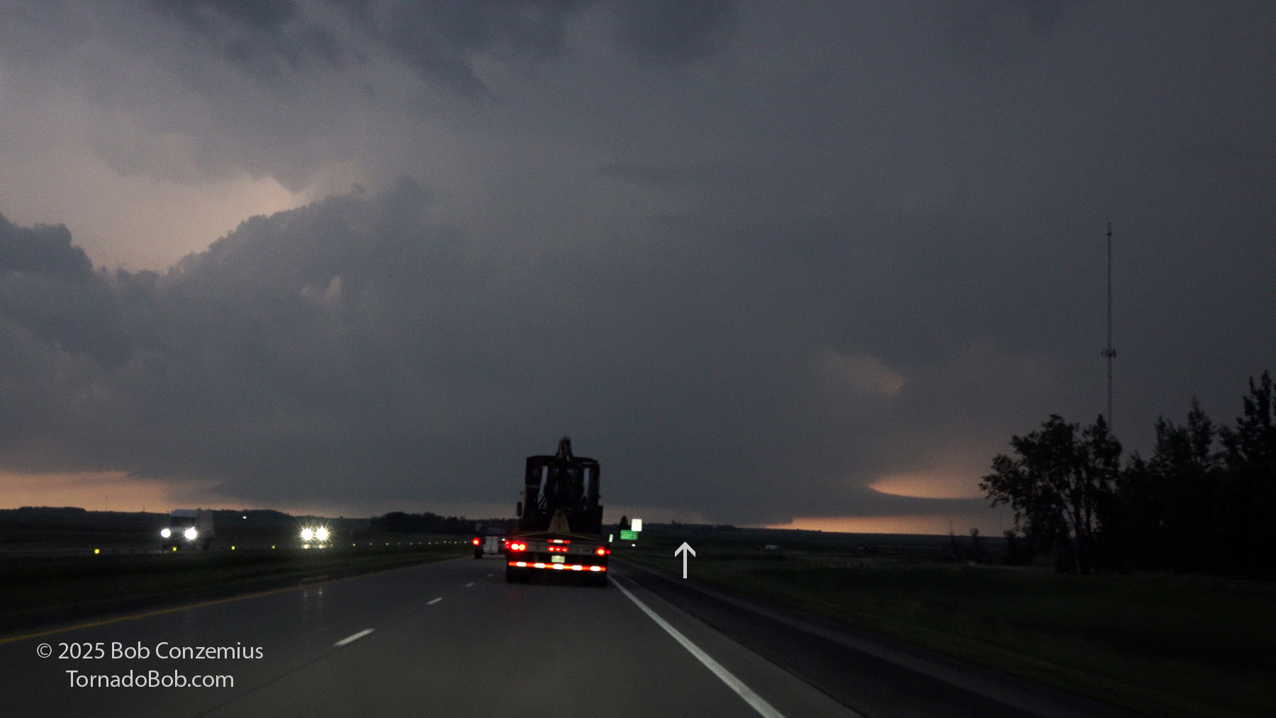
I hopped back on I-94 and drove west, going about 80 mph (North Dakota has a faster speed limit than Minnesota). Somewhat to my surprise, a tornado warning was quickly issued for the northern storm. Apparently, it was not in too stable an environment for tornadoes. Although this initial warning was for a radar-indicated tornado, a report soon came in. Indeed, I was missing the first tornado, and the race was on to see if I could get there in time to see the next one. Apparently, this first tornado was really brief because I cannot recall seeing any images of it from chasers.
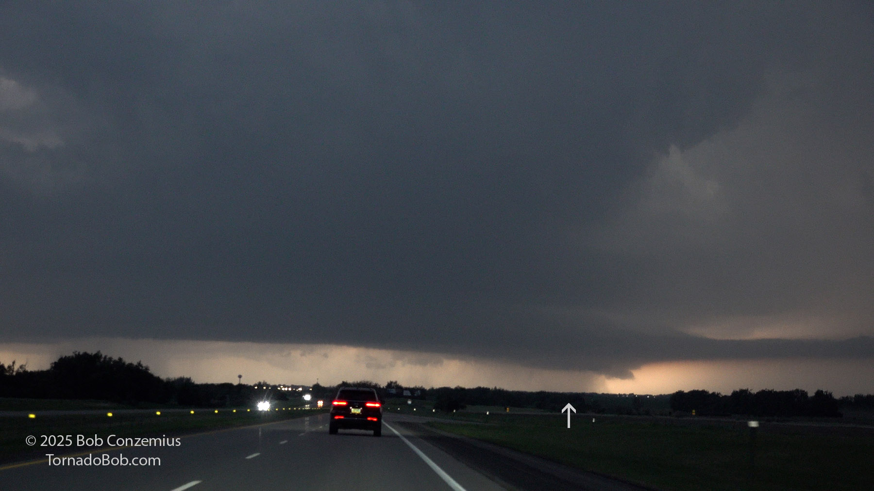
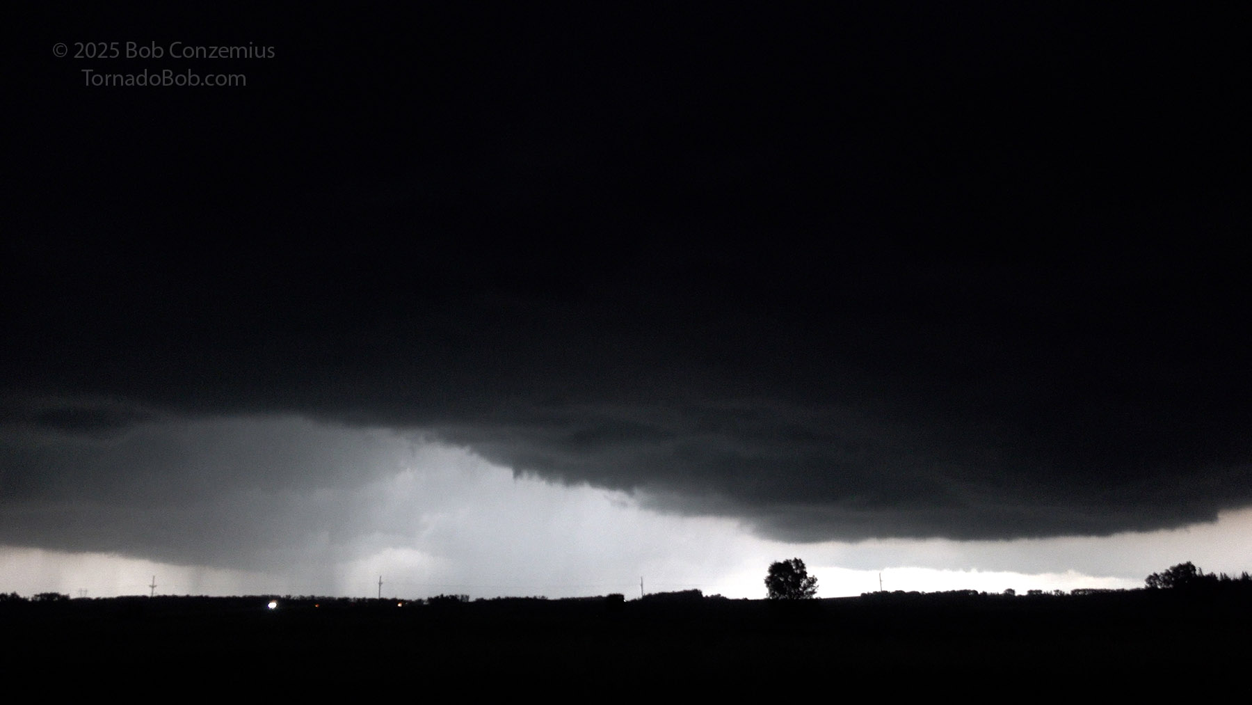
To my surprise, it did not take long for me to see some structure on the storm. Despite my distance of nearly 50 miles and relatively low bases, I could easily make out low-level features a few miles east-southeast of Tower City while the storm was still near Jamestown. It was at this point that I joked I could break my record for longest distance observing a tornado. Also at this time, the Spiritwood EF-3 was developing.
View of the storm at 8:56 PM from the I-94 curve 4 miles southeast of Tower City. The arrow indicates the location of the developing Spiritwood tornado.
When I was between Tower City and Valley City, tornado reports were coming in. Chaser live streams at this time were showing a very large and strong cone tornado (I determined this after the chase, not while I was driving), but rain was beginning to wrap around this tornado. From my vantage point, I was not able visually locate the tornado, but had the base been a bit more translucent, my line of sight would have afforded me an opportunity to see it. This terrain was flat, wide-open, and great for chasing!
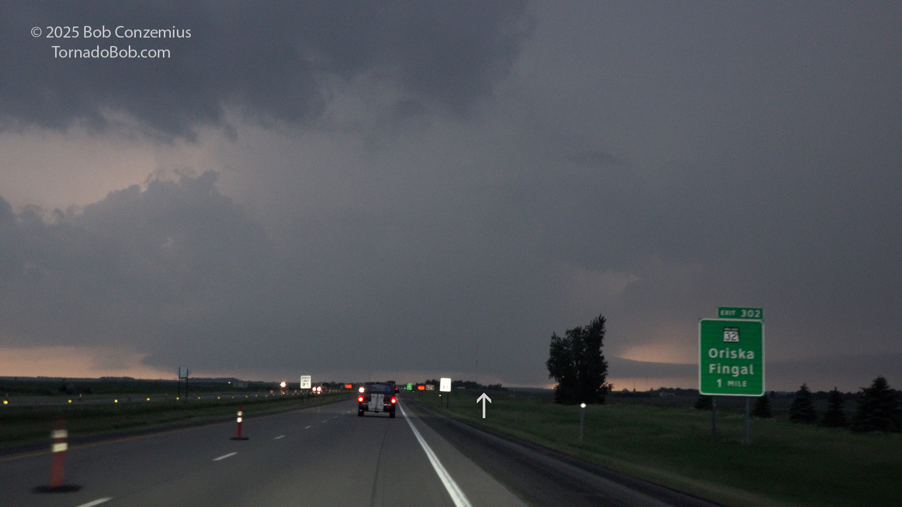
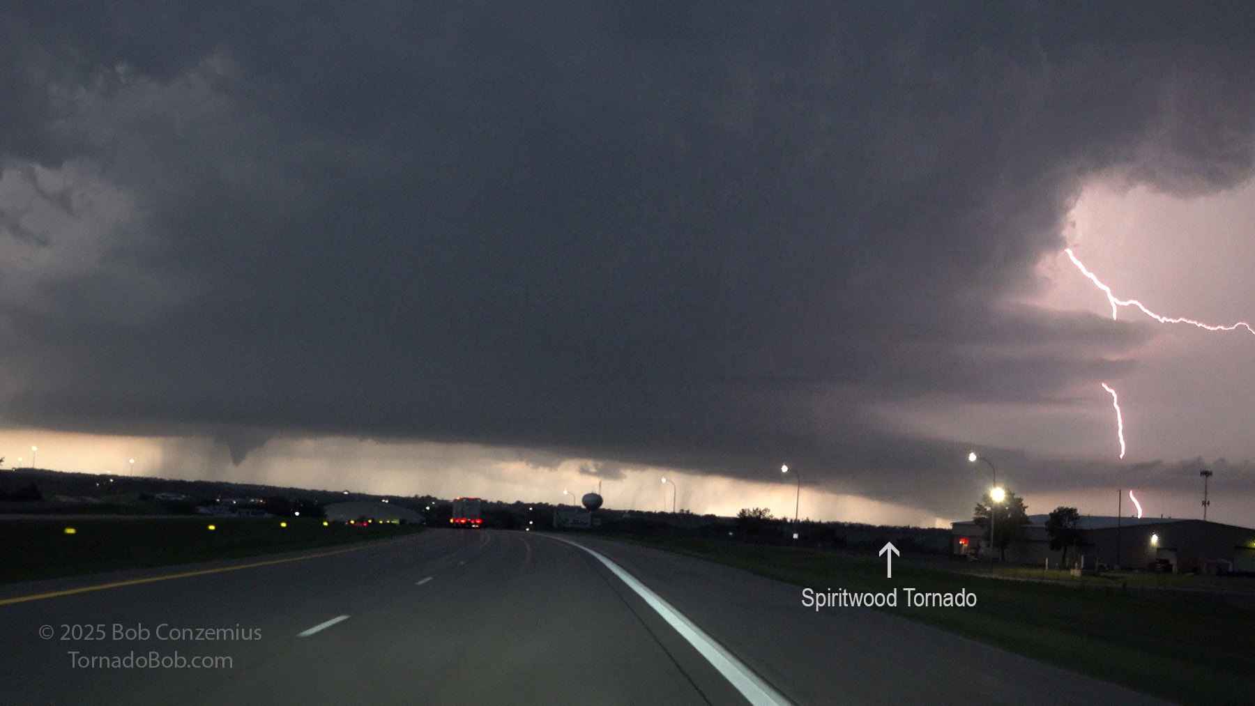
View of the storm at 9:03 PM from the I-94 exit at Oriska. The Spiritwood tornado is where the arrow is pointing. On live streams, it was becoming rain-wrapped at this time.
The next image below is the only time I have anything on my video that would match what the Spiritwood tornado looked like on live streams. I measured my various lines of sight and the angles between them as precisely as I could. The tornado had become mostly rain-wrapped, but it was a fairly large cone. Its location in my video capture matches its reported location at this time.
View of the storm at 9:04 PM from the I-94 exit at Oriska. The arrow indicates the location of the Spiritwood tornado. At this point on Reed Timmer's live stream, it was rain-wrapped.
Yep, there it might be-- that barely perceptible dark area to the left of a much lower looking wall cloud. Certainly not an obvious tornado!
From this point, the Spiritwood tornado became more fully wrapped in rain, although it emerged a little later in Read Timmer's live stream as a wedge as it was hitting a house. It completely disappeared while Reed and crew checked on the house that had just gotten hit, but it then reappeared as a rope that lasted a few more minutes. During these later phases, the tornado was definitely out of my view, first completely wrapped in rain (during the wedge phase) then behind trees, rain, and cloud bases closer to me (during the rope phase). On one of my video captures below, you can see that the edge of the rain core, on the right side of the mesocyclone, is canted inward, pulled into the circulation by the low-level inflow to the tornado. This area soon lost its inward cantation (in the second image immediately below) as the tornado began to rope out.
Valley City at 9:07 PM. My guess of the Spiritwood EF3 tornado location is indicated by the arrow.
Valley City at 9:08 PM. My guess of the Spiritwood tornado location is indicated by the arrow.
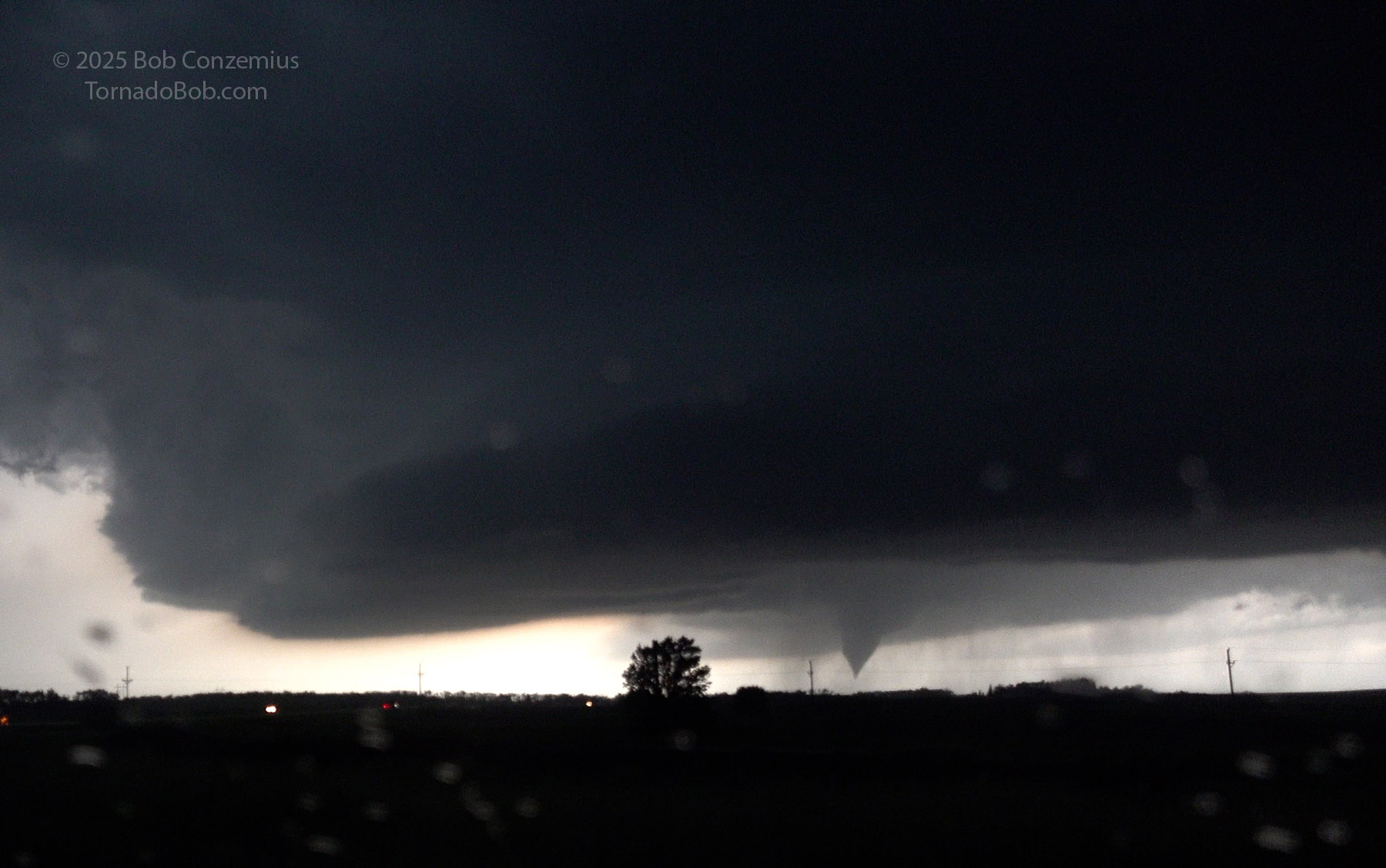
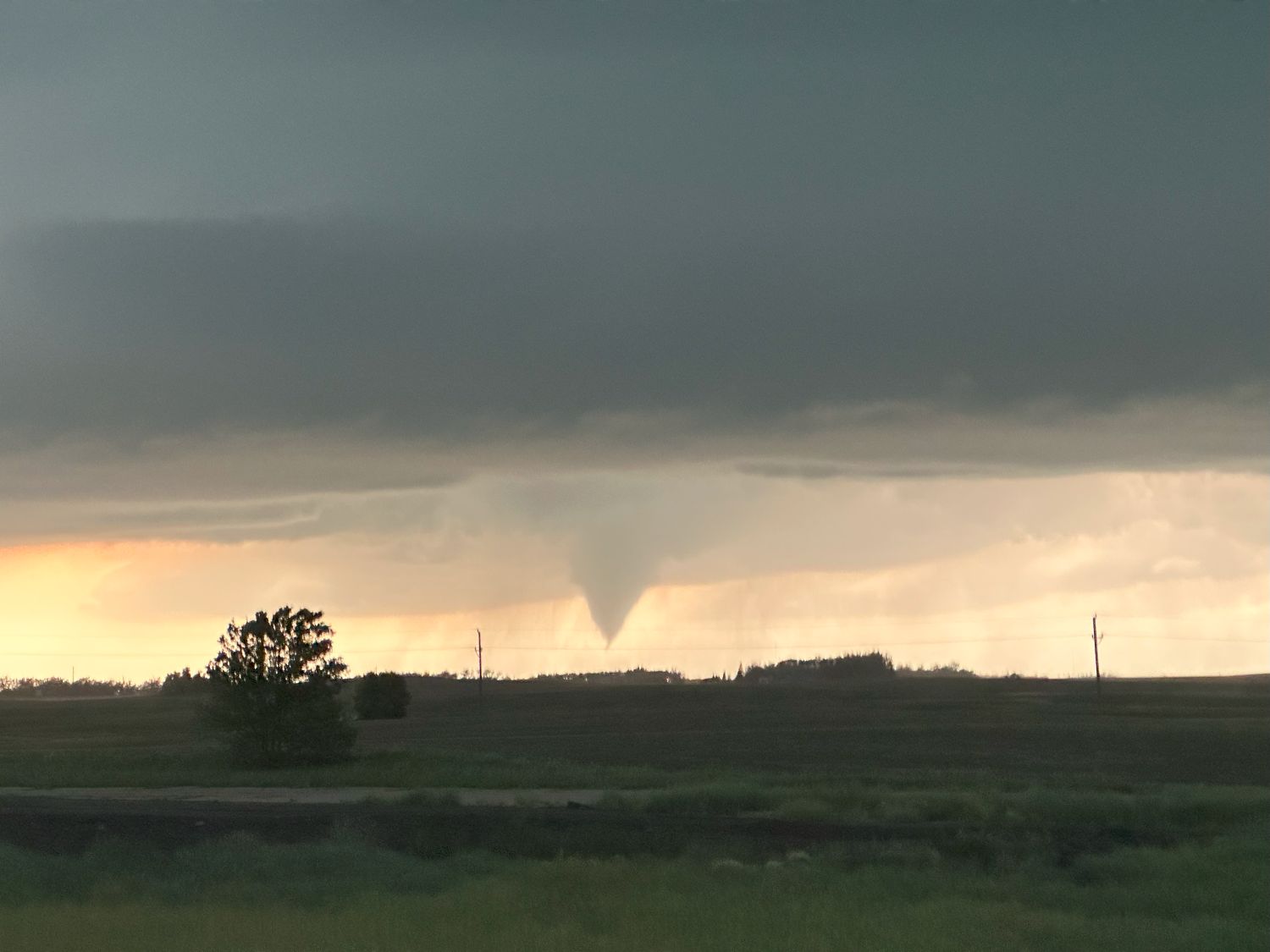
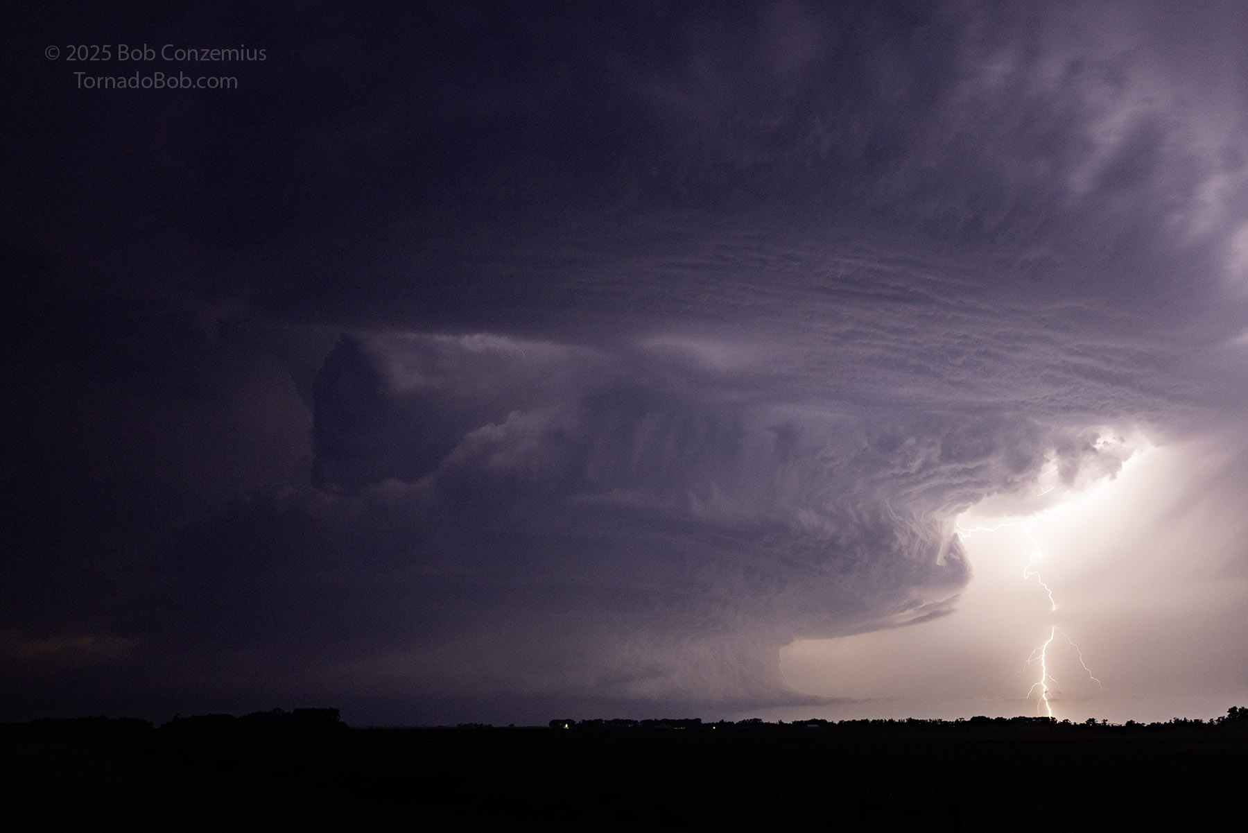
As I came into Valley City, a suspicious lowering developed well to the south (left) of the action area. I initially wrote this off as a shelf cloud on the south side of the RFD, but this was the wrong interpretation. I was correct that it was on the south side of the RFD, but it was a new, anticyclonic tornado, not a shelf cloud. I drove through Valley City and stopped at the first possible (Berea) exit now that I could see a tornado on the storm.
View of the storm at 9:10 PM from Valley City. The Spiritwood tornado is out of view, but an anticyclonic tornado (an EF0) has developed to the south (left side of this image).
Pulling into the Berea exit at 9:13 PM. The anticyclonic tornado is in progress.
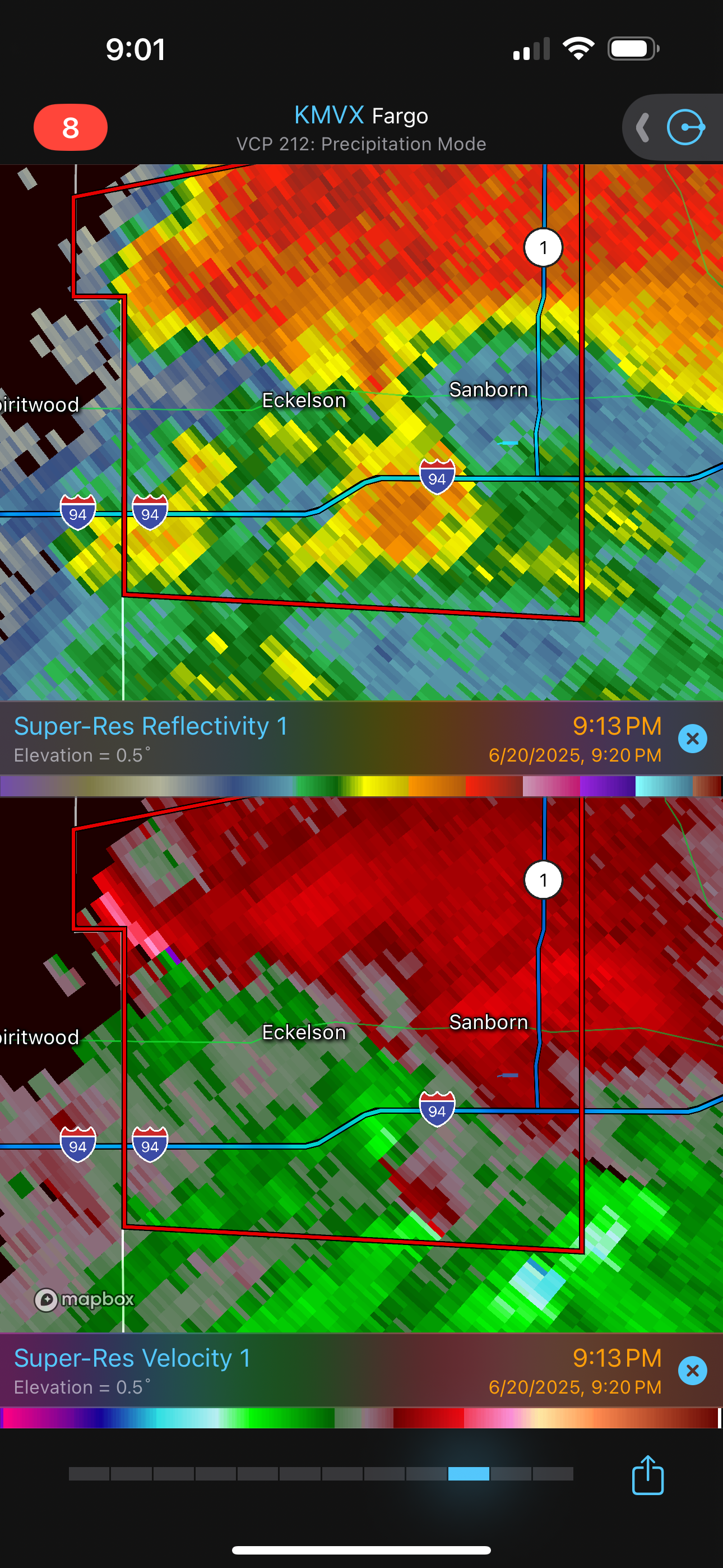
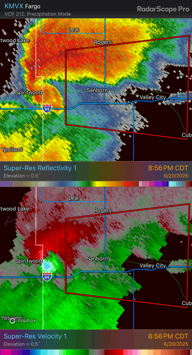
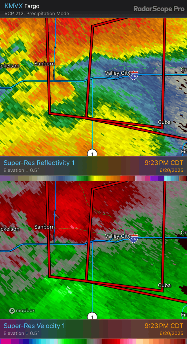
Radar image at the same time, showing an anticyclonic couplet with the Spiritwood tornado (near the center of the image, just southwest of the "94" marker) and a cyclonic couplet to the north (north of I-94, about midway between Spiritwood and Eckelson).
The anticyclonic tornado at 9:15 PM. Photo from my iPhone.
View of the storm at 9:19 PM with an anticyclonic tornado at the Berea, ND exit off I-94.
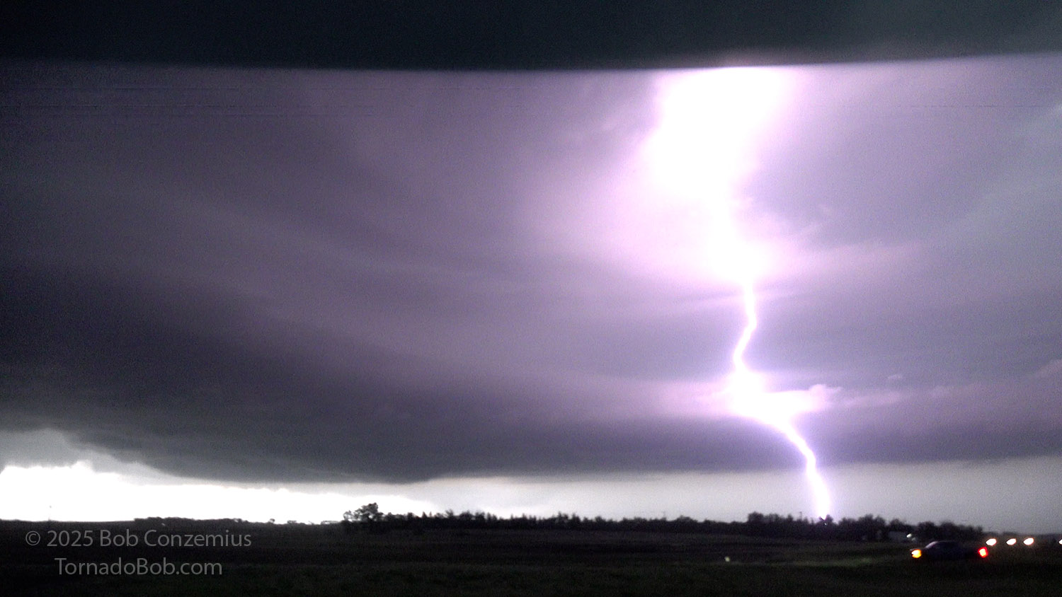
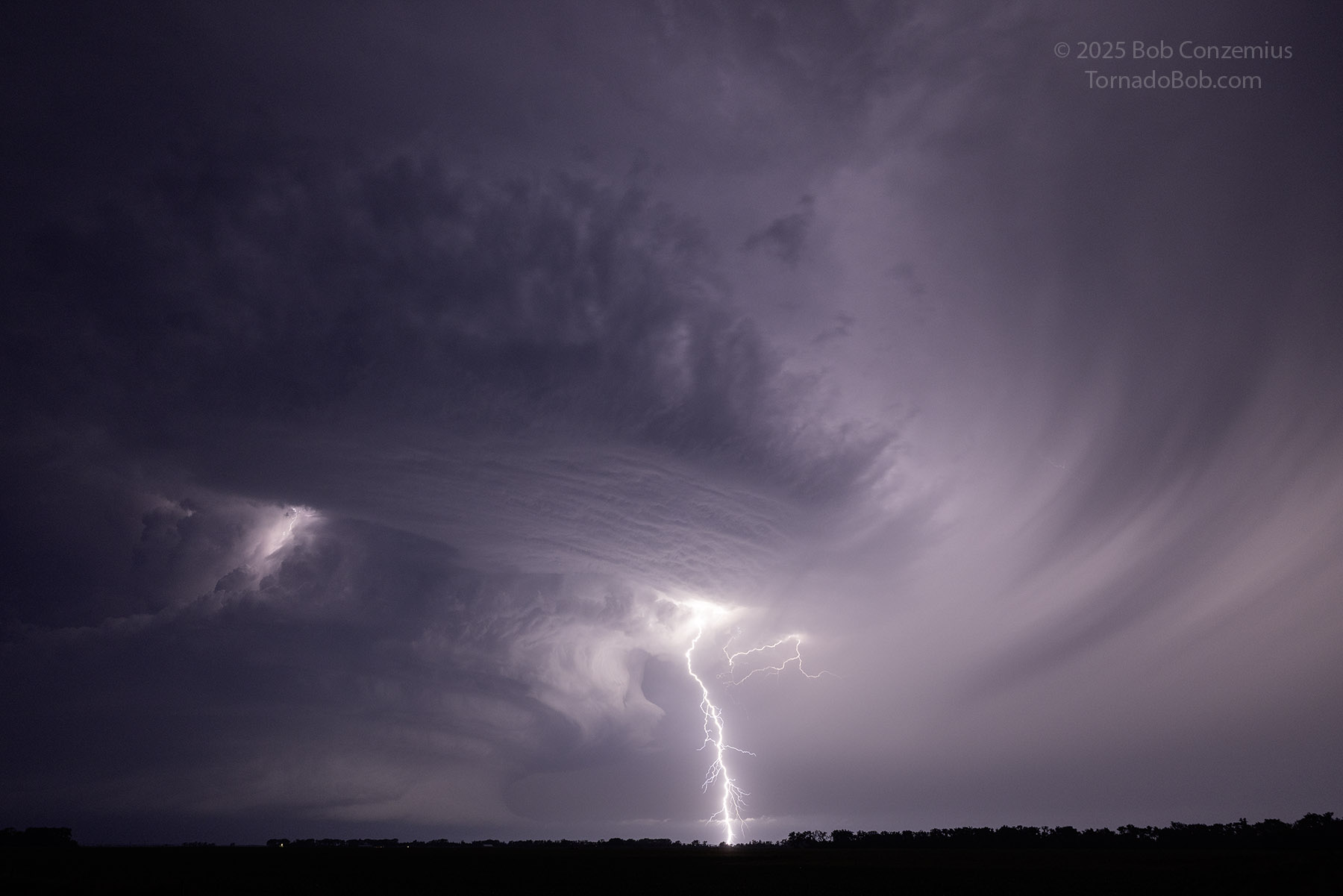
As I watched, the tornado became rain-wrapped, and I thought it had dissipated, but chasers on the west side of the tornado had a clearer view and saw the elephant trunk-shaped condensation funnel reach the ground. At my location, inflow winds were strong from the east, and as I shot some still pictures, the wind took my lens hood and tossed it into the grass. I searched but could not find it. Once I lost sight of the tornado, I was greeted by an intense CG barrage, which lasted several minutes. This storm was really intense!
A cloud-to-ground lightning barrage commenced.
The lightning barrage continued for several minutes as the action area approached my location.
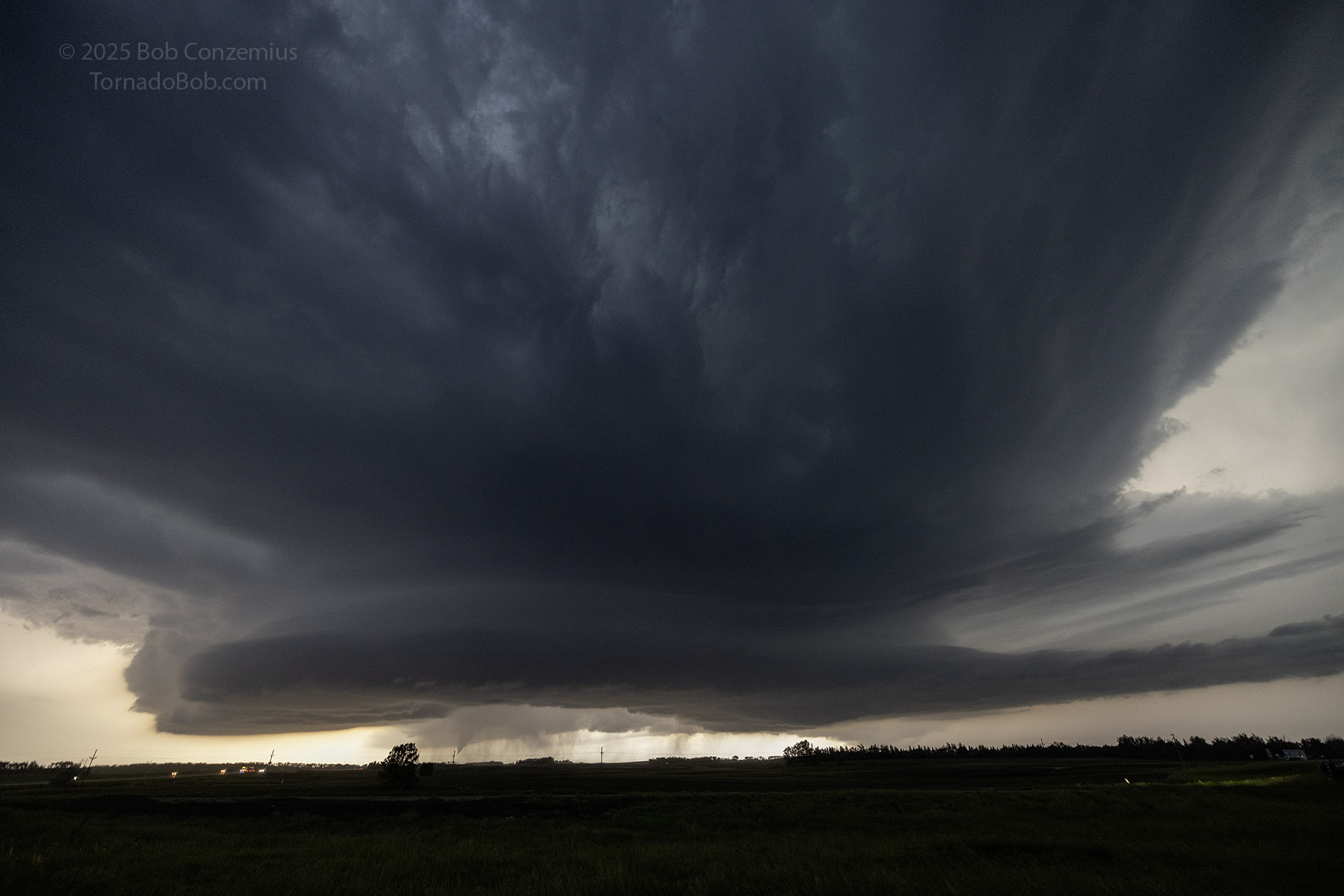
After a few minutes enjoying the lightning, I spotted a new lowering to my immediate west, and once this new action area got close to me, I decided to move back east on I-94 to get to the other side of Valley City so I would be able to safely and easily watch anything that developed.
A mean-looking updraft base as I decide to head east from the Berea exit at 9:23 PM.
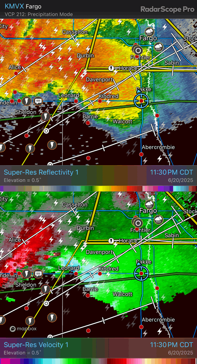
The radar loop, below, shows the evolution of the reflectivity and base velocity if the Spiritwood and anticyclonic tornadoes, with the Spiritwood tornado developing first and recurving back northwest, to the north of I-94. While this happens, a weaker, anticyclonic couplet develops to the south of I-94. At the end of the loop, a couplet is intensifying west-southwest of Valley City. This last couplet is associated with an EF-2 tornado.
Radar loop of the Spiritwood and anticyclonic tornadoes.
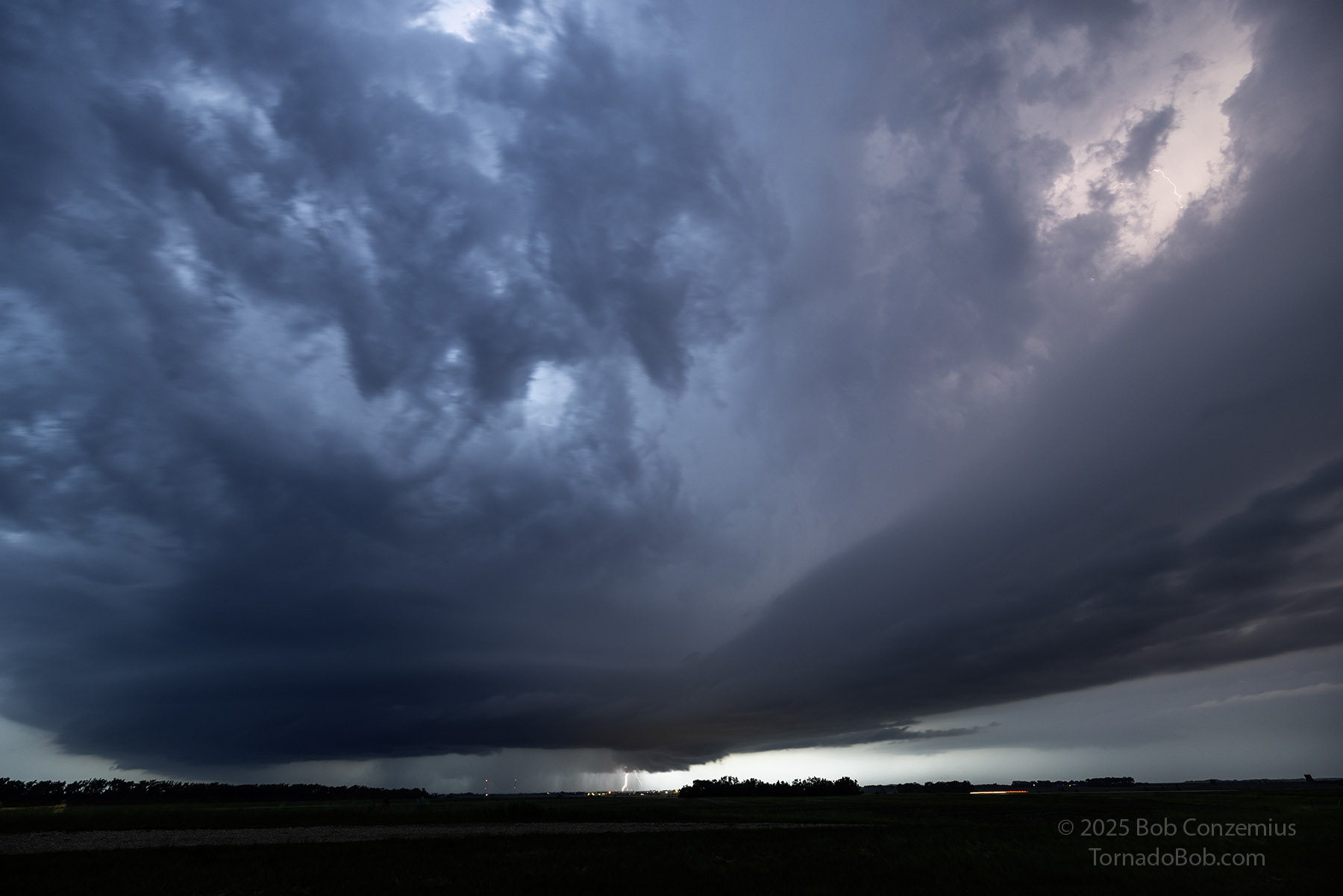
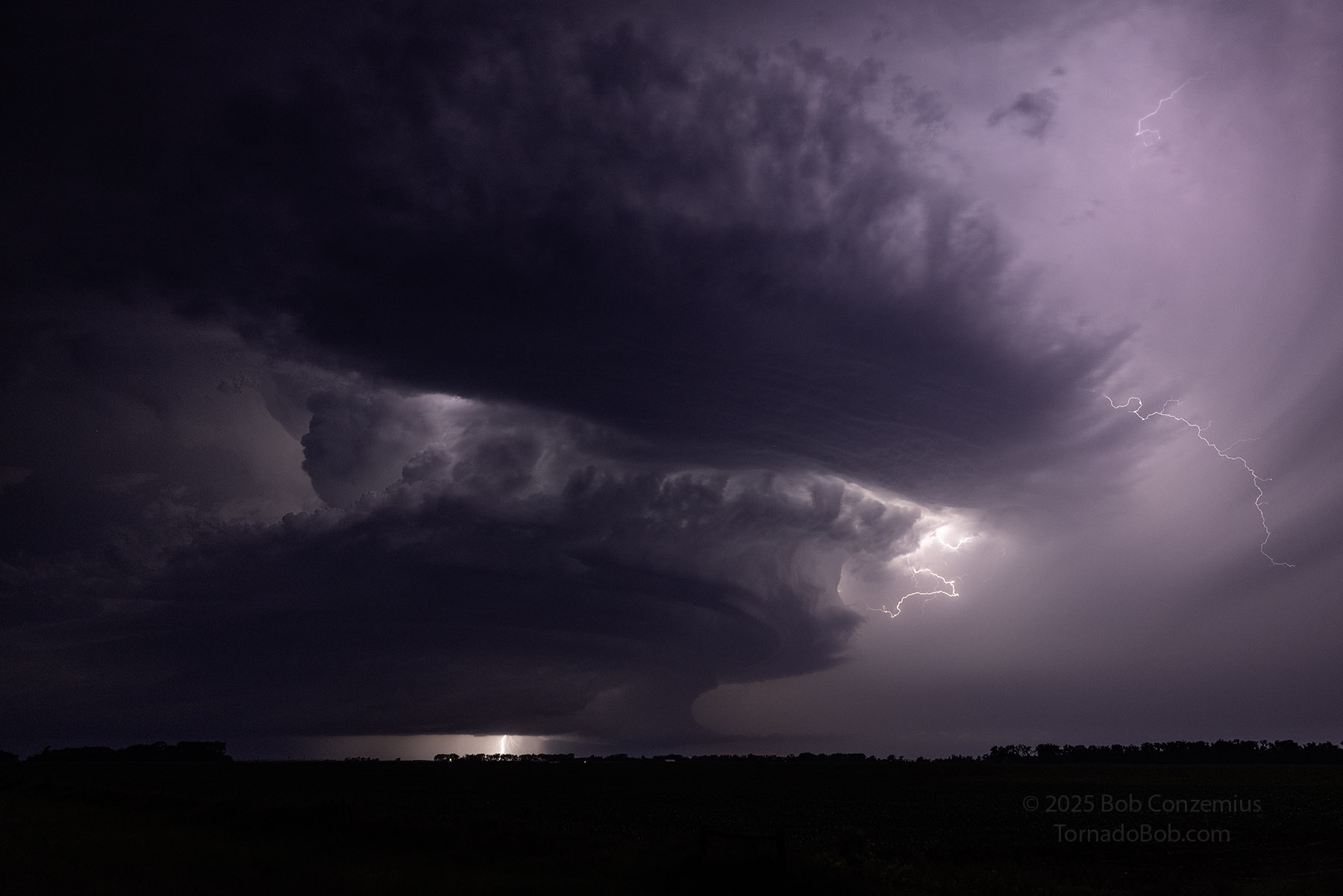
I got back out of the valley on the east side and set up a tripod to capture some stills. The storm was in a somewhat HP process, and a lot of rain filled the mesocyclone, but after a couple minutes of shooting, I could make out a wedge tornado. This tornado was rated EF-2 and was the storm's fourth tornado (including that first spin-up when the storm was first tornado-warned). By this time, the southern storm was also beginning to produce tornadoes. I found it interesting that the northern storm was the first one to produce tornadoes since 1) it looked fairly stable at first, and 2) it was not "tail-end Charlie". As I watched the Valley City wedge, the southern storm's precipitation shield was encroaching upon the northern storm. I was in rain.
The storm viewed from just east of Valley City at 9:41 PM.
Same image as above, cropped and processed to show the Valley City EF2 tornado.
The radar loop below shows the evolution of the Valley City circulation. It starts west-southwest of Valley City, just south of I-94, and moves southeast, finally ending up due south of Valley City before the circulation weakens. Note that, throughout the loop, the hook of the Valley City storm is becoming embedded in precipitation from the more southern storm.
Radar loop of the Valley City tornado.
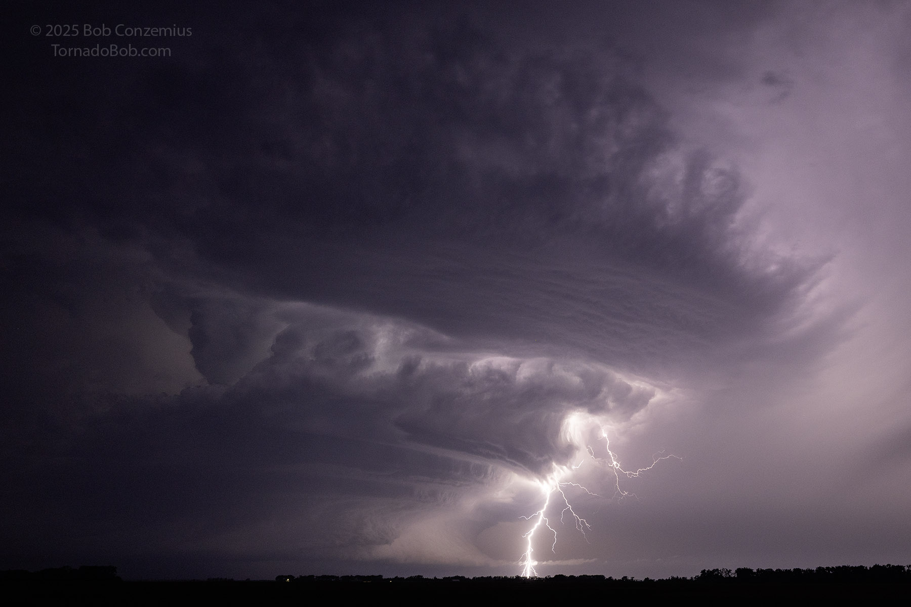
I looked again at radar and decided the tornadic phase of the northern storm might be ending (see above). There was too much precipitation from the southern cell now falling into the action of the northern cell, and the northern cell's hook did not look as well-defined or its velocity couplet as intense. Indeed, the Valley City tornado would be the last tornado it would produce. Damage reports indicate another tornado a bit to the east, but this tornado did not occur until after 11:00 PM, when the squall line would have been moving into that location.
From here, I began an eastward drive to get ahead of everything. It was getting dark, and visibility would be bad enough at night. I didn't want any rain to make it worse, so I my goal was to get east of the rain and then drop south ahead of the southern storm and safely ahead of its precipitation core. I drove south on Highway 18 through Leonard and then followed it farther south until I could identify the mesocyclone of the southern storm. This took me over an hour-- a bit longer than I thought it would.
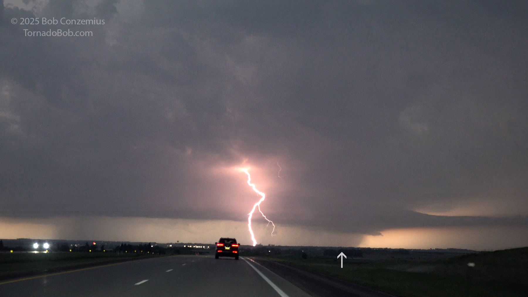
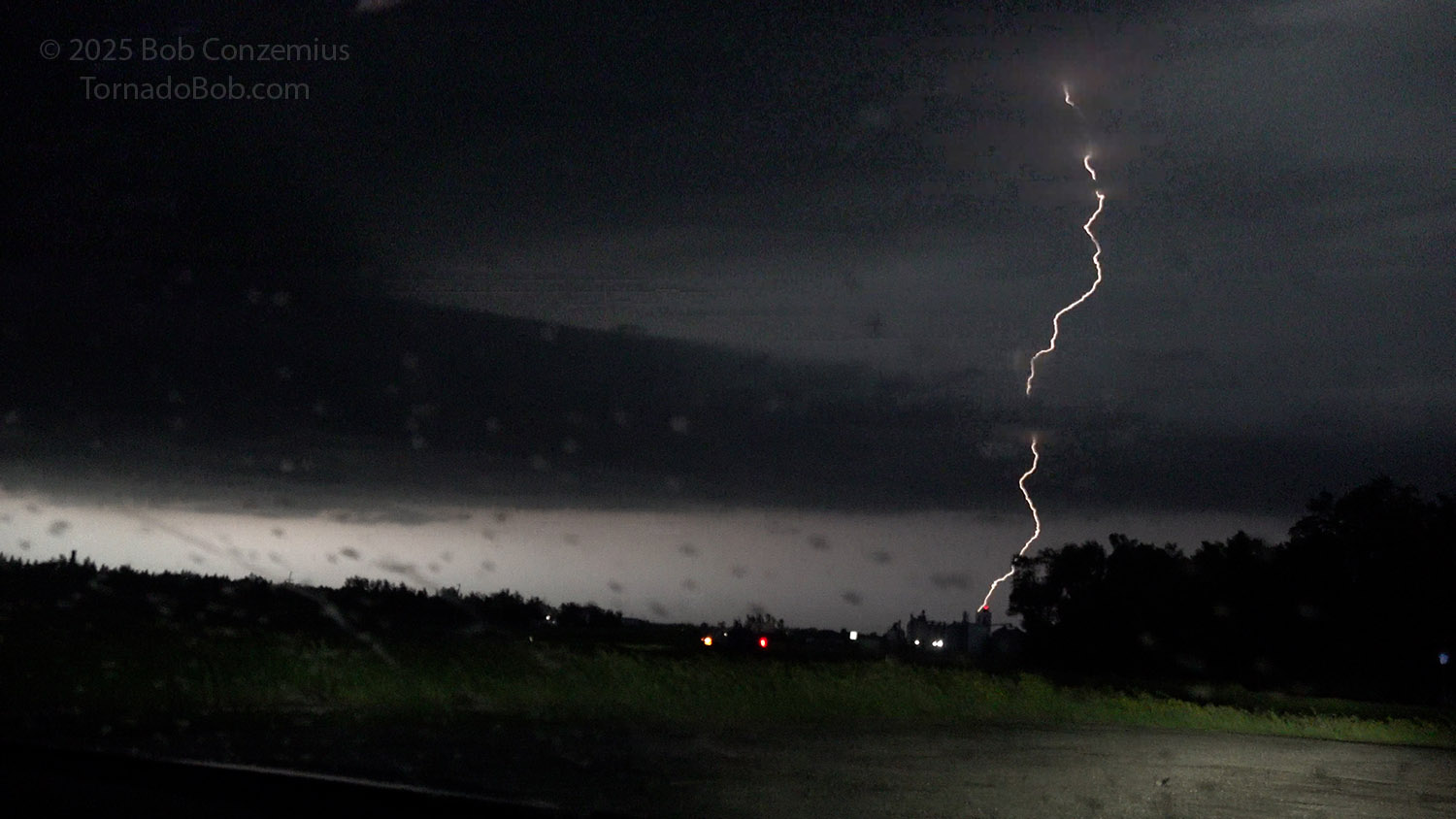
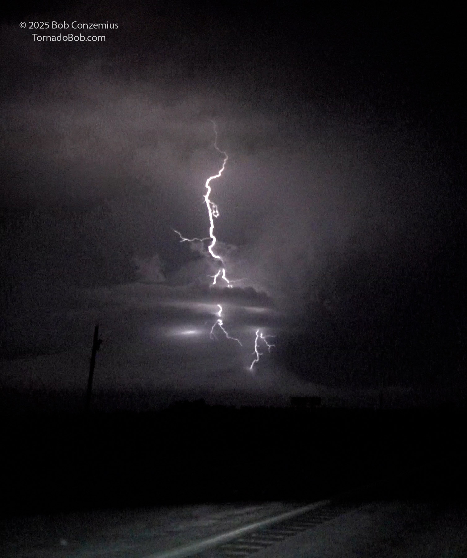
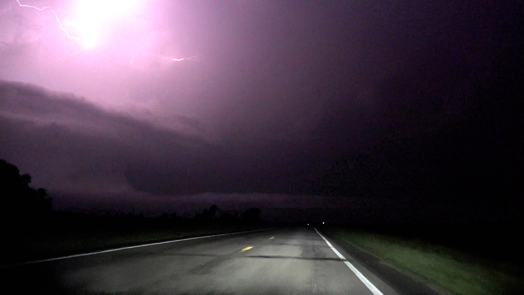
Video capture from a close lightning strike (about 100 yards to my north) as I drove east on I-94.
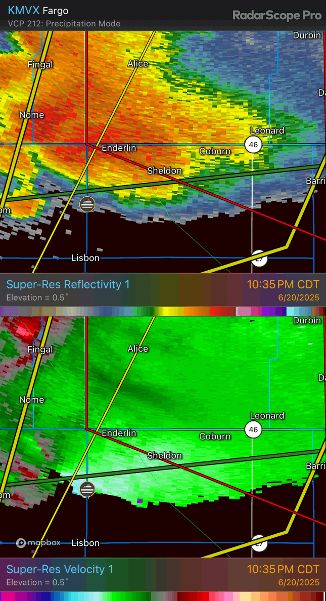
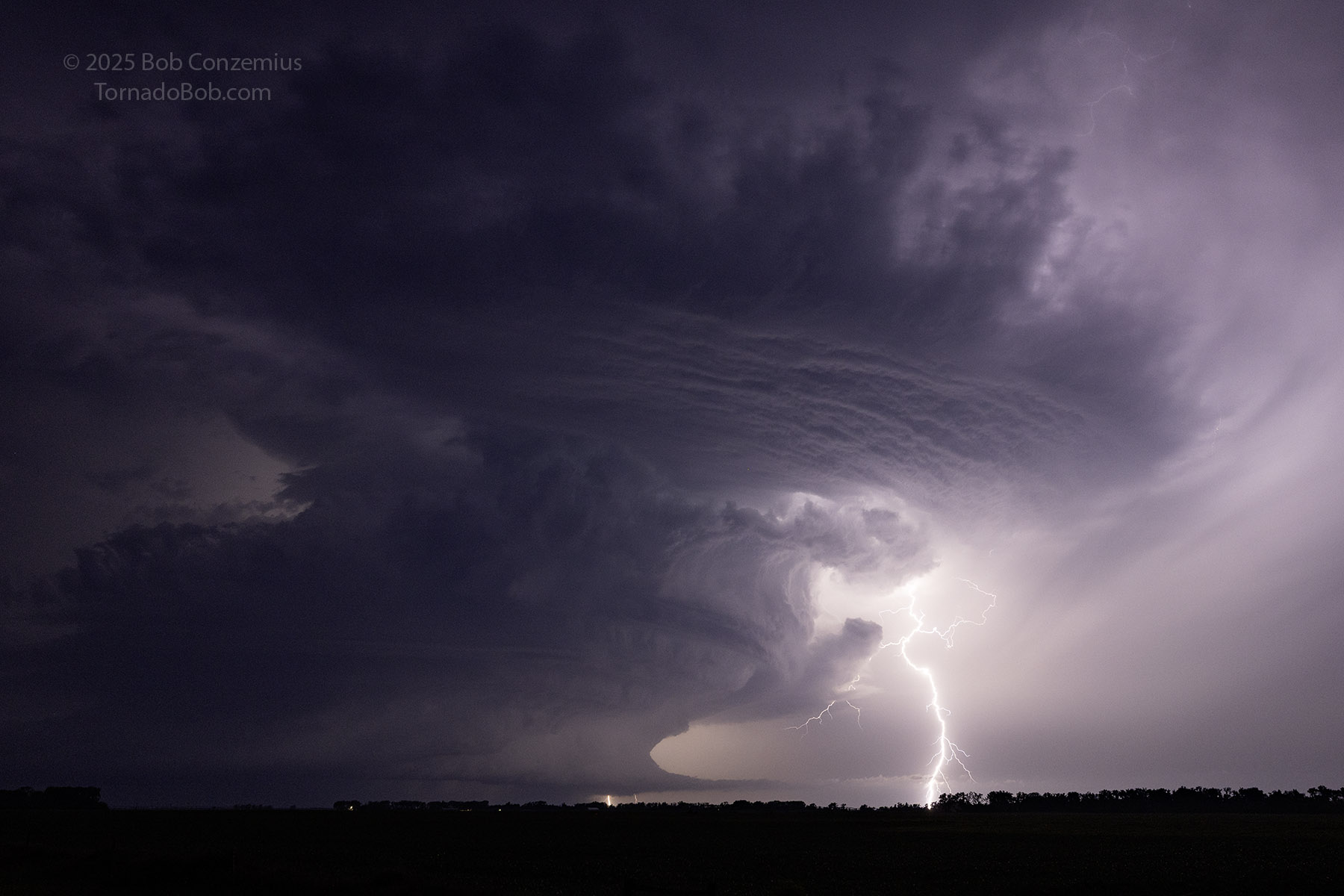
At around 11:00 PM, radar showed I had gone far enough southward and had no intervening precipitation between the mesocyclone and me, so I found the first available westward route to get a bit closer. This road was Highway 27, and when I first turned onto it, I was surprised that I could still not identify the supercell updraft to my west, but after three miles, I was finally able to see it clearly and stopped. The lightning was intense and almost continuous. Radar had showed the storm looking perhaps less supercellular than it had earlier, but now it was developing a stronger hook again. As I was stopping, the Enderline EF-3 tornado was developing, and it was visible given just the right lightning flashes around the supercell. I was 20 miles away, but this afforded me a great view of both the storm structure and the wedge phase of this tornado. In my excitment, I initially (accidentally) shot a minute of video with my Canon R5 still camera, but this turned out to be fortuitous because its low-light capabilities were better than those of my camcorder, and I was able to get a couple good video frame captures of the wedge. I followed up with some stills from the Canon and then some video with my camcorder.
Radar now showed the southern storm with a big hook extending well south of the storm. At the beginning of this loop, the storm had just finished producing an EF2 tornado northwest of Lisbon. A new circulation developed near Enderlin, moved initially northeast, then curved back to the northwest, much like the Spiritwood tornado had done. The damage survey revealed that a second tornado (EF2) then quickly developed near then end of the EF5 path and moved southeastward. Consistent with this damage path, radar showed another couplet restrengthening around 11:24 then moving southeast before quickly weakening. The second loop in the sequence of radar images below focuses more on the first (EF5) tornado.
It is pretty interesting that the Spiritwood and the Enderlin tornadoes both curved to the northwest and exited out the northwest side of their respective storms. In the Enderlin case, there was more reflectivity behind the storm, but the general propagation of the circulation was the same. This phenomenon also happened during the Andover, KS tornado of April 22, 2022, which also happened to be an EF3.
Radar loop of the Enderlin tornado(es).
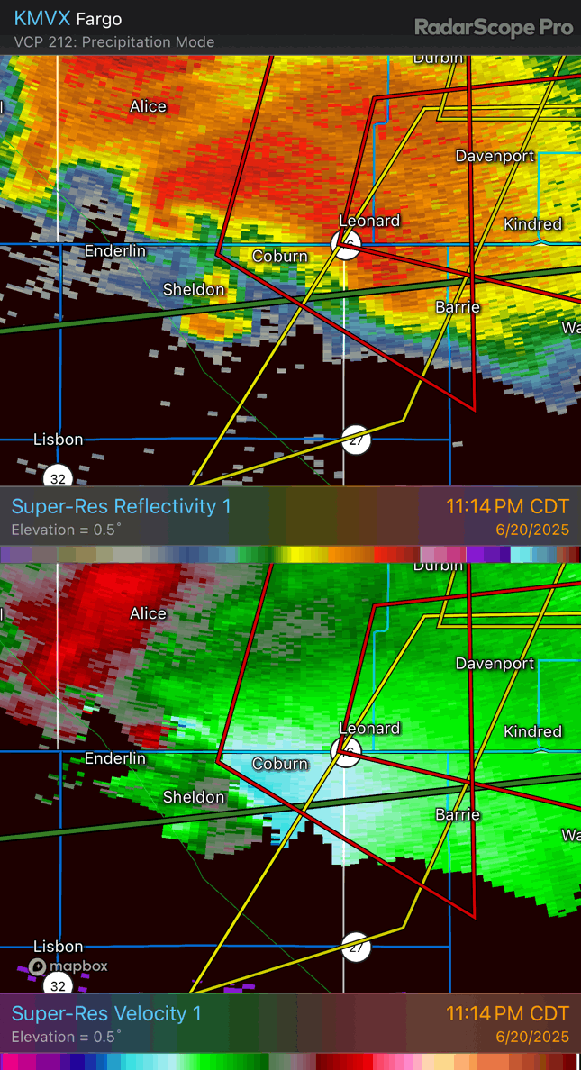
Radar loop focusing more on the Enderlin EF5.
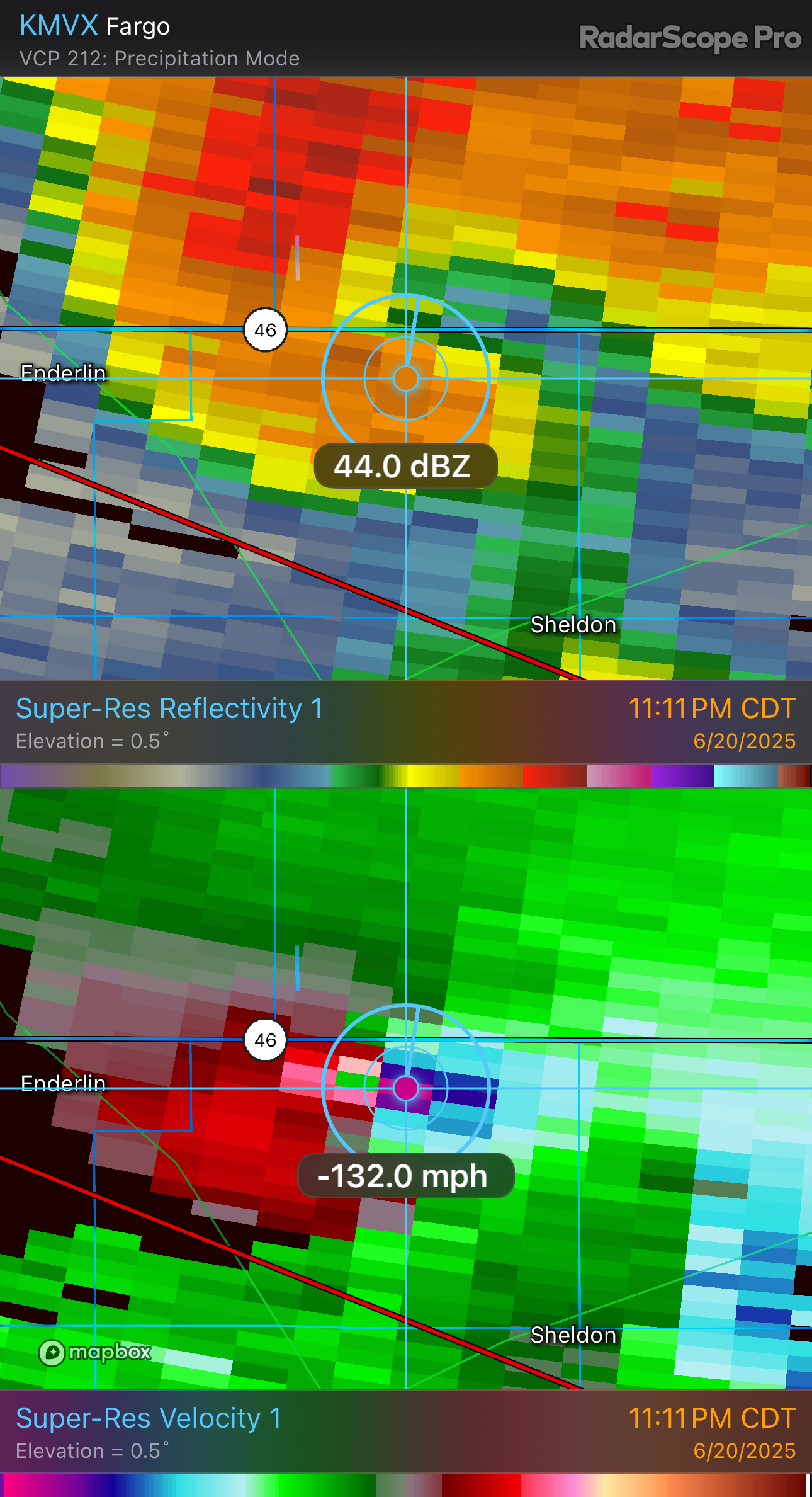
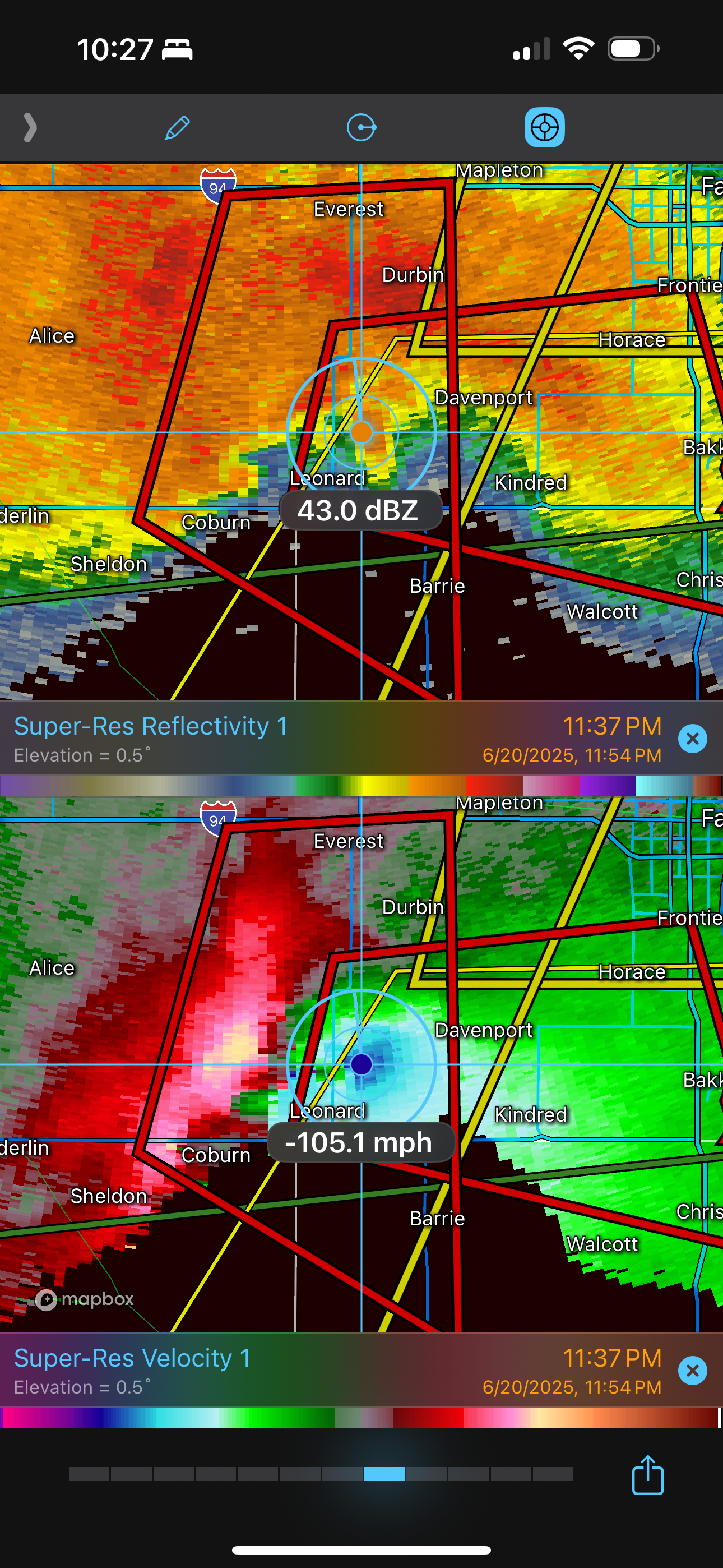
Radar image showing location of maximum inbound velocity during the Enderlin EF5 tornado.
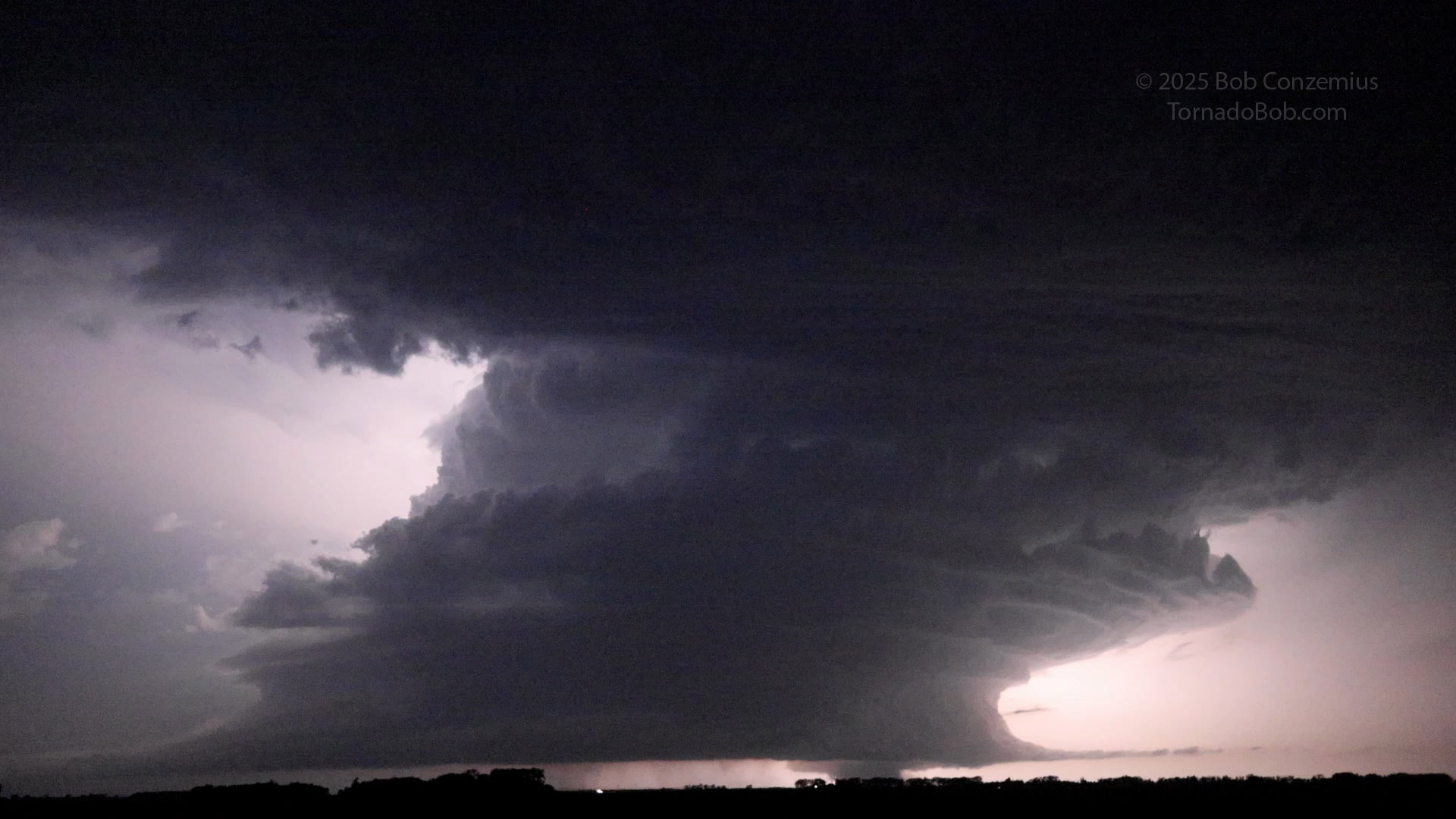
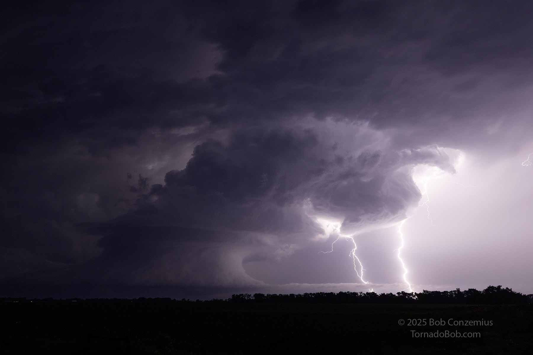
Enderlin/Sheldon storm with a wedge tornado immediately after it had hit the parked train and was moving into the field to the north. Video frame capture at 11:10 PM
A second video capture of the Enderlin tornado at 11:11 PM.
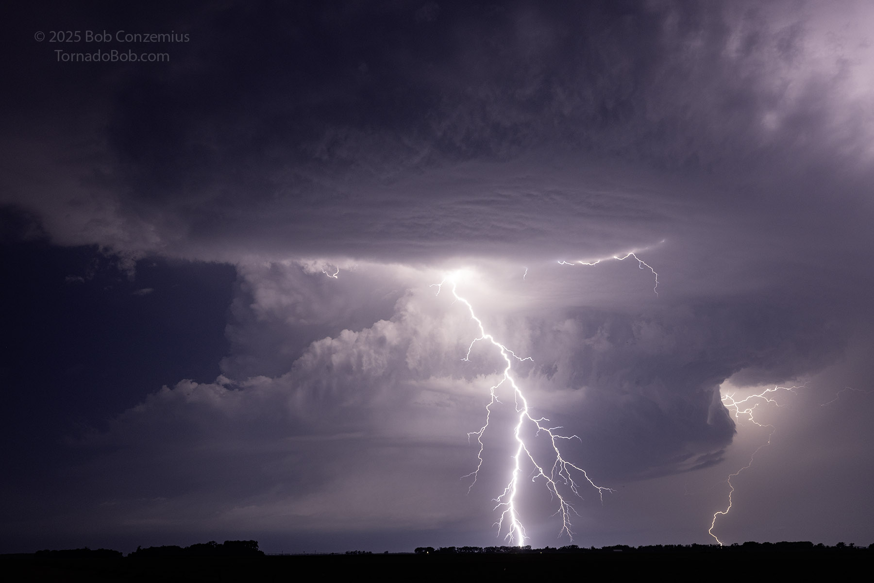
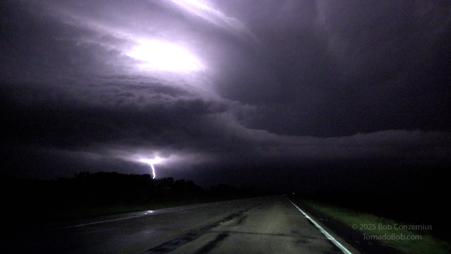
Lightning illuminates the storm.
I like this shot because of the detail in the storm. It needed 3 stops of brightening.
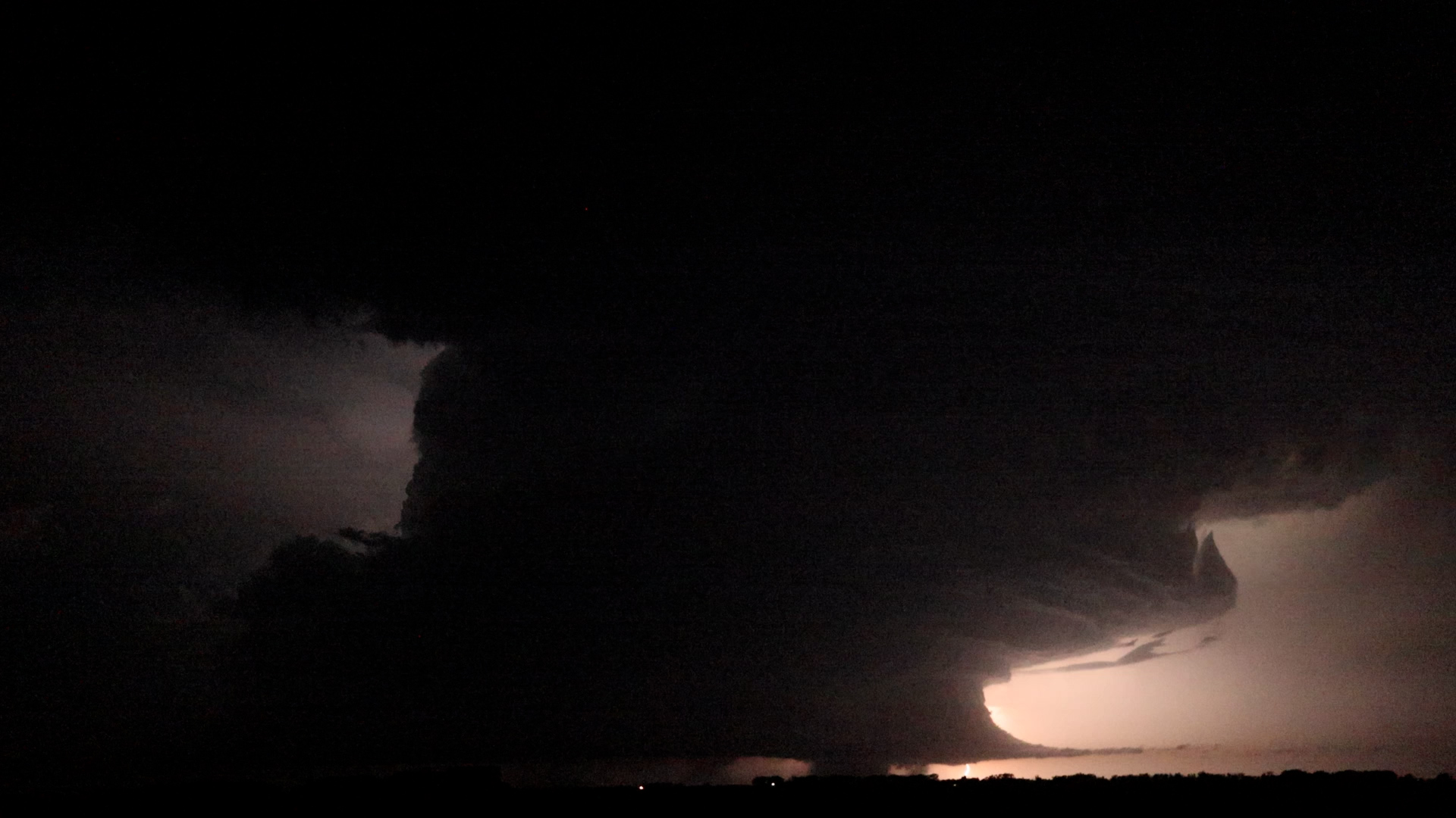
Enderlin/Sheldon Storm.
Enderlin/Sheldon Storm at 11:14. The cloud-to-ground strike illuminates the back side of the tornado
Enderlin/Sheldon Storm.
Enderlin/Sheldon Storm.
Enderlin/Sheldon Storm at 11:25. The Enderlin EF5 no longer appears to be visible, but an EF2 tornado is indicated in the storm reports at this time (began at 11:22).
Enderlin/Sheldon Storm starts to shrink as outflow-dominant storms approach from the west. Supposedly, the second EF-1 tornado is in progress now.
The updraft of the storm began to get narrower, and the stills show, at one point, that there was no tornado for at least a little bit. However, the storm reports then indicate a second tornado (an EF2) developed at 11:22 and lasted until 11:34. I had my video camera in nightshot mode at this time. I did not get distinct comfirmation of this on video. A couple captures did show something suspicious in the video, but it's not as obvious as the first Enderlin tornado. This video capture was at 11:25. I had a second video, during this interval, that started at 11:31, but I did not have any suspicious lowerings on this second clip.
Suspicious lowering under the center of this cell might be the second Enderlin tornado. Taken at 11:25 PM.
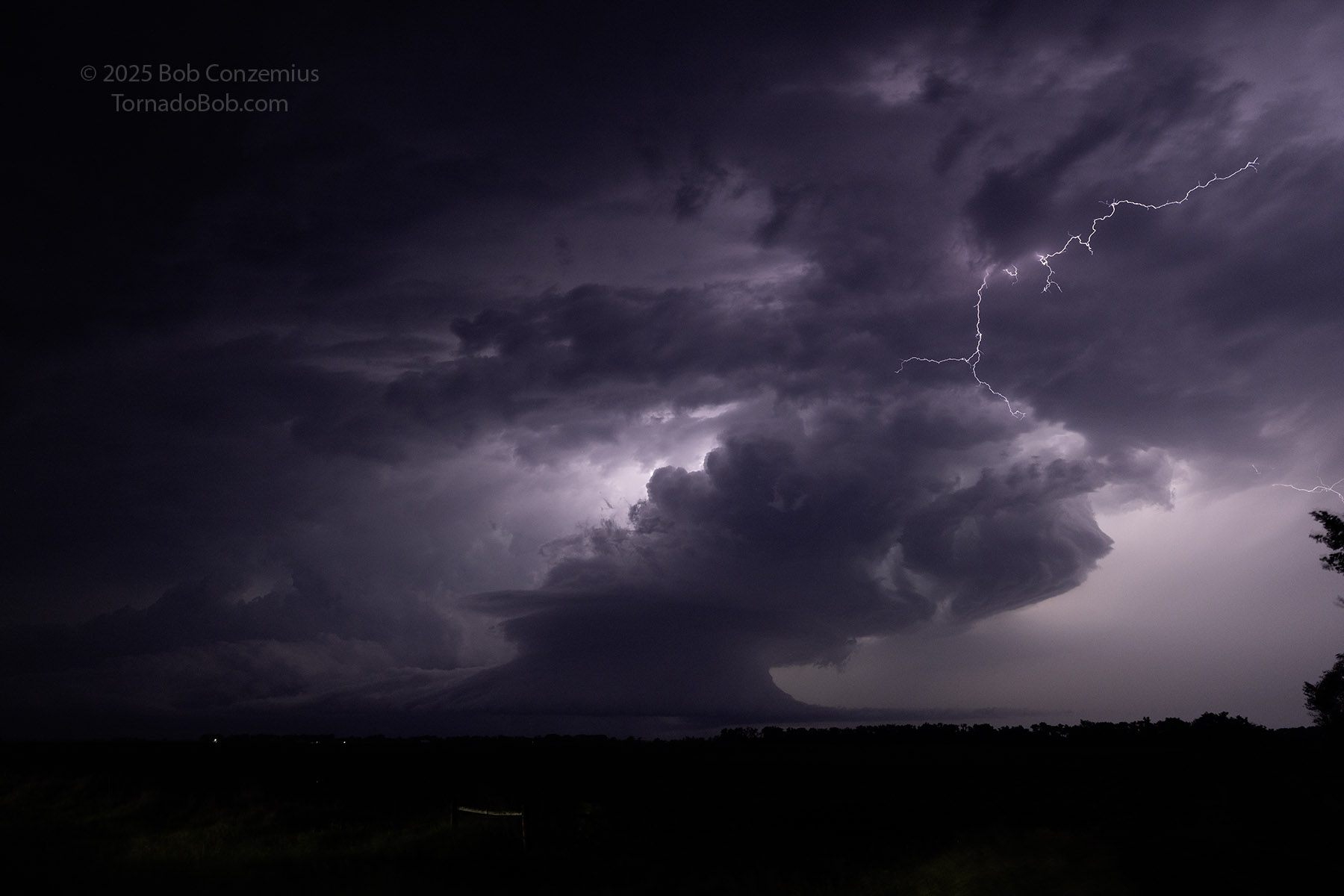
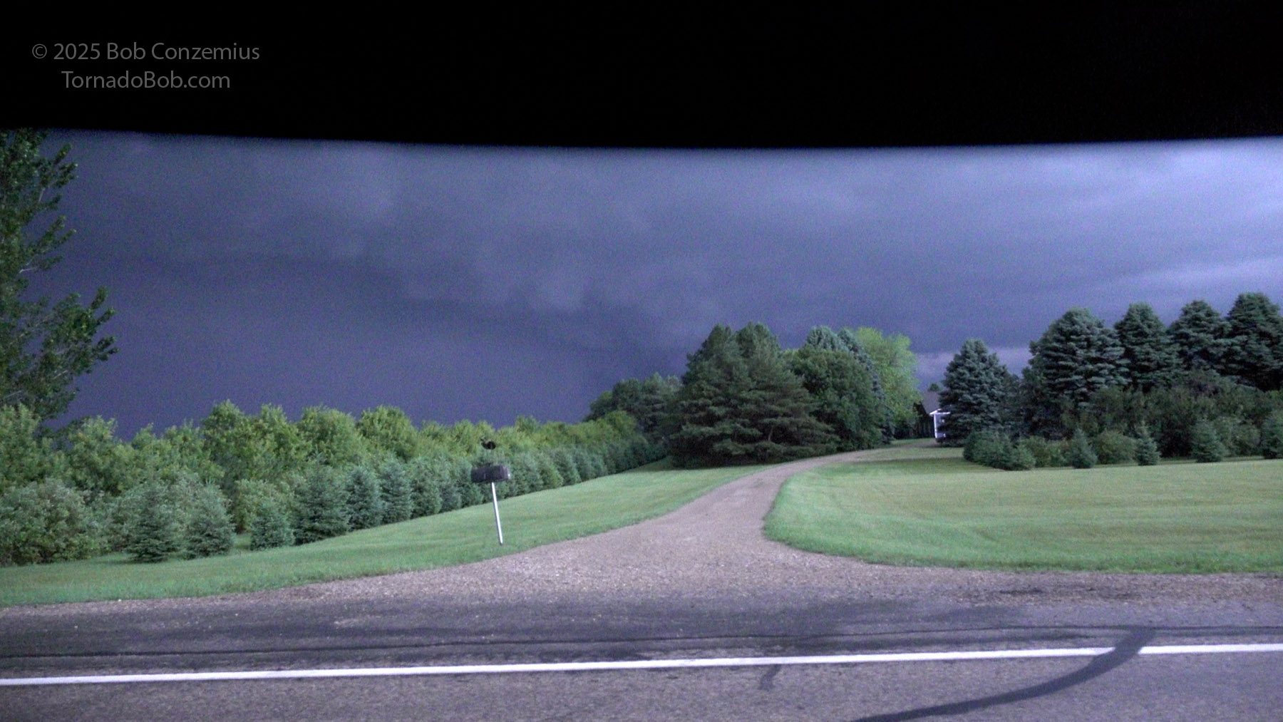
From this point, I drove back to Highway 18 to get closer to the cell. It appeared the tornado phase would be finished fairly soon because the squall line was overtaking the storm from the west. The original supercell updraft also became skinnier and more tilted as the squall line caught up to it. When I got to Highway 46, however, this updraft no longer looked so skinny. In front of me, I now saw an HP process storm. My perception of the storm could have been influenced by the fact that I was much closer to it now, but it looked suddenly a lot more ominous! The storm apparently had at least one more tornado to produce. Below are a couple still captures as I moved north on 18.
Still capture moving north on Highway 18 around 11:31 PM.
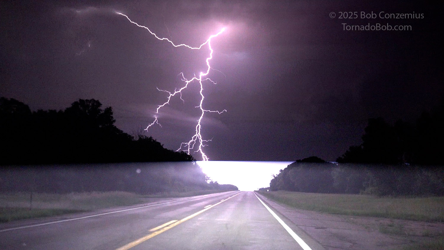
Around 11:31 PM. The lightning was impressive.
Around 11:36 PM.
Amazing lightning.
Getting closer to the updraft base of the supercell, which is beginning to be absorbed by the squall line.
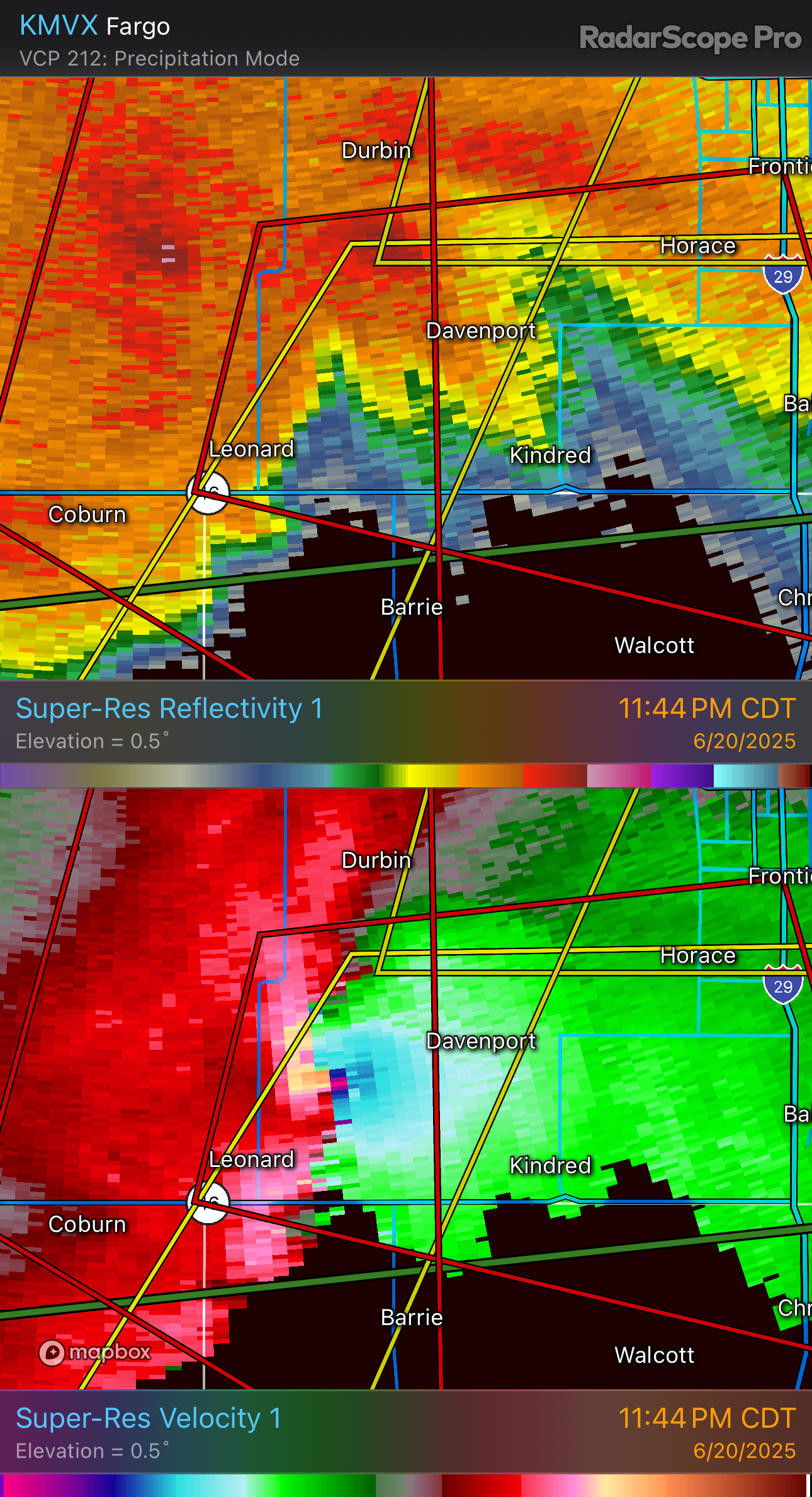
Approaching Highway 46 at 11:44 PM. Storm is looking pretty impressive again. There is a much larger (visibly HP) mesocyclone.
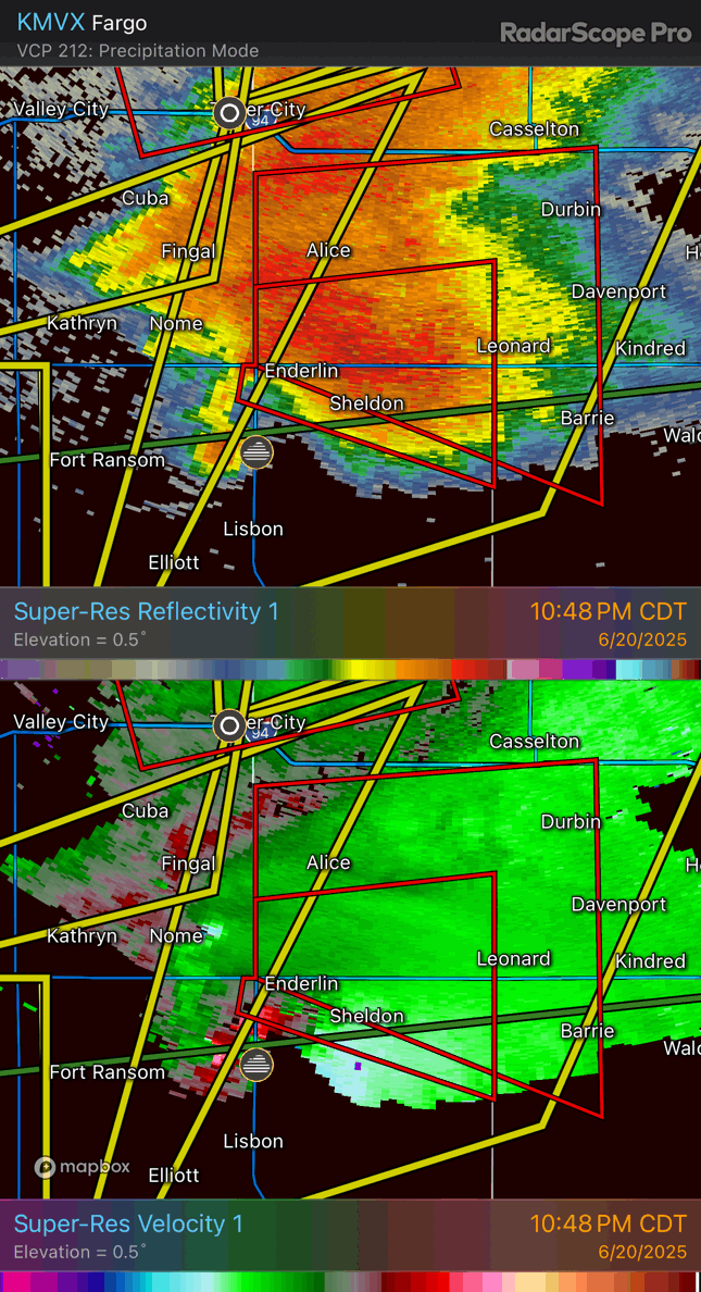
Radar during this period showed a lot of strong velocity maxima strengthening and weakening. As the second Enderlin tornado dissipates, strong inbounds just over 100 mph develop near Kindred. The apparent mesocyclone from Enderlin (there actually appears to be two hooks) EF-1 approaches, and the velocity couplet becomes more coherent west-northwest of Kindred. The couplet then moves quickly east and quickly weakens as it is overwhelmed by the squall line, which finally completely engulfs the supercell. The Kindred tornado was rated EF-1 with two satellite EF-0 tornadoes paralelling its track (see FGF's page on the event, link above).
Strong (>100mph) inbounds near Kindred prior to the Kindred EF-1.
Radar image showing the evolution of reflectivity and velocity prior to and during the Kindred EF-1.
Strongest appearance of the velocity couplet of the Kindred EF-1.
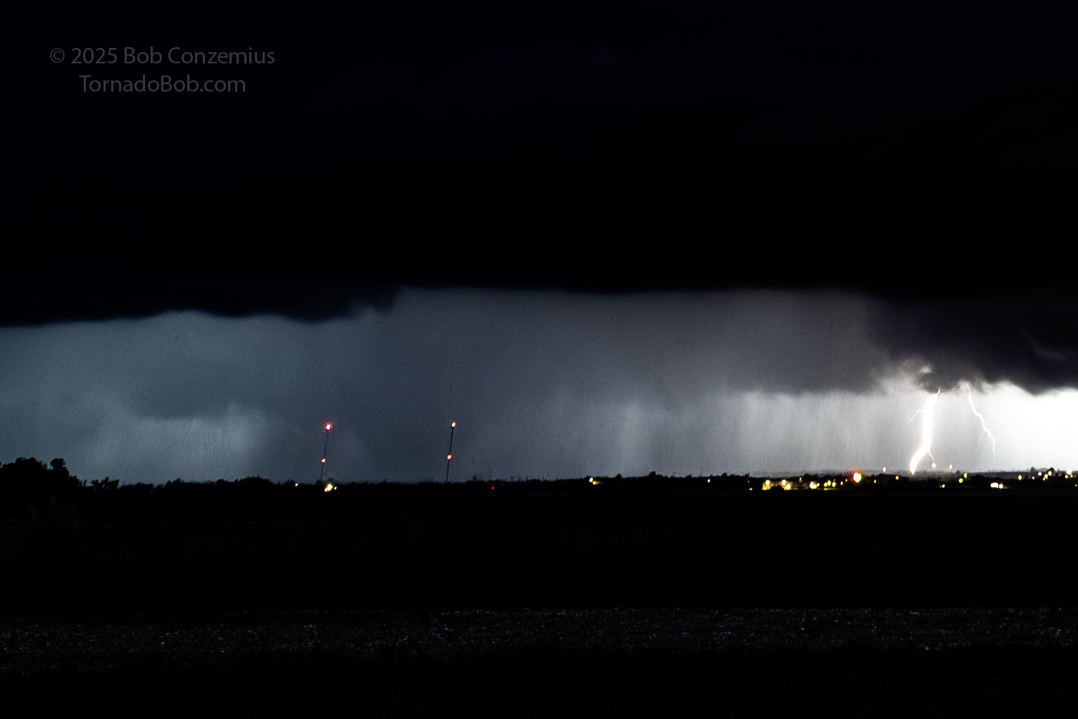
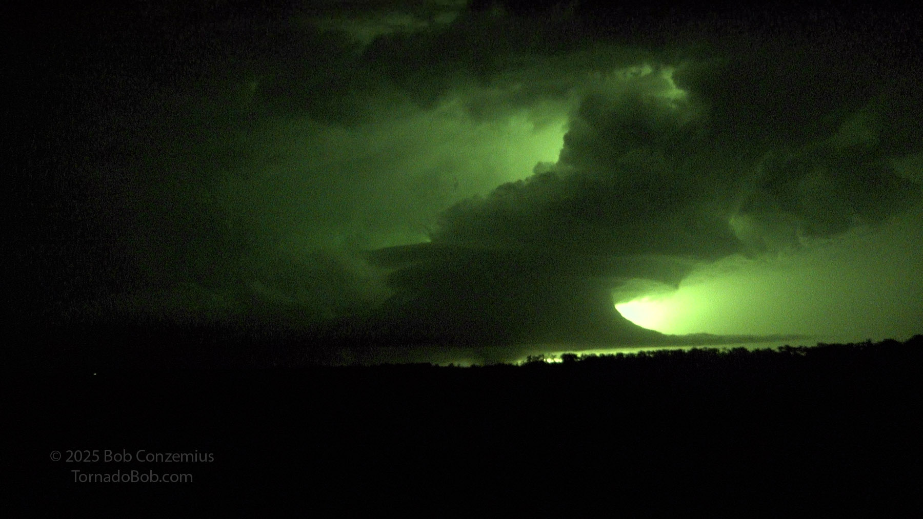
I drove east a bit on Highway 46 and shot a minute or two of video out my left window (looking north). Flashes revealed a rain-filled circulation.
Looking north from Highway 46 at 11:46 PM, about 1/3 mile east of the Highway 18 intersection. Foreground illuminated by a lightning flash. An EF-1 tornado is in progress about 3 miles to the north of my location in that rain-filled area on the left side of the picture.
I continued eastward then stopped briefly to figure out what was behind me. To my immediate northwest, what I saw led me to believe there might be a tornado coming at me, closing the remaining distance pretty fast, so I hopped back in the car and made the decision to keep driving quickly east until I was safely ahead of the circulation. As I drove, I found myself in increasingly uniform outflow winds. The tornado damage path stopped about a mile north of the road, just west of Kindred, as the outflow-dominant storm from Montana overtook everything. I'm somewhat doubtful what I saw behind me was a tornado because my video captures showed only an HP process storm (tornado had to be inside the rain area, not along its front edge), and the damage path did not show the tornado getting that close to the road. Either way, distance is hard to judge at night with something that close.
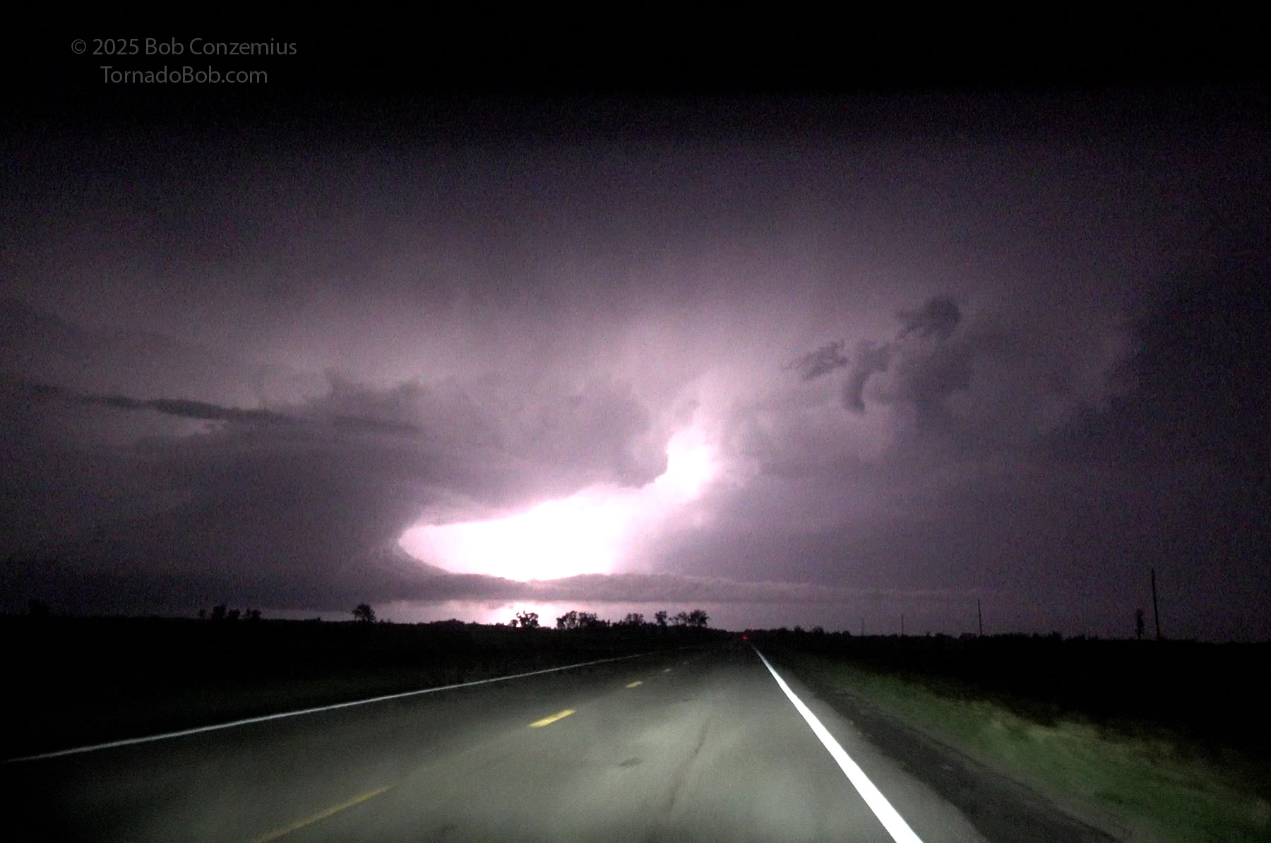
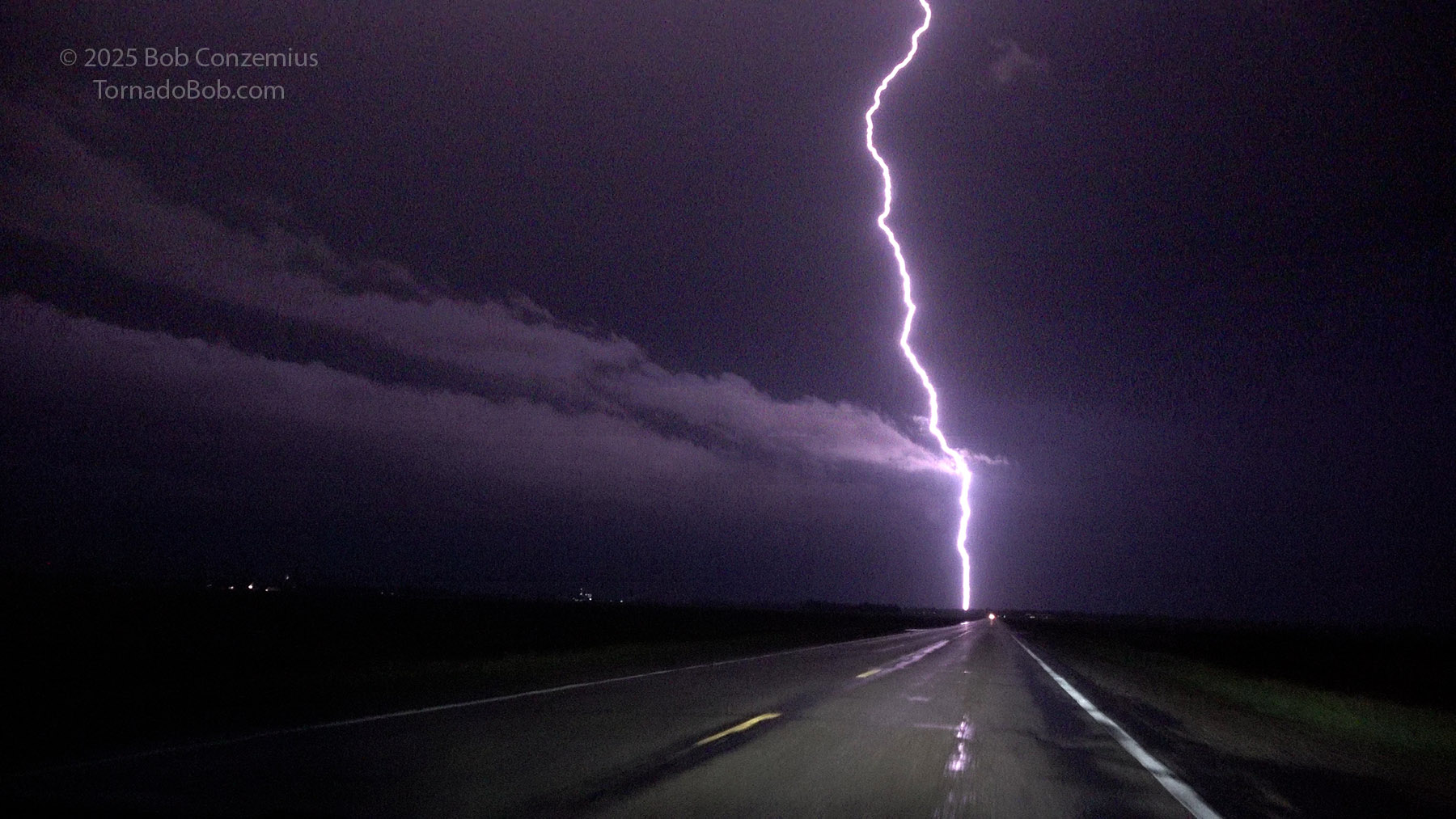
Lightning bolt looking eastbound on Highway 46, at 11:49 PM, driving toward I-29.
Radar image showing the Supercell (and the Kindred circulation) becoming fully engulfed by the squall line.
Whatever the case, I reached I-29 and decided to park on the northbound entrance ramp and wait out the core. I wanted to let the worst of it pass me before returning to Fargo to charge and then go home. I was hit by blinding rain and strong winds. I'm glad I stayed put until the rain let up a bit. It would have been almost impossible to see.
Here I was, now getting hit with the squall line, before driving back to Fargo to charge before heading home.
When the wind (and also the rain, to some extent), began to subside, and I was confident I would not have any large hail, I began driving northward to Fargo. By the time I reached the city, there was only some very light rain falling. The Tesla navigation system wanted to take me to a different charger a little more out of the way and north of I-94, but I routed myself to the same charger I had used on the way out. This was closer and had the convenience store next to it.
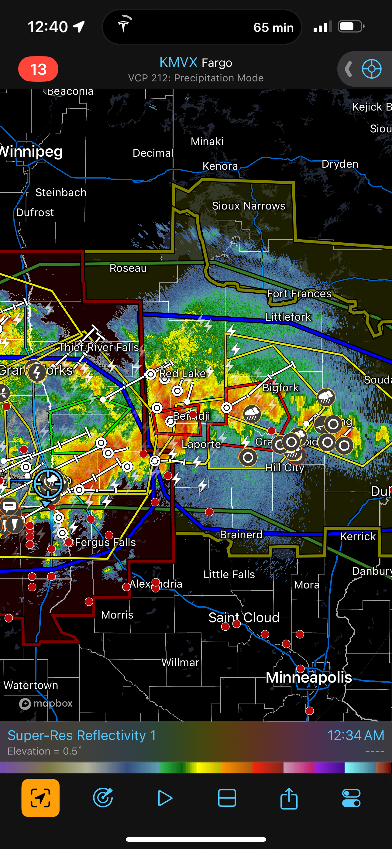
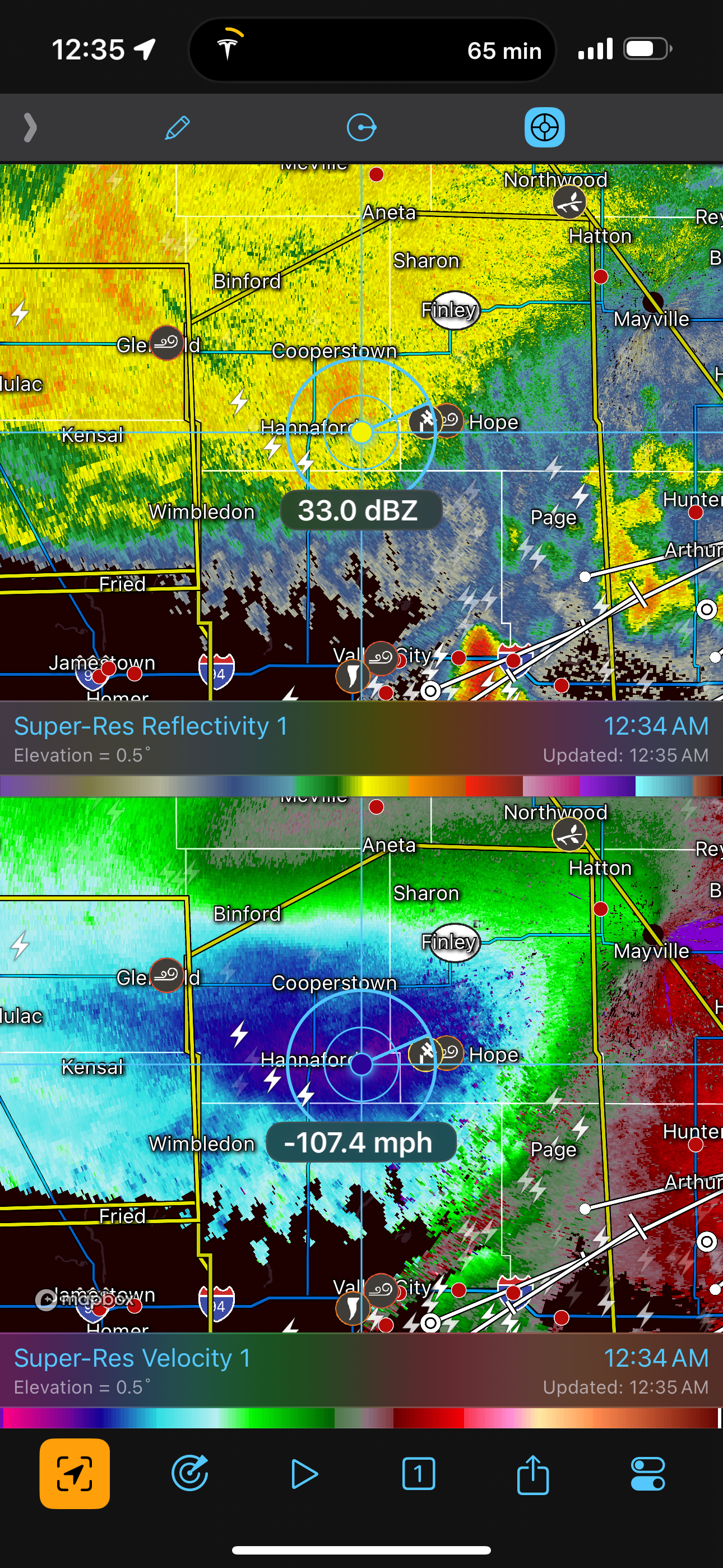
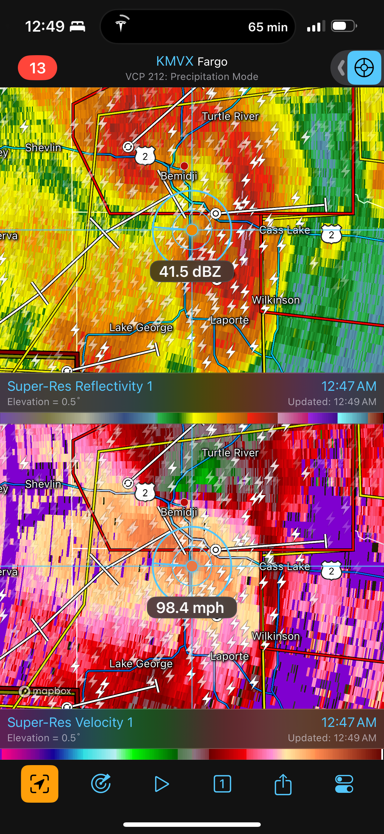
While charging, I decided to look at radar to see what I would have to drive through on my way home. It did not look great. The view into Minnesota showed storms lined up east-west, and they would likely cover my route home, making for a long drive through heavy rain. To my northwest, in North Dakota, there was a fairly large area of 100+ mph wind coming southeastward through the trailing stratiform precipitation region. I hoped those would not expand and affect my charging session in Fargo or my drive home. They looked like they might pass to the north. Also particularly noteworthy was a supercellular storm, embedded in the east-west line, moving trough the Bemidji area. This storm was hitting the Bemidji area with winds over 100 mph!
The Bemidji storm was the costliest one of this event. Damage estimates were between 70 million and 80 million dollars. This amount, apparently, was just short of the level required for federal assistance, so Beltrami County was left to clean it up on their own. I wonder if they could have looked a little more carefully for another couple million dollars of damage, because it seems like they would have found it given how extensive the swath of destruction was. Trees were leveled and snapped, and buildings were damaged, with some of the building damage looking like it crossed the EF-2 threshold.
It looks like I might have a lot of storms to drive through on the way home. Storms are lined up east-west in Minnesota
Meanwhile, very strong winds are coming across eastern North Dakota north of Fargo. I hope this doesn't hit me while I'm charging and knock out the power!
Very strong winds are coming through Bemidji! I'm glad I don't have to drive through there, but I'm worried about the town.
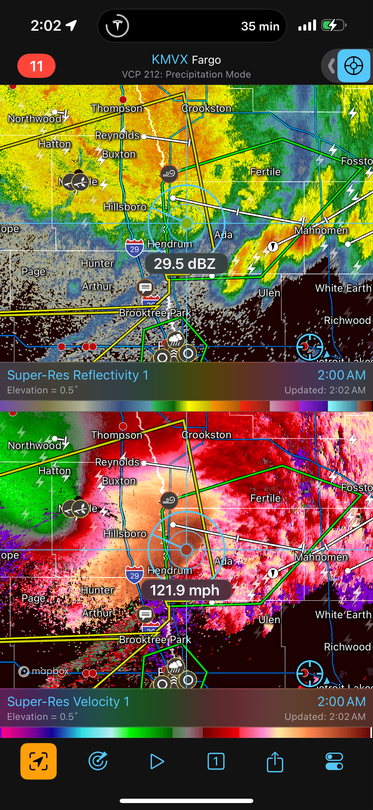
Back in Fargo, I unplugged after about a 30- or 40-minute charging session and started the rest of the drive home. I stopped on Highway 10 between Moorhead and Detroit Lakes to look around at things and check radar again. That area of strong winds in North Dakota was now crossing into Minnesota with speeds hitting 120 mph! Somehow, the damage in those more open areas was not as extensive as in Bemidji, but maybe that was only because there's less stuff to damage in the more more open landscape. Surely, there must have been at least some flattened crops.
Winds are more than 120 mph!
The rest of my drive did not really have much rain. By the time I came through, the storms had moved south or east of my route, and crews had already cleared most of the fallen trees from the road. A couple still remained, partially blocking the road, but I was easily able to drive around them. I made it home around 4:30 AM.
I would have a chance to see the destruction in the Bemidji area within 36 hours. I would chase again on June 22.