July 27, 2025 Squall Line
Isle Royale
For the second day in a row, Isle Royale was hit with a squall line. The storms today delivered an even more deeply structured shelf cloud than yesterday's storms. Unlike yesterday, Isle Royale was within a slight risk area for severe storms, and there was also a two percent risk of tornadoes, although this would be exceedingly unlikely at this time of year over Lake Superior (more likely in the Fall when air temperatures are colder and the water is still relatively "warm"). It was an active day in South Dakota, with one of 2025's most photogenic tornadoes happening at Henry, South Dakota. I did not have much cell phone service, but I was aware of storms approaching, so I kept an eye on the western sky. We had left Siskiwit Bay in the morning and were boating over to Rock Harbor. Our planned destination was the Rock Harbor Lodge, which is near the eastern end of Isle Royale.
We stopped at Greenstone Beach (about the halfway point) to get out of the boat and hike around a bit. It was blueberry season, and we picked lots of them. When we left Greenstone Beach to continue to Rock Harbor, the skies were getting dark to the west. We knew, at that point, that we better not delay any further. We stayed mostly at a full cruising speed, and the storm structure gradually revealed itself out of the haze to the west. At first, it looked like a regular shelf cloud, but as it got closer, multiple new layers revealed themselves, and it became quite a visual spectacle. We reached Rock Harbor Lodge just as the shelf cloud moved overhead. Below are some pictures of that journey.
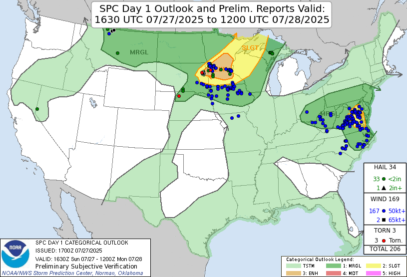 |
| Storm Prediction Center 1630 UTC Day 1 convective outlook with verification. |
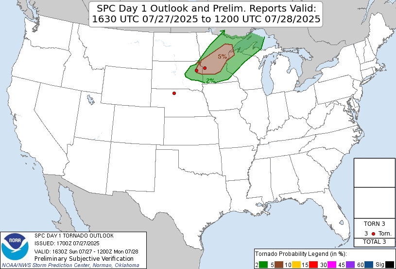 |
| Storm Prediction Center 1630 UTC Day 1 tornado outlook with verification. |
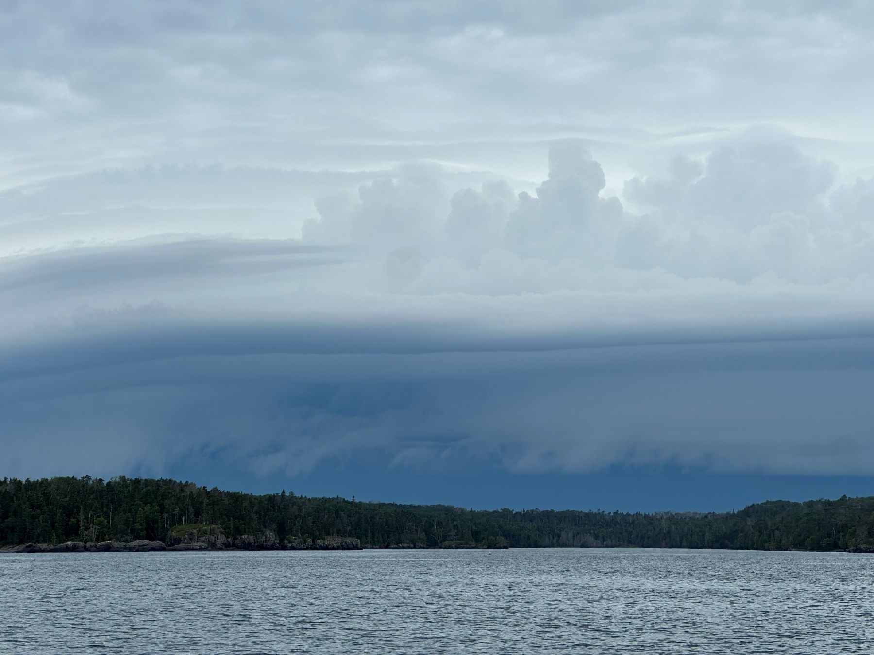 |
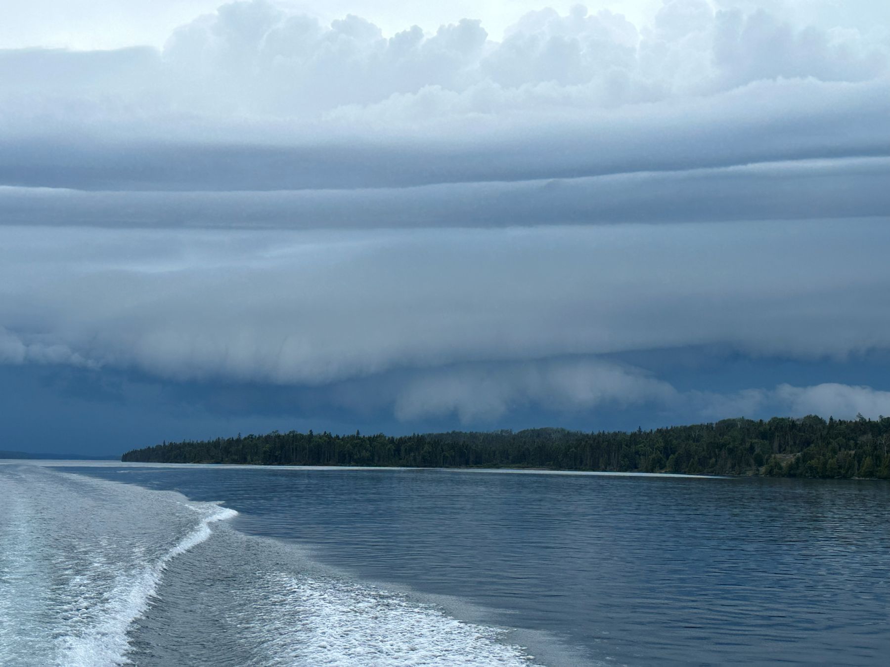
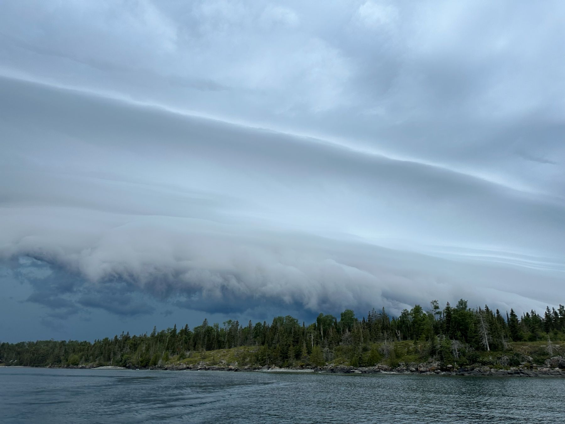
| The shelf cloud comes fully into view. We are still outside of Rock Harbor. |
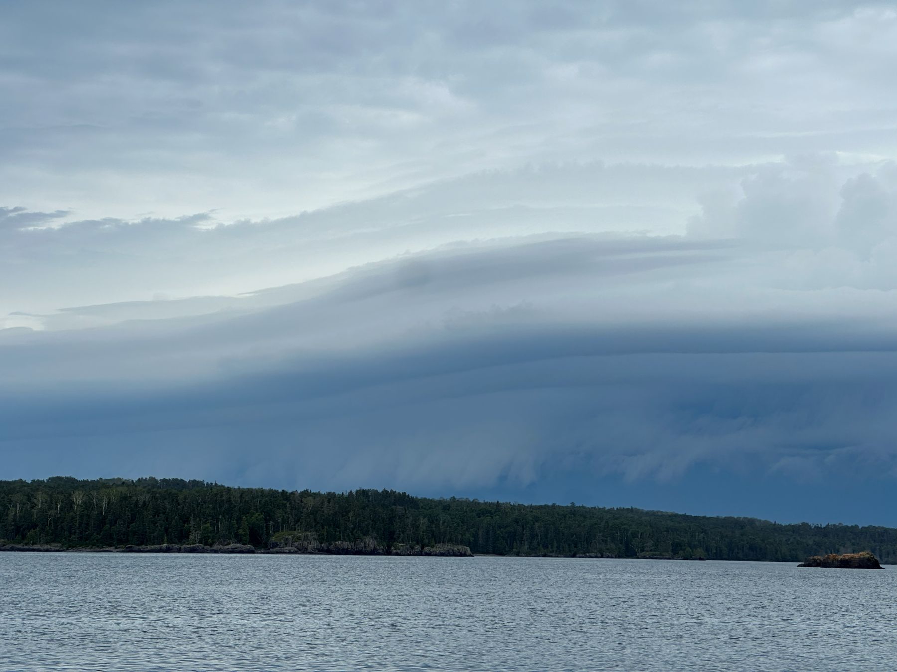 |
| Multiple layers to this shelf cloud. |
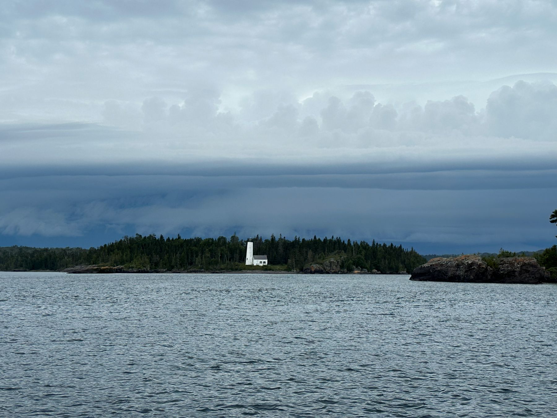 |
| We are about to enter Rock Harbor. This is the Rock Harbor Lighthouse. |
 |
| Another picture of the lighthouse as we enter the navigation channel into the harbor. |
 |
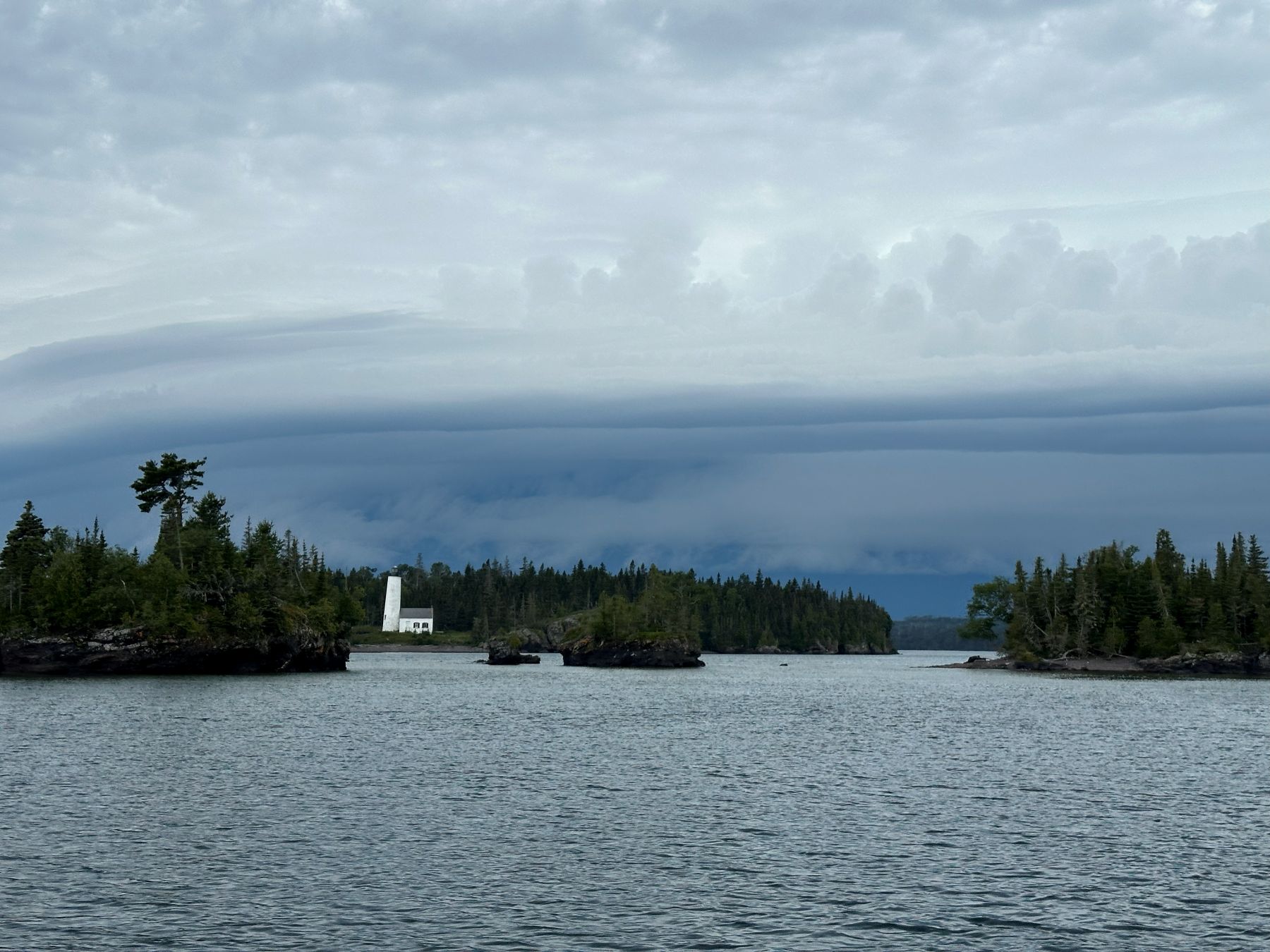
| Now we are in the harbor, looking at the western end. The shelf cloud is getting closer. |
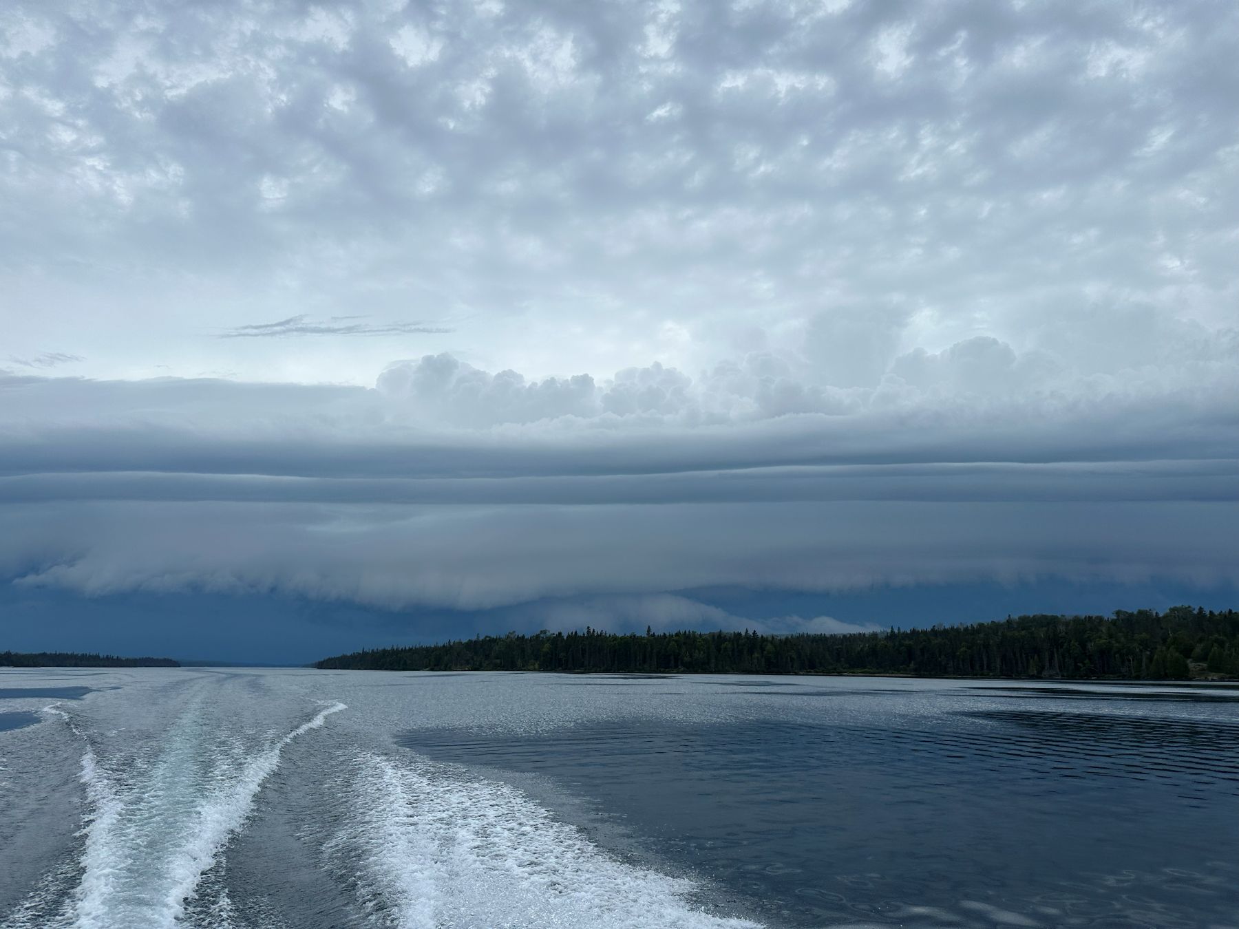 |
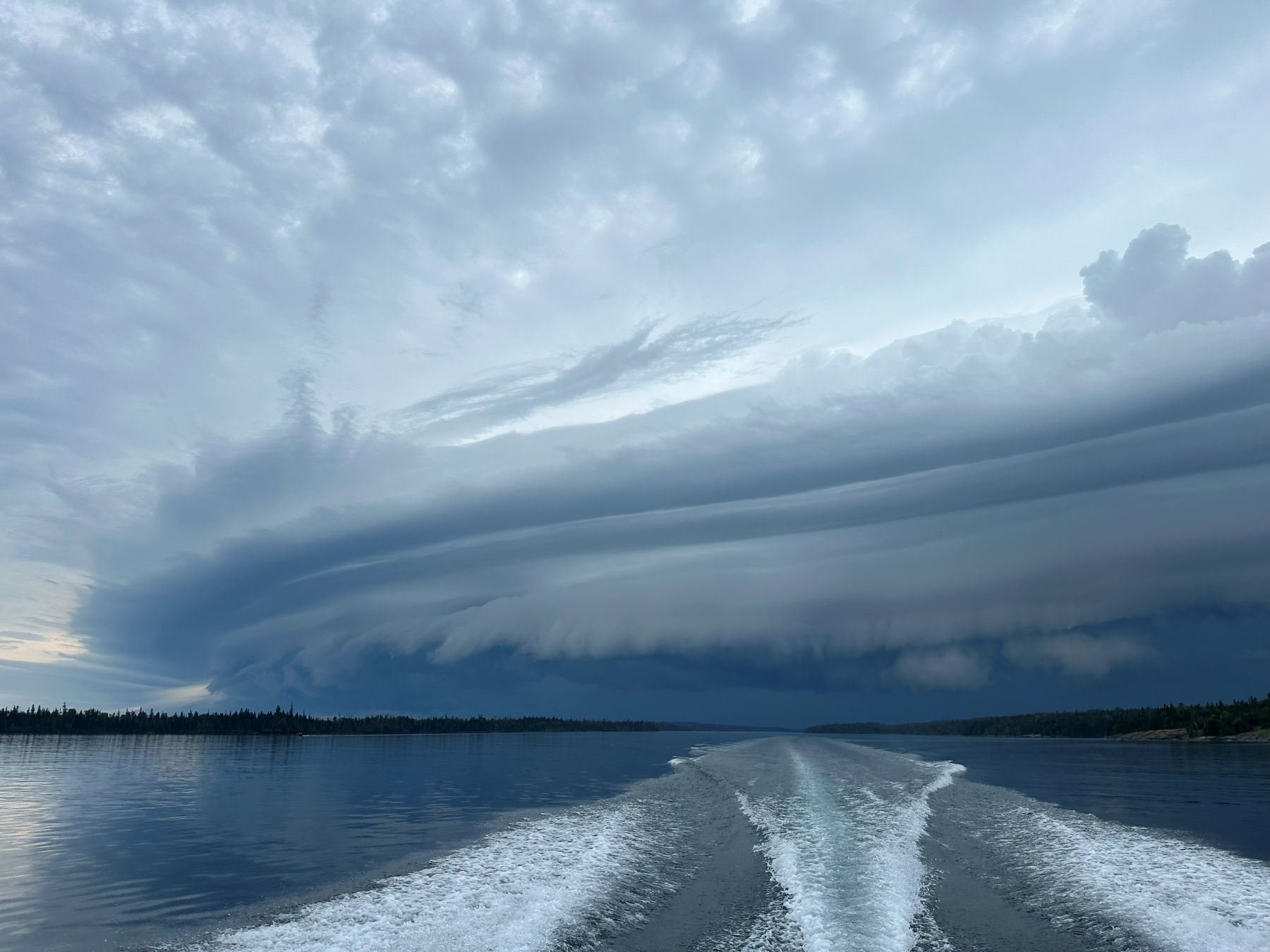
| You can see by our wake that we are not on a slow, leisurely cruise. |
 |
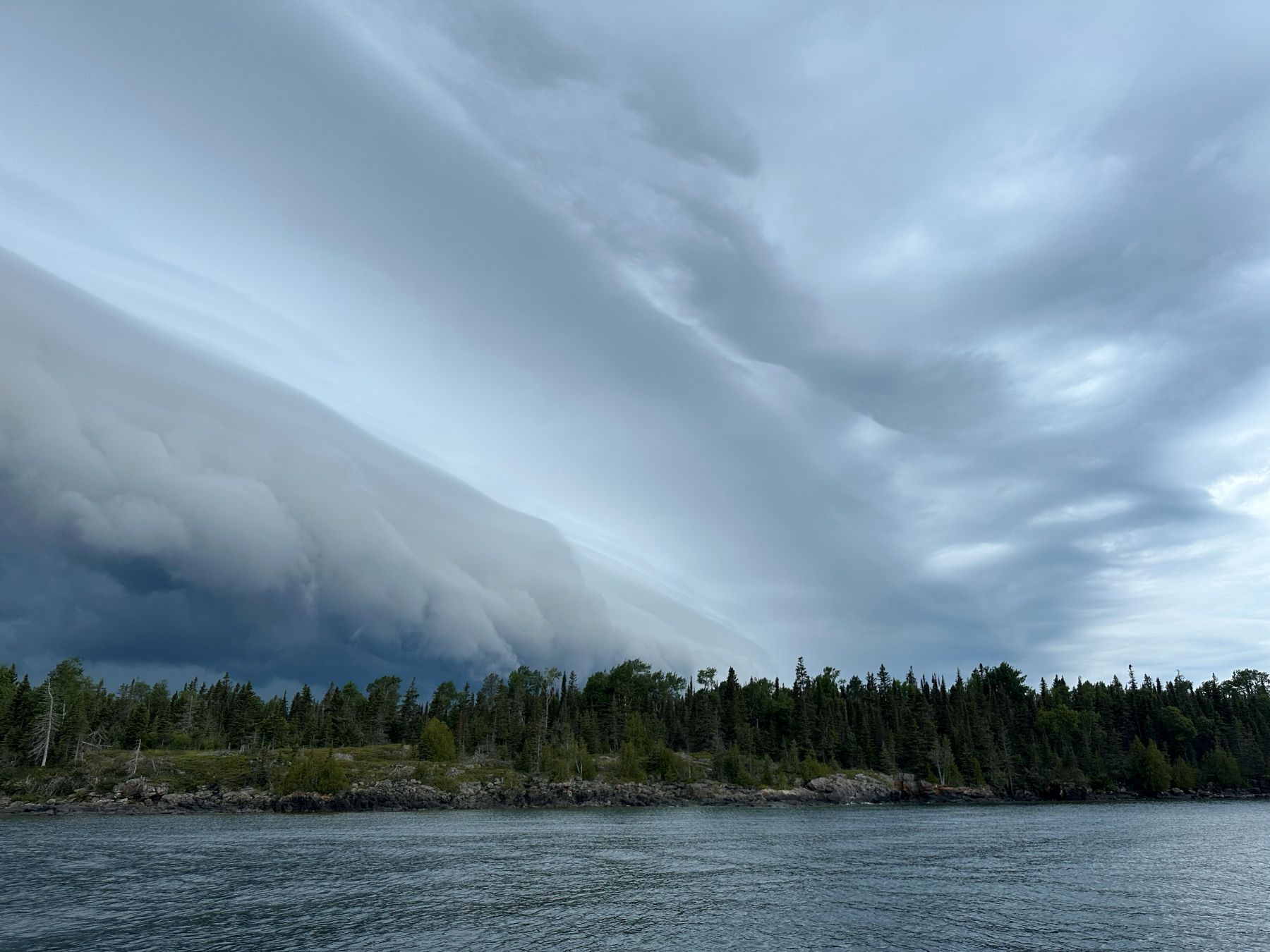
| More layers are emerging, and the squall is at least past the western end of the island. |
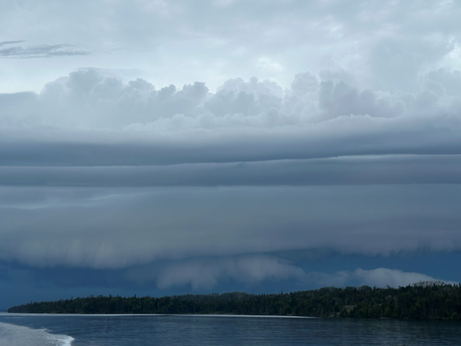 |
| Laminar below and convective (turbulent) above. |
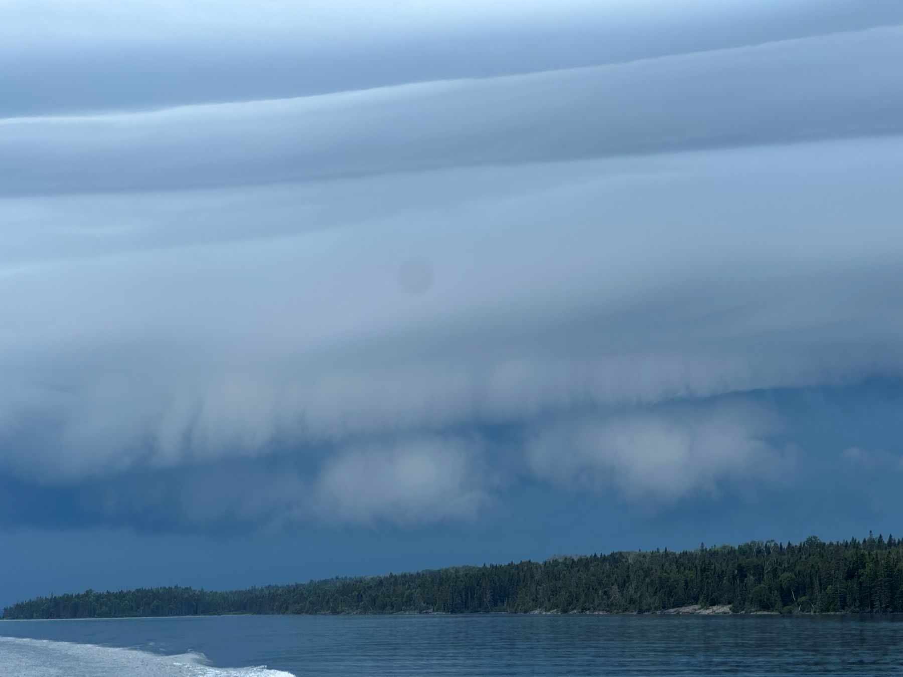 |
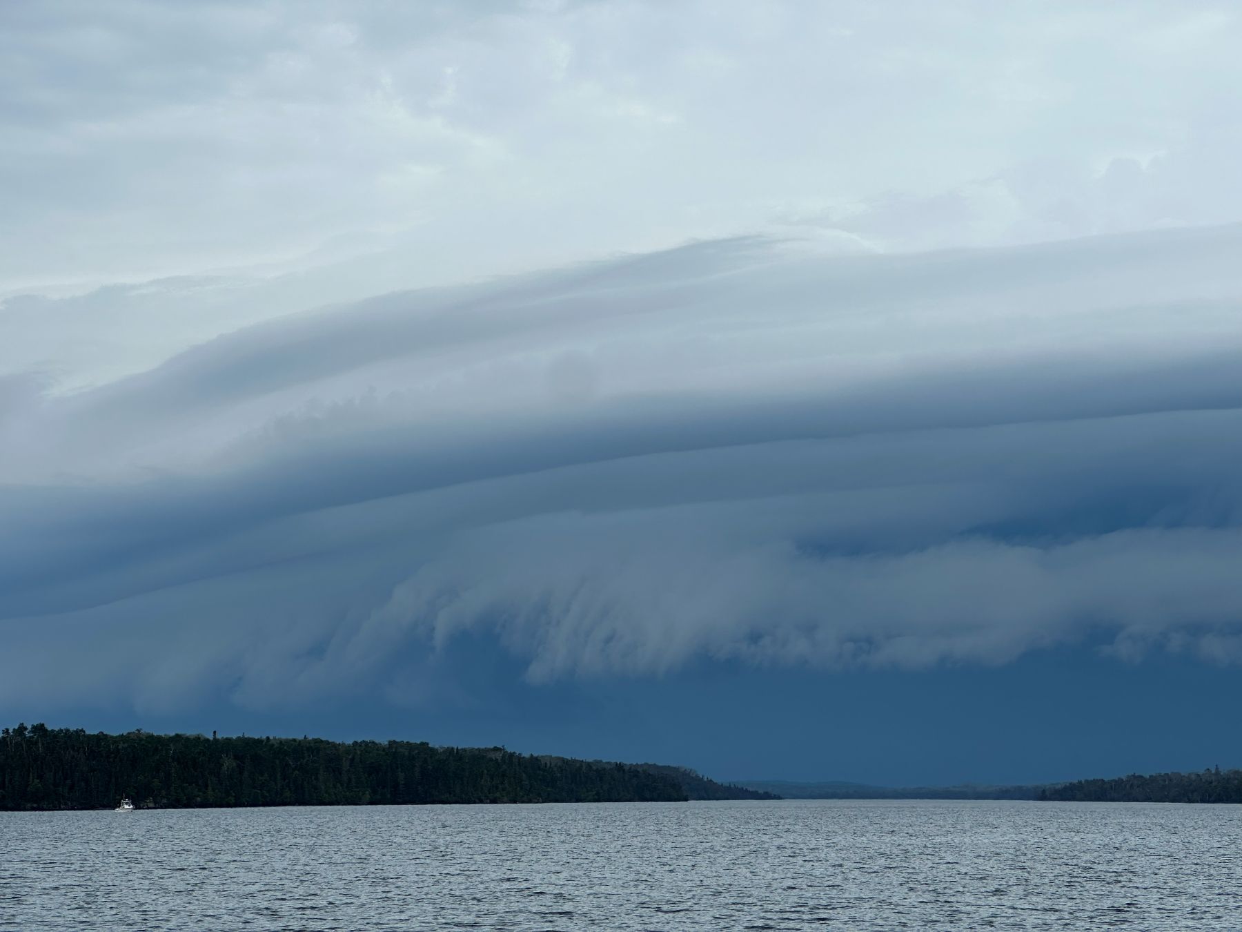
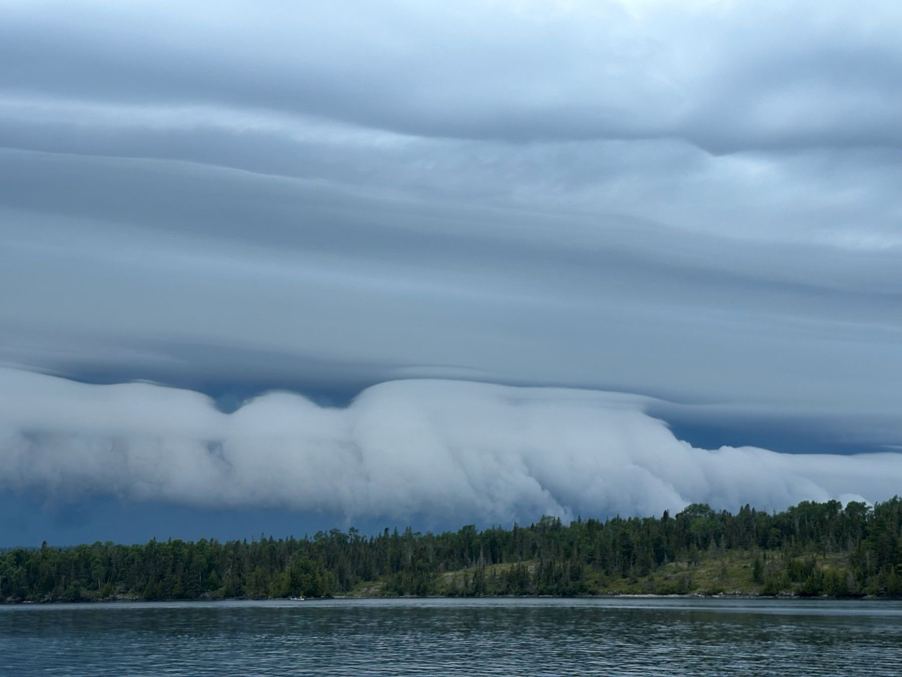
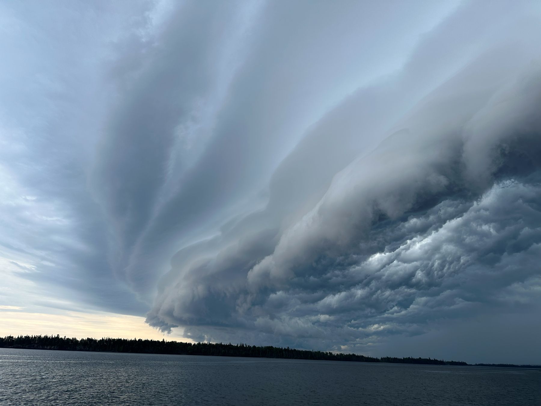
| Now, I think we can see all the layers. The core of heavy precipitation is visible behind it. |
 |
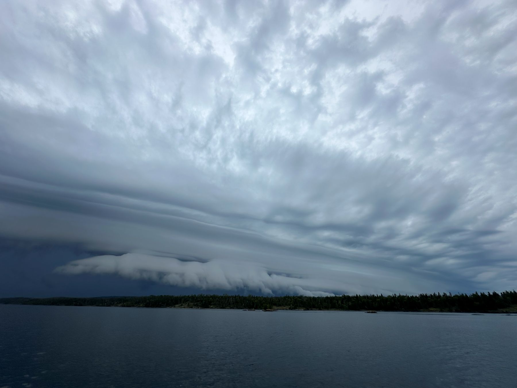
| Zoomed wider with the cell phone camera to show that we're still safely in front of it. |
 |
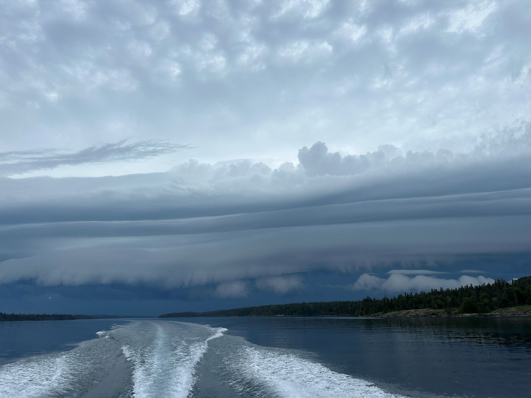
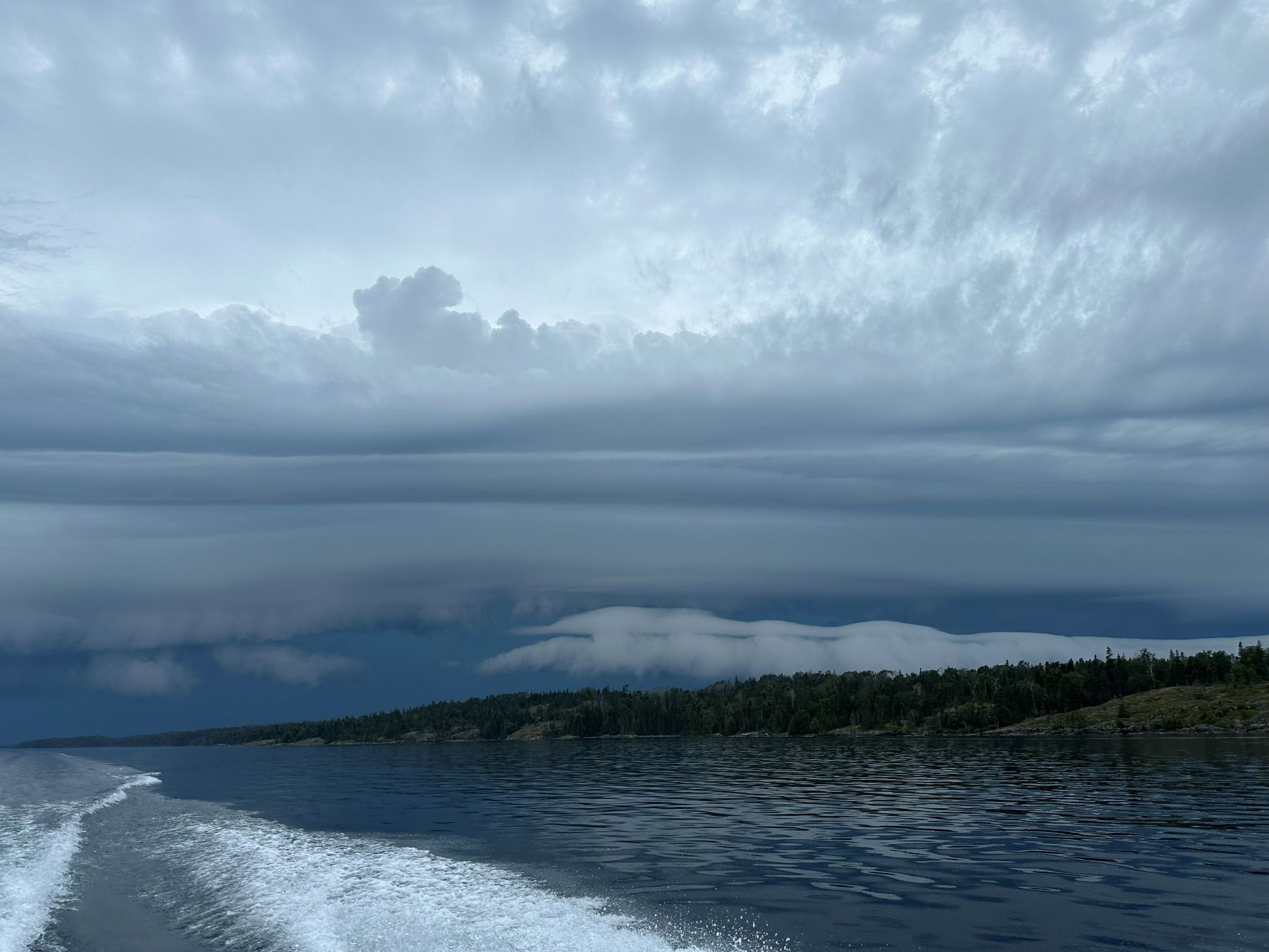
| Looking more southwest to see the horizontal extent of the storm. |
 |
| Looking back west now. The lodge is now in view ahead of us. |
 |
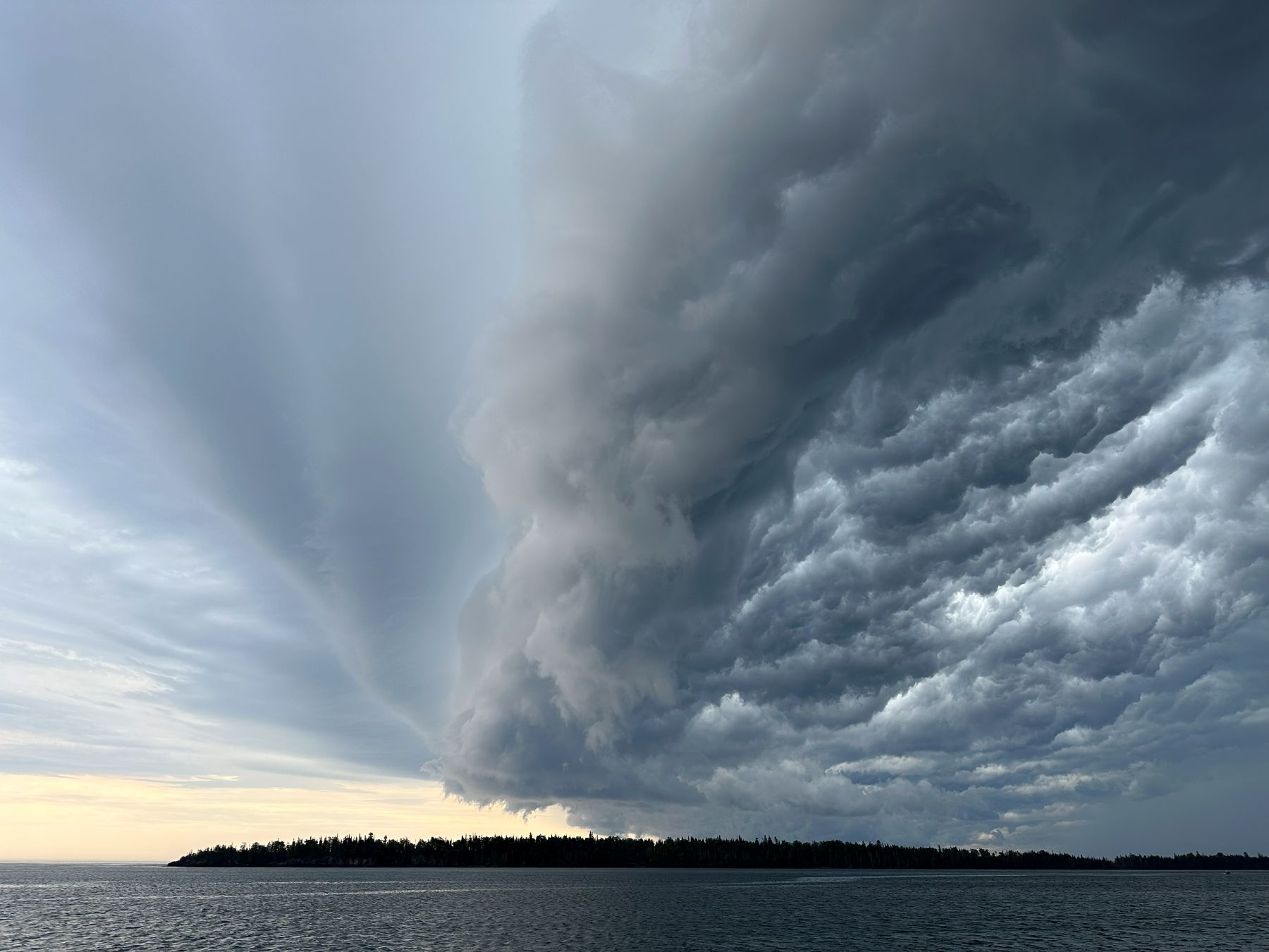
| This lowest layer looks like it's scraping the ground. |
 |
| Wider view. Waters are calm. This is the calm before the storm. |
 |
| We know we're in good shape now, so we slow down a bit to take a few pictures. |
 |
| We let this get a little closer before docking. This is looking straight north. |
 |
| Now, we can see the "whale's mouth" underside of the shelf cloud as the gust font approahes us. |
 |
| The lodge is right in front of us here, although this view is looking back at the shelf cloud. The wind has just kicked up! |
Back to Storm Chases | Home