July 11, 2025 Storms/Supercells
Juleburg, CO and Cheyenne, WY
The last day of the Tempest chase season was upon us. There was a slight risk of severe storms in northeastern Colorado and adjacent portions of Wyoming, Nebraska, and Kansas. There was an enhanced risk of severe storms in the Iowa/Illinois/Missouri vicinity, but that was well out of reach for us, given that this was the last day of the tour. The enhanced risk area had a ten percent tornado threat, and our area had less than two percent.
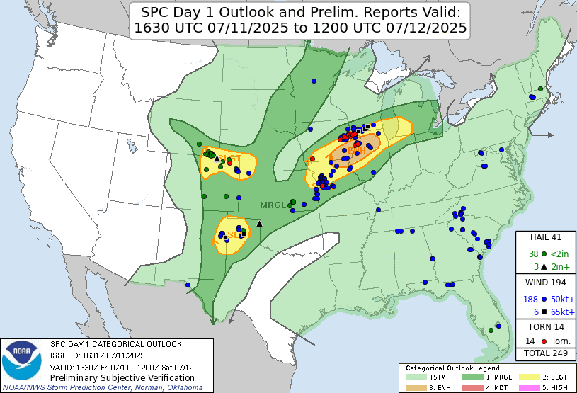 |
| Storm Prediction Center 1630 UTC Day 1 convective outlook with verification. |
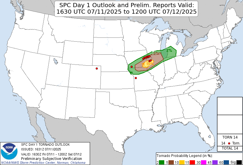 |
| Storm Prediction Center 1630 UTC Day 1 tornado outlook with verification. |
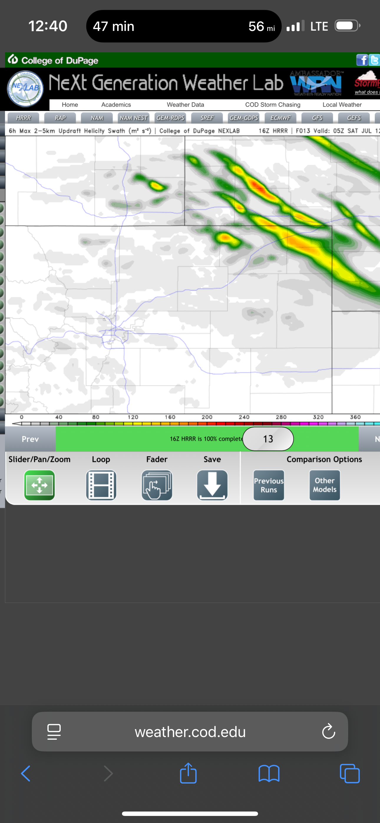 |
| CAMs showed plenty of helicity swaths in the Cheyenne Ridge vicinity. This looked like a great supercell day. |
We had a bit of extra time, and Martin wanted to show is the Lisius family farm, which was pretty close to Valentine, so we took a tour of the farm in the morning. It was pretty interesting to learn what the cost of the equipment was and how much farmers needed to have to have an efficient and profitable operation. That would be high stress work for me.
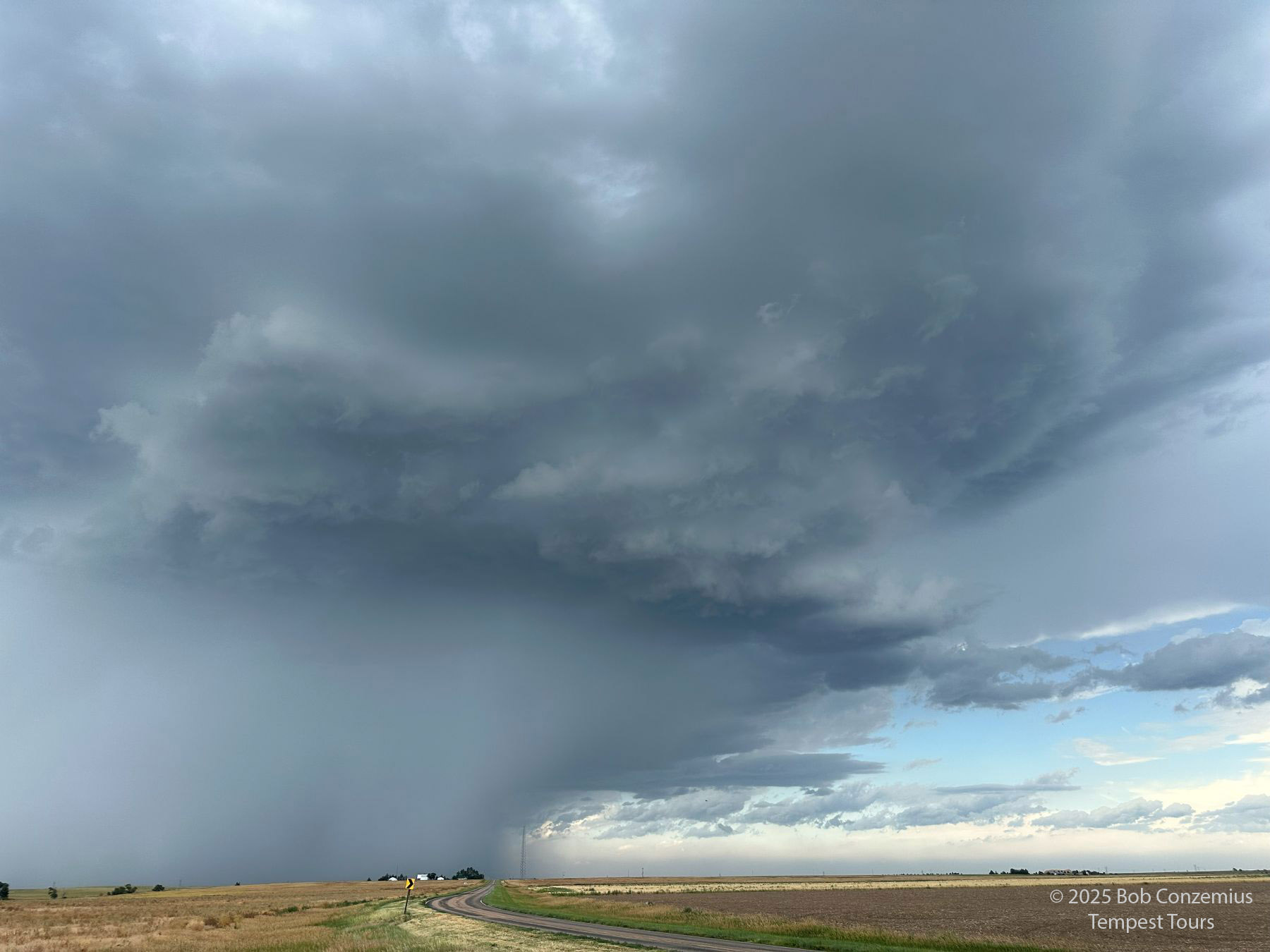
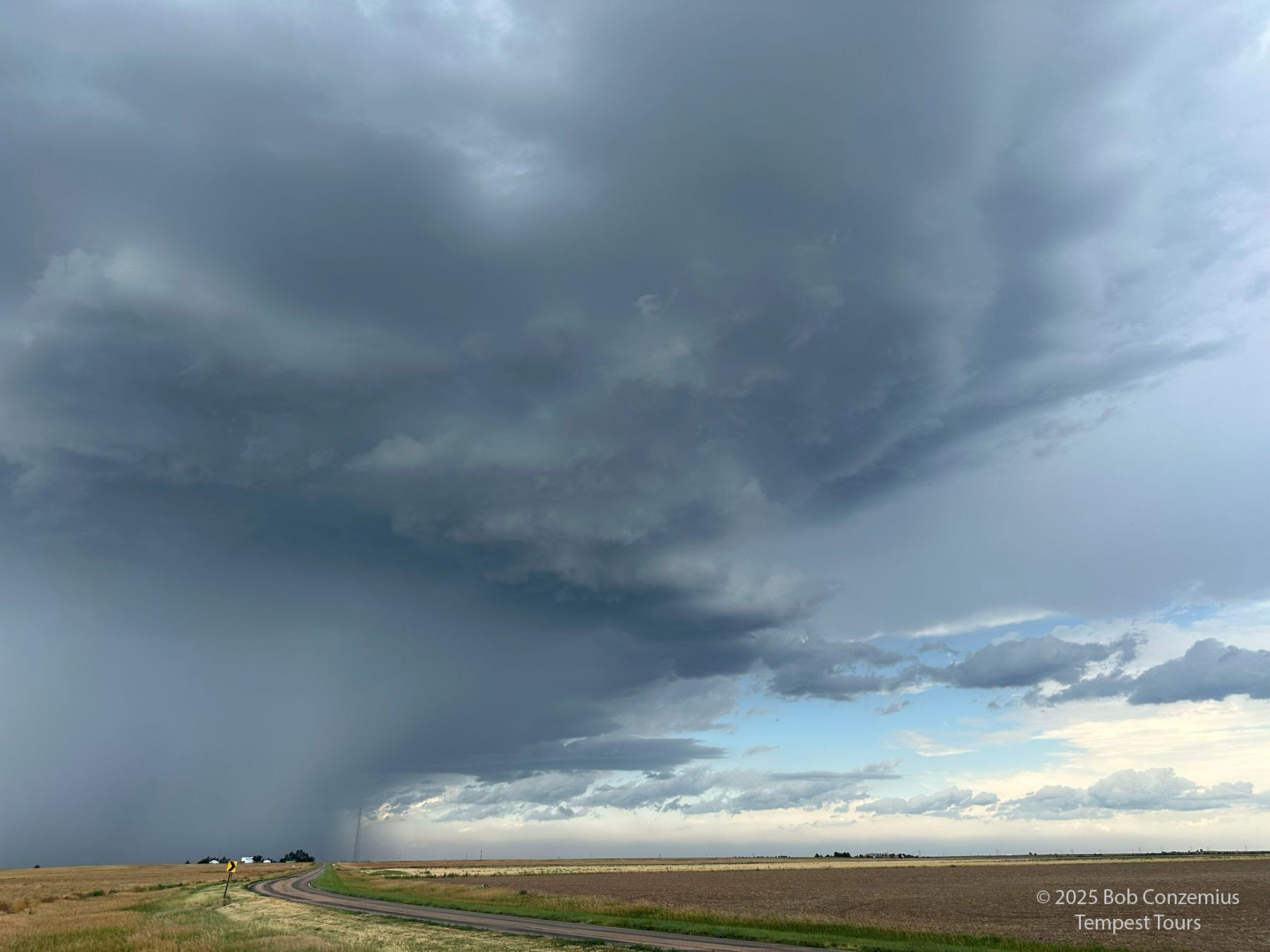
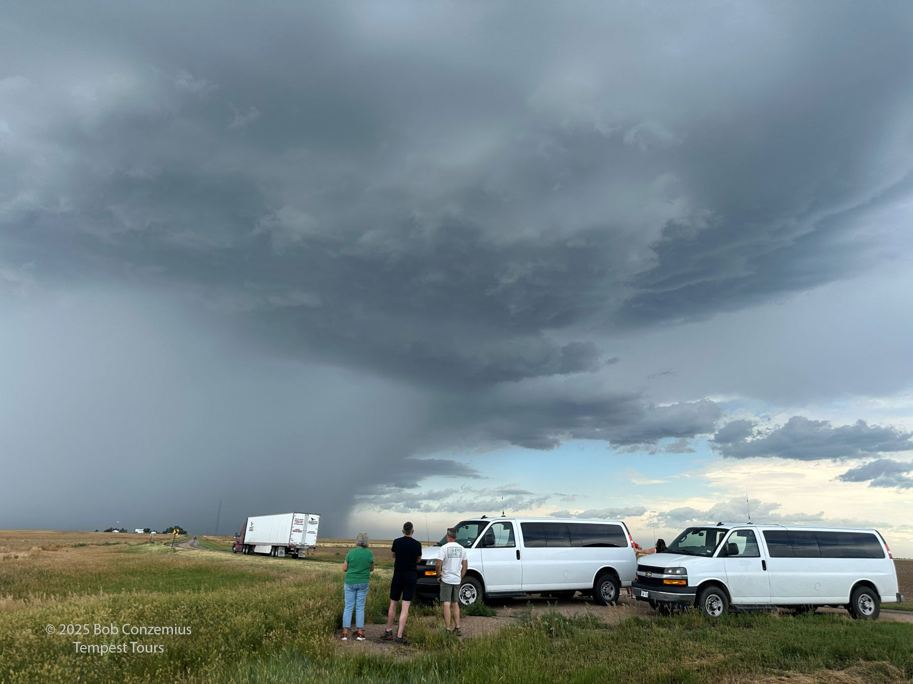
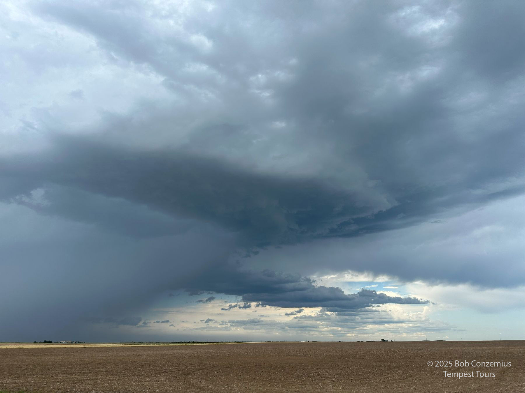
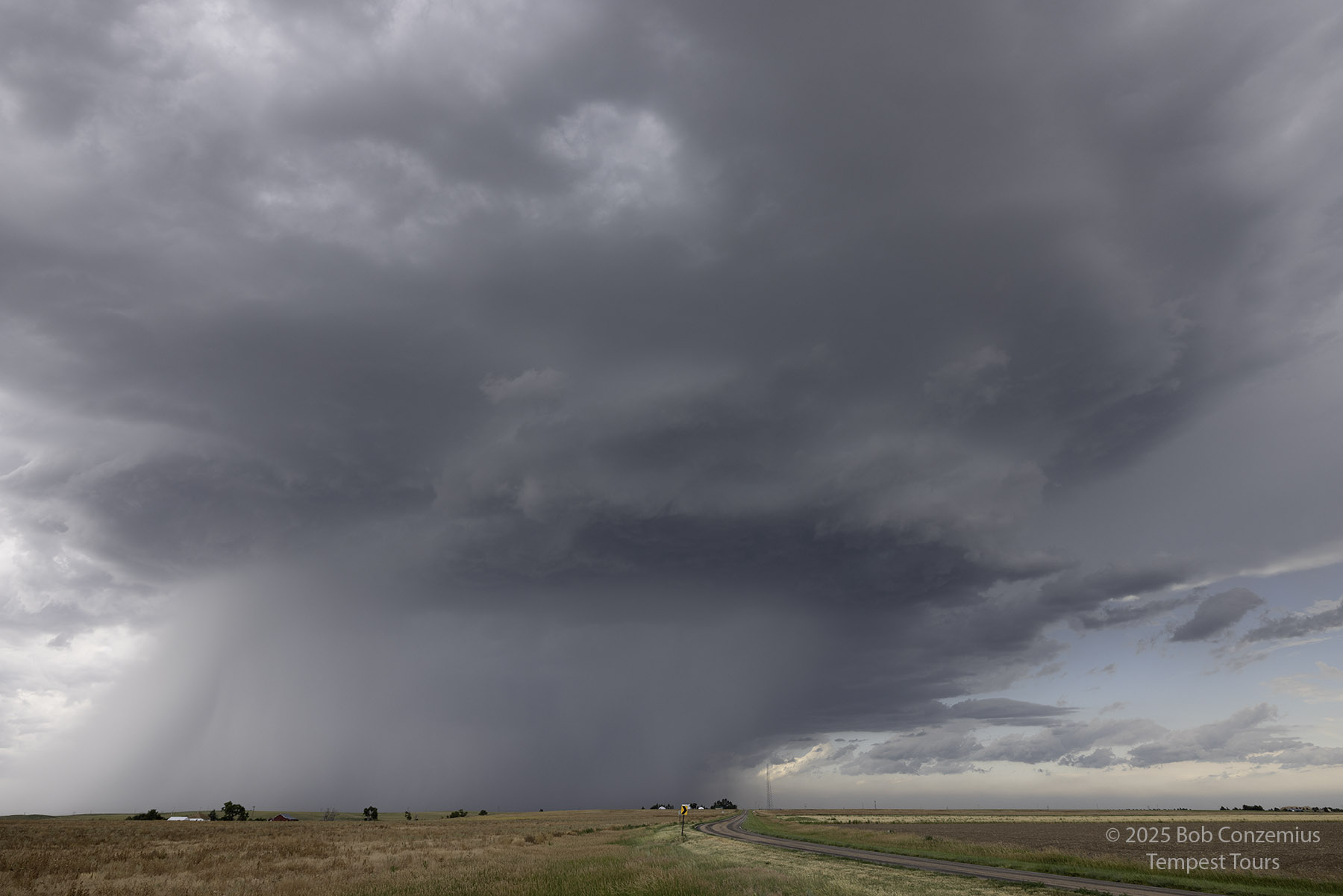
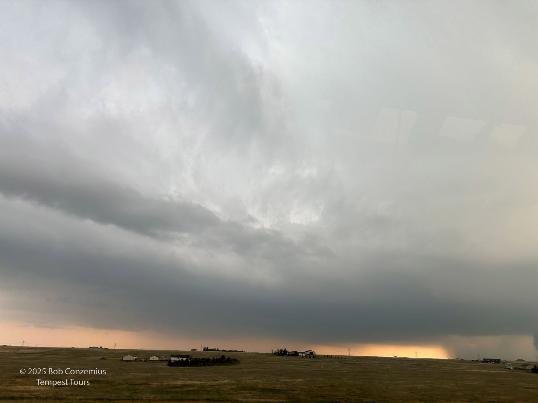
After the tour, we drove west to Julesburg, where we found some early storms. We stopped for a bit, thinking we'd just take a few pictures of a storm and then target bigger storms to the west. This ended up being our most photogenic photo of the day.
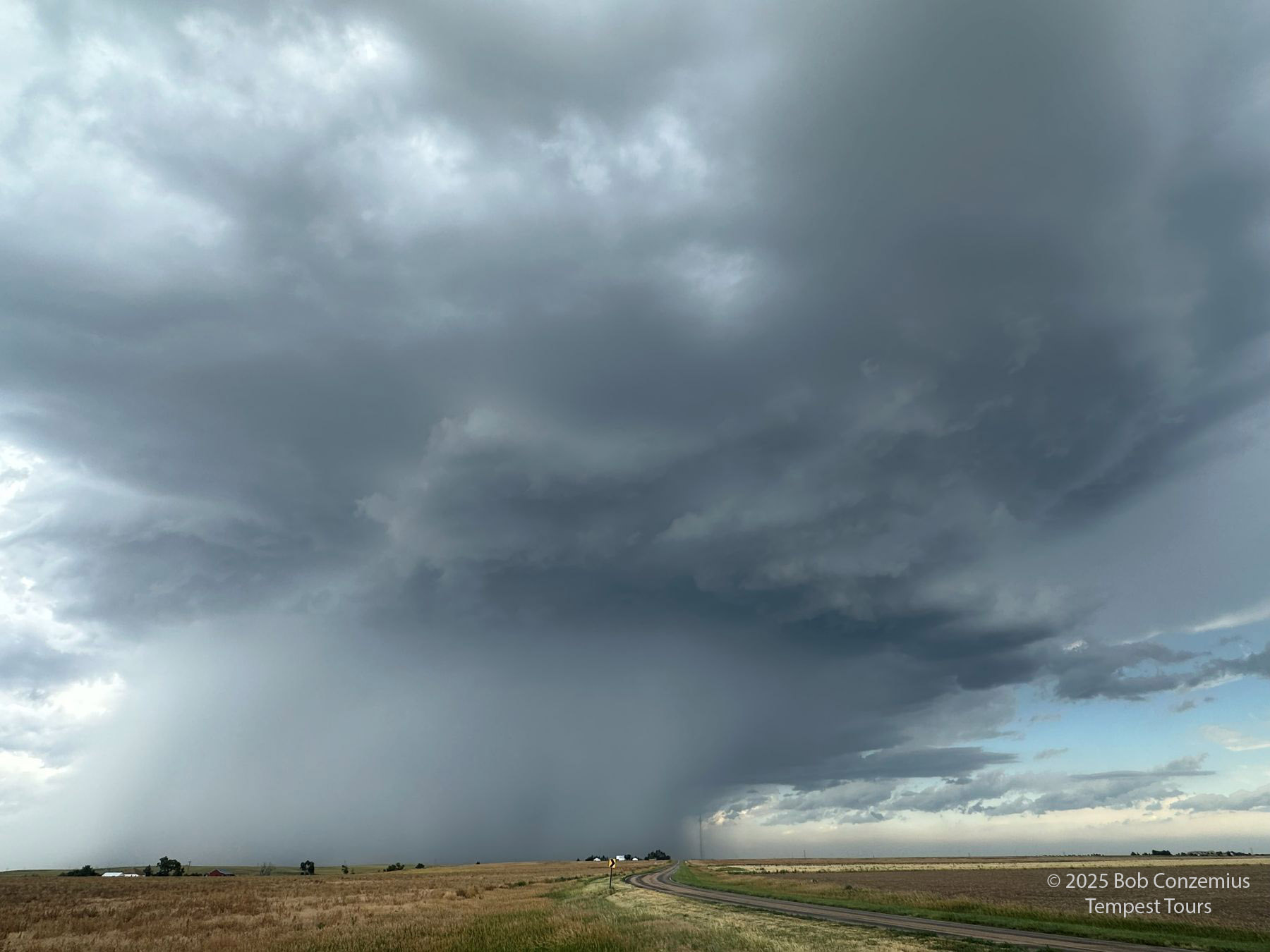 |
| Our early storm near Julesburg. |
 |
| Here's another picture of our early storm. |
 |
| ...and another. |
 |
| ...and yet another. |
 |
| Okay, here's the last one with my cell phone. |
 |
| But wait, there's more! Here's a shot of the same storm with the Canon R5. |
There were, indeed, more storms to the west, but there were so many storms and so many interactions among them that it was very difficult to single one out and intercept it before it interacted with other storms, and it fell apart. We drove west on I-80 to Burns, WY then dropped south toward Grover, CO, attempting to get in front of a bunch of storms on the Colorado side of the border, but to no avail. There was no dominant storm in this mess, so we turned around.
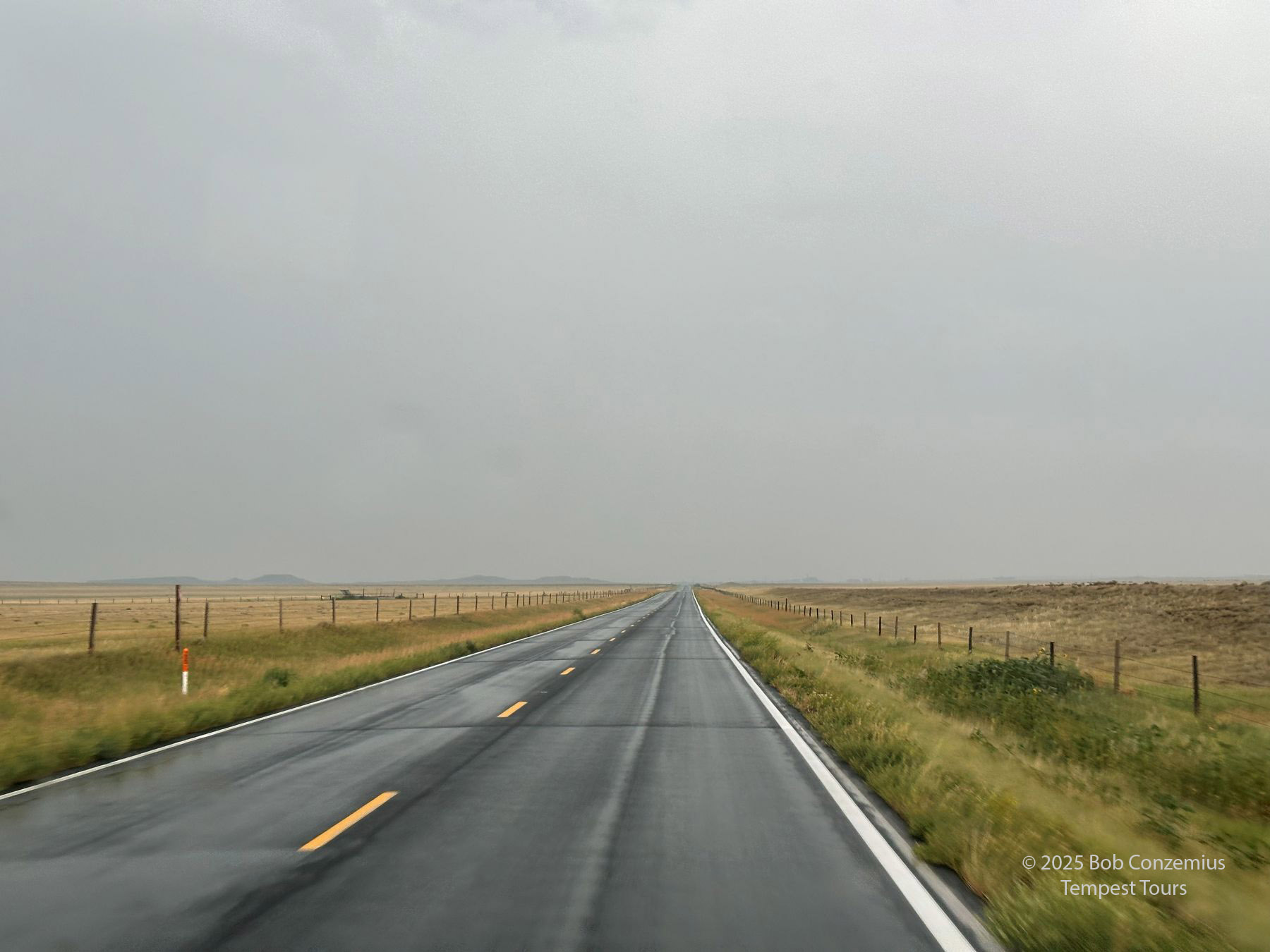 |
| Our view as we attempted to get ahead of storms near Grover, CO. |
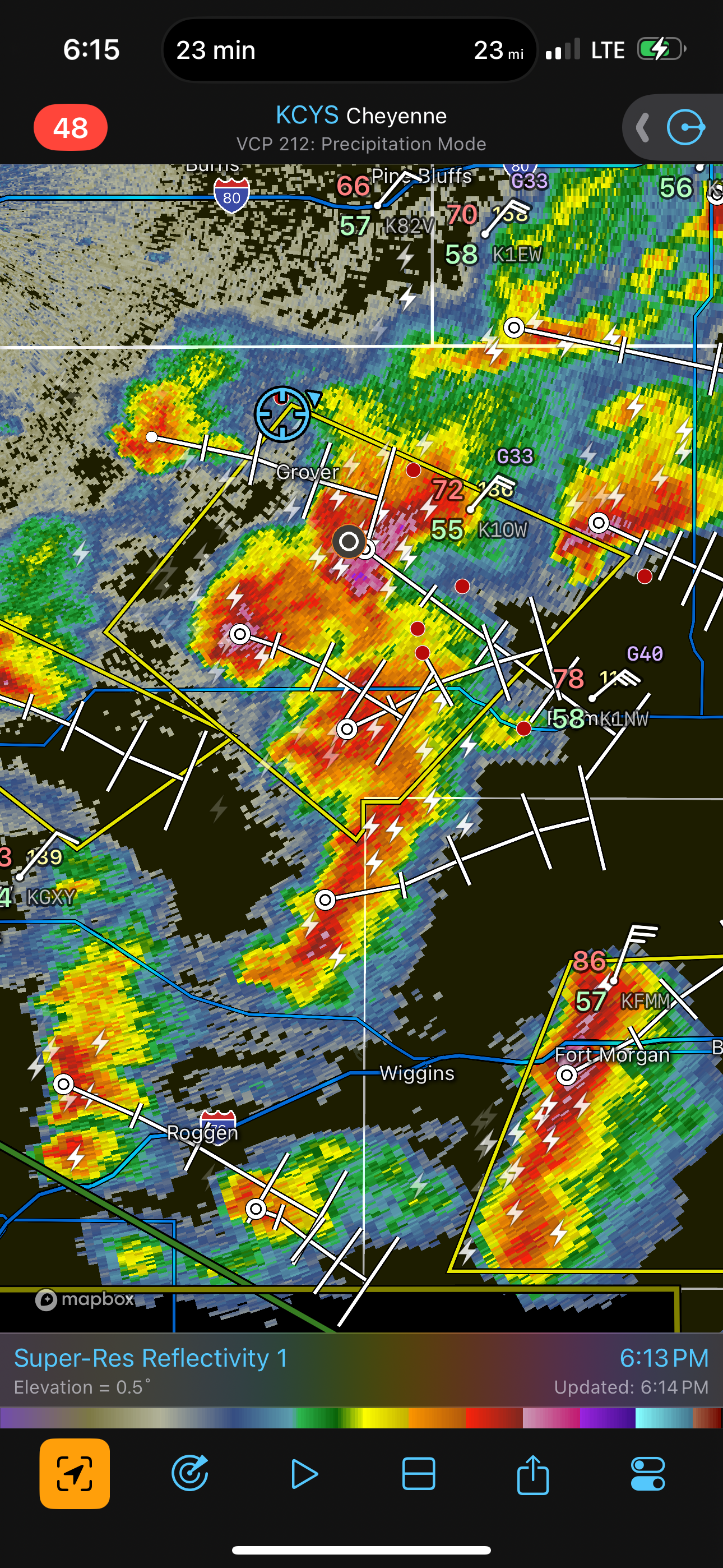 |
| A radar image shows the mess we were in. Too many storms packed into a small area! |
Finally, I gave up and decided to target a longer shot storm. There was a discrete storm approaching the Cheyenne area from the northwest. It was in colder air, but it was holding together, and it had some space between it and other storms. We drove back up to I-80 then raced west toward Cheyenne.
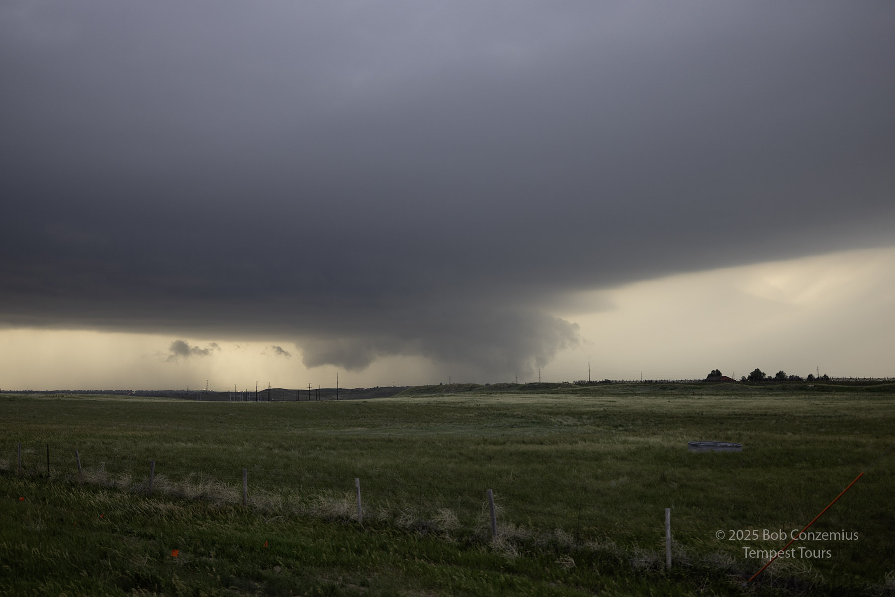
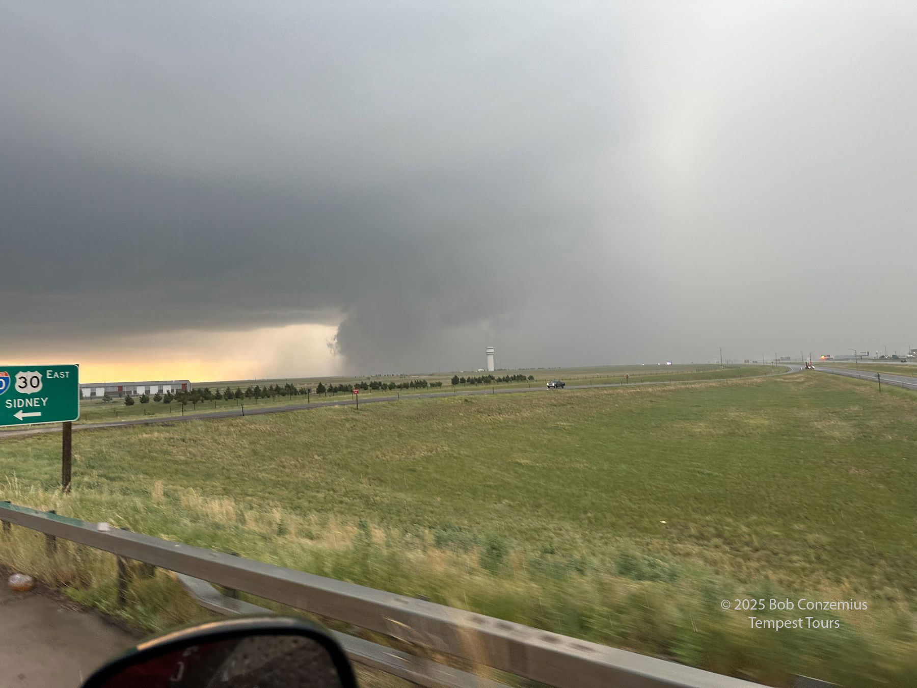
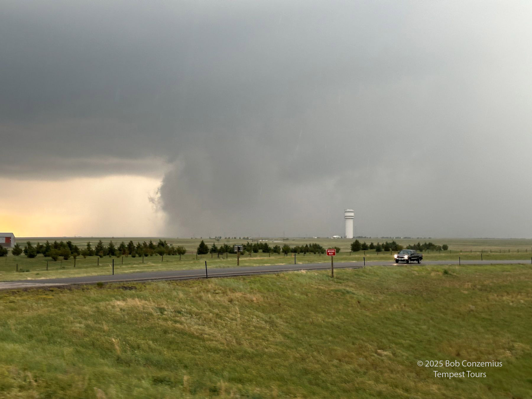
As we approached, the skies became overcast with stratus, but then a brightening appeared on the western horizon, revealing the wet RFD portion of the storm. As we got even closer, a wall cloud appeared to our northwest, and I could discern some slow rotation. It could be an interesting area to watch!
Our time with this storm was not long, but I thought it was pretty exciting. We were getting into the Cheyenne area, so we had to get off the interstate and find a decent pull-off location. Once we were there, it was just about five minutes. The cloud bases were low, the wind was strong from the east-northeast, and the wall cloud to our northwest was rotating slowly. Maybe something could happen. I snapped a couple pictures with the R5, then put it away, grabbed the cell phone, and took a few shots as the action area got closer, and it started to rain. The storm was moving quickly. Finally, I got everyone loaded back into the van and got us going back east to avoid getting cored and behind this action area.
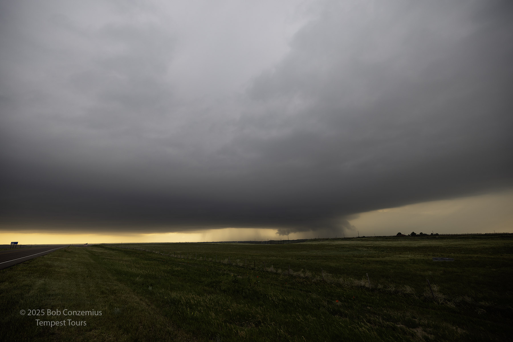 |
| Cheyenne Storm with the R5. |
 |
| Cheyenne Storm with the R5. |
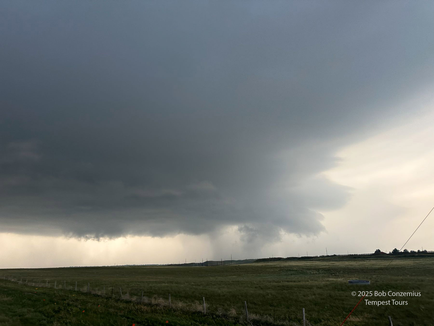 |
| Cheyenne storm. |
 |
| Cheyenne Storm. |
 |
| Cheyenne Storm. |
 |
| Cheyenne Storm. |
That was about all. We raced east on I-80 to get back in front. I wanted to drop south ahead of it one more time, but we missed that exit amid some construction on I-80. That ended up not being much of a problem. The storm appeared to lose some if its structure, anyway, as it got toward that mess of storms in northeastern Colorado.
Our tour season had now concluded. To me, it felt like a non-dramatic finish, but at least we had a wonderful, exciting few moments with a supercell!
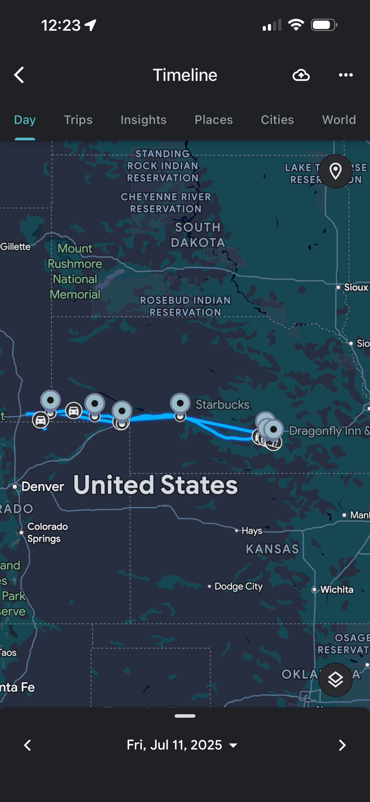 |
| This is the route we took. |
Back to Storm Chases | Home