July 6, 2025 Anticyclonic Landspout Day
Northeastern Colorado
Well, Colorado certainly always throws curve balls at me. It was an interesting day for the start of Tour 10. I gave the guests their orientation and had us on the road by late morning. Typical of Colorado Days, it didn't take storms long to develop.
We were conveniently located, at the start of our tour, in a slight risk area with a 2 percent risk area for tornadoes. Our plan was to head east from Denver (once again, crossing our fingers that we did not miss any landspouts near Denver International Airport), and drive to our target area, which, today, really wasn't far away at all.
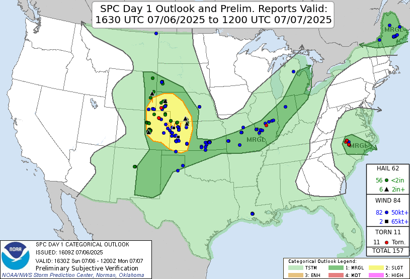 |
| Storm Prediction Center 1630 UTC Day 1 convective outlook with verification. |
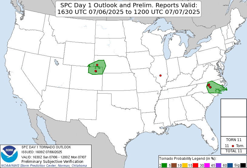 |
| Storm Prediction Center 1630 UTC Day 1 tornado outlook with verification. |
We got to Brush, Colorado and dropped south on Highway 71 for some early storms that were to our south. We enjoyed watching updraft bases form and rain areas develop later on. None of these showed any severe characteristics, so we began looking for something else. There were other storms to our northeast.
 |
| The first small storm of our tour, south of Brush, CO. |
 |
| The updraft bases were not that persistent, so we looked elsewhere for supercells. |
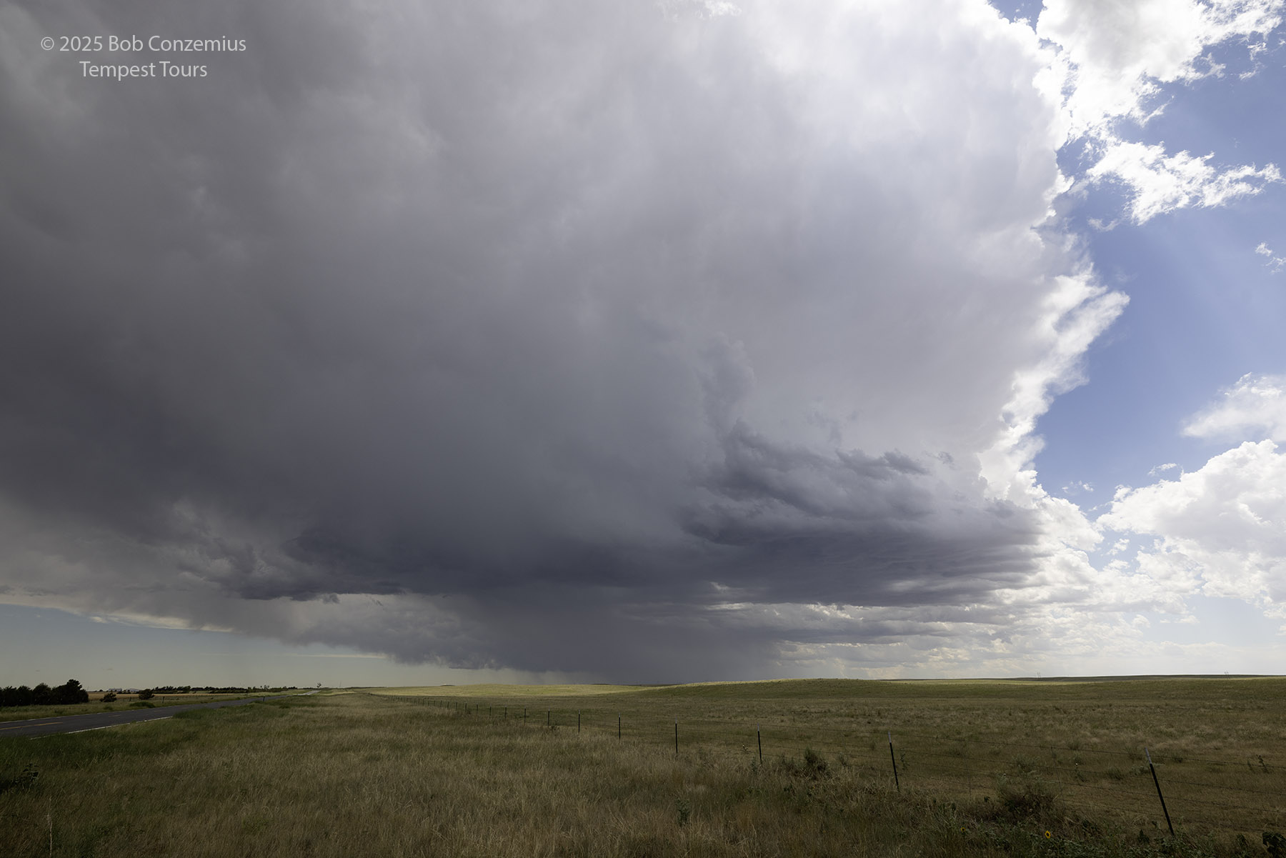
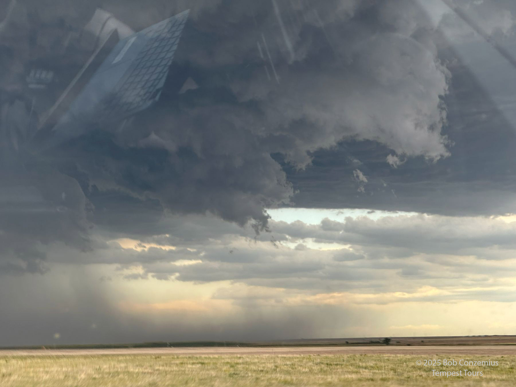
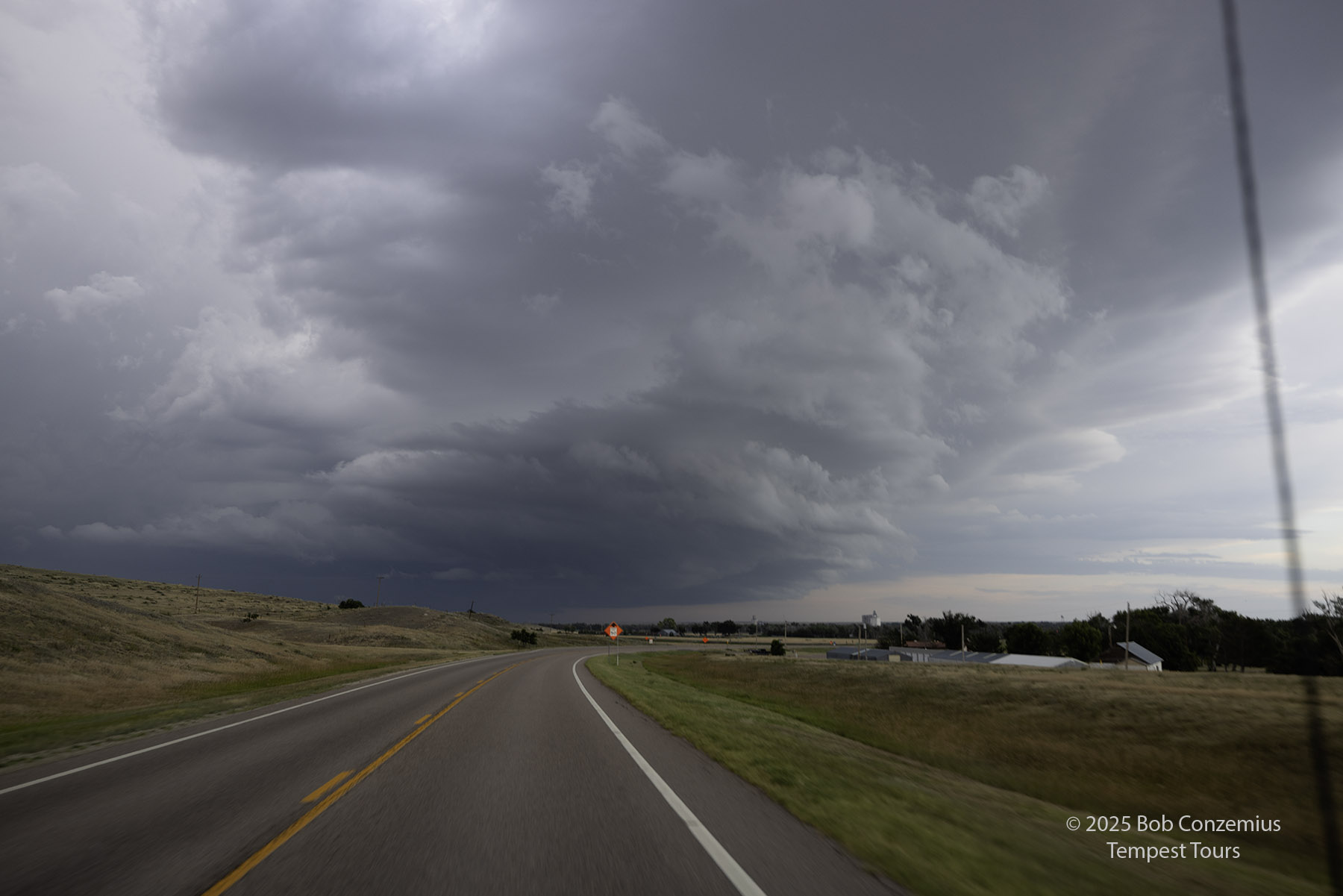
We drove back to Brush and did a quick pit stop. While we were there, I noticed a rather photogenic updraft of a storm and decided to take a few pictures. There was a storm to our northeast that looked like it had the best chance of becoming a supercell, but as long as we were here, I want to take a picture of this one.
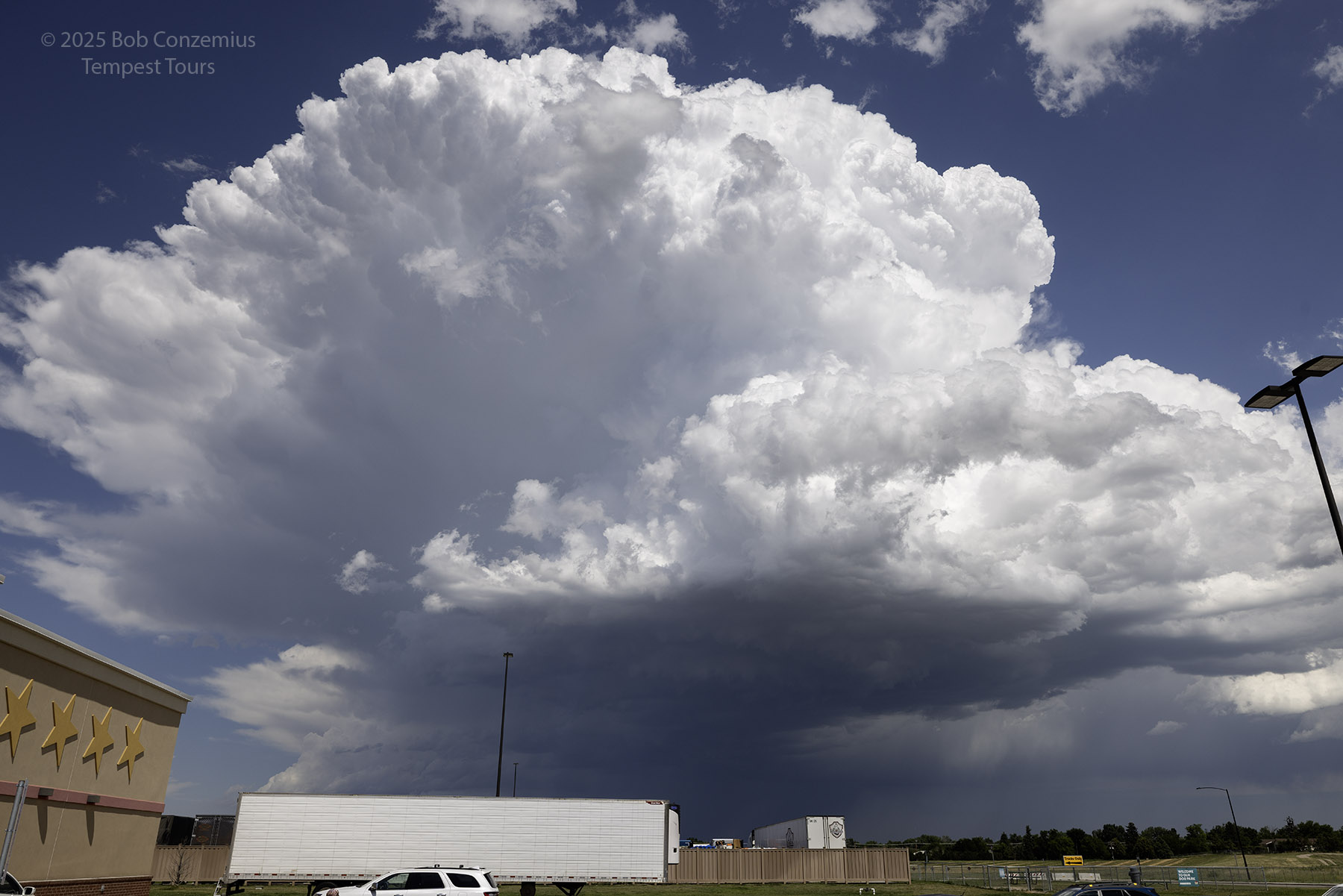 |
| Does this storm look like it's about to produce a tornado? |
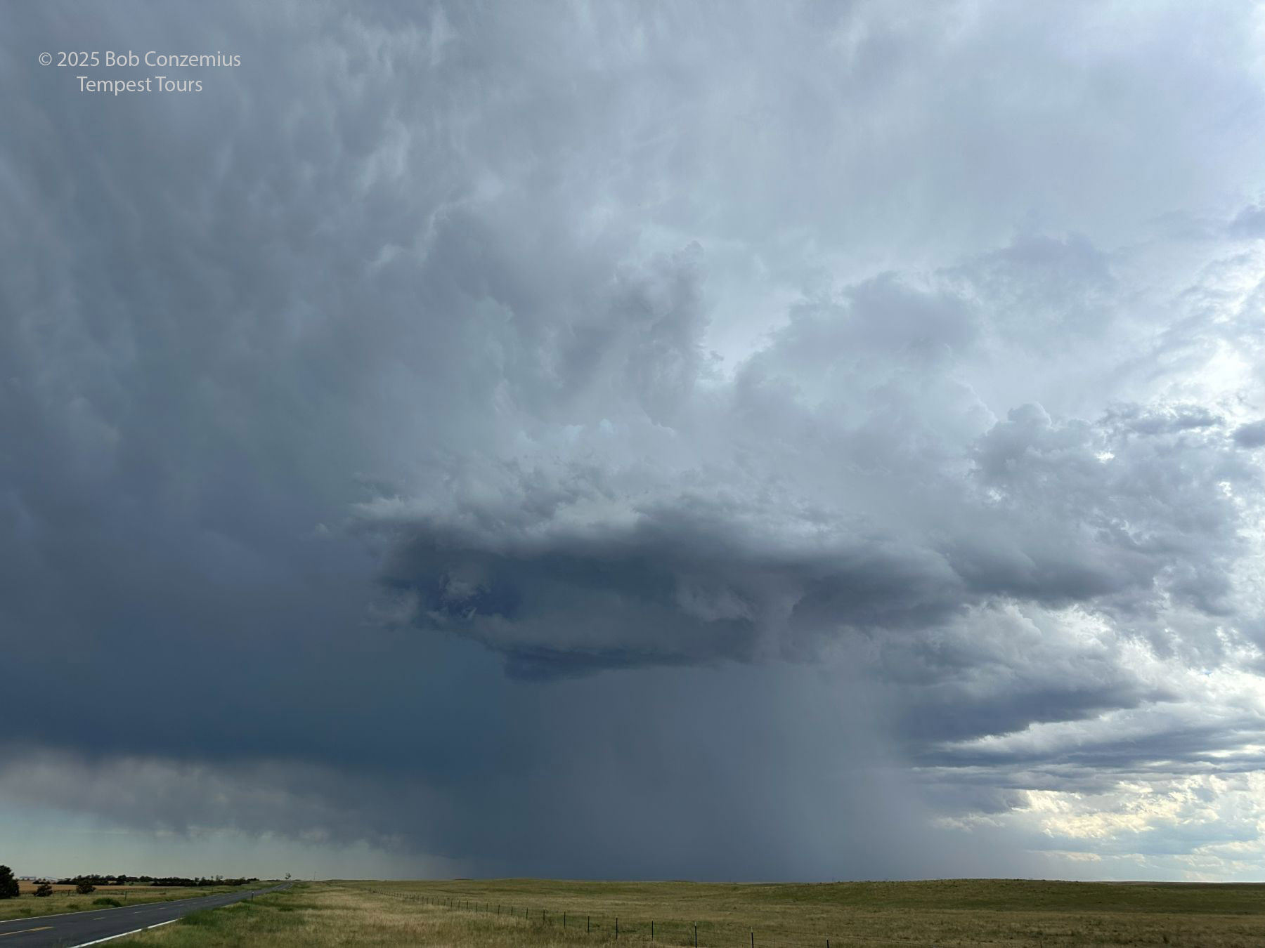
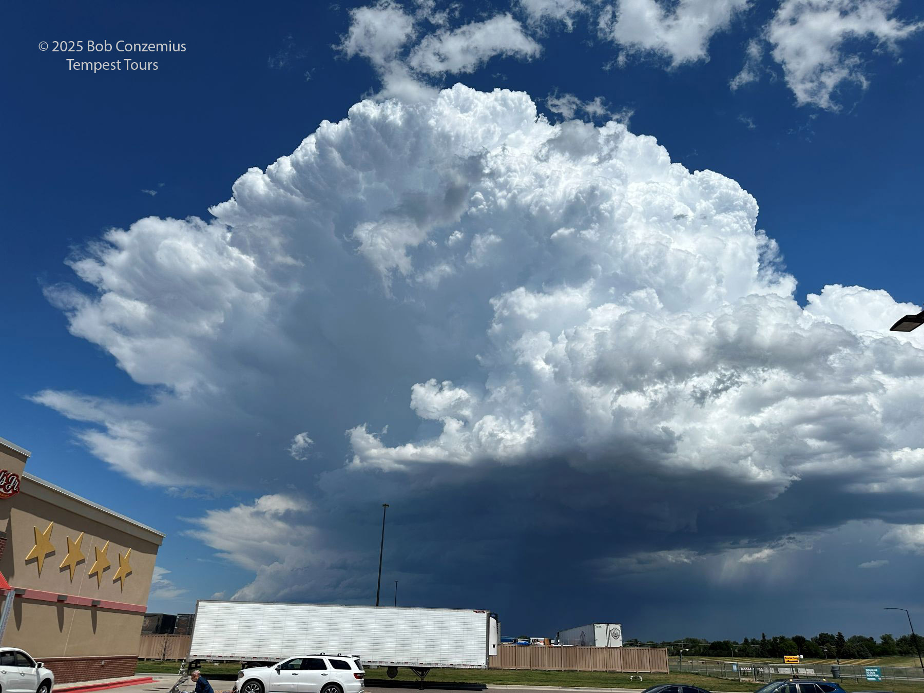 |
| Here's a cell phone image of the storm. |
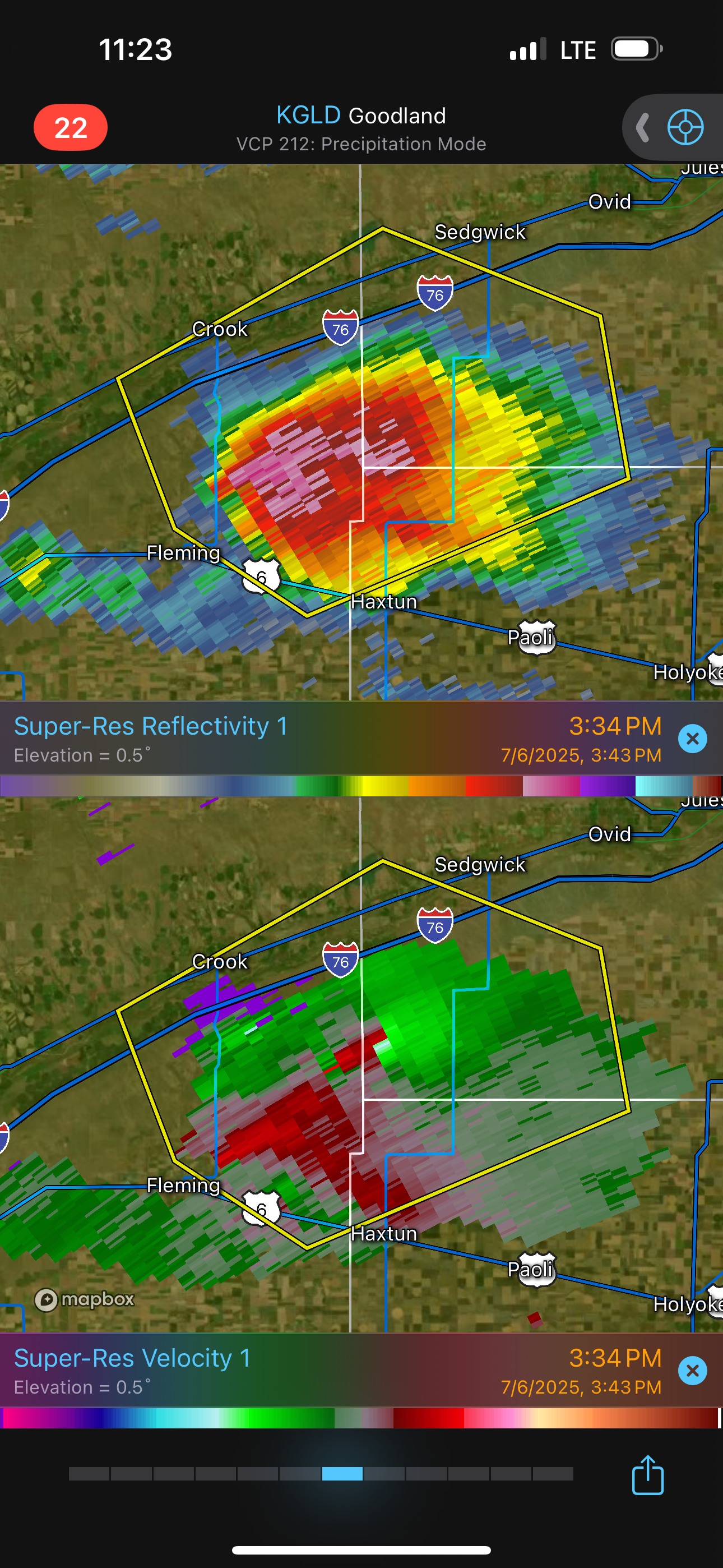
We were maybe fifteen minutes down the road, headed in the direction of Sterling, when a tornado warning was issued for the storm we had just seen at Brush. It looked photogenic but nowhere near tornadic. Well, that doesn't matter for landspouts. In this case, radar showed the rotation to be anticyclonic! This was certainly an interesting case.
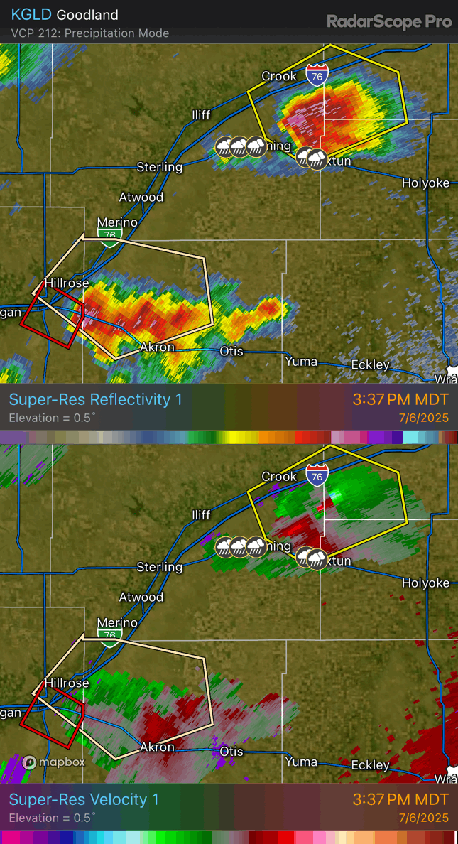 |
| Radar loop showing anticyclonic rotation in many of the storms. The storm we had just seen at Brush is tornado-warned. |
 |
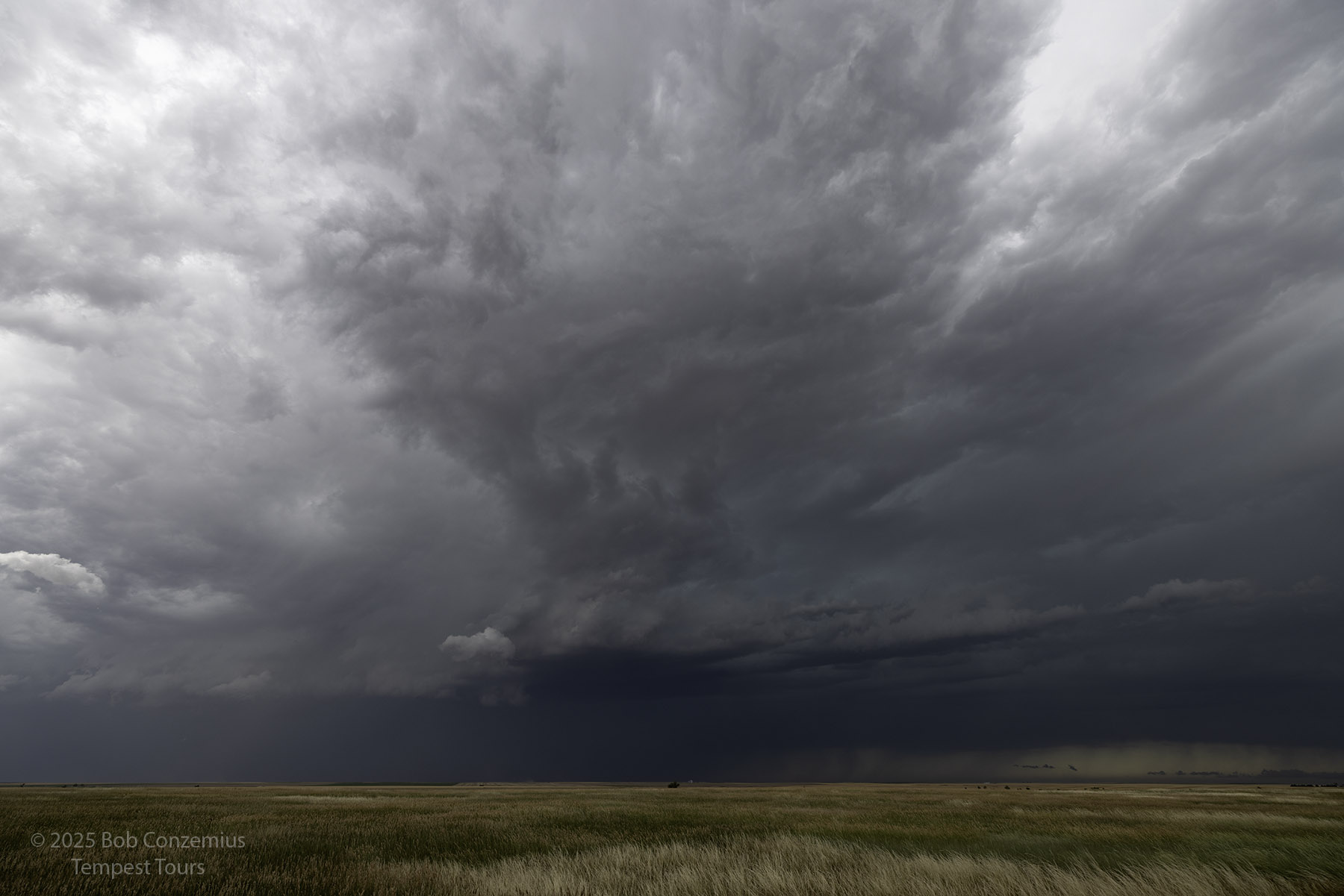
| Picture of our target storm near Sterling, taken as we were northeastbound on I-76. |
Our target storm was looking more interesting, but there were also a couple anticyclonic couplets on a couple smaller storms on its far side. I wanted to give the largest storm a chance to become a supercell, and I did not want to be out of position and on anticyclonic storms while that happened. Maybe today was the day to give that a try. Anyway, we exited at Sterling onto U.S. Highway 6 then turned south at Fleming to get in front of our supercell. We'd have to come around the western flank, and the storm developed a slightly wet RFD, so we had to really get around on it to see what was going on underneath it.
 |
| Coming around the western flank of our storm. |
 |
| Radar image of our storm. Note the anticyclonic couplet in the northeastern flank. |
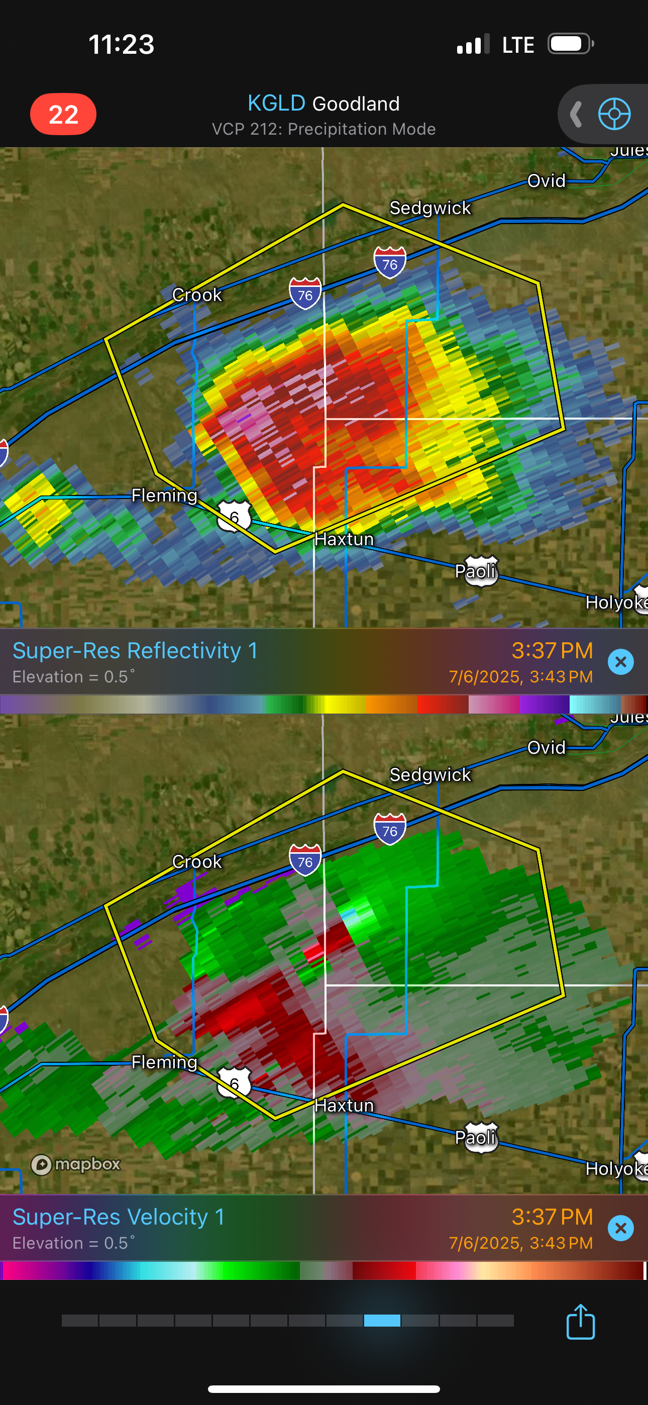 |
| The anticyclonic couplet persists, but the larger storm has a broad, cyclonic spin. |
 |
| We cleared the RFD and were able to see (at least somewhat) to our east. |
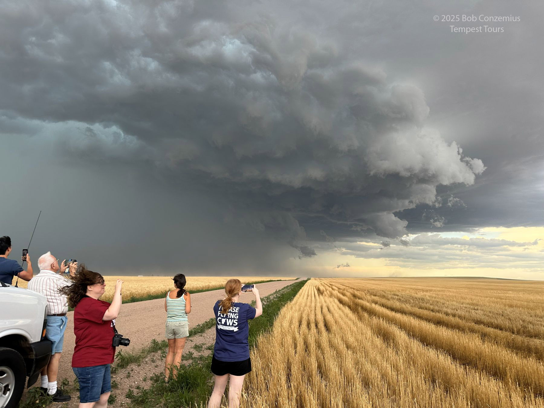 |
| Guests enjoying their first supercell. |
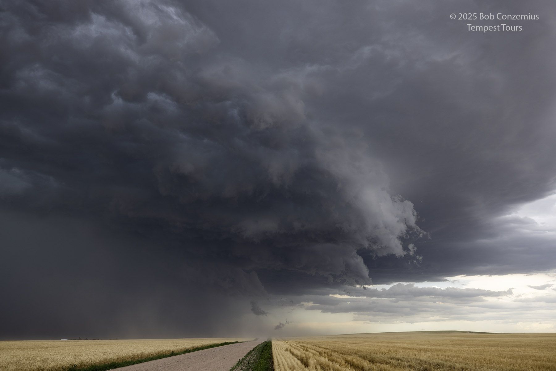
We came around the south side of the storm and got to view its inflow a bit. The RFD side of the storm had a bunch of dust, obscuring visibility into the low levels of the storm. To get a better view, we kept going east, and we eventually reached Colorado Highway 59 south of Haxtun. By this time, the cell was looking less organized, so we targeted some newer storms to our south.
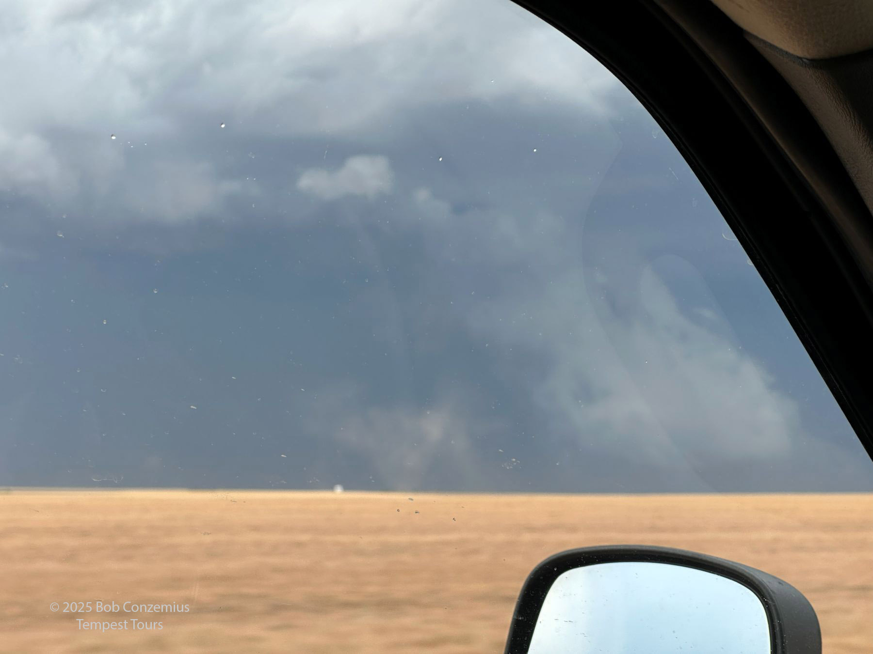 |
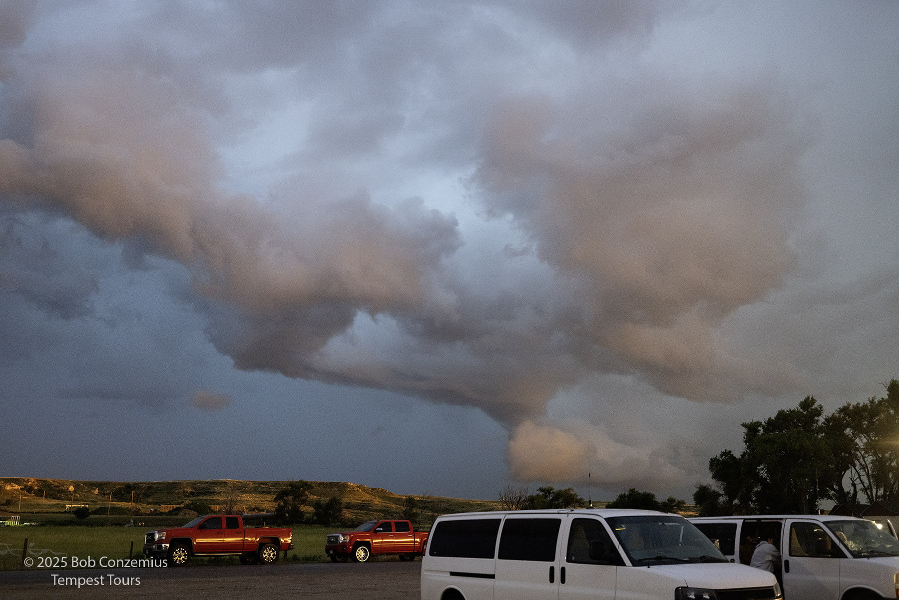
| As we came around to the south, there were some gustnadoes under the storm. |
 |
| There are some dust swirls under the storm. |
 |
| We were able to get a little ahead of the storm on County Road 2. |
 |
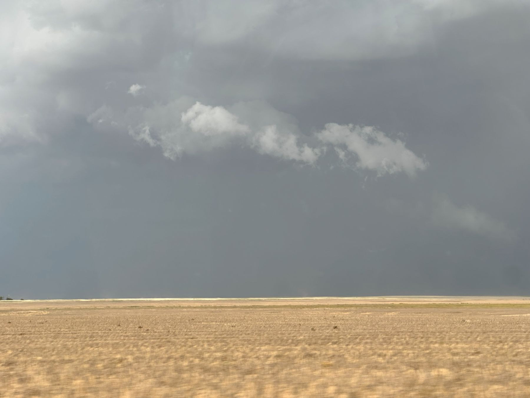
| South of the storm, looking north into it. |
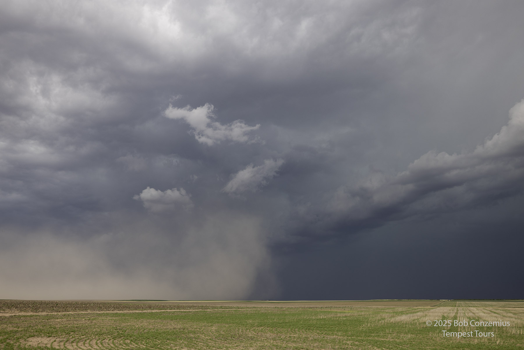 |
| The RFD outflow kicks up a bunch of dust. |
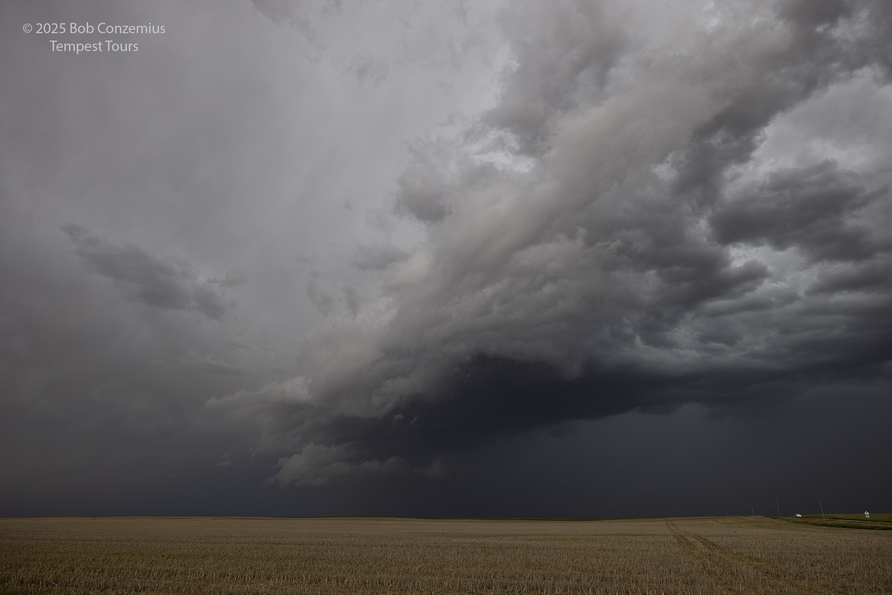 |
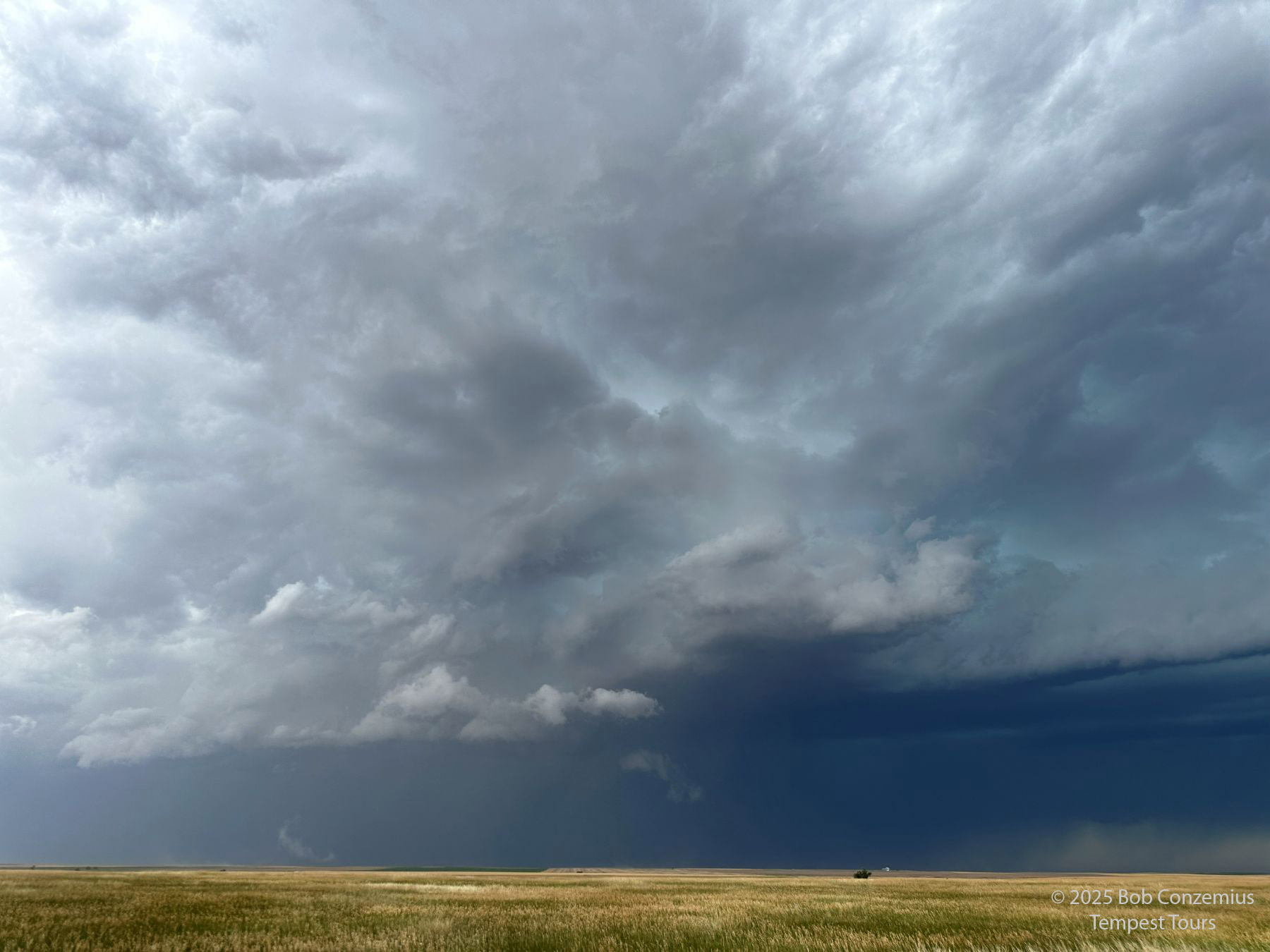
| This was the view when we reached Colorado Highway 59 south of Haxtun. |
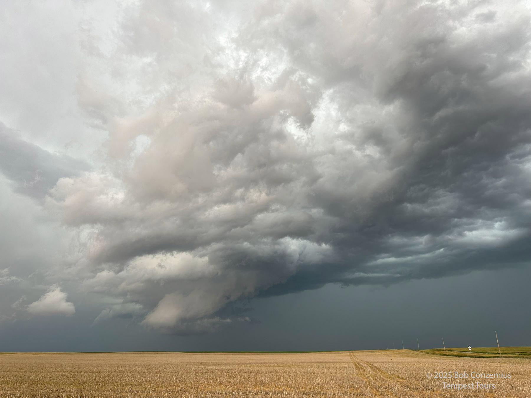 |
| A cell phone shot at the same location. |
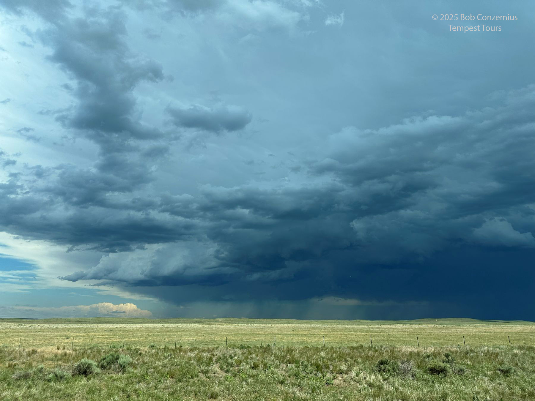
The southern storms took us into Wray. By the time we got there, they looked somewhat linear and outflow-dominant, but there was still some hope for supercellular structures if we were able get through Wray and turn east ahead of the storm.
 |
| Another storm as we came southward into Wray. We needed to get south and around this shelf cloud. |
We got around the storm and continued east into Kansas a bit, but the structure fell apart. It was getting close to sunset, so we opted to get rooms in Wray and to get dinner at El Vaquero Mexican Restaurant on the west side of Wray. We stayed at the Cobblestone Inn and Suites on the north side of town. The hotel had some sort of water problem. When we got there, there was no water coming out of the faucets. The problem did not last long, though. Water pressure returned to normal within about an hour.
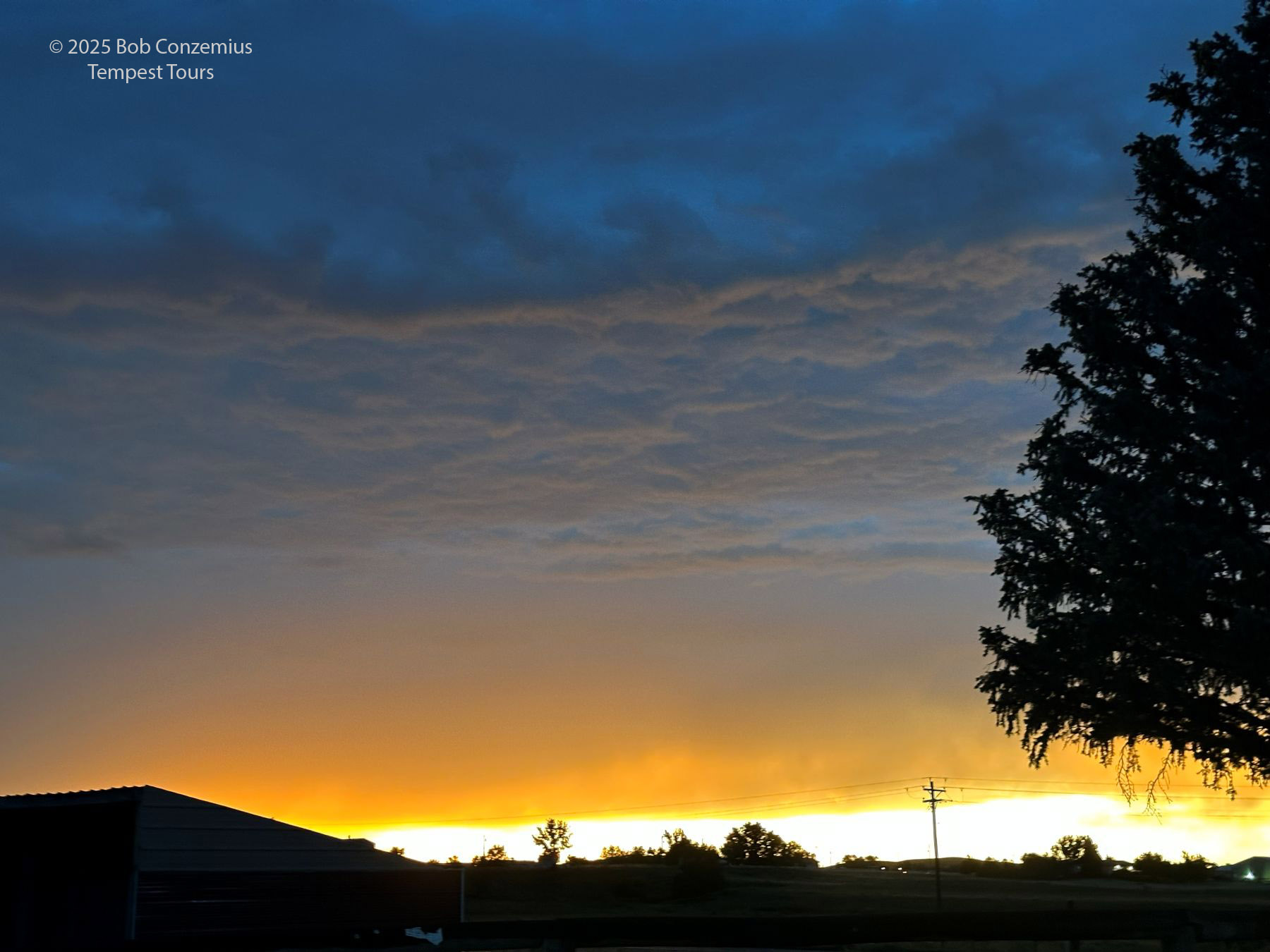 |
| Sunset on the west side of Wray. |
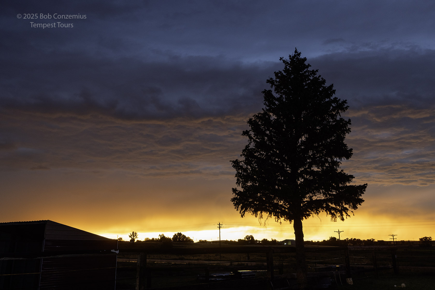 |
| A shot with the Canon R5. |
 |
| Looking away from the sunset. |
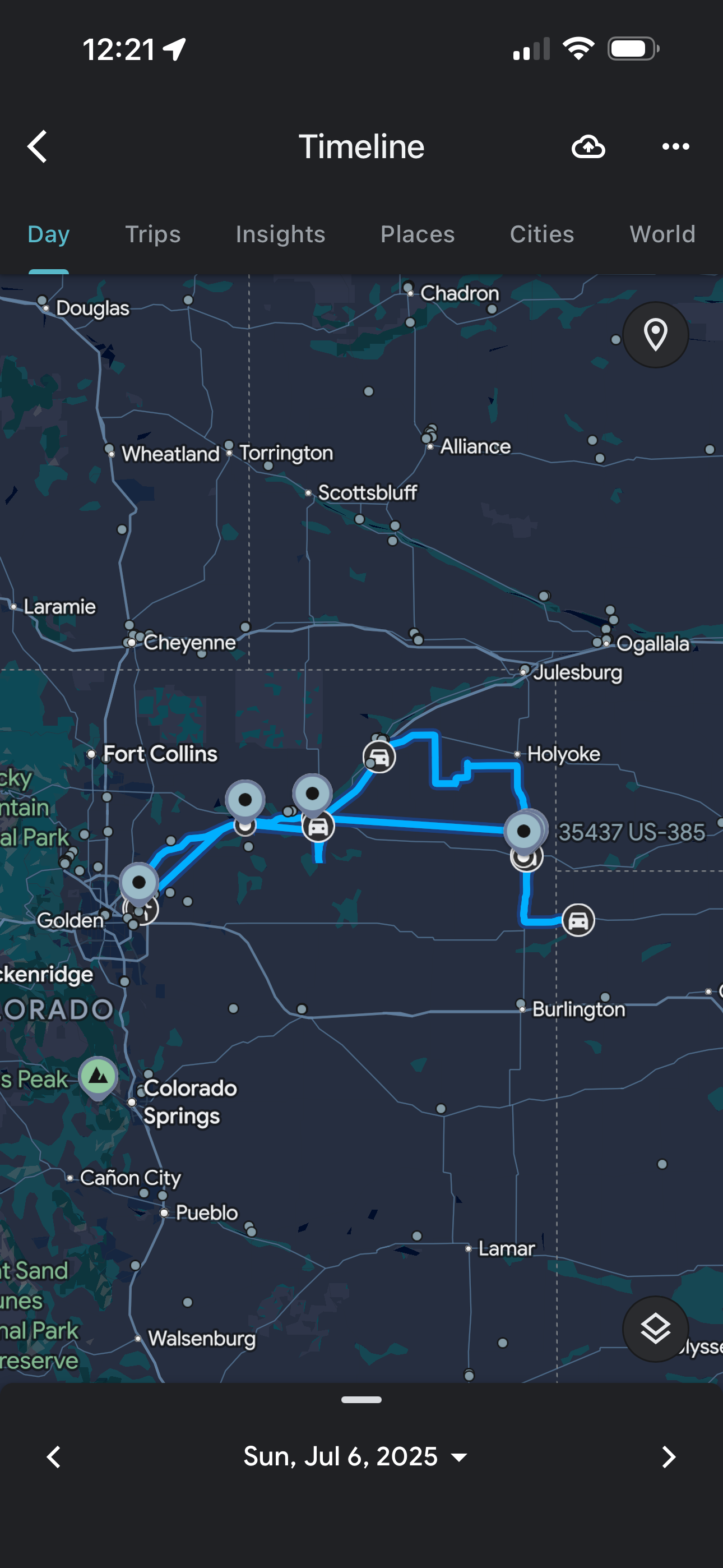 |
| This is the route we took. |
Back to Storm Chases | Home