June 29, 2025 Supercell
Chadron, Nebraska
Today was the first day of Tempest Tour 9. We met the guests in Denver at the Airport Springhill Suites. A period of significant severe weather had just occurred, and on my day of travel to Denver, the most photogenic and visually dramatic tornado of the year had occurred at Gary, SD. If you looked at all the storm chaser posts on Facebook in 2025, you would think that Gary, SD was the only tornado. It's always tough missing those big events, particularly if your time is dedicated to chasing. It's the perpetual curse of running storm tours. You try to be out there as much as possible, but logistics require being back at the base city to pick up guests and service the vans, and a significant number of tornadoes happen on those days and are out of reach.
The trough that had produced the tornadoes had moved to the east, but there was still some instability and shear over parts of Nebraska. It looked like the tornado threat was smaller, but maybe we could get a nice supercell storm, and sometimes there are suprises. After the orientation, we drove northeast with a general target in the panhandle of Nebraska. We stopped at a Buc-ee's store on I-25 in Colorado to give the guests a little experience of these huge gas stations, and we stopped in Cheyenne for lunch. From there, we continued northeast through La Grange, Scottsbluff (I think-- Google timeline isn't as great as it used to be), Crawford, Nebraska.
As always, when starting tours out of Denver, there is a risk of missing a landspout near the Denver airport if your target is a couple hundred miles away. That did not happen today, but if you don't miss landspouts, you have to drive past a lot of storms developing off the mountains. Today was not exception to that rule. We drove past one fairly strong storm, but I pointed out that the updraft base was on the north side of the storm. It was a left-mover and not something we usually like to chase.
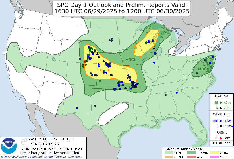 |
| The Storm Prediction Center 1630 UTC Day 1 convective outlook with verification. There was no risk area for tornadoes indicated. |
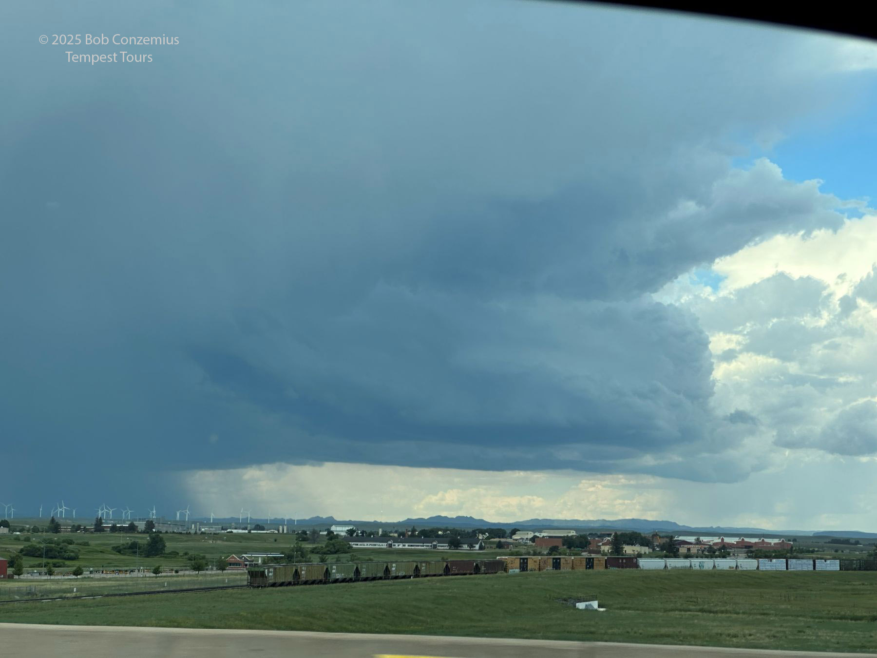 |
| Here is the updraft base on the north side of a storm we passed as we drove up I-25 north of Denver. |
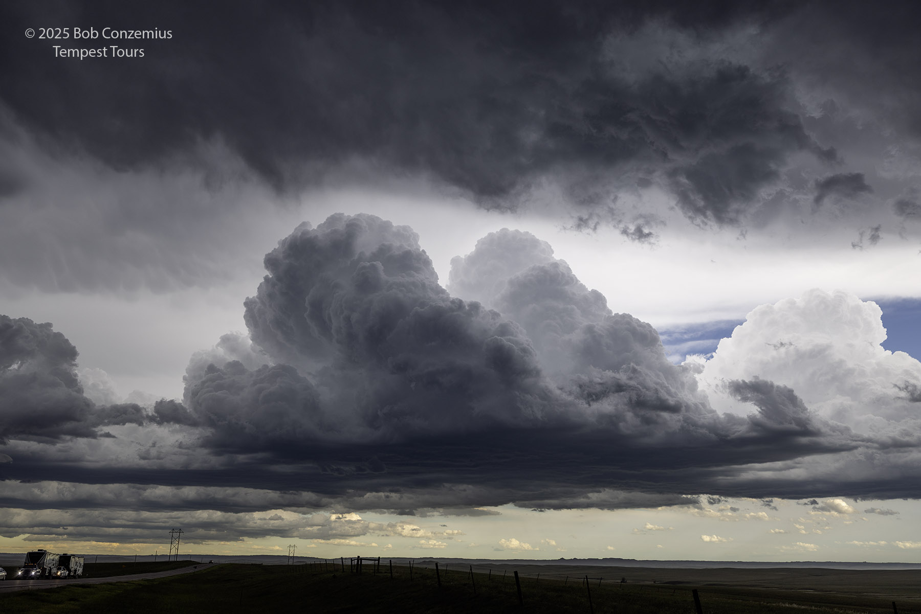
When we got into the Nebraska Panhandle, the skies got darker and some storms came into view. I saw a nice supercell on radar farther north, but the first storm that greeted us between Crawford and Chadron was a small LP. It wasn't severe, but it was interesting enough for me to take a couple pictures.
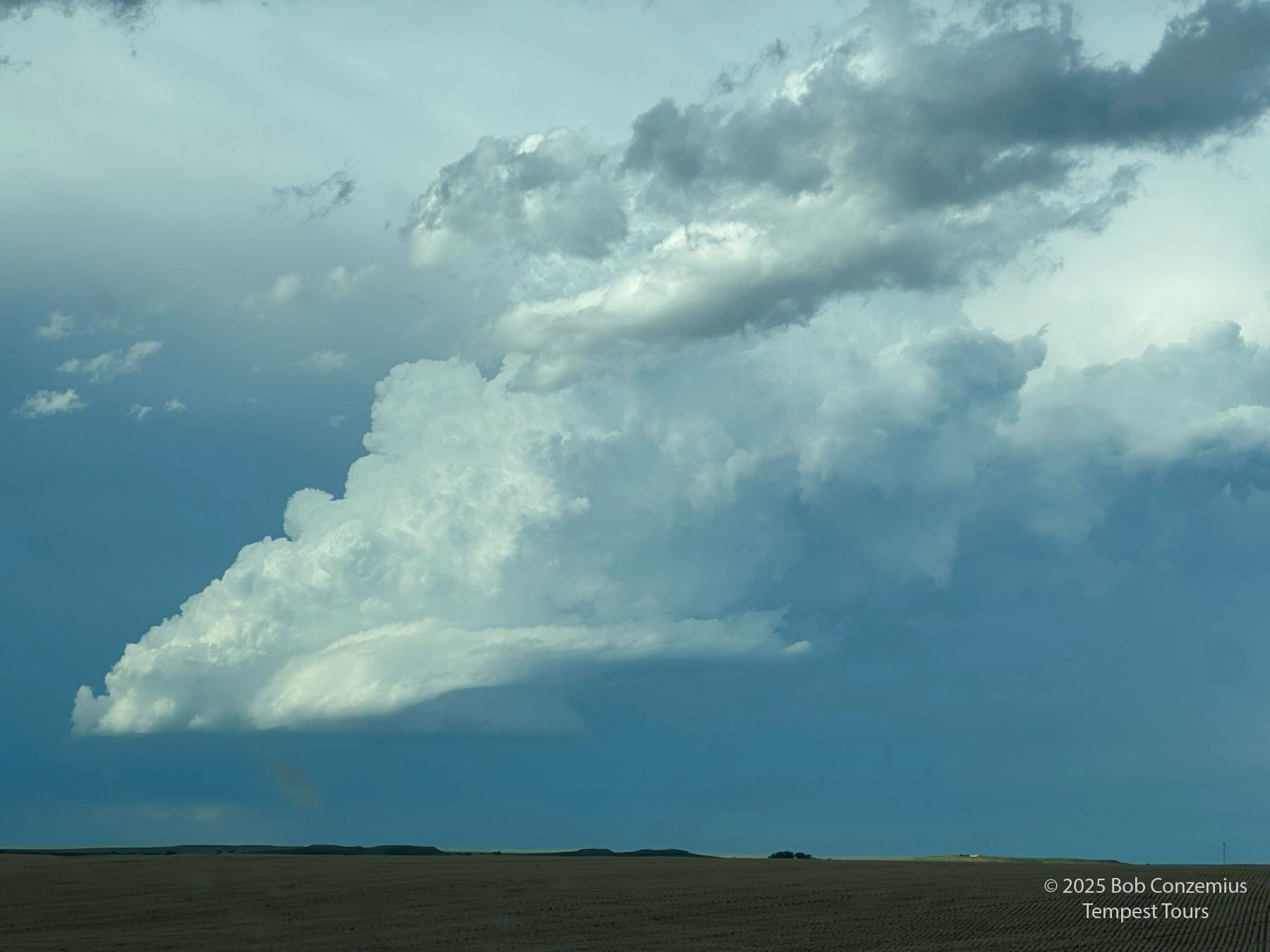 |
| A small LP updraft comes into view as we drive eastward from Crawford to Chadron. |
 |
| As we arrive in Chadron, here's another look at the same LP storm. |
 |
| As we exit Chadron towards are target, here's another look at the LP. |
 |
| Here's a picture of the LP storm with the Canon R5. |
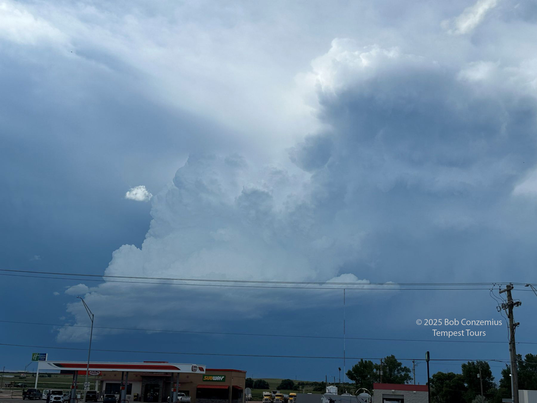
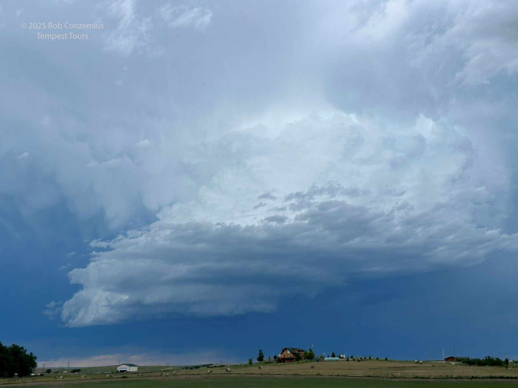
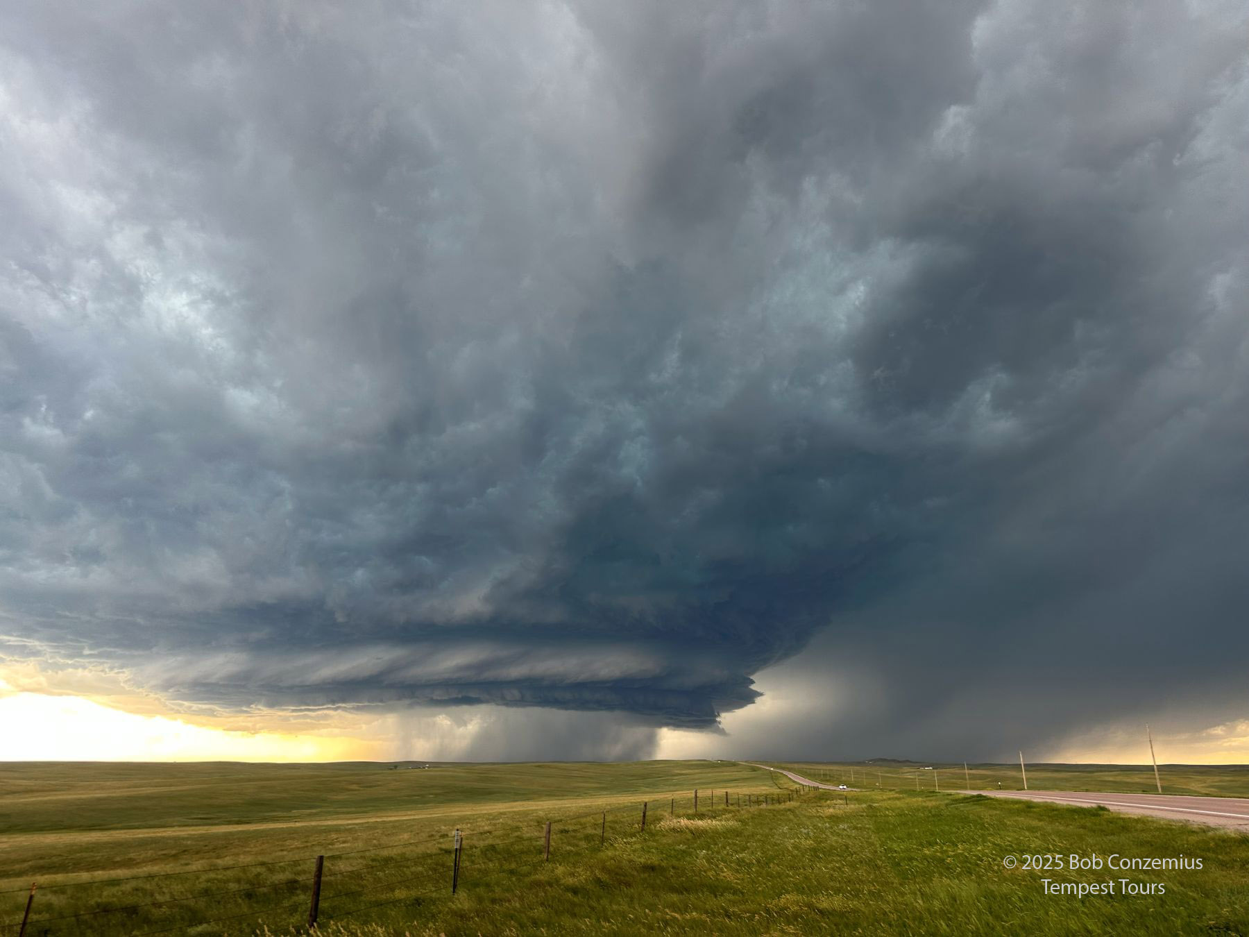
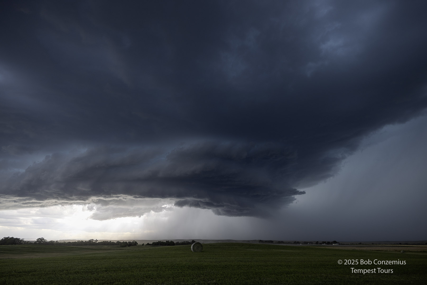
We drove northwest from Chadron to intercept our target storm. On Day 1 of the tour, we already had a wonderful, structured supercell! I was happy with this result.
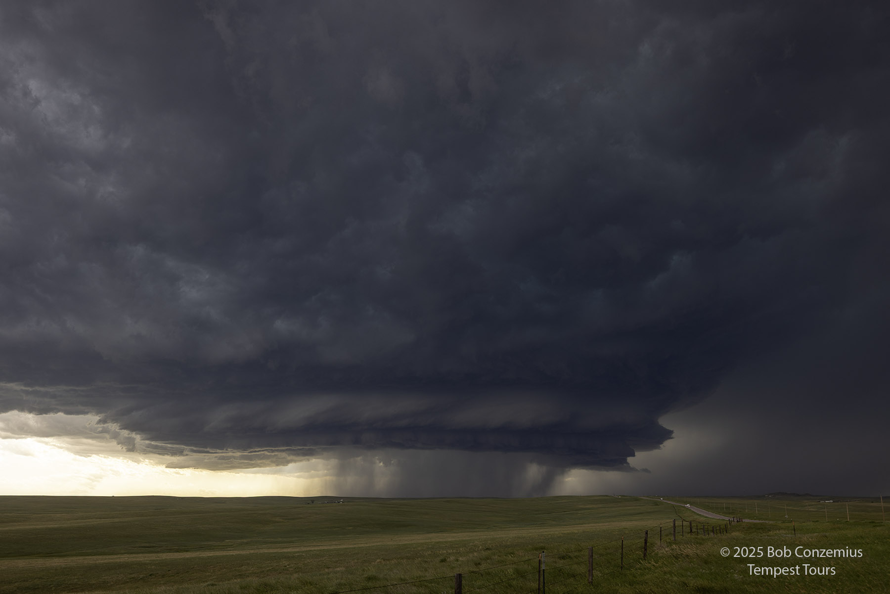
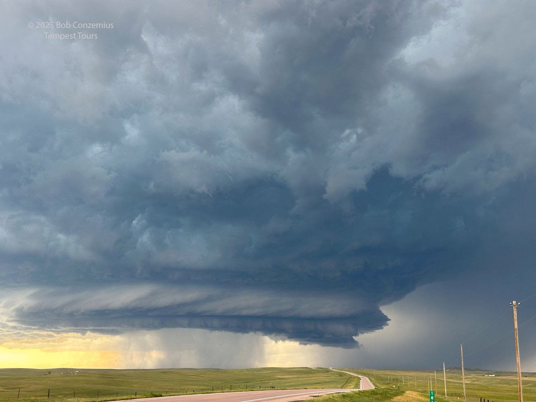 |
| Here's our target storm. It's a beauty! |
 |
| Here's a somewhat wider view. Picture from my cell phone. |
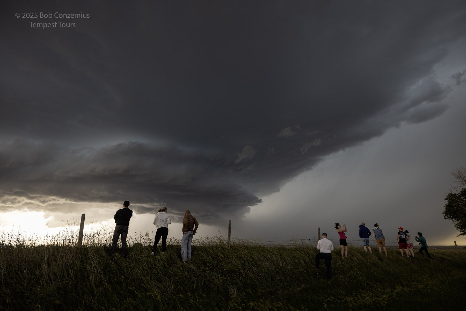
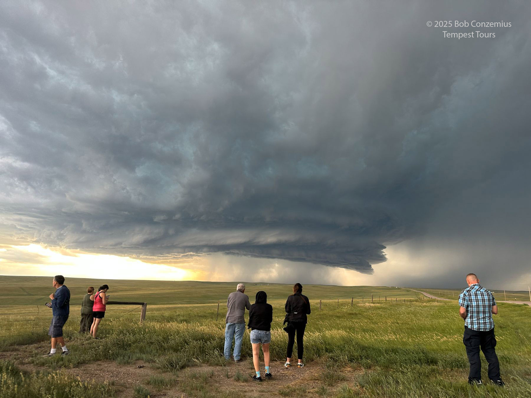 |
| Cell phone picture of the guests taking in the storm. |
 |
| Here's a picture of the target storm with the Canon R5. |
 |
| Another picture with the R5. |
 |
| At the same time, here's what the view to the east looked like. |
 |
| The updraft base comes closer and begins to get past us. Time to move southeast. |
 |
| View from the next deployment a little farther southeast. |
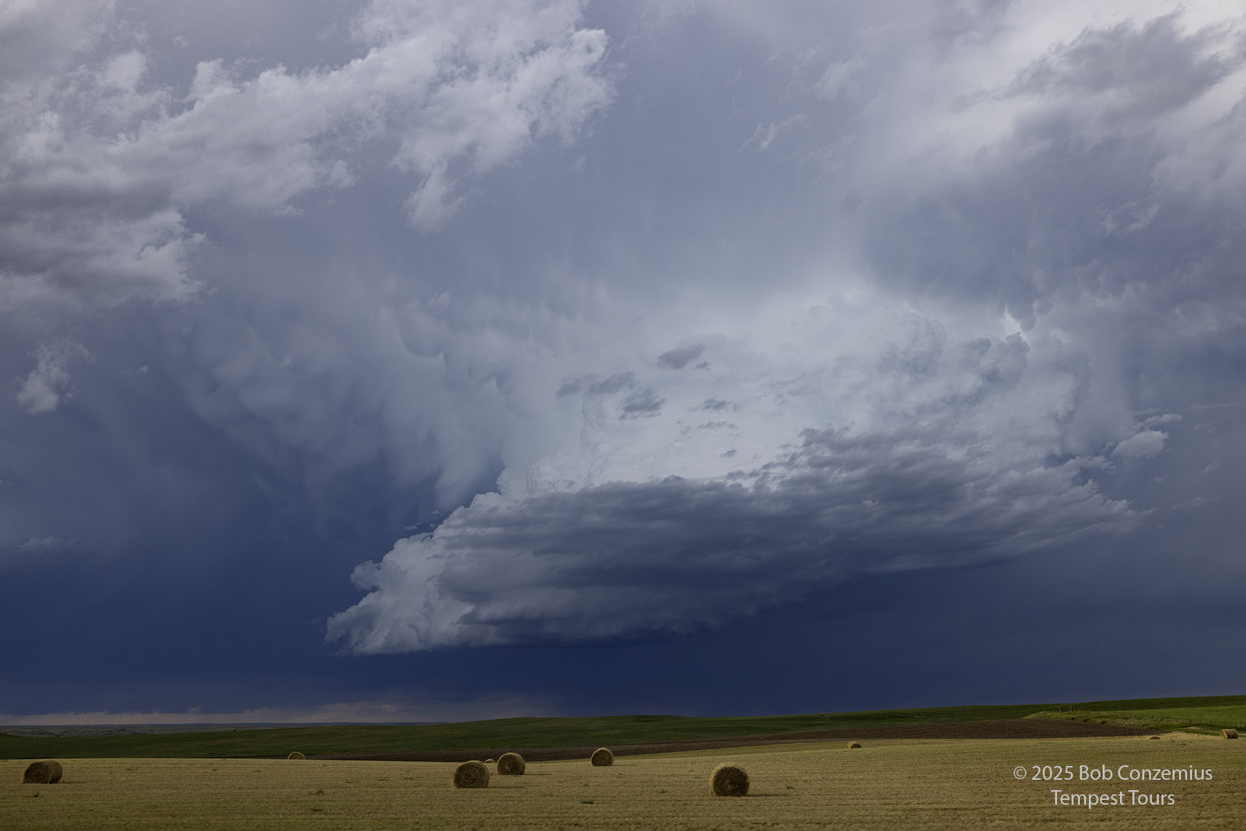
After a couple deployments on the storm north of Chadron, we stayed with the storm as it continued south-southeast. Its structure faded, however, and we didn't see a whole lot else photogenic. We stopped at our favorite Maverick's gas station in Alliance for a pit stop, and then we drove to Ogallala to stay overnight.
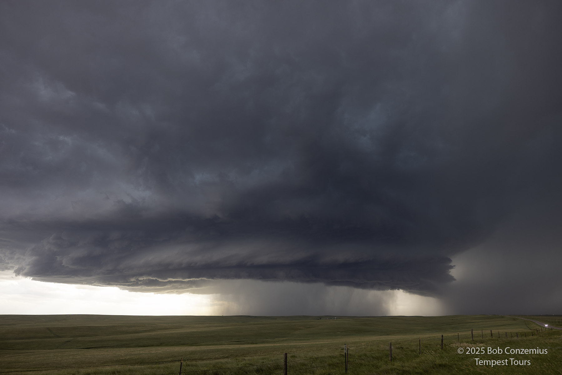
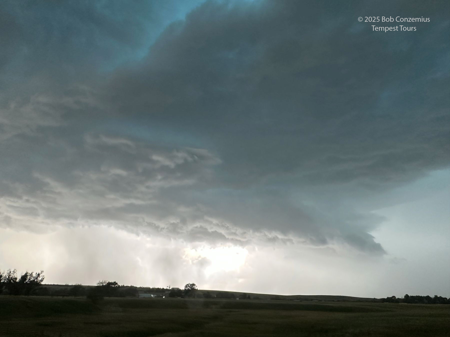 |
| South of Chadron, we got closer to the updraft base, but the structure appeared less organized. |
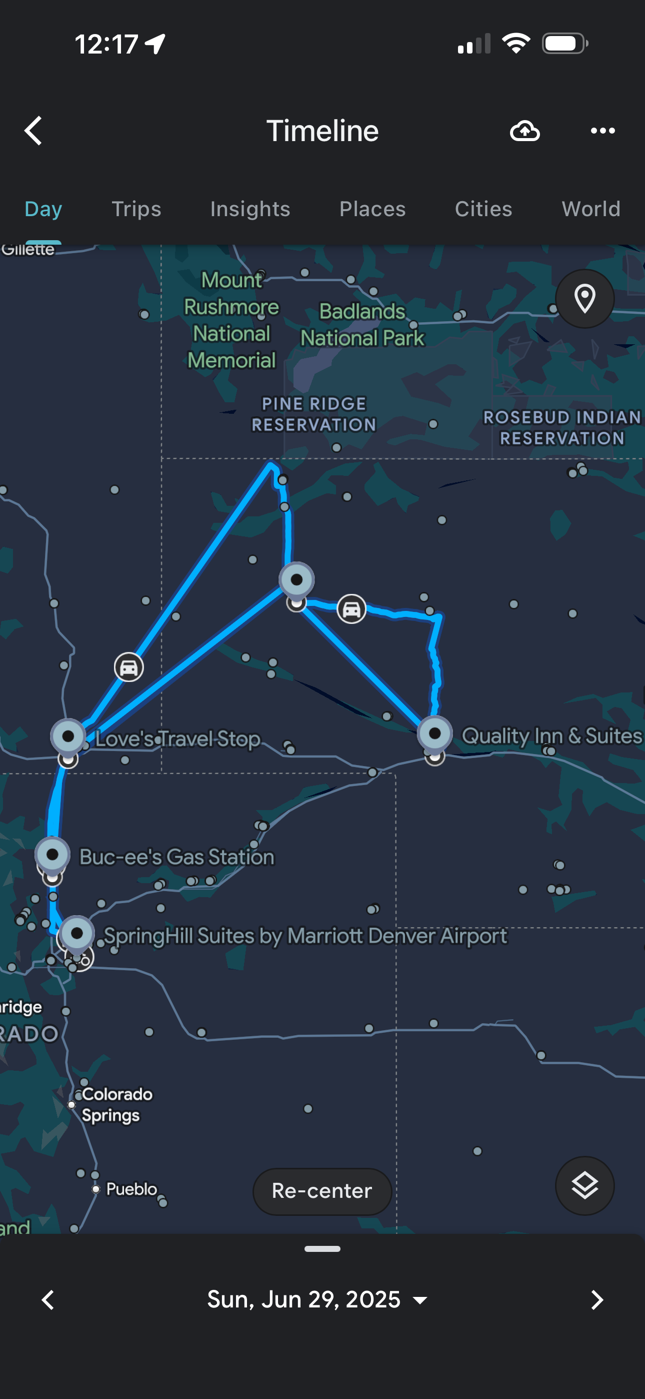 |
| This is the approximate route we drove. |
Back to Storm Chases | Home